Emma

Hey! My name is Emma. I'm from Australia but have lived in Bergen, Norway, for the last eight years. I work as a local guide and tour leader for all over Northern Europe. The Hidden North is an online travel guide I have made to help you plan your own visit here.

  • Drive it Yourself: Sognefjellet Tourist Road

    Drive it Yourself: Sognefjellet Tourist Road

    Alright, this is the big one. The Sognefjellet Tourist Road is one of the highest roads in Norway and also the most notorious for bad weather. Winding its way from Lom through the Jotunheimen National Park and then down to the Lustrafjord, this road is nicknamed the ‘road over the roof of Norway’.

    This road has been a main traffic road since the Middle Ages, linking the coast and inland areas. Trading led to the transport of salt and fish eastwards while butter, pitch and leather were transported west.

    The decision to build a modern gravel road came in 1936 when the Minister of Social Affairs put together an initiative to employ unemployed young people. The road opened in 1938 and was the highest road at the time. It rises to a height of 1434m.

    This is where you experience true Norwegian nature. In winter the weather is so severe that the road has to close. In early spring, soon after the road opens, there are almost 10m high banks of snow on the side of the road.

    The Sognefjellet Tourist Road is notorious for bad weather, and boy did we experience that. I think I was mildly traumatised by the time I got to the bottom of the road! I would love to go back and film this when the weather is good. In the meantime, the footage and my photos aren’t great, but at least it paints a true picture of the power of nature on Sognefjellet.

    In this article...

    Download this Guide

    All of our guides can be downloaded via my online store. 

    I offer downloadable versions of our self-guided drives on my online store. 

    Online Guide

    Downloadable Guide

    Watch on Youtube

    All of our roadtrips are available on YouTube to watch. They include information about the area provided in text and voiceover form, plus they show the drive in full (sped up in some spots!) so you can get an idea what the drive is like. 

    The drive: Sognefjellet Tourist Road

    Lom

    Lom has it all. Museums, shops, scenic views, a stave church and an award-winning bakery. It’s also surrounded by tourist roads. We begin our drive here after filling up with coffee and petrol.


    Flåklypa

    Scenic Site

    Flåklypa is the first place we’ll pass. The name comes from a Norwegian kids film called Flåklypa Grand Prix, where the place is described as a small mountain village. Historically, though, this is a place where farmers risked getting stuck when they pulled their hay on the ice – they got stuck in Flåklypa, which means ‘pinch’.

    Galdhøpiggvegen

    Mountain

    If the weather is incredible, or you can at least see the mountain peaks, take a 15km detour up Galdhøpiggvegen.

    Galdhøpiggvegen offers an ascent of 1300m and, on a clear day, you get a panoramic view of Northern Europe’s highest mountains at the end of the road. The road is open mid-May to the end of October but may close throughout the season if there’s bad weather. It’s a toll road, so after 5km you have to pay – card only.

    There are tourist cabins at the top if you want to spend the night there and do some outdoor activities.

    Lisanden

    Rest Area

    Liasanden is a beautiful rest area in a pine forest. You’ll find maps, information boards, and picnic benches.

    For more info, click here. 

    Jotunheimen Mountain Hotel

    Hotel

    This is a viewpoint and great place to stay.

    Sognefjellshytta

    Hotel

    This lodge is where the tourist road reaches its highest point: 1400m. Understandably, this accommodation is also a popular training centre for ski teams from all over the world. There is a common room here where you can go and warm up or use the restrooms, or you can opt to spend the night here.

    Click here to visit their website.

    Oscarshaug Viewpoint

    Viewpoint

    This is considered the best viewpoint on the scenic drive. Keep an eye out for it: it’s off one of the hairpin turns.

    Turtagrø Hotel

    Hotel

    This is a hotel that has been a central meeting place for mountaineers since the late 19th century. The first hotel was built here in 1888 by mountain guide Ola Berge. Another hotel was built 100m away in the same year. The two hotels merged in 1911 after Berge bought the other hotel. After Berges death in 1928, his daugther Kari took over the hotel. After the Sognefjellet tourist road was finished in 1938 and the climbing assocation build their own cabin, the purpose of the hotel changed.

    On 28 April 1940, during the closing days of the Norwegian Campaign in Southern Norway, German prisoners of war and their guards arrived at Turtagrø. They spent the night here on their way to Vadheim in Sogn.

    From 1953 Johannes Drægni ran the hotel. He introduced the first climbing school in Norway at the property. Ole Berge Drægni took over the hotel in 1997, but sadly he died in the tsunami in Thailand in 2004. His four-year-old daughter Sofie inherited the majority of the stocks. His daughter still owns 80% of shares in the company, but Ingunn Weka is the manager of the hotel.

    The old main building and staff accommodation burned down in 2001, destroyed old cultural monuments. A new hotel was rebuilt by 2002.

    The area is one of Norway’s most alpine areas with 24 peaks over 2,000m above sea level. Throughout the season you can take tours with mountain guides.

    Click here to visit their website

    Fortun Overlook

    Viewpoint

    Your last chance to get some photos high up in the mountains comes a short drive after the hotel. Here you can see the village Fortun.

    Fortun

    Village

    Fortun is a small village located on the innermost part of the Lustrafjord, which we’ll now be following.

    The village is best known for its church. The present church is from 1879, but it replaced an earlier stave church.

    The earliest existing records date back to 1330, but it’s believed there was a church here built in the mid-12th century. It was originally a stave church. As with many churches, it was too small and there were plans to tear it down. However, there was some controversy about this. So, consul Fredrik Georg Gade bought the stave church and moved it to Fantoft in Bergen. It became known as Fantoft Stave Church and operated as a museum. Sadly, in 1992 it was destroyed by an arson fire. A replica has been built, but virtually all the old parts have been lost.

    The picture is of the village between 1860 and 1880, and shows the stave church just before it was moved.

    Wittgenstein

    Historic Site

    Ludwig Wittgenstein (1889-1951) was an Austrian-British philosopher who worked in logic, mathematics, the mind, and language. What does this have to do with Fortun?

    Well, Ludwig visited Norway and fell in love with the region. He eventually made the decision to move here. He lived in various small villages before building a small wooden house to sit on a rock to overlook the Eidsvatnet lake. The place was nicknamed “Østerrike” (Austria) by the locals. The house was dismantled in 1958 but rebuilt by the locals in 2014. Now it’s a memorial, and a rest area along the road!

    You can see a photo of the house here. 

    Skjolden

    Village

    Skjolden is a small village of 250-300 people.

    At Skjolden, you’ll reach the turn-off for Urnes Stave Church. This is where you come some options.

    Where to go from here

    The Sognefjellet Tourist Road continues to Gaupne along the Lustrafjord. However, if you take this road, you’ll miss out on one of the biggest attractions: Urnes Stave Church. I know, there are a lot of stave churches in Norway, so what makes this one so special? Well, it’s the oldest stave church! It’s also the oldest one on the UNESCO World Heritage List. The church is only open in the summer months, as is the ferry to/from it, so I highly recommend going provided it is open.

    Still, we shouldn’t ignore the rest of the Sognefjellet Tourist Road. It’s a beautiful drive and there are things to see along the way. If it’s possible, I recommend doing option one.

    Option One: Drive to Urnes Stave Church, take the ferry to Solvorn, go back along the Fv55 (recommended)

    Take the 30-40 min drive to Urnes Stave Church, then take the ferry across to Solvorn. From Solvorn, drive back along the Sognefellet Tourist Road to Dale Church – the last major point of interest. Then you can come back to Solvorn.

    Option Two: Do the Sognefjellet Tourist Road to Solvorn, take the ferry to/from Urnes Stave Church

    This is a fine option too. The only reason I don’t recommend it is that the ferry is pricey, infrequent, and the drive to Urnes is quite scenic and recommended.

    Notes:

    • The road to Urnes Stave Church is very beautiful but it’s extremely narrow and a little daunting. It’s surprisingly long, too. This is why I don’t recommend doing it both ways
    • The ferry between Ornes (the village where the church is) is a little pricey, takes few vehicles, and can be crowded. Also, it operates few times during the day. It’s great one way.
    • You can take the ferry without a car and then walk up to Urnes Stave Church, but it’s up a semi-steep hill

    Urnes Stave Church

    Urnes Stave Church is the only UNESCO World Heritage-listed stave church in the world. It is open in the summer months as a museum, too!

    The Next Drive

    Aurlandsfjellet Tourist Road

    On the next day we finished our ultimate Norwegian road-trip by heading across the Sognefjord to Aurland. 

    The Previous Drive

    Geiranger to Lom

    This short but stunning drive connects the Sognefjellet Tourist Road with the Geiranger UNESCO region. 

    If you liked this drive, or if you have any travel tips, please leave a comment in the section below!

  • Geiranger – Lom Scenic Drive

    Geiranger – Lom Scenic Drive

    The Geiranger-Lom road is one of the most visited ways to get to Geiranger. It follows the Highway 15 from Otta, which is on the E6 between Trondheim and Oslo. It may seem like just a standard highway to get from A-B, but there’s a lot to see and do!

    With incredible photo-stops, scenic overlooks and detours, be sure to spend some time between Geiranger and Lom.

    I have done this drive many times with tour groups. In September 2020 I got to do the drive with the husband as part of our roadtrip around southern Norway.

    In this article...

    Download this Guide

    All of our guides can be downloaded via our online store. 

    We offer downloadable versions of our self-guided drives on our online store. 

    Online Guide

    Downloadable Guide

    Watch on Youtube

    All of our roadtrips are available on YouTube to watch. They include information about the area provided in text and voiceover form, plus they show the drive in full (sped up in some spots!) so you can get an idea what the drive is like. 

    The drive: Geiranger to Lom

    Geiranger

    This drive begins in beautiful Geiranger. I’ve got a lot to say about this place, so I’ve put it in a separate article which you’ll see below.

    Knuten

    Historic Site

    Knuten (the Knot) is a section of the old road. It’s still the same as it was when it opened in 1882. It is a loop road used to get up/down the steep mountain. The road curves 270 degrees, and was designed to reduce the road graient for passing horses and people.

    It’s important to note that it’s very hard to see Knuten if you’re going down into Geiranger. It’s best viewed if going up from Geiranger.

    Cars are not allowed to go up, but people and bikes can.

    Blåfjellbrakka

    Historic Site

    Blåfjellbrakka is a small cabin from 1904. It was built for those who worked to maintain Geirangervegen. It is the only barracks in the Norwegian Public Roads Administration. The building was restored in 1989 and today it’s a holiday home for employees in the Norwegian Public Roads Administration.

    They have a small information board on a wooden shed. You can pull over and have a read.

    Dalsnibba

    Viewpoint

    We are now at the famous Dalsnibba Viewpoint. It’s a lengthy detour, but if you can see the mountain peaks, it’s well worth doing.

    At an altitude of 1,746m, you can see Geiranger, the Geirangerfjord, and the road we’ve taken to get here. The view is unlike anything else.

    The road is only 5km (3 mi) off the main road, but it takes a long time as the road is narrow, has many hairpin bends, and often has a lot of traffic.

    The road has a toll as it is a private road. You can see updated prices via the link in the description. At the top you’ll find a café, souvenir shop, and incredible views. It is often very, very cold and very windy. Bring extra layers! Snow is common all year round.

    I wrote a separate article as one of the very first articles for this blog! You can see it here. 

    Innlandet County

    You cross over into Innlandet county. 

    Skjåk Municipality

    Skjåk is a municipality in Innlandet. It’s part of the traditional region of Gudbrandsdalen. The name comes from an old farm.

    After the last Ice Age, it’s believed reindeer followed the ice as it retreated north to Scandinavia. Skjåk is in the middle of the central migration route for the Scandinavian reindeer. There are ancient large hunting facilities and traces of settlements that show hunting and trapping was important here from the Ice Age until today. There are farm names that date back to the Iron Age. There is a hunting facility for moose from 220-570AD.

    The region is mentioned in the Viking Age and has a rich cultural heritage. St. Olav supposedly travelled through the valley when he was Christianising the villages. He christianised Lom, but Skjåk refused. As a result, the village was burned. St. Olav said: “It’s a pity to burn such a beautiful village”.

    There was a high population growth during the Middle Ages, and there were around 120 farms here just before the Black Death in 1349. After the plague, the population was more than halved.

    In the second half of the 17th century, the population recovered to the pre-plague numbers. Most of the farms in Skjåk were owned by the farmers. From 1730, the forest began to be exploited for the timber industry.

    Geography

    An ancient route of travel between east and west went up from Skjåk through the Raudal valley and then onwards to Stryn. This area is a historically significant traffic artery between Stryn and Nordfjrod, Geiranger, Sunnmøre, Ottadal, Lom and Vågå.

    Skjåk is the westernmost part of the Gudbrandsdalen region. The community is at the meeting point between east and west. The valley is rain shadowed and therefore one of the most arid places in Europe with an annual precipitation of 250mm (10 inc) per year. It has a subarctic climate.

    Industry

    Due to the lack of rain, Agriculture has been enabled by elaborate irrigation systems for hundreds of years. The area is green and productive rather than being desert like. There are long traditions of pig breeding in the municipality. 19% of the population is involved in agriculture and timber.

    The main village in Skjåk is Bismo, which has the Otta River flowing through it.

    Fun fact: 78% of the municipality is part of a national park.

    Gamle Strynefjellsvegen

    Tourist Road/Detour

    Gamle Strynefjellsvegen is one of Norway’s 18 national tourist roads. It’s the old road that came up here from Stryn.

    Unfortunately I have not done this road, so I can’t say too much about it. We were originally going to do it as a detour, but the weather was too bad. It takes about 45 minutes one way, so if you have the time I highly recommend it. To get back to this point quickly, you can take Highway 15 back.

    Click here to visit the website for the Gamle Strynefjellsvegen route.

    Lom Municipality

    You enter Lom municipality. 

    Lom

    Lom is a beautiful town and well worth a visit when in Norway. It is located between some of Norway’s most famous national parks and is home to Lom Stave Church, one of the most impressive stave churches left. 

    Continue the drive

    Sognefjellet Tourist Road

    From Lom you can get to the Sognefjellet Tourist Road, one of the 18 National Tourist Roads in Norway. 

    Previous Route

    Trollstigen Tourist Road

    Drive from Åndalsnes to Geiranger on one of the most famous tourist drives in Norway. 

    If you liked this drive, or if you have any travel tips, please leave a comment in the section below!

  • Drive it Yourself: Åndalsnes to Geiranger via the Trollstigen Tourist Road

    Drive it Yourself: Åndalsnes to Geiranger via the Trollstigen Tourist Road

    Trollstigen is arguably the most famous of the 18 national tourist roads in Norway. Beginning just outside Åndalsnes in north-western Norway, the road twists and turns up the mountains, across the fjord, and then down to UNESCO World-Heritage-listed Geiranger. The views are incredible, the road is a little nerve-wrecking, but it’s well worth doing.

    You’ve probably seen something like the image above. Trollstigen has been featured countless times on television programs – especially those about cars – and every guidebook will include a picture of it. The road is slightly terrifying, difficult, and not for the inexperienced. However, get to the top and you will be rewarded!

    I got to do the Trollstigen National Tourist Road last September. The weather was miserable and we didn’t see anything, but that didn’t change my opinion of the road. I’m glad I didn’t do it in the middle of summer – the traffic looks like a nightmare. Here’s an overview of everything you can see and do on the road between Åndalsnes and Geiranger. 

    In this article...

    Download this Guide

    All of our guides can be downloaded via our online store. 

    We offer downloadable versions of our self-guided drives on our online store. 

    Online Guide

    Downloadable Guide

    Watch on Youtube

    All of our roadtrips are available on YouTube to watch. They include information about the area provided in text and voiceover form, plus they show the drive in full (sped up in some spots!) so you can get an idea what the drive is like. 

    IMPORTANT: TROLLSTIGEN CLOSED

    Please note that Trollstigen Tourist Road is closed until July 2025 due to concerns over rockslides and subsequent safety issues. It is possible to visit the visitor centre and viewpoint at the top, but you must come from the southern (Valldal) side. It is not possible to drive on the Trollstigen switchback road. 

    The Drive: Åndalsnes to Geiranger

    Åndalsnes

    This drive begins in Åndalsnes, which is a popular place to stay for those who love outdoor activities. You can learn more about Åndalsnes via the button below. 

    Troll Wall (Trollveggen)

    Mountain Range

    If you continue past the turn for Trollstigen, you’ll be driving along Trollveggen.

    Trollveggen is the tallest vertical rock face in Europe, about 1100m (3600ft) from its base to the summit ridge of the highest point. The wall is popular with skiers and mountain climbers.

    The drive along the E134 provides excellent views of Trollveggen, though the best views are achieved by hiking. 

    If you want to see the whole of Trollveggen, drive to Dombås and back again. One way is 104km (90 minutes), so it is a day trip. Otherwise, you might be coming from Oslo and do the drive from Dombås into Åndalsnes anyway.


    Rauma River

    River

    The Rauma river is a 68km (42 mi) long river that runs through Romsdalen, the valley you drive through for Trollveggen. The river used to be famous for salmon fishing, but since an infection, only 5-10% of the stock survives.

    The Rauma River is regarded as one of the most beautiful in Norway. It has a natural green tint from melting ice. The mountains on either side are 1500m – 1800m (4900ft to 5900ft) high.

    Isterdalen

    Valley

    We are in the valley called Isterdalen. It is a distinct U-shaped valley with a steep end point: this is where Trollstigen is. The valley is cultivated for agricultural purposes.

    When driving through the valley, keep an eye out for the famous mountains “Queen”, “King” and “Bishop” on the west side of the valley.

    Trollstigen Resort

    Accommodation

    This quirky cabin rental and camping ground has some – unique? – troll statues you can stop to take photos of. They also have a shop with food and drinks, plus some restrooms.

    Besides the trolls, it’s worth stopping here to look at the maps of the surrounding area. 

    Trollstigen

    Historic Overview

    The road is very old. The market near Åndalsnes began in 1533, and the road was used as the main crossing over the mountain. A text in 1766 says that the mountain road was inspected annually and continuously.

    Around the turn of the 20th century, the road was widened to allow for riding: it was around 1.5m wide. Discussion began for modernising the road and allowing access for wider vehicles. The Armed Forces was interested in the construction of the road for the sake of mobilisation and exercises in connection with a nearby military camp. Additionally, the opening of the Rauma Line provided subsidies for the construction of the road. 

    In 1912, county engineer Hovednark said that the road would become “one of our most important tourist roads.” I’d say he is right!

    In 1916, upgrading of the road began. Throughout the building process, the road was criticised for being an expensive project, but the council began to work on it. The construction of the hairpin turns began in 1930. The turns were designed so they would not be too sharp. Work was done by hand with wheelbarrows, hammers and drills. Two men could do 3m of road a day. Eventually construction workers laid rails on the road so stones and gravel could be transported away.

    Trollstigen officially opened on 31 July 1936 by King Håkon VII. It is practically on the same route as the older path; though most of the older path is the Kløvstien walk. 

    Renovation Work

    Due to the location and weather, Trollstigen is continuously monitored. Due to rockfalls, a section at the bottom of Trollstigen was rebuilt in 2005. The road from Trollstigen to Geiranger was upgraded between 2005-2008 due to the large number of tourists crossing.

    Some of the turns have been widened to allow for buses to get up/down. 

    The Turns

    Each turn is named after the work team member who was responsible for that turn. From the bottom:
    – Otmar Østigård
    – Johan Voll (turns 2-4)
    – Kjelstad
    – Anton Fiva
    – Lars Daniel Tafjord
    – Martin Uri (8 and 10)
    – Arthur Langdal
    – Volda (now called Bispesvingen)

    The turns are named so if you get stuck you can tell the emergency authorities where exactly you are.

    Stats

    • 11 hairpin bends. Several have been widened, while others are their original width
    • There is a 1:12, or 10% gradient
    • The highest point is Alnesreset, where the info centre is, and it’s 850m high
    • The road is 4-6m wide – more at meeting places. When the road first opened, it was 3-4m wide

    Trollstigen Visitor Centre

    Centre

    At the top of Trollstigen is this incredible looking visitor centre. The complex is fairly new: it was built in 2012. Perhaps unsurprisingly, it was designed by an architecture firm.

    Here you’ll find restrooms, food, drinks, and souvenirs. There are walking paths all around the centre, and two viewpoints where you can capture that famous view of Trollstigen.

    Since I went on a horribly day, I didn’t get a photo of the road. It’s okay, I can always go back!

    Fjord Municipality

    Shortly after leaving the visitor centre, we cross into Fjord Municipality (Kommune).

    Fjord is a small municipality in the traditional district of Sunnmøre.

    The name ‘Fjord’ is kind of strange. It is not an old or historic name: it was chosen in 2020 for reasons of search enging optimisation. If you google ‘Fjord’, they wanted their muncipality to be the first in the list and bring tourists to the region. They have been criticised by the Language Council of Norway because fjord is a very common place name in the country. Also, they were unhappy that the name was chosen for SEO; they said that names should be based on names with a historic tradition in the area, and that ‘invented names’ with no tradition such as Fjord are unfortunate.

    I tried it and the municipality was not at the top of my list on Google!

    Gudbrandsjuvet

    Scenic area

    After a short drive, you’ll pass brown tourist signs leading you to Gudbrandsjuvet. This is a short detour with some incredible views. 

    Gudbrandsjuvet is a 5m narrow and 25m high ravine. There is a stone bridge across the river: it’s from 1919 and replaced an even older bridge from 1785.

    According to a story from the 1500s, the ravine was named after a man called Gudbrand. He ran off with his new bride and saved himself from his angry pursuers by jumping over the ravine at its narrowest point. Gudbrand was declared an outlaw for his deeds, and lived the rest of his life in a stone hut in one of the side valleys above Gudbrandsjuvet. The valley is still called Gudbrandsdalen (not to be confused with the Gudbrandsdalen north of Oslo) to this day. The story doesn’t mention whether his bride followed him over the ravine.

    There’s a gorgeous visitor centre and platform here. Have a look at the pictures on the VisitÅlesund website (click here). 

    Fun fact
    The British film Ex Machina was partly filmed at the Juvet Landscape Hotel. The hotel is just behind the viewing platform. If you want to stay there, you have to stay for a minimum of 2 nights and pay 4500 NOK per night. 

    Valldal

    Valley

    Valldal is a valley and high tourist area. We’ve been passing caravan parks and cabins for the last 15 or so minutes, so that’s definitely their main industry.

    The valley runs for 30km from Storfjorden to Trollstigen. The valley is relatively flat with a gentle slope, providing great opportunities for agriculture. The valley rises from sea level (by the fjord) to 850m above sea level at Trollstigen.

    St. Olav & Valldal

    Even though the valley is assoicated with tourism today, it is very old. Valldal is mentioned in the Old Norse Sagas. In the Saga of St. Olav, it’s written that Olav fought with a sea serpent in the Storfjord (the fjord Valldal sits on). Olav wins the battle by throwing it in the rock wall of Syltefjellet. To this day, you can see an outline of the serpent on the side of the mountain Syltefjellet.

    Just above the centre of town is Olavsstøtta. This is a monument commemorating the place where Olav sat and watched his boats burn so the enemy could not use them. After that, he set out across Valldalen – the valley we’ve been driving through. As Olav made his way through the valley, he got help from the locals who lived here. As a way to say thanks, he promised that the grain here would never freeze. According to the locals, it has never frozen!

    There’s another place named after him – Olavskilda – which is a spring with water said to have a healing effect. Before the modern times, it was used to give to animals that were unhealthy.

    Tourism

    Valldal is located in the centre of two important tourist destinations in Norway: the Geirangerfjord and Trollstigen. Vallden is located on the tourist route between the two, and understandably it gets a lot of traffic.

    Valldal is surrounded by mountains that are 1500-1800m above sea level. As you can imagine, the surrounding nature attracts a lot of tourism. There are plenty of marked hiking trails in the area, and the Norwegian Tourist Association’s cabins can be found in the region.

    Valldøla, which flows through the river, is known for its salmon and trout fishing. Fishing licences can be bought at the tourist centre in Sylte. Hunting is also common here. Valldal has a large deer herd that every autumn provides food for landowners. Grouse hunting is also possible at the top of the valley.

    Agriculture

    This is the most important industry in Valldal. The valley is known for strawberries. Before the municipality was changed to ‘Fjord’ it was called Norddal and the coat-of-arms was three berries. Besides strawberries, there are also apples, pears, plums, apricots, cherries and walnuts growing in the valley.

    Sylte

    Sylte is the name of the settlement by the fjord, but it’s often also called Valldal town centre. Around 1000 people live here. Historically, Sylte was a common area used by the farmers of Valldal where they all had a boathouse and stalls where they could store horses while attending church as well as private belongings. The area has now been developed and has a petrol station, car repair shop, and grocery store.

    Sylte Church is from 1863. It’s believed there has been a church here for a long time. The site is mentioend in documents as far back as 1589. Some guesses believe that the first church was built in 1100 after church building became common.

    Linge to Eidsdal

    Ferry

    When we get to Linge, we take the ferry over to Eidsdal.

    It’s worth noting that the ferry pier in Linge is one of the attractions along the national tourist route. I don’t know if you’ll spend any time there: we just went straight to the ferry. Click here for info about the attraction. 

    To take the ferry, join the queue in the parking lot. The ferry comes every 30-45 minutes, so you don’t have to wait long. When you are signalled, drive onto the ferry and make sure you park as close as possible to the car in front of you. You then have to turn off your car and leave it.

    How to buy a ticket? Easy. They scan the e-toll tag inside your car. All rentals will have one. After you drop off the car, the rental company sends you a bill for all the tolls/ferries you took.

    When you see the ferry getting closer to the other side, go back to your car. Don’t turn it on until you’re docked. Leave the ferry when instructed. Easy!

    Most ferries serve hot and cold food and drinks and have restrooms.

    You can view the website for the ferry here. 

    Eidsdal

    Village

    Eidsdal is a tiny town. Around 400 people live here, and the major industry is agriculture. Tourism is fastly becoming a major industry, with many campsites, cabins, and guesthouses being built in recent years.

    If you find accommodation in Geiranger is sold out – which is common – or it’s too expensive, Eidsdal is a great affordable alternative. It’s a short drive from Geiranger but accommodation can be half the price for the same standards. 

    Herdalssetra

    Farm

    Herdalssetra is a preserved mountain summer farm and one of the largest alpine farm centres for goat farming. The farm has been in continuous operaton for 300 years. It has several hundred goats, plus some cows, sheep and fjord horses. There are over 30 historic buildings gathered in a cluster. During the summer, the farm is open to the public. You can visit these historic buildings and watch as brown and white goat cheese is produced using the traditional method. The farm also has courses you can take and a café where you can try what’s made here.

    If you see the Snøfrisk brand in supermarkets – that is what is produced here!

    The drive up the toll road is 10km and steep and narrow, so be careful! Honestly, this place is spectacular and I really recommend it.

    The farm is free to access and is open in the summer when the snow has melted. Check their website for info. The drive is about 30 minutes from Eidsdal.

    To get there, you can use GPS (it’s ‘Herdalssetra’ on Google Maps) or drive along the fjord to Norddal and then take the only road that goes up the valley. 

    Stranda Municipality

    The next municipality we drive through is Stranda. It’s a typical fjord municipality with one large town and three small villages: most of the municipality itself is either fjord or mountain.

    Due to the natural environment, Stranda Municipality is one of the most visited in the Nordic countries. Tourism has long traditions here, with the first cruise ship coming into Geiranger in 1869. Today, Geiranger is the second-largest cruise ship port in Norway after Bergen.

    Besides tourism, agriculture is an important industry with around 160 farms producing milk and meat products. Many factories have long traditions for producing meat products, especially salted and cured meat. One of the most famous companies here is Orkla, which produces frozen pizzas (among other things). Since 1979, over 500 million frozen pizzas have been produced at the factory.

    Norwegians are obsessed with frozen pizzas. The number one hit song in 2005 was all about the love of frozen pizza. Click here to hear it. 

    Ørnesvingen

    Scenic Road

    Ørnesvingen is a series of 11 hairpin bends that will take you down to sea level from 620m high. At the top of the bends is the Ørnesvingen viewpoint platform, where you get a spectacular view of the Geirangerfjord, the Seven Sisters, and Geiranger village.

    The road officially opened on 15 September 1955, giving Geiranger a year-round road connection. Yes, this is the only road open in and out of Geiranger all year round. The road got the name “Ørnesvingen” because the area traditionally had lots of eagles (Ørnes = Eagle).

    The climb is steep – 10% – and it can be difficult in summer but especially winter. Traffic can make it difficult as well, so just take your time.

    The viewing point is worth stopping at but it creates its own set of issues. The parking lot is small and during summer it’ll be crowded with buses. Then, you have to cross the road to get to the viewpoint. There are no lights or pedestrian crossings; you just have to make a run for it. If you are spending the night in Geiranger, I recommend coming back later in the day if it’s too crowded. The area also creates traffic jams.

    Geiranger

    You have now made it to Geiranger!

    You can learn about Geiranger through our travel guide. 

    Continue the drive

    Geiranger - Lom Drive

    Drive up the mountains on this continuation of the tourist road. 

    Previous Route

    Atlantic Road

    The Atlantic Road is located close to Åndalsnes. 

    If you liked this drive, or if you have any travel tips, please leave a comment in the section below!

  • The oldest of the Møre type: Rødven Stave Church

    The oldest of the Møre type: Rødven Stave Church

    Everyone flocks to Åndalsnes to embark on an epic outdoors journey. Whether it be hiking one of the nearby mountains, heading out on the water, or even driving up the Trollstigen Scenic Road – Åndalsnes has it all. Still, for those who like history – like me! – you might want to take a short trip out of the town to visit the incredible Rødven Stave Church (Norwegian: Rødven stavkyrkje/stavkirke).

    If you are driving down from Molde and/or the Atlantic Road towards Åndalsnes, the stave church is more or less on the way. Built in the characteristic Møre type with the somewhat funny supporting beams, Rødven Stave Church is old and important to the town. I got to visit the church in September 2020. While it wasn’t open, like everything that year, it was fun getting to walk around outside. Here’s some information about the history and importance of the church, plus what you can do if you visit.

    In this article...

    The Fv64 Highway

    You can find this stave church just off the Fv64 highway. You can find my guide to the E6 by clicking the link below. 

    History of Rødven Stave Church

    The Site & Early Church

    The village of Rødven isn’t an important village, though it is very pretty! Yet, the fjord it sits on – the Romsdalsfjord – was well populated in the old times and a thriving agricultural region. The site of the church doesn’t make sense to those of us today who have to drive to it. The road is very long, narrow and windy from the highway – but back then the main method of transport was boats. Located on the hillside, the church is visible from almost anywhere on the fjord. So, the site is the best place to build a community church.

    This is not the first church to stand on the site. In the 1960s, archaeological surveys discovered evidence of an earlier church. The predecessor to the stave church was the pillar church. This is where wooden beams go deep into the ground – and evidence of these pillars are on the site.

    Rødven Stave Church's History

    The age of Rødven Stave Church is unknown because the church has bits from different periods of history. Additionally, since this is such a rural church, very little is written on it throughout history. We do know that a heavy storm in 1689 took hold of the tower and blew it out to sea. This is around the time the church started to undergo a series of renovations. In 1712, the church was in poor condition and extensive work began to repair the church. Most of what we see today is from this renovation period. Again in the 19th century, the church was in poor condition. Authorities threatened to prosecute the owners of the church. Still, little work happened to the church.

    In 1908, the Society for the Preservation of Ancient Norwegian Monuments took over the responsibility of the church. Today their Romsdal division maintains the church. It is the responsibility of the farmers in the village to keep an eye on the church. Rødven Stave Church remains one of their most important projects. It is the oldest and only pre-Reformation Møre type church remaining, and the church is suffering from leaks and wall damage. The other Møre church remaining, Kvernes Stave Church, was recently discovered as being much younger than thought. It’s believed to be from the 1600s.

    Architecture & style

    As mentioned above, the church is the Møre type (Møre is the name of the region we are in), which is a unique type in Norway. What characterises a Møre church is the external support beams holding the church up. It is pretty adorable to see a church like this held up by these massive beams, but they are essential to making sure the church doesn’t collapse. In other stave churches, these support beams are inside the church and are richly decorated. In Norwegian, these support beams are known as ‘skordene’.

    Another unique feature of the Møre churches is their simple interior. Rødven today by no means has a simple interior, but compared to other churches, the interior design is much plainer. Additionally, there are less external decorations than other stave churches. The church looks more like the predecessor ‘pillar church’ than a stave church.

    The church is made up of several pieces from different periods of history, making it tricky to characterise. Originally, it was a simple long church with a rectangular nave. The south portal is unique: it consists of twisted stalks ending in folded leaves. The south portal is likely from the first half of the 12th century and may have come from the earlier church.

    Most of the architecture found in the church today is from the renovation period of the 17th and 18th centuries. The external gallery around the church was removed around 1600, about the same time the chancel was pulled down and replaced. Of the original church, it’s believed that the pillars and inner walls are original. The panelling, tiles and windows on the church are from the latter half of the 18th century.

    Interior Decoration

    The interior is a mish-mash of everything. The ceiling is very low, making it feel cosy or claustrophobic, and the walls are richly painted but faded. Most of the interior is from the 1712 renovation.

    The oldest item inside the church is the life-size crucifix. It’s believed to be from between 1250 and 1275. It is one of Norway’s finest examples of early Gothic style. There is also a marble slag from the mid-1200s.

    Otherwise, the pulpit and altar are from 1712. The benches are from different periods in history. Some of them have the Danish/Norwegian King Christian IV’s monogram (1641), while others have Christian V’s monogram (1673). Benches are from after the Reformation; Catholic churches in Norway didn’t have benches. You had to stand through the several-hour Latin service. That was one pro of the new Lutheran religion: you could sit and listen to a much shorter Danish service!

    If you want to see some photos of the interior, there’s a huge collection of images here.

    Exterior Decoration & Surrounds

    Photos of the church from 15 years ago show bare wood and faded tar. However, when I visited in 2020 the church looks almost freshly tarred.

    Archaeological excavations in the 1960s found marks under the earth. These show that pillars were buried in the ground. Traces of settlement and tombs from the Iron Age and Roman times near the church were found. Also, coins from the 12th century were discovered under the present church.

    The portals are worth taking a look at as they depict different periods in history. On the north side, the portal is Romanesque and from the end of the 12th century. The south portal is unique to stave churches and has Gothic features from around the 13th century.

    The cemetery around the church is in its original spot.

    The new Rødven Church

    Rødven Stave Church isn’t an active church anymore; it has been this way since 1907. The new church, which is the bright red one across the street, is from 1907. It is the church the community uses today.

    Rødven Stave Church Today

    Sign out the front in Norwegian, English and German

    Rødven Stave Church is no longer an active church; it is a museum that is open in the summer months.

    There is one worship service every year. It’s on Olsok, the eve of St. Olav’s Day. This day is a celebration in Norway and the Faroe Islands, plus some parts of Sweden. The day commemorates St. Olav, who died in battle in 1030. After he was buried where today’s Nidaros Cathedral is in Trondheim, he became a saint for his contributions to establishing Christianity in Norway. Until the Reformation in the 16th century, Olsok was a major church feast. The late 19th and early 20th century saw a renewed interest in Olsok. The Roman Catholic Church in Norway recognises it as a major feast in the country. Meanwhile, the Lutheran Church recognises it primarily in Nidaros Cathedral and some other churches. Ever since 1930, the 29th of July (when he died in battle), St. Olav’s Day has been a flag day.

    Sign from the road Source: Google Maps

    Approaching the church (parking area to the right) Source: Google Maps

    Guided tours are available in the summer. The church is well signed from the main highway (Fv64) that links Kristiansund to Molde via the Atlantic Road and then onto Åndalsnes. Keep in mind the road between the highway and the church is very, very narrow and windy. Drive carefully.

    Good to know

    • Updated opening hours & admission fees can be found by clicking here.
    • Norwegian name: Rødven Stavkyrkje or stavekirke (all the signs are in Norwegian)
    • Parking: Free off-street parking, but small parking area
    • Facilities: None
    • Distance to Åndalsnes: 30 mins (32km / 20 miles)
    • Distance to Molde (via ferry): 1 hour 18 mins (43km / 27 miles)

    I hope you enjoyed this article and let me know in the comments if you have any questions. If you’ve been to the church, also let me know below!

    The Fv64 Highway

    You can find this stave church just off the Fv64 highway. You can find my guide to the E6 by clicking the link below. 

  • Drive it Yourself: The Atlantic Road

    Drive it Yourself: The Atlantic Road

    The Atlantic Road is incredibly famous. I mean, whenever you see a list of the top things to do in Norway, it’s right up there.

    In Norway, it has earned the title of ‘Construction of the Century in Norway 1905-2005’. The UK’s Guardian once crowned it as the world’s best road-trip. Norway’s Aftenposten called it the ‘Most Beautiful Car Journey’. Lonely Planet called it the ‘World’s Best Place to Mend a Broken Heart’. The television program Fifth Gear named it the World’s Best for Car Testing.

    Yeah, the Atlantic Road is pretty great. But it’s also worth keeping in mind that the stretch of road they are talking about is only 8km (5 mi) long. Yes, really. It’s very short. Blink and you miss it. So, does that make it worth it?

    Absolutely! If you make a trip out of the whole drive between Kristiansund and Molde, you get to see spectacular coastline. You pass the famous Hustadvika stretch of sea, historic fishing villages, and famous mountain peaks. As long as you don’t surround your hype only on the famous bit of road, the Atlantic Road is excellent.

    Beyond the road, there are plenty of detours to be made: there’s the Kvernes and Rødven stave churches nearby, or you can take the ferry from Molde to Åndalsnes and do the Trollstigen Scenic Road – that’s what we did!

    We did the Atlantic Road in September 2020. The weather was horrible, and while I thought about simply not uploading the video, I think it’s important to show. After all, the west coast is known for this kind of weather and you may just get a day like this when you visit.

    Here’s my guide to the Atlantic Road, including what to see and do, plus some worthy detours, along the way. I do the trip from Kristiansund to Molde, but this drive can easily be reversed.

    In this article...

    Download this Guide

    All of our guides can be downloaded via our online store. 

    We offer downloadable versions of our self-guided drives on our online store. 

    Online Guide

    Downloadable Guide

    Watch on Youtube

    All of our roadtrips are available on YouTube to watch. They include information about the area provided in text and voiceover form, plus they show the drive in full (sped up in some spots!) so you can get an idea what the drive is like. 

    The drive: The Atlantic Road

    Kristiansund

    This drive begins in Kristiansund. Kristiansund is a seaside city built across four islands. 

    Kvernes Stave Church

    Stave Church/Detour

    Kvernes Stave Church is one of Norway’s 28 remaining stave churches. The church is not far from the beginning of the Atlantic Road, but it is a bit of a detour. 

    As you’re driving along the Fv64 towards the Atlantic Road, you’ll reach a town called Bruhagen. There will be a left-hand turn with a brown tourist sign saying stave church – follow that. After 9km, you will be at Kvernes. 

    To get back to the Atlantic Road, just keep following the road you took – it loops around the island you are on and it’s quicker to not go all the way back and rejoin the Fv64.

    Click here to read about Kvernes Stave Church.

    Geitøya

    Island

    Geitøya (Goat Island) is the first main island you’ll cross onto. Almost immediately after crossing onto the island, there’s a large parking lot if you want to take photos. However, the better parking lot is on the other side of the island – just a couple minutes drive.

    This is where you’ll get the famous photo of the Atlantic Road.

    The first parking lot you’ll see is for the ferry to Håholmen – there’s not much to take photos of from here!

    Otherwise, Geitøya has many short walks along the shore and up on the hills that provide rewarding views. You can also take a ferry to the historic Håholmen fishing village. Håholmen has been a fishing community since the beginning of the 1700s. Here, they primarily produced stockfish. Today the village is a large hotel complex. Don’t let that scare you off! The fisherman’s cottages have been transformed into rental properties. They are well preserved and very unique.

    The owner of Håholmen is Ragnar Thorseth, a famous Norwegian explorer and author. He rowed from Måløy on the west coast to the Shetland Islands in 1969, following the same route that the Vikings did. In 1975 he spent five months crossing the Atlantic, again following the same route as the Vikings. Thorseth was captain on the Viking ship Gaia that sailed from Norway to New York in 1991.
    Learn more about Håholmen

    Famous Viewpoint

    Viewpoint

    The second large parking lot on Geitøya is perfect for photos. There are many places to park, but keep in mind they may fill up in summer. From the parking lot, it’s a couple minutes walk to the viewpoint for the bridge. If you choose to walk around the site, you can see one of the famous sculptures of the Atlantic Road: the plastic crab (plastkrabben).

    The sculpture is supposed to reflect on the amount of plastic in the sea. You can see images of it here.

    There is a path all around the island. It looks just like my picture above. You can continue following it past the viewpoint to reach the plastic crab and get more photos of the island.

    Parking here is free. According to the tourist road website, there’s a cafe here in the summer months. It’s open weekdays from 1 June -31. August from 12pm – 4pm and on weekends from 11am – 5pm. There are toilets open all year round.
    You can view their page here. 

    Hustadvika Coastline

    Coastline

    Hustadvika is a municipality located between the traditional districts of Nordmøre and Romsdal.

    The municipality is named after the 19km (12 mi) long Hustadvika coastline. The coat of arms depict a fish and a plow, representing the two main industries: fishing and agriculture.

    Hustadvika sits on the northwestern end of the Romsdal peninsula along the Hustadvika shorline. There are a number of small islands here, and the terrain is either marshy or very rocky. Most people live on beaches along the coast.

    The Hustadvika shoreline is notorious as one of the most dangerous stretches of sea along the Norwegian coast. If you’ve done it on the coastal ferry (Hurtigruten), you probably know what I’m talking about. It is a 10 nautical mile (18.5km) stretch of open sea and is part of the shipping lane between Bud and Kristiansund. Unlike most of the Norwegian coast, there are no islands or skerries sheltering waves. The area is shallow and has many islands and reefs, so ships have to go outside in the open ocean. This creates a very bumpy ride if you are on Hurtigruten on a stormy day. It’s also why the weather on the Atlantic Road is often not so great – there’s nothing protecting the road from the open sea.

    There’s a photo stop for Hustavika later on in the drive. 

    Other Side

    Viewpoint

    If you are unable to get parking, just head across the bridge and park on the other side. The views are just as good, but there’s no cafe or plastic crab keeping people parked for long periods of time.

    The famous bridge is called Steinsundbrua (Steinsund Bridge). You can view the national tourist road website about it here. 

    End of the Road

    Viewpoint

    When you see the brown sign saying “Hågå 400m” – that’s the end of the bridge/island part of the Atlantic Road. Yes, it’s that short. But there’s still so much more to see. So let’s keep going!

    Hågå

    Walking Trail

    Håga is one of the roadside attractions you can spend some time at. It’s a walking path that leads to the coast, and at the other end is a sculpture consisting of marble white columns scattered all over the landscape.

    You can view images & more info at the tourist road website here. 

    Farstad

    Town

    Farstad is a small town with a population of 256. It has many facilities here. Farstad is also home to Hustad prison, a former civil defence camp, and the police ATK centre.
    The Farstad Beach is the world’s most northerly sandy beach of the ‘southern type’ and is used for kiting and windsurfing. Here’s a link with more info and pictures of the beach.
    Farstad has access to some hiking trails as well as a coastal walking path. 

    Hustad

    Town

    Hustad is the next little town we drive through.

    Hustad is a small village with a population of around 250.
    It has all the facilities you’d expect of a small town. The surrounding nature provides plenty to do. The Stemshest mountains are to the east, and there are five lakes nearby that are well-stocked with trout. There are numerous hiking trails from Hustad.

    Hustad is a known historic place. It’s mentioned in Bergen in 1329 as Hustodum regarding the land owners. After all, nearby Bud was a historic trading place with Bergen. Hustad is mentioned even earlier than that. In the Norse Sagas by Snoore Sturlasson (Heimskringla), Øystein Magnusson, who was the King of Norway in 1103-1123, died during a stay at the royal estate Stim at Hustad. The location of the royal estate is unknown today.

    Hustad Church

    Hustad Church is a typical 19th century white wooden church. However, there has been an older church here. The earliest existing records of a church date back to 1589, but there was likely a church here as far back as the 12th or 13th century. The church in the 1500s was a stave church. At some point, the stave church deteriorated and a new church was built next to it. In 1646, both churches stood side by side. At some point the stave church was torn down. Later on, the newer church was destroyed by a lightning strike. A new church was built, but it was too small and replaced by the present church.

    Aslaksteinen

    Rock Formation

    Close to Hustad is the Aslaksteinen, a 200m high rock formation that was inhabited more than 2000 years ago. The traces they left behind shows stays for longer periods and that they spent their time cooking and making handicrafts. My kind of hidden rock village!

    In the 1980s, archaeological investigations were carried out. Charcoal, burnt bones and shards from pts were found. Furthermore, an iron knife and several flint pieces that were likely used for fire were found. Archaeologists found ornaments in the form of bronze bracelets dated to the Viking Age.

    Today you can hike to the site. Here’s a link to the hiking trail. There are signs pointing to Aslaksteinen from the main highway. 

    Kjeksa Viewpoint

    Viewpoint

    At this viewpoint you’ll find some picnic tables, an information board about Hustadvika, and some excellent views of the open ocean and coastline. The stop is by the highway, so I recommend pulling over to take some photos. Bud is only a few minutes from here.

    Bud

    Town

    Welcome to Bud!

    A historic fishing village

    Bud is a historic fishing village. The name (pronounced more like bood than the English word bud) comes from the old fishing cabins: a ‘bu’ was a cabin where fishermen would live during the seasonal fishing. The word is found in many places along the coast. For example, the rorbuer are very popular in Lofoten.
    Bud was at its peak during the 14th and 15th centuries. This was during the height of the Hansa period in Bergen, and the demand for fish for export was great. Bud is close to the fishing grounds, and it became a large place for fishing. Until the 17th century, Bud was one of the largest trading places between Bergen and Trondheim.

    The final Norwegian State meeting

    After the death of King Frederick I of Denmark in 1533, there was a push for Norway to leave the Kalmar Union (between the three Scandi countries). On top of that, Denmark was pushing for the Protestant Reformation in Norway, and the Catholic country didn’t want that.

    The archbishop Olav Engelbrektsson of Nidaros called the meeting with the Norwegian state committee as he felt the Catholic Church (and Norway as a country) was being threatened by Denmark and the Reformation. Important issues were discussed, but no decisions were made. The attempt for independence failed. The Reformation was introduced, the Norwegian state committee was dissolved, and Norway became further incorporated into the Danish state. This was the final blow for any hope of an independent Norway. The council was the last of its kind in Norway for 270 years.

    There is a monument in town to commemorate the meeting. It was removed by German occupying forces in 1941, but was put back in 1947.

    World War II

    Bud was occupied during World War II and became an important part of the Germans’ Atlantic Wall along the west coast of Europe. The Ergan coastal fortifications were built near Bud. They were the largest built during the war in Norway by Germans. In addition to 350 German troops, there were 150 Russian and Polish prisoners of war in Bud during the war.
    The goal of the fortifications was to monitor the busy Hustadvika shipping lane and the approach to the towns of Ålesund, Molde and Kristiansund.

    It is possible to visit the remains of the fort today. It’s open as a museum during the summer months. You can find info here. 
    Outside Bud Church is a memorial to the locals who passed away during World War II. 

    Bud Today

    Today Bud is still an active fishing village, and you can see the drying racks along the shoreline. There are some excellent seafood restaurants, shops, and a coastal museum here.
    If you want to stretch your legs, you can walk along the coastal path that circles around the village. Along the way are information boards explaining Bud’s history. There are also great views to the village and the sea.

    Molde

    The Atlantic Road ends in Molde, a beautiful town. You can find more information about Molde at the Hidden North travel guide. 

    Continue the drive

    Trollstigen Tourist Road

    Take the ferry from Molde across the fjord and begin the most famous tourist road in the country (besides the Atlantic Road, of course). 

    Previous Route

    Oppdal to Kristiansund

    Take a secret highway through a dramatic valley to Kristiansund. 

    If you liked this drive, or if you have any travel tips, please leave a comment in the section below!

  • Why Kvernes Stave Church is Worth a Stop near the Atlantic Road

    Why Kvernes Stave Church is Worth a Stop near the Atlantic Road

    When doing the Atlantic Road, it’s worth knowing that it’s a rather short drive. The best way to enjoy the scenic road is to drive all over the region – not only the famous stretch over the islands. One of the most popular places to head to is Kvernes Stave Church. This is one of three stave churches in the Møre og Romsdal county. It has a fascinating story that came to its grand conclusion in 2020. The church is a short drive from the Kristiansund end of the Atlantic Road, so it’s worth heading here. I visited the church on a very wet and windy day in September 2020. While it was closed to the public, I got to walk around the outside and admire this unique building. Here’s my guide to what Kvernes Stave Church so special.

    In this article...

    The Atlantic Road

    Kvernes Stave Church is located close to the Atlantic Road, one of Norway’s most popular tourist roads. You can find my guide to the Atlantic Road by clicking the link below. 

    The Earliest Church

    The first church on this site was likely built in the 1300s. In the Middle Ages, there were 53 stave churches in the Møre og Romsdal County, and Kvernes was one of them. The name, kvernes, comes from the Old Norse word hverfa, meaning ‘to turn’. This is in reference to the headland. Kvernes Stave Church stands high on the hill, and it is visible to any boats passing on the fjord. The area around the church is well documented in history and was a wealthy property. There are many heritage monuments (grave fields, the Ting district, the phallic stone, place names like Lunden) that show the importance of the farm here in the Iron Age and early medieval period. The location of a church here supports this.

    Yet, the church we see today is not the original church. That’s where things get interesting.

    When was this church built?

    Until 2020, there was a lot of debate over the age of this church. The original theory was that the stave part of the church (the nave) is from the 14th century, while there are extensions from the 17th century. The dating of the church was unknown, but it was always considered the youngest stave church remaining in the country. Knowledge of the church was largely based on guesswork since most of the archives were destroyed by a fire in 1734.

    The best evidence of the age comes from the epitaph in the nave. It commemorates minister and sawmill owner Anders Erichsen (1575-1662) and his contribution to the church. The epitaph says that he commissioned the construction of the chancel and the baptistry in 1633. The epitaph doesn’t mention anything about the nave, so he might have funded renovations.

    A breakthrough in 2020

    The church made history in 2020. Through dendrochronology, which is the study of the number and width of tree rings to establish the age of building materials, the church was found to be from 1633. The church is unique because the middle of the church is in the stave technique, which was not used in the 17th century. Meanwhile, the extensions are in the more appropriate-of-its-time cog method. Stave churches were Catholic, but in 1536 the Reformation happened, and Norway converted to Lutheranism.

    Stave churches became Lutheran, but new Lutheran churches were not built in the stave style. This is not only because of its Catholic origins but also because the style was outdated. The fact that Kvernes was built 100 years into the new religion and in an outdated method is very unique.

    It’s worth mentioning that the theory that the church was new is not new. The first theory that the church was post-Reformation is from 2010 by stave church researcher Ola Storsletten.

    The epitaph is now seen differently. It’s assumed that Anders Erichsen funded a partial construction of the church, but the church in its entirety is from 1633.

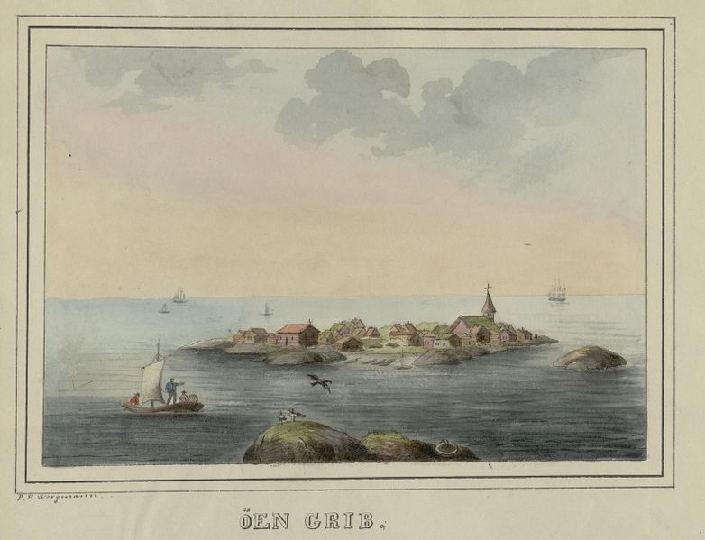
    This makes Kvernes very special. It is the only stave church in Norway built after the Middle Ages and Reformation. Now there is a theory that Grip Stave Church is also post-Reformation. If this is proven to be true, Rødven Stave Church will be the only Middle Ages stave church in the county.

    Architectural Style, or ‘What’s with the Supporting Beams?’

    Kvernes Stave Church is built in the Møre style, which is characterised by those supporting beams you see on either side of the church. The rough sloping beams hold the staves to the ground. The only other church that looks like this is Rødven Stave Church. It’s not known if they are original beams or if they have been added later on.

    So, the beams are a way of reinforcing the church. It could be because the church is exposed to bad weather and needs extra support, or the church was slipping on the ground and needed further support. In any case, it creates a very unique look!

    The Møre type also has intermediate staves in the long walls. In contrast with other stave churches, the Møre churches have roof beams across the nave.

    The church has undergone later renovation. Parts of the church were rebuilt in 1776, and in 1810 the steeple was added.

    Interior Decoration

    Most of the interior decoration is from the 17th century. The walls are richly painted with rosemaling style. There are also some depictions of biblical scenes. The walls were later whitewashed, but efforts have been made in recent years to uncover the original decorations.

    The altarpiece is unique. It’s believed it was made in the Hanseatic city of Lubeck in the 17th century.

    The pulpit is from the 1630s and is of a Dutch character. With this and the Hanseatic links considered, it’s clear this property had links to the international export of dried fish and timber.

    Another unique piece is the 300-year-old ship hanging in the nave. It has Danish flags on it.

    Preserving the Church

    A new church was built for Kvernes in the mid-19th century, and Kvernes Stave Church was no longer used. There were plans to demolish it. Luckily at the last minute, the church was bought by a group of individuals. They didn’t keep it; they donated it as a gift to the Society for the Preservation of Ancient Norwegian Monuments. The Preservation still owns the church today, and it operates as a museum in the summer.

    Visiting the Church

    The church is very well signed from the Atlantic Road. There’s only one road around the island it’s on, so you can’t get lost. There is a large parking area, and the church is a short walk from the parking lot.

    There’s a walking trail around the church where you can pass the cultural sites. Unfortunately, I didn’t go because we had a lot of heavy rain. There are three stave churches in the region: besides Kvernes, you can also visit Rødven south of Molde, or you can visit Grip Stave Church on Grip Island. We went to the first one as it’s easier to get to.

    The new Kvernes Church stands right next to the stave church, like what we saw at Torpo Stave Church.

    Kvernes Stave Church is open in the summer months. Guided tours are available in many languages.

    Close by the church are many signs with detailed information about the church in English, Norwegian and German.

    Close by is the Kvernes Rural Museum, which is an open-air museum with a collection of old farm buildings. The museum represents a 17th-century coastal farm. By the sea is a fisherman’s cabin and some preserved historic boats. The museum also has an archaeological exhibition with finds from the Stone Age Fosna culture, which (if you read into the history of Kristiansund), were some of the first peoples in Norway. Click here for info about the museum.

    Toilets are on the site, but no shops.

    Click here to view opening hours & prices.

    This is all about Kvernes Stave Church! Sure, it’s not as old as the other stave churches. But I think we can agree there’s something special about this church’s story. I hope you get to visit it on your Norwegian adventure.

    The Atlantic Road

    Kvernes Stave Church is located close to the Atlantic Road, one of Norway’s most popular tourist roads. You can find my guide to the Atlantic Road by clicking the link below. 

  • Norway’s Highways: Highway 70 from Oppdal to Kristiansund

    Norway’s Highways: Highway 70 from Oppdal to Kristiansund

    Follow our guide for the drive from Oppdal to Kristiansund! Kristiansund is typically only visited by people driving on the Alantic Road. Of course, the Atlantic Road is famous for a reason. However, if you’re looking to combine your road-trip with something a little more ‘off the beaten path’ but just as beautiful, I really recommend Highway 70. 

    Highway 70 goes from Oppdal in Central Norway to Kristiansund on the west coast. It connects you to Trondheim and Roros, two places I always recommend visiting. 

    You start at the top of the hills, and eventually wind your way down a steep valley, ending up surrounded by 1000m (3000ft) high mountains. Eventually you reach the fjords, which lead you all the way to the coast.

    Here’s my overview of what to see and do on Highway 70. 

    In this article...

    Download this Guide

    All of our guides can be downloaded via our online store. 

    We offer downloadable versions of our self-guided drives on our online store. 

    Online Guide

    Downloadable Guide

    Watch on Youtube

    All of our roadtrips are available on YouTube to watch. They include information about the area provided in text and voiceover form, plus they show the drive in full (sped up in some spots!) so you can get an idea what the drive is like. 

    The drive: Oppdal to Kristiansund

    Oppdal

    This drive begins in Oppdal, a beautiful town surrounded by national parks. It is also located at the junction of the E6 and Highway 70, making it a perfect place to start our road-trip. 

    Vang Burial Mounds

    Historic Site

    These are the largest burial mounds in Norway: there are at least 700 graves here spanning an area of 100 acres. People were buried here with their precious items between 400 AD and 1000 AD. This means the graves are pre-historic, pre-Christian and Viking graves. What makes this place even better is that it’s largely in tact.

    The area around Oppdal – the major town near Vang burial mounds – was a known wealthy site during the Viking Age and one of the most important places in pre-Christian Norway. 

    Excavations show that Oppdal as in contact with Christianised Ireland during the Viking Age. Many swords have also been found here. All the finds are in the Science Museum in Trondheim.

    I recommend going for a walk around here before starting the drive. There are marked trails and information boards everywhere. Just note – we found there was a lot of sheep poop! It’s a grazing area for sheep as well, so you’ll see and smell them. Clean your shoes before you get back in the car. 

    The site is well marked on Google Maps & there are brown tourist signs leading you there. The road down is paved, narrow, and slightly steep. There is a large carpark but no facilities. 

    Oppdal Church

    Church

    Oppdal Church is a historic church from 1651. There has been a church here ever since Christianity was introduced, and the present church replaced a stave church. As we know, Oppdal was an important place not just during the Viking Age but also during the early years of Christianity – it is situated on the historic pilgrims road. Therefore, it can be assumed that Oppdal Church was very important in the old times.

    It is possible to visit the church.

    Note – just before the turnoff is Håkkåran – the highest point on the highway at 600m (2000ft). 

    Image source

    Trollheimen

    Mountain Range

    Trollheimen is a famous mountain range. It is considered the most varied of all mountain ranges in Norway: the western part are alpine in form, with pointed peaks. Meanwhile, the mountains in the east are less steep with rounded shapes and wide valleys. The park has a unique flora and it is believed Trollheimen was one of the first areas in Norway to be cleared of ice after the last Ice Age.

    There are several traces of people using the mountains as a hunting ground. The hunters made traps for reindeer and are considered to be among the first wave of humans migrating to Norway. If you happen to be hiking near the glaciers in late summer/autumn it’s recommended to keep an eye out for prehistoric artefacts.

    If you plan on taking a detour to Trollheimen, I recommended spending at least one night there: it’s not close enough that you can quickly drive there and back. Additionally, the best views of the mountains are only accessible via hiking.

    Want to see the exact view in the photo? See info on how to get there further below 🙂 

    Resources:

    Lønset

    Village

    Lønset is a small agricultural village with a population of 450. There is a local church here from the early 19th century, though it was built to replace an earlier 18th century church. It has a memorial outside it for the 32 who were killed in the Kletthamranskredet in 1868. This is the largest avalanche in Norwegian history. The main industry is agriculture with 42 active farms, followed by tourism.

    Møre og Romsdal County

    Møre og Romsdal is a county in central-western Norway. The county is made up of three districts: Nordmøre, Sunnmøre and Romsdal. The name of the county represents these regions. We are in Nordmøre. 

    The county is similar to Vestlandet (to the south) and Trøndelag (to the north) in that it has a mild but wet climate thanks to the Gulf Stream and Atlantic Ocean. 

    Agriculture is an important industry, though oil and gas is growing thanks to the Ormen Lange field – the second-largest deposit on the Norwegian shelf. Møre og Romsdal is Norway’s largest fishing county measured in export value, and clipfish is very popular. 

    Today tourism is very important to the region. The county has some of Norway’s most famous destinations, including the national scenic roads Trollstigveien and Atlanterhavsveien. Additionally, Geiranger is one of the largest cruise ship destinations and the Geirangerfjord is on the UNESCO World Heritage list.

    The largest cities in Møre og Romsdal are Ålesund, Molde and Kristiansund. 

    Nordmøre

    Traditional Region

    We have entered the county and are in the Nordmøre traditional region. People first settled here after the last ice age, and findings from the Fosna culture have been found near Kristiansund.

    Nordmøre is mentioned several times in the old Norse saga. It’s believed that it was one of the first petty kingdoms conquered by Harald Fairhair when he was unifying Norway into one country. Nordmøre is also one of the first places Olav Tryggvason and his army christianised on their travels. 

    Åmotan Gorge

    Natural Attraction

    This site has been described as the ‘Niagara of the North’. I’m not sure how accurate that is, but it certainly is quite the site. Åmotan Gorge is an area with steep mountain peaks, moorlands and terraces. This is the place where five rivers meet, creating spectacular waterfalls.

    The parking area is 5km/3 mi off the main highway. Guided walks take place in summer, but the area is well-marked if you want to do it on your own.

    The Gorge is close to Åmoten-Grøvdalen, which is part of the Dovrefjell National Park. 

    Romfo Church

    Church

    There has been a church here since the end of the 16th century, though it has moved a few times due to flooding from the Driva River. The present-day church is from the early 1800s and is built in this, ahem, unique octagonal shape. 

    Inside are some items from the older churches, including an altarpiece from 1713 and a figure of St. Olav from the Catholic times. 

    Leikvin Cultural Heritage Site & Open Air Museum

    Historic Site

    The Leikvin Cultural Heritage Park is a historic site that provides an interesting overview of Sunndal’s history. 

    The park is spread out over a farmstead that was famously lived in by Lady Barbara Arbuthnott (1822-1904) from Scotland. She had visited Sunndal several times with her husband, William Arbuthnott, and in 1868 they bought half the farm here. 

    After she and William divorced, Barbara remained here and lived with a tour guide Oluf Endresen, who managed the farm. She learned Norwegian and became a pioneer in agriculture, importing British pigs and chickens to her farm. She wrote many Norwegian books on chicken breeding. Besides that, she was known as being extravagant and throwing large parties on the farm. She became involved in the local health service and hunting club, having a hunting lodge and local library built. 

    Today the park consists of several interesting sites. The open air museum has a collection of buildings and objects from the old peasant culture in Sunndal, plus a collection of the rich folk art from here. Exhibitions explore British salmon fishing, 10,000 years of reindeer hunting, plus the history of Sunndal. 

    The botanic garden (called Phillipshaugen) is worth seeing. It has a large collection of rhododendrons, plus around 50 species. It’s designed in a British countryside style. 

    Lastly, there is a burial ground here (Løkja). There are over 200 graves with finds from the Roman times until the end of the 10th century. All finds from the graves are at the Science Museum in Trondheim. 

    The museum is open between June and August, with guided tours available. Otherwise, the grounds are free to walk around in all year round. 

    Resources

    Sunndalsøra

    Town

    Welcome to Sunndalsøra, the largest town we’ll visit on the way to Kristiansund!

    Sunndalsøra is located in a beautiful spot. It’s at the mouth of the river Driva, which we’ve been following this entire drive, plus it’s at the beginning of the Sunndalsfjord, which we’ll be visiting next. The town is surrounded by steep mountains reaching heights of 1700m (5600ft).

    Industry

    While Sunndalsøra is a good rest stop, there’s not a whole lot to see. The town is dominated by the aluminium plant, which employs 900 people (total population 4,054). The plant has been operating since 1954 and in 2004 it was modernised to become the largest and one of the most modern aluminium plants in Europe. Aquaculture research, public service and agriculture are other main industries.

    Climate

    The climate of Sunndalsøra is unique. Atlantic lows produce a strong foehn effect in winter. This occurs when there is a strong low located southwest of the coast, bringing mild air from the Atlantic Ocean. The air is further warmed when forced over the mountains, and a dry warm air comes down to the fjord. Sunndalsøra has the national all-time high for all winter months: December with 18.3C (64.9F) (1998), January with 19C (66.2F) (2020) – this was also the warmest winter ever in Scandinavia, and February with 18.9C (66F) (1990).

    Hov Church

    Hov Church is the main church of Sunndalsøra. The church has had a very interesting history.

    The first church was mentioned in 1432, but it burned down in 1647 – it was likely a stave church. A new church was built, but it was built in such poor condition that it collapsed during a storm in 1725. A new church was built, but it was almost completely destroyed in 1727 by snow. So, a new church was built and it survived until 1849, when it was damaged by strong autumn winds. Another church was built, but it was destroyed by strong winds in 1883. The present church is from 1887 and is built on the same site as its predecessors. I don’t know about you, but I think it looks very sturdy today!

    Flåøya

    Peninsula

    Flåøya is a peninsula by the Sunndalsfjord. It’s a popular area where the locals go to spend time outdoors. It’s believed people lived here back in the Iron Age. Back then, it was an island in the middle of the fjord. There are many graves from the migration period to the Viking Age. If you walk around the site, there are information boards in English, Norwegian and German. In summer, you can swim here!

    The parking lot is only 6km / 4 mi from the highway, so that makes it a short detour. However, the best views are done by following the trail, and that can take some time. 

    Ålvundeid Church

    Church

    There has been a church here from at least 1309, according to historical records. The old church was demolished some time before the 1800s, and the new church was built in 1848. It is in an octagonal style. It’s typically not open for visits.

    Ålvundfjord

    Fjord

    Ålvund, or Ålvundfjord, is a small village at the beginning of the Ålvundfjord. Since 2004, it has not been considered an urban settlement by Statistics Norway. Yeah, it’s a small place!

    Tingvoll Municipality

    Welcome to Tingvoll Municipality! This is a small municipality with a scattered population, and we’ll be visiting the main town on this drive.

    The name is very special. Eight or nine centuries ago, Tingvoll was the site of the Nordmøre Ting – hence the name. There was a flat field here, which in Norwegian is voll. It was here that the meetings were held – ting + voll. Ting is best compared to a parliament: representatives from different regions come together to make decisions. Today, the parliament in Norway is still called Ting. Tingvoll is a name found in many place: the Scottish town of Dingwall, the parliament on the Isle of Man is Tynwald, the English town of Thingwall (colonised by the Norwegians), and Thingvellir (Þingvellir) in Iceland.

    It’s believed this is where the Tingvoll Church is today.

    Tingvoll Church

    Historic Church

    Tingvoll Church is one of the oldest stone churches in Norway. It’s well worth taking the two minute detour here to have a look at this gorgeous building.

    Tingvoll Open Air Museum

    Museum

    Tingvoll Museum is an open-air muesum built on an old farm. The farm itself is ancient, while the museum is from 1954 – that year the farm closed down and the municipality took over.

    The museum is comprised of farm buildings from the mid-19th century. Additional buildings have been moved here, including a workshop, mill, and school building.

    Tingvoll Museum is 1.7km off the main highway. It’s open from 12pm to 4pm during summer, and they have plenty of activities for kids during that time.

    Up-to-date opening hours and practical info can be found here.

    Bergsøya

    Village

    Agriculture and forestry are important industries here. Nearly half of all the employees commute to the neighbouring municipalities, especially Molde.

    Bergsøya has been connected to the mainland via bridge since the 1990s. Before then, it only had a ferry connection. The road we are on is nicknamed “Krifast” – it’s the main road connection between Kristiansund and the mainland. Because of this, it is often a very busy road.

    Frei Church

    Historic Church

    Frei is a fairly well-known island, especially when it comes to Norway’s early history. The early Norwegian kings often came here to take part in hunting, the most known being King Haakon the Good.

    Haakon the Good was also one side in a famous battle that took place here in 955. It’s called the Battle of Rastarkalv. Basically, it was one of several battles between King Haakon and the sons of Eirik Bloodaxe. After Eirik’s death, Harald Greycloak (one of the sons) and his brothers were allied with King Harald Bluetooth of Denmark against King Haakon. They set out to Frei to find Haakon and kill him. Haakon was smart, though, and he had set up a warning system with cairns that would be lit to tell of approaching fleets. Therefore, Haakon knew they were coming. Haakon fooled Eirik’s sons into believing they were outnumbered. The Danes attempted to flee the island, but when they arrived at the beach they realised that their ships had been pushed out to sea. Haakon gained victory and the Danish forces were slaughtered. Woohoo?

    Egil Ullserk, Haakon’s leading man, died in the battle. Today there is a stone monument near the Frei Church to commemorate the battle. 

    You should also visit Frei Church. It’s a very pretty yellow wooden church built in 1897 to replace an older building. However, the first church on Frei was mentioned in 1432. In the middle of the 1600s, it was described as a stave church. Sadly, in 1766 it was struck by lightning. The next church was torn down to be replaced by this one. 

    Frei Church is a short detour off the main highway. It’s located in the town Nedre Frei. 

    Nordlandet

    Island

    Nordlandet is one of the islands where Kristiansund city is located (it’s spread out over three islands). In the city centre area, Nordlandet consists of some old warehouses and homes, plus the Nordlandet church – the church that dominates the Kristiansund skyline.

    Further out, Nordlandet consists of large shops and a shopping mall, plus the Kristiansund Airport. At the airport is a helicopter base for the oil business. Nordlandet is the part of Kristiansund that has seen the most development in the last thirty years.

    It’s important to note that if you want to visit Nordlandet Church or the island, you have to drive all the way over the Rv70 from town – there’s no direct bridge from the city centre. There are ferries for people, though. 

    The picture above is Nordlandet from the city centre. It’s the island to the left – you can see Nordlandet Church. 

    Kristiansund

    Welcome to Kristiansund! You can find a comprehensive overview of Kristiansund via the travel guide below. 

    The Previous Drive

    Folldal to Røros

    On the previous day we had driven from Folldal to Røros in Eastern Norway. 

    The Next Drive

    The Atlantic Road

    On the following day we took one of Norway’s most famous drives, the Atlantic Road. 

    If you liked this drive, or if you have any travel tips, please leave a comment in the section below!

  • From the First People to Klippfisk: the History of Kristiansund

    From the First People to Klippfisk: the History of Kristiansund

    Kristiansund is an important place in Norway. Today it’s associated with the klippfisk (clip fish, dried and salted cod) trade that took place here. And rightly so! Thanks to klippfisk, we have Kristiansund. Still, there’s a lot more to this island city that is worth knowing before you make the trip there. The history of Kristiansund is truly fascinating.

    Here’s my historical overview of Kristiansund. As always, I have relied on books and websites that provide an incredible amount of detail. You can find links to them throughout and at the bottom of this article.

    In this article...

    The E39 Highway

    Kristiansund is located on the E39, the main highway along the west coast. You can find my guide to the E39 by clicking the link below. 

    Norway's Coastal Ferry

    Kirkenes is a port of call of Norway’s coastal ferry. Find my guide for the coastal ferry by clicking the link below. 

    Kristiansund is the oldest settlement in Norway

    Kristiansund wasn’t always known as Kristiansund. The name came in 1742 when King Christian VI gave the settlement a town charter. The town gets its name from him, but more on that later.

    The first name of Kristiansund is Fosna. It’s generally believed that this place was one of the earliest settlements after the last Ice Age. People likely arrived around 8000BC as Kristiansund (and its surrounds) were one of the first ice-free places in Norway. Additionally, the surrounding sea had lots of food. Additionally, there was lots of stone and flint they could use as weapons and tools.

    Today, the first Norwegian peoples as known as the ‘Fosna culture’. Traces of these peoples were first made in Voldvatnet (Vold Lake) in 1909. Kristiansund isn’t the only place where the Fosna people lived – it’s just where they got their name. Fosna is an umbrella term for the oldest settlements along the Norwegian coast. Additionally, similar cultures were on the coastline in Sweden and Northern Germany. The sea used to be much higher – today their settlements are 60-70m above present sea level.

    You can visit Voldvatnet (also spelt Vollvatnet) today. Sadly it’s in a very crowded industrial place in Kristiansund. 

    Wiki (English) https://en.wikipedia.org/wiki/Fosna%E2%80%93Hensbacka_culture

    Wiki (Norwegian) https://no.wikipedia.org/wiki/Fosna-Hensbacka-kulturen

    Vikings around Kristiansund

    While Kristiansund itself is not mentioned in the Viking Age, we know the Vikings were in this area. Firstly, because nearby Tingvoll was a historic meeting place. ‘Ting’ is an Old Norse word that means ‘assembly’. It’s where the chieftains would meet to discuss important matters. Secondly, the nearby island of Frei is mentioned in connection to a battle that took place during the Viking Age. You can read about it on my page about driving from Oppdal to Kristiansund as we drive past the place where it happened. 

    Fil:Grip hamna2005.jpg
    Grip (Source)

    Trade & Stockfish on the island of Grip

    Grip is one of the places I hope to visit and write about someday, but if you go to Kristiansund it’s an island you can take a day trip to. I recommend it.

    We know Kristiansund wasn’t very populated in the early years, but the island of Grip sure was. The first settlement of Grip is unknown. The island emerged from the sea sometime between 3500BC and 2500BC. This is well after the Fosna people of Kristiansund (and surrounds). There are no archaeological traces on the island, which is notoriously hostile. The very first fishermen to settle here must’ve been very brave!

    There are no written documents about when Grip was first settled. However, it was likely between the 9th and the 13th centuries. The island has no arable land and no shelter from strong winds, but it does have very rich fisheries. The people who moved here wanted to be close to the fishing grounds. In the 13th century, the Hanseatic League was gaining prominence in Bergen. The export of stockfish from Lofoten was becoming big business. The fishermen likely saw an opportunity in settling on this island, which is on the journey south from Lofoten to Bergen. 

    Grip became a very important place. In fact, it was the largest settlement in Nordmøre. The island came under the control of the archbishop of Norway, which is common. The church was the wealthiest landowner until the Reformation. 

    Fil:No-nb digibok 2014091028002 0141 1.jpg
    Grip in 1833 (Source)

    Grip has one of Norway’s 28 remaining stave churches. Grip Stave Church is from 1470 and is the oldest building on the island today. The altarpiece represents the strong connection to the Hanseatic merchants from Europe. Having a decorated stave church on such a remote island indicates how important this island was for the merchants. 

    The 15th and 16th centuries were the peak period for the island, thanks to the Hanseatic trade. Many wealthy merchants settled on Grip, and the population was as much as 300, making it the largest village in the region. The Hanseatic merchants exported stockfish to Europe, and Grip was one of the production sites. 

    Everything came crashing down at the Reformation when in 1537 King Christian III seized all church property in Norway. From the 18th century onwards, several harsh storms hit Grip, and the fishing grounds began to fluctuate. The population came and went depending on how good fishing was. No one lives permanently on the island today. Simply put, the island didn’t have a good enough location to develop a city. Additionally, towns by the fjords were becoming more popular as timber export grew. The houses today are holiday homes. You can visit Grip via a ferry from Kristiansund. 

    A harbour founded amongst islands

    Grip was where the action was, but there was a tiny settlement in Kristiansund. At the time it was known as Lille-Fosen based on the first peoples who lived here. The people lived on the meadow by the bay, Vågen, and this is where the city began to grow. You can see it on a map. Firstly, it’s where the Shipbuilding Museum is. Secondly, you can see how the bay is sheltered from strong winds coming in from the North Sea. 

    We know Grip wasn’t a great place to live. So, as trade moved away towards timber in the 17th century, merchants started looking for a natural harbour. This is the basis for commercial expansion and settlement in many places along the Norwegian coast. This is how Kristiansund began to grow. Even though Grip was important for boat traffic sailing along the coast, the significance of Lille-Fosen’s harbour between three islands increased. The small community grew from the 17th century, especially when the Dutch discovered it.

    The Golden Age of the Dutch Merchants, otherwise known as Hollendertiden

    The Dutch began coming to Norway in the 16th and 17th century to take all the timber. At the time, the Netherlands was the leading shipbuilding nation in Europe. To maintain this they needed a lot of timber. But not any timber. They needed long, straight trees with strong resilience to withstand harsh weather. Norway had large quantities of timber that they could buy at a reasonable price. 

    Fun fact: Amsterdam is literally built on Norwegian timber as timber was needed for foundations under large buildings.

    The Dutch came to the area around Kristiansund. There are some rich forests on the fjords, and the harbour of Kristiansund (then Lille-Fosen) was safe and suitable for them. The harbour Vågen became a permanent mooring and gathering place for vessels that visited the district. A customs station was established in 1630 to control the timber trade. 

    The Dutch didn’t only come to take all the timber; they brought goods for sale. Ceramics were very important. It’s likely they also brought wine, beer and liquors to Kristiansund. The Norwegians profited heavily from this, especially the forest and sawmill owners. They didn’t only go to Kristiansund; many coastal towns in Sørlandet, Østlandet, Vestlandet and Nordmøre (the stretch of coast from Kristiansand to Kristiansund) saw Dutch merchants come here. 

    The Dutch period lasted until 1850. 

    In the 1690s, something happened that would change Kristiansund forever. A Dutchman named Jappe Ippes brought knowledge about the production of klippfisk. He received a royal privilege that gave him permission to manufacture and export klippfisk. And so, a new industry was born. 

    Kristiansund in the early 18th century (Source)

    Klippfisk – Wikipedia
    Klippfisk

    The city founded on Klippfisk

    Kristiansund is said to be founded on klippfisk. After Jappe Ippes introduced the process in the 1690s, men came to Kristiansund to learn and expand the business. One of the most prominent men to come here was the Scotsman John Ramsay. John turned it into a large company, and soon after the most enterprising of merchants in Kristiansund gained control of all stages of klippfisk production. They received the catch, processed it, and then exported it. 

    We should back up a moment. What is klippfisk? It was virtually unknown in Norwegian cuisine at the time. Clipfish (I’m using the Norwegian name, klippfisk) is cod that has been both salted and dried. It is a descendant of stockfish – cod that dries unsalted and is as old as the Viking times. The process of salting fish started in the 15th century but was introduced to Norway by the Dutch. 

    ‘Klippfisk’ means ‘rock fish’ because they leave the fish out on rocks to dry. 

    There’s a big overview of how they make klippfisk (in English) here: https://cod.fromnorway.com/norwegian-cod/clipfish/

    During the 18th century, klippfisk became a major industry. Boats came in from the sea with the salted catch. Producing klippfisk was labour intensive, and soon factories popped up all over Vågen. They wash the fish before salting it again and drying it on a ‘fish mountain’. They then press it flat for two weeks to allow the saltwater to drain. Milnbrygga and Milnbergan are important cultural monuments from this time. Today, the whole process is modern and explained in that link above. 

    Thanks to klippfisk, the town began to expand. Lille-Fosen built up a large fleet with shipyards and ropeways. Expertise in shipbuilding was obtained from Copenhagen. The city grew in the 18th century as klippfisk became the major industry. 

    Lille-Fosen becomes Kristiansund

    The town got its name after King Christian VI granted it a town charter in 1742. He named it after himself, much like the Danish kings before him had named towns after themselves (see Kristiania/Oslo and Kristiansand in the south). Yes, there is often some confusion between Kristiansund and Kristiansand. Before postcodes, it was obligatory to add an N (for north) to Kristiansund and an S (for south) for Kristiansand. Some people still practice this, and when I say I’m going to Kristiansund, I have to word it like “KristianSUND (the one in the north)”. 

    The town charter meant expansion. Commerce in the town developed during the following decades and Kristiansund prospered. The demand for klippfisk was so great that the fishermen could not supply it all. Fishermen brought cod down from Lofoten and Finnmark to make the klippfisk. From the 1820s, salted herring also became an important export product. The city got a large fleet of sailing vessels, yachts, and galleys for traffic. The market expanded to the United States. The Danish merchant Christian Johnsen learned the principles of klippfisk trade in Bilbao and established his business in Kristiansund that exported klippfisk to Asia, South America, and Europe. Another klippfisk merchant, Nicolai H. Knudtzon, was Norway’s richest man at the end of the 19th century. 

    By the end of the 19th century, Kristiansund was a wealthy and prosperous town with merchant mansions, quaysides and wharves. 

    The Spanish Era & Eventual Collapse

    Around the time the Dutch trade was ending, the Spanish began to come to Kristiansund. Spain is one of the countries that ate a lot of klippfisk, due to the rules around Catholicism and not eating meat. Additionally, the Spanish had introduced bacalao using klippfisk. 

    Basically, the Spanish came to Kristiansund to buy klippfisk without a middle man. The Spanish sailors introduced bacalao to the city. 

    Fun fact: The ships that brought klippfisk to Spain brought back soil as ballast. The area around Kristiansund had little soil and Spanish soil was used in, among other things, the towns first public cemetery. 

    The klippfisk business continued until 1884. A sudden fall in market prices in Spain hit the companies in Kristiansund. All klippfisk exporters, with one exception, went bankrupt. 

    1870: https://digitaltmuseum.no/011013318326/kristiansund-more-og-romsdal-lunds-nr-21

    1880: https://digitaltmuseum.no/011013318387/panorama-av-havna-pa-innlandet-kristiansund-ca-1880-del-av-panorama-se

    Kristiansund in 1911 (Source)

    Kristiansund or Fosna?

    When Norway became independent in 1905, many cities started discussing the possibility of changing their name back. The Danes had changed many Norwegian town names. This is most prominent in Oslo, which was named Kristiania by Christian IV and changed back shortly after World War I. In Kristiansund, it was argued that the old name Fosna should replace Kristiansund. In 1929, a vote showed overwhelmingly that 99.1% of locals didn’t want the name changed. 

    The 1920s & 1930s: Wealth and Collapse

    At the end of the 19th century, Kristiansund was a beautiful city with many large merchant farms, boathouses and piers. The city didn’t have much of a zoning plan; instead, a house went wherever you could fit it. While this was impractical when cars were introduced, it was charming. Most of the houses were wooden.

    Kristiansund in 1882: https://digitaltmuseum.no/011013318183/gatebilde-fra-torvet-kirkelandet-kristianssund-1882-i-forgrunnen-til-venstre

    In 1928, 32 years before a national opera was founded in Oslo, the Norwegian Peoples Opera was founded in Kristiansund. So, opera came to Norway through Kristiansund. Today there is an opera festival that takes place every February. 

    Due to the limited scope of commercial activities, Kristiansund struggled to recover after the post-WWI economic collapse. Attempts in the 1930s to find new industries for Kristiansund began, but that was all halted by World War II. 

    The Bombing of Kristiansund (Source)

    World War II

    At the end of April 1940, when Nazi Germany was invading Norway, Kristiansund was subject to almost four days of continuous bombing by the German Luftwaffe. The town was left almost in ruins. Five people died, and 800 buildings were destroyed by fires that ravaged for days after the bombing. This corresponds to 28% of Norway’s total war damage to buildings during World War II. 

    Why did Germany bomb Kristiansund? Well, they thought the Norwegian King and the government were hiding here. They were not; they were in Molde. 

    Little could be rebuilt during the war, and most of the inhabitants who became homeless had to live in barracks until the end of the war. Some Swedish prefabricated houses were built in Kristiansund, and they still stand today. The street they are on is Vuggaveien. 

    Post-war Rebuilding

    After the war, Norwegian architects got to re-designing towns that were damaged during the war. The rebuilding was initiated under the ‘Brente steders regulation’ (Burnt Places Regulation). While a zoning plan was ready as early as August 1940, work couldn’t begin until after the war.

    Kristiansund got typical post-war architecture that characterises many of these ‘burnt places’. It’s best described as a sober functional style. The central parts of the city completely changed from charming, wooden districts to planned streets with concrete blocks. The building of Kirkelandet Church in 1964 marked the end of re-building.

    By 1950, 68% of the city had been rebuilt.

    Today, the reconstruction of Kristiansund is highlighted as one of the 20th century’s most worthy cultural environments in Norway. Furthermore, the town has the best-preserved examples of post-war architecture. The area that was rebuilt is the ‘Reconstruction City’ and has a very strong concentration of post-war houses not found elsewhere in Norway. 

    The main street, Kaibakken, is a great example of post-war design. It was a key element in the city’s reconstruction architecture. Many ‘burnt places’ in Norway got long, main streets like this one. They found inspiration in streets like the Champs Eylyss in Paris. 

    Finding new industries

    After the war, Kristiansund knew it had to expand beyond klippfisk. While klippfisk is still at the heart of the city, there are new industries in Kristiansund. The food industry is still important, but Kristiansund is now a central operations and supply base for the offshore oil industry. Oil is now the main commercial basis in the town.

    Modern Kristiansund's Highlights

    Today 24,334 people live in Kristiansund and it has all the facilities you’d ever need. The population of Kristiansund is actually rising. 

    Transport connections to Kristiansund are pretty good. Besides ferries out to the surrounding area, Kristiansund has the Norwegian National Road 70 and the European route E39. The airport, Kvernberget, has connections to major cities in Norway plus some European destinations in the summer. Kristiansund is also a port on the Hurtigruten. If you take the Hurtigruten southbound (Kirkenes – Bergen), you stop in Kristiansund for one hour in the afternoon. They have excursions to the Atlantic Road.

    There are plenty of primary, middle and upper secondary schools in Kristiansund. However, there no higher education facilities. 

     Culture & Tradition

    Kristiansund has a rich cultural life with the Opera Festival, the Nordic Light International Festival of Photography, the City Festival and the Tahiti Festival. The Opera House is the oldest in Norway. It is from 1914 and is one of the few buildings to survive the World War II bombing. Another one of the few buildings to survive World War II is Nordlandet Church, which is built of stone from 1914. It dominates the skyline on the island of Nordlandet. The newest church is Kirkelandet Church, which was the final postwar building in Kristiansund. 

    As you may imagine, there’s also a rich food culture in Kristiansund. Besides bacalao, another main dish is blandaball. I know the name doesn’t sound great in English. It’s a fishball consisting of fish (of course!), onion and potato. The ingredients are ground and shaped. In the middle is a piece of pork, just like a Norwegian Kinder Surprise. They don’t look great, but they taste excellent. 

    There are plenty of museums in Kristiansund about the history of the city. The Norwegian Bacalao Museum is the most popular. The Nordmøre Museum is also located here, plus the historic Mellemvaerftet Shipyard that you can visit. Vågen – the old harbour – has many interesting cultural monuments and is a great place to visit. Some old merchant farms and wharves are still standing. The old town was somehow spared during the bombing and it gives an insight into what Kristiansund used to look like.

    Lastly, the big thing people come here to see is the famous Atlantic Road – one of 18 national tourist roads in Norway. But more on that in a separate article.

    I hope you’ve enjoyed this overview of Kristiansund’s history, and that it’s inspired you to visit someday!

    The E39 Highway

    Kristiansund is located on the E39, the main highway along the west coast. You can find my guide to the E39 by clicking the link below. 

    Norway's Coastal Ferry

    Kirkenes is a port of call of Norway’s coastal ferry. Find my guide for the coastal ferry by clicking the link below. 

  • The Old Meeting Place & Stone Church of Tingvoll

    The Old Meeting Place & Stone Church of Tingvoll

    Tingvoll Church is a historically important church in the west of Norway. Located close to Kristiansund on the Tingvollfjord, the site is where chieftains met in pre-Christian times. When Christianity came to Norway, they plopped a church down on the important place. Tingvoll Church has stood here since the second half of the 1100s. Today it’s one of the most important stone churches in the country.

    If you find yourself driving around Kristiansund, I recommend making a detour to this church. Below I’ve written an overview of the history, decoration, and significant of the church. Hopefully, it inspires you to make the journey there.

    In this article...

    The Rv70 Highway

    Tingvoll Church is located on the Rv70, a major highway in western Norway. You can find my guide to the Rv70 by clicking the link below. 

    History of Tingvoll Church

    Tingvoll Church is one of the few stone churches remaining from early Christian times in Norway. The first mention of the church is in 1357. It is referred to as Þingualla kirkiu. However, the church is much older than that. It is from the 1100s.

    The site of the church is important. The name Tingvoll refers to a meeting place where the chieftains would meet to discuss laws, events, and settlements. Ting is a word that comes from the Old Norse meaning ‘assembly’. Today the parliament in Norway is the Ting. ‘Tingvoll’ is a name found in many Viking settlements, too. This includes the Scottish town of Dingwall, the parliament on the Isle of Man is Tynwald, the English town of Thingwall, and Thingvellir in Iceland.

    In the old times, Tingvoll was the meeting place of the chieftains for the region of Nordmøre. There is very little evidence that Tingvoll Church was an important county church. Instead, the choice of location is likely symbolic: representing Christianity coming to the region. Tingvoll Church is sometimes nicknamed Nordmøre Cathedral to symbolise the location as important in the region.

    In the Middle Ages, there were around ten stone churches in the county. This indicates that the region was very important when it came to religion. They used stone as a building material for the most important churches. Normally, wooden stave churches were built during this period.

    Johan Meyer’s Description of Tingvoll Church

    A lot of what we know about Tingvoll Church today comes from one man, Johan Meyer. He (1860-1940) was a Norwegian architecture professor. Meyer conducted extensive work on Norwegian ancient monuments and historical architecture. He believes there used to be a stave church on the site, but it burned down during the Civil War in the 12th century. It was then replaced by the current church.

    Meyer also wrote a detailed overview of the design, architecture, and use of the church. His book, Tingvoll County Church on Nordmøre, is the most important historical document on the church. It is from 1910 and you can read it online here (in Norwegian).

    Click here to learn more about Johan Meyer.

    Design & Architecture

    As mentioned above, a lot of what we know about architecture comes from Johan Meyer. The walls of the church are 1.8m (5ft 11in) thick, and Meyer believed that the church doubled as a fortress. Unlike other stone churches in Norway, there are corridors and stairs in the thick walls. Tingvoll Church is the only church in Norway (and the Nordic region) partly built as a fortress with a corridor system and thick walls.

    Other than the unique fortress aspect, Tingvoll Church has a similar style to other stone churches in Norway. This includes Veøy Gamle Kirke near Molde, Værnes Church in Trøndelag, Mære Church in Steinkjer, and Trondenes Church near Harstad.

    The corners and openings have marble stone, a common feature of old churches in north-western Norway. Unlike many other medieval churches, though, there is an unusual number of windows. The three-leaf clover arches on the west gable are inspired by Nidaros Cathedral in Trondheim.

    Interior of the Church

    The church is a little plainer than some other churches, especially the stave churches. But what decorations there are, we see rich and beautiful details. While there’s not much of it, what craftsmanship we can see shows that these people were very skilled.

    Sadly, after the Reformation, the new Lutherans removed or covered many of the decorations. Efforts to uncover the old decoration took place during a more recent renovation, but many objects remain lost. Most of the decoration inside is reminiscent of the 17th century.

    On the walls are remnants of frescos, but most of them were painted over during the Reformation. You can see a fresco of St. Georg in battle with a dragon, and a fresco on the north wall has remnants of a king and bishop.

    Important Pieces

    The pulpit is Dutch and comes from around 1632. The carved figures are in the Spanish Baroque style depicting Christ and the Evangelists and Adam and Eve on the canopy.

    Fil:2008 04 20 Tingvoll gamle kirke 110.jpg
    Image source // Image by Frode Inge Helland

    The altarpiece is early Gothic from the 13th century and still in use, though there is a second Baroque altarpiece from 1660.

    The baptismal font is from Nuremberg and dates back to 1444. It’s made of brass.

    Fil:Tingvollskulptur.2.jpg
    One of the the chapter figures // Image source // Image by Nina Aldin Thune

    On the lecture wall/choir wall are two preserved chapter figures from 1200. They were uncovered when the wall opened in a later restoration. The 17th-century wall had been built over the figures. Today, they are the only stone sculptures in the church.

    Fil:2008 04 20 Tingvoll gml kirke 106.jpg
    Image source: https://kunsthistorie.com/fagwiki/Fil:2008_04_20_Tingvoll_gml_kirke_106.jpg // Image by Frode Inge Helland

    A special item inside is the ‘King’s Chair’. It is from 1662 and has its name because King Christian V of Denmark/Norway visited in 1685. He attended service at Tingvoll Church and sat in the chair. So, it became known as the King’s Chair! In memory of the event, a monogram C5 is above the chair.

    Runic Inscriptions

    Like many churches, this also has a runic inscription on it. A rune inscription is the Old Norse written text carved into stone or wood. These runes are on marble and say:

    I pray for God’s sake you learned men who guard this holy place and all those who interpret my prayer: Remember my soul in holy prayers. But my name was Gunnar and I made this house. Live well.

    Historians regard this inscription as one of the finest in a Norwegian church. Additionally, it teaches us a lot about this person. The person who did this inscription probably mastered Latin letters. Also, the spelling is influenced by Latin script culture. Because the spelling is consistent, the person was likely familiar with text in books.

    Restoration Work Attempts and Lawsuits

    The most original part of the church is the walls, which are the same as they were in the Middle Ages. Storms damaged the tower in the 17th and 18th centuries, and repair work in 1708 gave the tower its present form.

    In the early 1900s, it was discovered that the building lacked proper foundations – the thick walls stood right on the ground. The ground underneath was sliding, causing the walls to begin to crack. A major restoration was done in 1928 when the interior got its current appearance.

    And then came the lawsuit. In 2016, a new refurbishment of the exterior was carried out. Ever since the 12th century, the stone walls had traces of the original builders on them. However, the company that did the restoration used angle grinders – something you aren’t supposed to do – and destroyed the traces of the original buildings.

    After the work was done, the National Heritage Board claimed that the company did the work in such a way that the surface of the rock changed. The case went to court. While the company was known for restoring old buildings, many errors were made on this one. The company had used incorrect methods and equipment, and the crew were not properly trained. They didn’t speak Norwegian well, and they didn’t understand the instruction and control. 1/6 of the buildings 300 stones were completely or partially damaged. The construction company was fined 400,000 NOK for their error.

    Article about the damage + images of what the builders did

    Another article with more pictures

    Tingvoll Vicarage

    Next to the church is the old vicarage (prestgård). This is the culture centre for Nordmøre, but historically it’s where the priests lived. Several priests who lived here are quite well known, such as Hans Tausen (1659-1697), who started an astronomical observatory here during his tenure. This guy was a character. Look here at this photo of him.

    The buildings here are listed. The main building (with the turf roof) is from 1622-25, the barn is from 1900, and the boathouse is of unknown age.

    Cemetery

    In the cemetery you’ll find a memorial for all the locals who died during Wold War II.

    The Church Today

    Today the church is open during summer, and guided tours can be arranged. Summer concerts are held on Saturdays at 5pm.

    There is a large (free) parking area outside, and it’s just a minute or so to walk to the church. It is fairly well signed from the town of Tingvoll, but all GPS navigation systems have it marked as well.

    There are no facilities here.

    The Rv70 Highway

    Tingvoll Church is located on the Rv70, a major highway in western Norway. You can find my guide to the Rv70 by clicking the link below. 

  • Drive it Yourself: Folldal to Røros: A Scenic Drive Through the Industrial Region of Eastern Norway

    Drive it Yourself: Folldal to Røros: A Scenic Drive Through the Industrial Region of Eastern Norway

    I love Røros. I’m fairly positive I begin each article about Røros with that statement, but it’s very true. Røros has an incredible history and is a very well preserved town. I’m surprised more travellers in Norway don’t go there.

    When we are visiting Røros in September 2020, we were driving up from Ringebu via the Rondane National Park. The road to Røros isn’t direct, but we didn’t mind. Little did we know that we were actually driving through a historic mining region. The road from Folldal to Røros is a very old mining area – mining began here in the 17th century. Many of the towns you pass through on this drive were established thanks to Røros Copperworks – the main mining company here.

    Even if mining isn’t of interest to you, don’t pass up a chance to drive through this gorgeous part of the country.

    Here’s my drive from Folldal to Røros via Alvdal on Highway 3 in Norway.

    In this article...

    Watch on Youtube

    All of our roadtrips are available on YouTube to watch. They include information about the area provided in text and voiceover form, plus they show the drive in full (sped up in some spots!) so you can get an idea what the drive is like. 

    The drive: Folldal to Røros

    Folldal Mines

    Historic Site

    We begin at the Folldal mines, an old 18th century mine that is today heritage listed in Norway.

    Mining was the main industry in Folldal from the 18th century until 1993.

    Folldal Works (Folldal Verk) was founded in 1748, the same year the main copper mine opened. Copper, mine and zinc was all mined in Folldal. It was then transported by horse carriage to the neighbouring Alvdal municipality, where there was a smelter. In 1906, a 34km-long cable car (North Europe’s longest) was built to transport goods to the smelter.

    The main mine closed in 1941, but smelting continued using ore from other deposits until 1968. Business closed in 1993.

    Today the mines are a museum.

    The museum has short opening hours – late June to mid-August. They have some really interesting attractions and ticket combos, so I will be back!

    You can drive up to the carpark and wander around outside for free.

    Click here to view their website.

    On their website you’ll find opening hours and ticket fees.

    Vassaga

    Historic Site/Detour

    Vassaga is a preserved sawmill from 1900. It is powered by water and is unique because it has a special device for sawing shavings. This is the only known instance of a sawmill having a device for shavings. The shavings are used in roofing in the area.

    You’ll see signs pointing to it from the highway.

    Folldal Church

    Church/Detour

    Folldal Church is located on the road that leads to Vassaga. The church is a typical rural church from the late 19th century. The altarpiece inside is from the 17th century.

    Grimsbu

    Village

    Grimsbu is a tiny town; when I was researching it, some of the top hits on the web were for the IKEA furniture named after the town!

    There is a campsite in Grimsbu – the Grimsbu Turistsenter – that has everything you’ll ever need when camping. From Grimsbu, there are hiking and skiing trails plus spots for fishing.

    There is an ancient road in Grimsbu called Byveien. It is a route over the mountain that from around 1050 until the Reformation connected the pilgrims routes through Gudbrandsdalen and Østerdalen. In the 12th century, the road was laid out as a pilgrimate route from Innlandet to Nidaros. The road was forgotten for many centuries, but now there is an active effort to restore the road. The trail is north of Grimsbu. An image of it can be seen here. 

    Grimsbu also has an old BP petrol station that looks as it did when it was put there in 1955. There used to be a country store on the property – it dates back to 1900 – but in the 50s they modernised with a petrol station. A website for it is found here (also the image source). 

    The BP station is by the Fv29 and across the street from the Grimsbu Turistsenter – a hotel/cafe/shop building.

    Einunna

    Historic Site

    When Norway was invaded on 9 April 1940, a group of Norwegians mobilised in Alvdal. They organised a defence at Einunna Bridge by blowing it up.

    When the Germans arrive on 26 April, they inspected the bridge and the Norwegians surprised them with gunfire. A fight commenced, but the Norwegians were buried in snow and hard to see. The German tanks managed to keep the Norwegians down so most of the Germans could get out. They tried to advance, but it was impossible. The Germans did eventually occupy Alvdal, but they came in via another road.

    From 2020, the bridge is being rebuilt.

    There was a rest area, but when I visited it was closed due to the construction work.

    Info about the WWII battle

    Musea i Nord Osterdalen link

    Alvdal Municipality

    You cross into Alvdal Municipality.

    Alvdal

    Town

    Alvdal is a small town (pop. 2,418) with a long tradition of mining, as is common in this part of Norway (and the focus of our drive!).

    There has been mining in Alvdal since 1656, when the first finds of copper ore were made nearby. Mining didn’t take off until copper was found in Folldal in 1745.

    The mines in Folldal got into disputes with the mining operations in Røros, including access to timber. Due to the little access to timber in Folldal, a smelting hut was built in Alvdal instead. Alvdal has plenty of access to timber. It was less resource intensive to transfer ore to Alvdal than it was to transport wood to Folldal.

    New mines were built around the area in the 18th century. From 1905, a cable car was used to transport ore to Alvdal.

    Mining operations declined and have mostly ended now. Today the largest employer is the dairy company, and many people work in agriculture and the timber industry.

    Glomma River

    River

    At 621km (386 mi), the Glomma is Norway’s longest river. It has a drainage basin that covers 13% of Norway’s surface area, all in the southern part of the country.

    At its full length, the river runs from Aursund near Røros and empties into the Oslofjord in Fredrikstad.

    The combination of raw materials, water power and transport has over the centuries encouraged industry along the Glomma. Some of the country’s largest manufacturing and processing businesses are found at its mouth.

    Tynset Municipality

    You cross into Tynset Municipality.

    Tynset

    Town

    Tynset is a small town located in the north of Østerdalen, or the Eastern Valley. It is first mentioned in 1211, when the archbishop of Nidaros consecrated a stave church. There is no stave church today; there are parts from an old stave church at Kvikne (more on that below).

    The town is known for its vast areas of forest and mountains, which are ideal for outdoor activities. Tynset is also one of the few places where most of its mountain farms (seter) are in use. You can visit them when hiking, and even rent some for the night.

    Kickers/kicksleds (Norwegian: spark) are produced here. The world’s largest kicker is in the main square of Tynset; it is four times life-size.

    Kvikne

    Historic Site/Detour

    Kvikne is home to the Kvikne copperworks, founded in 1630, which was one of Norway’s first copperworks. This led to the population in the mountain village rising and laying a foundation for further development. The copperworks was run by the Danish King, and was the largest copper plant in Norway. Eventually Folldal and Røros became more important, and Kvikne was clsoed down in 1812, though operations continued in a much smaller capacity until 1912. Only ruins remain today, but you can visit them.

    Kvikne Church is from 1654 and seats 203. It has decorated equipment and an interior with a carved altarpiece and pulpit. The crucifix is in the Romanesque style and dates to around 1200. In the attic, stave church planks in the Urnes style have been found, probably from an older church on the site. Bjørnstjerne Bjørnson was baptised in the church.

    Close to the church is the Bjørgan vicarage, a museum and former vicarage in Kvikne. It is considered an artists home as Bjørnstjerne Bjørnson (1832-1910) was born here and lived here until he was five.

    The house is built in 1780 and was a vicarage until 1860. The building was supposed to be demolished, but it was saved in an attempt to make it a museum for Bjørnson. Several items from his time are on display in the museum.

    Kvikne is a 40 minute drive from Tynset, so it is quite the detour but worth doing.

    Telneset

    Town

    The next small town along the Fv30 is Telneset. It is not an old town; it was actually built up alongside the establishment of the Røros Line in 1877. A small community was built up around the train station, and soon there was a post office and a sawmill. The sawmill made materials for building houses, and soon there was a concrete foundry to supply roof tiles and pipes, plus a carpentry to make windows, doors and furniture.

    Telneset saw a dramatic event take place here during World War II. On 24 April 1940, the Germans were coming up Østerdalen while a train with Norwegians was in retreat. The train was shelled and had to stop at Telneset. German planes came and dropped 13 bombs on the train and the damage was great; six Norwegians were killed.

    Today Telneset is a small agricultural community.

    Tolga Municipality

    You cross into Tolga Municipality.

    Tolga

    Town

    Our next stop is Tolga, which was built up around the Tolga smeltehytte (smelting cabin) in the 1660s. The smelter was operated by Røros Kobberverk and it was in operation until 8171. Tolga was a suitable location because it had waterfall power plus a good supply of timber.

    Today many people work in agricultural, though the municipality is the largest employer.

    In the town centre you’ll find an old farmstead called Dølmotunet. During the summer there are tons of activities thee, and an exhibition has items from the Stone Age to the 19th century.

    You can learn more about the smelter here. 

    Os

    Town

    Os is a small village with about 25% of the population working in agriculture. The timber industry is also important to the region.

    A skirmish took place here duing World War II. It was the last skirmish in the region before the Germans were able to occupy the area, and it was one of the few fighting operations where Swedish and Finnish volunteers participated in fighting against the occupying forces in 1940. The Germans burned down eight farms as reprisals.

    In Os you’ll find a museum with objects preserved from the region. The Forollhogna National Park is also nearby. The mountain peaks are popular for skiing in the winter.

    Trøndelag County

    You cross into Trøndelag County.

    Røros Municipality

    You cross into Røros Municipality.

    Røros

    Welcome to Røros! We made it. Røros is a UNESCO World Heritage Area full of history, charm, and things to do. I recommend parking at the Smelthytta Musuem and exploring Røros on foot. You can spend heaps of time here – be sure to make the most of it.

    The Previous Drive

    The Rondane National Park

    The best way to get to Folldal is by taking the Rondane Tourist Road. 

    The Next Drive

    Oppdal to Kristiansund

    On the following day we drove to Kristiansund on the west coast of Norway via Oppdal. 

    If you liked this drive, or if you have any travel tips, please leave a comment in the section below!