
Norway’s Highways: Highway 70 from Oppdal to Kristiansund
Follow our guide for the drive from Oppdal to Kristiansund! Kristiansund is typically only visited by people driving on the Alantic Road. Of course, the Atlantic Road is famous for a reason. However, if you’re looking to combine your road-trip with something a little more ‘off the beaten path’ but just as beautiful, I really recommend Highway 70.
Highway 70 goes from Oppdal in Central Norway to Kristiansund on the west coast. It connects you to Trondheim and Roros, two places I always recommend visiting.
You start at the top of the hills, and eventually wind your way down a steep valley, ending up surrounded by 1000m (3000ft) high mountains. Eventually you reach the fjords, which lead you all the way to the coast.
Here’s my overview of what to see and do on Highway 70.
In this article...
Download this Guide
All of our guides can be downloaded via our online store.
We offer downloadable versions of our self-guided drives on our online store.
Online Guide
- Information about points of interest
- Images of each point of interest
- Historic overview of the neighbourhood
- Directions between points
- Historic photos
- Information about facilities along the way
Downloadable Guide
- Information about points of interest
- Images of each point of interest
- Historic overview of the region & towns
- Directions between points
- Historic photos
- Facilities including supermarkets, toilets, petrol, hotels, cafes, restaurants with addresses.
Watch on Youtube
All of our roadtrips are available on YouTube to watch. They include information about the area provided in text and voiceover form, plus they show the drive in full (sped up in some spots!) so you can get an idea what the drive is like.
The drive: Oppdal to Kristiansund
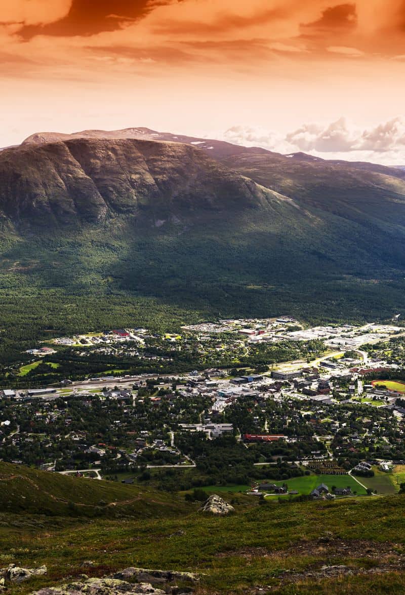
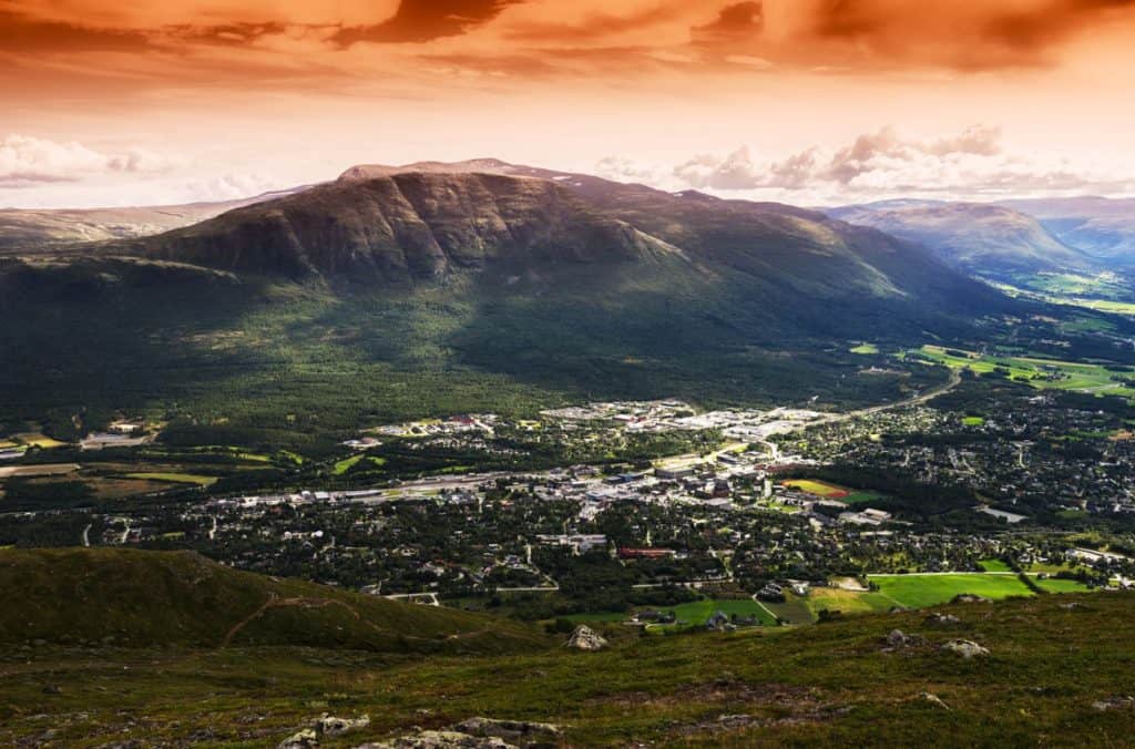
Oppdal
This drive begins in Oppdal, a beautiful town surrounded by national parks. It is also located at the junction of the E6 and Highway 70, making it a perfect place to start our road-trip.
Vang Burial Mounds
Historic Site
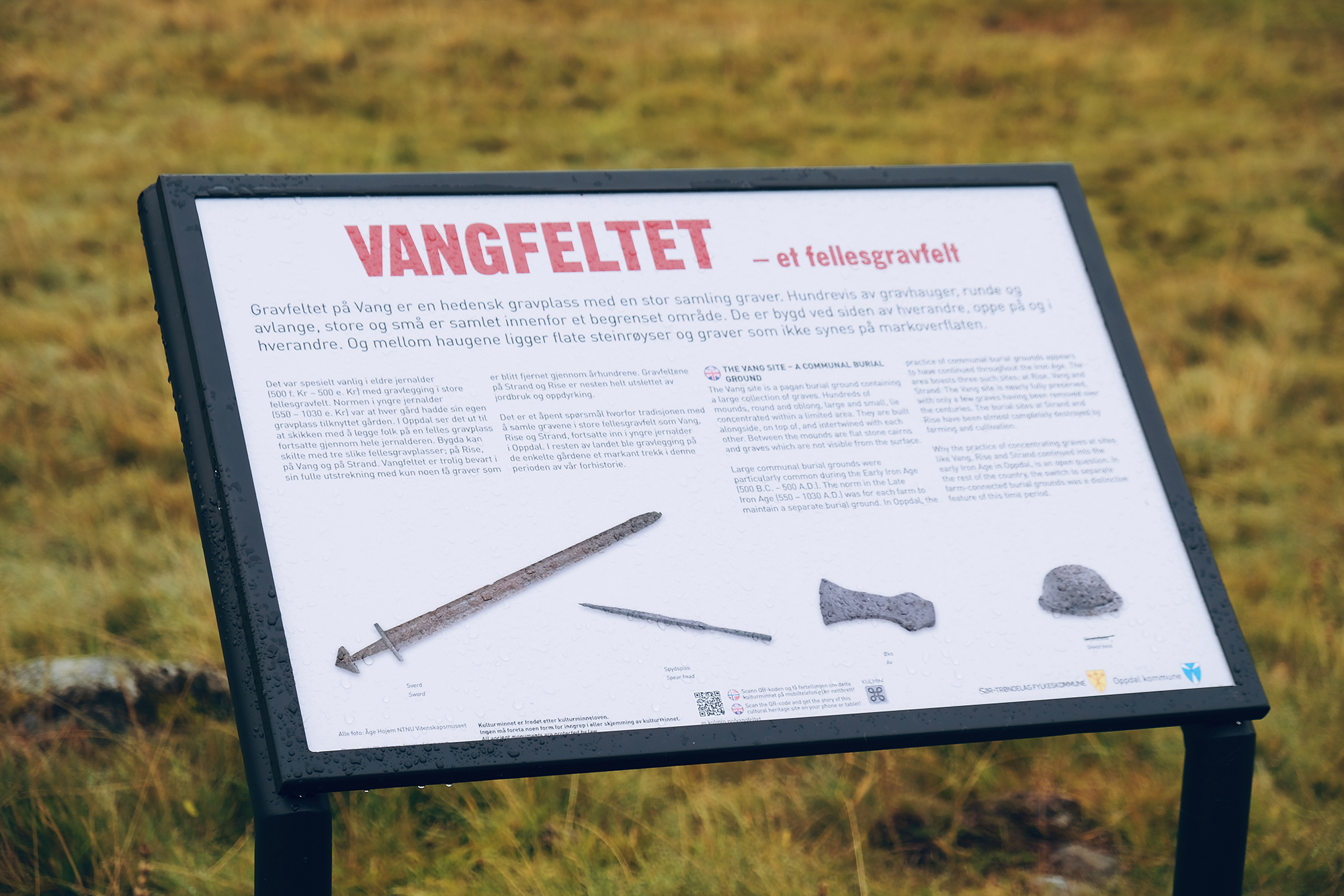
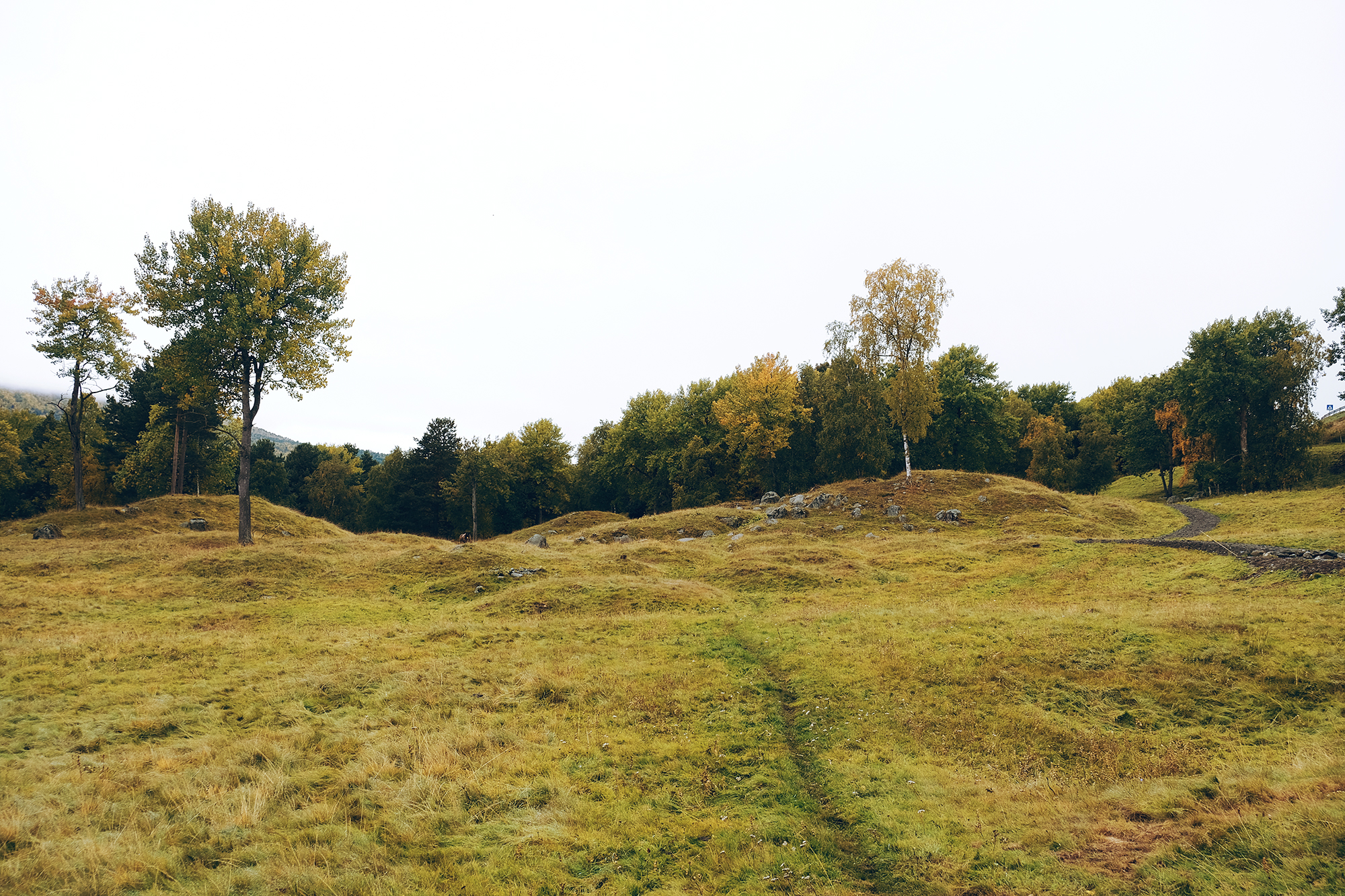
These are the largest burial mounds in Norway: there are at least 700 graves here spanning an area of 100 acres. People were buried here with their precious items between 400 AD and 1000 AD. This means the graves are pre-historic, pre-Christian and Viking graves. What makes this place even better is that it’s largely in tact.
The area around Oppdal – the major town near Vang burial mounds – was a known wealthy site during the Viking Age and one of the most important places in pre-Christian Norway.
Excavations show that Oppdal as in contact with Christianised Ireland during the Viking Age. Many swords have also been found here. All the finds are in the Science Museum in Trondheim.
I recommend going for a walk around here before starting the drive. There are marked trails and information boards everywhere. Just note – we found there was a lot of sheep poop! It’s a grazing area for sheep as well, so you’ll see and smell them. Clean your shoes before you get back in the car.
The site is well marked on Google Maps & there are brown tourist signs leading you there. The road down is paved, narrow, and slightly steep. There is a large carpark but no facilities.
Oppdal Church
Church
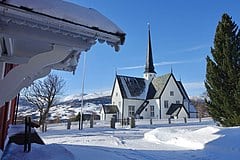
Oppdal Church is a historic church from 1651. There has been a church here ever since Christianity was introduced, and the present church replaced a stave church. As we know, Oppdal was an important place not just during the Viking Age but also during the early years of Christianity – it is situated on the historic pilgrims road. Therefore, it can be assumed that Oppdal Church was very important in the old times.
It is possible to visit the church.
Note – just before the turnoff is Håkkåran – the highest point on the highway at 600m (2000ft).
,_Gauldal_deanery_(prosti),_Oppdal_municipality,_Tr%C3%B8ndelag_county,_Norway._Cruciform_style_1651._Raul%C3%A5na._Blue_sky,_snow,_view,_etc._2019-03-19_E.jpg)
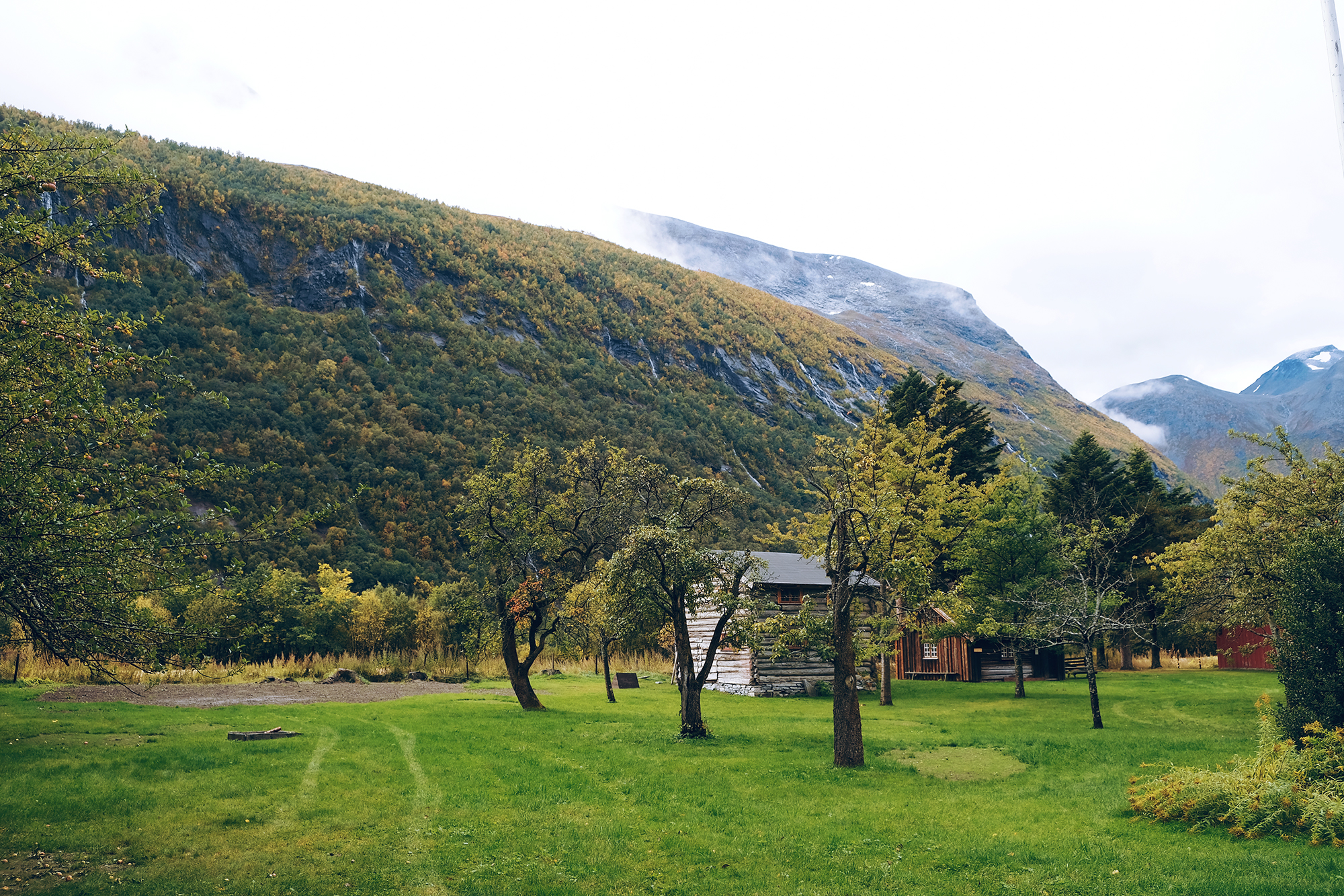
Trollheimen
Mountain Range
Trollheimen is a famous mountain range. It is considered the most varied of all mountain ranges in Norway: the western part are alpine in form, with pointed peaks. Meanwhile, the mountains in the east are less steep with rounded shapes and wide valleys. The park has a unique flora and it is believed Trollheimen was one of the first areas in Norway to be cleared of ice after the last Ice Age.
There are several traces of people using the mountains as a hunting ground. The hunters made traps for reindeer and are considered to be among the first wave of humans migrating to Norway. If you happen to be hiking near the glaciers in late summer/autumn it’s recommended to keep an eye out for prehistoric artefacts.
If you plan on taking a detour to Trollheimen, I recommended spending at least one night there: it’s not close enough that you can quickly drive there and back. Additionally, the best views of the mountains are only accessible via hiking.
Want to see the exact view in the photo? See info on how to get there further below 🙂
Resources:
Lønset
Village
Lønset is a small agricultural village with a population of 450. There is a local church here from the early 19th century, though it was built to replace an earlier 18th century church. It has a memorial outside it for the 32 who were killed in the Kletthamranskredet in 1868. This is the largest avalanche in Norwegian history. The main industry is agriculture with 42 active farms, followed by tourism.

Møre og Romsdal County
Møre og Romsdal is a county in central-western Norway. The county is made up of three districts: Nordmøre, Sunnmøre and Romsdal. The name of the county represents these regions. We are in Nordmøre.
The county is similar to Vestlandet (to the south) and Trøndelag (to the north) in that it has a mild but wet climate thanks to the Gulf Stream and Atlantic Ocean.
Agriculture is an important industry, though oil and gas is growing thanks to the Ormen Lange field – the second-largest deposit on the Norwegian shelf. Møre og Romsdal is Norway’s largest fishing county measured in export value, and clipfish is very popular.
Today tourism is very important to the region. The county has some of Norway’s most famous destinations, including the national scenic roads Trollstigveien and Atlanterhavsveien. Additionally, Geiranger is one of the largest cruise ship destinations and the Geirangerfjord is on the UNESCO World Heritage list.
The largest cities in Møre og Romsdal are Ålesund, Molde and Kristiansund.
Nordmøre
Traditional Region
We have entered the county and are in the Nordmøre traditional region. People first settled here after the last ice age, and findings from the Fosna culture have been found near Kristiansund.
Nordmøre is mentioned several times in the old Norse saga. It’s believed that it was one of the first petty kingdoms conquered by Harald Fairhair when he was unifying Norway into one country. Nordmøre is also one of the first places Olav Tryggvason and his army christianised on their travels.
Åmotan Gorge
Natural Attraction
This site has been described as the ‘Niagara of the North’. I’m not sure how accurate that is, but it certainly is quite the site. Åmotan Gorge is an area with steep mountain peaks, moorlands and terraces. This is the place where five rivers meet, creating spectacular waterfalls.
The parking area is 5km/3 mi off the main highway. Guided walks take place in summer, but the area is well-marked if you want to do it on your own.
The Gorge is close to Åmoten-Grøvdalen, which is part of the Dovrefjell National Park.
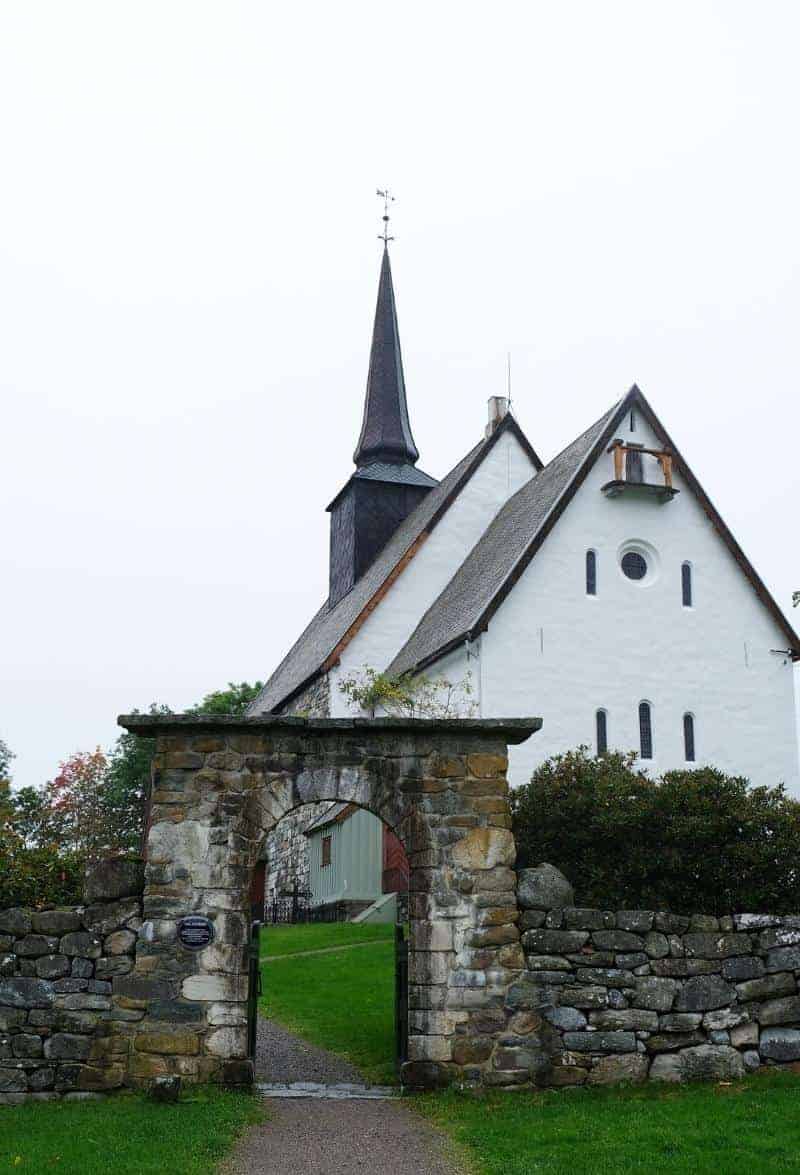
Romfo Church
Church
There has been a church here since the end of the 16th century, though it has moved a few times due to flooding from the Driva River. The present-day church is from the early 1800s and is built in this, ahem, unique octagonal shape.
Inside are some items from the older churches, including an altarpiece from 1713 and a figure of St. Olav from the Catholic times.
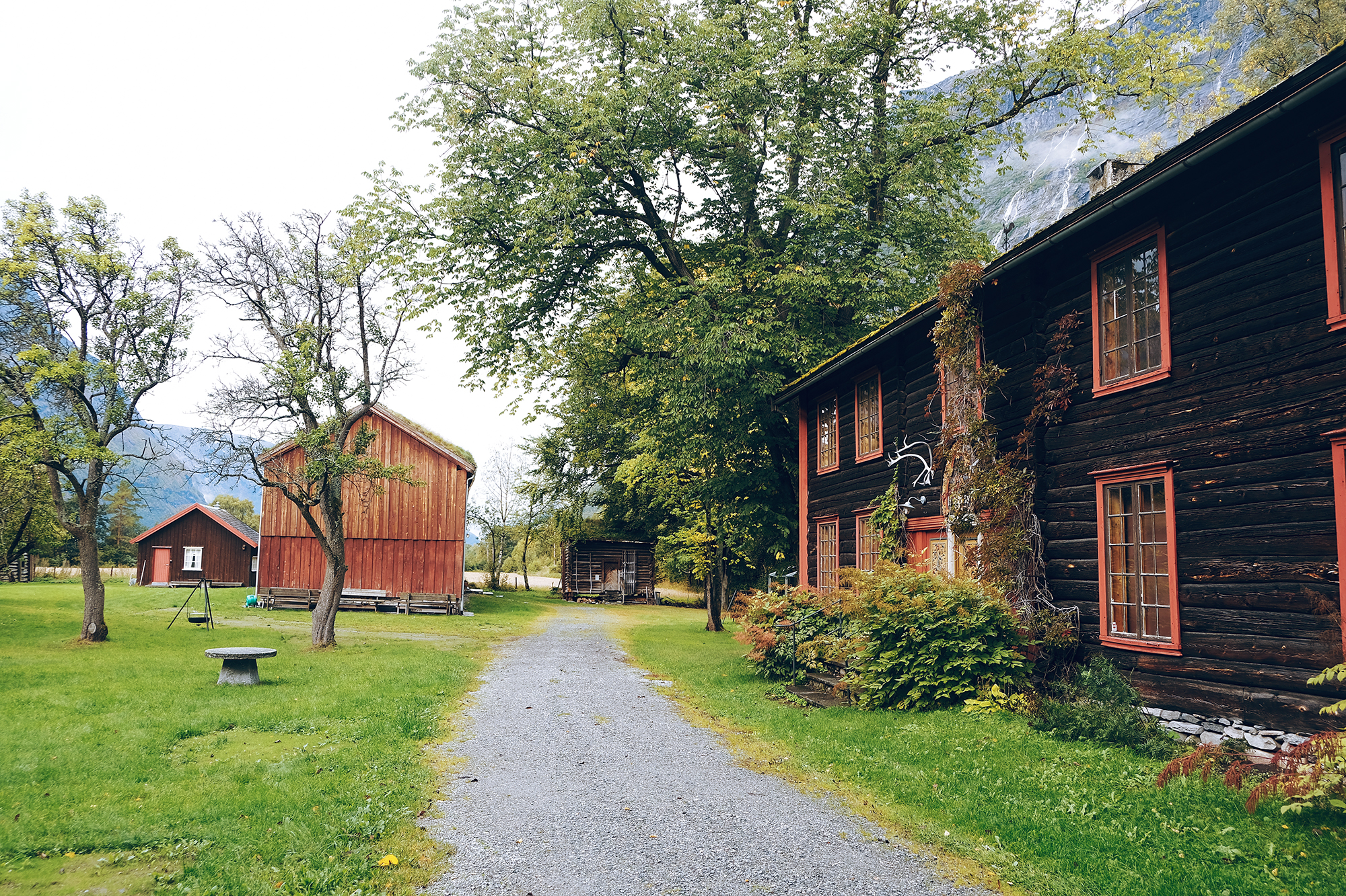
Leikvin Cultural Heritage Site & Open Air Museum
Historic Site
The Leikvin Cultural Heritage Park is a historic site that provides an interesting overview of Sunndal’s history.
The park is spread out over a farmstead that was famously lived in by Lady Barbara Arbuthnott (1822-1904) from Scotland. She had visited Sunndal several times with her husband, William Arbuthnott, and in 1868 they bought half the farm here.
After she and William divorced, Barbara remained here and lived with a tour guide Oluf Endresen, who managed the farm. She learned Norwegian and became a pioneer in agriculture, importing British pigs and chickens to her farm. She wrote many Norwegian books on chicken breeding. Besides that, she was known as being extravagant and throwing large parties on the farm. She became involved in the local health service and hunting club, having a hunting lodge and local library built.
Today the park consists of several interesting sites. The open air museum has a collection of buildings and objects from the old peasant culture in Sunndal, plus a collection of the rich folk art from here. Exhibitions explore British salmon fishing, 10,000 years of reindeer hunting, plus the history of Sunndal.
The botanic garden (called Phillipshaugen) is worth seeing. It has a large collection of rhododendrons, plus around 50 species. It’s designed in a British countryside style.
Lastly, there is a burial ground here (Løkja). There are over 200 graves with finds from the Roman times until the end of the 10th century. All finds from the graves are at the Science Museum in Trondheim.
The museum is open between June and August, with guided tours available. Otherwise, the grounds are free to walk around in all year round.
Resources
Sunndalsøra
Town
Welcome to Sunndalsøra, the largest town we’ll visit on the way to Kristiansund!
Sunndalsøra is located in a beautiful spot. It’s at the mouth of the river Driva, which we’ve been following this entire drive, plus it’s at the beginning of the Sunndalsfjord, which we’ll be visiting next. The town is surrounded by steep mountains reaching heights of 1700m (5600ft).
Industry
While Sunndalsøra is a good rest stop, there’s not a whole lot to see. The town is dominated by the aluminium plant, which employs 900 people (total population 4,054). The plant has been operating since 1954 and in 2004 it was modernised to become the largest and one of the most modern aluminium plants in Europe. Aquaculture research, public service and agriculture are other main industries.
Climate
The climate of Sunndalsøra is unique. Atlantic lows produce a strong foehn effect in winter. This occurs when there is a strong low located southwest of the coast, bringing mild air from the Atlantic Ocean. The air is further warmed when forced over the mountains, and a dry warm air comes down to the fjord. Sunndalsøra has the national all-time high for all winter months: December with 18.3C (64.9F) (1998), January with 19C (66.2F) (2020) – this was also the warmest winter ever in Scandinavia, and February with 18.9C (66F) (1990).
Hov Church
Hov Church is the main church of Sunndalsøra. The church has had a very interesting history.
The first church was mentioned in 1432, but it burned down in 1647 – it was likely a stave church. A new church was built, but it was built in such poor condition that it collapsed during a storm in 1725. A new church was built, but it was almost completely destroyed in 1727 by snow. So, a new church was built and it survived until 1849, when it was damaged by strong autumn winds. Another church was built, but it was destroyed by strong winds in 1883. The present church is from 1887 and is built on the same site as its predecessors. I don’t know about you, but I think it looks very sturdy today!
Flåøya
Peninsula
Flåøya is a peninsula by the Sunndalsfjord. It’s a popular area where the locals go to spend time outdoors. It’s believed people lived here back in the Iron Age. Back then, it was an island in the middle of the fjord. There are many graves from the migration period to the Viking Age. If you walk around the site, there are information boards in English, Norwegian and German. In summer, you can swim here!
The parking lot is only 6km / 4 mi from the highway, so that makes it a short detour. However, the best views are done by following the trail, and that can take some time.
Ålvundeid Church
Church
There has been a church here from at least 1309, according to historical records. The old church was demolished some time before the 1800s, and the new church was built in 1848. It is in an octagonal style. It’s typically not open for visits.


Ålvundfjord
Fjord
Ålvund, or Ålvundfjord, is a small village at the beginning of the Ålvundfjord. Since 2004, it has not been considered an urban settlement by Statistics Norway. Yeah, it’s a small place!
Tingvoll Municipality
Welcome to Tingvoll Municipality! This is a small municipality with a scattered population, and we’ll be visiting the main town on this drive.
The name is very special. Eight or nine centuries ago, Tingvoll was the site of the Nordmøre Ting – hence the name. There was a flat field here, which in Norwegian is voll. It was here that the meetings were held – ting + voll. Ting is best compared to a parliament: representatives from different regions come together to make decisions. Today, the parliament in Norway is still called Ting. Tingvoll is a name found in many place: the Scottish town of Dingwall, the parliament on the Isle of Man is Tynwald, the English town of Thingwall (colonised by the Norwegians), and Thingvellir (Þingvellir) in Iceland.
It’s believed this is where the Tingvoll Church is today.
Tingvoll Church
Historic Church
Tingvoll Church is one of the oldest stone churches in Norway. It’s well worth taking the two minute detour here to have a look at this gorgeous building.
Tingvoll Open Air Museum
Museum
Tingvoll Museum is an open-air muesum built on an old farm. The farm itself is ancient, while the museum is from 1954 – that year the farm closed down and the municipality took over.
The museum is comprised of farm buildings from the mid-19th century. Additional buildings have been moved here, including a workshop, mill, and school building.
Tingvoll Museum is 1.7km off the main highway. It’s open from 12pm to 4pm during summer, and they have plenty of activities for kids during that time.
Up-to-date opening hours and practical info can be found here.
Bergsøya
Village
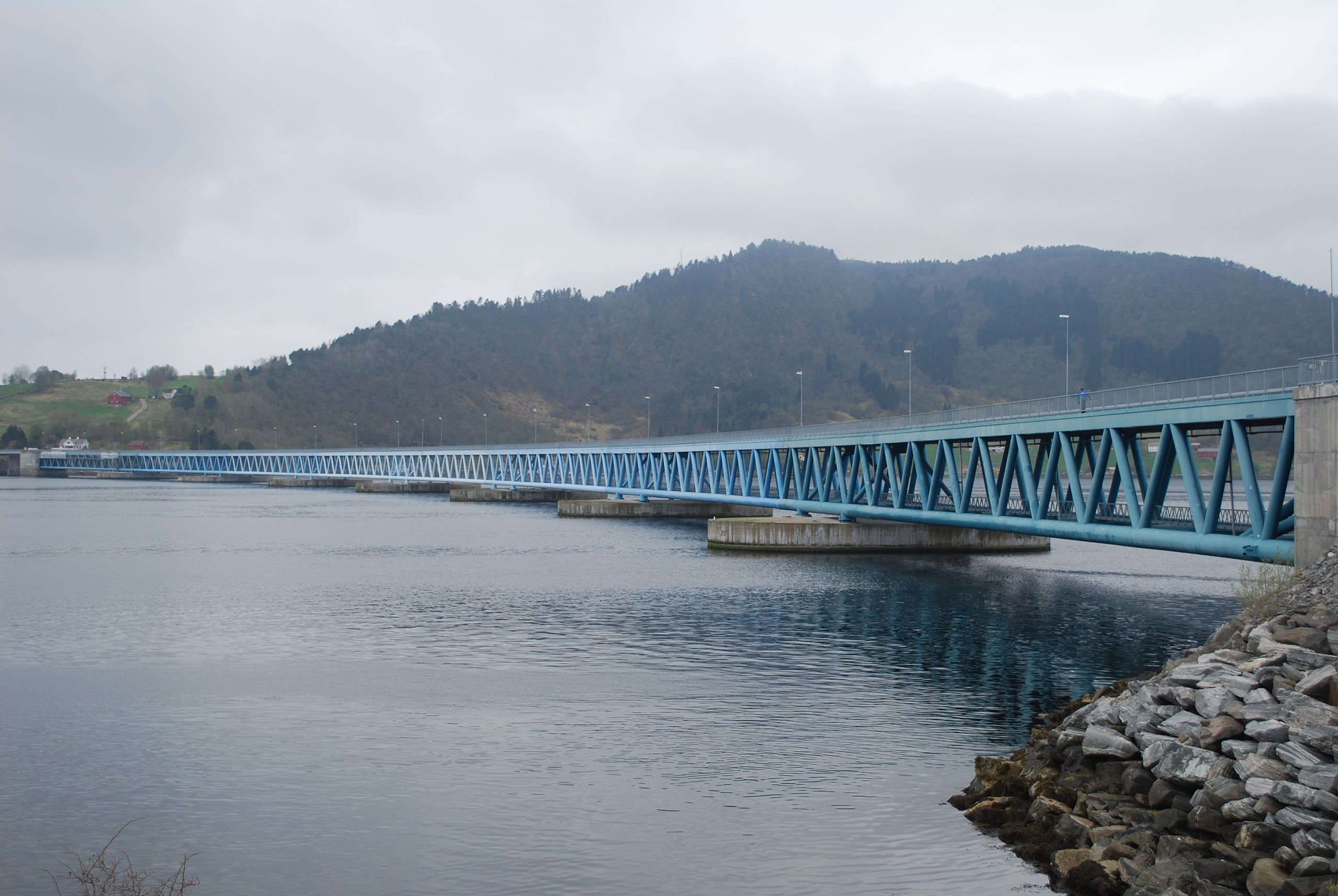
Agriculture and forestry are important industries here. Nearly half of all the employees commute to the neighbouring municipalities, especially Molde.
Bergsøya has been connected to the mainland via bridge since the 1990s. Before then, it only had a ferry connection. The road we are on is nicknamed “Krifast” – it’s the main road connection between Kristiansund and the mainland. Because of this, it is often a very busy road.
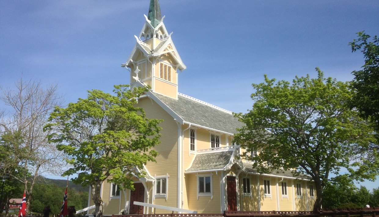
Frei Church
Historic Church
Frei is a fairly well-known island, especially when it comes to Norway’s early history. The early Norwegian kings often came here to take part in hunting, the most known being King Haakon the Good.
Haakon the Good was also one side in a famous battle that took place here in 955. It’s called the Battle of Rastarkalv. Basically, it was one of several battles between King Haakon and the sons of Eirik Bloodaxe. After Eirik’s death, Harald Greycloak (one of the sons) and his brothers were allied with King Harald Bluetooth of Denmark against King Haakon. They set out to Frei to find Haakon and kill him. Haakon was smart, though, and he had set up a warning system with cairns that would be lit to tell of approaching fleets. Therefore, Haakon knew they were coming. Haakon fooled Eirik’s sons into believing they were outnumbered. The Danes attempted to flee the island, but when they arrived at the beach they realised that their ships had been pushed out to sea. Haakon gained victory and the Danish forces were slaughtered. Woohoo?
Egil Ullserk, Haakon’s leading man, died in the battle. Today there is a stone monument near the Frei Church to commemorate the battle.
You should also visit Frei Church. It’s a very pretty yellow wooden church built in 1897 to replace an older building. However, the first church on Frei was mentioned in 1432. In the middle of the 1600s, it was described as a stave church. Sadly, in 1766 it was struck by lightning. The next church was torn down to be replaced by this one.
Frei Church is a short detour off the main highway. It’s located in the town Nedre Frei.
Nordlandet
Island
Nordlandet is one of the islands where Kristiansund city is located (it’s spread out over three islands). In the city centre area, Nordlandet consists of some old warehouses and homes, plus the Nordlandet church – the church that dominates the Kristiansund skyline.
Further out, Nordlandet consists of large shops and a shopping mall, plus the Kristiansund Airport. At the airport is a helicopter base for the oil business. Nordlandet is the part of Kristiansund that has seen the most development in the last thirty years.
It’s important to note that if you want to visit Nordlandet Church or the island, you have to drive all the way over the Rv70 from town – there’s no direct bridge from the city centre. There are ferries for people, though.
The picture above is Nordlandet from the city centre. It’s the island to the left – you can see Nordlandet Church.
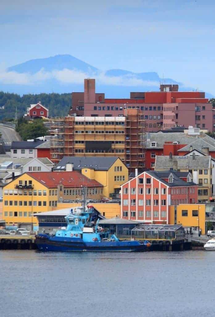
Kristiansund
Welcome to Kristiansund! You can find a comprehensive overview of Kristiansund via the travel guide below.
The Previous Drive
Folldal to Røros
On the previous day we had driven from Folldal to Røros in Eastern Norway.
The Next Drive
The Atlantic Road
On the following day we took one of Norway’s most famous drives, the Atlantic Road.
If you liked this drive, or if you have any travel tips, please leave a comment in the section below!