
Drive it Yourself: Folldal to Røros: A Scenic Drive Through the Industrial Region of Eastern Norway
I love Røros. I’m fairly positive I begin each article about Røros with that statement, but it’s very true. Røros has an incredible history and is a very well preserved town. I’m surprised more travellers in Norway don’t go there.
When we are visiting Røros in September 2020, we were driving up from Ringebu via the Rondane National Park. The road to Røros isn’t direct, but we didn’t mind. Little did we know that we were actually driving through a historic mining region. The road from Folldal to Røros is a very old mining area – mining began here in the 17th century. Many of the towns you pass through on this drive were established thanks to Røros Copperworks – the main mining company here.
Even if mining isn’t of interest to you, don’t pass up a chance to drive through this gorgeous part of the country.
Here’s my drive from Folldal to Røros via Alvdal on Highway 3 in Norway.
In this article...
Watch on Youtube
All of our roadtrips are available on YouTube to watch. They include information about the area provided in text and voiceover form, plus they show the drive in full (sped up in some spots!) so you can get an idea what the drive is like.
The drive: Folldal to Røros
Folldal Mines
Historic Site
We begin at the Folldal mines, an old 18th century mine that is today heritage listed in Norway.
Mining was the main industry in Folldal from the 18th century until 1993.
Folldal Works (Folldal Verk) was founded in 1748, the same year the main copper mine opened. Copper, mine and zinc was all mined in Folldal. It was then transported by horse carriage to the neighbouring Alvdal municipality, where there was a smelter. In 1906, a 34km-long cable car (North Europe’s longest) was built to transport goods to the smelter.
The main mine closed in 1941, but smelting continued using ore from other deposits until 1968. Business closed in 1993.
Today the mines are a museum.
The museum has short opening hours – late June to mid-August. They have some really interesting attractions and ticket combos, so I will be back!
You can drive up to the carpark and wander around outside for free.
Click here to view their website.
On their website you’ll find opening hours and ticket fees.
Vassaga
Historic Site/Detour
Vassaga is a preserved sawmill from 1900. It is powered by water and is unique because it has a special device for sawing shavings. This is the only known instance of a sawmill having a device for shavings. The shavings are used in roofing in the area.
You’ll see signs pointing to it from the highway.
Folldal Church
Church/Detour
Folldal Church is located on the road that leads to Vassaga. The church is a typical rural church from the late 19th century. The altarpiece inside is from the 17th century.
Grimsbu
Village
Grimsbu is a tiny town; when I was researching it, some of the top hits on the web were for the IKEA furniture named after the town!
There is a campsite in Grimsbu – the Grimsbu Turistsenter – that has everything you’ll ever need when camping. From Grimsbu, there are hiking and skiing trails plus spots for fishing.
There is an ancient road in Grimsbu called Byveien. It is a route over the mountain that from around 1050 until the Reformation connected the pilgrims routes through Gudbrandsdalen and Østerdalen. In the 12th century, the road was laid out as a pilgrimate route from Innlandet to Nidaros. The road was forgotten for many centuries, but now there is an active effort to restore the road. The trail is north of Grimsbu. An image of it can be seen here.
Grimsbu also has an old BP petrol station that looks as it did when it was put there in 1955. There used to be a country store on the property – it dates back to 1900 – but in the 50s they modernised with a petrol station. A website for it is found here (also the image source).
The BP station is by the Fv29 and across the street from the Grimsbu Turistsenter – a hotel/cafe/shop building.
Einunna
Historic Site
When Norway was invaded on 9 April 1940, a group of Norwegians mobilised in Alvdal. They organised a defence at Einunna Bridge by blowing it up.
When the Germans arrive on 26 April, they inspected the bridge and the Norwegians surprised them with gunfire. A fight commenced, but the Norwegians were buried in snow and hard to see. The German tanks managed to keep the Norwegians down so most of the Germans could get out. They tried to advance, but it was impossible. The Germans did eventually occupy Alvdal, but they came in via another road.
From 2020, the bridge is being rebuilt.
There was a rest area, but when I visited it was closed due to the construction work.
Alvdal Municipality
You cross into Alvdal Municipality.
Alvdal
Town
Alvdal is a small town (pop. 2,418) with a long tradition of mining, as is common in this part of Norway (and the focus of our drive!).
There has been mining in Alvdal since 1656, when the first finds of copper ore were made nearby. Mining didn’t take off until copper was found in Folldal in 1745.
The mines in Folldal got into disputes with the mining operations in Røros, including access to timber. Due to the little access to timber in Folldal, a smelting hut was built in Alvdal instead. Alvdal has plenty of access to timber. It was less resource intensive to transfer ore to Alvdal than it was to transport wood to Folldal.
New mines were built around the area in the 18th century. From 1905, a cable car was used to transport ore to Alvdal.
Mining operations declined and have mostly ended now. Today the largest employer is the dairy company, and many people work in agriculture and the timber industry.
Glomma River
River
At 621km (386 mi), the Glomma is Norway’s longest river. It has a drainage basin that covers 13% of Norway’s surface area, all in the southern part of the country.
At its full length, the river runs from Aursund near Røros and empties into the Oslofjord in Fredrikstad.
The combination of raw materials, water power and transport has over the centuries encouraged industry along the Glomma. Some of the country’s largest manufacturing and processing businesses are found at its mouth.
Tynset Municipality
You cross into Tynset Municipality.
Tynset
Town
Tynset is a small town located in the north of Østerdalen, or the Eastern Valley. It is first mentioned in 1211, when the archbishop of Nidaros consecrated a stave church. There is no stave church today; there are parts from an old stave church at Kvikne (more on that below).
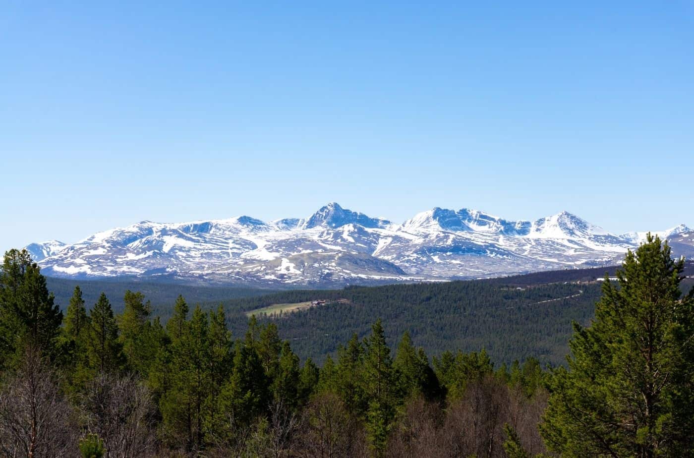
The town is known for its vast areas of forest and mountains, which are ideal for outdoor activities. Tynset is also one of the few places where most of its mountain farms (seter) are in use. You can visit them when hiking, and even rent some for the night.
Kickers/kicksleds (Norwegian: spark) are produced here. The world’s largest kicker is in the main square of Tynset; it is four times life-size.
Kvikne
Historic Site/Detour
Kvikne is home to the Kvikne copperworks, founded in 1630, which was one of Norway’s first copperworks. This led to the population in the mountain village rising and laying a foundation for further development. The copperworks was run by the Danish King, and was the largest copper plant in Norway. Eventually Folldal and Røros became more important, and Kvikne was clsoed down in 1812, though operations continued in a much smaller capacity until 1912. Only ruins remain today, but you can visit them.
Kvikne Church is from 1654 and seats 203. It has decorated equipment and an interior with a carved altarpiece and pulpit. The crucifix is in the Romanesque style and dates to around 1200. In the attic, stave church planks in the Urnes style have been found, probably from an older church on the site. Bjørnstjerne Bjørnson was baptised in the church.
Close to the church is the Bjørgan vicarage, a museum and former vicarage in Kvikne. It is considered an artists home as Bjørnstjerne Bjørnson (1832-1910) was born here and lived here until he was five.
The house is built in 1780 and was a vicarage until 1860. The building was supposed to be demolished, but it was saved in an attempt to make it a museum for Bjørnson. Several items from his time are on display in the museum.
Kvikne is a 40 minute drive from Tynset, so it is quite the detour but worth doing.
Telneset
Town
The next small town along the Fv30 is Telneset. It is not an old town; it was actually built up alongside the establishment of the Røros Line in 1877. A small community was built up around the train station, and soon there was a post office and a sawmill. The sawmill made materials for building houses, and soon there was a concrete foundry to supply roof tiles and pipes, plus a carpentry to make windows, doors and furniture.
Telneset saw a dramatic event take place here during World War II. On 24 April 1940, the Germans were coming up Østerdalen while a train with Norwegians was in retreat. The train was shelled and had to stop at Telneset. German planes came and dropped 13 bombs on the train and the damage was great; six Norwegians were killed.
Today Telneset is a small agricultural community.
Tolga Municipality
You cross into Tolga Municipality.
Tolga
Town
Our next stop is Tolga, which was built up around the Tolga smeltehytte (smelting cabin) in the 1660s. The smelter was operated by Røros Kobberverk and it was in operation until 8171. Tolga was a suitable location because it had waterfall power plus a good supply of timber.
Today many people work in agricultural, though the municipality is the largest employer.
In the town centre you’ll find an old farmstead called Dølmotunet. During the summer there are tons of activities thee, and an exhibition has items from the Stone Age to the 19th century.
Os
Town
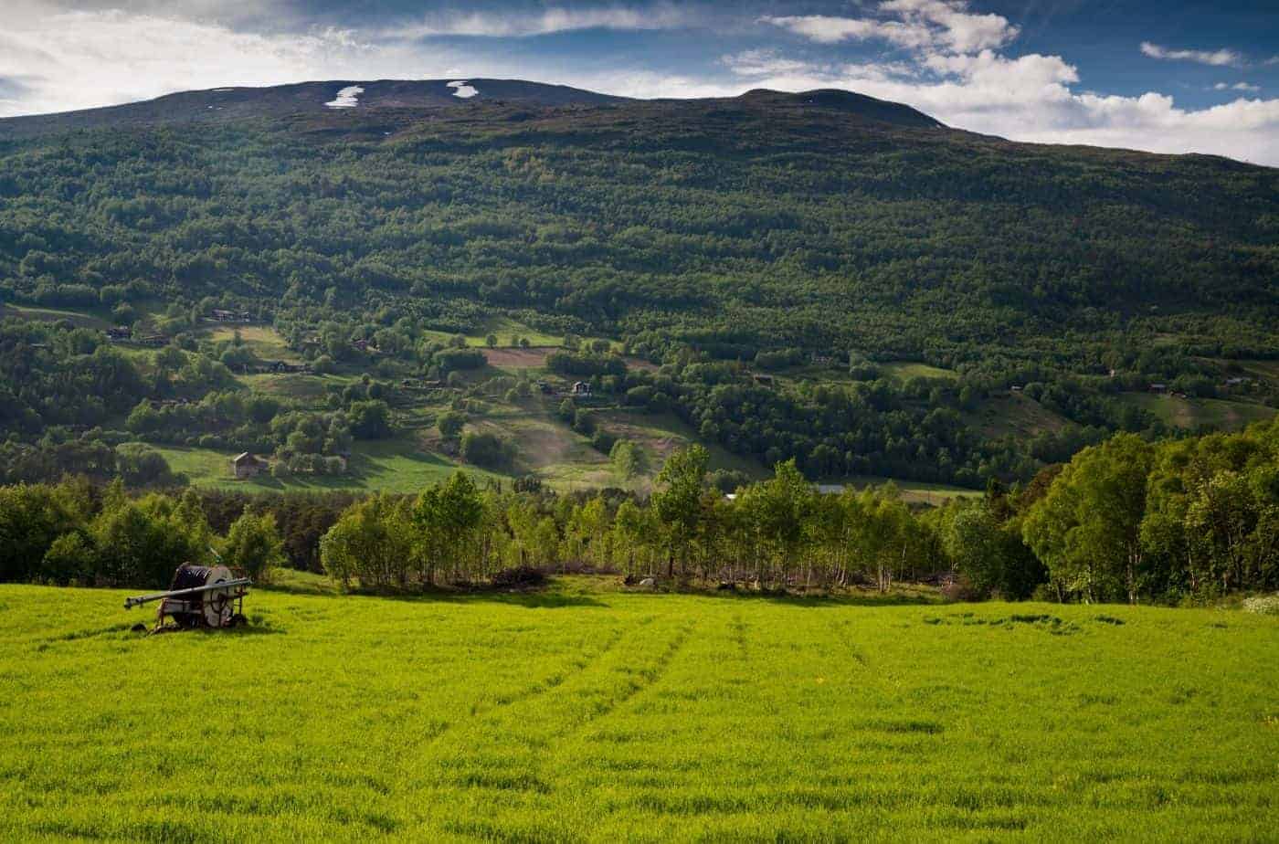
Os is a small village with about 25% of the population working in agriculture. The timber industry is also important to the region.
A skirmish took place here duing World War II. It was the last skirmish in the region before the Germans were able to occupy the area, and it was one of the few fighting operations where Swedish and Finnish volunteers participated in fighting against the occupying forces in 1940. The Germans burned down eight farms as reprisals.
In Os you’ll find a museum with objects preserved from the region. The Forollhogna National Park is also nearby. The mountain peaks are popular for skiing in the winter.
Trøndelag County
You cross into Trøndelag County.
Røros Municipality
You cross into Røros Municipality.

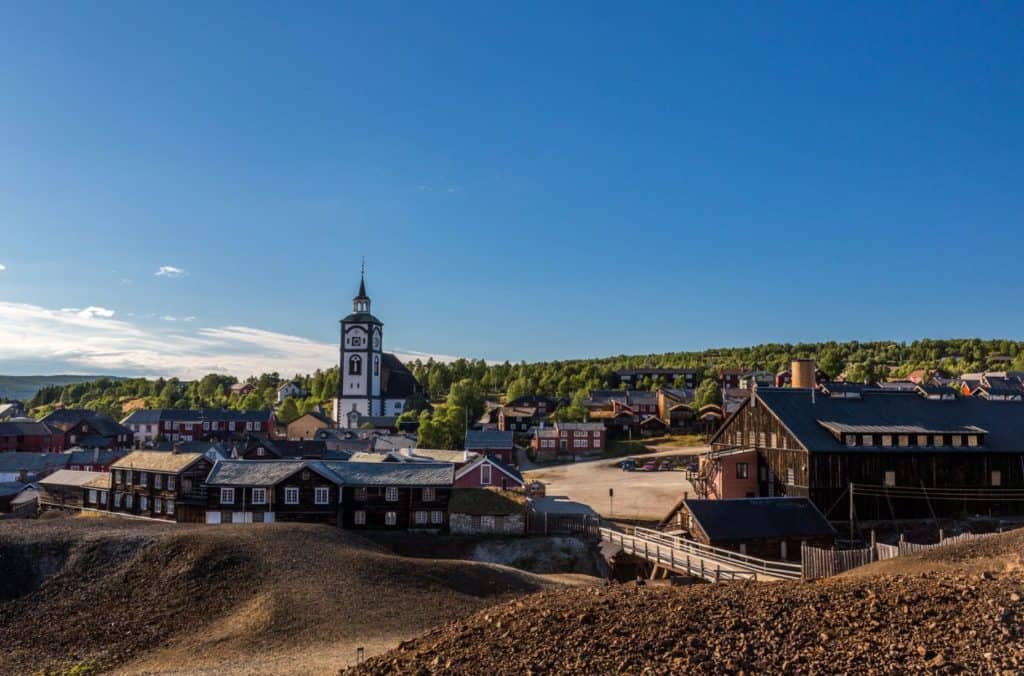
Røros
Welcome to Røros! We made it. Røros is a UNESCO World Heritage Area full of history, charm, and things to do. I recommend parking at the Smelthytta Musuem and exploring Røros on foot. You can spend heaps of time here – be sure to make the most of it.
The Previous Drive
The Rondane National Park
The best way to get to Folldal is by taking the Rondane Tourist Road.
The Next Drive
Oppdal to Kristiansund
On the following day we drove to Kristiansund on the west coast of Norway via Oppdal.
If you liked this drive, or if you have any travel tips, please leave a comment in the section below!