
Drive it Yourself: Sognefjellet Tourist Road
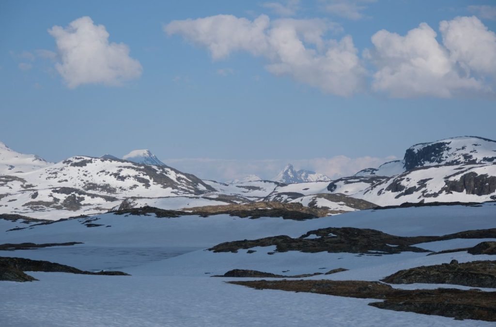
Alright, this is the big one. The Sognefjellet Tourist Road is one of the highest roads in Norway and also the most notorious for bad weather. Winding its way from Lom through the Jotunheimen National Park and then down to the Lustrafjord, this road is nicknamed the ‘road over the roof of Norway’.
This road has been a main traffic road since the Middle Ages, linking the coast and inland areas. Trading led to the transport of salt and fish eastwards while butter, pitch and leather were transported west.
The decision to build a modern gravel road came in 1936 when the Minister of Social Affairs put together an initiative to employ unemployed young people. The road opened in 1938 and was the highest road at the time. It rises to a height of 1434m.
This is where you experience true Norwegian nature. In winter the weather is so severe that the road has to close. In early spring, soon after the road opens, there are almost 10m high banks of snow on the side of the road.
The Sognefjellet Tourist Road is notorious for bad weather, and boy did we experience that. I think I was mildly traumatised by the time I got to the bottom of the road! I would love to go back and film this when the weather is good. In the meantime, the footage and my photos aren’t great, but at least it paints a true picture of the power of nature on Sognefjellet.
In this article...
Download this Guide
All of our guides can be downloaded via my online store.
I offer downloadable versions of our self-guided drives on my online store.
Online Guide
- Information about points of interest
- Images of each point of interest
- Historic overview of the neighbourhood
- Directions between points
- Historic photos
- Information about facilities along the way
Downloadable Guide
- Information about points of interest
- Images of each point of interest
- Historic overview of the region & towns
- Directions between points
- Historic photos
- Facilities including supermarkets, toilets, petrol, hotels, cafes, restaurants with addresses.
Watch on Youtube
All of our roadtrips are available on YouTube to watch. They include information about the area provided in text and voiceover form, plus they show the drive in full (sped up in some spots!) so you can get an idea what the drive is like.
The drive: Sognefjellet Tourist Road
Lom
Lom has it all. Museums, shops, scenic views, a stave church and an award-winning bakery. It’s also surrounded by tourist roads. We begin our drive here after filling up with coffee and petrol.
Flåklypa
Scenic Site
Flåklypa is the first place we’ll pass. The name comes from a Norwegian kids film called Flåklypa Grand Prix, where the place is described as a small mountain village. Historically, though, this is a place where farmers risked getting stuck when they pulled their hay on the ice – they got stuck in Flåklypa, which means ‘pinch’.
Galdhøpiggvegen
Mountain
If the weather is incredible, or you can at least see the mountain peaks, take a 15km detour up Galdhøpiggvegen.
Galdhøpiggvegen offers an ascent of 1300m and, on a clear day, you get a panoramic view of Northern Europe’s highest mountains at the end of the road. The road is open mid-May to the end of October but may close throughout the season if there’s bad weather. It’s a toll road, so after 5km you have to pay – card only.
There are tourist cabins at the top if you want to spend the night there and do some outdoor activities.
Lisanden
Rest Area
Liasanden is a beautiful rest area in a pine forest. You’ll find maps, information boards, and picnic benches.
For more info, click here.
Jotunheimen Mountain Hotel
Hotel
This is a viewpoint and great place to stay.
Sognefjellshytta
Hotel
This lodge is where the tourist road reaches its highest point: 1400m. Understandably, this accommodation is also a popular training centre for ski teams from all over the world. There is a common room here where you can go and warm up or use the restrooms, or you can opt to spend the night here.

Oscarshaug Viewpoint
Viewpoint
This is considered the best viewpoint on the scenic drive. Keep an eye out for it: it’s off one of the hairpin turns.
Turtagrø Hotel
Hotel
This is a hotel that has been a central meeting place for mountaineers since the late 19th century. The first hotel was built here in 1888 by mountain guide Ola Berge. Another hotel was built 100m away in the same year. The two hotels merged in 1911 after Berge bought the other hotel. After Berges death in 1928, his daugther Kari took over the hotel. After the Sognefjellet tourist road was finished in 1938 and the climbing assocation build their own cabin, the purpose of the hotel changed.
On 28 April 1940, during the closing days of the Norwegian Campaign in Southern Norway, German prisoners of war and their guards arrived at Turtagrø. They spent the night here on their way to Vadheim in Sogn.
From 1953 Johannes Drægni ran the hotel. He introduced the first climbing school in Norway at the property. Ole Berge Drægni took over the hotel in 1997, but sadly he died in the tsunami in Thailand in 2004. His four-year-old daughter Sofie inherited the majority of the stocks. His daughter still owns 80% of shares in the company, but Ingunn Weka is the manager of the hotel.
The old main building and staff accommodation burned down in 2001, destroyed old cultural monuments. A new hotel was rebuilt by 2002.
The area is one of Norway’s most alpine areas with 24 peaks over 2,000m above sea level. Throughout the season you can take tours with mountain guides.
Fortun Overlook
Viewpoint
Your last chance to get some photos high up in the mountains comes a short drive after the hotel. Here you can see the village Fortun.
Fortun
Village
Fortun is a small village located on the innermost part of the Lustrafjord, which we’ll now be following.
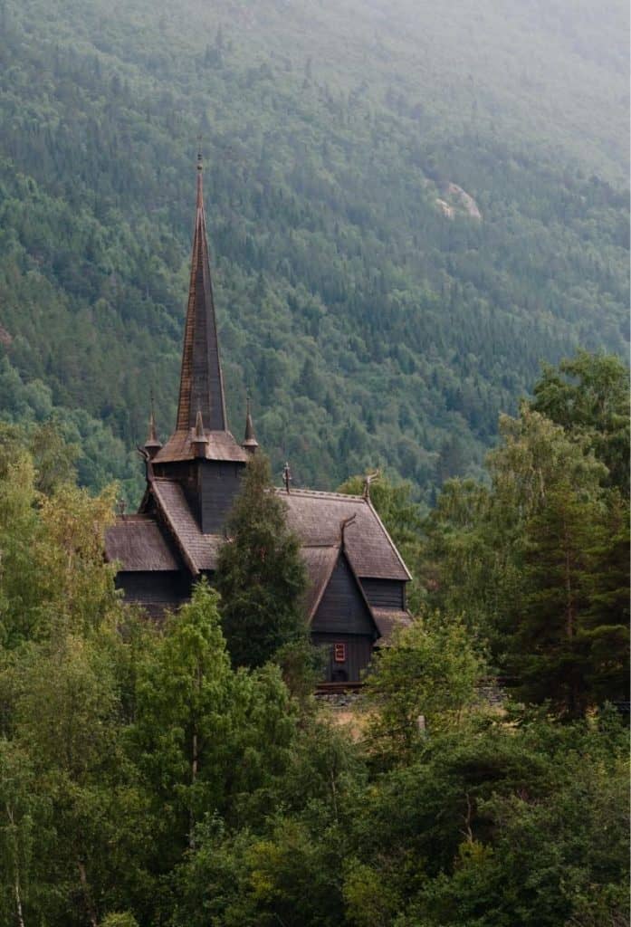
The village is best known for its church. The present church is from 1879, but it replaced an earlier stave church.
The earliest existing records date back to 1330, but it’s believed there was a church here built in the mid-12th century. It was originally a stave church. As with many churches, it was too small and there were plans to tear it down. However, there was some controversy about this. So, consul Fredrik Georg Gade bought the stave church and moved it to Fantoft in Bergen. It became known as Fantoft Stave Church and operated as a museum. Sadly, in 1992 it was destroyed by an arson fire. A replica has been built, but virtually all the old parts have been lost.
The picture is of the village between 1860 and 1880, and shows the stave church just before it was moved.
Wittgenstein
Historic Site
Ludwig Wittgenstein (1889-1951) was an Austrian-British philosopher who worked in logic, mathematics, the mind, and language. What does this have to do with Fortun?
Well, Ludwig visited Norway and fell in love with the region. He eventually made the decision to move here. He lived in various small villages before building a small wooden house to sit on a rock to overlook the Eidsvatnet lake. The place was nicknamed “Østerrike” (Austria) by the locals. The house was dismantled in 1958 but rebuilt by the locals in 2014. Now it’s a memorial, and a rest area along the road!
Skjolden
Village
Skjolden is a small village of 250-300 people.
At Skjolden, you’ll reach the turn-off for Urnes Stave Church. This is where you come some options.
Where to go from here
The Sognefjellet Tourist Road continues to Gaupne along the Lustrafjord. However, if you take this road, you’ll miss out on one of the biggest attractions: Urnes Stave Church. I know, there are a lot of stave churches in Norway, so what makes this one so special? Well, it’s the oldest stave church! It’s also the oldest one on the UNESCO World Heritage List. The church is only open in the summer months, as is the ferry to/from it, so I highly recommend going provided it is open.
Still, we shouldn’t ignore the rest of the Sognefjellet Tourist Road. It’s a beautiful drive and there are things to see along the way. If it’s possible, I recommend doing option one.
Option One: Drive to Urnes Stave Church, take the ferry to Solvorn, go back along the Fv55 (recommended)
Take the 30-40 min drive to Urnes Stave Church, then take the ferry across to Solvorn. From Solvorn, drive back along the Sognefellet Tourist Road to Dale Church – the last major point of interest. Then you can come back to Solvorn.
Option Two: Do the Sognefjellet Tourist Road to Solvorn, take the ferry to/from Urnes Stave Church
This is a fine option too. The only reason I don’t recommend it is that the ferry is pricey, infrequent, and the drive to Urnes is quite scenic and recommended.
Notes:
- The road to Urnes Stave Church is very beautiful but it’s extremely narrow and a little daunting. It’s surprisingly long, too. This is why I don’t recommend doing it both ways
- The ferry between Ornes (the village where the church is) is a little pricey, takes few vehicles, and can be crowded. Also, it operates few times during the day. It’s great one way.
- You can take the ferry without a car and then walk up to Urnes Stave Church, but it’s up a semi-steep hill
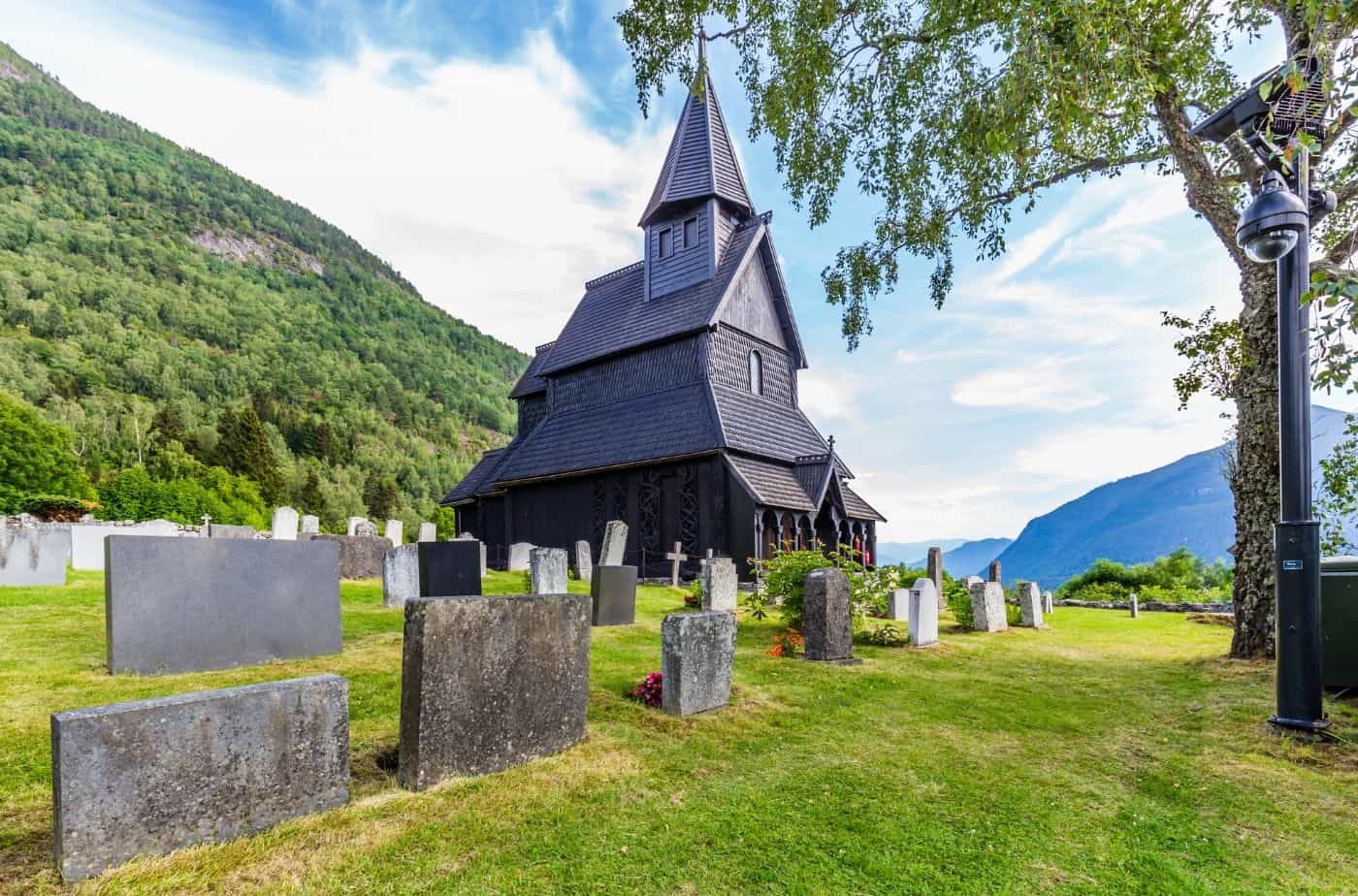
Urnes Stave Church
Urnes Stave Church is the only UNESCO World Heritage-listed stave church in the world. It is open in the summer months as a museum, too!
The Next Drive
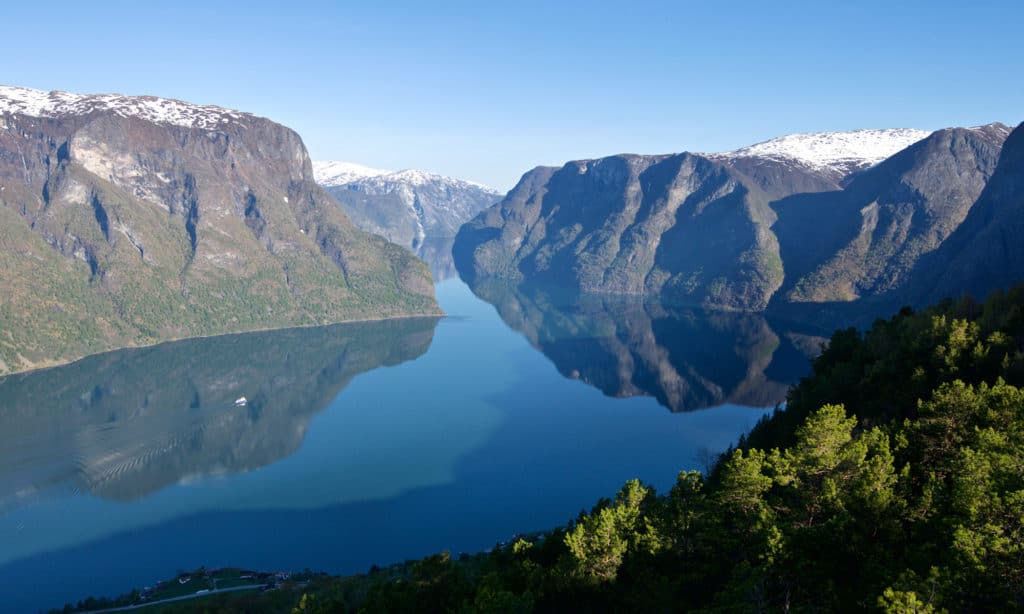
Aurlandsfjellet Tourist Road
On the next day we finished our ultimate Norwegian road-trip by heading across the Sognefjord to Aurland.
The Previous Drive
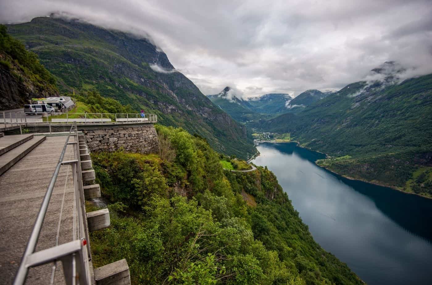
Geiranger to Lom
This short but stunning drive connects the Sognefjellet Tourist Road with the Geiranger UNESCO region.
If you liked this drive, or if you have any travel tips, please leave a comment in the section below!