Drive it Yourself:
Lærdal to Lom via Tindeveien & Sognefjellet
Here’s my self-guided drive for the journey from Lærdal to Lom via the Sognefjellet Tourist Road. In June 2023, Sean and I decided to head out for a weekend in the fjords. Very good weather was forecast, and we didn’t want to miss an opportunity to see this area in the sun! The last time we did Sognefjellet, in September 2020, it was incredibly stormy and we missed all the views.
We left Bergen in the afternoon and had a brief break in Lærdal before beginning the journey. I didn’t know what to expect when driving through Årdal to get to Sognefejllet; I had never heard of Tindeveien before and figured it would just be some back road. But wow, was I wrong. Tindeveien was one of the most beautiful roads I have driven on in Norway. Why don’t more people know about it? Well, hopefully I can share it to other people driving in Western Norway.
Here’s my guide to the very, very scenic drive from Lærdal to Lom via Tindeveien and Sognefjellet.
In this article...
Lærdal to Lom via Tindeveien & Sognefjellet
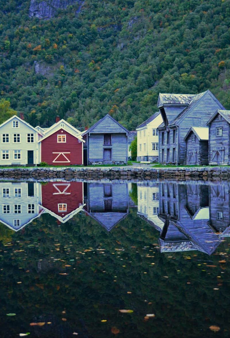
Lærdal Travel Guide
Lærdal has been a trading place since the Middle Ages and probably took over from the old Viking marketplace Kaupanger. Coastal farmers brought herring and fish and exchanged goods with mountain farmers from Valdres and Hallingdal. The Lærdal Market is first mentioned in written sources in 1596. It eventually ended but restarted in 1982 and is still held every year.
We are now driving along the Sognefjord, which is the longest and deepest fjord in Norway. It is 205km (approx. 125 mi) long and 1303m deep at its deepest point. The width varies from 1 to 2km up to 4 to 5km. Many of the mountains around the fjord are around 1,000 metres high.
The Sognefjord has been an important transport artery since ancient times. From the innermost arms of the fjord it is a relatively short distance to the inland villages in Eastern Norway.
The Sognefjord has good herring fishing. In the outer parts of the fjord, salmon has traditionally been fished. There is also some fish farming in the outer parts.
Årdal Municipality
Årdal has long been known as a municipality for heavy industry. In 1702, the Årdal Copperworks was established, and there were also sawmills and hydropower plants in this area. In 1948, aluminium production started in Årdal. The aluminium works has been the cornerstone company in Årdal for over 50 years. It was started by the Nazis furing World War II.
In recent years there has been a lot of investment into tourism and green industries. The municipality has been featured on several television programs in recent years, and the hike in Øvre Årdal has become famous on social media.
Årdal is still at the forefront of industrial technological development in the fields of aluminium, solar cell production and hydropower.
Årdal
Årdalstangen is the main town in Årdal municipality, with a population of around 1,3700. This is largely an industrial town, with a shipping port for the Aluminium company here. There is also a carbon plant, laboratory and administration building for Norsk Hydro here. The old mining office from 1702 is located at the administration building.
Øvre Årdal is a settlement and industrial site. It is where the major aluminium plant is in the region. In Øvre Årdal you’ll also find the famous hiking trail called Tusenmeteren, which was the old road from Øvre Årdal to Valdres constructed in 1937. The train has become increasingly popular on social media because of its incredible views.
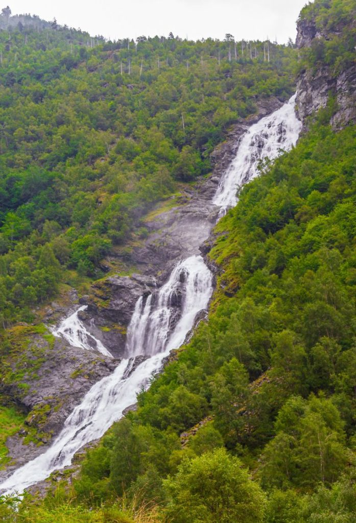
Tindeveien
Scenic Road
Tindeveien is the old mountain road between Årdal and Turtagrø. The road is also the main link between the Sognefjord to the Jotunheimen National Park area. The road is only open from May to November due to snow. The road is also part of the shortest land connection between Bergen and Trondheim.
The road does have a toll booth – payable by credit card. The toll booth is located at the highest point on the road, 1315 metres above sea level.
Turtagrø
Mountain Lodge
Turtagrø is located at 900 metres above sea level and is a popular starting point for many hiking trips. The area has been an important stopping place on the road over the mountain between Lom and Skjolden for a long time. In the 1880s the farmer Ole Berge gave travellers food and shelter, and many Englishmen and pioneers in Nordic mountain sports came to his farm.
The first hotel was built here in 1888 and helped developed the area as an important meeting place and haunt for mountaineers and hikers. Edvard Grieg also played at the hotel several times. The historic building burned down in 2001 and Ole Berge Draegni, the fourth generation owner, quickly planned a new hotel. It reopened in 2002. Ole Berge Draegni died in the flood disaster in Thailand in 2004. His daughter took over from him.
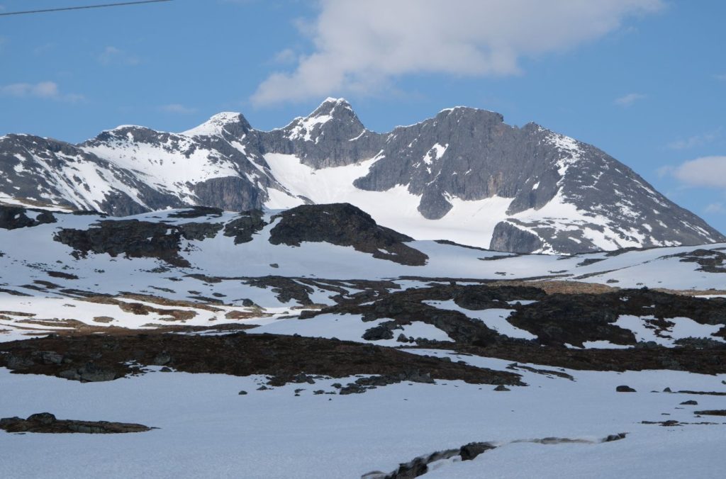
The area, known as Hurrungane, is one of Norway’s most alpine areas, with 24 peaks over 2,000 metres above sea level. The peaks have sharp tops and are often separated by glacier formations. Many of the mountains require experienced climbers.
Nedre Oscarshaug
Photo Stop
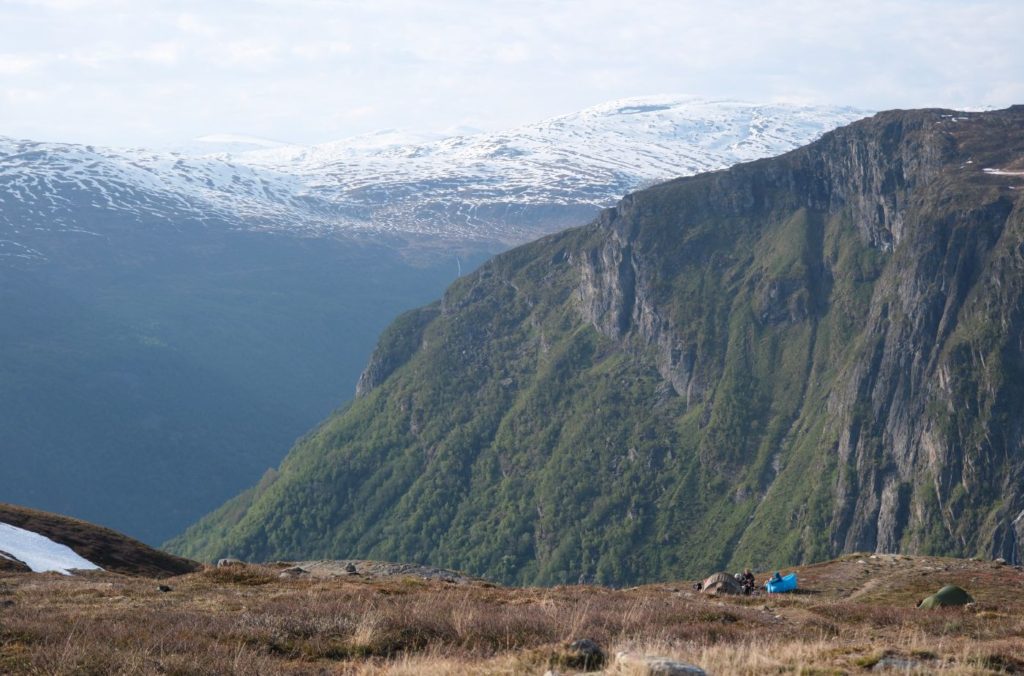
Nedre Oscarshaug is one of the popular photo stops on the Sognefjellet Tourist Road. Here you can see many of the mountains over the Hurrungane mountain range as well as the valley down to the Sognefjord.
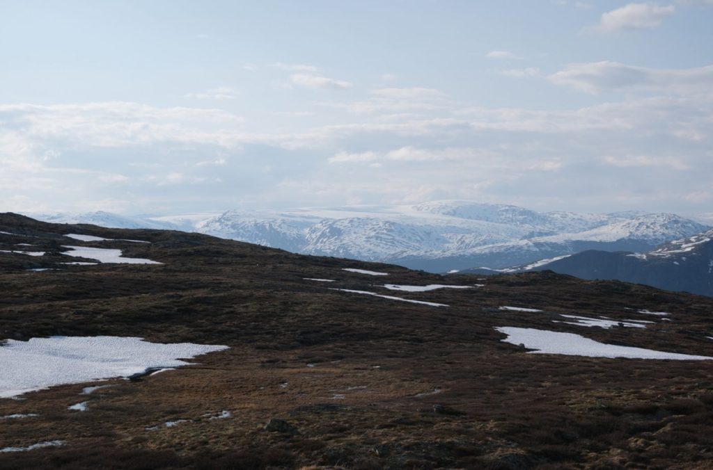
Sognefjellet
Tourist Road
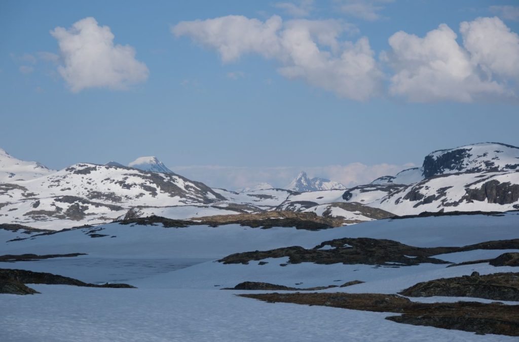
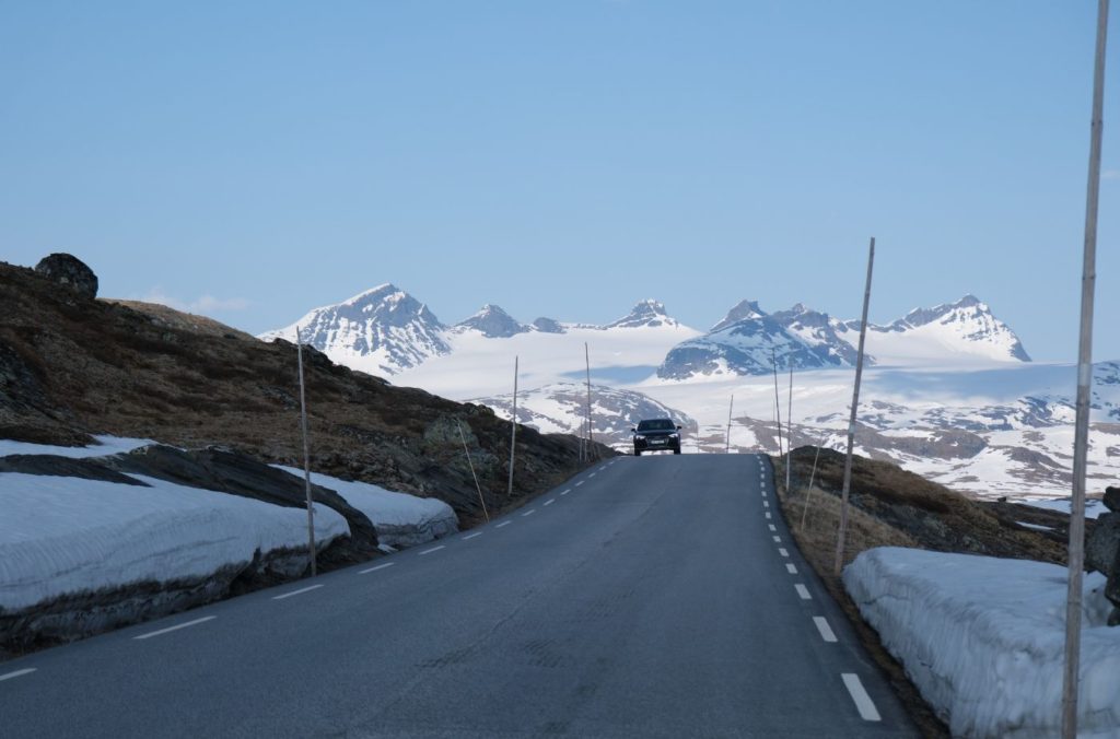
The Sognefjellet Tourist Road is one of Norway’s 18 national tourist roads. It is located on the border between the Innlandet and Vestlandet counties. The mountain crossing has been used for centuries, and it was a popular trade route for bringing grain over from the east to the west.
From the 19th century onwards, the area developed as a popular place for hikers and climbers, and a number of mountain lodges were established. The first road was completed in 1915, though it has been upgraded since then. Today it is one of the most popular tourist roads. The road is only open in the summer months.
Innlandet County
You will cross into Innlandet County, which is a county located in the inner parts of Norway. It has no connection to the sea.
Galdbygde
Village
Galdbygde is a small village with lodgings for the mountains. It is also where you take the road up to Galdhøpiggen, the highest mountain in Norway. Of course, you can’t drive all the way to the top. This takes you to the start of the hiking trail.
Lom Municipality
You drive into Lom Municipality, which is where our final stop is.
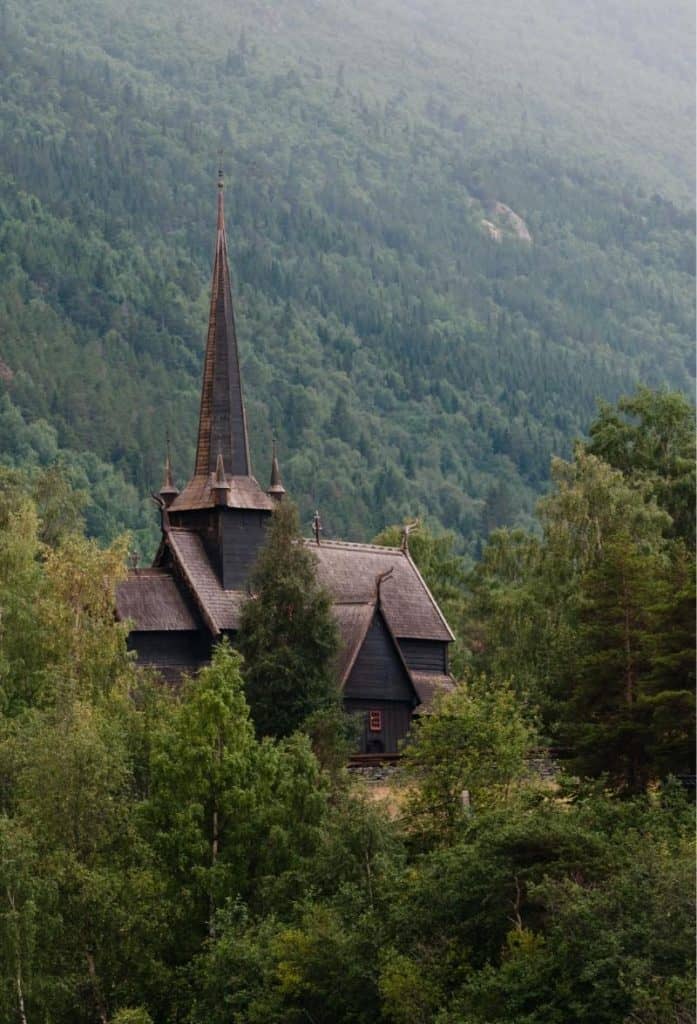
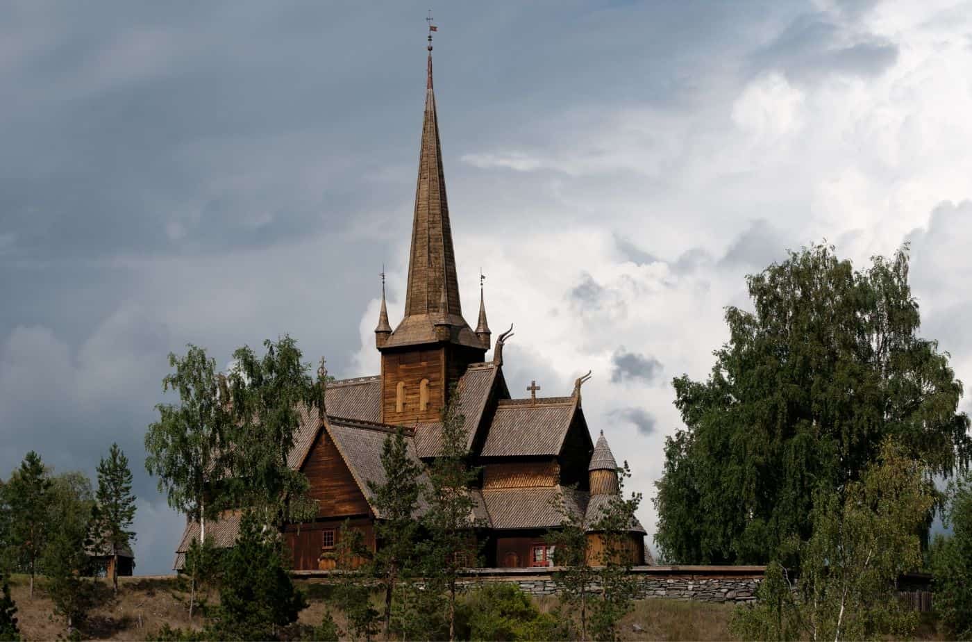
Lom
Welcome to Lom! Lom is a gorgeous village located between three national parks. It is also home to one of Norway’s most impressive stave churches.