Drive it Yourself: The Lofoten Islands Part 1: Å to Svolvær
The Lofoten Islands is probably one of the most famous places in Norway. Many people making the trip here want to head to Lofoten, and rightly so. Steep mountain peaks rise out of the ocean forming the Lofoten archipelago, one of the most scenic places in Norway. For thousands of years fishermen have lived at the foot of these peaks, building now iconic rorbuer and living off the cod fishing season. This history survives today on Lofoten, and you get to explore it with this road-trip!
This road-trip is part one of two parts and takes you from Å in the south to Svolvær, which is a little over halfway up the archipelago.
In this article...
Downloadable Version of This Guide
All of our guides can be downloaded via our online store.
We offer downloadable versions of our self-guided drives on our online store.
Facilities including supermarkets, toilets, petrol, hotels, cafes, restaurants with addresses.
Watch on Youtube
All of our roadtrips are available on YouTube to watch. They include information about the area provided in text and voiceover form, plus they show the drive in full (sped up in some spots!) so you can get an idea what the drive is like.
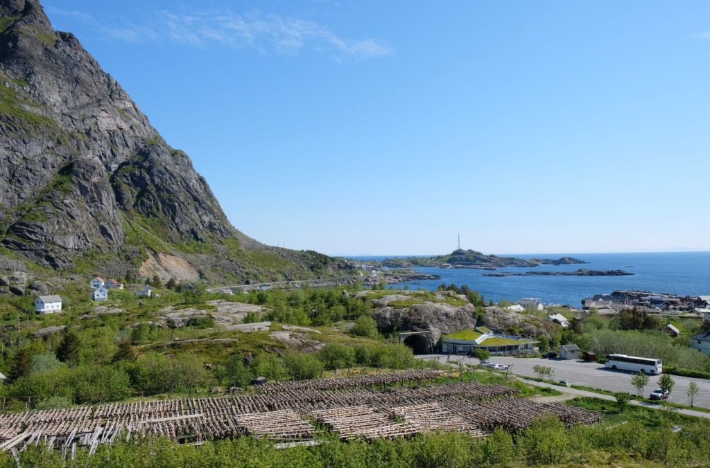
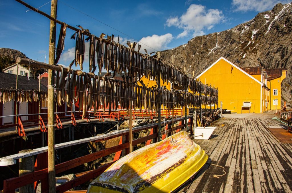
Not many places in the world have just one letter for a name, so Å is a special place. Å means stream in Norwegian – sometimes the village is known as Å i Lofoten because there are many places known as Å in Norway. Until the 1990s, Å was mainly a small fishing village specialising in stockfish, but since then tourism has taken over as the main economic activity.
Unique buildings in Å have been preserved, including a cod steamer from 1850, a bakery from 1844, several fisherman’s cabins, an old trading environment and more. Several of the houses are listed.
Moskenes is both the name of the municipality we are currently in and the ferry pier that will take you to Røst or Bodø. The name of the village itself is Sørvågen. Sørvågen has a population of around 700. It has one museum, the Norwegian Telecom Museum, because this is where the first telegraph between Northern Europe and Europe was connected in 1867.
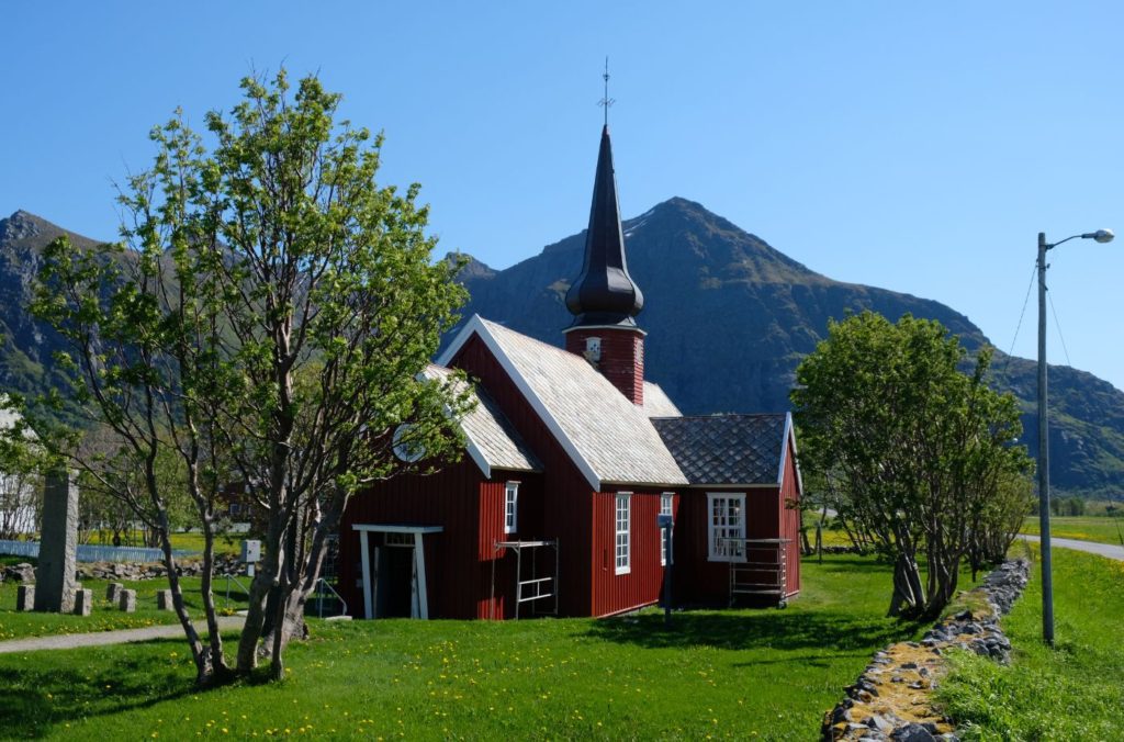
In the village you’ll see Moskenes Church, the main church for the region. The church is from 1819 and seats 280 people. The earliest mention of a church is from 1589, but the church was not considered new then. The church was replaced in 1819 to make a more modern and stable church.
Reine
Photo Stop
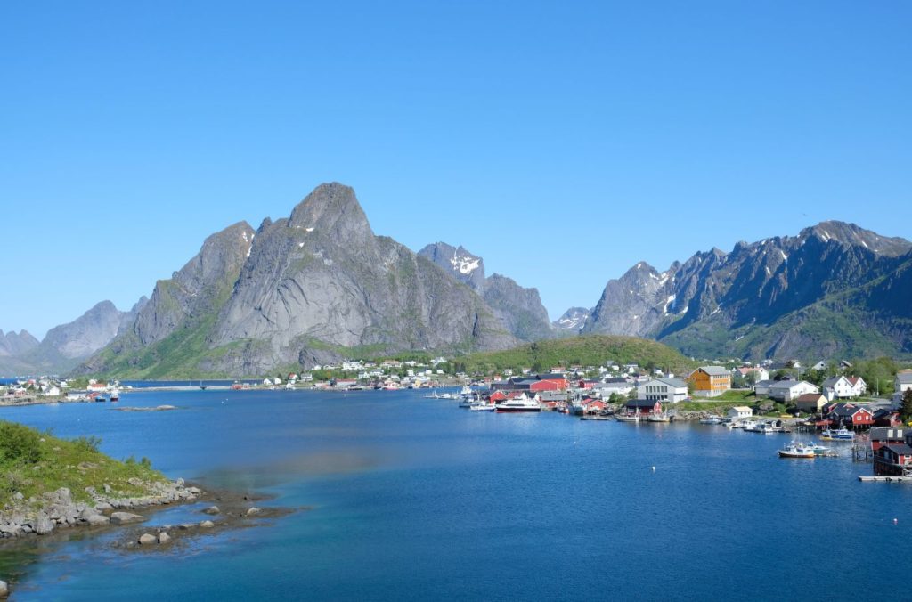
The photo of Reine seen above is perhaps one of the most famous photos of Norway. It generally circulates the internet when discussions of Norway’s beauty arise, and it’s often featured on travel websites. This photo requires very little effort to get! As you turn off the E10 onto the road to Reine (there’s only one), there is a parking lot on the left right before you take the bridge. Step out the car and you have this view. It’s that easy! It’s even on Google Maps as “Reine korttidsparkeringsplass” (Reine Short Term Parking Place)
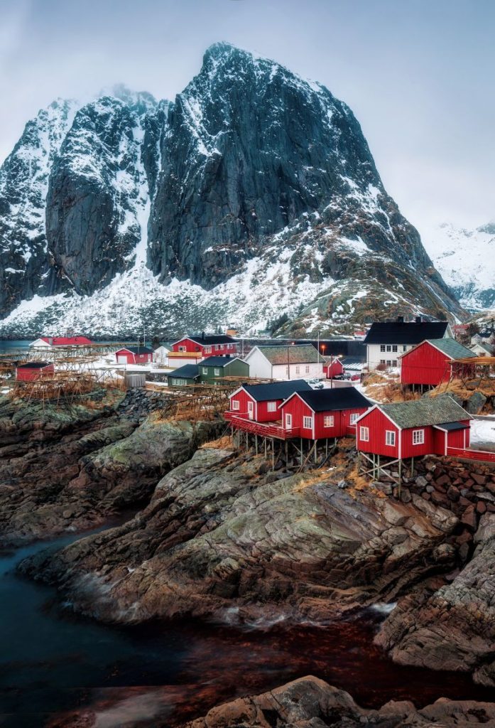
Reine
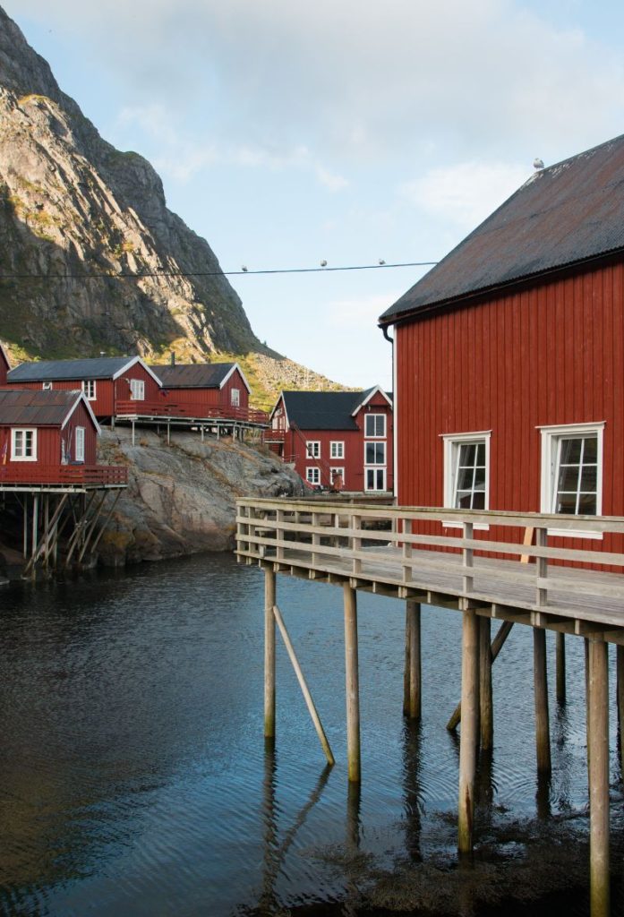
Reine has been a trading post since 1743, and it is an important centre for the fishing industry. The tradition of the iconic fishermen’s cabins, or rorbu, dates to the 18th century. They were seasonal shelters with one end of the house on pillars onto the fjord, allowing boats to dock next to the building. In Reine, many people still make their living from the sea and have passed on marine skills and traditions for generations. The prime fishing season is from January to April, when the Norwegian Arctic cod are spawning in the waters of Lofoten.
Today Reine is arguably the most famous village in Lofoten. The stunning scenery of steep mountain peaks contrasted with the fishing village have made the rounds on the internet, and it’s hard to plan a trip to Norway without seeing the famous Reine shot.
Sakrisøy is a small island located at the foot of the mountain Olstind. The island has been dominated by one family, the Gylseth family, for over 130 years. In 1889, Sven Kornelius Gylseth bought the island and built a manor house. He ran the local shop, but he was also a fish buyer. For five generations, the family has been buying cod from the fishermen and trading it with European merchants. One of the historic ships, M/V Pøyken, is on display. It shows how fishermen lived in Lofoten.
Today the family runs a hotel, shop and restaurant in the original buildings. This is a great alternative for a place to stay if Reine is too crowded for you. The island is tiny, though. Blink and you’ll miss it!
Hamnøy
Island
Hamnøy is a small island and village just next to Sakrisøy. The first buildings were constructed here as residential and business buildings. Today the fishing industry is still important to Hamnøy, but it also has some places to stay and tours. Most of the buildings are owned by the company Eliassen Rorbuer, who have managed to preserve many of the original rorbuer and business buildings. Additionally, they have a restaurant and many activities available such as boat trips, bike rental, diving, and kayaking. If you want to stay away from busy Reine, this is a great alternative.
Akkarvikodden is a scenic rest stop with beautiful views out to the south east.
Flakstad Municipality
The municipality of Flakstad is located on the northern part of the island Moskenesøya and the entire island Flakstadøya. The name comes from the Flakstad farm, which is where the Flakstad Church was built. The coat of arms shows a fastening device used on boats. As you can probably guess, the municipality’s economy is dominated by fishing. The fishing fleet consists mostly of small boats.
Sund
Village/Detour
Sund is a small fishing village with around 100 permanent residents. It is believed to be one of the oldest settlements on the Lofoten Islands. Today a large part of the village is preserved with traditional rorbuer and there’s the Sund Fiskerimuseum, which has a traditional workshop.
In Sund there is a blacksmith who makes cormorants out of metal. These have been made in Sund for over fifty years and are a well-known souvenir to buy from Lofoten. The black cormorant is known in Norwegian folklore for living in the outermost reefs in the ocean. It stands there drying its wings before the next dive.
The Sund Fiskerimuseum is a private museum with a collection gathered by the locals. The rorbu buildings by the museum are original – these are the original fisherman’s cabins and not ones that were built as tourist accommodation. The décor inside also shows how fishermen lived.
Ramberg
Village
Ramberg is the municipal centre for Flakstad. The town has everything you’d expect for a town this size – tourist office, library, school, petrol station, restaurant, and accommodation. As with every place in Lofoten, the main industry here is fishing. The Lofoten fishing season is the dominant type of fishing, and the fleet is made up of small boats. Some farms here have sheep, while larger properties have cows.
Ramberg is one of the few places in Lofoten where you can see the midnight sun. It is one of the few settlements on the side of Lofoten facing the sea, so it is possible to see the sun above the horizon. Most settlements are on the eastern part of the islands, facing the Norwegian mainland and therefore blocked from seeing the midnight sun. Ramberg is particularly known for its beach, which is one of the most beautiful in Lofoten.
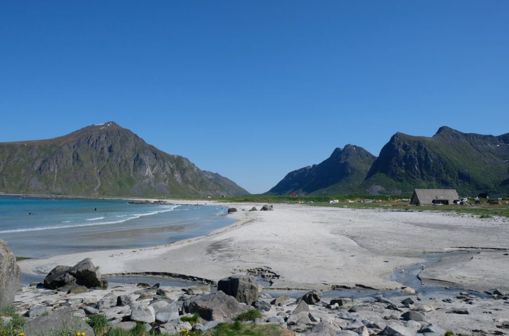
Flakstad Beach
Beach
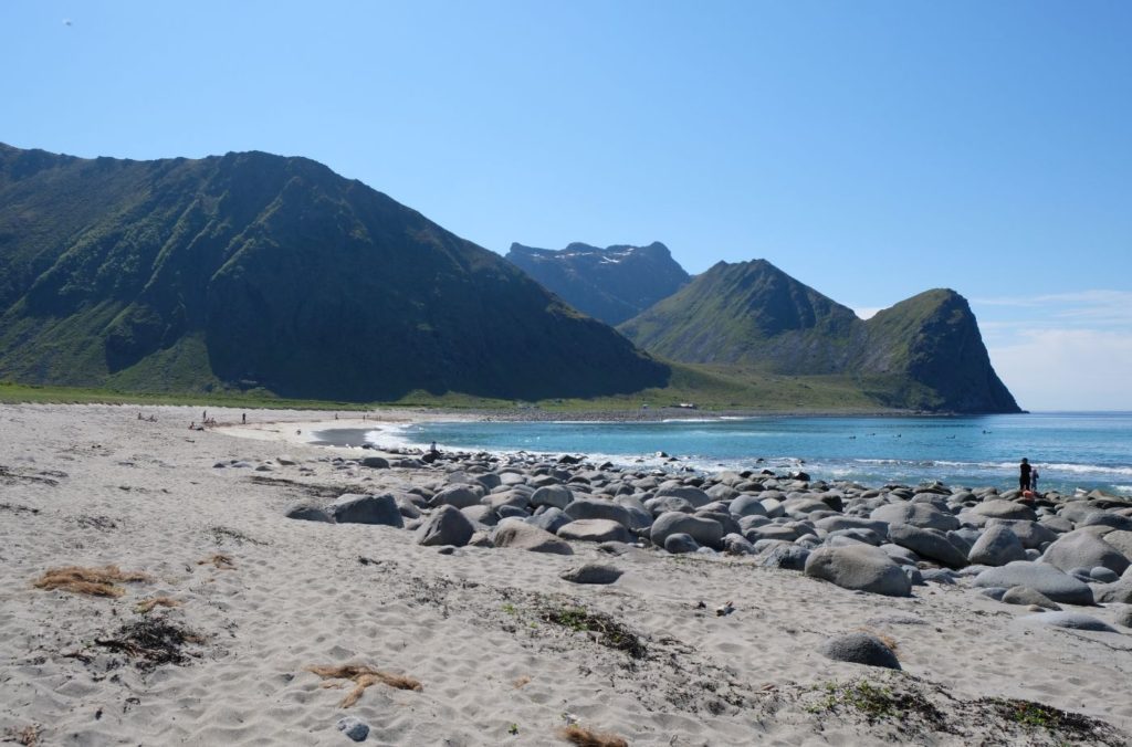
Flakstad Beach is one of the most famous beaches in Lofoten. Here you can go surfing or take surfing classes. By the beach is the Lofoten Beach Camp. You can set up your tent here or park your mobile home. Some indoor rooms are available, too. Lofoten Beach Camp offers surf lessons and surf rentals, including the appropriate wetsuit for the arctic surf.
Flakstad Church is one of the oldest churches on the Lofoten Islands. It is first mentioned in 1430 but is likely older than that. The church has a limestone baptismal font that dates to 1250-1300. This isn’t the same church today; the older medieval building has now been replaced since a storm around the year 1780 blew it down. Shortly afterwards, a new church was built on the same site using timber from Russia. One of the new chandeliers also came from Russia. Some items from the earlier church have been preserved. Flakstad Church has a characteristic onion dome on top.
Nappskaret Photo Stop
Photo stop
Nappskaret is a scenic photo stop by the rock. You park your car and head up a small staircase to get some incredible views of the island.
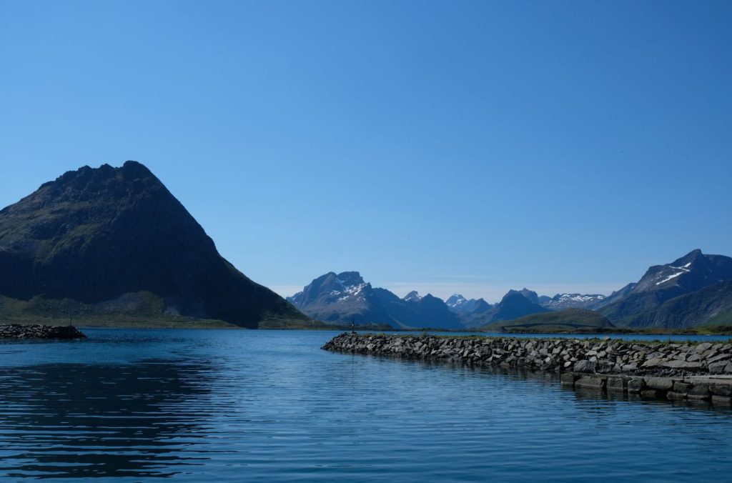
Vestvågøya
Island
After Nappskaret photo stop there is an undersea tunnel to the next island.
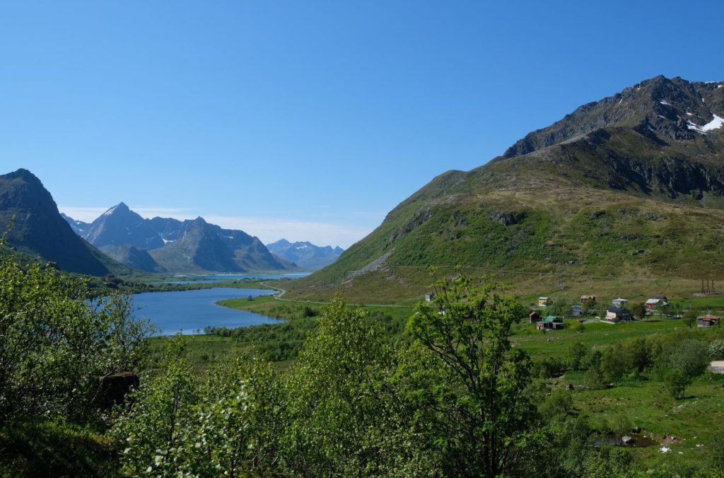
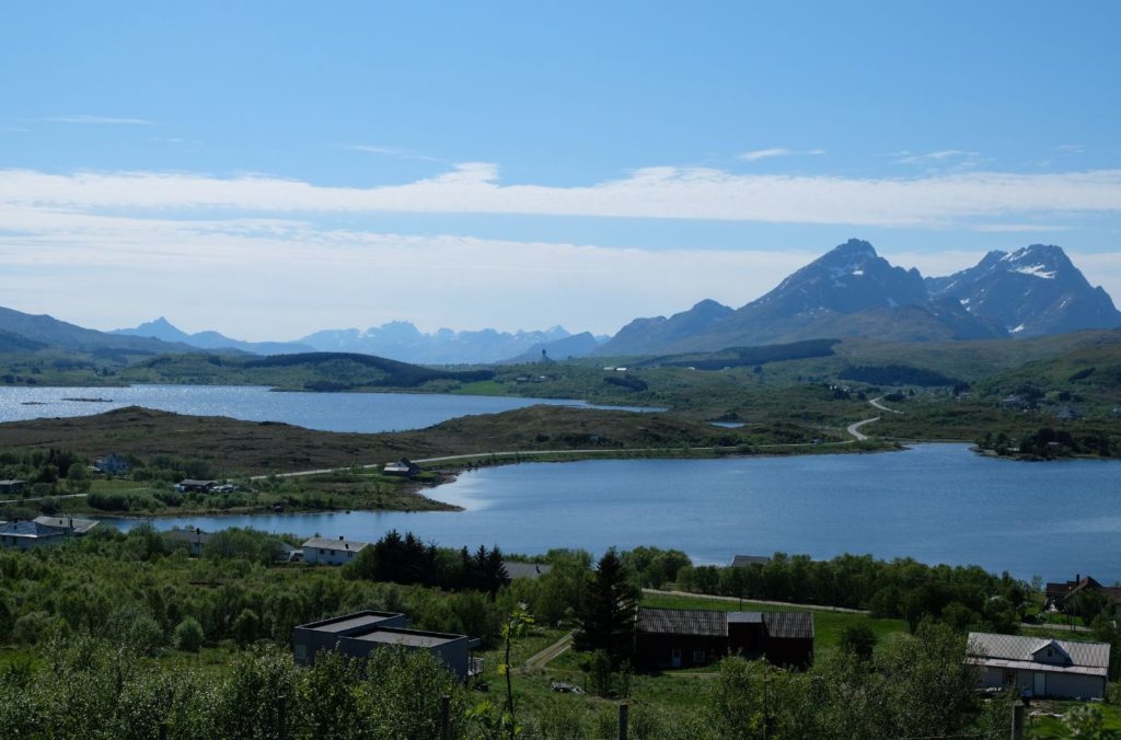
Vestvågøya is a large island in the Lofoten Islands both in terms of geography and population (around 10,000 people live here). A large part of the island is relatively flat and marshy, while the outer parts of the island are mountainous. The highest point on the island is the 964m (3163ft) mountain Himmeltindan.
Vestvågøy Municipality
Vestvågøy is the most populous municipality in all Lofoten. The administrative centre is Leknes, which is close by to where we are right now.
Leknes
Town
Leknes is one of the main towns in Lofoten. Leknes is in the geographic centre of the Lofoten islands and is the main town on the island Vestvågøya. Leknes is one of the few towns in Lofoten that is not by the sea and therefore not dependent on fishing; it is more of an administrative centre. Leknes has one of the main airports for Lofoten and it also has a cruise port for larger ships. Here is an upper secondary school, sports hall, and police station. The Lofoten Centre, one of Northern Norway’s largest shopping centres, is located here. The Lofothallen is one of the main concert venues on the Lofoten Islands.
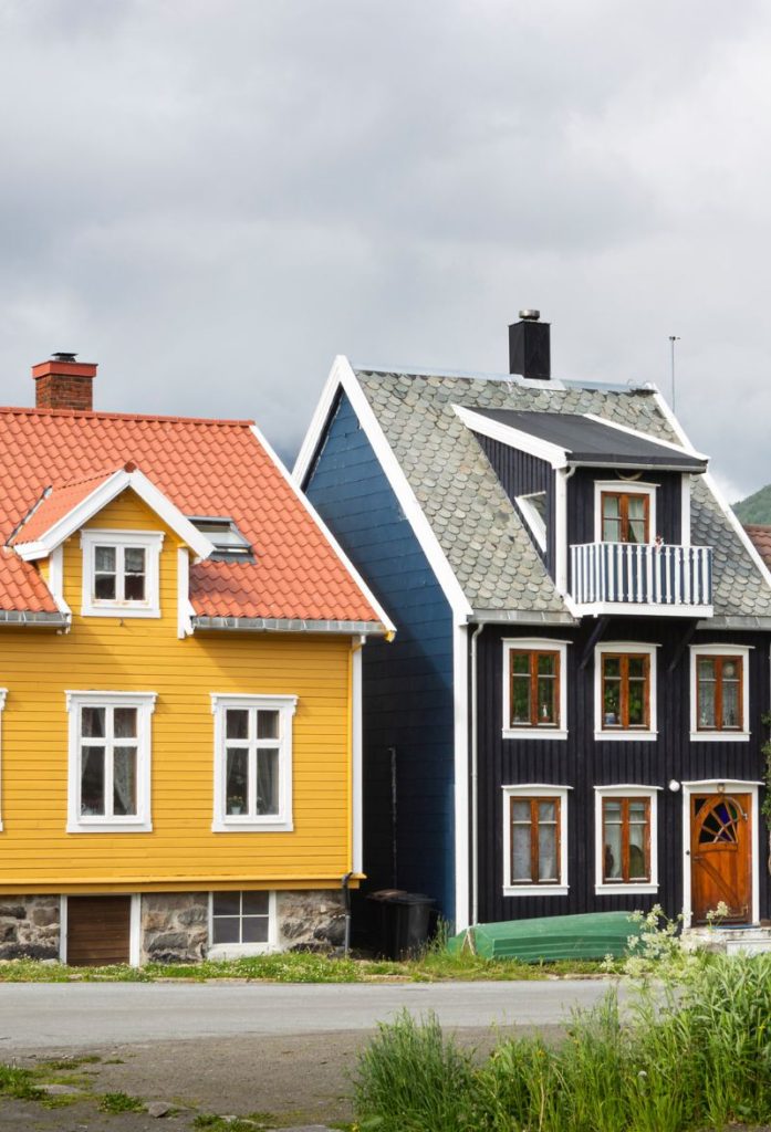
Leknes doesn’t have the same history as many of the other places in Lofoten; it didn’t really see growth until the 1960s. Because of this, there are few characteristic wooden buildings here. There are areas around Leknes that have finds from the Iron Age and Viking Age, though. We are heading towards one of these famous places.
Unstad Beach
Beach/Detour
This small village has only around 15 people living here, but it is one of the most visited places in Lofoten. It is regarded as one of the best surf beaches on the Lofoten Islands. The area has been inhabited since before 1350; it is mentioned as being older than other farm in Borge and Valberg (Borg is well-known from Viking times). The population was at its peak in the 1930s, when around 350 people lived here.
Today the village is centered around tourism, especially surfing. There are some beaches from the Iron Age and Middle Ages here, too. If you want to go surfing here, check out the company Unstad Arctic Surf.
Haukland Beach is the first beach we pass. The village is tiny – only 12 people live here all year round. Still, Haukland Beach is known as one of the most beautiful beaches in Norway. From Haukland Beach, you can follow the old road (hiking and cycling only) to Uttakleiv Beach for even more stunning views. There are also hiking trails to the tops of the mountain peaks you can see.
Uttakleiv is one of the most beautiful beaches on Lofoten. There aren’t many places in the world where you can see steep mountains, white sandy beaches, and farms all in one shot! Uttakleiv is a great spot to sit and watch the midnight sign. A lot of people also come here to observe the northern lights.
The village is a protected area for its natural habitat and historic farms. The old road that used to connect Uttakleiv to the rest of Lofoten is now a hiking and cycling track, and a great thing to do it you have the time.
Borg Viking Museum
Museum
The Borg Viking Museum is a reconstructed longhouse built on the site where one of the biggest Viking Age archaeological discoveries was made. The inside musuem has all the artefacts on display, and in summer you can follow the cultural heritage trail down to a beach.
Torvdalshalsen
Viewpoint
At this viewpoint you get a very clear overview of the Borg region, and you can almost imagine the Vikings arriving at the harbour and making their way to the longhouse! There are some useful information signs here, too.
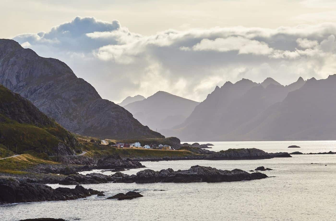
Austvågøya
Island
The next island we cross onto is Austvågøya. Austvågøya is the north easternmost of the large islands in Lofoten. Around 9,000 people live on Austvågøya, and many of them live in Svolvaer – the largest city in Lofoten. The island mostly consists of mountains; the largest is Higravstinden, which is 1,146m (3,760ft). One of the most famous mountains, however, is Vågakallen (942m or 3,091ft) – it towers over the picturesque village of Henningsvaer. Vågakallen is famous in troll stories about the Lofoten islands – it is the name of one of the trolls who lived here. The famous Trollfjord is also located on Austvågøya.
Kabelvåg
Kabelvåg is the historic capital of Lofoten and finds have been made here that date back to the Viking Age.
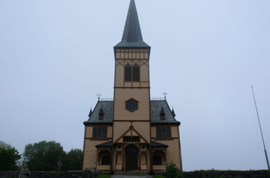
This is the main church for the municipality of Vågan, and one of the most beautiful churches in Lofoten. The church is built in the cruciform style from 1898. The church seats around 1,200 people, making it the largest wooden building in Northern Norway. Because of that, it often gets the nickname Lofoten Cathedral.
The earliest church dates to the 12th century when King Øystein Magnusson founded Vågan. It was likely a stave church and probably stood 200m (660ft) west of the present site. The church was renovated in the 1600s, but by the early 1700s it was too deteriorated and had to be rebuilt. A new church was completed in 1712, but by the late 1800s it was becoming too small due to the huge population growth in Kabelvåg. So, in 1898 a new church was built about 200m to the east of the old church.
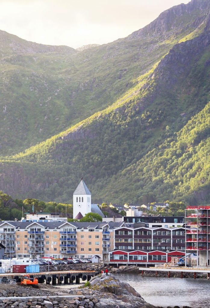
Svolvær
With a population of 4,720, Svolvær is the largest city in the Lofoten Islands. The settlement is old; Svolvær was first mentioned in 1567. However, Svolvær didn’t gain prominence until the early 20th century when the motorized boats needed a modern harbour.
The cod fisheries are still an important industry in Svolvær, but tourism is one of the main industries in the city. Svolvær is also a major transportation hub and favourite starting point for tourists. The Hurtigruten also stops here twice a day. It is possible to do sea eagle safaris, whale watching tours, and take a scenic cruise into the nearby Trollfjord. Svolvær also has a downhill skiing centre. In town, you’ll find the Lofoten War Memorial Museum a Magic Ice Bar, and numerous galleries.