
Drive it Yourself: The Lofoten Islands Part 2: Svolvær to Harstad
The Lofoten Islands is probably one of the most famous places in Norway. Many people making the trip here want to head to Lofoten, and rightly so. Steep mountain peaks rise out of the ocean forming the Lofoten archipelago, one of the most scenic places in Norway. For thousands of years fishermen have lived at the foot of these peaks, building now iconic rorbuer and living off the cod fishing season. This history survives today on Lofoten, and you get to explore it with this road-trip!
This road-trip is part one of two parts and takes you from Å in the south to Svolvær, which is a little over halfway up the archipelago.
In this article...
Download This Guide
All of our guides can be downloaded via our online store.
Online Guide
- Information about points of interest
- Images of each point of interest
- Historic overview of the neighbourhood
- Directions between points
- Historic photos
- Information about facilities along the way
Downloadable Guide
- Information about points of interest
- Images of each point of interest
- Historic overview of the region & towns
- Directions between points
- Historic photos
- Facilities including supermarkets, toilets, petrol, hotels, cafes, restaurants with addresses.
Watch on Youtube
All of our roadtrips are available on YouTube to watch. They include information about the area provided in text and voiceover form, plus they show the drive in full (sped up in some spots!) so you can get an idea what the drive is like.
Begin: Svolvær
With a population of 4,720, Svolvær is the largest city in the Lofoten Islands. The settlement is old; Svolvær was first mentioned in 1567. However, Svolvær didn’t gain prominence until the early 20th century when the motorized boats needed a modern harbour.
The cod fisheries are still an important industry in Svolvær, but tourism is one of the main industries in the city. Svolvær is also a major transportation hub and favourite starting point for tourists. The Hurtigruten also stops here twice a day. It is possible to do sea eagle safaris, whale watching tours, and take a scenic cruise into the nearby Trollfjord. Svolvær also has a downhill skiing centre. In town, you’ll find the Lofoten War Memorial Museum a Magic Ice Bar, and numerous galleries.
Svolvær Airport
Airport
Svolvær Airport is a regional airport in Lofoten. While it is one of the main airports for Lofoten, it is likely not the one you will fly to if you are flying to Lofoten – instead, it’s better to fly to Harstad/Narvik and drive from there. Svolvær Airport is served by Widerøe and the routes are subsidized by the government with direct flights to Bodø, Oslo, and small communities in Nordland county. There are plans to make a new primary airport to serve the Lofoten and Vesterålen region, making it more attractive to visit out of the tourist season.
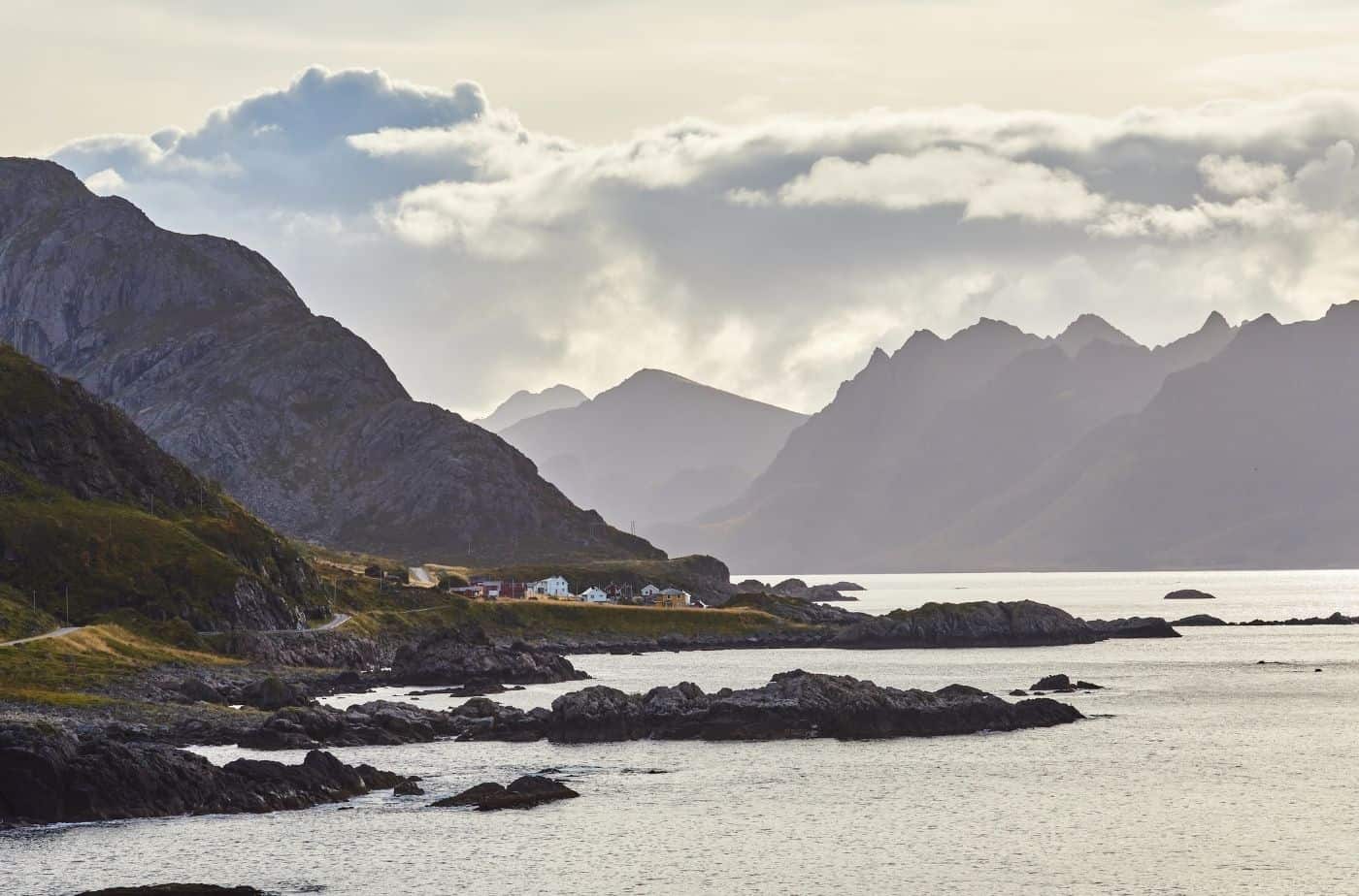
Austnesfjorden
Photo Stop
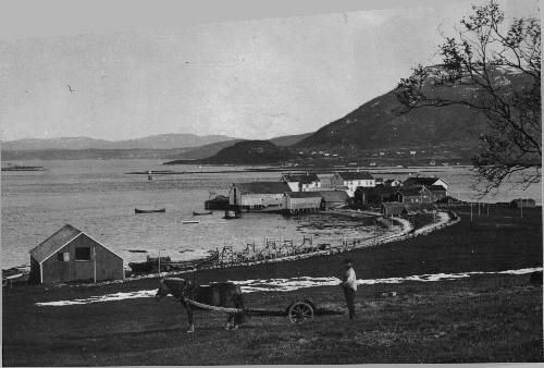
The Austnesfjorden Photo Stop is located shortly after Svolvær Airport. The view is excellent over the fjord and you can see Sildpollnes Church in the distance.
Sildpollnes Church is a small white wooden church from 1891. The church had some drama recently, when the current neighbour refused to let people through his property to get to the church because he said the 1890 agreement stated people could pass on foot, but it didn’t mention automobiles. The church closed in 2015 and the case went to court, with the neighbour loosing and the Lofoten District Court ruling in favour of the church.
At the photo stop they have a place you can walk up to with a viewing platform. I’ve used a photo of it at the top of this page. This is where you get the view out to the church.

Hadsel Municipality
Hadsel municipality is located on four main islands in Vesterålen – Hinnøya, Langøya, Hadseløya, and Austvågøya.
Hadsel has been an important hub for the fishing industry, and due to its proximity to Lofoten has always been an important trading place for Lofoten residents. The oldest settlements were likely on the southern side of Hadseløya, but the main harbour has always been Stokmarknes.
The name “Hadsel” comes from the Old Norse word “Hovdasegl”, meaning “main sail”. The name describes that Hadseløya can look like a merged mainsail on a Nordland boat when you see Hadseløya from Langøya. The Sami name for Hadsel is Ulpesuohkan, referring to the old name for the area (Ulvøya).
The main airport here is the Stokmarknes Airport, the busiest small aircraft airport in Norway. Stokmarknes is also the birthplace of Hurtigruten, the Norwegian coastal ferry.
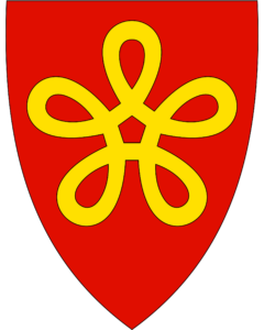
The coat of arms represents four yellow rings, representing the four main islands the municipality is on.
Vesterålen
Traditional Region
Many people confuse Vesterålen for Lofoten, but in fact they are two different areas.
Vesterålen is an archipelago between Lofoten and the Norwegian mainland. Many assume that the whole area is just Lofoten, but it’s just the southern half of the islands. The name “Vesterålen” means “western strait”. The landscape here is very mountainous, but the mountains are more rounded than Lofoten. The towns and villages are on the coastal brim between the mountains and the fjords. Fishing, in particular cod fisheries, has always been important to Vesterålen. Today there is also fish farming and some agriculture in the area.
Hinnøya
Island
Hinnøya is the fourth largest island in Norway, and the largest out of Svalbard. The island has several fjords and typically has a mountainous and rugged terrain. There are also valleys and lakes; the treeline is around 400m above sea level.
Lødingen Municipality
Lødingen (Sami name: Lodek) is a region on the southwestern part of the island Hinnøya and it is part of the traditional district called Ofoten. While not technically part of Vesterålen, it does participate in councils with the municipalities in Vesterålen.
The most historically important place in Lødingen is Hjertholmen, a farm and meeting place for residents and visitors. It was owned by the Lødingen Prestegård (rectory) in 1860, and a lighthouse was also built on the site along with the guardhouse and telegraph office. Today the place is used as a gathering place for schools, kindergartens, and visitors. The site is located in Lødingen village.
Another important site is Hustad gård, which was a large Viking farm 1,000 years ago. The museum tells the story of agricultural history, but there is also a cultural path that follows the Iron Age settlement. The main church, Lødingen Church, is built on the site of the first church in the area, built in the 13th century.
The tallest mountain in Lødingen is the mountain Møysalen, which is 1263m above sea level making it the second highest mountain peak on an island in Norway.
Lødingen is known as “Biketown” because it has several annual bike races. The Lødingen Cycling Club is Norway’s largest cycling club in terms of population. Lofoten Insomnia is a race that begins in Å (at the far end of Lofoten) and ends in Lødingen.
Another important event here is the Seafood Festival with concerts and an excellent selection of seafood. Sailboats from all over the country visit the festival, which takes place in the early summer.
Troms County
Troms County existed up until 1 January 2020, when it was merged with Finnmark County to make Troms og Finnmark. However, at time of writing, there are rumours the two will split up. So, I’m going to provide information just about Troms.
The area has been settled since the Stone Age, and the first of the current ethnic groups to settle in the county were the Sami people. Archaeological evidence shows that a Norse-based culture existed here in the Late Roman Iron Age (200-400AD). The Norse settled along the coast and some of the larger fjords, while the Sami lived in some fjord areas and inland. The southern part of Troms was a petty kingdom in the Viking Age. Trondenes (today’s Harstad) was an important Viking power centre and gathering place.
Troms takes its name from the island Tromsøya where the city Tromsø is located. The area is in the northern part of the Scandinavian peninsula, and due to its low population and distance from high density European cities, it is one of the least polluted areas in Europe.
With its latitude of nearly 70 degrees north, the area has cool, short summers but mild winters due to the Gulf Stream. The area experiences the midnight sun between May and July and then the polar night between November and January.
Outside of the big cities, fishing remains an important industry and there are several important fishing ports throughout the county. Tromsø is the commercial centre for the northern part of the county, while Harstad is the centre for the southern part of the county.
Kvæfjord Municipality
Kvæfjord (Sami: Giehtavuotna) is in the traditional region of Central Hålogaland with the main village being Borkenes. The municipality is known for its agriculture and farming, with the quality of the strawberries being particularly famous. The long hours of daylight and low summer temperatures are great for strawberries, making them more tasteful than berries grown in warmer climates. Potatoes are also particularly well known from this region, and the fjords are known for their good herring. Chicken farming for egg production and pig farming are also important.
Kvæfjord is a historic region, and burial mounds and items found during excavations indicate that there have been settlements here since the Iron Age. One of the oldest farms, Vebostad, has traces from 300BC. Many of the names in the area have Iron Age and Viking Age origin. For example, Vebostad has ‘ve’ in it, which is an old word meaning sanctuary, residence, and pagan sacrificial site. Another farm, Hundstad, may be connected to the famous Viking Tore Hund.
On the mountain Melåaksla, over 30 shooting shelters have been found on an inaccessible mountain path that the reindeer use as a migration route. As many as 40-50 people were involved in reindeer hunting here.
Sami people have lived in Kvæfjord for a very long time, but the historical information is scattered. It is known that the Sami lived along the fjords, particularly Austerfjord, as well as in the inland areas. In the Storjord area are traces of Sami settlement from the 17th to 19th centuries.
Kvæfjord is the home of the Kvæfjord Cake, the Norwegian national cake. The cake is a sponge cake baked with meringue, vanilla cream, and almonds.
Boazovazzi
Shop
On the right is Boazovazzi, a shop where you can buy Sami products. The name is the Sami word for ‘Reindeer herder’ and here you can buy reindeer meat or Sami handicrafts. They also have six rooms for rent. Put the name of the shop in Google and check them out!
Tjeldsund Municipality
Tjeldsund (Sami name: Dielddanuorri) is a municipality that’s part of the Ofoten traditional district and the Central Hålogaland district. The main village in the municipality is Evenskjer. The main education and training centre for Norway’s firemen, Norges Brannskole, is in Fjelldal in Tjeldsund. A naval base is also located here at Ramsund. Besides that, there is some small industry including farming, fishing, banking, and transport.
Kongsvika
Village
Kongsvika is a small village with around 300 people living there. It has cabins for rental and the first petrol station we’ve seen in a while! It’s a good place to stop for a break.
Sandtorg
Village
Sandtorg is a small village with a population of around 300. It is an old settlement; there has been a trading post here since the 13th century. Sandtorg grew in importance in the 18th century when pilot services were added for foreign and local ships. The trading post lasted until 1945, when the Norwegian Amy’s communication services took over operations after German occupation. The army returned the post to civilian use in the 1990s and today the trading post still stands with a hotel and restaurant.
In 2014, three coins from the Middle Ages and two pieces of payment silver dating to the Viking times were found here. The two coins were minted under Eirik Magnusson and date to 1285-1290. The third coin is from 1483-1513. In 2020, it was concluded that Sandtorg is the only Viking Age trading place in Northern Norway.
You can spend the night at Sandtorgholmen Hotel, which is built on the site that has been used as the trading post since the 19th century. The original site was further north. Prices start at around 1200 NOK for a standard room for one night.
You can visit the hotel website here: https://www.sandtorgholmen.no/?lang=en
Sørvik
Village
Sørvik is a small village located close to Harstad. The village has a historical museum that opens in the summer. They’ve collected log buildings from around Harstad and recreated the museum like an old farm and village. The museum aims to show the Norwegian home and lifestyle in the 19th and early 20th century, though some of the architecture dates back to before the 19th century.
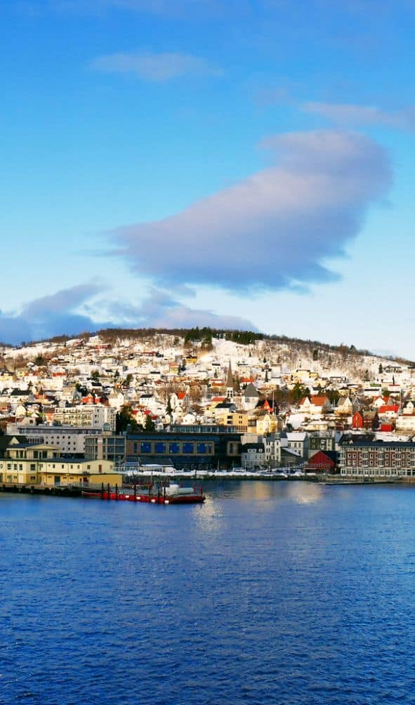
Harstad
Harstad is the second most populated city in Troms after Tromsø, with a population of 24,703.
The oldest part of Harstad is the area Trondenes, which is mentioned in the Heimskringla (King’s Sagas) as a power centre in the Viking Age and a place to meet and discuss important issues. It wasn’t a trading place; Sandtorg is the only known Viking Age trading place in Northern Norway. It is possible to visit Trondenes, and that’s where we are going!
Harstad city didn’t grow until the late 19th and early 20th centuries, when it emerged as an important trading place with a large harbour for ships. The city experienced rapid expansion with the introduction of steam ships.
Continue the drive
Andøya Tourist Road
Visit Norway’s most remote tourist road at the end of the world!
Previous Drive

The Lofoten Islands Part 1: Å to Svolvær
See the previous day’s drive through the lower part of Lofoten
If you liked this drive, or if you have any travel tips, please leave a comment in the section below!