

Drive it Yourself: Harstad to Andenes on the Andøya Tourist Road
This drive doesn’t have to begin in Harstad. The Andøya Tourist Road is close to the Lofoten Tourist Road, so you can easily do this from Svolvær, for example.
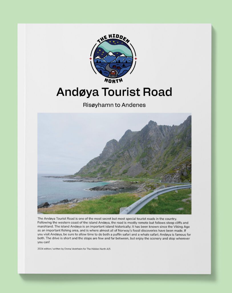
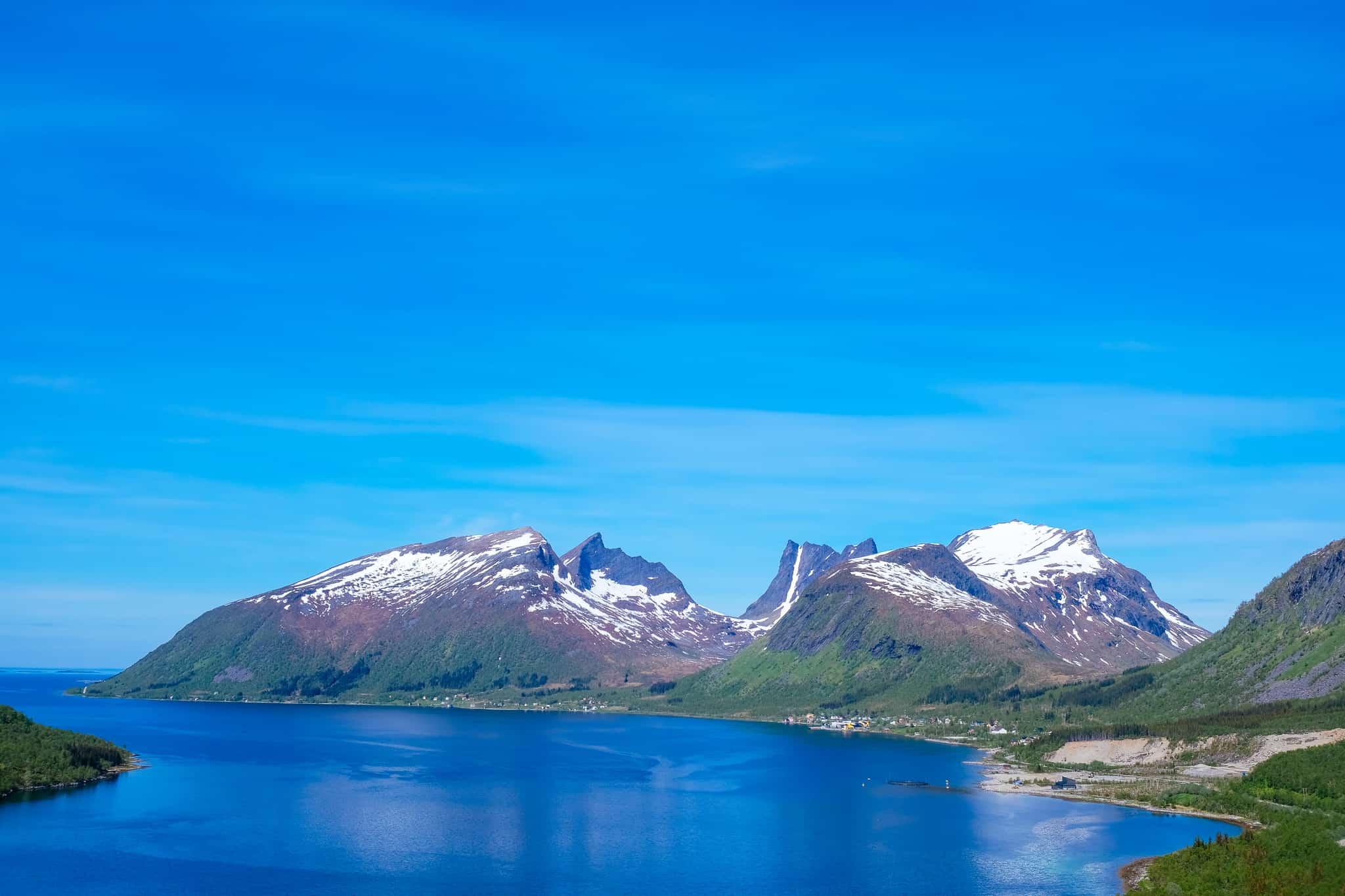
The Andøya Tourist Road is one of Norway’s most remote tourist roads, and in many ways, it feels like one of the country’s best-kept secrets. Located close to the far more famous Lofoten Islands, this road takes along the rough coastline past some of the most stunning scenery Norway has to offer.
Andøya Island (explained in detail later in this driving guide) is a unique island. It is the only place on the Norwegian mainland where dinosaur fossils have been found, it is famous for its Arctic cloudberries, and whales, puffins and seals can be seen for large parts of the year.
While the tourist road itself is short, the drive is well worth the time it takes to get to this remote part of the world.
In this article...
Downloadable Version of This Guide
We offer downloadable versions of our self-guided drives on our online store.
Online Guide
- Information about points of interest
- Images of each point of interest
- Historic overview of the neighbourhood
- Directions between points
- Historic photos
- Information about facilities along the way
Downloadable Guide
- Information about points of interest
- Images of each point of interest
- Historic overview of the region & towns
- Directions between points
- Historic photos
- Facilities including supermarkets, toilets, petrol, hotels, cafes, restaurants with addresses.
Watch on Youtube
All of our roadtrips are available on YouTube to watch. They include information about the area provided in text and voiceover form, plus they show the drive in full (sped up in some spots!) so you can get an idea what the drive is like.
The drive: Harstad to Andenes
Harstad
Harstad is the second largest city in Troms (after Tromsø). It’s a good place to spend the night thanks to its large selection of hotels and restaurants. The YouTube video begins in Harstad.
For information about Harstad, head to the travel guide page.
Sørvik
Village
Sørvik is a small village located close to Harstad. The village has a historical museum that opens in the summer. They’ve collected log buildings from around Harstad and recreated the museum like an old farm and village. The museum aims to show the Norwegian home and lifestyle in the 19th and early 20th century, though some of the architecture dates back to before the 19th century.
Sandtorg
Village
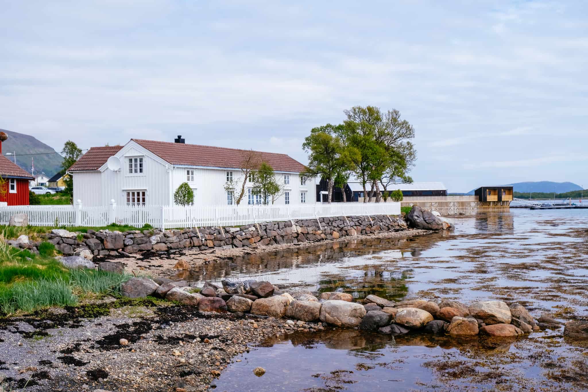
Sandtorg is a small village with a population of around 300. It is an old settlement; there has been a trading post here since the 13th century. Sandtorg grew in importance in the 18th century when pilot services were added for foreign and local ships. The trading post lasted until 1945, when the Norwegian Amy’s communication services took over operations after German occupation. The army returned the post to civilian use in the 1990s and today the trading post still stands with a hotel and restaurant.
In 2014, three coins from the Middle Ages and two pieces of payment silver dating to the Viking times were found here. The two coins were minted under Eirik Magnusson and date to 1285-1290. The third coin is from 1483-1513. In 2020, it was concluded that Sandtorg is the only Viking Age trading place in Northern Norway.
You can spend the night at Sandtorgholmen Hotel, which is built on the site that has been used as the trading post since the 19th century. The original site was further north. Prices start at around 1200 NOK for a standard room for one night.
You can visit the hotel website here: https://www.sandtorgholmen.no/?lang=en
Tjeldsund Municipality
Tjeldsund (Sami name: Dielddanuorri) is a municipality that’s part of the Ofoten traditional district and the Central Hålogaland district. The main village in the municipality is Evenskjer. The main education and training centre for Norway’s firemen, Norges Brannskole, is in Fjelldal in Tjeldsund. A naval base is also located here at Ramsund. Besides that, there is some small industry including farming, fishing, banking, and transport.
Kongsvik
Village
Kongsvika is a small village with around 300 people living there. It has cabins for rental and a petrol station.
Nordland County
Nordland County is located along the north-western coast of the Scandinavian peninsula. Due to its huge size and low population, it is one of the least polluted areas in Europe. The county is defined by steep mountains near the sea and a lowland area between the mountains and the sea. The Arctic Circle cuts through the county.
Troms County
We cross back into Troms County.
Troms County existed up until 1 January 2020, when it was merged with Finnmark County to make Troms og Finnmark. However, at time of writing, there are rumours the two will split up. So, I’m going to provide information just about Troms.
The area has been settled since the Stone Age, and the first of the current ethnic groups to settle in the county were the Sami people. Archaeological evidence shows that a Norse-based culture existed here in the Late Roman Iron Age (200-400AD).
The Norse settled along the coast and some of the larger fjords, while the Sami lived in some fjord areas and inland. The southern part of Troms was a petty kingdom in the Viking Age. Trondenes (today’s Harstad) was an important Viking power centre and gathering place.
Troms takes its name from the island Tromsøya where the city Tromsø is located. The area is in the northern part of the Scandinavian peninsula, and due to its low population and distance from high density European cities, it is one of the least polluted areas in Europe.
With its latitude of nearly 70 degrees north, the area has cool, short summers but mild winters due to the Gulf Stream. The area experiences the midnight sun between May and July and then the polar night between November and January.
Outside of the big cities, fishing remains an important industry and there are several important fishing ports throughout the county. Tromsø is the commercial centre for the northern part of the county, while Harstad is the centre for the southern part of the county.
Kvæfjord Municipality
Kvæfjord (Sami: Giehtavuotna) is in the traditional region of Central Hålogaland with the main village being Borkenes. The municipality is known for its agriculture and farming, with the quality of the strawberries being particularly famous.
The long hours of daylight and low summer temperatures are great for strawberries, making them more tasteful than berries grown in warmer climates. Potatoes are also particularly well known from this region, and the fjords are known for their good herring. Chicken farming for egg production and pig farming are also important.
Kvæfjord is a historic region, and burial mounds and items found during excavations indicate that there have been settlements here since the Iron Age. One of the oldest farms, Vebostad, has traces from 300BC. Many of the names in the area have Iron Age and Viking Age origin. For example, Vebostad has ‘ve’ in it, which is an old word meaning sanctuary, residence, and pagan sacrificial site. Another farm, Hundstad, may be connected to the famous Viking Tore Hund.
Sami people have lived in Kvæfjord for a very long time, but the historical information is scattered. It is known that the Sami lived along the fjords, particularly Austerfjord, as well as in the inland areas. In the Storjord area are traces of Sami settlement from the 17th to 19th centuries.
Langvassbukta
Village
Kvæfjord (Sami: Giehtavuotna) is in the traditional region of Central Hålogaland with the main village being Borkenes. The municipality is known for its agriculture and farming, with the quality of the strawberries being particularly famous.
The long hours of daylight and low summer temperatures are great for strawberries, making them more tasteful than berries grown in warmer climates. Potatoes are also particularly well known from this region, and the fjords are known for their good herring. Chicken farming for egg production and pig farming are also important.
Kvæfjord is a historic region, and burial mounds and items found during excavations indicate that there have been settlements here since the Iron Age. One of the oldest farms, Vebostad, has traces from 300BC. Many of the names in the area have Iron Age and Viking Age origin. For example, Vebostad has ‘ve’ in it, which is an old word meaning sanctuary, residence, and pagan sacrificial site. Another farm, Hundstad, may be connected to the famous Viking Tore Hund.
Sami people have lived in Kvæfjord for a very long time, but the historical information is scattered. It is known that the Sami lived along the fjords, particularly Austerfjord, as well as in the inland areas. In the Storjord area are traces of Sami settlement from the 17th to 19th centuries.
Sortland Municipality
Sortland (Sami name: Suortá) Municipality is part of the traditional region of Vesterålen. It is located in the southern part of Vesterålen on the islands Langøya and Hinnøya, and the municipality surrounds the inner part of the Eidsfjorden and the Sortland Strait. The midnight sun occurs from 23 May to 23 July, while the polar night is from 30 November to 12 January. The region is popular for observing the northern lights.
History
The region is mentioned in the Viking Sagas, where it is written as the home of Karle and Gunnstein, who took part in Tore Hund’s campaign against King Olav. The first church is mentioned in written sources in 1370.
Yacht skipper Søren Mørch from Bergen settled here and started a yacht trade in 1659. This is the year Sortland is considered to be founded.
Industry
Sortland is home to the Coast Guard Base in Norway. Tourism is also important, as is agriculture. Parts of the municipality were known in the latter half of the 19th century as one of Norway’s best regions for herring. The herring adventure here helped lay the foundation or the establishment of Hurtigruten. While the herring aren’t as plentiful as back then, there are still fishing in Sortland.
Sami Activity
Sortland has a small Sami population. A Sami family runs reindeer herding on Hinnøya. There used to be a reindeer husbandry, but it was closed in 1972. Some place names in the region come from Sami words.
Culture
Sortland is regarded as one of the best music communities in Norway and the local band Madrugada has been one of the best in the country. The Sortland Jazz Festival takes place every autumn, and some of the world’s leading jazz musicians have taken part.
Sortland is the only municipality in Vesterålen that has seen a stable increase in the popular over the past 25 years.
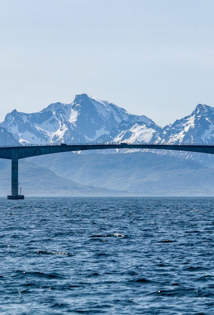
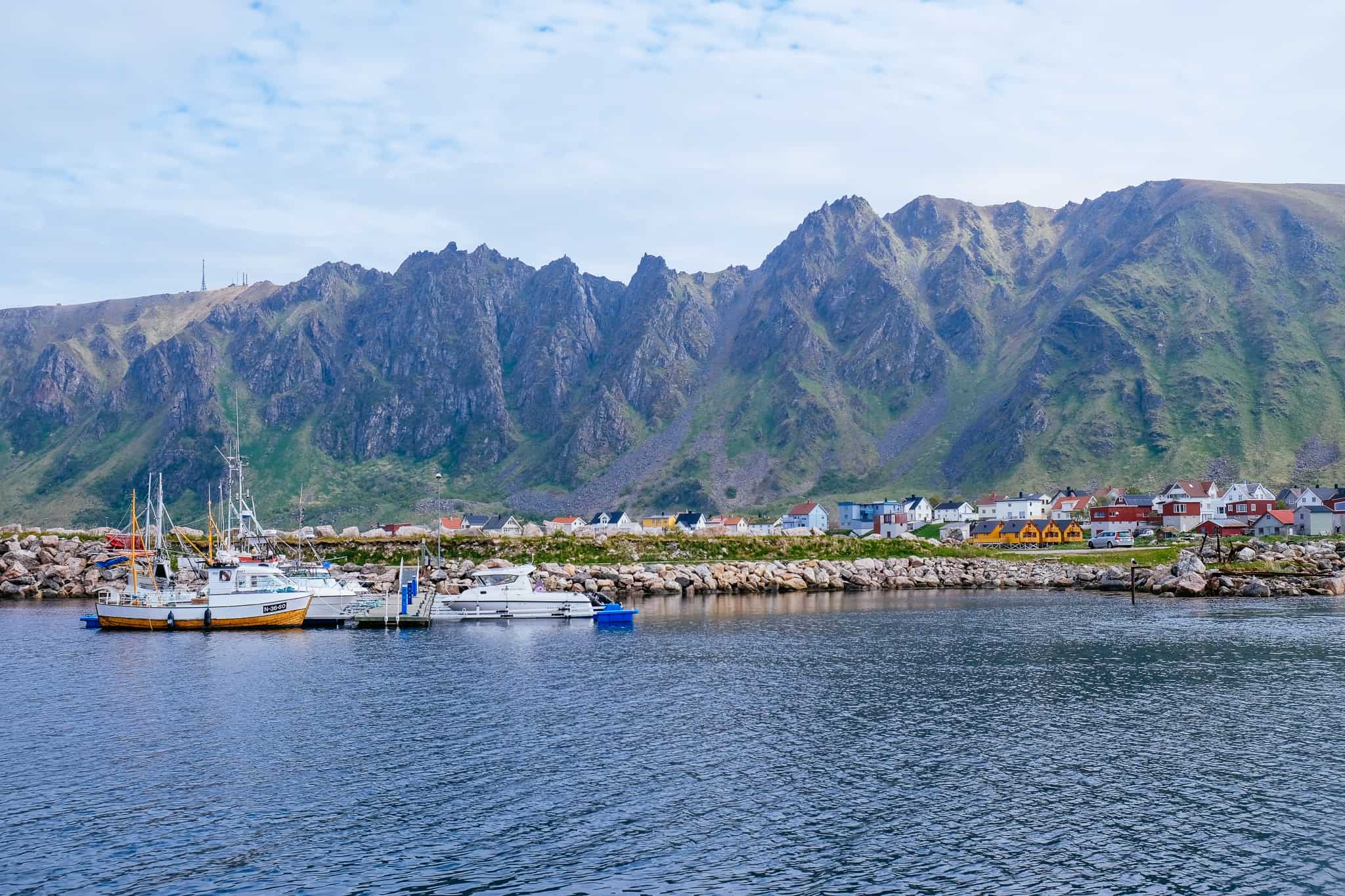
Sortland
If you want to go into Sortland, you’ll take the Sortland Bridge across the town (instead of continuing straight towards Andøya). You come to this junction as you are crossing through the village Strand (you see Sortland across the strait and you see the massive bridge well in advance).
Sortland has a population of around 5,500 and is the largest town and commercial centre in Vesterålen.
As you drive through Sortland, you will notice many of the buildings are painted blue. The local artist Bjørn Elvenes came up with the idea to bring colour into the city and attract tourists too. The idea wasn’t too popular amongst the locals, but it was adopted as a millennium project by the city. However, it didn’t go very well. Elvenes wanted more artistic control in creating Sortland into a 3D-like painting, while the architects wanted to use colour to highlight the features of the buildings.
Elvenes fell out with the council and began to cooperate with the buildings directly, while others chose the councils plans. Because of that, the blue buildings are not as unified as they could be. Not all the buildings are blue, but enough of them are that you’ll wonder what’s going on.
Sortland has a massive shopping mall, Sortland Storsenter, where you’ll be able to buy groceries, alcohol, clothing, cosmetics, etc. If you need anything, I recommend stopping here as Andenes doesn’t have so much. There are also cafes, restaurants, takeaway and petrol stations in Sortland.
Andøy Municipality
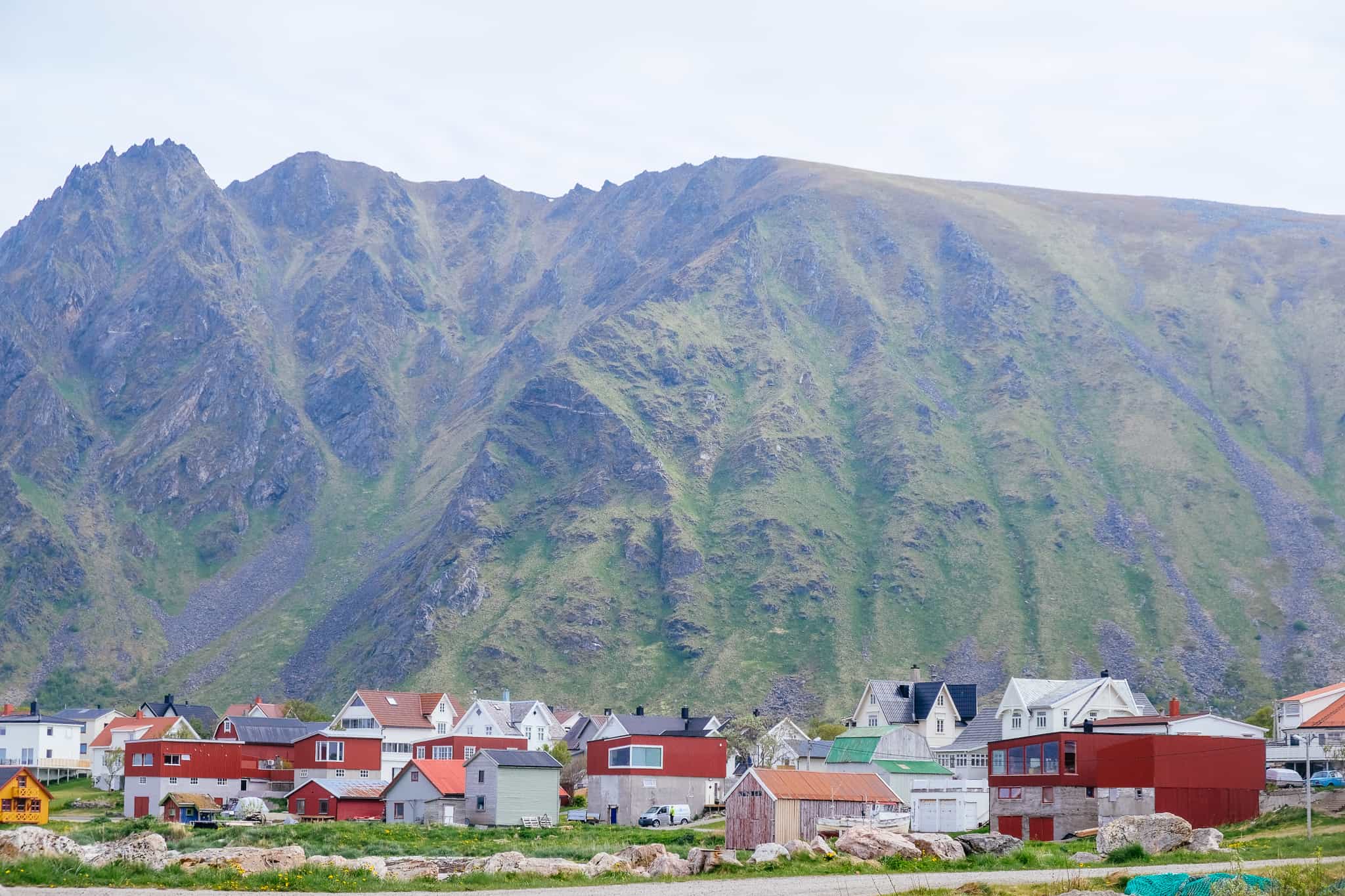
Andøy is the northernmost municipality in Nordland, and forms part of the Vesterålen archipelago. The population of Andøya has decreased by 6.8% over the last ten years, and the main settlement is Andenes. The meaning of Andøy is unknown, though the last element means ‘island’.
The municipality is spread across the island of Andøya and Hinnøya. The mid-section has bogs and marshes known for their Arctic cloudberries, and there are numerous lakes here too. The island is the only place in continental Norway where coal and fossils from dinosaurs are found. The Forfjorddalen nature reserve has some of the oldest pine trees in Scandinavia – some are more than 700 years old. Andøys is also the place where Egga, the edge of the continental shelf, is closest to the land.
The municipality has a strong connection to aviation, with the 333 Squadron of the Air Force being stationed at Andøya Airport. The Andøya Space Centre is involved in international cooperation of the polar atmosphere and the northern lights. Andøya Airport is proposed to be closed by 2025, with air traffic moving to Evenes Airport.
The fishing industry is still important to the municipality, and Andenes is one of the country’s largest fishing harbours and one of Northern Europe’s largest port facilities.
Forfjord
Village
The name of the village is Forfjord, which comes from the name of the fjord the village is built around. The nature reserve here has the oldest living pine trees in Northern Europe, with some of them dating back to 830 AD. It is assumed that the forest was a source of timber and tar for Viking ships, and there are settlements and burial sites that are yet to be excavated.
A famous person in Norwegian exploration came from Forfjord: Hans Jørgen Furfjord. He led the first expedition to stay the winter on Svalbard to hunt silver foxes, walruses, seals and polar bears. Items from his expeditions are on display in museums in Tromsø and Svalbard. Hans also kept diaries describing his adventures, including European monarchs visiting, his being imprisoned by British soldiers for not supplying them for free, barely surviving polar bear encounters, and surviving not freezing to death. He died at the age of 81 at his home in Forfjord. Some of his children emigrated to Canada and the United States, where some of his descendants live today. Some remain in Forfjord.
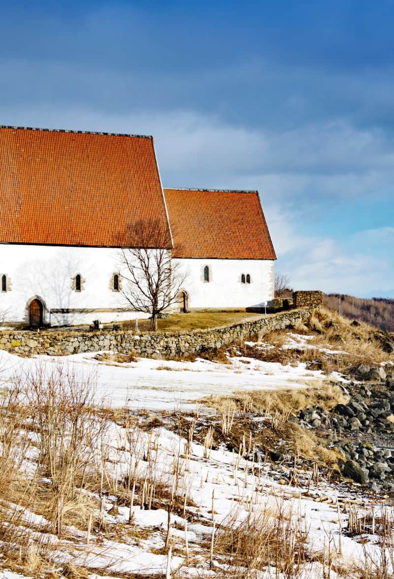
Risøyhamn
Village
Risøyhamn is a small village located on the island Andøya. It has a population of 216 and is serviced by the Hurtigruten twice a day – if you take the Hurtigruten southbound you see the village around 11:30am. There are many older buildings in Risøyhamn, including Gammelg ården from the early 18th century. There is a small open-air museum here with five buildings. Click here to view a website about the buildings (in Norwegian only).
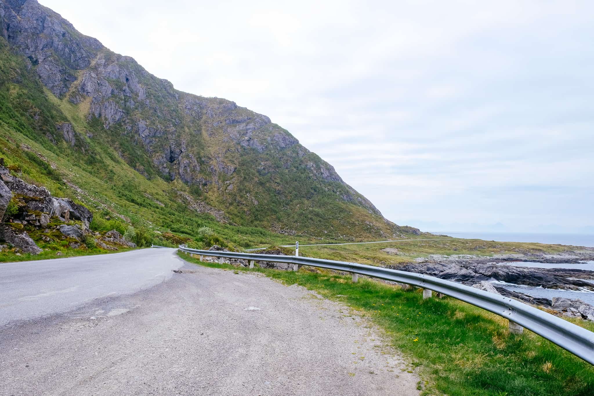
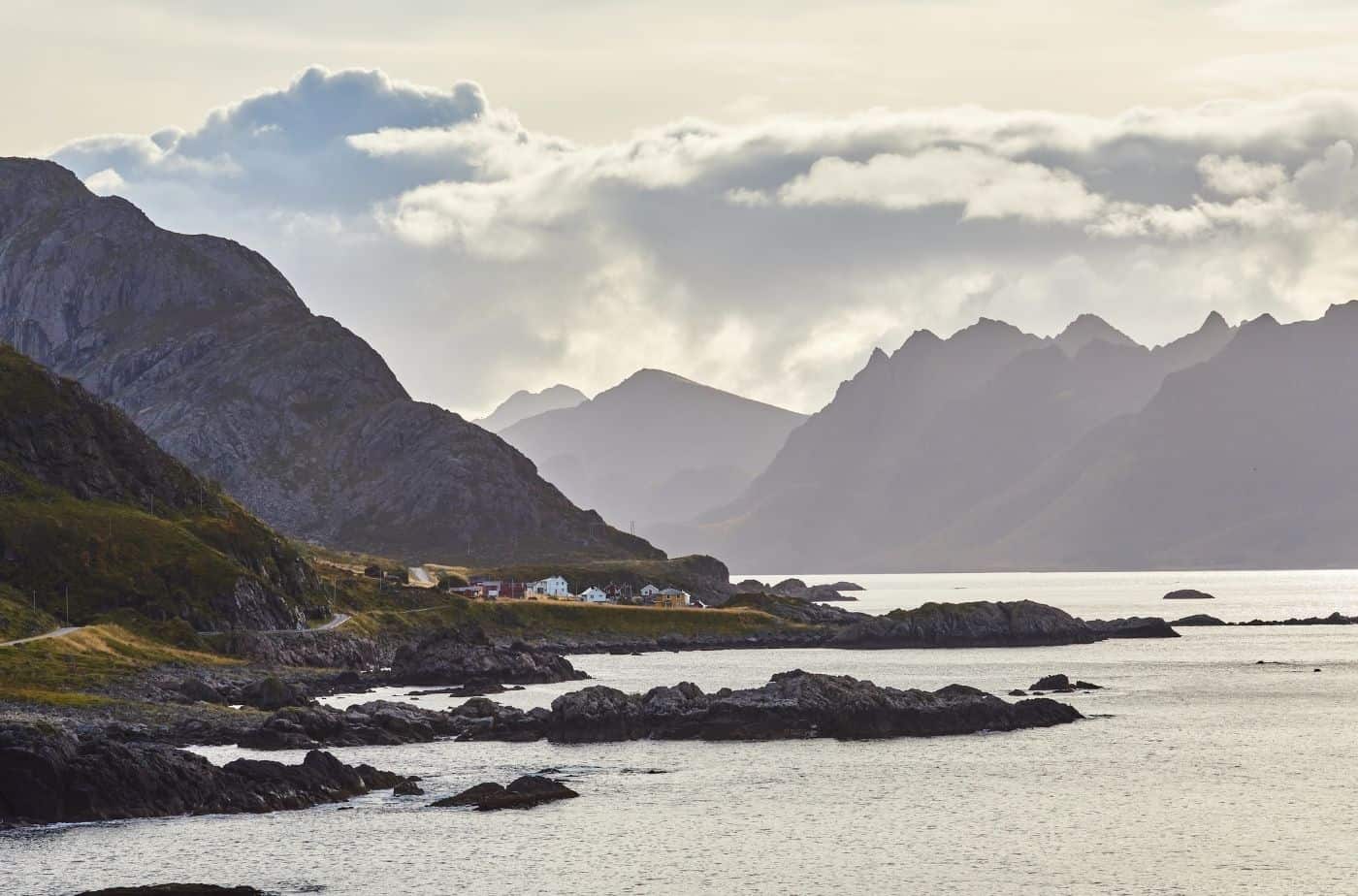
Andøya Tourist Road
Bjørnskinn
Village
Bjørnskinn is a small settlement with the Bjørnskinn church. The church was in use in 1589, but it was not new then. The church was replaced in 1740 and again in 1885.
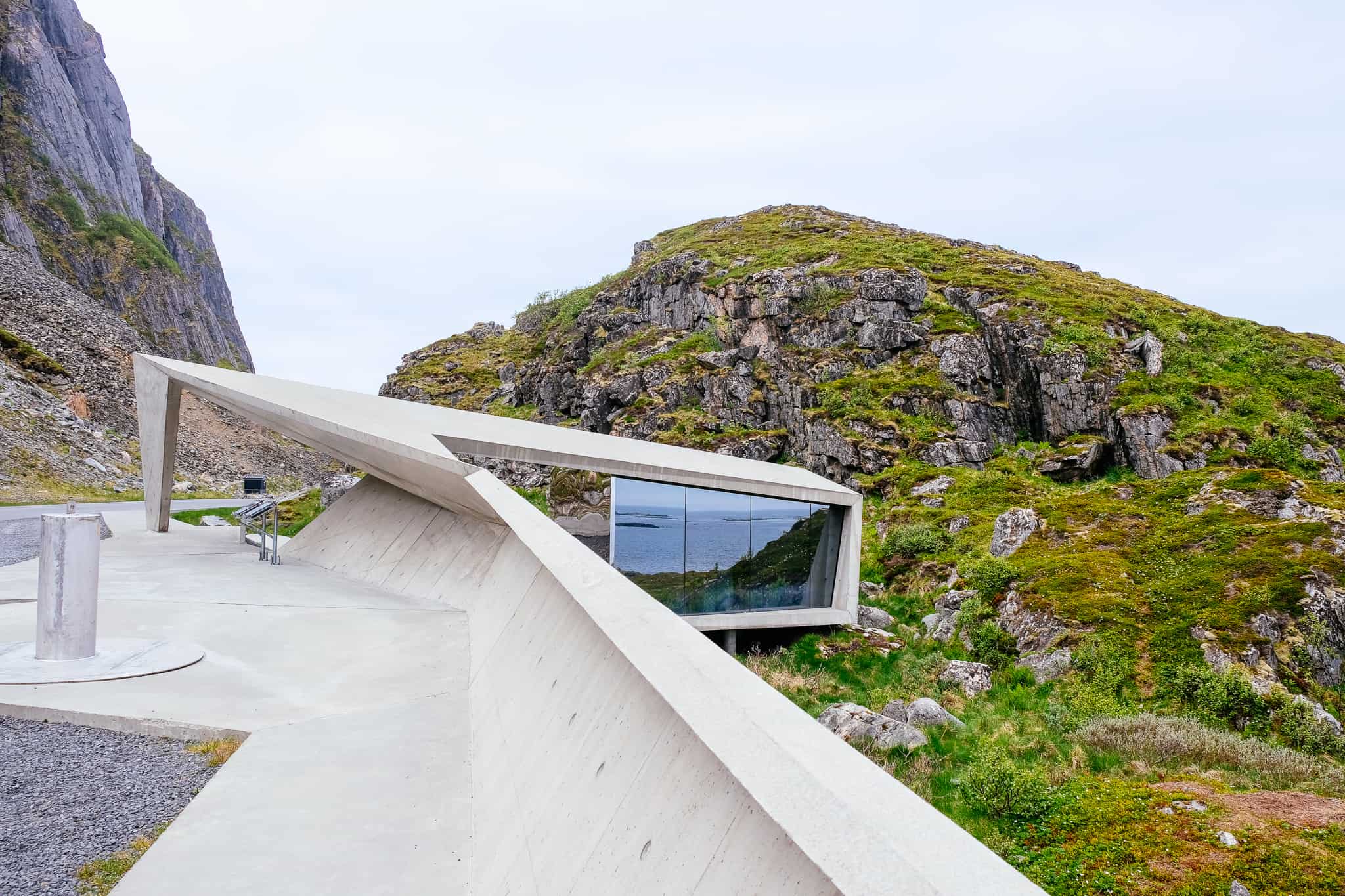
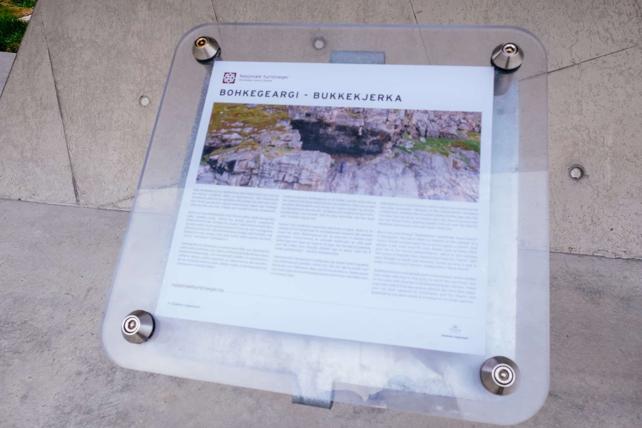
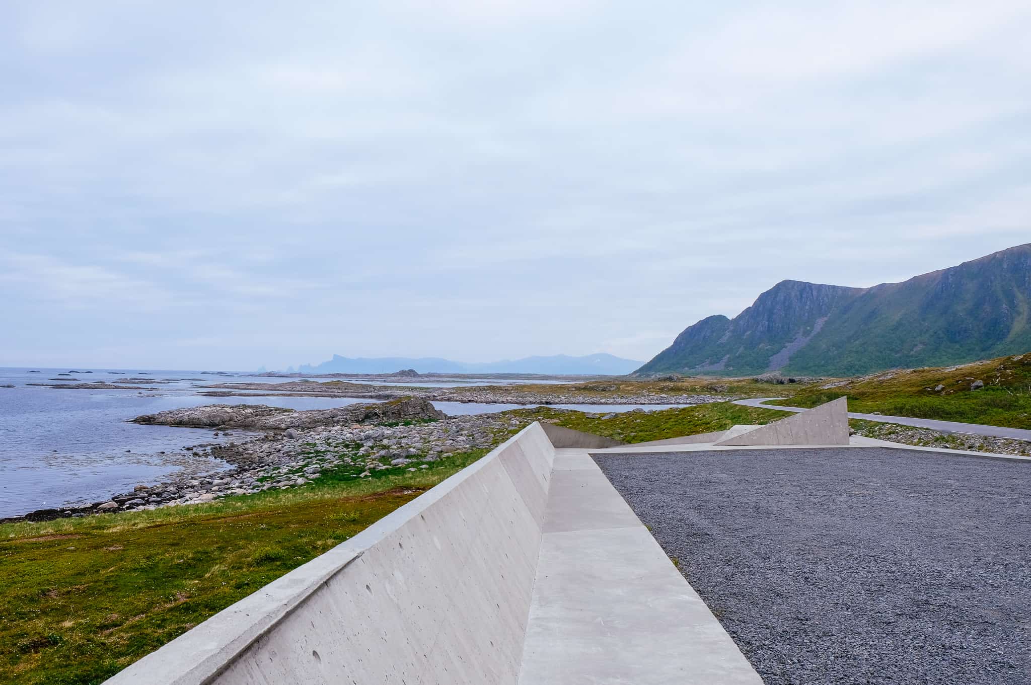
Bukkekjerka
Rest Stop
Bukkekjerka is a rest stop and rock formation that was historically a Sami sacrificial site. The word Bukkekjerka, which is a Sami word, refers to crevice (bohki) and rock (giergie). Several tracks lead to the top of the rock, where there is a small bench.
There used to be a fishing village here called Børvågen that was very active during the herring fisheries period, but the town was reduced to rubble in a huge storm in 1879. Remains of Iron Age buildings, burial mounds and boat landings have been found in the area.
There are toilets here, too. They are open from mid-May until the end of September. The rest area won an architecture design prize in 2018.
Nordmela
Village
Nordmela is a fishing village with about 120 inhabitants. There are written sources that people have lived here since the 16th century, but there are findings from the Stone Age in the area. The area used to be a stronger fishing village, but one of the main companies went bankrupt in 2009. The local school closed down in 2008.
Måtinden
Mountain
Måtinden is 408m (2000ft) high and the walking path is about 4km each way. The hike is not demanding, but some sections are a little steep.
Bleik
Village
Bleik is a small fishing village with a population of around 460. Bleik has one of the longest beaches in Norway, and it’s believed that’s where the village gets its name (bleik = white/pale). It’s believed people have lived here for a very long time, as an old farm mound can be traced back to 600AD and has a depth of 6 metres.
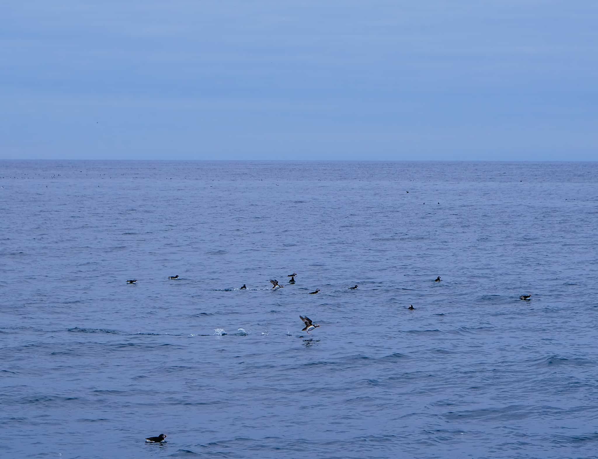
15km offshore from the beach is the Bleik Canyon, a deep canyon with depths of up to 3000m. It’s common to see sperm whales here, which is why Andøya is known for its whale safaris.
There is a triangle shaped island off the coast called Bleiksøya, and that’s where you can see puffins – it is the largest resort for puffins in Norway. These puffins are highly endangered due to the white-tailed eagle and the golden eagle, which are also often spotted here. The puffins are here from mid-April until mid-August, and puffin safaris can be taken from Bleik, which is what we did!
Andøya Space
Space centre
Shortly after Bleik you’ll pass a large complex on your left; this is Andøya Space. It’s a rocket launch site, rocket range and space port. Over 1,200 sounding and sub-orbital rockets of various configurations have been launched from the site. The centre is also used for observing and studying the northern lights. Andøya Space has worked with the likes of ESA, NASA, JAXA and national and international universities.
Andenes
Andenes is a small fishing community located on the top of Andøya. The village is known as being one of the best places to set off on a whale safari, and it has a direct ferry connection to the famous Senja Island, which we will be taking the following day.
You can read all about Andenes on the travel guide section of the website.
Continue the drive
Senja Tourist Road
It is an absolute must to combine the Andøya Tourist Road with the Senja Tourist Road!
Previous Drive
The Lofoten Islands Part 2: Svolvær to Harstad
See the previous day’s drive through the Lofoten Islands.
If you liked this drive, or if you have any travel tips, please leave a comment in the section below!