
Drive it Yourself: The Coastal Road Day 5 – Forøy to Bodø
The Coastal Road that runs from Brønnøysund to Bodø is one of Norway’s 18 national tourist roads. At 433km (269 mi), it is also the longest of all the tourist roads. You can’t do it in one day: some websites will recommend up to a week. In June 2021 Sean (the husband) and I did the coastal road in three days. It definitely felt quick and we couldn’t make all the detours we wanted, but we did it!
I’ve put together a guide breaking down the coastal road. My guide includes the history & everyday life of the region, plus options for your own customisations.
Kystriksveien vs. Helgelandskysten
The road has two names, and this can be pretty confusing. Kystriksveien begins in Steinkjer just outside Trondheim and provides more options for detours to the islands.
On the other hand, Helgelandskysten begins in Holm just south of Brønnøysund, where my guide begins. It features more-so on the one highway, known as the Fv17.
When driving the road, the brown tourist signs will follow the path of the Helgelandskysten national tourist road, which is on the Fv17. However, you can get a free guide online for the Kystriksveien.
- Click here for the Kystriksveien online guide
- Click here for information about the Helgelandskysten
Both roads end in Bodø.
Highlights of today’s section
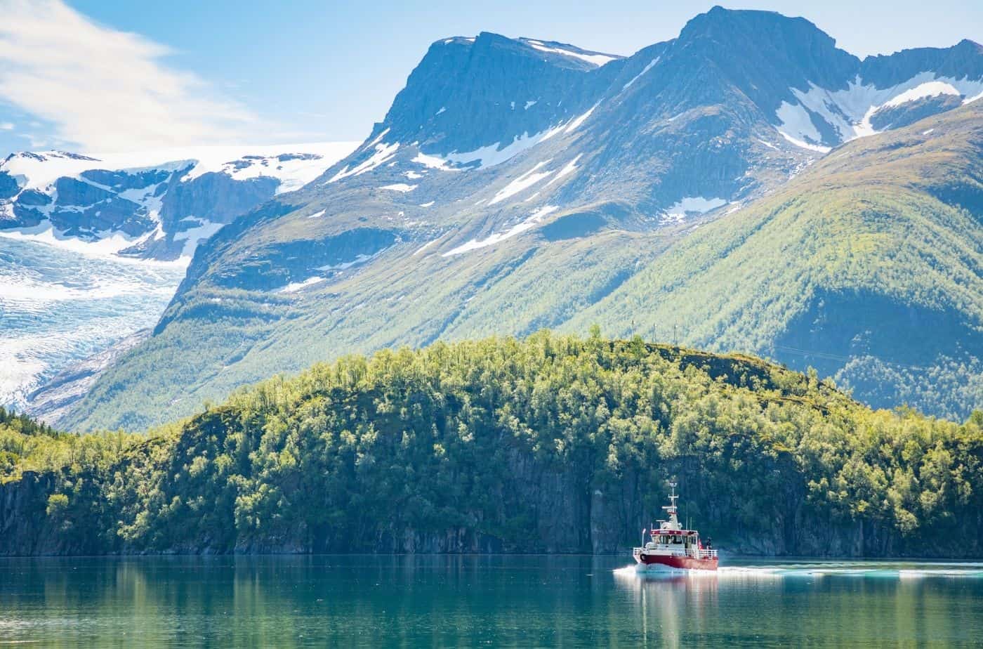
- This stretch of road is probably the most scenic part of the whole drive. We’ll pass steep snowy mountains, a glacier, and beautiful fjords
- There is plenty to see on this road – Svartisen glacier, Gildeskål historic site, and Salstraumen maelstrom.
In this article...
Download this Guide
All of our guides can be downloaded via our online store.
Download this guide to have it as a PDF ready to go for your road-trip!
All downloadable guides come with an interactive Google Map for easier navigation.
Online Guide
- Information about points of interest
- Images of each point of interest
- Historic overview of the neighbourhood
- Directions between points
- Historic photos
- Information about facilities along the way
Downloadable Guide
- Information about points of interest
- Images of each point of interest
- Historic overview of the region & towns
- Directions between points
- Historic photos
- Facilities including supermarkets, toilets, petrol, hotels, cafes, restaurants with addresses.
- Interactive Google Map for easier navigation
Watch on Youtube
All of our roadtrips are available on YouTube to watch. They include information about the area provided in text and voiceover form, plus they show the drive in full (sped up in some spots!) so you can get an idea what the drive is like.
The drive: Forøy to Bodø
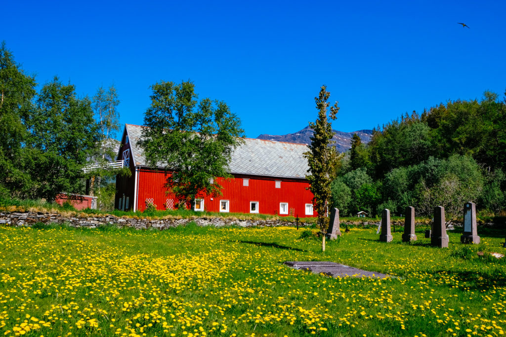
Forøy
Village
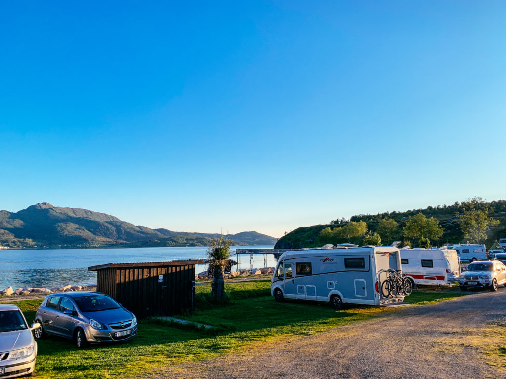
Forøy is a small village with several camping grounds and cabins for rent. It’s on the Fv17, making it a convenient place to begin today’s drive!
You may or may not be staying in this area – we found it to be the easiest place to split the drive! You’re close to Svartisen glacier and some lovely hiking trails. Otherwise, Ørnes is another popular spot to spend the night.
Braset Picnic Area
Scenic Overlook
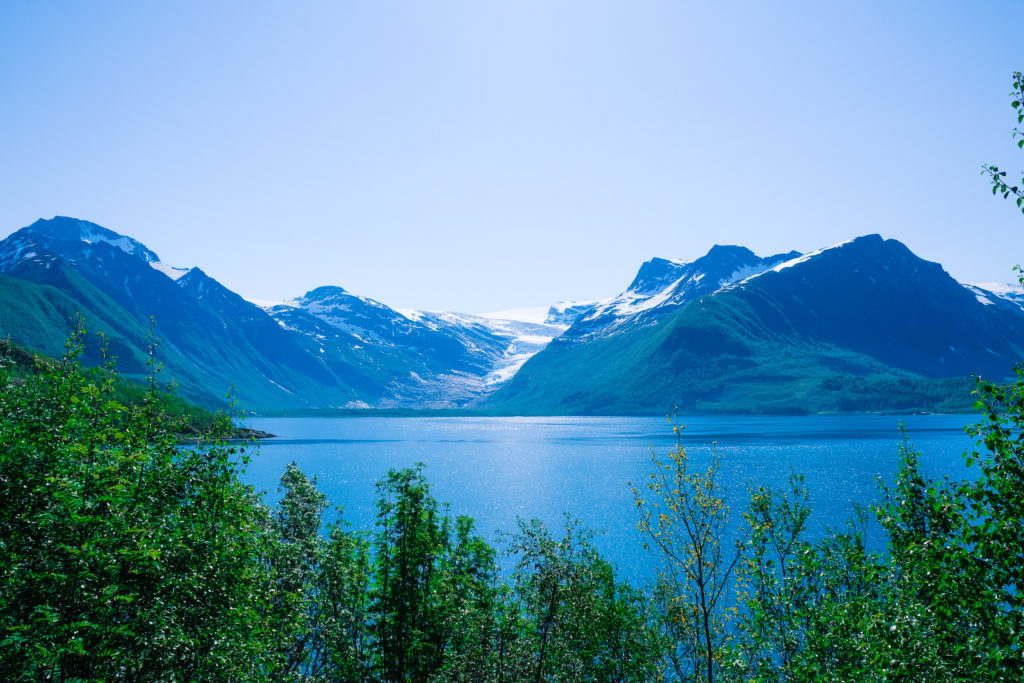
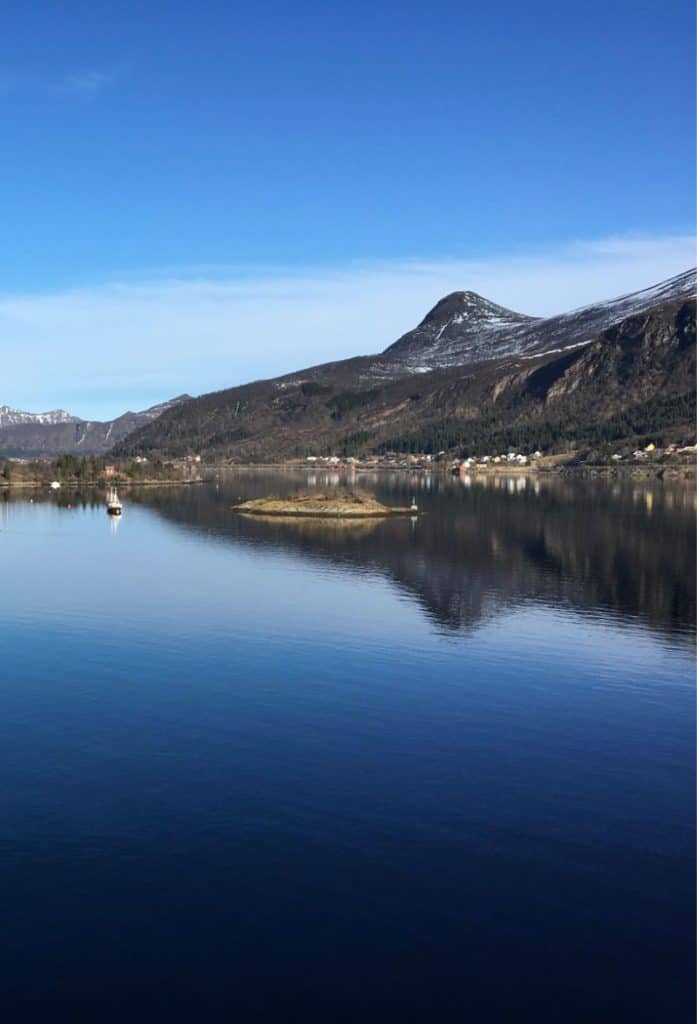
We are at the Braset picnic area, which is one of the best places to get a photo of Svartisen glacier. Svartisen is Norway’s second largest glacier, covering around 370km2. It used to be one continuous glacier, but from the 18th century it has been split in two: we are seeing the western glacier. The part of Svartisen you can see from here is Engabreen, one of the tongues of Svartisen glacier. Engabreen ends at the lowest point of any glacier on the European mainland, at 20m (66ft) above sea level.
In 1992, the Norwegian Water Resources and Energy Directorate established a glacier laboratory, the ‘Svartisen subglacial laboratory’ the only one of its kind in the world. It is in a tunnel under Engabreen, and the researchers can see the underside of glacier. They take samples of the old ice and can get an understanding of how glaciers move. To access the underside of the glacier, researchers use hot water to melt a cave to get into the ice. The ice contracts quickly – in about 24 hours it’ll be cover.
Svartisen is being affected by climate change. From 1930 to 1960 Engabreen retreated by about two kilometres in length and lost about 200m of thickness. It increased again between the 1970s and 1990s. As of 2010, the glacier arm has retreated over 100m. In total, over the last 100 years Svartisen has largely diminished. This has led to the emergence of land and water that has been under ice for thousands of years. Life forms have been established here.
Near here is a ferry that will take you right up to the glacier in the summer months. You’ll see signs shortly after leaving this parking spot. On the other side, it is possible to go regular hiking or glacial hiking with a guide. Bikes can also be rented from the ferry pier.
For information on ferry times, click here: https://www.engenbreenskyss.no/ruteinformasjon/
Svartisen Tunnel (7.4km)
Tunnel
The tunnel is from 1986; before then, there was a ferry to take you to Ørnes. At the time when it opened, it was Norway’s longest tunnel. Today, it is the fourth-longest tunnel in Nordland county. It was also the first in Norway to be made with the use of a tunnel boring machine – the tunnel doesn’t have a centre line as it is rather narrow.
Glomfjord
Town
Glomfjord is an industrial village located at the end of the Glomfjorden. The village is based around the Glomfjord hydroelectric power plant. Norsk Hydro began construction for fertilizer production here in 1912, with power production beginning in 1920. The facilities were bought by the state in 1918 but leased to Hydro in 1947. Today there is a large industrial park here with many industries.
During World War II, the area was of importance to the occupying German forces due to the production of heavy water. The sabotage operation Operation Muskedunder took place here. Twelve commandos from England, Canada and Norway came ashore and carried out a sabotage operation against Glomfjord Kraftverk’s turbine hall. After the operation, the Germans gave up the development of an aluminium plant here. Eight of the saboteurs were arrested during the operation; the other four made it over the mountains to Sweden.
The Glomfjorden is 21km (13 mi) long and varies from 1km to 3km (0.6 – 1.8 mi) wide.
Neverdal
Village
Neverdal is a small village just outside Ørnes. The village has a supermarket, café, kindergarten, and a boating association. Some of the ladies in the village have started a shop for their handicrafts, called Krambua.The Neverdal School closed in 2019 and the pupils then had to travel to school in Ørnes. There is a private school in Neverdal. There are a lot of sport activities in Neverdal. Every May, the village hosts the Neverdal tournament, where around 50 teams register and play over one weekend.
During World War II, there was a prison camp here with around 120 prisoners, mostly Russian and Ukrainian prisoners of war. There are bunker facilities in Neverdal as well as cannon positions. The students at the old Neverdal School wrote a book about Neverdal during World War II.
Ørnes Travel Guide
Ørnes was originally a homestead and farm. In 1794, the then owner Elling Pedersen, received a permit to run an inn on the site. The homestead grew into a trading place and eventually a market town. Some of the buildings from the 1800s remain, including several dwellings, fisherman’s cabins, boathouses, and barns. You can find them in the town centre: the old homestead is a museum called Ørnes handelsted. You can learn more about the museum on their website: https://nordlandsmuseet.no/ornes-handelssted
Today Ørnes is one of the stops for Hurtigruten, and it is often named the most beautiful approach to port on the entire Hurtigruten journey. If travelling north, Ørnes is the port where they begin the Arctic circle ceremony.
Reipa
Village
Reipå is the largest fishing harbour in Meløy municipality. Agriculture also takes place in the village. The local church, Fore Church, is from 1909 and is built in a neo-gothic, long church style. The church is a concert venue during the ‘Summer Day’ festival in Meløy.
The village has a huge focus on being environmentally friendly, and the local school was received a Green Badge for its efforts to better the environment.

Gildeskål Municipality
Gildeskål Municipality is part of the Bodø region and the traditional district of Salten. The name comes from an old farm called Gildeskål, which is a famous historic site. We’ll go there on this drive.
The municipality is primarily an agricultural and fishing municipality, and aquaculture is the largest industry.
Ureddplassen
Photo stop
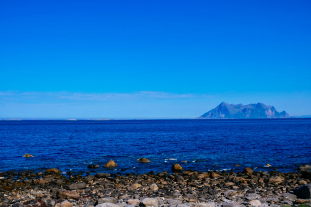
This is a scenic photostop and rest place with a view over the fjord towards the open sea. On a very clear day, you can see the Lofoten Wall on the horizon. Ureddplassen is also a memorial place, and there’s a monument here for those who left their lives when the submarine ‘Uredd’ hit a mine during World War II.
You’ll find some public restrooms and a picnic bench here.
Storvik
Photo stop
We are passing the rest stop Storvika. At Storvika you’ll see a stone vault bridge that connects the rest area with a sandy beach. It’s a nice spot to stop for photos.
https://www.nasjonaleturistveger.no/en/routes/helgelandskysten?attraction=Storvika
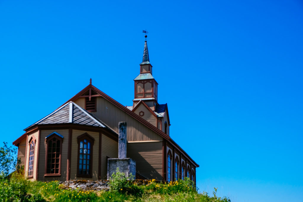
Gildeskål
Town/Detour
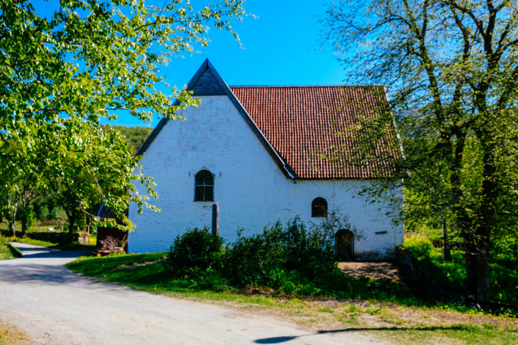
The churchyard consists of a medieval church of stone from the 12th century, the Gildeskål main church from 1881, the old rectory from the 18th century and two old storehouses.
There have been people here for at least 1,000 years. The church was historically in the centre of the village. Based on the farm name and finds of objects and burial mounds from the Viking Age, it has been assumed that the church may have been a gathering place in pre-Christian times. The name Gildeskål can also refer to a meeting house or a guild hall. It is not known how old the church really is.
The property today is maintained by the Nordland Museum. There are exhibitions about the place’s history, religious life, church customs and folk life. The white and red wooden buildings are the Gildeskål vicarage. These buildings are from around 1750.
The Gildeskål Main Church is built in a neo-Gothic style from 1881. The old Gildeskål church is a medieval building in stone. It’s believed to be from the 12th century, though it is first mentioned in written sources from 1589.
The cultural landscape around the churchyard is untouched by recent development. Burial mounds, old stone mounds and the old church path are examples of what has been preserved in the area. From the church hill there is an excellent view of the islands, shipping lanes, and flora in the area.
Bodø Municipality
Bodø Municipality is the county capital for Nordland. Most of the population for the municipality lives around Bodø city as well as Saltstraumen, two places we’ll visit on this drive. The coat-of-arms reflects the midnight sun and is based on an old coat-of-arms from 1889.
Saltstraumen
Tidal Current
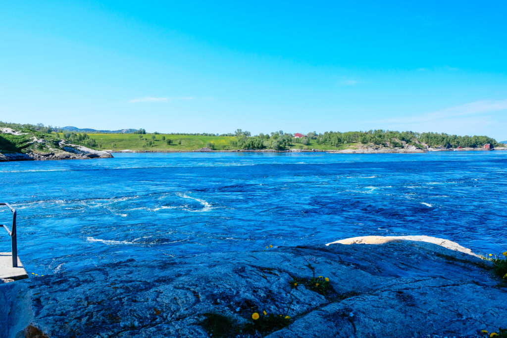
Salstraumen is one of the strongest tidal currents in the world.
I cover Saltstraumen in a separate article.
Godøystraumen
Tidal Current
Godøystraumen is a lesser known maelstrom near Saltstraumen. There is a carpark to the left of the road if you want to stop and take photos. A lot of people come here to go fishing.
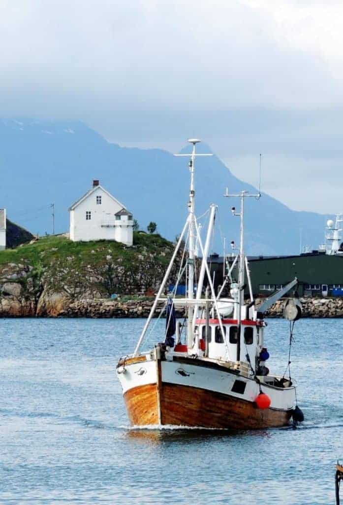
Bodø
We have arrived at our final destination, Bodø. You can find a comprehensive overview of Bodø on my dedicated travel guide page.
Continue the drive

Lofoten Islands: Å to Svolvær
After finishing the coastal road, why not take the ferry from Bodø to Moskenes and do the Lofoten Tourist Road?
Previous Route
Norway's Coastal Road Part 4: Sandnessjøen to Forøy
The previous day, we drove from Sandnessjøen to Forøy on Norway’s Coastal Road.
If you liked this drive, or if you have any travel tips, please leave a comment in the section below!