Drive it Yourself:
Geiranger to Sandane via Stryn and Loen
In June 2023 Sean and I set off for a weekend in the fjords. The goal was to film as much as possible while the weather was good. Originally I had wanted to do the Gamle Strynefjellvegen Tourist Road, but it was still closed because of snow. Oh well – it’s just an excuse to go back!
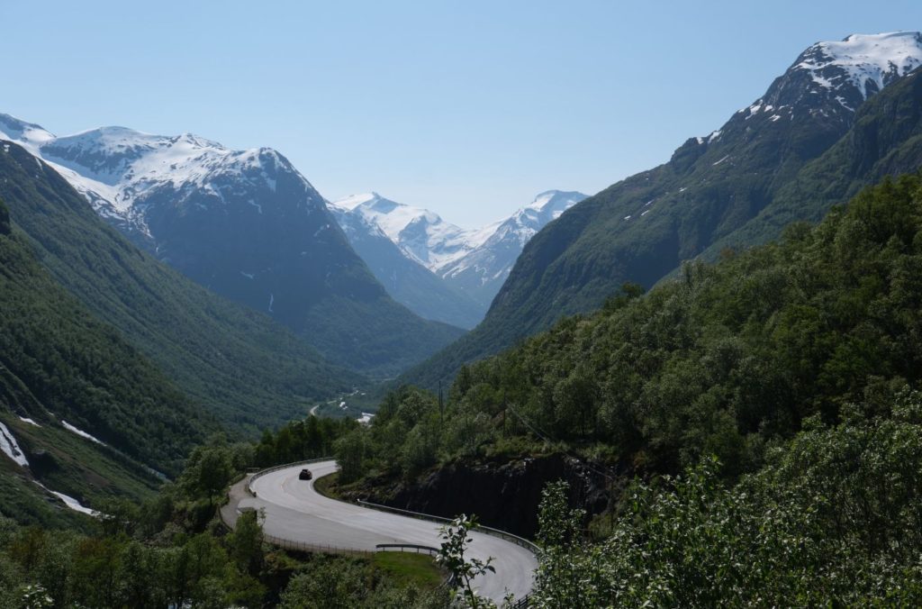
This road was beautiful. I hadn’t been to this part of Western Norway for years, and was reminded of just how special it was. A highlight was the stretch from Loen to Utvik; easily the most beautiful fjord I’ve driven along.
We chose Sandane to spend the night because of the historic hotel; it was a town I had never heard of but I had heard of the hotel.
In this article...
Download this Guide
All of our guides can be downloaded via our online store.
We offer downloadable versions of our self-guided drives on our online store.
Facilities including supermarkets, toilets, petrol, hotels, cafes, restaurants with addresses.
Watch on Youtube
All of our roadtrips are available on YouTube to watch. They include information about the area provided in text and voiceover form, plus they show the drive in full (sped up in some spots!) so you can get an idea what the drive is like.
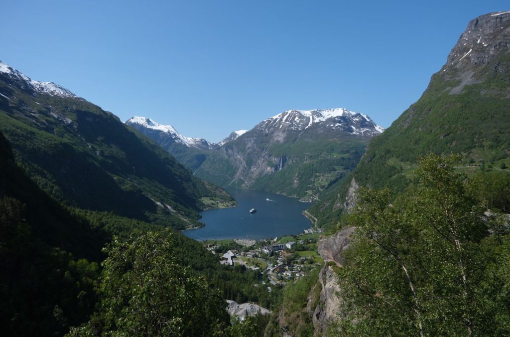
This drive begins in Geiranger, a popular village due to its incredible fjord. This is also the end of the Trollstigen Tourist Road, a very popular road in Western Norway. You can read all about Geiranger via our travel guide page.
As you leave Geiranger there is a lovely viewpoint over the village and the fjord called Flydalsjuvet. It’s not to be missed!
Knuten
Historic Site
Knuten (the Knot) is a section of the old road. It’s still the same as it was when it opened in 1882. It is a loop road used to get up/down the steep mountain. The road curves 270 degrees, and was designed to reduce the road graient for passing horses and people.
It’s important to note that it’s very hard to see Knuten if you’re going down into Geiranger. It’s best viewed if going up from Geiranger.
Cars are not allowed to go up, but people and bikes can.
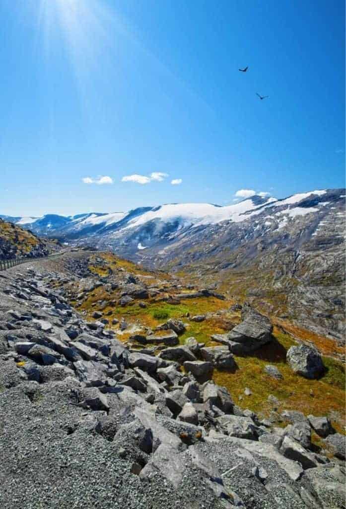
Dalsnibba Viewpoint
We are now at the famous Dalsnibba Viewpoint. It’s a lengthy detour, but if you can see the mountain peaks, it’s well worth doing.
Dalsnibba is a viewpoint located at an altitude of 1,746m. From the top, you can see Geiranger, the Geirangerfjord, and the road we’ve taken to get here. The view is unlike anything else. The road is only 5km (3 mi) off the main road, but it takes a long time as the road is narrow, has many hairpin bends, and often has a lot of traffic.
The road has a toll as it is a private road. You can see updated prices via the link in the description. At the top you’ll find a café, souvenir shop, and incredible views. It is often very, very cold and very windy. Bring extra layers! Snow is common all year round.
Skjåk is a municipality in Innlandet. It’s part of the traditional region of Gudbrandsdalen. The name comes from an old farm.
After the last Ice Age, it’s believed reindeer followed the ice as it retreated north to Scandinavia. Skjåk is in the middle of the central migration route for the Scandinavian reindeer. There are ancient large hunting facilities and traces of settlements that show hunting and trapping was important here from the Ice Age until today. There are farm names that date back to the Iron Age. There is a hunting facility for moose from 220-570AD.
The region is mentioned in the Viking Age and has a rich cultural heritage. St. Olav supposedly travelled through the valley when he was Christianising the villages. He christianised Lom, but Skjåk refused. As a result, the village was burned. St. Olav said: “It’s a pity to burn such a beautiful village”.
There was a high population growth during the Middle Ages, and there were around 120 farms here just before the Black Death in 1349. After the plague, the population was more than halved. In the second half of the 17th century, the population recovered to the pre-plague numbers. Most of the farms in Skjåk were owned by the farmers. From 1730, the forest began to be exploited for the timber industry.
You will then turn right, following signs towards Stryn. We did this trip in the low season so were not able to do the Gamle Strynefjellvegen Tourist Road, but if you are doing this drive from mid-June to early September, the road will be open.
Vestlandet County
Stryn Municipality
Stryn municipality is located around the innermost part of the Nordfjorden. Farming, forestry, fruit growing, animal breeding for fur and manufacturing is important to the region. Stryn is also known for its all-year glacier skiing at Stryn Sommerski.
Strynefjellet
Mountains
Strynefjellet is a mountain range that separates Vestland and Innlandet counties. The mountain area is partly within the Breheimen National Park and the mountains are the main watershed between West and East Norway.
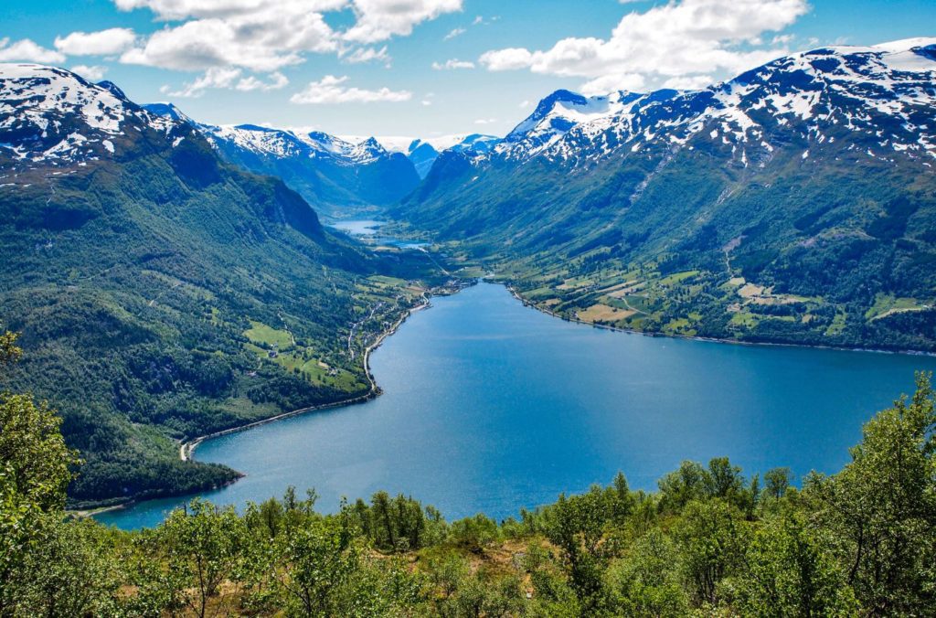
Oppstrynsvatn
Lake
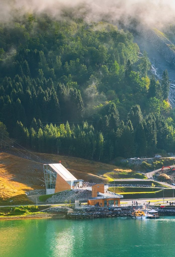
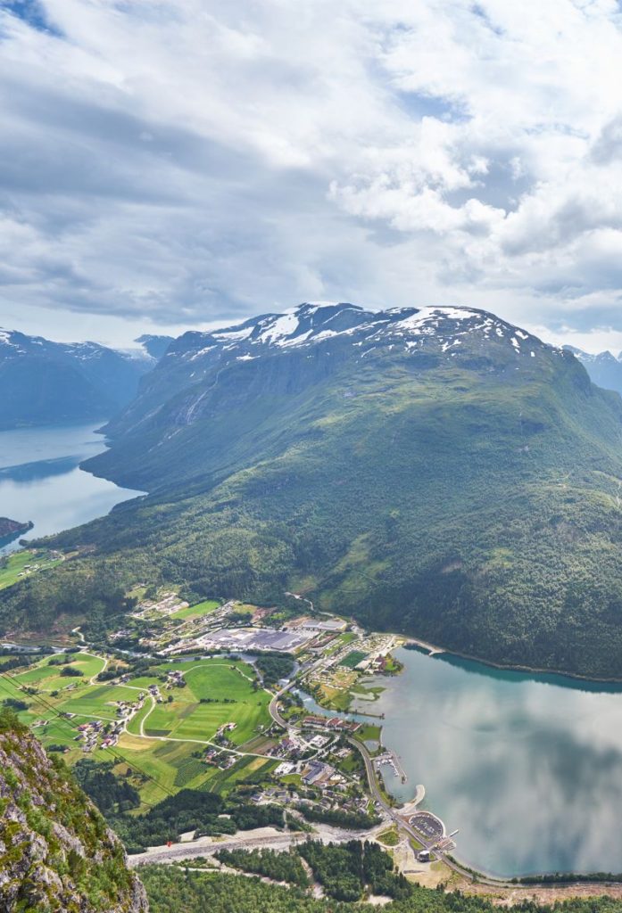
The Oppstrynsvatnet lake is the main outflow of the river Stryneelva, which flows west into the Nordfjorden. The village we are driving through is located by the lake. This is where you also find the Jostedalsbreen National Park Centre.
Stryn
The village of Stryn has a population of around 2,600 people. One of the fastest growing industries here is tourism because of the proximity to the national parks and popular areas like Geiranger. Stryn is the administrative centre for the region.
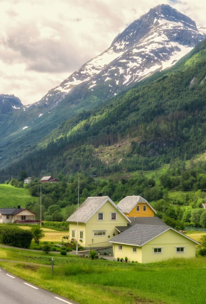
Loen is a small village located on the inner part of the Nordfjord. Loen is home to the historic Hotel Alexandra, which opened in 1884. It is named after Princess Alexandra of Denmark. The hotel has undergone a lot of development since it opened, and it is currently in its fifth generation of the same family running it. Loen Church is from 1838 and is located higher up in the valley, but historical records indicate that a church has been here since the early 14th century.
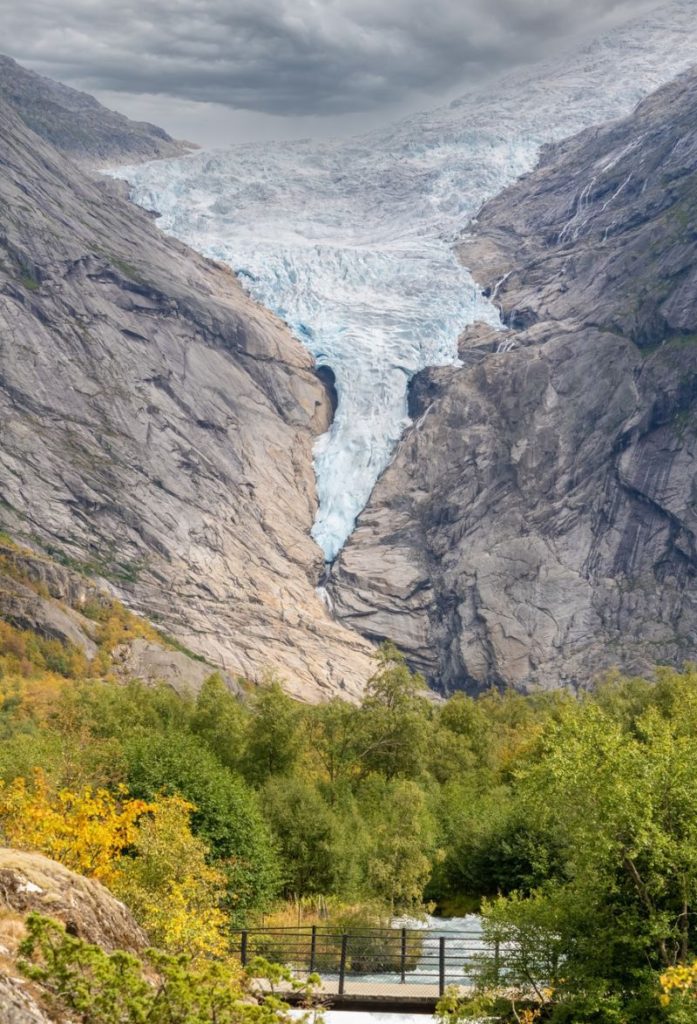
Olden is a small village with around 500 people. This is where the larger cruise ships dock that are heading to Loen or the Jostedalsbreen National Park. In 2019, 102 cruise ships came here. The Briksdalsbreen glacier is a popular hiking destination and is located about 25km (16 mi) from Olden.
Innvik is a small village with around 430 people living there. At its peak, however, there were over 3,000 people living here.
Utvik
Village
Utvik is a small village with around 332 people living there. The village is located on the southern side of the Nordfjord. Utvik has been an important communications hub for hundreds of years. The Royal Trondheim Postal Route was established through here in 1795, and at Utvik the postal workers would take a boat to the northern side of the fjord.
Utvik developed as an important place for trade. There was an inn, pier, post office, bakers, dyers, and blacksmiths living here. Trade has existed here since the mid-17th century. Additionally, there has been a church in Utvik since the 14th century, though the church the village has today is from 1840. The altarpiece and pulpit are from 1617, while the church bells are from the Middle Ages.
Today Utvik has a large production of fruit and berries.
Gloppen Municipality
Gloppen is a municipality located just south of the Nordfjord with around 5,800 people living there. Part of the municipality is located around the Gloppefjorden. Gloppen is one of the largest agricultural municipalities in Western Norway and accounts for 10% of Norway’s milk production.
The word ‘Gloppen’ comes from the old Norse Gloppi and means “narrow opening”. The area was an important place in the Viking Age, and a number of burial mounds have been found here. Some of the oldest burial mounds go back to the 4th century. Karnilshaugen is West Norway’s largest mound – 7 metres high and a diameter of 50 metres. It was probably built as an astronomical mark as the mound is the last point to receive sun during the winter solstice.
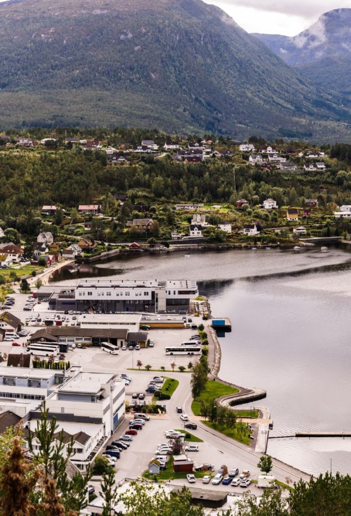
Sandane
Sandane is a small town with a population of 2,500. The centre is fairly modern, but people have lived here for hundreds of years. The village has a high school, football team, gold course and small airport. The main square of the town is Heradsplassen, which has a monument of a copy of a wooden object that was found dating to the 4th century. The original is in the Historical Museum in Bergen. This is the only wood carving of its type to be found in Norway; similar objects have been found in Iran and Afghanistan.
Sandane is home to the Gloppen Hotel, one of Norway’s historic hotels. The hotel was established in 1866 and is today owned by the hotel chain Classic Norway. It was extended in 1921 and now has a Swiss-style appearance. The highlight of the hotel is the kitchen. Gloppen Mat is the hotels own production kitchen in the back garden, and the restaurant only serves locally sourced food.