Drive it Yourself:
Dombås to Ålesund via Åndalsnes on the E136
Here’s my guide to the drive from Dombås to Ålesund on the E136. In June 2023 Sean and I decided to take advantage of a sunny weekend and head out to the fjords for a road-trip. I have only ever driving along Trollveggen once, and I vaguely remembered it. However, I had heard over and over again how beautiful it was and realised this was the perfect chance to see the mountains. The drive is short but so beautiful and a great thing to do before climbing up Trollstigen.
In this article...
Download this Guide
All of our guides can be downloaded via our online store.
We offer downloadable versions of our self-guided drives on our online store.
Facilities including supermarkets, toilets, petrol, hotels, cafes, restaurants with addresses.
Watch on Youtube
All of our roadtrips are available on YouTube to watch. They include information about the area provided in text and voiceover form, plus they show the drive in full (sped up in some spots!) so you can get an idea what the drive is like.
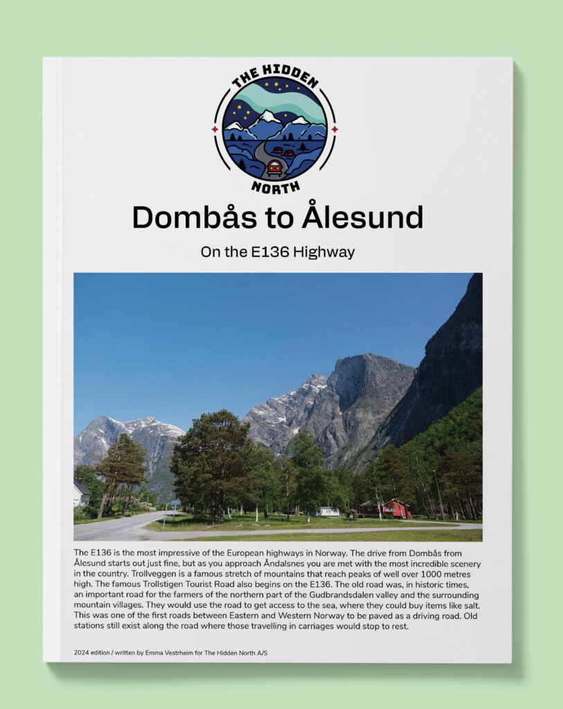
The E136 highway goes between Ålesund and Dombås, connecting the coastal city with the E6 highway that runs through Norway. The E136 is the main road running between Eastern Norway and the Ålesund/Molde region.
The old road was, in historic times, an important road for the farmers of the northern part of the Gudbrandsdalen valley and the surrounding mountain villages. They would use the road to get access to the sea, where they could buy items like salt.
This was one of the first roads between Eastern and Western Norway to be paved as a driving road. Old stations still exist along the road where those travelling in carriages would stop to rest.
The road runs parallel to the Rauma Railway, a scenic train. Construction for the railway began in 1912 and it was open in 1924. The railway is today mostly a scenic train.
Lesja Municipality
Lesja is a mountainous municipality located in the traditional Gudbrandsdalen region. Most of the municipality is above 900m above sea level. The main industry here is agriculture, employing around 30% of the population.
Rauma Valley
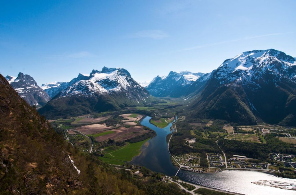
Valley
The Romsdalen valley is one of the most spectacular valleys in Norway. Large parts of the valley are narrow and run between high alpine mountains. The valley floor rises from the Romsdalsfjorden and the Rauma river runs through the valley.
Lesjaverk
Valley
Lesjaverk is a small village located at 633m above sea level. In 1659, an ironworks was established here. The mines had a very uneven supply of ore and business here was never stable. However, the iron ore was of very good quality due to the amount of chromium in the ore. The ironworks closed in 1812 as the operation was of never any great importance. Remnants of the mine exist around the village.
Bjorli
Village
Bjorli is a small village that is popular for skiing, with the Bjorli Ski Centre being located here. The area has stable snow conditions and a long ski season. Bjorli is also a good base for the Dovrefjell-Sunndalsfjella National Park. One scene in ‘Harry Potter and the Half-Blood Prince’ was filmed in this area because of its unique mountainous terrain.
Møre og Romsdal County
Rauma Municipality
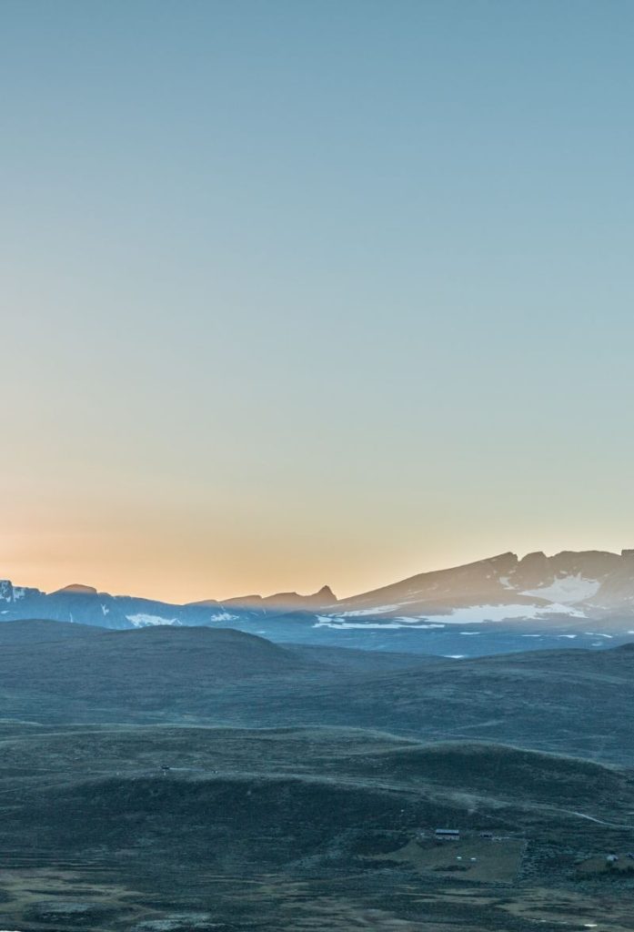
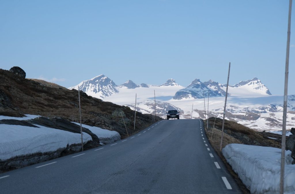
Rauma municipality is known for its incredible diversity of nature. In the outer parts, the mountains are low and the slopes are gentler. In the inner parts, the slopes are steeper and many mountains have vertical walls. The highest mountain is Pyttegga, at 1999m above sea level.
Agriculture has traditionally been the most important industry in Rauma, but the number of farms has been greatly reduced since the last half of the 20th century. In the mid-19th century the area became industrialised with textiles factories, and Rauma wool was established in 1927. Today tourism is an important industry.
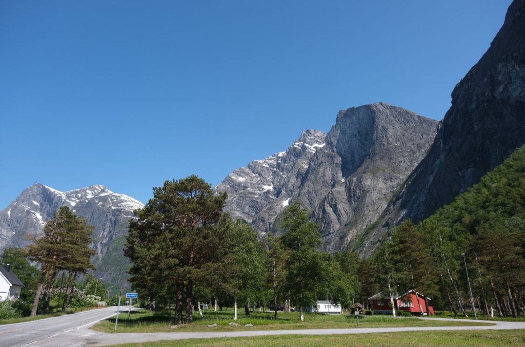
Trollveggen
Mountain Wall
You are now beginning your drive along Trollveggen, the ‘Troll Wall’ in English. It is Europe’s highest vertical cliff and is approximately 1,700 metres high, with around a 1,000 metre vertical drop. The area has been popular with climbers since the 1960s.
Kors Kirke
Church
Soon we will pass Kors Kirke on the right. This church is from 1797 but was moved from its original location to here in 1902. There has been a church in the valley since the 15th century.
Trollveggen Visitor Centre
Trollveggen Visitor Centre is located close to the start of the Trollstigen Tourist Road. Here you’ll find restrooms, a cafeteria and a souvenir shop. There is also some information about Trollveggen and the surrounding area.
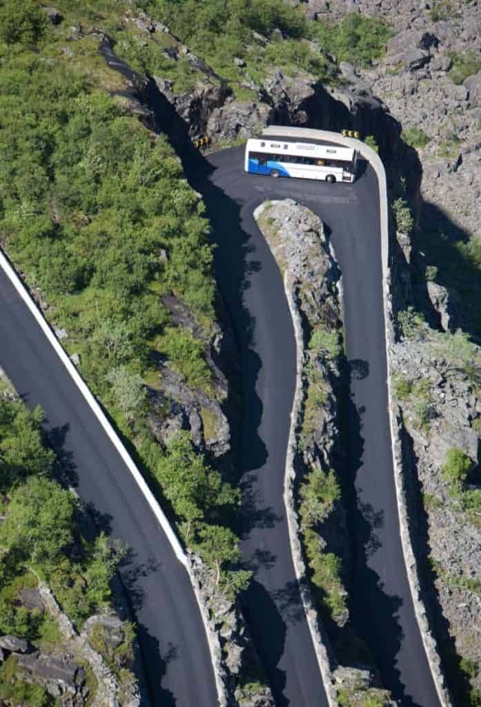
Trollstigen Tourist Road
Shortly before arriving at Åndalsnes, you’ll pass the turn-off to the Trollstigen Tourist Road, one of Norway’s 18 national tourist roads. It is a lengthy detour, but is well worth doing!
Åndalsnes is a scenic fjord-side town with all the major facilities you need during a road-trip. It is also am excellent place to stay if you want to break up the drive.
Veblungsnes is a small village just across the river from Åndalsnes. It is a historic farm that has existed for hundreds of years. In the last 200 years it has developed into a village. The Rauma wool company is located here. The local church, Grytten Church, is from 1829.
After passing through the village, you’ll go through the 6.5km-long Innfjord Tunnel.
Innfjorden
Village
Innfjorden is a small village located within Rauma municipality. The village is primarily agricultural. The Innfjorden fjord that the village sits along is a branch of the Romsdalsfjorden.
Vestnes Municipality
Vestnes is a mountainous municipality that is mentioned in the Norse sagas, when a chieftain lived here. The municipality is divided into three by two fjords. The main industry here is agriculture, with some maritime industry and boat building.
Vikebukt
Village
Vikebukt is a small village with around 650 people living here. The larger town of Molde is located just across the fjord, but a ferry is needed to get across there. The village has been inhabited since the Viking Age, and today a number of burial mounds can be found throughout the area.
After driving through Vikebukt you cross the Tresfjordbrua Bridge.
Vestnes
Village
Vestnes village is located on the shore of the Tresfjorden, which is a branch of the Romsdalsfjord. It is the administrative centre for the municipality. This is also where the E39 merges with the E136, which you have been travelling on so far. From Vestnes it is possible to take a ferry across to Molde.
Ålesund Municipality
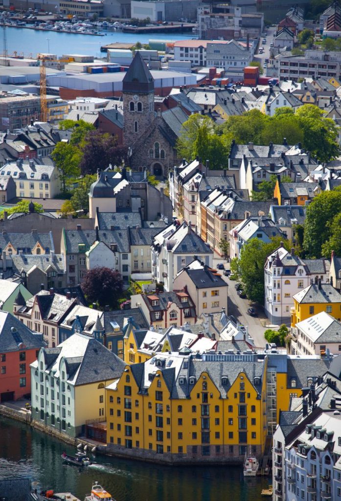
Ålesund
Ålesund is one of the larger towns along the west Norwegian coast. It is most famous for its Art Nouveau architecture and modern fishing industry. Read our guide to Ålesund below.