Hey! My name is Emma. I'm from Australia but have lived in Bergen, Norway, for the last eight years. I work as a local guide and tour leader for all over Northern Europe. The Hidden North is an online travel guide I have made to help you plan your own visit here.
The history of Hammerfest is incredibly interesting, and I always get excited explaining it to groups. Who would’ve thought that such a small town could have such a varied and complex history? Anyway, here’s the history of Hammerfest.
In this article...
Norway's Coastal Ferry
Hammerfest is a port of call of Norway’s coastal ferry. Find my guide for the coastal ferry by clicking the link below.
Many gravesites dating back to the Stone Age can be found in the area around Hammerfest. In Leirbukt a boulder was found that had a 2,500-year-old rock carving representing a boat and three moose. Near the highway is a collection of stones called Stalloen that was a Sami sacrificial site in pre-Christian times. So people have lived here for hundreds of years, but Hammerfest didn’t gain prominence until it became an official market town.
Hammerfest Gets Market Status
From ancient times Hammerfest was known as a central fishing village, and it was also central to hunting in the Arctic. The first church was built in 1684, and at around that time, the population was 60. Hammerfest lost its trading right by King Frederick V of Denmark-Norway, who wanted all trade to come out of Bergen. Because of this, Russia began to ship grain to Hammerfest as part of the Pomor Trade.
In 1789 Hammerfest was given market town rights by royal decree of Christian VII of Denmark-Norway, who was trying to establish new market towns in the Arctic after the collapse of Bergen’s trading monopoly. This makes Hammerfest, together with Vardø, the oldest town in Northern Norway.
The reason Hammerfest was granted status is due to its strategic position – Hammerfest has long been an important way station for shipping, fishing and Arctic hunting.
Throughout the 19th century, Hammerfest grew as a major trading port thanks to the Russian trade. The ladies wore the finest Paris fashions, while the men learned how to hunt in the Arctic from the Russians. Polar sea explorations began in the late 18th century, and at the beginning of the 20th century Hammerfest was regarded as the ‘Polar Capital of Norway’. Several major powers set up consulates in Hammerfest, including Russia, England, Holland, France, Hamburg and the United States.
Napoleonic Wars
Hammerfest was not spared during the Napoleonic Wars. When Denmark-Norway chose the side of France, the UK saw Hammerfest as a target due to its status as one of the main centres of commerce and transportation in the Arctic. The town was attacked on 22 July 1809 – Hammerfest’s two-cannon batteries and the British warships with a total of 32 cannons made for a surprisingly intense battle that only ended when Hammerfest ran out of gunpowder. Most of the town was able to flee, but the British raided the area over eight days, including taking the church donation box and some of the church’s silver.
The Great Fire of 1890
Hammerfest was struck by a fire in 1890 which started at the bakery and wiped out almost half of the houses in town. After the fire, Hammerfest received donations and humanitarian assistance from across the world, with the biggest single donor being Kaiser Wilhelm II of Germany. The Kaiser had personally visited the town several times on his yacht and had great affection for the small northern settlement.
Electric Street Lights
In 1891, Hammerfest became the first urban settlement in Northern Europe to get electrical street lights. The invention was brought by two of the town’s merchants who had seen it demonstrated at a fair in Paris.
Hammerfest in 1890Hammerfest street in 1920Hammerfest in 1920Hammerfest 1938
World War II
After their victory in the Norwegian Campaign, the Germans soon fortified Hammerfest and used it as a major base. The importance of Hammerfest to the Germans increased dramatically after they invaded the Soviet Union in 1941. The occupiers installed three coastal batteries in and around Hammerfest, and the main U-boat base for Finnmark was located here. It was central to the vessels attacking the Allied supply convoys to Russia.
Hammerfest was an important base during the Second World War. The Germans occupied the town and used it as a major base after invading the Soviet Union in 1941. The main German U-boat base in the county of Finnmark was in Hammerfest, and the garrison was protected by 4,000 mines and numerous anti-aircraft guns. The garrison in Hammerfest was also protected by around 4,000 mines and numerous anti-aircraft guns.
The first time Hammerfest was bombed by the Soviets was on 14 February 1944, doing little damage to the town. The Soviets bombed a second time on 29 August 1944, and this did significantly more damage to the buildings and infrastructure, and two local transport ships were sunk.
German soldiers in Hammerfest
The population was forcibly evacuated by the Germans in the autumn of 1944 after the Soviet offensive was pushing into Norway. Hammerfest was then looted and burned to the ground by the Germans, and by 10 February 1945 the town was completely destroyed.
The only building remaining was the chapel. Mines and munitions left over from WWII are still being found and disposed of in the Hammerfest area.
Hammerfest saw massive growth in the post-war years, partly from people moving to the city after abandoning their smaller villages. The fishing industry also became important in Hammerfest.
Chapel in 1946
Liked reading about the history of Hammerfest? Click here to read about what Hammerfest is like today.
Hammerfest in 1946Hurtigruten M/S Midnatsol in HammerfestHammerfest in 1960
Norway's Coastal Ferry
Hammerfest is a port of call of Norway’s coastal ferry. Find my guide for the coastal ferry by clicking the link below.
Tromsø is a cool city, in every sense of the word. It is the largest city in Northern Norway and is also one of the first settlements in the far north by Norwegians. Sami and Norwegian populations have lived alongside one another here for a thousand years, and in the last few centuries, the town has been built up as an important Arctic port. Here’s the history of Tromsø – everything you need to know before you go!
In this article...
Norway's Coastal Ferry
Tromsø is a port of call of Norway’s coastal ferry. Find my guide for the coastal ferry by clicking the link below.
It’s believed that the area around Tromsø has been inhabited since the end of the Ice Age. The area around Tromsø became ice-free around 10,500 years ago. The area was first inhabited by the Sami people, and traces of Sami settlement can be found in the fjord areas around the city. At some point, Norwegians also settled in the area. Archaeological excavations have taken place at nearby Tønsvika, and they have turned up artefacts and remains of buildings that are believed to be up to 10,000 years old.
The First Settlement in Tromsø
During the Middle Ages, both Sami and Norwegian people lived here. Perhaps the earliest resident we know about is Ottar, the Viking traveller we met in Finnsnes (if travelling northbound on Hurtigruten). As mentioned in Finnsnes, Ottar lived somewhere in Troms, and one of the possibilities is near present-day Tromsø. He described himself as living “furthest to the north of all Norwegians” with areas north of this being populated by the Sami. Tromsø’s location correlates with this; Icelandic sources from the 12th-century state that the fjord ‘Malangen’ near Tromsø was a border between the Norse and Sami settlements, though there were some living on either side of the border. Both Norse and Sami Iron Age remains have been found on Kvaløya, the neighbouring island to Tromsø.
The name Tromsø is a bit of a mystery; one theory suggests that ‘Troms’ derives from the old name of the island as several islands and rivers have the same name, which may derive from the word ‘straumr’ which means a strong stream. Another theory is that Tromsø was originally called ‘Store Tromsøya’ due to a characteristic mountain known as ‘Tromma’ (the Drum). The mountains name in Sami, Rumbbučohkka, is identical in meaning, and it is said to have been a sacred mountain for the Sami in pre-Christian times. The Sami name for the island is Romsa, which is assumed to be a loan word from Norse. The ‘ø’ at the end is an Old Norse (and present-day Danish) word for ‘island’ (today in Norway we say ‘Øy’ for island).
Tromsø´s First Church
The first church was built on Tromsøya island (the island where Tromsø is today) in 1252 and was believed to be commissioned by King Håkon Håkonsson, and the first time Tromsø is mentioned in historical documents is in The Saga of Håkon Håkonsson. It was called “The Church of Saint Mary in Troms near the heathens”, which just rolls off the tongue and refers to the Sami people, who followed their religion that wasn’t exactly in line with the new Norwegian Catholic religion. At the time, it was the northernmost church in the world. King Håkon also commissioned the building of a turf rampart called Skansen to protect the island against attacks from the Karelians (from Karelia, an area between the White Sea and the Gulf of Finland) and Russia. Today no traces of the original church remain (it was a simple wooden building), though it may have been built where the present-day Tromsø Cathedral is. Skansen still exists in the form of a grass mound with a diameter of 50 metres, and it’s visible near the Polar Museum.
Historic Meeting Place
While Tromsø didn’t develop into a proper town for another 500 years, it did become a settlement and meeting place. Few people did live here, and because of the church, more people from further away travelled to worship at Tromsø. Back then it was compulsory, and if you didn’t show up to church, you’d receive a fine or imprisonment. So, while Tromsø didn’t have a large population, it became a local meeting place for isolated communities in the area.
Tromsø was also an important location for Norway when considering the proximity to Russia. Originally, the border extended towards the Lyngen Alps, and the state of Novgorod in Russia was able to tax the Sami up until this point. Norway was also able to tax the Sami as far east as the Kola Peninsula. So, the Sami people had to pay taxes to both states if they lived in that area. Sometimes even the Swedes and Finns would try to claim tax from the Sami, depending on where they lived! During the next 500 years, Norway’s border with Russia and Norwegian settlement would extend east towards Varanger, near Kirkenes, making Tromsø lose its status as a ‘frontier town’.
Tromsø Begins to Grow
While Tromsø wasn’t really a town until the 18th century, there is evidence of people living here (besides the first church). Back then, if someone living as far north as Tromsø wanted to trade, they had to travel to Vågan in Lofoten or to Bergen in the south-west. The first trader was mentioned as coming from Tromsø in 1536 when they had travelled south to conduct trade. It’s believed it was the priests of the church that were the ones making the trip to Vågån to trade; it was common back then for the priests to also be merchants. We also know people were living here in the early 17th century, as Tromsø (like many other places in Northern Norway) conducted witchcraft trials, and three people were burned at the stake. Then, in the early 18th century, a new church was built to replace the old one.
Settling the North
During the 17th century, Denmark-Norway was solidifying its claim to the northern coast of Scandinavia, and Skansen was reinforced at Tromsø. Then, despite being home to only around 80 people, in 1794 Tromsø was issued a city charter by King Christian VII. This coincided with the abolition of Bergen’s centuries-old monopoly on the trade of cod. Bergen lost its trading privileges in 1789, and the people in Northern Norway were now free to trade with whoever they wanted. Hammerfest and Vardø were the first towns to get city status, but Norway wanted a third city in the North, and a debate had arisen as to where it would be. Candidates were Gibostad near Finnsnes and Gausvik near Harstad, but in the end, Tromsø was the city that won.
The development and growth of Tromsø wasn’t immediate; in 1807 the population was only 100. And even though a new church had been completed in 1803, the present-day Elverhøy Church (it was relocated in 1861) and in 1804 the Diocese of Hålogaland was created and headquartered in Tromsø. The town was met with hard times during the Napoleonic Wars; in 1812 the town was attacked by English forces. In the Battle of Pølsehamna, the small Danish-Norwegian garrison set itself so strongly to counter that the English didn’t dare to enter the city; the day they left, the 2nd of August 1812, is still celebrated as an important anniversary in the Danish Naval Defence.
The Pomor Trade
During the 19th century, the Pomor Trade with Russia became increasingly popular. Trade with Russia had begun in 1725, while Bergen still had the trading monopoly, and Tromsø (before it got city rights) was the starting point for the trading routes eastwards and became one of the most important Pomor Trade Centres in the north. Pomor Trade continued until the Russian Revolution in 1917.
Arctic Hunting
Arctic hunting started around 1820 with expeditions to Svalbard, Greenland, and even as far west as Canada. By 1850, Tromsø had developed into a major centre of Arctic hunting, overtaking the former centre Hammerfest. Tromsø had direct trading links with Arkhangelsk, Bordeaux, and Central Europe. The trade of Arctic goods, whether it be hides, skins, bones or food, accelerated the development of the town and the entire harbour area on the east side of the island was developed as a continuous urban area of piers and residential houses with large gardens. Some of these buildings remain, especially the mansions on Sjøgata and Skippergata.
Tromsø also became an important departure point from which many Arctic expeditions originated. Explorers like Roald Amundsen, Umberto Nobile and Fritjof Nansen made use of the know-how in Tromsø on the conditions in the Arctic and often recruited their crews in the city.
Tromsø Develops into a City
Just 10 years after Arctic hunting had started, Tromsø’s population had risen from a little over 100 to 1,200. Land on the island was sold off so the locals could develop country houses and farmsteads; present-day Hope, Nøysomheden, Charlottenlund and Sommerlyst are the names of such old country estates. Sjøgata (Sea Street) was developed as the main street, while Storgata (Big Street) was a back alley with more modern buildings.
The increase in trade with other countries, the influx of foreigners and visiting summer tourists introduced new trends among local people. Furniture from Europe, fashions, entertainment and socialising helped develop the town into a cultural hub. Travelling associations brought literature, music, the circus and theatre to the town. Special clubs formed for French, German and Russian language speakers.
A travel guide from 1841 says:
‘No other place in the far north has impressed as us much as Tromsø. The attraction is not its large population but rather to experience its bustling commerce, its lively company, and its rapid rise; to put it another way – the young and invigorating life that is emerging in this booming town.’
Paris of the North
Tromsø quickly developed the nickname ‘The Paris of the North’. How this nickname came to be is uncertain, but it is generally assumed that people in Tromsø appeared to be far more sophisticated than what visitors from the south were expecting. The women were often dressed in the finest clothing, the locals had very good formation and language skills, and there was a strong culture in Tromsø. All of this was thanks to the large amount of money that was coming in from the fish and Arctic trade. Also, the people in Tromsø were trading directly with Europe and not going through a trade house such as the one in Oslo. Several places in Tromsø have French names because of these strong trading links.
The commercial and cultural development of Tromsø continued, and in 1838 the postal ship ‘Prinds Gustav’ began sailing to Tromsø during the summer route from Trondheim. In 1848, the teacher training college moved from Trondenes (near Harstad) to Tromsø with part of its mission being to educate Sami scholars – there was a quote ensuring the Sami gained access. The same year, the Tromsø Shipyard was established. In 1847, a local ferry began sailing from Tromsø to the outlying villages. Tromsø Cathedral was built in 1861 and Tromsø Museum opened in 1872; the same year the first railway planning committee met to discuss building a rail network. Tromsø still does not have a rail network. Mack Brewery was founded in 1877.
By 1890, the population had increased to 6,000. In 1893, the first Hurtigruten ship called at Tromsø. At the start of the 1900s, better quays and breakwaters were built, providing safer facilities for fishing boats and steamships. By this time, almost all of Tromsø island had been cleared for housing or building, so neighbouring municipalities were swallowed up to become Tromsø. Today, Tromsø is one of the largest municipalities in Norway by area.
World War II
When Germany invaded Norway in 1940, Tromsø briefly served as the seat of the Norwegian Government while King Haakon VII and the government hide out here. They left Tromsø with the cruiser Devonshire on 7 June 1940 and would not return to Norway after the war.
The Battleship TirpitzTirpitz as it can be seen today
Tromsø was an important base for the Germans throughout the war, and the city escaped the war unscathed. The most dramatic event to happen in Tromsø throughout the war involves the Tirpitz. The German Battleship Tirpitz was sunk by RAF Avro Lancaster during Operation Catechism off Tromsøya Island on 12 November 1944, killing close to 1,000 German soldiers. The Tirpitz was the largest German battleship ever built. It still lies off the coast and is visible during low tide.
“South Point”, which was established in 1941 for political prisoners. The first prisoners were male Jews from Tromsø. There were around 120 men in the camp. The second camp was “Krøkebaersletta”, which was a camp for political prisoners who had participated in military resistance. The prisoners here were subject to terrible treatment. On 20 October 1943, eight prisoners were sentenced to death and executed. The number of prisoners at any one time was around 250, though 2,500 prisoners passed through here on their way to larger camps. The third camp was “Isrenna”, established in 1942 for Russian prisoners of war. After the war, both Krøkebaersletta and Isrenna were used as prison camps for traitors and members of the Gestapo.
During the forced evacuation of Northern Norway, which was being devastated due to the Germans ‘scorched earth’ policy, Tromsø received 7381 evacuees from the area. Additionally, 6000 Germans came to Tromsø after leaving Finland; this brought the total number of German soldiers in Tromsø at the end of the ear to 14,000. At the end of the war, more refugees from Northern Norway went to Tromsø and stayed there; resulting in a huge boom in the population.
Post-war Growth
Expansion after World War II was rapid. More municipalities merged with Tromsø, tripling the population. Overall, population growth has been strong compared to many places in the north, with the population growing by more than 1,000 every year even today.
The rapid growth led to many areas being overlooked, and Tromsø became a run-down city. Many materials and money were being sent elsewhere in Northern Norway to try and rebuild destroyed towns. This lack in care led to two major fires in Tromsø in 1948 and 1969, so while Tromsø was one of the towns saved from destruction during the war, many of the pre-war buildings were destroyed by fire.
Throughout the 1960s Tromsø got many new structures. In 1960, the Tromsdalen bridge was built, connecting the island to the mainland; in 1961, the cable car opened. The Tromsø Airport and famous Arctic Cathedral were completed in 1964, and then in 1972, the University of Tromsø was opened. The local teachers college and the museum were incorporated into the University. Today, the University is the third largest in the country.
In the 1990s, an underwater bridge was built connecting the island to the mainland. The Norwegian Polar Institute was moved to Tromsø from Oslo in 1998.
Norway's Coastal Ferry
Tromsø is a port of call of Norway’s coastal ferry. Find my guide for the coastal ferry by clicking the link below.
Trondheim Self-Guided Walking Tour: Medieval History & Everyday Life
Trondheim is best explored on foot, and if you get the chance I highly recommend it over a bus tour. You can pass some historically important cities as well as modern wonders. For my Trondheim self-guided walking tour, I’ve mapped out a path that I like to take.
This walk is designed for those on Hurtigruten; it starts and ends at the pier. If you are travelling to Trondheim without Hurtigruten, you can still do this walk. However, I’m going to put together a separate walking path for non-Hurtigruten visitors because you get much more time to explore the city 🙂 For now, though, here’s the walk.
In this article...
The E6 Highway
Trondheim is located on the E6, Norway’s main highway. You can find my guide to the E6 by clicking the link below.
Facilities including supermarkets, toilets, petrol, hotels, cafes, restaurants with addresses.
Link to an online map to load into your phone
The walk: Trondheim
Pirsenteret
Pirsenteret is part of the new development this part of Trondheim is seeing. It has historically been a major industrial area with shipping ports and rail connections, but since the late 1990s, there has been an urban renewal program. Pirsenteret is a modern school, shopping & office complex.
Rockheim
Rockheim is Norway’s national museum for popular music and it also includes the Rock Hall of Fame for established Norwegian bands, the most internationally famous being A-Ha.
A railway station was first built in Trondheim in 1864, and in 1877 a new station (the one we see today) was built to serve the Meråker Line to Sweden, which has since become the Nordland Line to Bodø. The older building is the Nordland Line, whereas the newer post-modernist building was built in 1921 for the Dovre Line, which connects Trondheim to Oslo. Today Vy serves the station with express trains to Oslo and Bodø, regional trains to Røros and Ostersund in Sweden, and the local Trøndelag commuter rail.
The Last Viking Statue
This statue is to reflect on the fishing traditions that have existed in the area for the centuries. The name comes from a popular book with the same name, written by Johan Bojer. The quote says: “In winter, they would sail 500 nautical miles to Lofoten in their open boats. Perhaps it was only the hint of profit that lured them, but perhaps it was also because of the open sea, they were free men.”
The statue is situated next to Ravnkloa, which has been a Trondheim port and fish market for centuries, though it was first mentioned in history in 1619. You can see the modern fish market, built in the early 2000s, just behind the statue.
Stiftsgården
Stiftsgården is a true highlight of Trondheim; this massive timber building has a fascinating history. It was built between the years 1774-1778 for Cecilie Christine Schøller (1720-1786), who was a wealthy widow of a merchant who had passed away in 1769. She was looking for a private townhouse to settle down in, so she had this 140-room or 4,000m2 (43,000ft2) house built for just her. When the house was finished, she barely used it as she travelled abroad often. When Cecilie passed away in Copenhagen in 1786, the house had been rented by her son-in-law, General Georg Frederik von Krogh (1732-1818), and his son inherited the building. Stiftsgården was sold to the state in 1800 for 10,000 rigsdaler (about 26,427 NOK today) and went through various functions, serving as the house for the Governor, the law courts, and a residence for the visiting Danish Royal Family.
When Norway became part of Sweden in 1814, the house was used for the coronation of King Carl Johan III (1818). It became the royal residence for the Swedish monarchy, and all Swedish Kings were coronated here. After Norway gained her independence in 1905, it officially became the royal residence of Trondheim, and King Haakon VII and Queen Maud (1906) were coronated here. Each Norwegian king has since had a benediction in Trondheim (as they are now a purely representative figurehead), and the procession has always started from Stiftsgården before reaching Nidaros Cathedral.
The exterior of the building is very much in its original form, but the interior has changed extensively. The garden was separated as a public park in 1906, and that’s our next stop.
Stiftsgården Park
Inside the park, you’ll get a lovely view of Stiftsgården, and you’ll also see a statue of Olav V looking out to the palace. Olav V was always seen as the people’s king, and he was very popular in Trondheim. The statue was placed here in 1997 as part of Trondheim’s 1000-year birthday celebrations.
Torvet
The square was designed as part of Cicignon’s town plan of 1681, and before it was laid out the area was a known market square. Torvet has just undergone a major renovation, and nearby archaeological digs have uncovered the original market square. Trust me, the last few years have been terrible at Torvet: construction, congestion and the statue was hard to see. Since 2003, Torvet has been home to Trondheim’s annual Christmas market. The statue is of Olav Tryggvason (Olav I) and it was placed here in 1921. He is 3.5m high and stands on a pedestal that’s 14.5m high. In his left hand is a communion chalice and in his right hand is a sword. At his feet is the head of the god Thor, which symbolises the King’s victory over the pagans. Poor Thor.
Church of Our Lady
Vår Frue Kirke is the third-largest preserved Middle Age church in Norway and first built in the late 1100s. It’s believed that the first version of this church may have been built by King Harald Hardråde (1015-1066) as his saga mentions him building a church near Nidaros Cathedral in 1060. The church has been rebuilt and expanded multiple times due to fires, and got its current appearance in the 19th century, though the tower was built in the early 18th century.
In 2004, the church was included in the Directorate of Cultural Heritage’s list of 12 churches of national significance. Today Vår Frue Kirke functions as a missionary church, serving lunch to those in need.
Trondheim Courthouse
Trondheim Courthouse was completed in 1951, though construction began before the Second World War. The foundation stone was laid by cabinet minister Trygve Lie, who later became the UN General Secretary. In 2003, the courthouse was merged with other municipalities to become the Sør-Trøndelag District Court (South Trøndelag). The judicial duties of this court are mainly to settle criminal cases and resolve civil litigation. The administrative tasks include death registration, certificate issuing, performing duties of a notary public, and officiating civil wedding ceremonies.
Trondheim Cathedral School
Trondheim Cathedral School is the oldest school in Norway, founded in 1152 as ‘Scholae Cathedralis Nidrosiensis’. It has been in at least five different locations since its founding and moved to its present building in 1786. The school was further expanded in 1960.
Across the street is the National Museum of Decorative Arts, which opened in 1986 and exhibits textiles, glass, silverwork, costumes, furniture and ceramics from all over Europe.
Military Buildings
The Non-Commissioned Officers Academy (Munkegata 6)
This building was built in 1812-1814 for the Engineer Corps as a depot and was also used as a training college for non-commissioned officers. From 1930 it served as the Officers Academy, which moved in 1975.
The Exercise House (Munkegata 4)
The exercise house was built in 1806 as a gym and training centre for soldiers in Trondheim. The gymnasium was 350m2.
The Military Bakery (Munkegata 2)
The military bakery was built between 1808 and 1810. It served as a bakery for the military until 1870, after which it became a cobbler and tailors workshop.
Trondheim City Hall
Trondheim City Hall was originally built as the Technical College in 1895, but in 1929 it became the City Hall.
Nidaros Cathedral
The iconic Nidaros Cathedral is the northernmost medieval cathedral in the world and is Norway’s national sanctuary.
Nidaros Cathedral is worthy of its own page, which will come soon.
The Archbishops Palace was originally constructed in 1152 when the Episcopal seat was founded. The stone building we can see now dates back to around 1500. The building served as the residence of the Archbishop until the Reformation when the Danish King confiscated the building and renamed it Kongsgården. During the Danish union, the feudal overlords were based here, and from the end of the 1600s, it was used as a military depot with an arsenal and textile store for the northern troops.
Today the Archbishop’s Palace is a museum that displays the foundations uncovered during archaeological excavations as well as the statues from Nidaros Cathedral that were recovered in the 19th century. It’s a fascinating museum but sadly there isn’t enough time to visit it during the Hurtigruten stay. Just an excuse to come back to Trondheim!
Pilgrims Route
The 640km (400 miles) journey begins in Oslo’s Old Town and continues north along Lake Mjøsa, up the Gudbrandsdalen valley, over the Dovrefjell mountain range, down the Oppdal valley, and then finishes in front of Nidaros Cathedral. Once you arrive at Nidaros, the nearby Pilgrims Centre (which is located where you are currently standing) has a certificate for you. You have to “sign-in” to special places along the way and collect stamps in your “Pilgrims Passport”.
The route can be traced back to the Iron Age when it was used as a highway for merchants and travellers. Around 700 Viking-era grave mounds have been discovered in the Oppdal valley, indicating that it was also used by the Vikings. The road was used for hundreds of years, and many settlements along the way developed as places for the travellers to rest and get food. In the mountains, special houses (fjellstue) were built for travellers to seek shelter. It served as a road until the railway line Rørosbanen opened on the 13th of October 1877, connecting Hamar and Trondheim via Elverum and Røros, and then the Dovre Line connected Oslo to Trondheim in 1921. The thought of crossing mountains suddenly lost its appeal and the train sounded much more comfortable, so travel along the road died out.
Today people still use the Pilgrims Route and it even has a website where you can find sections of the route to complete and tourist attractions along the way. Very few people complete the entire journey, but some parts of it are very popular.
Gamle Bybro
The bridge was originally built in 1681 to provide better access to the Kristiansten Fortress. It had a toll booth and a guardhouse with guards at each end – the western guardhouse remains today and is the red concrete building you just passed. Today it’s a kindergarten!
The archway on the bridge is known as the ‘gateway to happiness’. The warehouses date back to the olden times when extensive trade took place here. In the time of King Sverre (1177-1202), the quays were used as defence barriers. The River Nid runs through Trondheim. It is the northern part of the 153km-long watercourse that has its source in Nesjon in Sweden (950m above sea level). Hydroelectric plants along the river produce electricity to Trondheim and the surrounding areas. The river has been used for industrial purposes since the Middle Ages.
Trampe
This is the only bicycle lift in the world. It was installed in 1993 and has a length of 130m, a height of 24m and a gradient that varies from 1:11 to 1:5. The speed is 2m per second and the lift has a capacity of 288 cyclists per hour, with a maximum of 5 cyclists simultaneously. To use it, you stay on your bike and put your right foot over the silver beam. When you press the button, the beam starts pushing you up the hill, and a little footrest will take you to the top.
Bakklandet
Bakklandet is an authentic look into old Trondheim. Technically the first suburb of the city, Bakklandet was built up throughout the 17th century as a poor area where seamen, fishermen and manual workers lived in small wooden houses. It was not part of the town plan of 1681, so it developed naturally and not in a grid pattern. Also, as Bakklandet was not part of Trondheim, it was able to continue building in wood. Bakklandet was incorporated into Trondheim in 1847.
Bakklandet has historically been an industrial area, and from the Middle Ages, a brick factory was located along the river. Today the company is known as “Trondhjems Aktieteglverk”, and brick from Bakklandet had a reputation for high quality. The area was also key for boat building, and from the 1600s boats were being repaired here. Bakklandet has been the victim of the Swedish raids as well as redevelopment. During the siege in 1658, Swedish troops burned down the area, and in 1718 Bakklandet was destroyed by the Norwegian side in an attempt to defend the city. The area was in decline for most of the 20th century and it was anticipated that it would be condemned and demolished, with a highway to be built over it. However, the locals complained and in 1983 a decision was made to preserve the historic houses.
Today Bakklandet is one of the most charming areas in Trondheim and has many well-cared for (now very expensive!) houses and distinctive cafes. By following Nedre Bakklandet, you’ll get a taste of this lovely picturesque area.
Seafarers Museum
Trondheim Seafarers Museum contains exhibitions around fishing and trading in Trondheim throughout history until the present day, but this wasn’t always the function fo the building. it was originally a defensive structure, and around 1725 a Corps de Garde with a slavery was erected. The current building was built in 1784 after the slavery was moved to Skansen. A slavery was a building where hard punishment was carried out by criminal prisoners. They were common in the 18th century and abolished in the 19th century. This one was one of the last ones standing, lasting until 1885.
Leif Ericson Monument
This statue was given as a gift to the city in connection with the millennium celebrations in 1997. the statue is dedicated to the many thousands of emigrants who left for America in the 19th/20th centuries. The statue is an exact copy of the original that stands in Seattle.
Leif Ericson was a Norse explorer from Iceland (his parents settled there from Norway) who is believed to be the first European to set foot on continental North America, before Christopher Columbus. He attempted to establish a Norse settlement at Vinland, considered today to be the northern tip of Newfoundland in Canada.
The E6 Highway
Trondheim is located on the E6, Norway’s main highway. You can find my guide to the E6 by clicking the link below.
Trondheim is one of Norway’s most important historic cities. The history of Trondheim is like reading from the Norse sagas. It was inhabited during the Viking Age and was chosen as the place where the Vikings, who were raised in England under Catholicism, would land in an attempt to Christianise the pagan Norwegians. There are two Olavs accredited with this – who you’ll learn about below – and today one of them is buried under Nidaros Cathedral, one of Norway’s most important churches. After suffering fire after fire, the city became less important, but today it is noted for its prestigious University and fascinating town centre.
Here’s my summary of the history of Trondheim: everything you need to know before you go.
In this article...
The E6 Highway
Trondheim is located on the E6, Norway’s main highway. You can find my guide to the E6 by clicking the link below.
The history of Trondheim begins thousands of years ago. People have lived here since the BCs, as evidenced by the 300+ rock carvings that have been found in the area. They depict not just the animals of the region (elk, red deer, halibut, salmon, etc), but also show people gathering, hunting and fishing.
Before Trondheim was officially founded, the area was known as Øretinget. An Øretinget is an assembly for representatives from each reason, who would meet to award legal judgements and pass laws. It eventually developed into an assembly where the King of Norway was proclaimed, and it’s believed that Harald Fairhair was proclaimed at this assembly.
The Early Years & Battle for Christianity
Olav Tryggvason
Trondheim was officially founded in the year 997 by Olav Tryggvason (960s-1000), a Viking King who had returned from England to Christianise Norway. He established Nidaros, as the town was called, on the edge of the river Nid, which twists around the peninsula before emptying into the fjord.
Olav’s goal was to resist and Christianise the pagans, which was the main religion at the time. While he did find some success, he was killed in the Battle of Svolder in 1000.
Olav Haraldsson (St. Olav)
Shortly after Olav Tryggvason’s death, another Olav decided to become king of Norway. A descendent of the first King Harald Fairhair, Olav Haraldsson had been a Viking since the age of 12, travelling throughout Northern Europe. He returned to Norway in 1015 to establish himself as the King in Trondheim. To cement this title, he built himself a wooden church, St. Clemens, shortly after.
Olav II also wanted to Christianise Norway, but he had a slightly different approach than Olav I. His approach was to travel to the small villages, meet the locals, and tell them to become Christian or he’ll kill them. This brutal plan was effective; once a village knew that Olav II was visiting, they’d quickly build a Christian church over their old pagan worshipping site. Many of these churches are stave churches: Catholic wooden churches with pagan motifs on them.
Eventually, and perhaps unsurprisingly, Olav II’s methods made some wealthy pagans angry. Olav was forced to flee to Russia in 1028 but decided to come back to Trondheim the following year. As he was making his return, he was met by the angry pagans in Stiklestad (95km/51 miles away), who killed him in the Battle of Stiklestad in 1030.
Battle of Stiklestad 1030
Stiklestad
I visited Stiklestad in 2021 and wrote about all the places you can visit that relate to this famous battle and st. Olav. You can read my guide to Stiklestad below.
After he died, his followers secretly took Olav’s body to Trondheim and buried him somewhere near the present-day Nidaros Cathedral. Strange things began to happen. There was an eclipse of the sun, and a spring came from his grave that was believed to have healing powers. Some of Olav’s blood was placed in a blind man’s eye and the man’s vision was restored.
Several months after this death, Olav’s body was exhumed and his hair, beard and nails were seen to have grown. By this point, Olav had a large following – the Cult of Olav – and this following not only unified the country, but it also Christianised it. While Olav wasn’t around to see it, he had succeeded in Christianising Norway. His casket was placed into Kristkirken (Christ Church) in 1070 and Olav was canonised as the Saint of Norway.
Kristkirken over the layout of the present-day Nidaros CathedralThe evolution of Nidaros Cathedral – Kristkirken is in the red section
The Norwegian Civil War
Trondheim quickly developed as a major religious centre, furthered by the fact that it became the episcopal seat in 1080, and pilgrims from Europe started coming to visit St. Olav’s Casket at Kristkirken, which later became known as Nidaros Cathedral. The church was continuously extended throughout the 12th century, and officially completed in 1320 (it burned down a few years later, though, kickstarting centuries of rebuilding and burning down). The Archbishops Palace was constructed in 1152 as the religious and political centre of the Kingdom of Norway, which not only included Norway but also the Faroe Islands, Shetland, Isle of Man, Iceland and Greenland.
Reformation and Danish Union
While Norway had not been a truly independent country since 1380 due to the Kalmar Union, it was the Reformation in 1536/7 that reconfirmed Norway as a Danish territory under Danish rule. Norway, a catholic country at the time, was forced to convert to the Lutheran (Protestant) religion after the Danish king adopted the doctrine of Lutheran. Many old Catholic churches were torn down to make way for new Lutheran churches, and many historic buildings were left untouched, eventually deteriorating into ruin. As Nidaros Cathedral and the Archbishops were symbols of the Catholic religion, the Danes prevented any repairs done to the cathedral after a major fire, and the Palace was turned into a military base. The last Catholic bishop of Trondheim, Olav Engelbrektsson, fled to the Netherlands. Olav’s casket, as well as most items in the church, were taken by the Danes and melted to be made into coins.
Kristiansten Fort was built to defend Trondheim from the Swedes
The Many Wars with Sweden
You’ll notice as you walk around that Trondheim has lots of timber buildings. Due to the proximity of forests, the main building material has always been timber. This, of course, means that Trondheim has also caught fire many times. The first major fire was in 1295 when much of the town and the Episcopal Palace was destroyed. In 1328, just 8 years after the 150-year construction of Nidaros Cathedral ended, the church burned down. It had been richly decorated and was regarded as Norway’s finest and most holy palace. A complete restoration was carried out, but a new fire in 1432 caused considerable damage. The town was destroyed by fire in 1531, but at this time the rebuilding was greatly limited. After the Reformation in 1537, the church now lacked importance. Parts of the church were left without a roof and stood in ruins for almost 400 years.
The town plan after the fire of 1681 by Cicignon
The most famous fire is the fire of 1681 when the town once again burned down. This caused the citizens to rethink how they built the town, and the town planner General John Caspar de Cicignon (1625-1696) from Luxembourg was called to Trondheim to redesign the city with fire prevention in mind. He adopted a grid system with wide, open streets and a quadratic layout. It is regarded as the finest example of a Baroque town plan in Norway and is the layout you’ll see today.
Still, it wasn’t fireproof. In 1708, the town was ravaged by fire. Nidaros Cathedral was destroyed – only the stone walls remained. Restoration of the church was only just completed when it was again struck by lightning in 1719. The church was rebuilt once again, but this time in a very simple design; for example, a simple pyramid-shaped roof was constructed over the old tower and the octagonal chancel was crowned by a dome in the Baroque style.
Trondheim in 1898
Several more fires occurred between 1788 and 1842. The street plans changed slightly to try and stop fire jumping, and in 1845 a new rule was introduced that said all buildings had to be built in stone. The locals were surprisingly stubborn about this and insisted on building in wood. They wanted Trondheim to always be a ‘timber town’. After a fire in 1899, they decided that maybe Trondheim should be built in stone. A brick law was enforced.
The City Fires
The 16th and 17th century in Scandinavian history is typically characterised by the many battles between Denmark/Norway and Sweden. As Trondheim is close to the Swedish border, the town became involved in some of these battles. In the Seven-Year War, which lasted between 1563 and 1570, the Swedish Army entered Trondheim and laid siege to the town for two months. During a new war in the years 1567/58 that was won by Sweden, the country of Trøndelag was ceded to the Swedes, though it was only Swedish territory for several months. The Norwegians built Kristiansten Fortress to defend themselves against the Swedes.
19th Century Industrial Growth
Trondheim has always been a major industrial centre for timber, mining and brickworks. The first brick factory opened in the 1200s (and yet it took them over 600 years to decide to use it as a building material), and timber factories existed along the river. The modern industry arrived in the 19th century with the construction of a textiles factory near the river in 1843. Between 1842 and 1870 there was considerable economic development in Trondheim; several businesses that used manual labour became industrialised. The towns commercial and industrial enterprises followed the international trends, with considerable development around the time of the First World War and the depression between the wars.
World War II
Like the other major cities in Norway, Trondheim was occupied on the 9th of April 1940 by German forces. The heavy cruiser ‘Admiral Hipper’ and four destroyers were anchored in the harbour, and 1,700 German troops oversaw the occupation. Trondheim was of strategic importance to the Germans; it was considered the ‘gateway’ to Northern Norway and the Trondheimsfjord provided a haven for German ships preparing to attack the Allied convoys heading for Murmansk. The Germans built U-boat pens along the harbour, a major defence fort at Munkholmen, and coastal forts along the fjord.
Resistance groups and martial law
A strong resistance group was active in Trondheim, working with the British via secret radio transmission and distributing illegal newspapers. Their acts of resistance eventually angered the German Reichskommissar Josef Terboven, who decided to implement martial law in the city. He arrived in Trondheim on the 5th of October 1942, and by the 6th of October there were signed all over the city notifying citizens of the ‘martial law’. The conditions for martial law included a curfew from 8pm to 5am, a general prohibition against the use of railroads for transport, and a prohibition against gatherings. Violations were to be punished with no less than 10 years’ imprisonment at hard labour camps or with capital punishment. 13,000 police officers were mobilised to enforce the law.
Terboven announced to the civilians from the town square that 10 prominent citizens of Trondheim had been executed as ‘atonement sacrifices’. A well-known concentration camp was situated just north of Trondheim, called Falstad, and nearby was the Falstadskogen (Falstad Woods), which were known as a killing ground. When Terboven made the announcement, eight of the citizens hadn’t been executed yet. Rather, they were being held at the Gestapo Headquarters at Misjonhotellet and had heard the announcement of their deaths. They were taken to Falstadskogen, blindfolded, and placed two by two in a mass grave. They were shot at short range by a firing squad of 10.
In the following two days, an additional 24 residents were arrested and executed. A dozen or so Jewish men were arrested, 1,434 properties were raided, and 93 Norwegian individuals were arrested. Everyone killed or arrested had some connection to the Norwegian resistance or was just a well-liked member of society whose arrest was to ‘send a message’. Martial law was lifted on the 12th of October once Terboven was confident he had stopped the resistance. However, these measures did little to stop the Norwegians. Rather, they only grew stronger, more organised and coordinated.
A memorial at Falstadskogen
The Jewish population of Trondheim
There was intense persecution of the Trondheim Jewish population that began at the local synagogue before spreading throughout the rest of the country. The Trondheim Synagogue was confiscated in April 1942, and in autumn that year Ernst Flesch, a ruthless anti-Semite, had become the commander of the Security Service for Trondheim. By summer 1942, he had taken over almost all business owned by Jews and had arrested the owners. The arrested and executed another four Jews for listening and spreading Norwegian news from London. In October 1942, the remaining Jews were arrested – this was the first city in the country to carry out the mass arrests. By November 1942, all Jews in Trondheim had been arrested and deported, where they would all be killed at a concentration camp, or they were imprisoned in a Norwegian concentration camp. Only a few managed to escape to Sweden.
Falstadskogen
You can read my article about the Falstad Centre & Forest via the link below.
Today, Trondheim is Norway’s third-largest city and is often referred to as the ‘technology capital’ of the country. This can be attributed to the large number of start-up companies that can be found in the city, but also because of the university the Norwegian University of Science and Technology (NTNU). Universities came to Norway late due to the Danish union (if you wanted an education back then, you had to go to Copenhagen). The first college in Trondheim was founded in 1760 as the ‘Det. Kgl. Norske Videnskabers Selskab’, or the Royal Scientific Society. The Norwegian Technical College opened in 1910. Throughout the 20th century, colleges for Arts and Sciences and Medicine opened.
NTNU University
In 1996, all of these colleges were brought together and became NTNU. NTNU has a professional basis in education and research, social sciences, humanistic sciences, scientific objects, medicine, architecture and art.
There are approximately 36,000 university or college students in Trondheim. The students are particularly known for their volunteer work, and the student society is run by more than 1,200 volunteers. NTNU is also known for closely collaborating with industries and has some of the closest industrial links in the world. NTNU is famous for its research, and there are 4,500 scientific staff and at any time the university is running more than 2000 research projects. In 2017, NTNU was ranked first in the world for universities with corporate links. Many of its Master and PhD programmes are in English, and NTNU offers a free Norwegian language course online if you are interested in learning.
In 2014, Professors May-Britt Moser and Edvard Moser at NTNU were awarded the Nobel Prize in Physiology or Medicine for their discoveries of how the brain creates a map of space around us to navigate complex medical surroundings. They share the award with John O’Keefe of the University College London.
Scientific Institutions & Sport
St. Olav’s Hospital is one of the major university hospitals in the country. The hospital has 8,69 employees and treats 725,000 patients every year. It specialises in back injuries and neuroscience.
There are several scientific organisations in Trondheim. One of them is SINTEF, the largest independent research organisation in Scandinavia. Of their 1,800 employees, 1,300 of them are located in Trondheim. The Geological Survey of Norway is also located in Trondheim and is a major geoscientific institution with 220 employees of which 70% are scientists.
Trondheim is regarded as the cross-country ski capital of Norway due to the fact its produced so many Olympians. The Granåsen Ski Centre is a major Nordic skiing venue that regularly hosts competitions. Trondheim is also known for its football club Rosenborg, which has won the Norwegian Premier League 26 times between 1967 and 2018 and has reached the UEFA Champions League group stage 12 times.
The E6 Highway
Trondheim is located on the E6, Norway’s main highway. You can find my guide to the E6 by clicking the link below.
Tromsø is a city best explored on foot, so I’ve put together a self-guided walking tour based on where I like to go when I’m in the city. I’ve also put this together with the Hurtigruten in mind and the time that has to be taken into account when you’re only in the city for four hours. I took these photos in February 2020 in the middle of winter; hopefully I’ll get some photos this summer to show how different the city looks when there’s no snow!
Tromsø is one of the most popular places to visit in Norway, and I can understand why. Called the “Arctic Capital of Norway”, Tromsø is located far, far north above the Arctic Circle, making it perfect in summer for the midnight sun or in winter for the northern lights. It’s got museums, restaurants, shopping, various outdoor activities, and countless lovely hotels. It’s also one of the most popular ports on the Hurtigruten, especially when travelling northbound (4 hours in the city!).
In this article...
Norway's Coastal Ferry
Tromsø is a port of call of Norway’s coastal ferry. Find my guide for the coastal ferry by clicking the link below.
Facilities including supermarkets, toilets, petrol, hotels, cafes, restaurants with addresses.
Practical Info
If you are doing this walk during winter, be wary of ice. Tromsø can get very icy, and they don’t always cover the ice with gravel. Some paths are heated, meaning no ice, but you will encounter ice on this trip.
This trip can be broken up with visits to the cable car, Polar Museum, and Perspective Museum.
If you’re doing this trip while on Hurtigruten, always keep an eye on the time. I did this walk in around 45 minutes (lots of photo-taking stops) with no entrances.
Walk length: 1.8km (1.1 miles) / Mostly flat (hilly if detouring to the Catholic Church).
Tromsø Self-Guided Walking Tour
Arctic Cathedral View
Completed in 1965, the Arctic Cathedral stands out over the cityscape. The white, glacier-like appearance is supposed to represent the stockfish drying racks, the Northern Lights, and the eleven Apostles that were left after the betrayal. The entire east wall is formed by a huge stained-glass window, one of the largest in Europe, and the organ is built to represent a ship when viewed from beneath.
The Arctic Cathedral is generally open, but to get there you’d need to take bus 26, explained later in this walk. If you’re in Tromsø for a couple of days, consider attending one of their concerts: https://www.ishavskatedralen.no/en/the-arctic-cathedral/concerts/
Roald Amundsen Statue
Since Tromsø was an important harbour area for Arctic exploration, it makes sense to have a statue of Roald Amundsen in one of the town squares. Amundsen (1872-1928) was a Norwegian explorer who led the first expedition to traverse the Northwest Passage by sea and also the first expedition to the South Pole. He also led the first expedition proven to have reached the North Pole in a dirigible in 1926.
Behind the Amundsen statue is the North Norwegian Museum for Art, a free museum with rotating exhibitions all about life in the north.
Jewish Memorial
Tucked away in the corner of the park is a monument for the Jewish members of the community who were deported during World War II. The monument reads: “in memory of the Jews from Tromsø killed in German concentration camps. Erected with deep love by their countrymen. We must never regret”. All 17 Jews were deported from Tromsø. 16 died in 1943, and 1 died in 1945.
Smørtorget
This is an old square from the times when Tromsø was an active market down. Called The Butter Market when translated to English, it was a place where farmers came with butter and dairy products to sell. There were plenty of different businesses, though – a bakery, butcher, pharmacy, hotel, barbershop, textiles and souvenir shops. This was also where Tromsø’s first roundabout was – the streets in town were so narrow and horses with carriages needed room to turn. Here the square was wide enough, so they would take a lap around the square before returning home. Nearby were small cottages that were used as a shelter for people coming from afar for church on Sundays, but eventually they became permanent homes of artists and tenants.
While Smørtorget survived during World War II, the fire destroyed some of the houses, and development in the 1970s destroyed some more of them. There is a cafe in the square called Smørtorget that has some lovely photos and information boards inside. It also doubles as a secondhand shop, so it’s worth going inside for a look!
Sjøgata 6 (Green Timber House)
Sjøgata 6 is a green timber house that was built in the mid-19th century and was owned by the Austad family, a wealthy merchant family who owned many properties in Tromsø. For a while, the property was divided into four different apartments where different merchants and traders lived. It became a florist in the mid-1970s and still is today.
Dreyergården
This is another example of a 19th-century merchants house – typically merchants houses end in ‘gård’ which means farm or tenement. Dreyer Gården was built in 1837 for Jørgen Dreyer, who had been brought to Tromsø as a servant. He received a merchant licence and, in collaboration with his old employer, formed the company “Killengreen & Dreyer”. Within a few years, they had one of the city’s largest commercial houses, co-owned several shops and exported goods. The son, Christian Frederik Dreyer joined the company and renamed it “JC Dreyer & Son”. After his father’s death, Christian moved into the building. He had spent several years in Russia and had some good contacts within the Pomor Trade. He became known as “Russe-Dreyer” and was one of the largest merchants of Pomor products from the White Sea.
Aunegården
Aunegården is another merchant’s house, built in 1860 for the merchant Hilmar Holmeboe. From 1878, it was the home of the local butcher. The butcher operated for 120 years until the business closed down in 1995. Today, it is a restaurant on the lower floor and a hub for Tromsø’s local guides on the upper floor. It was one of the few buildings to survive the 1969 fire.
*2022 update – the building is no longer used by the guides.
Bus 26 Stop: Arctic Cathedral & Cable Car
Once you reach the Peppes Pizza, you have reached the bus stop for the bus that will take you over to the Arctic Cathedral and Tromsø’s Cable Car. There is a ticket machine at the stop, so buy a ticket and then take BUS 26 to:
Arctic Cathedral: Ishavskatedralen
Tromsø Cable Car: Fjellheisen
It takes 5 or so minutes to reach the Cathedral, and then the Cable Car is another 10 minutes away. It is possible to do the cable car within the four hours Hurtigruten is in Tromsø.
Kystens hus
You’ll find a fish market inside this building. This is a place where you can buy the stockfish or perhaps try some whale meat. On the walls they have a nice historical photograph and some information about the old fishing business.
Old Fishing Warehouses
Here we are on Tromsø’s old harbour! These warehouses were built in the early 20th century after a fire from 1902 destroyed the previous buildings. Originally they would’ve gone out into the water; this walkway was added recently. On the buildings, you can see where the hooks to lift up the barrels of fish used to be, and the wide windows were once openings to put the barrels into the building.
Polar Museum
Located in the old customs house from 1830, the Polar Museum is a fascinating museum about Arctic hunting, life, and exploration. The lower floor focuses on Arctic hunting, while the upper floor focuses on the Arctic explorers. It’s a great museum worthy of a visit; allow for 40-60 minutes depending on how much reading you want to do. Nice little souvenir shop, too!
Old Customs Building
Across from the Polar Museum, you’ll see a green house with a bust of Roald Amundsen out the front. This is an old customs building and served as the customs house for around 100 years. It was in use until the 1970s and since 1992 has been the administration building for the Polar Museum.
Skansen
Skansen is a well-known 13th-century fortification that was built by King Håkon Håkonsson (who also built Håkons Hall in Bergen). The ramparts were built using stones and peat and were constructed as a defence against attacks from the Karelians (from Karelia, an area between the White Sea and the Gulf of Finland) and Russia. Today Skansen is a circular mound with a marked raised outer periphery and a diameter of 50 metres. It’s especially hard to see in winter.
Knudsen gården
Knudsen Gården was built in 1822 for the customs officer, and from 1843-1858 the building served as the post office. Well-known 19th-century novelist Bernt Lie lived here during the 1880s. The building has the last city private garden; the others have disappeared throughout the years due to development.
Aargard Gården
This was the home of the wealthy and well-known Aargard family, who sold “fish, hides, skin, salt, grain and colonial goods”.
Ingvald Jaklin statue
Ingvald Jaklin was a Norwegian politician for the Labor Party who also served as mayor of Tromsø after World War II.
Seafarers Home
This beautiful building was built in 1860 as a merchants house but later went on to serve as a hospital. Since 1926, it was a retirement home for seafarers.
The mine out front is a collection box to gather money for seamen who were made homeless after the submarine wars of 1916. The caption reads:
“ditt troll – du var sjømannens skrækk sank ham nu klingende mynt i din sækk”. It’s written in Old Norwegian, but it roughly means “You troll (referring to the mine), you were the seafarers fear, sinking him to get coins in your pouch”
Perspective Museum
The building was built in 1838 as a large commercial house for the export of cod and fish products and trade of grain, colonial goods, manufacturing and factory products. Today it houses the Perspective Museum, a free exhibition full of photographs of old Tromsø. When I visited, it had exhibitions on LGBT rights and religious history.
Verdens Theatret
This is Norway’s oldest cinema that’s still in use, and it dates back to 1915. Inside you can see signs for the Tromsø International Film Festival, which is held in January and includes an outdoor cinema!
Skancke Gården
This yellow timber house (now a shop called Nille) is an old merchants house from the early 19th-century.
Bispegård
The building on the street corner is Bispegård, or the bishop’s residence. It has been the Catholic bishops residence since 1860. When Pope John Paul II visited Tromsø in 1989, he spent the night here on the 3rd of June.
Option: If you want to see the world’s northernmost Catholic church, head up the street behind Bispegård. When I did it in February, I found it very icy to the point that I didn’t make it as far as I wanted to (hence the subpar photos). But if you’re doing this in summer, it’ll be fine!
Catholic Church
The Catholic Church was built in 1861 and is the world’s northernmost Catholic Episcopal seat with the world’s most northerly Catholic bishop. The church is also the geographical centre of Tromsø!
You can see that the church is connected to Bispegården, which reveals itself as a truly large building.
Løkkekiosken
The little hot dog stand is Løkkekiosken, a treasure of Tromsø. Meaning ‘Onion Kiosk’ in English (even though it’s just named after the owner and not for the shape), this was built in 1911 for 18-year-old Margrit Løkke, who wanted to sell goods from the stall. It was listed as an important cultural monument in 2009.
World's Northernmost Burger King
I mean what else can you say about it? Why not go in and get a burger from the world’s northernmost Burger King!
* It’s actually the second-northernmost Burger King because there’s another one at a shopping mall a few kilometres north. But still, this is close enough
Tromsø Cathedral
Tromsø Cathedral is Norway’s only wooden cathedral. It was built in 1861 and seats 600 people. It’s believed that it is built on the site of the previous churches, possibly all the way back to 1252 when the first church was built here. The stained glass windows on the cathedral were designed by Gustav Vigeland and were installed in 1960.
Norway's Coastal Ferry
Tromsø is a port of call of Norway’s coastal ferry. Find my guide for the coastal ferry by clicking the link below.
When you come to Bergen, you have to go for a walk through Bryggen. Many people wander along the front of these timber houses, browsing in and out of the shops. But there’s a whole world behind the postcard view. And it’s best explored with either a walking tour with a guide or a self-guided walking tour.
Bryggen has a fascinating story. It is where Norwegians first settled in the city. It’s where trade took off in the country, and it was the largest settlement in Scandinavia until the 16th century. For hundreds of years, Bryggen was operated by the Hanseatic League, a large German trading society. During World War II, Norwegian resistance workers hid in Bryggen. There’s so much to tell.
Join my Bergen walking tour!
I offer walking tours of the Hanseatic area of Bergen with my company I Love Bergen.
Bryggen (the wharf) is Bergen’s historic trading centre that goes back to the 11th century. While Bryggen was built up as a Norwegian wharf, between 1360 and 1954 the area became a main trading settlement for the Hanseatic League.
After some fires and modernisation efforts, Bryggen is a fraction of what it used to be. There are 61 buildings (or 30%) left, and 25% of them are from 1702, the last time Bryggen burnt down in its entirety.
Bryggen is the most popular place for visitors coming to Bergen. It’s packed full of Norwegian restaurants, souvenir shops, museums and galleries. The image of Bryggen is on t-shirts, postcards, Norwegian forums and tourism campaigns. Yet, at first glance, these buildings seem unassuming. Bryggen has a fascinating history, and in my self-guided walk, I try to provide an outline of what that history is. This is like the walk I do for groups, and I’ve done this walk hundreds of times. Hopefully, you enjoy it!
The Walk
Bryggen Museum
This tour starts from behind the Bryggen Museum. As you are approaching the museum at the front, walk to the right (between the museum and the Radisson Blu Hotel). You will see that the museum has glass windows on your left-hand side. Look inside the windows to see the first warehouses of Bryggen.
The First Wooden Buildings
These are the oldest buildings on Bryggen. They were warehouses and had a similar appearance to the current ones on Bryggen. The difference is that they were single storey and coated in tar. The oldest ones, which are closest to St. Mary’s Church, are from around 1150. Families lived and traded together in these buildings. When they burnt down in 1170, the remains were pushed into the water and the buildings in front were constructed. These new buildings were on the water; with piers out into the harbour.
Yes, Bryggen we have today is built on the water. About 150m, to be exact.
The Old Chapel & City Hall
The square stone building with the entranceway carved out is St. Lawrence’s Chapel. It was built here sometime in the 12th century, but after one of the fires, it was never rebuilt.
The same goes for the city hall, which is the remains next to the chapel. The city hall had its name from St. Mary’s Church (Maria Guildhall). This is because the original city hall meetings took place in the church graveyard. After one of the fires, the new city hall was constructed further away from Bryggen. Later it, it was moved far away from the Hanseatic League.
St. Catherine's Hospital
St. Catherine’s Hospital is Norway’s first hospital for women. It is from some time around 1250 and remained in use until a fire in 1527. The building was then abandoned and forgotten until it an excavation in 1986. It’s believed that (before it burnt down) the Hanseatics were large donors to the hospital.
There is an information board just inside the building so you can read more about the hospital.
Buekorps Statue
The Buekorps is a unique Bergen tradition. It consists of clubs (depending on where you live) made up of boys up to the age of 18. They are something like marching bands; practising through the streets of Bergen. Their main performance is on the 17th of May, Norway’s national day. The Buekorps began in the 19th century. Bored kids started copying the Norwegian army practice marches. Eventually, that developed into the Buekorps. If you are in Bergen in spring or early summer you may hear or even see them! What makes them especially unique is that they carry wooden weapons when they march. You can see this statue is holding a crossbow.
This particular statue is to commemorate the members of the Buekorps who fell during World War II.
St. Mary's Church
St. Mary’s Church is the oldest building in Bergen; built sometime between 1130 and 1170. The towers are a Romanesque style and there are High Gothic characteristics inside. The church received the country’s first stained-glass window in 1336 when a German glass painting was put in the northern wall. The church was important to Bergen. The king may have taken initiative to build the church in cooperation with the citizens of the town. It was most likely built to be the main church of Bergen.
St. Mary’s is the only church to survive (without major fires) because the Hanseatic merchants loved the church. The Germans controlled the church from 1480 onwards. It was a church for the German congregation in Bergen until 1874. Moreover, the Germans had the resources to maintain the church. They also kept the Reformation from affecting the interior.
You’ll notice a lot of the graves have German names on them. When the Hanseatic merchant died, they left their fortune to the church were buried here.
Schøtstuene Museum
You are standing outside the Schøtstuene Museum, which provides information about how merchants lived in Bergen. When the museum opened in the late 1930s, the Hanseatic merchants had a rather negative reputation in Bergen. The museum aimed at changing this. It represents the spirit of the Hanseatic’s through their games, drinking, meals, and social order. It’s a fantastic museum well worth a detour.
Bredsgården is the most original of the gårder on Bryggen. It was first mentioned in history in 1310 and stands on the same site. It has been rebuilt a few times, for the last time in 1702, but the building style has always been the same.
The Front of Bryggen
We are now standing at the front of Bryggen. You’ll see the cobblestone patterns on the front change. The cobblestone path closest to the buildings is as far out as Bryggen used to go. The road and square are from the 20th century.
On the front of the buildings, you’ll notice each one has a mascot of sorts (lumberjack, unicorn, etc). These were like company logos. It wasn’t common for fishermen to read. When they were arriving with their stockfish, they’d find their Hanseatic merchant according to the logo on the front. They always returned to the same merchant. Often they had relationships spanning generations. If the fishing catch was bad that year, the fishermen could still get the food and tools he needed; like a credit system.
Enhjørningsgården & The Theta Museum
This alley, which translates to Unicorn Alley, is dark and narrow. More-so than the others, it gives you the feeling of being in another century. It has the oldest wooden planks, fastened with wooden pegs. The alley also has some of the bare timber (the newest buildings are with wooden planks).
Svensgården
These two red wooden buildings used to be connected and belong to Svensgården, the closed-off alley. Svensgården has been closed for over a decade due to extensive rot. I’ve been coming to Bergen for nine years and never walked down it. The red wooden building to the left is the only remaining schøstuene in its original place. Today it’s a restaurant, so you can sit in the same spot the Hanseatics did and enjoy a traditional Norwegian meal!
Jacobsfjorden & Bellgården
The small wooden building you’ll see between Jacobsfjorden and Bellgården is an old schøtstuene. It is from the end of the use of Bryggen, so it was constructed in the middle of the alley rather than at the back. Both were separate alleys.
Bellgården was first mentioned in 1310 and Germans owned it from 1370. Jacobsfjorden used to be called Åfjorden (after a fjord in Sogn) and was first mentioned in 1309. The Munkeliv Monastery owned the building and land in 1399. The stone cellar (which was behind the stockfish statue) is from the 1420s. After a fire in 1476, the two alleys merged and came under German ownership. The name Jacobsfjorden took over in the early 1500s.
The Brick Buildings
Lets have a closer look at the brick buildings. When you’re standing on the front of Bryggen, look up to the walls of the brick buildings. You’ll see the coat of arms for various cities; London, Brygge, Skåne (a region in southern Sweden) and so on. These are various Hanseatic cities.
The date on the building refers to each time it has been rebuilt. This used to be the site of the Kjøpmanstuen, or the main meeting area for the German Office. It was originally built in the late 13th century (first mentioned 1389). The wine cellar was the oldest part of the building and had rooms for serving and warehouses.
The Kjøpmanstuen was rebuilt after 1476. It is rumoured that shortly after this King Christian II of Denmark had an affair with Dyveke Sigbritsdatter here.
The Kjøpmanstuen burned again in 1702 and was rebuilt. The wooden structure had two floors with high ceilings. Above the entrance were weapons. The ground floor had a living room and a guard room. This is where all the merchants in Bryggen would have their meetings to discuss important matters. ‘Kjøpman’ means merchant and ‘stuen’ (like schøtstuene) refers to the room.
Hanseatic Museum
Finnegården is the last gårder on Bryggen. The building was first mentioned in 1403 but is probably much older than that. Finnegården was owned by Germans from 1414 onwards. It was the largest commercial premise on Bryggen and more equipped than others.
Johan Wilhelm Wiberg ran trade here between 1866-1898. When he noticed that interest in Bryggen and the Hanseatic League was coming to an end, he took care of the interior of his building and collected objects from the other gården to preserve as much of Bryggen’s old trading environment as possible.
He founded the Hanseatic Museum, which his son Johan Christian Koren Wiberg developed further. The municipality purchased the building in 1916 to ensure it was never demolished.
In 2018 the Hanseatic Museum closed for renovation as it was found that the building was sinking. The renovation work is expected to take several years.
Join my Bergen walking tour!
I offer walking tours of the Hanseatic area of Bergen with my company I Love Bergen.
Oslo is one of the best places to visit in Norway if you’re a museum junkie, and what makes it even better is that the major ones are located practically next door to each other! There are six museums in Oslo that focus on Norwegian culture, history and industry are located on a peninsula called ‘Bygdøy’. These museums are must-see’s for anyone visiting the Norwegian capital, but at first glance can seem a bit confusing; I’ve always found it tough to explain to groups, so I decided to sit down and map out exactly what you should see as well as how to do it. This is what I’ve put together.
Bygdøy is a peninsula located just outside Oslo’s city centre. The name comes from an Old Norse term that means ‘built district on the island’ as the peninsula was originally an island (the land has been rising). Due to its proximity to the city, real estate here is expensive: a small apartment will cost you $1 million USD, while a house will cost several million. In 2013, a house went on the market for $20 million USD, breaking records.
The most known museums in Oslo are located on Bygdøy.
The Royal Summer Residence & Oscarshall
Bygdøy hasn’t just attracted the wealthy; it is also home to the Norwegian Royal Family’s summer residence (you will see it if you take the public bus to or from Bygdøy). It’s believed that the land has been used by Norwegian monarchs almost continuously since 1305. The estate, Bygdø Royal Farm, was originally built in 1733 for the Danish governor, but after the establishment of a Swedish-Norwegian union, King Charles III purchased the land from the government. King Oscar I built the palace Oscarshall (visible from the main highway to Bygdøy & the ferry) on the grounds. King Oscar II constructed residences and also established the Norwegian Folk Museum on the ground. After Norway became independent in 1905, King Haakon VII and Queen Maud lived at the estate while the Royal Palace was refurbished. Since then, it has served as a summer residence for the royal family and is actively used every summer.
Today, Bygdøy Royal Farm is one of the best examples of an upper-class 18th-century country house in Norway. It has ceased its function as a royal farm; King Harald handed over the user rights of the farm to the Norwegian Folk Museum, who are actively preserving it.
What does Bygdøy look like?
The Museums at Bygdøy
There are six museums you can visit at Bygdøy. Three of them focus on Norway’s seafaring and exploring the history and the other three focus on Norway’s history and culture.
Here’s my quick overview of the museums, numbered according to the map above. I’ve also included some tips about each museum.
Norwegian Folk Museum (Norske Folkemuseum)
The open-air museum contains over 140 buildings, sorted according to their county in Norway. Most notable is the Stave Church, which was relocated from the village ‘Gol’ in the 19th century. The museum has an excellent exhibition on the indigenous Sami population, as well as Norwegian farming culture. During the summer months, actors walk around the museum providing additional information and activities on the old ways of life.
Note- this museum takes 2-3 hours to explore fully and involves walking and hills. Not recommended on a rainy day. Viking Ship Museum
Viking Ship Museum
One of the most popular museums in Norway, the Viking Ship museum lets you get up close to real Viking ships from around the year 800 AD – and they are 96% original! Three ships are inside the museum, and there’s also an exhibition with the goods that were found in the ships when they were discovered in the 19th century. This is an unmissable museum, but keep in mind its popularity draws large crowds.
Notes- the souvenir shop is excellent! Bags cannot be taken into the museum. The ticket gives you free admission to the Historical Museum within a 48 hour period. Recommended visiting time: 45 minutes – 1 hour.
Kon Tiki Museum
The Kon-Tiki Museum is all about the exploration and research of Thor Heyerdahl, who is famous around the world for his crossing of the Pacific Ocean on the balsa-wood raft Kon-Tiki in 1947. Inside the museum, you can see the original Kon-Tiki, the Ra II, as well as artefacts from Easter Island, Fatu-Hiva and the Galapagos. The Academy Award-winning Kon-Tiki documentary is screened every day at 12pm.
Note- Combo tickets can be purchased for the Maritime Museum & Fram Museum. This museum sells ferry tickets back to the city. Recommended visiting time: 30-45 minutes
Fram Museum
The Fram ship is famous for its expeditions to the North and South Poles. The museum has excellent exhibitions about these expeditions, and you can also walk onto the Fram and see how the crew lived and worked together. There’s also an introductory film about the expeditions. This is my favourite museum!
Note- Excellent cafe and souvenir shop, which has an extensive book collection and lots of Arctic-themed souvenirs. Recommended visiting time: 1.5 – 2 hours
Maritime Museum
The museum covers Norway’s maritime history (makes sense) and has exhibitions about the Hurtigruten, maritime art, and the shipping industry.
Note- has a great cafe! Recommended visiting time 30-45 minutes.
Holocaust Centre
This is the centre for Studies of the Holocaust and Religious Minorities – it’s more of a research centre than the museum. The building is the former residence of Nazi collaborator Vidkun Quisling. There is an exhibition about the Nazipolicy of mass murder with special focus on the fate of Norwegian Jews.
Note- Long walk from the other museums. There is a Jewish Museum in Oslo if you want to learn more about Jews in Norway. There is a Resistance Museum in the city if you want to learn more about World War II.
How to Get Here
Option 1: Take the ferry
white line on the map.
The Bygdøy ferry runs from Oslo’s City Hall and stops twice at Bygdøy: Dronningen & Bygdøynes. The journey has incredible views of the Oslofjord, Akershus Fortress & Oslo city. The walk from Dronningen to the Viking Ship Museum may be a little long for some, but the Bygdøynes stop is right behind the Kon-Tiki/Fram museums.
The ferry doesn’t run all year: it runs from 15 March – 13 October. Keep this in mind when planning your trip!
One Way Ticket Cost: Adults 50 NOK (Seniors + Kids 50% off)
Tickets can be bought on board (10 NOK more expensive), at the ticket office on the pier, or at the Kon-Tiki Museum. If you have the Oslo Pass it’s free – you just have to show the pass on board.
Note – last year some of my groups had issues with the ferry being over-crowded during the high season, resulting in delays.
Timetable
Note – this timetable is from 2019. Hopefully they will publish an updated 2020/2021 timetable.
The pier at City Hall is easy to find: there’s a big sign saying “Ferry to the Museums”. Otherwise, look for pier 3. The Dronningen stop is signed from the Folk Museum, but it can be a little tricky to find (try to use Google Maps or the map). The Bygdøynes stop is also not marked, but you can see the pier from the Kon-Tiki & Fram Museums. The ferry is a pastel-yellow colour.
Option 2: Take the bus
Navy line on the map
The public bus network Ruter operates from the city centre to Bygdøy. The bus you are going to want is Bus 30.
City Centre – Bygdøy
The bus departs from both the central train station (Jernebanetorget) and the National Theatre before heading towards Bygdøy. It will stop four times on Bygdøy: Folkmuseet (Folk Museum), Viking Ship Museum, Bygdøynes (Fram, Kon-Tiki, Maritime) and Frimurerhjemmet (closest for Holocaust Center) before terminating at Huk.
Bygdøy – City Centre
If taking the bus back to the city from either the Viking Ship Museum or the Folk Museum, simply wait for the bus heading to Nydalen and get off in the city at the stop best for you.
It’s a bit trickier if you are leaving from Bygdøynes (Fram, Kon-Tiki, Maritime). The only bus that stops there is going to Huk. Get on the bus and get off at Frimurerhjemmet. From there, cross the street and wait for the bus heading towards Nydalen. This saves time and is better than travelling all the way to Huk and then waiting for the bus to turn around.
The journey from Bygdøy to the National Theatre (and vice versa) takes around 15 minutes. The buses come every 10-15 minutes depending on the time of day.
Tickets
If you have the Oslo Pass, the bus is free.
If you need to buy a ticket, a single adult ticket is 36 NOK for one hour of travel. Seniors & kids are 18 NOK for one hour of travel.
Tickets can be bought at kiosks and ticket machines. There are plenty of these in the city, but none at Bygdøy – if you are travelling this way, I’d recommend picking up a 24-hour card in the city before coming out. You can buy tickets on board, but you must pay in cash. Otherwise, if you have a phone you can download the Ruter app and use it to buy tickets.
Option 3: Walk/Cycle
green line on the map
The Oslo bike share bysykkel is located throughout Bygdøy and the city centre, and with that, you can cycle to or from the peninsula. To use the bikes, you will need to have the app on your phone.
If you are up for it, walking takes around 1 hour 15 minutes from the Folk Museum to the City Hall. Honestly, I wouldn’t recommend it. Once you are past the summer residence you walk alongside the main freeway into Oslo, which is noisy and not very nice. You do, however, walk along the water.
Getting Around Bygdøy
Say you start at the Viking Ship Museum and want to walk to the Fram Museum – how doable is it?
Pretty doable!
The walk between those two museums takes around 20 minutes, and you walk through the neighbourhood, giving you the chance to check out these upper-class Bygdøy homes. It’s not well signed for pedestrians; however if you keep an eye on the road signs, they point towards the museums. It is a little hilly in some places. The public bus follows the same route as the walking path, so as long as you can see where the public bus (or the countless tour buses) is going, you are fine!
If you have a bus ticket, you can also easily take the public bus between the museums.
Eating at Bygdøy
If you are after a quick bite to eat, the best museum cafeteria’s are at the Fram Museum and the Maritime Museum – both have simple sandwiches and pastries. For more sit down cafes, there is a great one at the Folk Museum. However, my favourite place to go to is Cafe Hjemme hos Svigers. Located between the Viking Ship Museum & Fram Museum, this cosy cafe has excellent sandwiches, salads, and small meals. The owner is typically always around for a chat, and the food is incredible considering how quick they prepare it. The cafe also doubles as an antique shop! I’d really recommend it if you need a break from the museums and want to try somewhere more local.
FAQ’s + tips
How crowded does it get at Bygdøy? During the summer, it gets very crowded. It’s not uncommon to see a dozen tour buses outside the Viking Ship Museum as it opens. Most tour groups visit the Viking Ship Museum & Kon-Tiki Museum, and they typically do so in the morning. If you can wait to the late afternoon, I’d 100% recommend visiting then. The Folk Museum can get crowded during the summer break as it’s very popular with kids
Should I use the hop-on hop-off bus to get to Bygdøy? I honestly wouldn’t recommend it. I understand the comfort of knowing how the bus works, having it in English, and it being catered to tourists, but the public bus is cheaper and provides a more local experience.
Can I do Bygdøy in a day? Technically, yes you can. However, you will be rushing through the museums. In 2018 my husband and I got a 24-hour Oslo Pass and did Bygdøy in a day. We started at the Folk Museum and then went to the Viking Ship, Kon-Tiki and Fram Museums – taking the bus to Bygdøy and the ferry to the city. We didn’t really focus on information at the museums and barely saw the Folk Museum. We were also exhausted by the end of the day. But it is possible!
Important: The Viking Ship Museum is closed for renovations until 2027
The Viking Ship Museum in Oslo
No trip to Norway is complete without seeing something to do with Vikings. Luckily, it is the Viking Ship Museum in Oslo can provide the Viking fix you need. Focusing on three Viking ships and their burial sites, the museum provides an incredible insight into the life of the Vikings, which is much more unique than many other museums which focus on their trading history. Instead, this museum focuses on what they found important to them, how they respected the dead, and how they viewed the after-life. Probably the most popular museum in the country, it’s hard to pass up a chance to see real Viking ships in person.
The museum focuses around three Viking ships that were uncovered in areas around the Oslofjord from the late 19th to early 20th centuries. The ships, titled Tønsberg, Oseberg and Gokstad (after where they were found), are the best-preserved Viking ships in the world.
Besides the ships, there’s also an excellent exhibition with the items that were found in the Viking ships. They are placed together to provide an incredible insight into how people were buried and what each item meant in the afterlife. There are also two graves – a man and a woman – that were uncovered with the ships.
Important: Renovations at the Viking Ship Museum
From autumn 2021, the Viking Ship Museum will close for five (!) years for a major renovation. Why? The current building and huge increase in traffic is causing the ships to decay at a fast rate. A new building will house the ships and protect them much better. They have a whole website with information about the new museum, but it’s all in Norwegian. Here are some highlights:
The new museum will be completed in 2025 (I think this will be delayed. 2024 confirmation: Yes, this was delayed!)
The new building will be climate regulated
The new museum will be three times as large as the old one
This will be an extension to the current building
The Three Ships
The Oseberg Ship
The Oseberg Ship is 96% original. It was excavated in 1904-1905 in what is considered the world’s largest burial site. Parts of the ship date back to 800 AD, but recent research indicates that the ship may be much older. This ship is the most popular for a reason; it so clearly evokes the power and strength of the Vikings and their seafaring capabilities. Spend some time admiring this beauty.
The Gokstad Ship
The second of the three ships you will see is the Gokstad Ship. This is the largest of the three ships and was uncovered in 1880. Inside this grave, they found a skeleton of a man in his 40s-50s with a powerful build. Some items were also found here, including small boats, a tent and riding equipment. While looking less like a Viking ship and more like a regular boat, it’s still impressive to see.
Be sure to walk past it to the end of the room, where you’ll see the two skeletons that were uncovered with the ships. The man mentioned above as well as a 25-30 year-old woman.
The Tune Ship
Opposite the Gokstad ship is the third ship – Tune. This is the least complete of all the ships but was the first excavated in 1867.
Behind the ship is one of the burial tends that was uncovered during the excavations. This is interesting to look at; especially how elaborate these graves were. Here you’ll see the smaller boats that were excavated along with the large ships.
What You Can See in the Museum
Watch the short film
A newer addition to the museum, there is a short film that plays on the ceiling above Tune three times an hour. The film, which has music but no words, provides an overview of the life of a Viking and Viking ship, from the time the ship is built to the time the Viking dies in battle and is buried. It’s an okay film and worth stopping for if you are there when it starts.
Explore the additional exhibition
The last corner of the museum is the exhibition, where various textiles, chests, jewellery pieces, and statues from the burial sites have been put on display. Information boards in Norwegian, English and German provide useful information into what the object is, as well as why it was buried with the individual. This part of the museum is where you’ll spend most of your time. See some images below – the best room in this exhibition is the textile room, but sadly images aren’t allowed there. Also, the glass cabinets make photo-taking a little tricky. But, of course, it’s much better in person 🙂
Facilities & Practical Information
Shop
I love a good souvenir shop, and this one certainly delivers. Think of it as ‘Viking overload’ if you can put a Viking on it, it’s for sale. There’s even a Donald Duck cartoon about the Oseberg ship. The book selection is the best in the country – most of the books are in English and cover everything (and I mean everything) about the Viking Age. I have bought a book on the Vikings in Norway, Norse Mythology, Snorre Sturluson’s Sagas, and one about a Queen called Emma (it felt fitting). There are t-shirts, posters, Viking helmets, keychains, magnets, figurines, statues, and so on. Prices are typical of Norwegian museums.
Museum Guidebook
If you are looking for a museum guide, the shop sells a book called The Viking Ships in Oslo. It uses some of the information from the signs around the museum, but also builds on the discovery and excavation of the ships, the design and build, the symbolic details, and how the ships are being preserved. It’s more novel than museum guide and not something you will read while in the museum, but it does provide an excellent insight into the ships, Honestly, after reading the book, I just wanted to go back and take another look at the ships – not something everyone will be able to do.
The book costs 69 NOK
Museum Brochure
The museum has a brochure that it shares with the Historical Museum, and it mostly provides an overview of the exhibitions in each museum. The information about the ships is the same as the information boards.
Languages
The museum has information boards in English, German & Norwegian. The brochure is available in more languages.
Notes
Crowds in Summer
The Viking Ship Museum is the most popular in Oslo, and when you go (especially during summer) there will be other people there. Almost every cruise ship offers excursions there, and almost every tour group goes there. It gets crazy packed.
If you want to avoid crowds, either visit out of season (Oct-April) or go in the evenings. Most tour groups & cruise ships do their tours between 8:30am and 12pm or maybe in the afternoon around 1pm-2pm. In summer the museum closes at 6pm.
Tickets & Security
As soon as you enter the building, the ticket office is immediately to your right (there may be long queues blocking the door). You scan your Oslo Pass, or pay for your ticket, at the ticket office.
Afterwards, there is a ticket inspector before you are able to enter the museum. This is not museum staff; rather, it is a security guard.
Bags are not allowed inside the museum. The security guard will be checking this, and you will have to leave your bag outside in a locker if he catches you. Be on the safe side and put your bag inside the locker before queuing to enter the museum.
When you buy your ticket it gives you free admission to the Historical Museum, provided you use it within 48 hours.
Practical Information
Opening Hours
1 October – 30 April: 10am – 4pm
1 May – 30 September: 9am – 6pm
Prices
Adult 100 NOK
Students/Seniors 80 NOK
Children under 18: Free
Oslo Pass: Free
Note – your ticket gives you free admission to the Historic Museum if you visit within 48 hours of the Viking Ship Museum
Getting Here
Take bus number 30 towards Bygdøy (stop: Vikingskipene)
The history of Oslo is truly fascinating. While today the city is very modern and there may seem like there are few traces of its beginnings, there are hints of history everywhere.
Oslo is one of the oldest places in Norway; the area around the Oslofjord has been inhabited since the last ice age due to its rich agricultural land. The oldest settlements date back to the Stone Age and the Bronze Age. Historically the area was called Viken, which means ‘the bay’.
It’s believed that the Oslofjord was an important place for the Vikings; this is mostly because three Viking ships have been found in the area. These are now on display at the Viking Ship Museum. The first church, St. Clements Church (Klemenskirken), was built in Oslo around the year 1000. Sadly the church is no more; its ruins can be seen in the Middelalderparken just outside the city centre.
Medieval Oslo. Akershus is on the bottom left. The hilly area to the right is Ekeberg.
Oslo wasn’t officially founded until 1049. It was founded by King Harald Hardråde (Harald Hardruler), but it was his son, Olav Kyrre (Olav the Peaceful, who also founded Bergen), who set up a cathedral and a bishopric. Oslo wasn’t where it is today; rather it was founded closer to the region around Ekeberg and where the Barcode is today (the region called Gamle Oslo (Old Oslo) highlights this).
Mariakirken Oslo
Throughout the 12th century, cathedrals and a cathedral school were built around the city. This includes Mariakirken, which would’ve looked similar to the church in Bergen. Sadly, like St. Clements, only its ruins remain.
At the time it was Trondheim that was the capital of Norway. In 1219, the capital moved to Bergen. It wasn’t until 1299 that Oslo got its title as the Capital of Norway.
The Capital of Norway
In 1299, King Håkon V decided to move from Bergen to Oslo, and with that, the capital moved. He cemented the city’s status as the capital when he had the Akershus Fortress built in 1299.
Everything changed in 1350 when the Black Plague came to Oslo. Around half of the town’s population passed away, and the churches began to lose income. This is around the time that the Hanseatic merchants came in to take over trade, and the churches fell into ruins.
The entire country had lost a lot during the Plague, and because of that, it was forced into a Danish union.
Danish Union, Fires, and Kristiania
The Kalmar Union put the three Scandinavian countries together in 1380, and during this time trade in Oslo was dominated by Hanseatic merchants and the town had little going on.
In 1536, the Danish and Norwegian union became a formal coalition, and the capital proper was now Copenhagen – though Oslo remained a symbolic capital. Due to the Reformation, in which Norway converted from Catholic to Lutheran, many of the old churches (most of which were already deteriorated) were destroyed by the Danes to make way for Lutheran churches. There are many ruins of churches in Gamle Oslo (the old town) today.
In 1624, the city changed forever. A massive fire burned for three days, destroying most of the city as it was built in timber. After the fire, King Christian IV of Denmark decided that, rather than rebuilt the old city, he was going to move it and build a whole new city and name it after himself. So, he did. And so Kristiania was born. At the time, it was spelt Christiania, but from 1877 it was spelt Kristiania.
A statue of Christian IV pointing to where he wants Christiania
Inspired by contemporary city planning, Kristiania was laid out in a grid close to Akershus Castle. The architecture of the time was Renaissance, and there are glimpses of this style still visible in the old centre of Kristiania. Akershus Fortress was also modernised and converted into a renaissance castle by Christian IV. All citizens and shops were strongly encouraged to move their businesses and homes to the new city, and they did. Around this time, the lower classes started to settle a little out of the city, near Vaterland and Grønland near the Old Oslo area.
Oslo’s first town hall from 1641
The area of Oslo today called Kvadraturen (the quadrature) is where King Christian IV moved the town. The oldest buildings in Oslo can be found here, including Kristiania’s first town hall and the oldest restaurant, Cafe Engebret.
It wasn’t until the 18th century that Kristiania started to see true growth when the (constant) wars between Denmark and Sweden boosted the town as a major shipbuilding and trading port.
Christiania in 1814. The fortress is visible out on the peninsula.
Christiania Self-Guided Walk
I’ve written a self-guided walk for Christiania so you can explore the old town independently.
In 1814, when Norway left the Danish union and was forced into a personal union with Sweden, Kristiania was re-instated as the capital. The 19th century was a period of massive growth for Kristiania; with its status back, several state institutions were established including the Bank of Norway (1828), the Royal Palace (1848) and the Storting (1866). In 1859, many of the surrounding areas were incorporated into Kristiania – including Old Oslo, which at the time was just called Oslo.
Karl Johans Gate 1890
The population increased dramatically in the 19th century – from 10,000 in 1814 to 230,000 in 1900. Finally, Kristiania overtook Bergen in terms of population. There was a spectacular building boom during the end of the 19th century, and many new apartments were built around the city centre.
Akerselva 19th century
Industry also rose dramatically in the 19th century, especially along the Aker River (Akerselva). Various industries were here, but they were primarily timber and fabrics. This is due to the number of waterfalls on the river, which gave power to numerous industry companies in Oslo.
Downtown Oslo (Stortorvet) in 1926
Oslo Returns
The city and municipality used the name Kristiania until 1 January 1925, when the name was changed back to Oslo. The reason the name was changed is because, after Norway became completely independent in 1905, the locals thought it was inappropriate to have the capital named after a Danish king.
World War II
During the Second World War, Oslo (like the rest of Norway) was occupied by German forces. Oslo was one of the first cities in Norway to be occupied; on 9 April 1940 the German ships made their way down the Oslofjord, and while the fortress Oscarsborg was able to sink a major warship and delay the occupation long enough for the King and government to escape, the city was occupied later that day.
Parliament with a German sign & Nazi flag flying
During the war, the main headquarters for the Germans was Victoria Terrasse, a beautiful building close to the Royal Palace. It was in this building that officers held the interrogation centre for all prisoners in Oslo, and the place became synonymous with torture and abuse. On occasion, prisoners jumped out of windows to their death while waiting to be interrogated. Allied bombers tried to destroy it twice, but missed and hit civilian targets.
Karl Johans Gate
All ships carrying Jews left for mainland Europe from the Oslofjord, and the German Army executed members of the Norwegian resistance groups at Akershus Fortress. After the war, eight Norwegian traitors who had been tried for war crimes were executed at the fortress, including Vidkun Quisling.
Modern Oslo
Oslo 1971
After the war, Oslo’s City Hall was finished in an area that had previously been a slum. This was also where Aker Brygge was revitalised between 1982 and 1998 and built up as a modern suburb.
Oslo’s postwar absorption of surrounding towns and suburbs gives us the sprawling city we see today. However, despite this growth, it wasn’t until the discovery of the Ekofisk oil field on Norway’s Continental shelf, that the economy of Oslo changed for good. Oslo transformed into one of the world’s wealthiest and liveable cities.
Oslo is the most ethnically diverse city in Norway, with 40% of the population first or second-generation immigrant.
Terrorist attack 2011
In 2011, Oslo was hit by a terrorist attack carried out by a right-wing extremist. A bomb was detonated in the Government quarter, damaging several buildings including the building that houses the Office of the Prime Minister. Eight people were killed in the attack. The terrorist then disguised as a police officer and killed 69 Labour party-affiliated activists on the island Utøya, about 45 minutes out of the city.
Geiranger is undeniably becoming one of the most popular places in Norway to see a fjord. The Geirangerfjord is UNESCO World Heritage-listed as it perfectly represents how a fjord is carved out from melting ice. In other words, the Geirangerfjord is the fjordiest of the fjords. And there is no better place to see the Geirangerfjord than from Dalsnibba Viewpoint.
Termed ‘Europe’s highest fjord view from a road’, Dalsnibba viewpoint gives you an incredible view over the village of Geiranger and the Geirangerfjord. Located 1500m (4921 feet) above sea level, it’s a truly spectacular sight. It is somewhere I take private groups, and while I definitely think it’s worth making the trip to the top, there are some things you need to keep in mind.
Regarded as one of the most ambitious road-building projects ever seen in Norway, it’s unsurprising that it took almost one hundred years before the road went from idea to reality. The plan to build a road was first mentioned in the mid-19th century, however back then Geiranger was a tiny farming village. It wasn’t until cruise ships started to arrive at the beginning of the 20th century, and a little later the addition of motorised vehicles, that the road was put into action.
Construction for the road began in June 1937 and around fifty men were working on the road. It took two years to build and had an unofficial opening in 1939. It was unofficial due to the outbreak of the Second World War, in which Norway was occupied and tourism became non-existent.
It wasn’t until 18 July 1948 that the road was officially opened, and it tied in with the visit of the first tourist ship to visit the Geirangerfjord since the end of the war.
Since its opening, the road has become increasingly popular, and due to a steep rise in tourism, the road has been asphalted and widened to two lanes to allow for tourist buses to go up.
What You See at Dalsnibba Viewpoint
The view is undeniably incredible. For me, I like how clearly it shows how the landscape has been carved out by glaciers. The uneven mountains and rocks in strange places highlight this, and the valley down into the fjord is steep. You also see the village of Geiranger and the Geirangerfjord.
You can also see a glacier – it’s very small and not one of Norway’s famous ones, but it’s still great to see!
Visiting Dalsnibba Viewpoint
Travelling with a Car
The drive from Geiranger to the viewpoint takes around thirty minutes, but note the road is very narrow and windy – be extra careful when making the trip. Follow the Fv63 out of Geiranger (past the Union hotel) and then turn off to the viewpoint. You’ll see the toll station right away.
Note – on Google Maps the viewpoint is called “Geiranger Skysslag AS”, which is the name of the transport company who own Dalsnibba.
The fee to enter is 330 NOK per car. You can buy a ticket online in advance, and the toll booth takes card or cash.
Note! This price is continuously going up. When I wrote this article in 2021, the cost was 170 NOK for a car. Now it’s 330 NOK! I recommend checking their website directly for the most current price. Click here
The short drive from the toll booth to the viewpoint consists of hairpin turns, and if you come across a tour bus it can be very tricky. Be careful and follow the bus drivers signals – if he tells you to drive past, drive past. If he tells you to wait, wait.
Parking is ample at the top, and you park right in front of the viewpoint.
You go back down the same way you came.
Road-trip Guide
You can get my road-trip guide for the Fv63 via the link below.
Several tour buses operate from Geiranger, and this may be a good option if you don’t want to risk your car, or perhaps you just want to sit back and admire the view.
This bus operates purely to drive people between Geiranger and Dalsnibba, and it operates whenever there is a cruise ship in town. The total trip takes 2 hours and 15 minutes, and you spend 15 minutes at the viewpoint. They also stop at Flydalsjuvet, a photo stop closer to the village. The bus has recorded English commentary.
The public buses in Geiranger also drive up to the viewpoint. The local bus operates three times a day and stops at Dalsnibba for 20 minutes.
Doing it on Your Own
If you don’t want to do it with groups, you can hire someone to take you up there:
Take a limousine: Geiranger Fjordservice offers private cars to drive you to the top. They have two different paths to Dalsnibba – either Trollstigen or the old Stryn road. Prices start at 5,300 NOK (Link)
Take a Tesla: Geiranger Fjordservice also offers a sightseeing tour in a Tesla. Prices start at 3,600 NOK (Link)
Take a taxi: Geiranger Taxi also offers the trip to the top. Like Geiranger Fjordservice, it offers different tours. Prices aren’t listed on the website, but their tours look great. (Link)
Take an electric car: It is possible to rent a tiny electric car and drive yourself (or hire a driver) to go to the top. These look like fun! You’ll see them all around Geiranger. Prices start at 1850 NOK (Link)
Take an electric bike: If you are wanting a little more, it is also possible to rent an electric bike. Prices start at 230 NOK (Link)
Walking: It is possible to park at the lower car park and walk up. In the last few years, the old walking path has been restored by Nepalese Sherpa, and it’s possible now to walk up. The walk is 400m but note – it is steep! You would still need some form of transport to get there; walking from Geiranger is very long and difficult.
Cruise Ships
Geiranger is a major cruise port, and it’s not uncommon to see a cruise ship in the harbour. If you are travelling on a cruise ship, they likely offer their own excursions to Dalsnibba, though you can save money by doing it yourself.
If you are not travelling with a cruise ship, consider waiting until the evening to go up Dalsnibba; cruise buses can overpower the viewpoint and almost ruin the experience.
You can find the cruise ship schedule here:
port, and it’s not uncommon to see a cruise ship in the harbour. If you are travelling on a cruise ship, they likely offer their own excursions to Dalsnibba, though you can save money by doing it yourself.
If you are not travelling with a cruise ship, consider waiting until the evening to go up Dalsnibba; cruise buses can overpower the viewpoint and almost ruin the experience.
And now for the most popular talking point in Norway – the weather!
Dalsnibba is located 1500m above sea level, and the west coast of Norway is known for being rainy. That means it’s very common to not see something from the top. Or maybe Geiranger will be covered in clouds, but you’ll have shining sun at the top. In any case, it’s very likely that you won’t see anything.
Additionally, it’s very common for Dalsnibba to have snow all year round. Even if it’s not snowing, the weather can be considerably colder than in Geiranger, and it will also likely be windy. Bring a warm coat if heading up there.
The viewpoint has restrooms and a souvenir shop. The shop is pretty similar to the one’s down in the village, but it’s worth going in and saying hi to the staff!


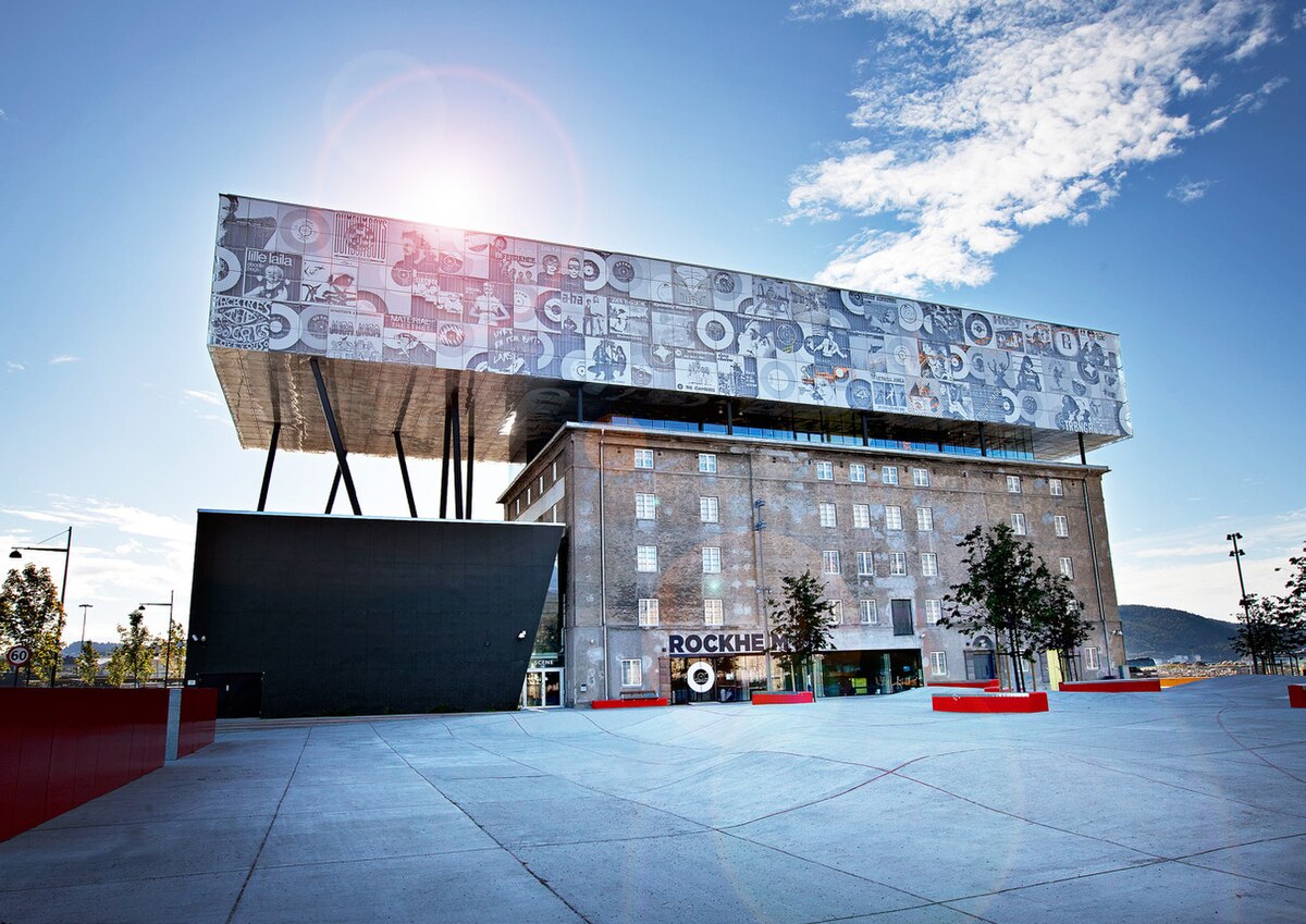
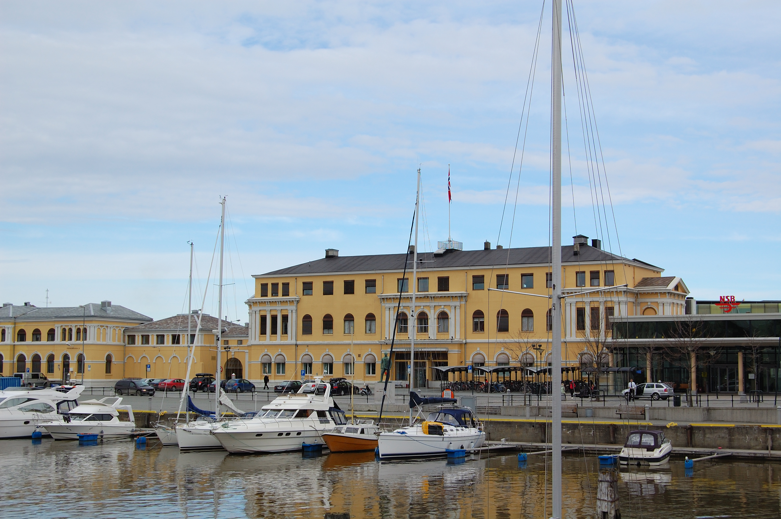


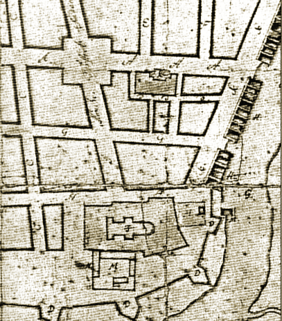
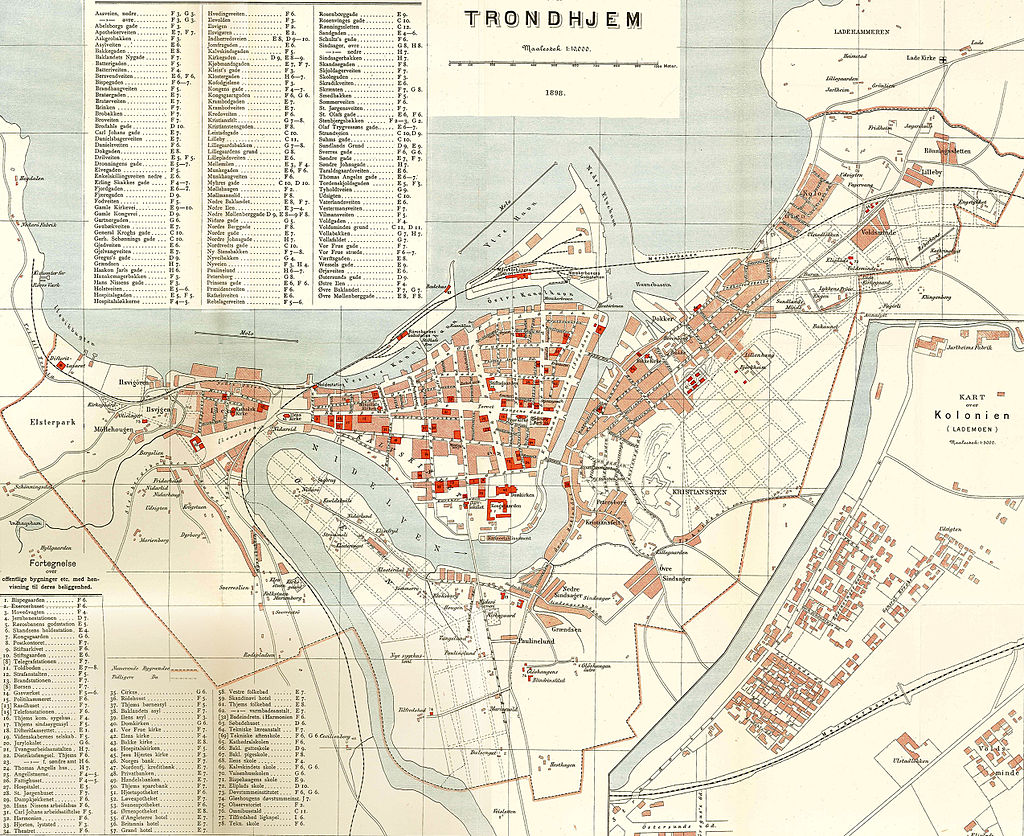


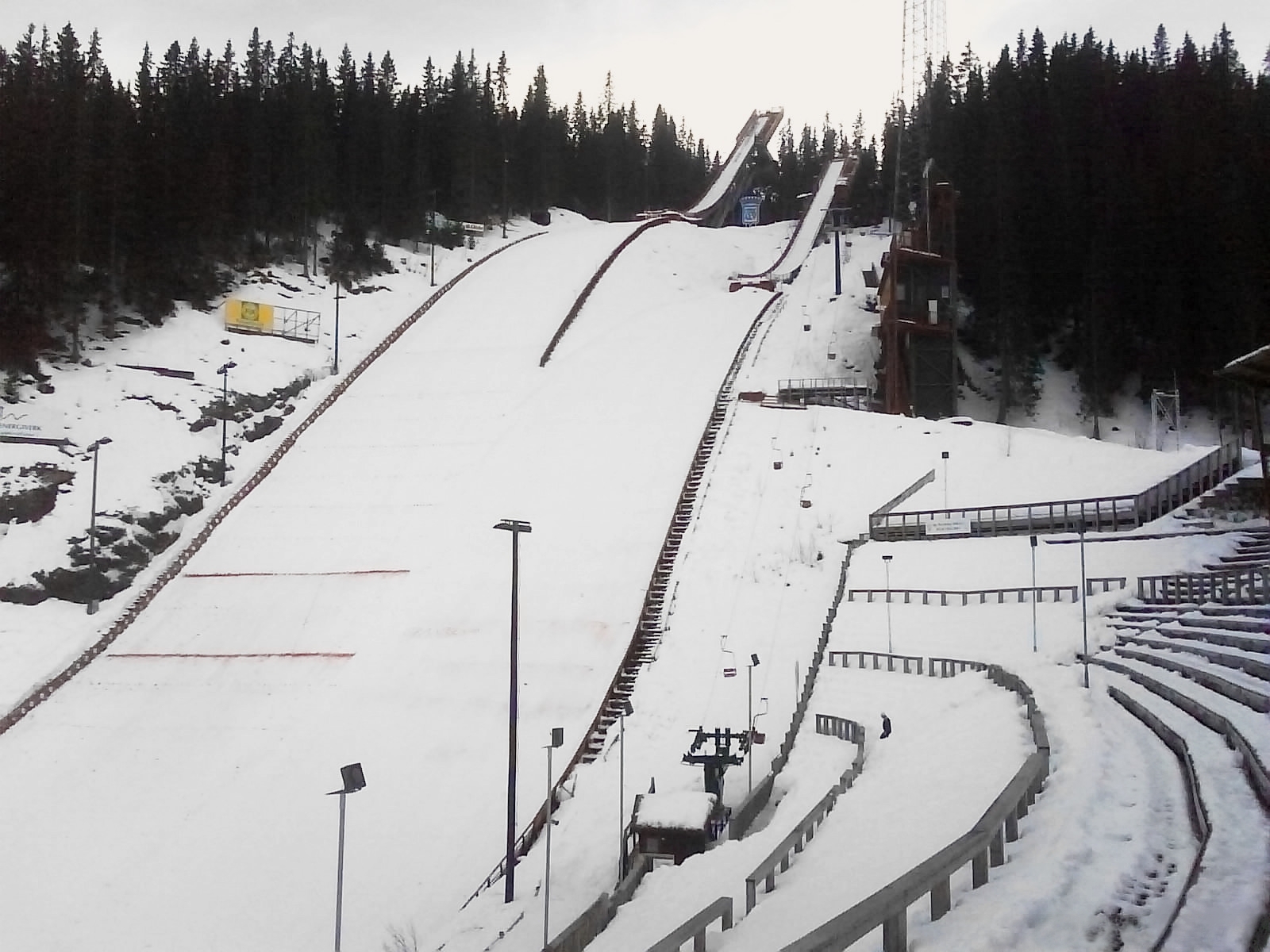


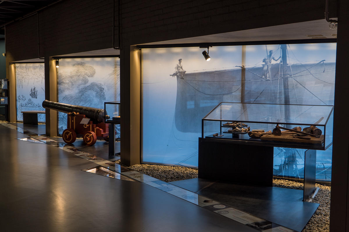


 The Oseberg Ship