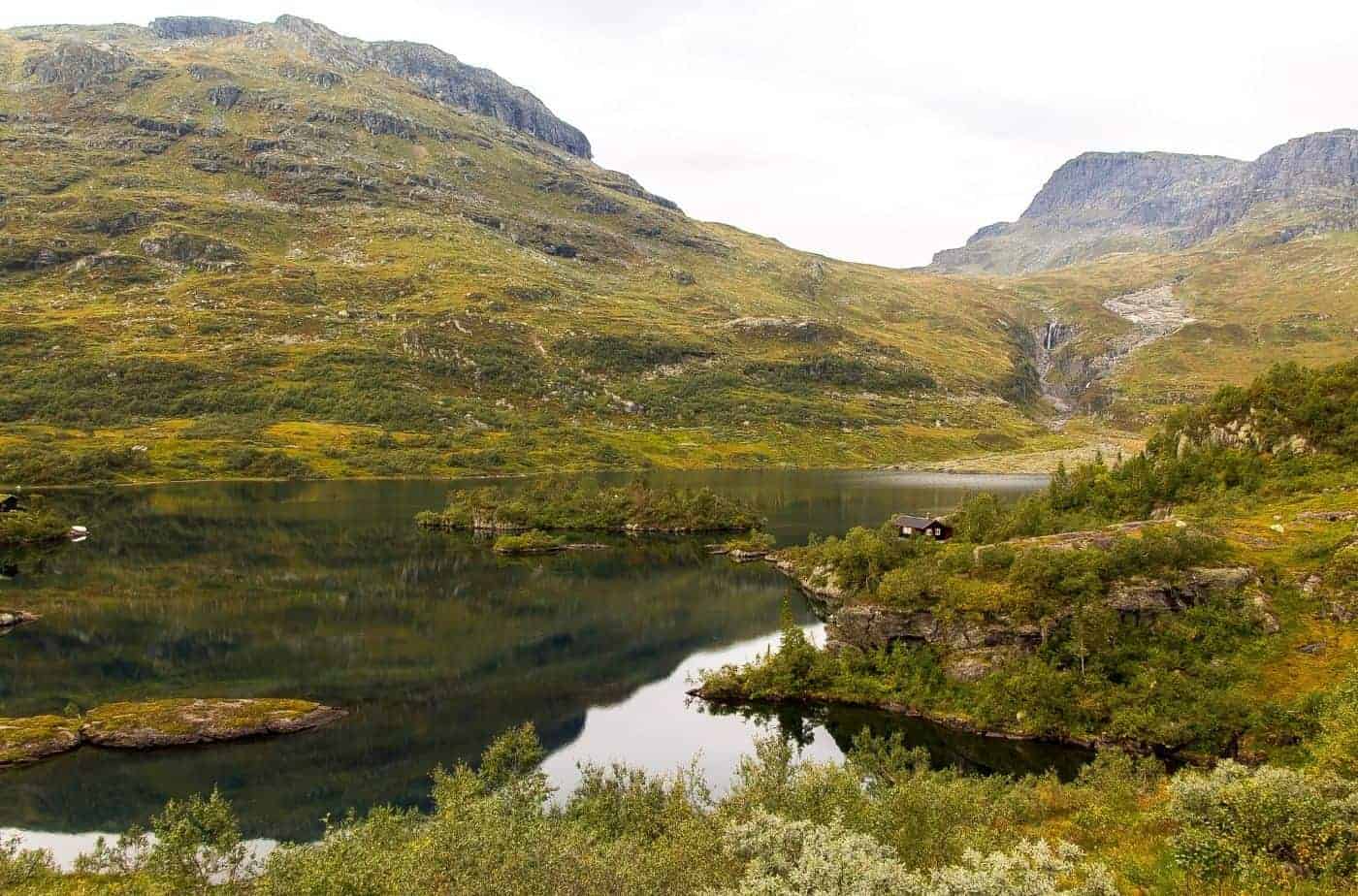
Jæren is a traditional district in Rogaland county, south of Stavanger. The landscape characterises the area; Jæren is the largest flat lowland area in Norway. Unlike most of Norway, the coast here is flat with no islands and very sandy beaches. The word ‘Jæren’ (almost pronounced like Yeah-en if you make ‘Yeah’ very nasally) is from the Old Norse Jaðarr, which means ‘edge’ or ‘brim’. It’s a common word found in Norway; around 30 farms have this name. It refers to the coastline. Until the 20th century, Jæren was spelled ‘Jaederen’, which is Danish. You can still see this word in some places.
This drive is part of our ultimate Norwegian road-trip. Click the button below to view the whole drive.
In this article...
Download this Guide
All of our guides can be downloaded via our online store.
We offer downloadable versions of our self-guided drives on our online store.
Facilities including supermarkets, toilets, petrol, hotels, cafes, restaurants with addresses.
Watch on Youtube
All of our roadtrips are available on YouTube to watch. They include information about the area provided in text and voiceover form, plus they show the drive in full (sped up in some spots!) so you can get an idea what the drive is like.
The Drive: Jæren Tourist Road
Sola Strand Hotel
Hotel
Sola Strand Hotel is located just outside Stavanger city centre, close to the airport and Sola Beach. Alternatively, you could start at Sola Ruin Church or Domsteinane, mentioned below. If you are staying in Stavanger, I recommend stopping by ‘Swords in the Rock’ before you leave. The video above begins at Sola Strand Hotel and stops at Domsteinane first.
The Sola Strand Hotel is a great hotel to stay at – it’s right on the beach, has all the facilities of a resort, and is the starting point of this drive!
Domsteinane
Historic Site
Domsteinane is a unique place in Norway. It’s often nicknamed ‘Norway’s Stonehenge’ because of the unknown status of why the rocks are laid out this way.
Ølberg Camp (Ølberg Leir) is a disused military camp primarily for the storage of ammunition. The camp was established by occupying German forces in 1940 in connection with their military activity at Sola. Sola Airport was a civilian airport, but under German occupation it had important military use. For security reasons, they placed the aircraft ammunition at a separate camp away from the airport. This is the Ølberg Camp. The camp consists of ammunition houses, bomb shelters, and storage sheds. The ammunition houses are simple timber buildings. The bomb shelters are between these structures. Nearly half the buildings are still standing. Moreover, the original road structure is also im place. After the war ended in 1945, the Norwegian Armed Forces took over the camp. They further used and developed the camp until 2003, when it closed. In 2007, it was sold to the Sola Municipality. The National Heritage Board is preserving 23 buildings and the surrounding pine forest, the only forested area in Jaeren.
Vigdel Fort is a coastal fort that was actively in use until 2007. The fort is leftover from the German occupation. It was one of the Germans’ methods of protecting Sola Airport from attacks from the sea. There was one such attack that influenced their decision to fortify the coast. On the 17th of April 1940, the British attempted to fire at Sola Airport from the sea. After several hours of intense gunfire, the British cruiser HMS Suffolk and several cruisers were forced to retreat. The German bombers had been no match for them. The British had conducted the attack in an attempt to recapture Trondheim from the Germans and stall the Germans’ advancement in Norway. After the battle, the English scrapped plans for a similar attack on Trondheim. Vigdel Fort was built to prevent an attack like this from happening again. Most important to them was their air force, and it was one of the key strategies for the occupation. The fort was to protect the airforce at Sola Airport. However, the English never returned to attack Sola Airport by ship. Moreover, the fort was never really used. It was too far from the airport to be of any use during air raids. After the war, the Norwegian Army used Vigdel Fort as a training facility. Since it has fallen out of use, the site has been transformed into a popular hiking area.
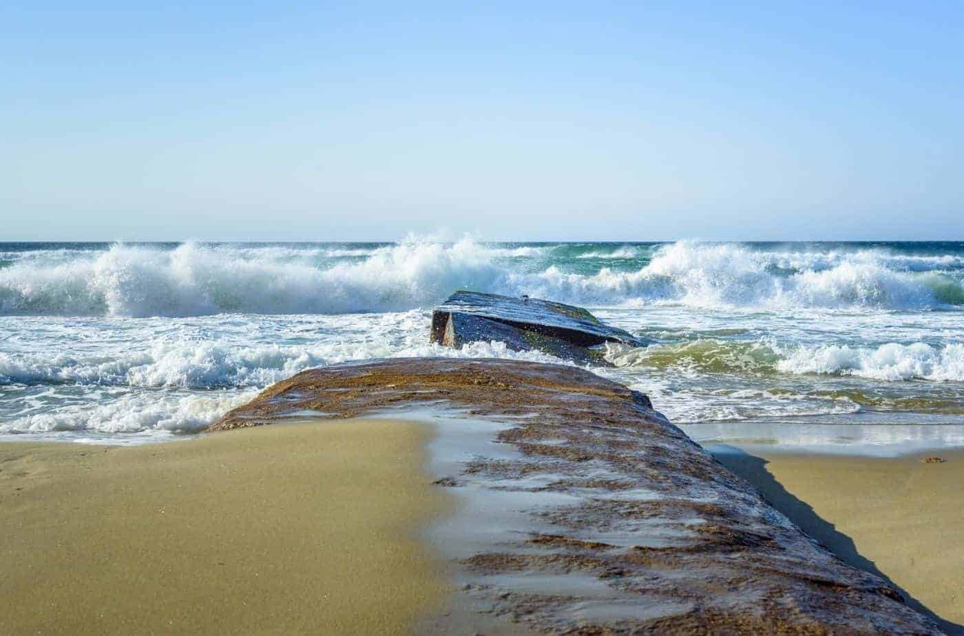
Hellestø Beach is a beautiful place to go for a walk. It’s a sandy beach surrounded by rocky hills. The parking place is free, and it’s a short walk to get to the beach. There are no facilities here.
TS Museum
Museum
The TS Museum in Stenebyen (Tjelta) has a unique collection of old tractors, cars, mortorbikes and trucks. In total, there are over 180 vehicles. All of them are still operating.
Visitor information can be found at their website (click here).
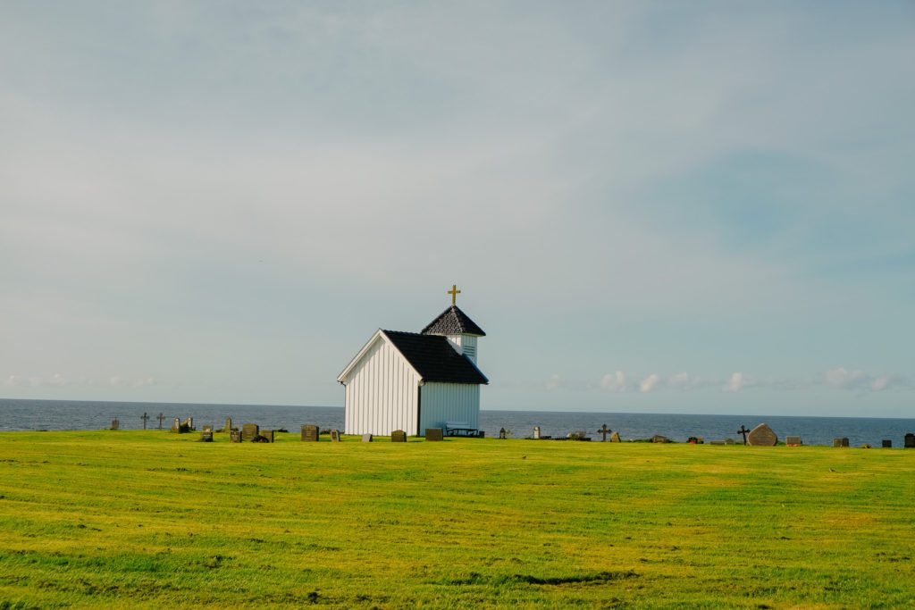
Bore Church
Historic Church
The earliest mention of Bore Church is in 1322, but the church was not new at that time. It’s likely that Bore Church was built as a stave church around the end of the 12th century. Only the baptismal font is preserved from the original church. The stave church was torn down in 1640 to make way for a more modern church. In 1895, the church and cemetery was rebuilt 1.5km (0.9 miles) to the northeast. After this church was finished, the old church was torn down.
Bore Beach
Beach
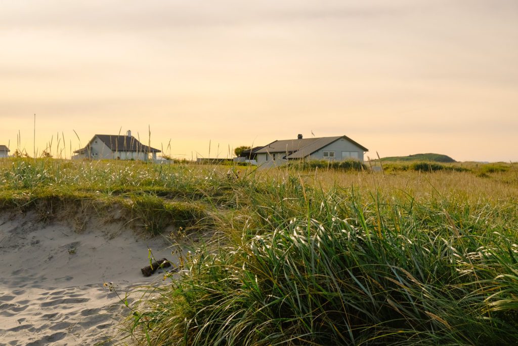
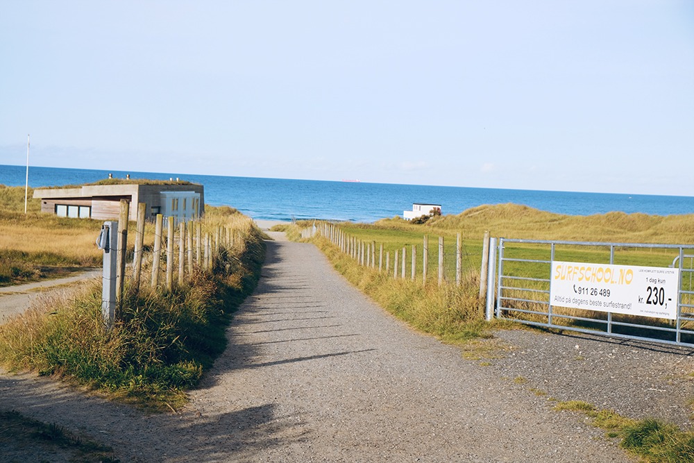
Bore Beach is located just north of Orre Beach, the longest beach in Norway. Bore is a great beach for swimmers and surfers; when we visited, we got to see a surf school heading out!
In the carpark you’ll find toilets and showers.
Orre Beach
Beach
At 5km (3 miles), Orre Beach is the longest beach in Norway. With its white sand and good swimming or surfing conditions, it will make you think you are in a warm country. However, once you get in the water, you’ll be reminded that you are actually in Norway.
Orre Beach is often mentioned among the best beaches in the world when it comes to its efforts to maintain a clean and preserved environment.
Close to the beach is the Friluftshuset. This building has an information centre about outdoor life and nature conservation. There is also a cultural centre with concerts and art exhibitions. A cafe serves food and drink, and there are restrooms here. It’s open daily in summer and on weekends the rest of the year, between 11am and 4pm.
Orre Old Church
Historic Church
Orre Old Church is the oldest building in the area. You can read my guide to Orre Old Church below.
We didn’t stop here on our drive because the facility was closed, but you certainly can visit on your own drive.
Hå Gamle Prestgård is a contemporary art gallery and local cultural history museum located inside an old vicarage. Rotating exhibitions highlight Norwegian and international contemporary artists. There is a permanent archaeological exhibition with ancient objects from the area.
The vicarage is from 1637 or earlier, and the oldest building is from 1787. The facility has undergone many renovations and has been listed for protection since 1920.
There are two outbuildings with showrooms. In the main house is the café. If you walk around the site, you’ll see remains of settlements from the Stone Age (8200 years old) and old burial grounds from the migration period.
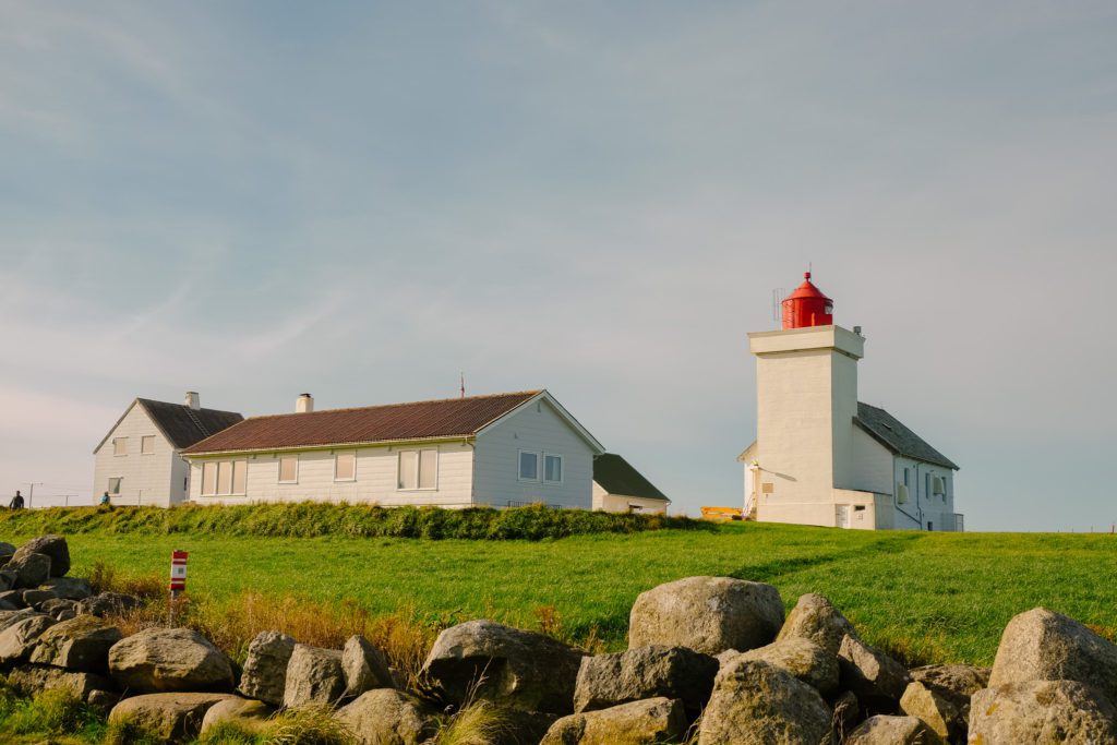
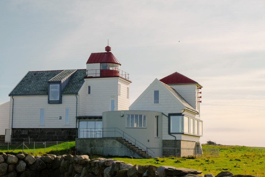
Obrestad Lighthouse
Lighthouse
Orre Old Church is the oldest building in the area. You can read my guide to Orre Old Church below.
Brusand is a small village with a population of 430. It is known for its beach, which has sandy dunes. Also, the largest carrot packing plant is located here!
Brusand is also known for its Hitler Teeth, which are a series of concrete blocks set up alongside the highway. These are anti-tank obstacles set up by Germans in World War II.
They were placed here by prisoners of war and forced labour workers. The Germans were worried an Allied invasion would come by sea, so they had these concrete blocks built to delay tanks advancing towards settlements. However, no Allied invasion ever came.
The prisoners sabotaged the teeth by mixing in more sand than concrete, making them weaker. They used to be on the whole coast, but this is one of the few spots that still has them.
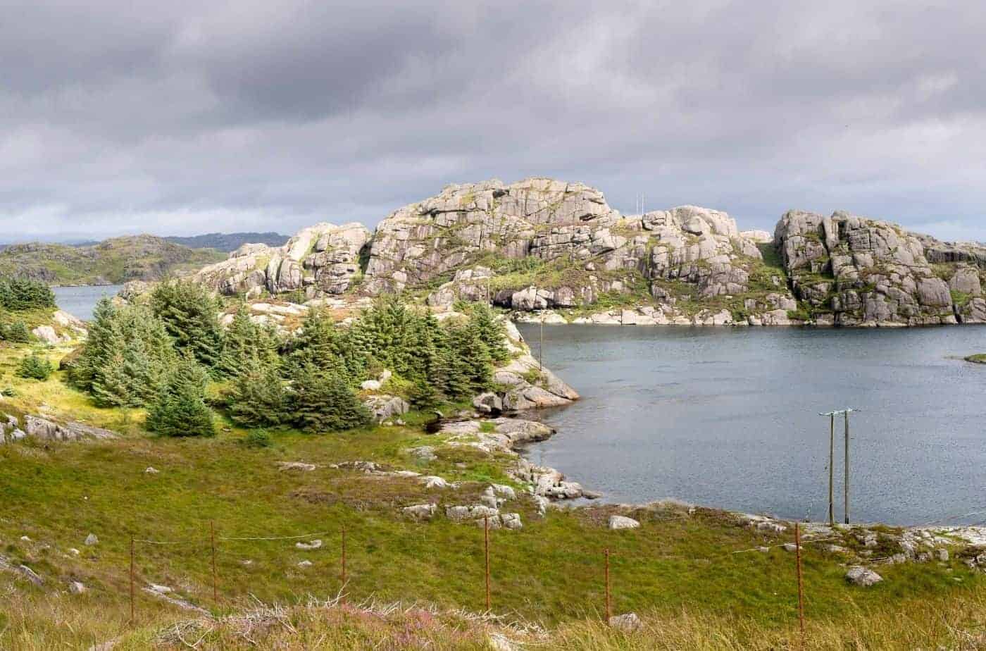
Magma Geopark
Natural Attraction
Shortly before Egersund is the Magma Geopark, an area with such a unique geology that it has been recognised by UNESCO. Here is also the world’s only sandy beach consisting of moon stone.
The rock here is the same as the one found on the moon: Anorthosite. Astronauts have even visited the area to prepare for taking rock samples on the moon.
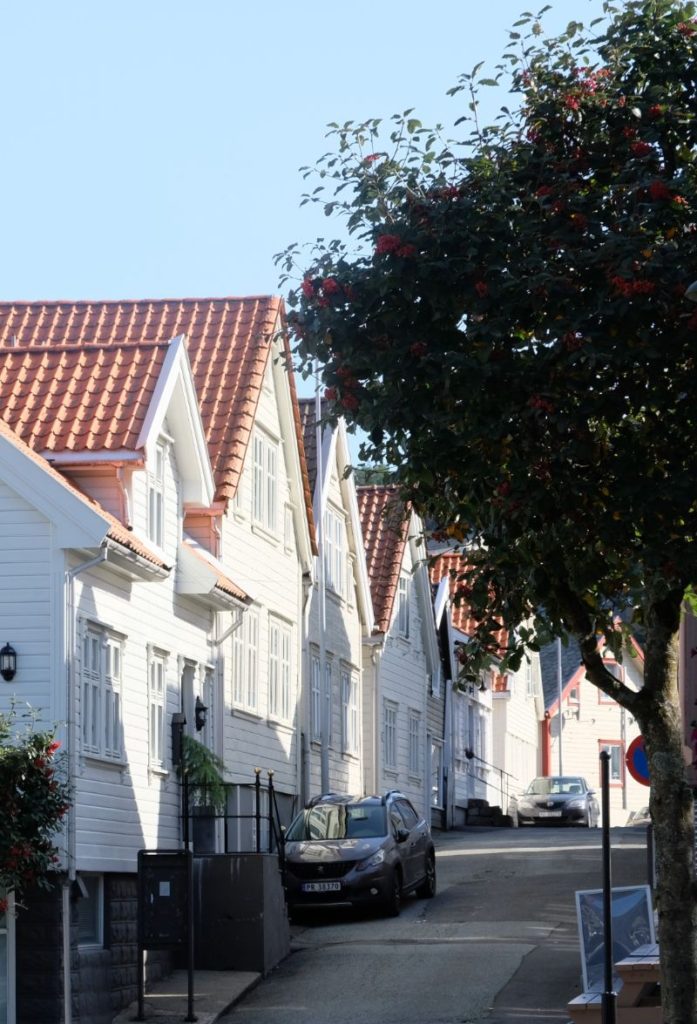
Egersund
Egersund is a charming small town on the south coast of Norway. It has lots of wonderful shops and cafes, making it a perfect place to stop on your road-trip.