
Drive it Yourself: Egersund to Dalen
Looking for an alternative road to the mountains, bypassing the tourists, highways and seeing the secret beauty of Norway? This drive is perfect. I know, the Egersund to Dalen drive is not the most commonly suggested route in Norway, but it is worth the consideration. Both towns are very cute and scenic with plenty to do, and they are separated by a beautiful valley and mountain range that you’ll pass.
On this page, you’ll find practical info outlining what you’ll see between the two towns, plus where you can stay and what you can do. Be sure to watch my own drive, where I’ve put together a timelapse with information.
If you have done this drive, or have any questions for me, let me know in the comments.
In this article...
Watch on Youtube
All of our roadtrips are available on YouTube to watch. They include information about the area provided in text and voiceover form, plus they show the drive in full (sped up in some spots!) so you can get an idea what the drive is like.
The drive: Egersund to Dalen
Egersund
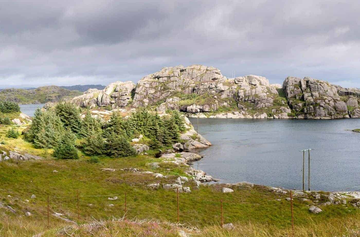
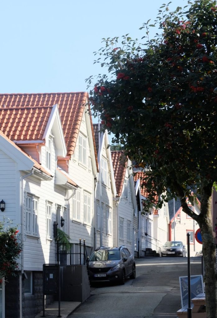
Egersund is a charming small town on the south coast of Norway. It has lots of wonderful shops and cafes, making it a perfect place to stop on your road-trip.
Trollpiken
Rock Formation
Trollpikken is a unique and strange rock formation in Norway. In the last few years, it has gained popularity due to its, well, shape. ‘Pikk’ is a relatively new word in Norway that translates to ‘dick’, and as you can see in the image, the name describes what locals have come to recognise the formation as.
Trollpikken made the news in 2017, when it was vandalised and severed off using power tools. The locals were saddened by this and a crowdfunding campaign raised an incredible 226,000 NOK and within two weeks the rock was reattached (watch the video on the left!). One person was arrested for vandalism.
Since this incident, there was more effort made in promoting Trollpikken. It’s got its own website now (click here), which goes over the history, folklore, and practical info of the site. There are road signs leading to the large carpark, and the walk to the monument is well marked with modern signs. The name is also recent; it’s only from 2017.
For those interested in geology, the rock is anorthosite. This is a very rare type of rock that’s found on the south-western coast of Norway and the moon. Yes, the moon! When astronauts were training for going to the moon, they came here to practice collecting rock samples. Trollpikken is 12m (39ft) high.
It is relatively easy to hike to Trollpikken, and the info can be found here: https://ut.no/turforslag/1113153/trollpikken
Helleland
Village
Helleland is a small village just outside Egersund. The language used here is nynorsk rather than the commonly used bokmål. The Sørlandet train connection between Oslo and Stavanger runs through (and stops at) Helleland.
Helleland Church is from 1832. It is built in wood and has seats for 500. The architect was Hans Linstow, who also designed the Royal Palace and Karl Johans gate in Oslo.
In Helleland, there are memorials dedicated to the British aircraft which crashed during the occupation of Norway by Nazi Germany in connection with the Operation Freshman sabotage attempt, part of an action that was aimed at the Vemork hydroelectric plant, site of heavy water production. Furthermore, there is a cave in the forest which was used as a hiding place during World War II. People who had kept illegal radio equipment hid in this cave, and the Germans never discovered them.
You’ll find a grocery store in Helleland (Coop).
Terland Klopp
Bridge
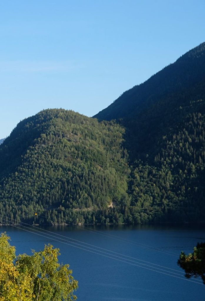
Terland Klopp was built around 1800 as a stone slab bridge. With 21 runs and 60 metres, it is considered the largest in the Nordic region of this type. The bridge crosses the river Gyaåna, which we are following on this road. The valley we are in is called the Gyadalen Valley.
Terland Klopp has not been in use since 1977; today it is a listed monument. It is considered the best-preserved bridge of this kind.
Agder County
We now cross over into Agder kommune. Originally, Agder was a medieval petty kingdom that governed itself until Norway was unified into one Kingdom. The name Agder was not used between 1662 and 1919; it was reinstated after the counties Aust-Agder (East Adger) and Vest-Adger (West Adger) were established. Since 2020, those two counties were merged into one: Adger.
Sirdal Municipality
Tonstad
Village
Welcome to Tonstad! The name means “Tone’s Farm” and is a typical small town name; towns were often built around farmsteads where the church was located. The church here is Tonstad Church and it’s from 1852. It seats 300.
The town has a large hydroelectric power station and a large ski centre. In fact, Tonstad has one of Norway’s most modern biathlon facilities, and it is known for producing many highly regarded biathletes. The local high school uses the facility for training.
Tonstad is located on the northern end of the Sirdal Lake. In July, the boat ‘Snorre’ does tours of the lake every Wednesday. A guide on board tells you the stories and local legends, as well as some tales of Vikings from the Norse Sagas.
At Tonstad you’ll find road signs leading to Kjerag, a famous natural monument and hiking trail.
Dorgefossen
Waterfall
Dorgefossen is a regulated waterfall, though it is more like a gorge. Due to the water regulations, the waterfall is much smaller than it used to be.
An old legend from Sirdal tells that death row inmates got one last chance to save their lives by jumping over Dorgefoss. If they managed to do so, they would be free. If they did not succeed, the fall of the waterfall and the rapids fulfilled the death sentence.
It is possible to swim in the river, but without warning water can be released from the pond, making the water colder than normal.
By the road, there is a picnic area with restrooms and information boards. The road we drive over goes over the waterfall via the Dorge Bridge. The bridge is from 1919.
Sinnes
Village
Sinnes is a small village located in the upper part of the Sirdal valley. There are two ski centres here: Ålsheia and Tjørhomfjellet. Together, they make the largest alpine facility in southwestern Norway.
Several alpine and cross-country competitions are held in the area. The largest one is Sesilåmi, which is a 52km long ski run.
Sinnes is a popular cabin area for people from Stavanger, Sandnes and Jaeren.
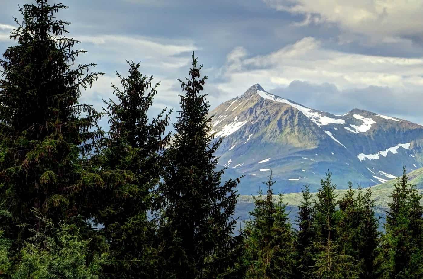
Setesdalsheiene
Mountains
The mountains to the north are called Setesdalsheiene. Just north of them is the Hardangervidda plateau, while the Ryfylke mountains lie to the west. The highest point is 1,300m (4,300ft). Wild reindeer herds live here.
Håhellervatn
Lake
The lake on our right is Håhellervatn. The total walking distance around the lake is 6km (4 mi).
On the east side is a cave called Håhelleren. It has a lot of stories associated with it. After the Napoleonic Wars, two families moved to the area. They first settled in a fisherman’s hut, and then built a home. Their main job was to keep the road clear and shelter road users in bad weather. They were unable to grow grain on the site, but they did try to grow potatoes, though without luck. After living here for 26 years, they realised it was not such a great place to live and they moved to Sirdal. After their house was torn down, road users used the cave for shelter if need be. Today there is a tourist cabin on the sight, and up to 16 adults can take accommodation in the cave.
Valle Municipality
Valle
town
Valle is the first major town we’ll pass after crossing the mountains, making it a good place to stop. We have now entered the traditional district of Setesdal; it’s a valley (dal) that up until recently was very isolated. The name Valle comes from the farm where the church was built. There used to be a stave church on the site called Hylestad stave church; sadly it was torn down in the 19th century to make way for a new church. Fortunately, the portal carvings were saved and are on display at the Historic Museum in Oslo. They illustrate the legend of Sigurd Favnesbane (Sigurd the Dragon Slayer), who is described in the Prose Edda and Beowulf saga. An important historic site is Rygnestadtunet, an old farm. It was built by Vonde-Åsmund (Asmund the Evil) in the mid-1500s and has been well-preserved. Today it is an open air museum, where the interiors reflect the period around 1919. Around the farm, grave findings indicate that the site was settled as early as 900AD. As mentioned above, Valle was incredibly isolated. To get out via the north, travellers had to follow the river and take a path on a torturous steep cliff face. This was the only way out until the 1870s. Today, the European Highway 9 (E9) crosses through the valley and under the torturous mountain thanks to a nice tunnel. Valle is known for its ancient silver smitheries. Today, the local high school specialises in silversmith and goldsmith training. Students from all over Norway and abroad come here to train to become jewellers.
Sylvartun Museum
Museum
Sylvartun was the central silversmith and folk music arena in Setesdal valley. Exhibitions in the museum focus on musical instruments and the visualisation of music and dance traditions in the valley.
Visitor information can be found here.
Store Bjørnevatn
Lake
We pass a large lake called Store Bjørnevatn. It’s about 15km (9 mi) north of Valle. The elevation is 801m (2,628 ft) above sea level.
Skafså
Town
Skafså is a small town known for its mountain farm Grimdalen. Today it’s a museum with farm buildings from the time of barter economy in the 17th century.
Famous sculptor Anne Grimdalen is from here, and there’s a gallery with 300 of her sculptures here.
Skafså Church is from 1839. There used to be a medieval crucifix standing outside the church; this is now at the Vest-Telemark Museum.
Dalen
This drive ends in Dalen, a small town located on the westernmost endpoint of the Telemark Canal. The Telemark Canal goes all the way to Skien on the coast of Norway – originally the canal was used for industry, but today it is more popular with tourists.
When the canal was completed, it was referred to as the ‘eighth wonder’. Ferries were able to link Telemark with Oslo through the canal and then Oslofjord.
Dalen Hotel is a famous historic hotel; it is one of the best preserved hotels from the 1800s. The hotel was built with the opening of the Telemark Canal in 1892. When it opened, it became popular with European royals.
During the occupation, it was a resort for German officers. Most of the interior was stripped and sold for parts. The building fell into disrepair.
After the war, the building was bought by singer and evangelist Aage Samuelsen. The hotel got a lot of attention and was restored in the 1980s. The hotel reopened in 1992. In 2000, the hotel won the Europa Nostra award for outstanding conservation.
The architecture is a mix of Swiss chalet with national romanticism and Dragestil, a type of Norwegian architecture inspired by Viking and medieval art.
A night at the hotel starts at 3,000 NOK, with rooms going up to 8,300 NOK.
Continue the drive

Previous Drive
This drive is part of the multi-day series “Ultimate Norway”. You can read about the whole drive below.
If you liked this drive, or if you have any travel tips, please leave a comment in the section below!