
Drive it Yourself: E6 from Nordkjosbotn to Narvik
Welcome to the next part of our amazing drive from Trondheim to the Lofoten Islands! This drive was actually the turning point for us as we made our way back south to Trondheim. It was a little sad turning around; I just wanted to keep on going! Anyway, today we begin the first of three travel days on the E6 south to Trondheim.
We actually began the drive in Finnsnes, a town across from the beautiful island of Senja. In the morning we ventured out to the Sami souvenir shop mentioned below before turning around and heading south on the E6.
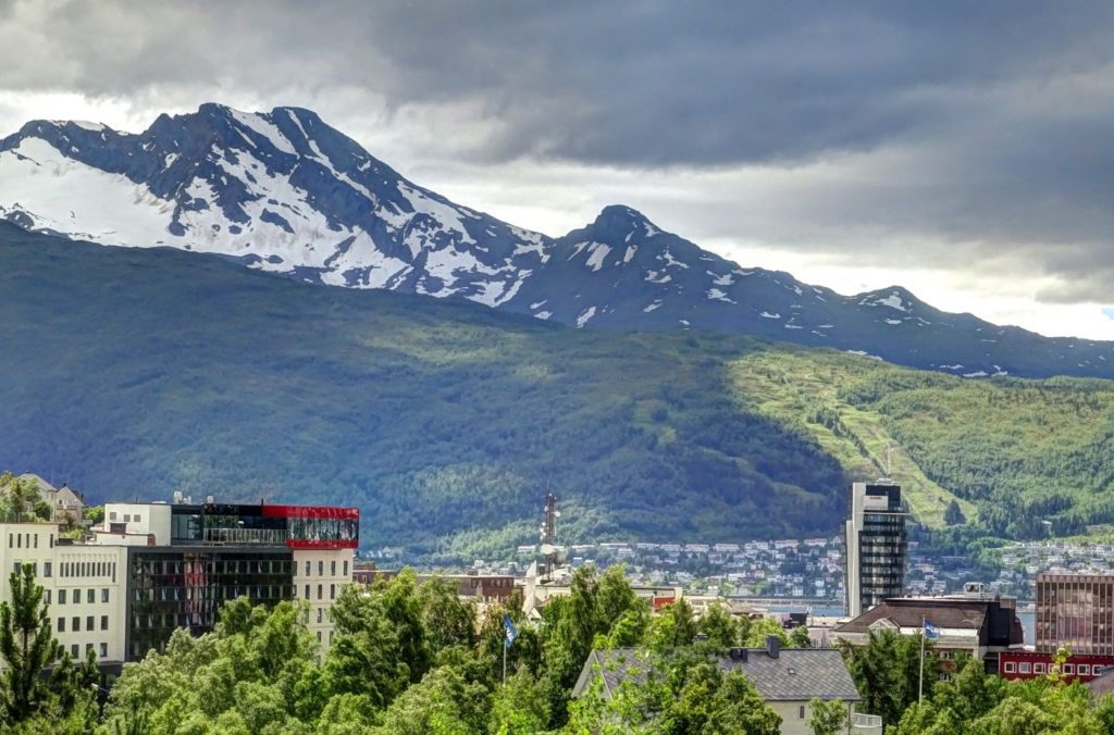
The drive close to Narvik is so beautiful! What I love is the amount of effort put into having rest areas with information about the Battle of Narvik, too.
Enjoy the drive!
In this article...
Downloadable Version of This Guide
We offer downloadable versions of our self-guided drives on our online store.
Online Guide
- Information about points of interest
- Images of each point of interest
- Historic overview of the neighbourhood
- Directions between points
- Historic photos
- Information about facilities along the way
Downloadable Guide
- Information about points of interest
- Images of each point of interest
- Historic overview of the region & towns
- Directions between points
- Historic photos
- Facilities including supermarkets, toilets, petrol, hotels, cafes, restaurants with addresses.
Watch on Youtube
All of our roadtrips are available on YouTube to watch. They include information about the area provided in text and voiceover form, plus they show the drive in full (sped up in some spots!) so you can get an idea what the drive is like.
The drive: E6 between Nordkjosbotn & Narvik
Nordkjosbotn
Village
Nordkjosbotn (Sami name: Gárgán) is a small village located at the junction of two major highways – the E6 and the E8. The E8 leads towards Tromsø, while the E6 runs through the entire length of Norway. It is one of the major crossroads in Norway. In the village you’ll find supermarkets, petrol stations, and a small church.
Balsfjord Municipality
Balsfjord Municipality (Sami name: Báhccavuotna) is located close to Tromsø Municipality. It has a population of around 5,500 people and has a very low population density. It is surrounded by two major fjords – Malangen and Balsfjorden. The farmland here is very rich.
The original inhabitants were the Sami people, but in the 1800s new settlers came from Finland. Eventually people moved up from southern Norway and settled in the area. Today there are very few traces of Sami culture. Petroglyphs have been found in the area that are 2,500 to 4,000 years old.
The coat-of-arms represents a yellow plough on a red background, symbolising the fact that agriculture is the main source of income for municipality. The plough also symbolises that the municipality is at the northernmost border on which grain can be grown in Norway. Agriculture is mostly based on milk and meat production, and Balsfjord has the highest number of cattle, sheep and goats in Troms county.

Målselv Municipality
Målselv (Sami name: Málatvuomi suohkan) is a municipality in Troms County. The area was settled by farmers from southern Norway from 1788 onwards. They came here because of the large, forested areas as well as the fertile land. The valley and the municipality take its name from the river Målselva, which is well known for its salmon. The river also forms the Målselv waterfall, which has been selected as Norway’s national waterfall. One of the rarest orchids in Europe, Lysiella oligantha, is found in Målselva.
Sami Shop Heia
Shop
One of my favourite places in the area is this Sami shop. Here you can buy authentic Sami handicrafts, but I love their cafe with some of the best coffee I’ve ever had – boiled over an open fire and very, very strong.
Øvre Divdal National Park
National Park
The Øvre Divdal National Park (Sami name: Dieváidvuovddi) is a 750km2 (290 sq mi) national park that opened in 1971. The intention behind establishing the park was to protect the inland valley and mountain area. The area is very popular with hiking today. Pine forests grow in the lower areas, while birch grows on the mountains. All the main predators are represented in the park, including the brown bear, wolf, wolverine and lynx. The wolverine are numerous in the area and it is also common to see reindeer (owned by Sami) and moose. The Arctic fox used to live in the area.
The valley is the second driest in Norway, with an annual precipitation of 282mm (11.1 inches). There is no permafrost in the lower elevations of the park.
Many Sami cultural monuments remain in the park, from pre-Christian sacrificial sites to reindeer fences. Norwegian settlement didn’t come to the area until the 18th and 19th centuries. The name Divdalen comes from the Sami word dievva, meaning ‘round and dry pile’.
If you are considering spending some time here, I recommend spending at least one night here. Cabins are available for rent throughout the area.
Bardufoss
Town
Bardufoss (Sami name: Beardogorži) is the commercial centre for the Målselv municipality. It is located in the Målselvdalen valley near the confluence of the Barduelva and Målselva Rivers. The population is 2,600.
Bardufoss is known in Norway for its association with the military. The Bardufoss Airport is both a civilian and military airport suitable for landing bomber aircraft, fighter jets and other heavy planes.
Many people who live in Bardufoss are associated with the Armed Forces. The two military camps Rusta and Heggelia, with the common name Bardufoss Camp, constitute the military centre of gravity in Troms together with Maukstadmoen camp in Øverbygd and Setermoen camp in Bardu. Between Rusta and Heggelia camps is Istindportalen, which is a welfare building for the Armed Forces. It houses the welfare service and equipment for the soldiers as well as a cinema, sports hall, and kiosk for civilians.
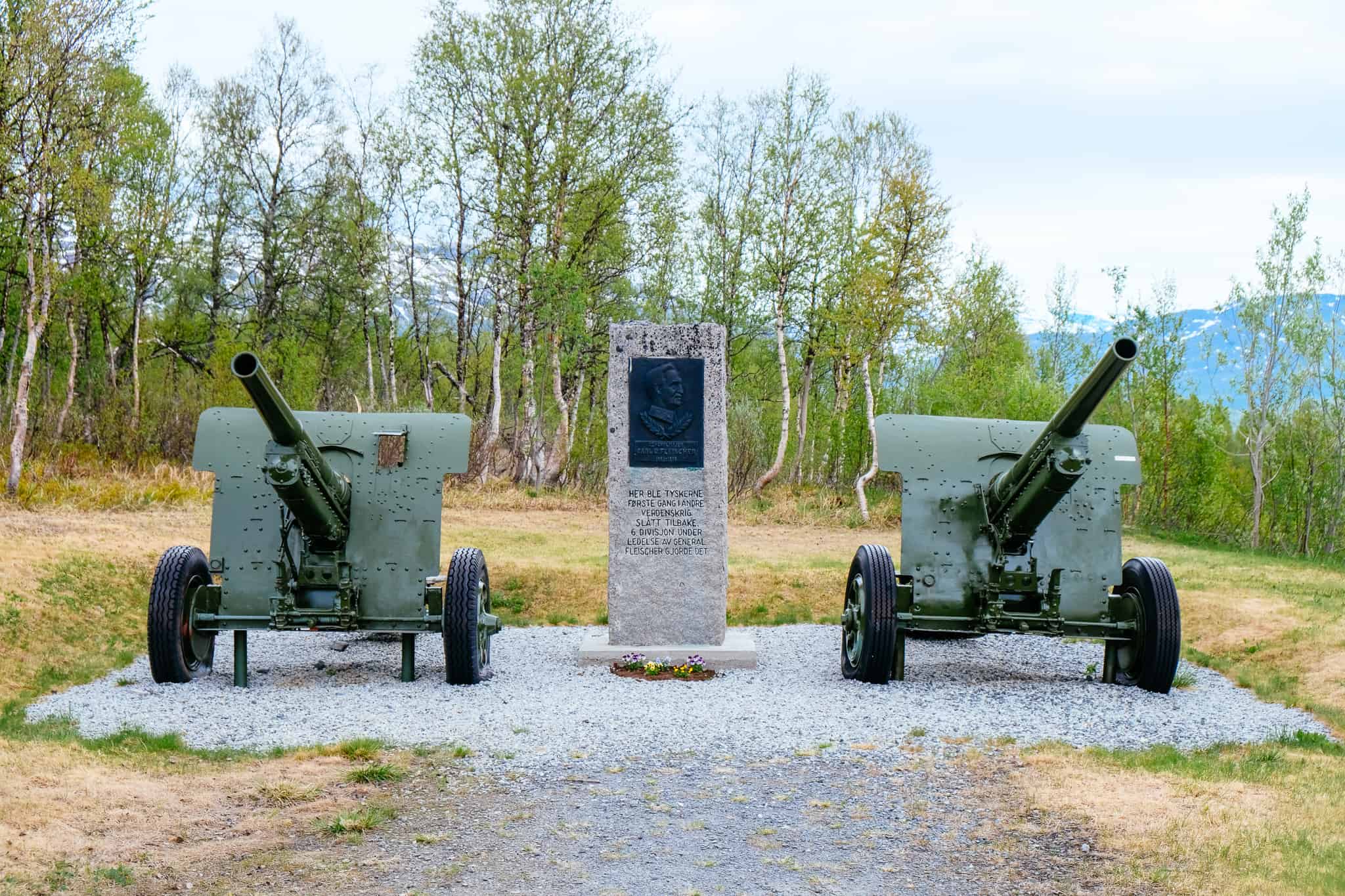
A street in Bardufoss is called General Fleischer’s Veg, in honour of Carl Gustav Fleischer. Carl Gustav Fleischer was a Norwegian general and the first land commander to win a victory against the Germans in World War II.
The main forest here is made up of Downy birch, Scot’s pine, aspen and grey alder. However, Norway spruce has been planted in the plantations since the middle part of the 20th century for economic reasons (timber).
The climate in Bardufoss is more continental, and it has reliable snow cover in the winter while the summers are warmer than Tromsø in the summer.
Bardufoss has an upper secondary school with practical subjects including aeronautical subjects, construction subjects and electrical subjects. The Armed Forces College is located here with courses at the college and university levels.
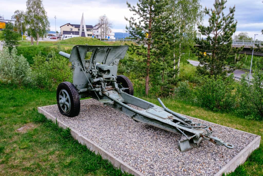
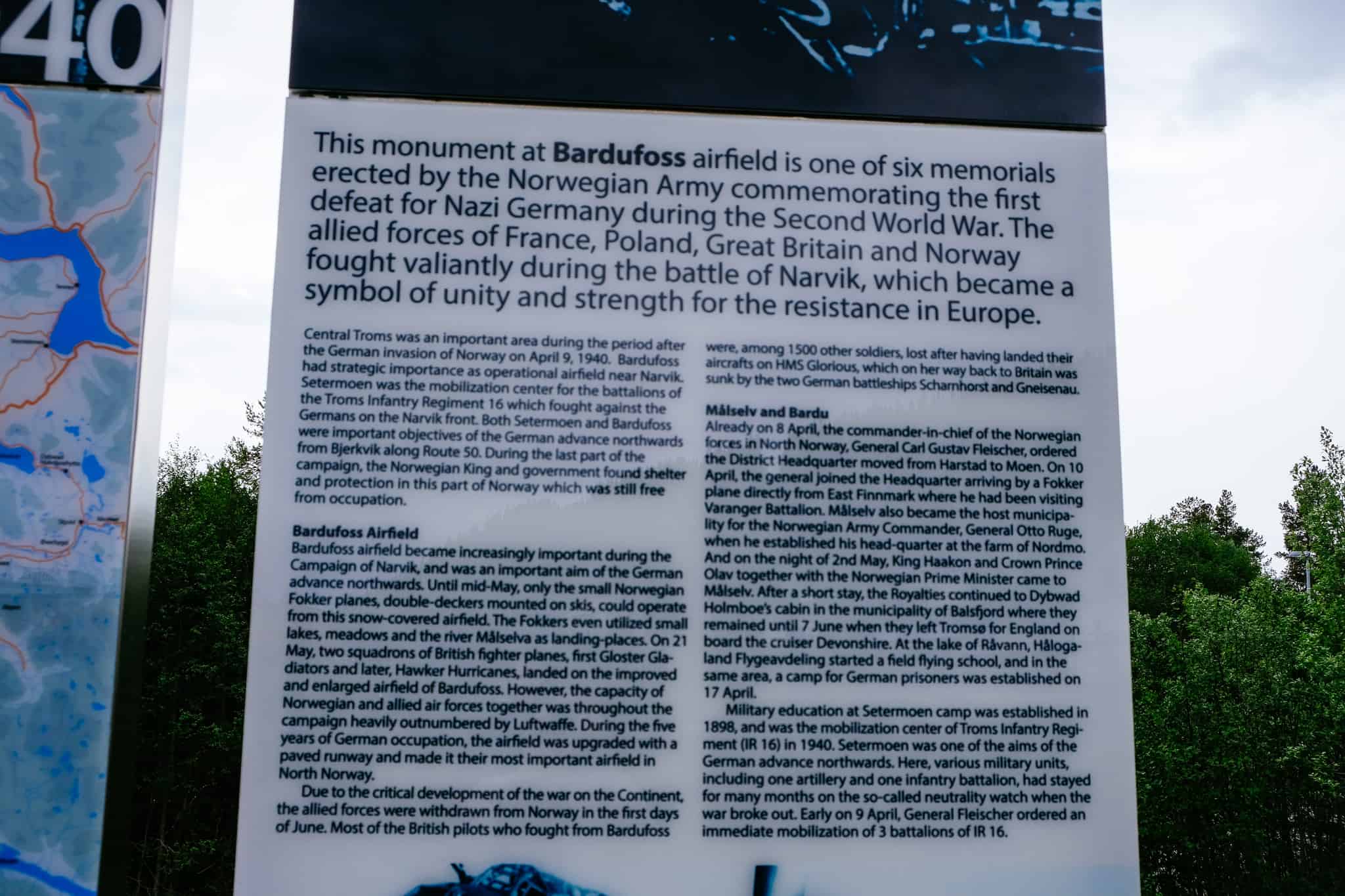
Battle of Narvik 1940 Memorial & General Carl Flesicher
Located just off the E6 in Bardufoss is a memorial about the importance of the Bardufoss Airport in the Narvik Campaign in 1940.
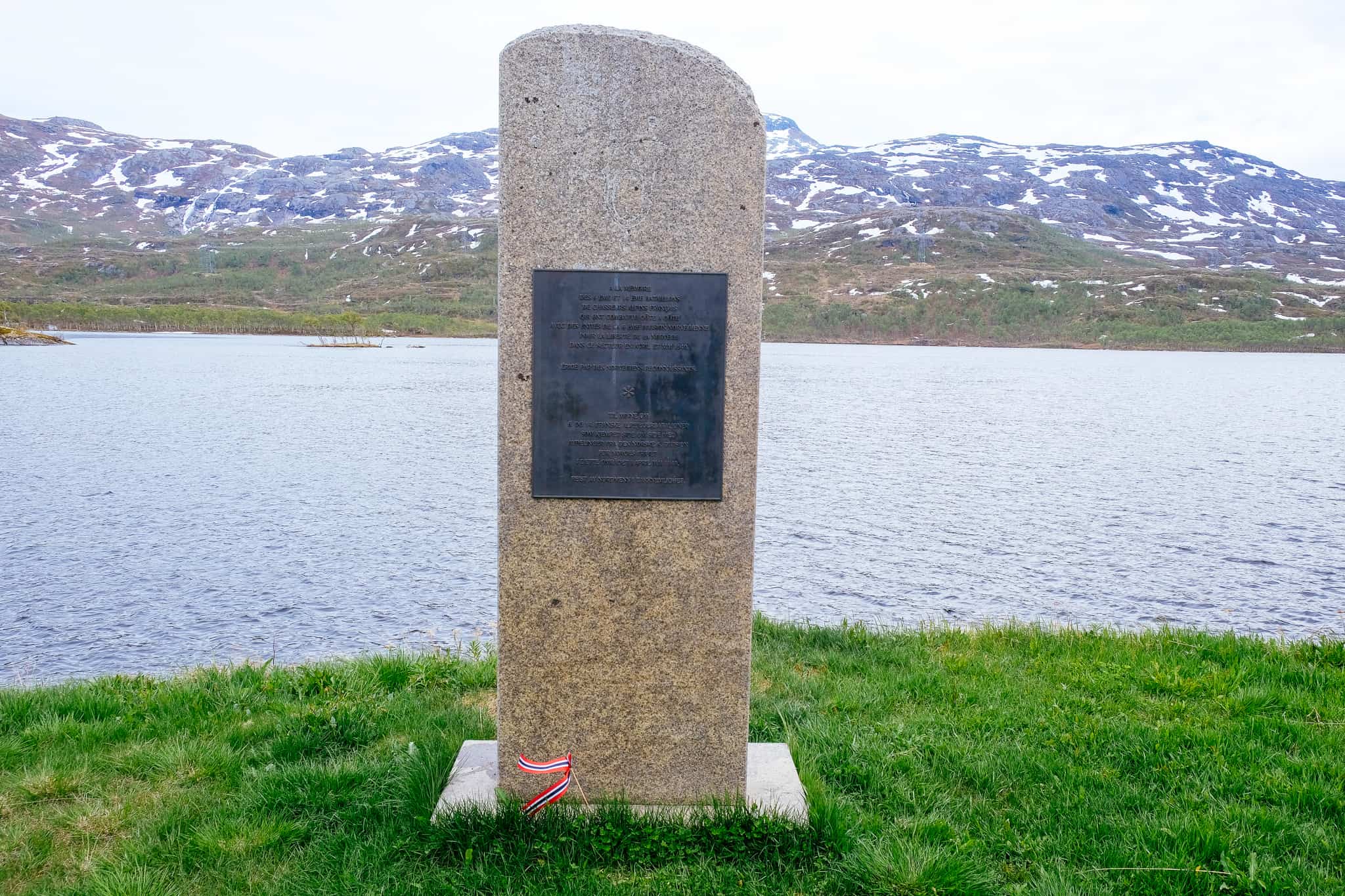
This monument at Bardufoss is one of the six memorials erected by the Norwegian Army commemorating the first defeat for Nazi Germany during World War II.
Bardufoss Airport was important during the Campaign of Narvik and was an important aim of the German advance northwards.
The street is named in memory of Carl Fleischer, a General in the Norwegian Army at the outbreak of World War II. He was crucial to the early successes of the military in the Battle of Narvik and is credited with coordinating the French, Polish, British and Norwegian forces in recapturing Narvik on the 28th of May. Narvik was the first major allied infantry victory in the Second World War. Unfortunately, the Allies left Narvik due to the German Invasion of France on the 10th of May 1940 and without the support the Norwegians couldn’t hold Narvik. The Germans reoccupied Narvik on the 9th of June. General Fleischer followed King Haakon VII and the government to the United Kingdom.
During his exile, he built up a Norwegian infantry brigade in Scotland, but he soon got at odds with the Norwegian political leadership due to his stubbornness. He became controversial in factions of the cabinet due to his support of British commando raids on the Norwegian coast. Likely because of his attitudes, he was bypassed when the government-in-exile recreated the post of commander in chief of the Norwegian Armed Forces. Instead, Fleischer was told he would go to Canada and be the commander there. Apart from the Royal Norwegian Air Forces training base near Toronto, which already had a leader, there were no Norwegian forces in Canada. Fleischer took this as an insult and humiliation, and he committed suicide on the 19th of December 1942.
Still disputed today, it is thought one of the reasons for sending him to Canada was that he favoured coastal raids against Norway to hamper German use of the occupied nation. He also wanted to build substantial army forces abroad and employ them in operations against the German occupying forces, something that was in direct conflict with the more passive strategy favoured by the government in exile. When General Fleischer’s ashes were brought back to Norway after the war, the Labour government denied him a state funeral. When a monument was raised in Harstad, which was attended by the King, the same lack of respect was shown by the Labour Party.
Bardu Municipality
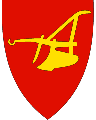
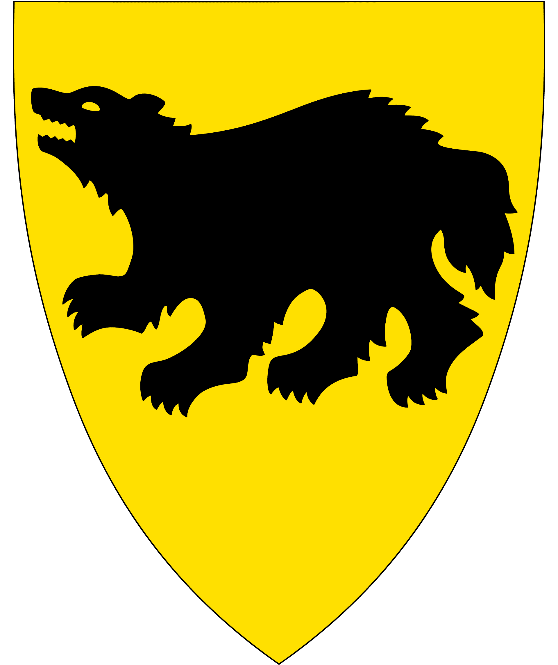
Bardu (Northern Sami: Bearddu suohkan) is a small municipality in Troms Country with a population of around 4,000. The Norwegian name of the municipality has been Norwegianised from the Sami name, which means “long and steep mountainside”. The coat-of-arms represent a black wolverine on a gold background, symbolising the rich wildlife in the area.
Norway’s largest military garrison is located at Setermoen, the administrative centre for Bardu. The military is the municipality’s largest employer, and more than 1,000 young soldiers perform their duty service here every year.
The world’s most northern zoo, Polar Park, is in the southern part of the municipality.
Setermoen
Village
Setermoen is the main town in Bardu municipality and has a population of around 2,400. Military education was established here in 1898 because of its strategic location in a valley surrounded by mountains. Today it is one of the oldest military camps in Norway, and in many ways the Norwegian Armed Forces has shaped Setermoen and the community through its presence. About 1,000 soldiers and 500 soldiers are stationed here, making it the largest garrison in Norway.
Click here to visit the Norwegian Army’s website about Setermoen (it has some great pictures!)
Bardu Bygdetun
Open-air museum
Bardu Bygdetun is an open-air museum that contains buildings mostly from the 1860s, arranged to show a historic farm and village. The main building is a farmhouse from 1868, but another interesting building is the school room that was built in the early 20th century to accommodate the 8-10 school students in the district.
The museum is only open in August, where you’ll find staff dressed up, coffee and food, and other events.
Click here to visit their website (in Norwegian).
Polar Park
Animal Park
Polar Park is an animal park that specialises in Nordic fauna, including Norway’s four largest predators: brown bear, lynx, wolf, and wolverine. Other animals include moose, muskox, red deer, and reindeer.
The park is open every day and they also have accommodation options close by.
Click here to visit their website (in English).
Lavangen Municipality
Lavangen (Sami name: Loabák) is a tiny municipality in the southern part of Troms County; the population is only 1,000! The name comes from the fjord nearby and is from the Old Norse words meaning “leaf fjord”. The coat-of-arms represents gold-coloured birch leaves on a red background, representing how the area was settled by Norwegians, Sami and Kvens. Over 20% of the population have a Sami background; they are mostly descendants of Swedish reindeer herding Sami.
General Fleischer Memorial & Lapphaugen
Memorial
Shortly after driving through the village of Fossbakken is a monument about the Battle of Narvik in 1940. It includes a memorial to General Carl Fleischer as well as some information about the fighting that took place in the area.
This is the site where the German troops advancing north were stopped by Norwegian forces. The Germans never again resumed the offensive in Narvik. The Germans were held back by a blizzard, which made for zero visibility and they had to stop here at Lapphaugen.
Gratangen Municipality
Gratangen (Sami name: Rivttága suohkan) is a small municipality in the southern part of Troms County. The population in the municipality is only around 1,000, with the main village being Årstein.
Gratangen was the site of the Battle of Gratangen, one of the first battles between the Germans and the Norwegians during the Narvik Campaign in 1940. The first attack was a huge failure as the German counter-attacked unprepared Norwegians, blunting the first Norwegian advance. This battle was, for Norwegians, their first serious lesson in the art of war. After this battle, the bitterness caused by the German ruthlessness – particularly the use of civilians as human shields – ensured that the Norwegian’s wouldn’t hesitate to fire on the enemy again.
Øse
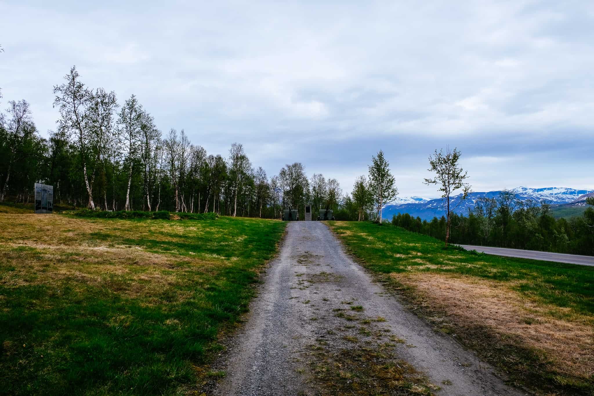
Memorial
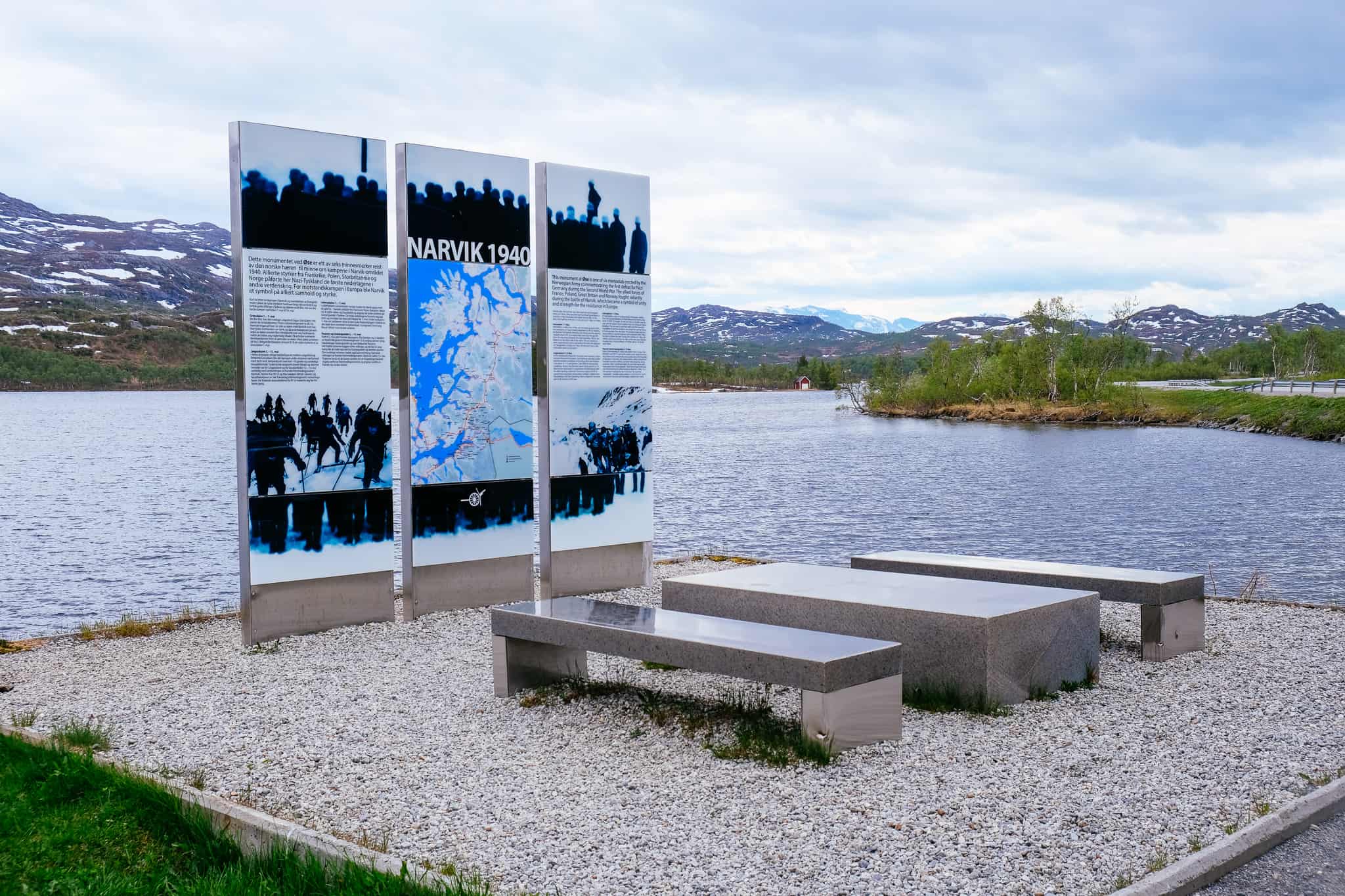
This memorial is located at a site called Øse, which was the site where fighting took place between the 1st and 14th of May 1940. The site is a strategically important mountain pass that the Germans were using. This is where the Norwegians fought alongside the French for the first time in the war. The goal was to clear the valley and mountain of German positions. The German troops put up a strong defence, and the area was not recaptured until the 7th of May. During the attack, the soldiers witnessed German air raids on the red-cross-labelled hospital ship, Dronning Maud, in the nearby fjord, and 19 people were killed when the ship sunk.
Nordland County
We cross into Nordland county.
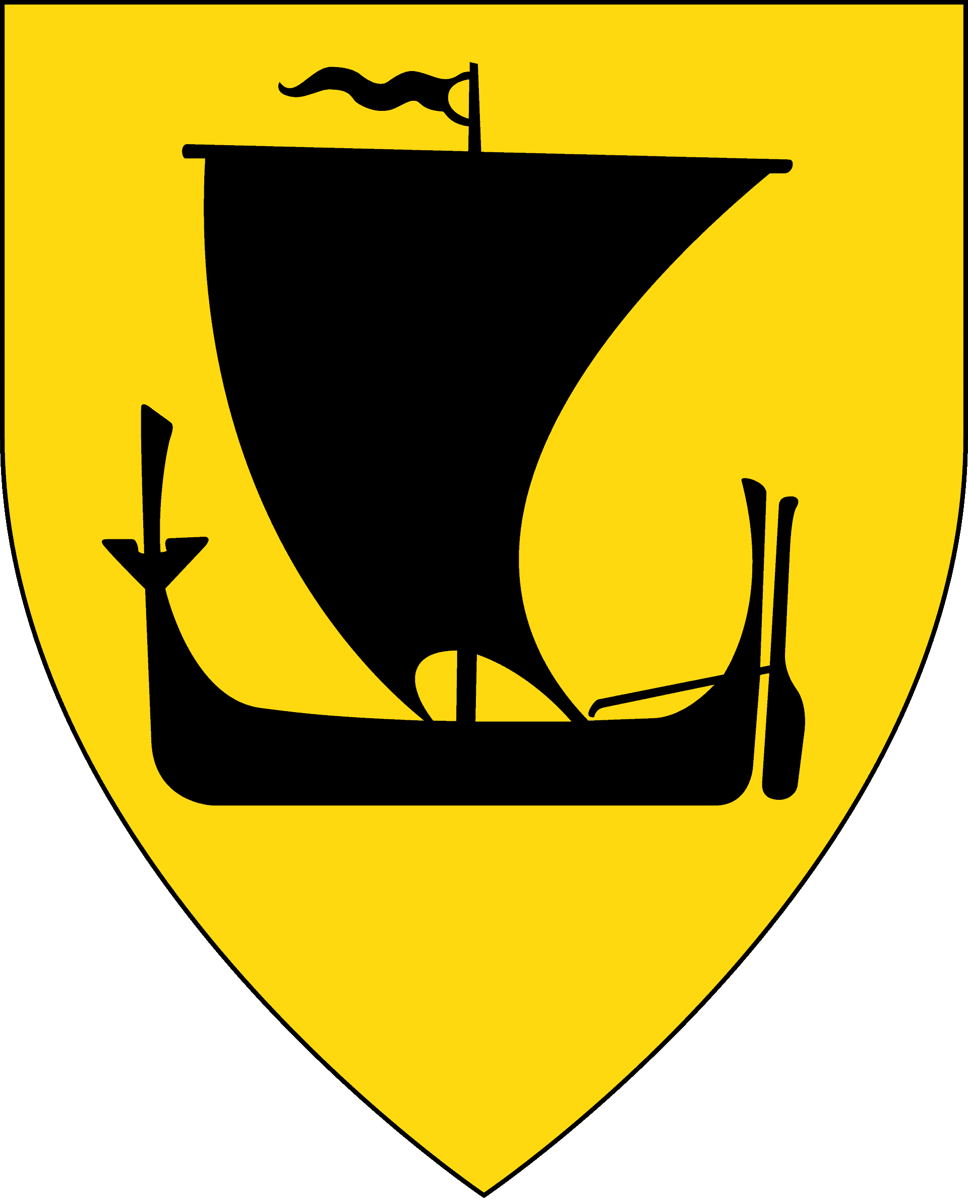
Narvik Municipality
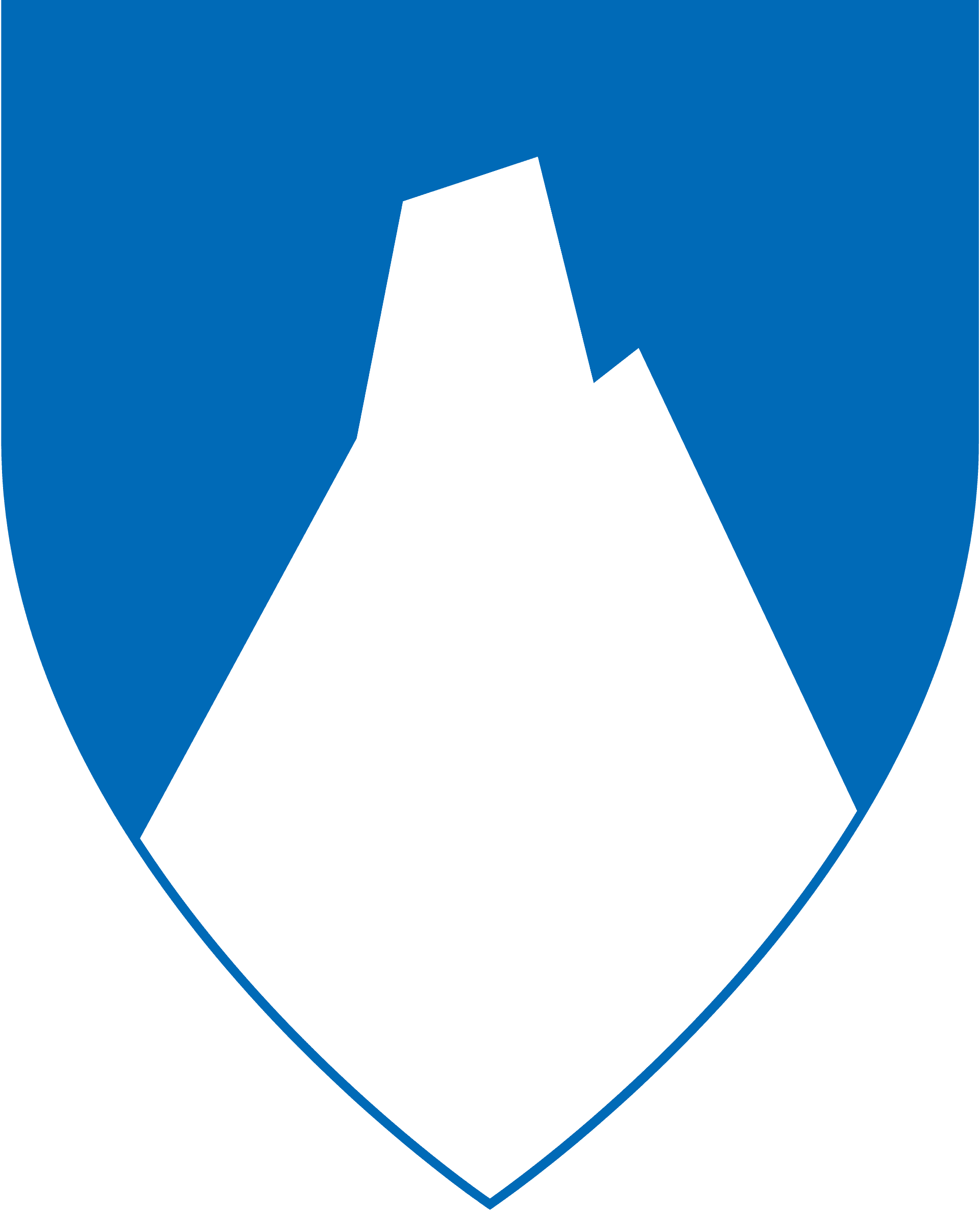
We have now crossed into Narvik municipality. We’ll talk more specifically about the town later. The municipality is fairly large and is located in the northernmost part of Nordland county. The population is around 22,000, and it has grown by 18% over the last 10 years. The coat-of-arms represents the mountain Stetind, a well-known mountain peak in the area.
Most of the municipality is around the Ofotfjorden and the mountain peaks here reach as high as 1,700 metres (5,600ft). Forests cover the lower parts of the mountains, but near the summits snow can stay for most of the year. Narvik is the best-known area in northern Norway for alpine skiing; some of the slopes start on top of the mountains and end near the town centre. Wreck diving attracts divers to the area as there are a lot of wrecks in the harbour.
The economy is still largely based around iron ore, but there are some high-tech businesses in Narvik including Natach and the largest research institute in Northern Norway, Norut Narvik. Narvik was one of the first areas in the world to be affected by the financial cricis of 2007-2008 as it had invested in Citigroup securities. Narvik lost the equivalent of $18 million USD in August 2007 and the Norwegian government refused to bail them out, so Narvik was forced to implement severe budget cuts.
Bjerkvik
Village
Bjerkvik is a small village with a population of 1,159. It has the European Highway 6 and the European Highway 10 running through it, making it a major junction between Harstad, Narvik and Tromsø.
During World War II, Bjerkvik was almost destroyed by the bombardment of gunfire from allied warships that caused significant civilian casualties. A landing was conducted in the area by Franco-British forces, pushing the German forces several miles away.
During a NATO exercise in 1986, sixteen Norwegian soldiers died in an avalanche just east of the town. Later, in 2006, two grenadiers from the Telemark battalion died of a tank accident during another NATO exercise. The tank they operated went through the ice on a swamp, and only two of the four crew managed to get out alive. The Commission of Inquiry concluded that it was human failure on the part of the crew who operated the tank. Also, they found that the crew were using old maps and that the Armed Forces had been warned against moving off the road due to little snowfall and bad ice.
Ofotfjord
Fjord
The Ofotfjord is an inlet of the Norwegian Sea and a fjord that Narvik is built around. At 78km (48 mi), the Ofotfjord is Norway’s 12th longest fjord. It has depths of up to 553m (1814ft), and the mountains around the fjord reach peaks of 1500m (4900ft).
In the fjord are huge quantities of herring staying in the fjord in the winter. The fish attract a lot of whales, notably orca. Lobsters have been occasionally observed in the fjord, making them the northernmost lobsters in the world. Cod and coalfish is the most common fish species throughout the year, while mackerel is common between July and September. White-tailed eagles and Eurasian otters are common in and around the fjord.
The Ofotfjord was the scene of several naval battles during the Battles of Narvik in World War II. The fjord today is very popular among divers, though some of the shipwrecks are declared war graves and thus you cannot dive to them. The German destroyer Georg Thiele is still visible from the railway as it sits in the Ofotfjord. See pictures here.
Hålogaland Bridge
Bridge
This bridge crosses the Rombaksfjorden and is the second-longest bridge span in Norway. It was built to shorten the drive on the E6 between Narvik and Bjkerkvik. Financing for the bridge came from a mix of state grants and toll roads. At the time of its construction, it was the longest suspension bridge within the Arctic Circle and was featured on the Science Channel show Building Giants. The bridge officially opened on 9 December 2018.
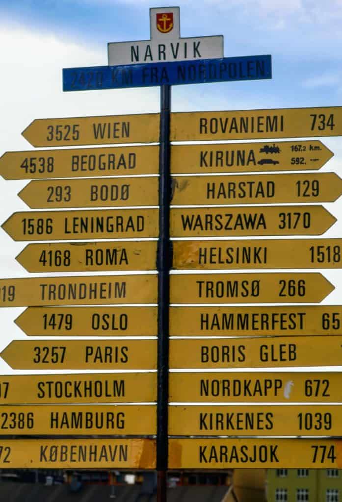
Narvik
We have now arrived in Narvik! A detailed overview of Narvik can be found on the travel guide section of The Hidden North.
Continue the drive

The E6 between Narvik and Mo i Rana
Continue on the E6 south to Mo i Rana. On this part of the drive, you cross the Arctic Circle!
Previous Drive

If you liked this drive, or if you have any travel tips, please leave a comment in the section below!