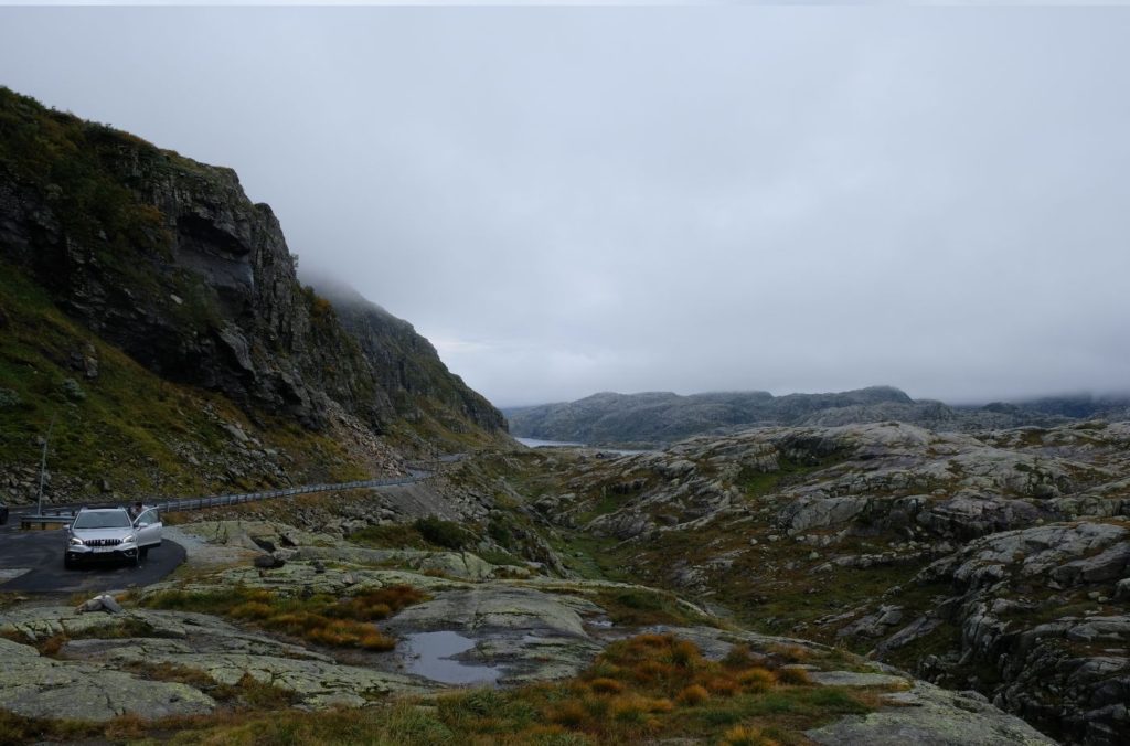
Rocky mountains, steep cliffs and scenic views. The Ryfylke Scenic Road is a true gem of southern Norway; built to serve the new hydropower plants, it’s hard to believe that this wasn’t designed as a tourist road. Today, it’s a scenic alternative to the main highway between Bergen and Stavanger.
I did the Ryfylke Scenic Road in September 2020 as part of my Ultimate Norwegian Road Trip. Here’s my driving guide with what you can see and experience, as well as a summary of the history and significance of each major sight. I’ve also included as much practical information as I can so you know exactly what to expect on the road.
Facilities including supermarkets, toilets, petrol, hotels, cafes, restaurants with addresses.
Watch on Youtube
All of our roadtrips are available on YouTube to watch. They include information about the area provided in text and voiceover form, plus they show the drive in full (sped up in some spots!) so you can get an idea what the drive is like.
Odda is a small industrial town located at the end of the Sørfjorden. It’s growing in popularity thanks to its nearby natural attractions, namely the Troll Tongue hike and the Folgefonna National Park.
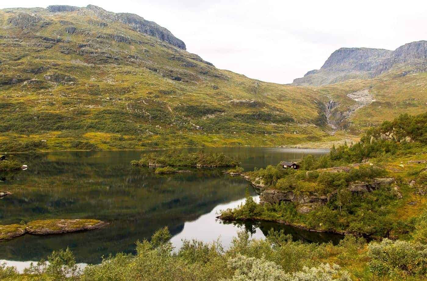
Sandvinvatnet is the lake you’ll pass immediately after leaving Odda. The lake is 4.3km2 (1.7 sq mi) and is close to the Buarbreen glacier, which is on the opposite side from where we are driving. You can take a detour there, but it adds considerable time.
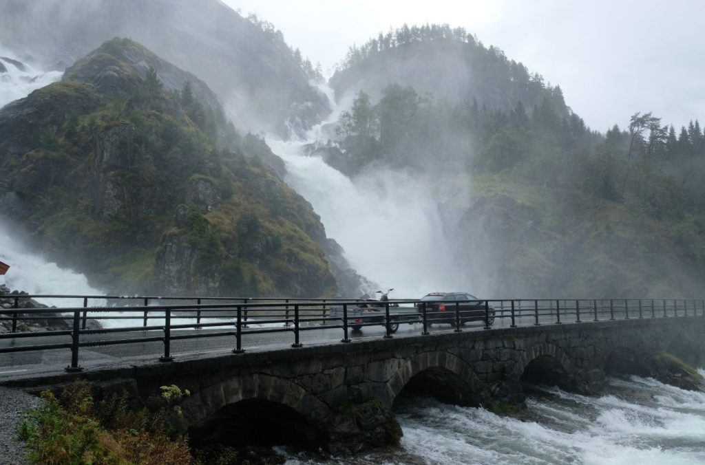
Låte Waterfall (Låtefossen)
Waterfall
This is one of the most popular places for visitors to take photos, and understandably so! It’s just before the village of Skare.
The waterfall is 95m (312ft) high and is well-known for the two separate streams flowing down from a lake on the hill. They then go under the E13 highway, and there is a historic stone six-arched bridge over the falls.
There is a carpark and footpath here. Just keep in mind it’s still a major highway so cars do rush past, and parking is very limited for such a popular attraction.
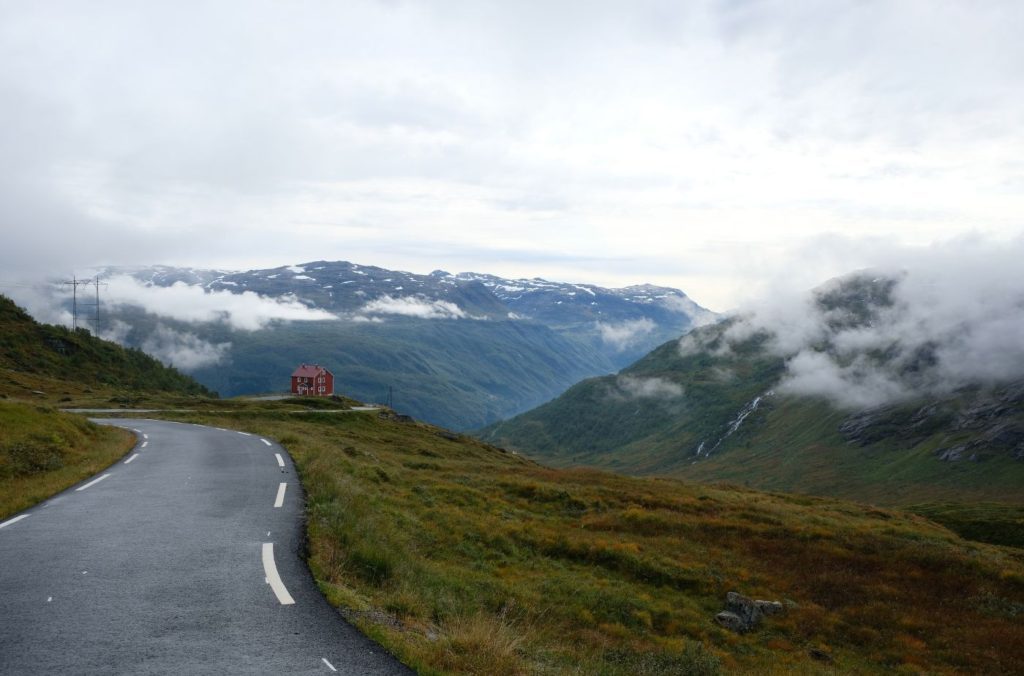
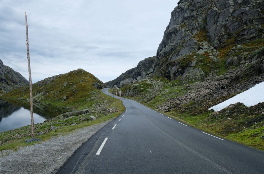
If you’re short on time you can opt to take the tunnels to Horda, but if you want to see some scenery you can take the old road over the mountains to Horda. The turn off is just before the Seljestadtunnelen.
The Seljestadjuvet road has recently been re-paved so it’s a modern road, but it’s very narrow and consists of several hairpin bends. The road was built between 1859 and 1865 and is considered a piece of Norwegian history. The repaved road is newer than this; it is possible to hike the original 1850s road. Pilgrims used to use this road as they made their way to the historic Røldal Stave Church; it was also used by traders on their way to Røldal Market and travellers on their way east.
The road is only open for vehicles under 2m.
You can see the entire road on my YouTube video.
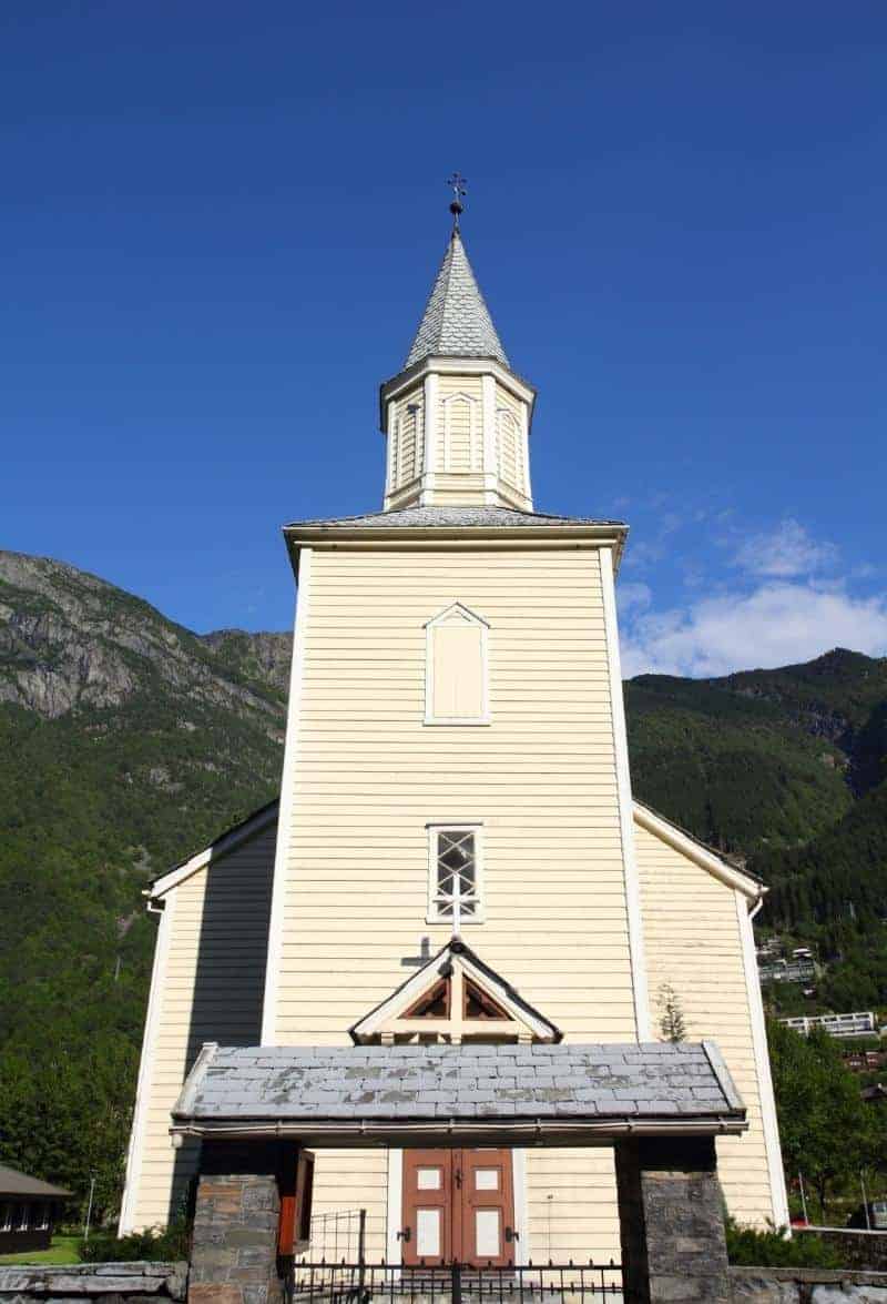
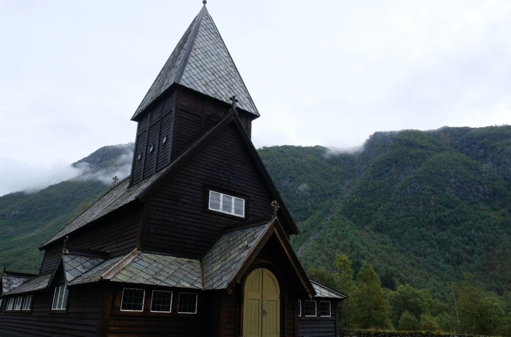
Røldal Stave Church
Stave Church
Click the button below for my overview of Røldal Stave Church.
Rogaland is a county in the south-western part of Norway. The first element of the name comes from rygir, which refers to a tribe that used to live in the area. The second element, land, means ‘land’ or ‘region’. Finds of skeletons have been found from the Stone Age, while many items from the Bronze Age and Iron Age have been found. Many crosses in the Irish style have also been found.
The coastal part of Rogaland was important during the Viking Age and rich finds indicate that there was strong chieftainship here from the Iron Age. Stavanger was a centre of power.
Sauda Municipality
Sauda’s business life is primarily based on metal processing, and unlike the rest of Rogaland there is no focus on agriculture here.
The way the landscape was formed comes from the last Ice Age. The ice that slid down from the Sauda mountains collided with a glacier. This collision created the Hylsfjord and resulted in the Saudafjord meeting the Sandsfjord. The narrow straits make it difficult for ships to call at the port of Sauda. During the Nazi occupation, the Germans planned to build a canal to make it easier. The plateaus were formed approximately 10,000 years ago during the last Ice Age.
Sauda
Town
With a population of 4,254 inhabitants, Sauda is the fifth largest town in Rogaland county. It is primarily an industrial town. From the medieval period onwards, waterfall power was used to run sawmills. People from all over the world, especially the Netherlands, started to traude with Sauda. By the end of the 19th century mining began here. In 1910 the American company Electric Furnace Company began the construction of then Europe’s largest smelting plant, which could only be built because of the large number of waterfalls. During World War II, the Germans built a large aluminium melting plant, though those buildings have since been demolished.
Sauda has historically been an important area for industry. It is home to Northern Europe’s largest melting plant, Eramet AS.
Svandalsfossen
Waterfall
Svandalsfossen is a beautiful waterfall located just outside Sauda. What makes the waterfall interesting is that there is a staircase with 540 steps leading up the side of the waterfall. The staircase system was built in 2006 and if you make it to the top you’ll be rewarded with a nice shower from the waterfall.
You’ll see brown tourist signs pointing to the carpark as you get close. If you don’t wish to park, you will very clearly see the waterfall as you drive past it.
Suldal Municipality
Suldal is a small agricultural municipality in the traditional Ryfylke district. The area has a long history of trade connections to the nearby valley regions in the north and east and is located on the historic trade route. The administrative centre is Sand i Ryfylke.
Hålandsosen
Settlement
Hålandsosen is the next settlement you’ll drive through. Here you’ll see the Erfjord Church, which is a white, wooden church from 1877. There is also a historic home here called Storgarden i Erfjord, which is part of the Ryfylke Museum. The museum was built in the 17th century and is open for private tours.
Hjelmeland Municipality
Hjelmeland is a municipality within the traditional district of Ryfylke. Traditionally, agriculture and fruit growing have been the most important industries. There is some heavy industry here too, with a large sand outlet at Årdal. Sand is collected in the village, cleaned and then exported on ships. At Hundsnes there is a salmon abattoir. The traditional Jaeren chairs also come from here.
Nesvik - Hjelmeland Ferry
Settlement
This is where you take the only ferry on this road-trip to Hjelmeland. Just follow signs to Stavanger & Hjelmeland to get onto the ferry. The ferry runs approximately every twenty minutes.
Hjelmelandsvågen
Village
Hjelmelandsvagen is the small village on the other side of the ferry.
One of the more unique things to visit here is the “World’s largest traditional Jærstol” (Jaeren Chair). It is clearly marked on Google Maps.
Årdal
Town
Årdal is a small village in the Hjelmeland municipality. The main industry here is sand, crushed stone and gravel, with about one million tons shipped every year.
Located in the village is the historic Old Årdal Church. The church was built in 1620, though the earliest church documents date back to 1308. The first church on the site was a stave church likely built in the 13th century. The new church from 1620 was built using some of the materials from the stave church and part of the foundation under the southwest corner is on the same foundation as the medieval stave church.
In 1919, the new Årdal Church was built about 600 metres to the southwest of the old church, and since then Årdal Old Church has not been used regularly. It is still used for weddings and concerts.
Strand Municipality
Strand municipality is known for its production of fruit, vegetables, and dairy products. There are also some mills located in the municipality. The coat-of-arms shows three red water wheels on a grey background, symbolising hydropower in the region.
Tau
Village
Tau is a small village within Strand Municipality. The main employer here is Comrod Communications, which manufactures antennas for military use.
Ryfylke Tunnel
Tunnel
At 14.4km (8.9 mi) long the Ryfylke Tunnel is currently the world’s longest and deepest subsea tunnel at the time it was built. In 2023 Rogfast, another subsea tunnel in Rogaland County, is expected to open and take over the title from the Ryfylke Tunnel. The tunnel opened in December 2019 after six years of construction.
When you come out on the other side, you are in Stavanger.
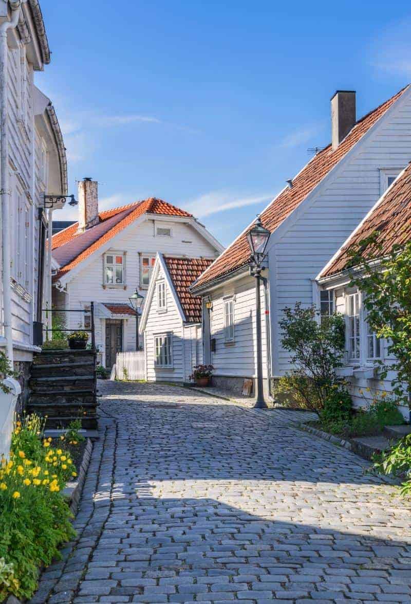
Stavanger
Stavanger is an interesting city with strong Viking connections. However, today Stavanger is known throughout Norway for being the centre of the oil industry.
This drive is part of the multi-day series “The Ultimate Norwegian Road-Trip”, which is a 10 day road-trip to the best spots in Norway. You can view the entire drive below.