Hurtigruten

  • Preparation & Embarking the Hurtigruten in Bergen

    Preparation & Embarking the Hurtigruten

    If you’re reading this article, there’s a good chance you’ll be embarking on a Hurtigruten voyage out of Bergen – lucky you! Often considered the world’s most beautiful voyage, the Hurtigruten is a daily ferry service that goes from Bergen to Kirkenes, and then back again. Along the way, the ship stops in 34 wonderful ports over 6 days. Once in Kirkenes, the ship repeats the same journey back south to Bergen.

    Embarkation day can be a stressful day, especially since information isn’t always exactly clear. However, I have done the Hurtigruten enough times to have a clear understanding of exactly how this day works. So, here is my guide to preparing for and embarking the Hurtigruten from the port of Bergen. 

    Embarking the Hurtigruten in Bergen

    Norway's Coastal Ferry

    Bergen is a port of call of Norway’s coastal ferry. Find my guide for the coastal ferry by clicking the link below. 

    Why trust me?

    I’ve been taking travellers on the Hurtigruten since 2019! I love taking the Hurtigruten so much that I have even taken it for a vacation. I believe it is one of the best ways to see Norway, and I encourage everyone to do the voyage at least once in their lifetimes. 

    Above you can see some of the cabin cards I’ve collected over the years. 

    Preparing to Board

    Before you even get on board, there are lot of questions about what you need to pack, what to expect on board, and just generally how things work. Here are some of the key things you need to know ahead of boarding: 

    Important! Hurtigruten FAQ

    Hurtigruten has an excellent FAQ page that you should read as well.

    You can find it here: https://www.hurtigruten.com/en/practical-information/coastal-express

    What currency is used on board? Can I use my credit card?

    The currency used on board is Norwegian Kroner (NOK). It may be possible to exchange currencies on board, but you may not get the best rate. There is a Forex in Bergen should you wish to get currency exchanged in advance.

    That said, you do not need cash on this voyage. On the ship you can pay for everything with bank card. In fact, when you check in at the Bergen terminal the staff will encourage you to open a cruise account. With a cruise account, your credit card is synced to your cabin card and you make all purchases onboard using your cabin number or cabin card. On the last night on board, the amount is charged to your credit card.

    The only time you may want cash is to leave a tip. There is a tip box in the restaurant where you can put cash.

    Is there a dress code on board?

    No. You can wear whatever you like on the ship, and that’s one of the reasons I love it. There’s no formal nights, but if you are on board for the Captains Dinner (Day 10), you may want to bring something nice to wear. But generally the atmosphere is laid back and relaxed.

    What do I do if I have allergies, dietary requirements, or need to keep medication in a fridge?

    Each night at dinner you get to choose between a meat, fish or vegetarian meal, and there are plenty of vegetarian and vegan options at breakfast and lunch. If you have a special diet or allergy, you need to alert the restaurant manager outside the restaurant when you board the ship. It’s also possible to alert them in advance when you book, but I would recommend double checking on board.

    If you have medication that needs to be refrigerated, there are no fridges in the cabins. Rather, simply give them to reception who will store them in a fridge for you.

    What electrical adapters should I bring?

    The sockets used on board are the 220v AC, two-pin Continental type. Basically, standard European plugs. The ship doesn’t offer adapters, so it’s important to come prepared. In Bergen, you can pick them up at sports store or electrical stores.

    Is there a laundry?

    There is a laundry on the ship with washing machines, dryers and irons. To use the machines, you purchase tokens from reception (for approximately 30 NOK) and put them into the washing machine. The detergent is in the machine already. The dryers are used for free.

    What should I pack that I may not be thinking of?

    Bringing a swimming costume and gym clothes. Some of the ships have hot tubs on board and all have gyms. Also, there are towels and hair wash/body wash in your rooms.

    You may also want to bring a lanyard to hold the cabin card. They do sell them on board, but if you have one at home it’s worth bringing it.

    I highly recommend bringing ear plugs and a sleep mask (if travelling in summer). The ship is noisy in the middle of the night, and you will get woken up when docking in the ports. Bring some ear plugs to tone down the noise. Why a sleep mask? Well, in summer it’s light 24/7. While the curtains do an okay job at blocking out the light, I find it just isn’t dark enough. 

    Hurtigruten Day-By-Day Guide

    Did you know I’ve written a day-by-day guide for Hurtigruten? You should read that after you’re done with this! Check it out by clicking the link below. 

    Hurtigruten Day-by-day Guide

    My Hurtigruten book will be coming out in May 2025 🙂 If you want to be notified when that’s released, follow me on Facebook:

    My Facebook Page

    Embarking Hurtigruten in Bergen

    Alright, you’re packed and ready to go. You’ve arrived in Bergen, and now you need to get to the ship. What do you do? Here’s the step-by-step guide!

    When is the terminal open?

    The terminal is open from 1pm to 8pm on departure days.

    Getting from the airport to the terminal

    The journey from the airport to the terminal takes approximately 45 minutes if you take the Flybussen (Airport Bus). You take it from platform A5 in front of the arrivals hall. You can find exact times on their website: https://www.flybussen.no/en

    If you take a taxi, the drive time is approximately 20 minutes. Be careful which company you take; some companies charge 20% more than others. If you want to take a taxi, I recommend downloading the 07000 Bergen Taxi app and booking a taxi. You can book once you pick up your suitcase; it typically takes the taxi 2-3 minutes to appear at the “preordered taxi” pick up zone.

    Getting from a hotel to the terminal

    The terminal is located a little ways outside the city centre, so I recommend booking a taxi (use the same method as mentioned above).

    Storing luggage at the terminal

    You can store luggage at the terminal. The luggage lockers are on the first floor of the terminal and can be paid for by credit card. It is possible to drop off the luggage between 1pm and 2:30pm.

    What time should you arrive?

    You can arrive at the terminal any time after 1pm, but I do encourage waiting until the evening. I know, it’s very exciting boarding Hurtigruten and seeing the ship, but the terminal itself is not so fun. Bergen is a great place – stay in town and explore!

    Tip – while the terminal opens at 1pm, do not come and try to check in between 2:45pm and 3:15pm. This is when the ship is arriving and the passengers are disembarking. To put it mildly, it will be chaos. 

    In Bergen, the embarkation time if 4pm (16:00). However, that doesn’t mean you have to board at 4pm. In fact, you can board as late as 8pm if you really wanted.

    I recommend boarding the ship between 5pm and 7pm. The reason is that the cabins are not ready until 6pm, and that’s the same time the buffet dinner is served. If you arrive before then, you’ll basically just be sitting around on the ship. The Expedition Team may not yet be on board ready to take excursion bookings. So really, you’re just sitting around. Bergen is a pretty wonderful place, so go out and enjoy it!

    I Love Bergen Walking Tours

    I operate walking tours in Bergen and you should absolutely do one while you’re in the city! 

    Click here for more information. 

    The Hurtigruten Guest Lounge

    The Hurtigruten Guest Lounge is located on the second floor of the terminal and is open from 1pm. There are some pastries and drinks that you can have, as well as free Wifi, USB chargers and sockets.

    When checking in at the terminal in Bergen, you simply have to hand over a form of identification, which in most cases is your passport. You will then get the envelope with your cabin card and some practical information inside. The reception will then ask if you want to sync your credit card to your cabin card. While I highly recommend doing it here, keep in mind you can also do it at the reception on board the ship.

    This is the envelope you receive. On the bottom left side, you have all the meal times of that day (lunch changes every day so be sure to double check). The dinner time is your set time, and the table is your assigned table. Remember – this is not for the first night in Bergen! Night one in Bergen is free seating and a buffet, so come whenever you want.

    In the bottom right, there’s all my practical information.

    In the top right, the “SEL” means “Select” package – I paid a little extra for coffee/tea and free Wifi. The Wifi slip is in the envelope. 

    My cabin number is also written here. This is important – it’s not written on your cabin card! This is for safety reasons. 

    Here is what the cabin card looks like. You can see SEL on the cabin card – this is important as the staff will ask to check this when you get coffee or tea. I can also see the dates I’m board, where I’m embarking and disembarking, and what meals I get. It also says that I’m an Ambassador Member, i.e. in their loyalty program. I’m sure that gets me extra benefits, I’ve just never used them. 

    What happens with your luggage?

    Unless you are embarking or disembarking the ship at the terminal in Bergen, you need to carry your own luggage on and off the ship at all the other ports.

    In Bergen, you drop off your luggage when checking in at the counter in the terminal. They put it on a luggage belt, like at an airport, and it goes to the back of the terminal where crew take it on the ship and put it outside your cabin.

    The Safety Briefing

    It is a safety requirement that all passengers attend the safety briefing inside the terminal at Bergen. Once you have checked in and dropped off your luggage, you take the escalator to the upper floor, where there’s a waiting room. Inside the waiting room are free snacks and drinks to keep you happy while you wait.

    If you’re boarding after 5pm, the safety briefings are pretty frequent. If boarding before 5pm, you may be waiting 30 minutes or more for the next briefing. They only run when there’s enough people ready to board.

    The briefing lasts for about 10 minutes and includes a video in Norwegian, English, German and sometimes French. It includes a demonstration of how to put on a life jacket and the instructions to be followed in the event of an evacuation.

    Going on Board

    Once the safety briefing is over, they’ll scan your cabin card so they know you’ve attended the briefing. Then, you’ll walk through the terminal (it’s a long walk!) to get to the place where you board the ship, You’ll have to scan your cabin card again; this time, it’s scanning you in so the staff know you’re on board.

    In Bergen, you embark on Deck 5. Normally once you embark, there is a counter promoting the drinks packages. From Deck 5, head down one level to Deck 4, which is where the reception, expedition team, and restaurant is.

    Wifi

    Yes, one of the first things people want is Wifi! Completely understandable.

    If you have a SEL package, or your documents say you have Wifi included, you’ll get a special Wifi slip in your envelope. About 30% of the time the staff have forgot to put mine in the envelope, which is fine. If this happens to you, just go and ask reception (Deck 4) for one. They’ll give it to you no issues 🙂

    Wifi is a bit of a pain to use as many don’t see that you have to log in two separate times. 

    First you connect to the Wifi on your device and enter the first password on the slip. Then, a popup window will come asking for a username and password. That’s where you enter the second username and password on the slip. Many people (myself included!) miss that.

    Now – the Wifi works fine. However, if you have data in Norway, you may just want to stick on 4G/5G – especially if you have unlimited. I find my 5G (Norwegian Simcard) is faster than the Wifi. 

    Dinner

    The first nights dinner is always a buffet dinner. Dinner opens at 6pm and I highly recommend going early; if you wait until after 7pm, it can get very crowded. Dinner often closes at 9pm. You do not sit in your assigned seats on this day.

    Sail Away

    When the ship leaves at 8:30pm, the expedition team and crew will normally have a little party out on the open deck, where they sell champagne. If the weather is miserable in Bergen, they may not do this. 

    Welcome Meeting

    Normally after the departure from Bergen, perhaps at 9pm or 9:30pm, the expedition team will have their first meeting. I highly recommend going to this!

    During this meeting, you’ll get an introduction to the crew (they come and say hi), the layout of the ship, and important practical information that you need to know. Trust me, it’s worth going to this meeting. It lasts up to 40 minutes.

    Daily Schedule

    Before going to bed, be sure to check out the daily schedule for the following day. This can be found on television screens all around the ship. Some ships also print the daily schedule. 

    Be sure to not only look at the schedule to see which ports you’re docking in, what the lectures are, and so on, but there are also the meal times on the right side. 

    Time for Bed!

    It’s been a long day, and normally by the time the meeting is over you’re done and ready for bed. 

    Norway's Coastal Ferry

    Bergen is a port of call of Norway’s coastal ferry. Find my guide for the coastal ferry by clicking the link below. 

  • Highlights of Ålesund Self-Guided Walking Tour

    Highlights of Ålesund Self-Guided Walking Tour

    Located on the west coast of Norway, Ålesund is a town not to be missed. The town is famous for its Art Nouveau architecture and has regularly been voted Norway’s most beautiful city. But it’s beauty arose from devastation; in 1904 a fire devastated the entire city, with almost all the wooden buildings in Ålesund destroyed. Like a phoenix, Ålesund rose from the ashes and is now a lively, thriving community.

    This walking guide is designed for people visiting on the coastal ferry but is suited to everyone. The walk starts at the Hurtigruten pier and ends at the hiking path for Mt. Aksla.

    The online version is simplified; if you want something with directions, depth and recommendations of things to do, consider buying our downloadable version. 

    In this article...

    The E39 Highway

    Ålesund is located on the E39, the main highway along the west coast. You can find my guide to the E39 by clicking the link below. 

    Norway's Coastal Ferry

    Ålesund is a port of call of Norway’s coastal ferry. Find my guide for the coastal ferry by clicking the link below. 

    Downloadable Version of This Guide

    We offer downloadable versions of our self-guided walks on our online store. 

    Online Guide

    Downloadable Guide

    Ålesund Self-Guided Walking Tour

    This walk begins at the Hurtigruten pier. 

    Skateflukaia & Skansekaia

    These are two piers that are located between the Hurtigruten pier and the tourist office. 

    Here you’ll find a national monument commemorating the Shetland Bus, which ran between Ålesund and the Shetland islands between 1940 and 1945. During World War II Ålesund was described as ‘Little London’ because of the illegal resistance activity in town and because so many people managed to escape to England via Ålesund.

    The monument was unveiled by Crown Prince Haakon on the 8th of May 1995. 

    There is another monument here for the fire of 1904. It is a row of four columns with images of the devastation from the fire. 

    Kongens gate

    Kongens gate is where you will see some beautiful examples of the Art Nouveau architecture. Start at the higher numbers and work your way down. 

    Kongens gate 28

    This is home to the Bjørknes School. You can see a difference in architecture compared to number 25. Both were built in the same period after the fire, but number 28 is more inspired by Central European art nouveau, while number 25 is inspired by Old Norse design, and it has taken inspiration from stave church buildings in Norway that fused Norse and Christian religions.

    Kongens gate 25

    The building burnt down in 1970. The only thing that was intact after the fire was the façade facing Kongens gate. There were discussions about demolishing it, but the town planning manager convinced the owner that it could survive.

    Kongens gate 21

    Number 21 is inspired by the Norwegian dragon style, which drew its motifs from the Norwegian Viking period.

    Kongens gate 18

    Kongens gate 18 is interesting because the building is actually a copy of the building that used to stand there. The original building was very dilapidated by the 1970s, so it was torn down and rebuilt as a copy. 

    Kongens gate 10B

    Kongens gate 10B is the most unique building on the street. The shape results from the rebuilding after the fire. It broadens out as it goes back. The building is so narrow that access to the upper floors is via the neighbour’s front door. The architect Karl Norum designed the building. The stone cladding is heritage listed.

    The Thousand Steps and Lihauggata

    Despite being known as ‘The Thousand Steps’, these 53 steps lead up to Lihauggata, one of the few remaining hills in town.

    Many of the original hills have been blasted away and flattened out as Ålesund was developed.

    The only victim of the town fire lived here. Ironically enough, she was the next-door neighbour of the fire station, which was also here. She was an older lady who safely escaped the fire, but decided she must take her possessions with her, so she returned to her home.

    Kongens gate 6

    This is a good example of well-preserved Årt Nouveau where the old style is looked after.

    Avisgutten

    On Kongens gate you’ll see a statue of a paperboy. It was donated to Ålesund by the newspaper in 1998.

    St. Olavs Plass & the Rønneberg Building

    At the end of Kongens gate you’ll cross a square called St. Olavs Plass.

    Walk out of Kongens gate, cross St. Olavs square and continue towards the Rønneberg Building (Notenesgate 9). The Rønneberg building was built for the Carl E. Rønneberg and Sons company in 1907 by the waterfront and was a trading company. This area is where the most traditional Ålesund companies have been since 1812. The building is clad in local light marble.

    Most of St. Olavs Plass and the roads here are built on reclaimed land.

    Arbeideren

    Arbeideren is the former trade union building that was completed in 1906. The distinctive façade is a mix of Art Nouveau detailing and ornamentation.

    It is now one of Norway’s finest public festivity centres and it is an important part of Ålesund’s social and cultural life.  

    On the other side of the building from where you are you can see ‘Arbeiderforening’ written on the building, which refers to the trade union. 

    Ålesund Strait

    Ålesund is spread out over multiple islands. The islands are interconnected by bridges and subsea tunnels. Ålesund’s town centre is built around the narrow sound Ålesundet, between the islands Åspøya in the west and Nørvøya in the east.

    From here you get a good view of the strait that runs through Ålesund. The ‘sund’ in ‘Ålesund’ means ‘strait’. 

    Art Nouveau Centre

    This is the old Swan pharmacy, built as a chemists shop and private residence for the Øwre family. The building was later bought by the Ålesund Savings Bank and was restored externally.

    The actual chemist’s shop is still intact inside. The chemist’s shop is one of the oldest institutions in Ålesund. From as early as 1819 there was a chemist here, until it closed in 2001 and the Art Nouveau Centre moved in. The centre has exhibitions spread across three floors. They have art nouveau ads, jewellery, and several multimedia presentations. The cobblestone is from 1915 – before then it was unpaved and quite dusty and muddy. 

    The Herring Wife

    Across the street from the Art Nouveau Centre is a statue of the herring wife – commemorating the role women had here in Ålesund. They were primarily the sellers of the fish. 

    Ålesund Church

    The church was ready to be consecrated in September 1909, so it is not an old church. However, the old Ålesund Church used to stand on the same site. 

    The first Ålesund Church was built in 1854. It was 50 years old when it burned down. The architectural competition jury received 63 proposals in response to its invitation to tender a new church.

    The church is heavily inspired by medieval times and therefore had small windows, making it very dark. The architect combined Norwegian church architecture with Jugendstil.

    Nedre Strandgate, Prestbrygge and Storneskaia

    This area is where historically the klippfisk (clipfish in English) was loaded onto boats. 

    Ålesund is one of the biggest export ports in Norway for klippfisk. This is without a doubt the most important basis for Ålesund’s growth as a trading town.

    Ålesund Town Hall

    Ålesund Town Hall is one of the classic 1970s style office buildings in Norway. It has been voted the second-ugliest building in Norway, and rightly so!

    Kaiser Wilhelms Gate

    The area here is called Kipervika and is named after the barrel makers who lived here. In the 1950s the sea came up to where the benches are. 

    The street is named after Kaiser Wilhelm. He often holidayed in the Norwegian fjords on his yacht Hohenzollern and was a great admirer of the west country landscape on the Sunnmøre Fjords. When he heard about the fire in Ålesund he ordered three fully loaded ships carrying food, medicine, building materials and blankets to Ålesund. Help also came from other parts of the world, but the assistance from Kaiser Wilhelm II was magnificent and he stole the show and overshadowed the other providers of assistance.

    Ålesund's Old Prison

    On the corner of Rådhusgata you’ll see the old prison. The building dates to 1864; during the fire in innards were destroyed but the stone walls survived. The state lion is above the entrance. It was formerly the district Court and prison. 14 prisoners were inside at the time of the fire. When the gaoler realised the prison as going to catch fire, he left them go but told them to come back the next day. Today it’s a prison admin building.

    Ålesund Town Park

    The park was designed in 1885 with the purpose of being for the pleasure and recreation of the townsfolk, who were beginning to be inconvenienced by the noise of wagons and other racket. The pattern was the English park landscape, with footpaths winding around hillocks and between the verdant trees and flower beds. The park got a major facelift in 2010.

    The vegetation is found in other parts of the country. A surprise is the Chilean tree, the monkey-puzzle tree. It was brought to the town from South America by sailors from Ålesund at the beginning of the 1900s.

    Thanks for coming!

    I hope you enjoyed this walk around Ålesund. Be sure to go and have the best fish and chips in town close to the pier before leaving! You can find more information about Ålesund via our travel guide page. 

    Norway's Coastal Ferry

    Ålesund is a port of call of Norway’s coastal ferry. Find my guide for the coastal ferry by clicking the link below. 

  • Andersgrotta, the Bomb Shelter Beneath Kirkenes

    Andersgrotta, the Bomb Shelter Beneath Kirkenes

    Kirkenes, a small town located about 10km (6 mi) from the Russian border, is a fascinating place to visit. It is the turning point of Norway’s Coastal Ferry (Hurtigruten & Havila), so it is easily accessible for visitors to Norway. The town itself is very sleepy today, so it’s hard to imagine that during World War II it was one of the most important places for the Nazis in their fight against the Soviets. In fact, Kirkenes is the most bombed place in Europe after Malta.

    There are two attractions in town that cover World War II history. The first is the Grenseland Museum, located a little ways out of town and covering more the history of border relations between Norway, Finland and Russia, and the second is the Andersgrotta bunker, a complex system of tunnels beneath the town itself. Andersgrotta is offered as an excursion on the Coastal Ferry but it is also possible to visit it yourself while visiting the town.

    Here’s an overview of why Andersgrotta is significant as well as what you can see on your visit.

    In this article...

    Norway's Coastal Ferry

    Kirkenes is a port of call of Norway’s coastal ferry. Find my guide for the coastal ferry by clicking the link below. 

    Be sure to check out our Kirkenes travel guide! Here you can find all our recommendations of things to do and see, including our self-guided road-trips. 

    Kirkenes During World War II

    After Norway was occupied by Nazis, Kirkenes became a strategic town due to its proximity to the Soviet Union. Its importance increased when Operation Barbarossa put Kirkenes right on the front lines. Additionally, Murmansk is an ice-free harbour and one of the only ones with access to the ocean, and the Allies were sending ships there to keep the Russians well-stocked to push the Nazis out of St. Petersburg and Russia. The Nazis used Kirkenes as a base to bomb these ships but also try and invade the Soviet Union. Because of these attacks, Kirkenes was bombed more than 300 times, while air raid alarms were held more than 1000 times.

    Andersgrotta Bunker

    This is the largest bomb shelter in Kirkenes. It was built in 1941 to protect the civilians of Kirkenes from the repeated bombings of the war. Because of the air quality, people couldn’t stay all night but would come down every time there was an alarm. Babies were born here, livestock was kept here, and people just did everything they could to survive. In total, the shelter had enough room for 2500 people. Somehow they survived down there – though it still remains a bit of a mystery.

    After the war, Kirkenes was left in ruins. These bunkers became places where people could live while waiting for their home to be built. This took a while as there aren’t many trees in Northern Norway, so much of the timber had to be imported from the south. Many of the civilians also used the caves out at the mines, approximately 10km from town. Andersgrotta was never used for mining; it is purposely built as a bomb shelter.

    Visiting Andersgrotta

    To get inside, you go down a staircase under the Norwegian flag. It is very cold inside – around 0C – and the air feels musty and damp. You hear dripping water everywhere. There is electrical lighting in there today, but during the war there was no electricity, plumbing, or ventilation systems. During the Cold War all of these were added in. You see one of the air vents when you go to the Russian monument.

    Andersgrotta

    First your guide will show you a selection of images of Kirkenes from before and after the war, explaining the destruction that took place here.

    Next you will sit down and watch a 10 minute documentary that explains what happens in Kirkenes during the war. It includes fictional footage (acting of life in Kirkenes) but also documentary footage of the Nazis, the bombing, and the Soviet Union liberating Kirkenes.

    After the movie you have a chance to walk around. The complex consists of several corridors which lead to a number of exits.

    Outside Attractions

    Andersgrotta

    Guided tours include a visit to the Russian monument that sits on top of Andersgrotta. It may seem a bit surreal to have a monument to a Russian soldier in Kirkenes, but the town was liberated by the Soviets and has maintained a close, positive relationship with the Russians ever since.

    The monument is from 1951 and shows a Red Army soldier standing on a plinth. Originally the soldier was trampling a German eagle under his foot, as a symbol of the Soviet Union’s victory over Nazi Germany, but the political climate changed and the eagle was replaced with a rock shortly before the statue was unveiled.

    Book Your Tour of Andersgrotta

    Andersgrotta is managed by Snowhotel Kirkenes. Andersgrotta is open to the public daily at 12:30pm – you can buy tickets at the entrance or on the Snowhotel website. Otherwise, other times are only available via private tour. These are booked through Snowhotel Kirkenes: https://www.snowhotelkirkenes.com/andersgrotta

    Here is the Hurtigruten excursion to Andersgrotta: https://www.hurtigruten.com.au/excursions/norway/7a-the-norwegian-border/

    Here is the Havila excursion to Andersgrotta: https://www.havilavoyages.com/excursions/the-russian-border

    It is easy to walk here. The entrance is approximately 250 metres from the town centre, though it is not marked with signs.

    Norway's Coastal Ferry

    Kirkenes is a port of call of Norway’s coastal ferry. Find my guide for the coastal ferry by clicking the link below. 

    Be sure to check out our Kirkenes travel guide! Here you can find all our recommendations of things to do and see, including our self-guided road-trips. 

  • Top Things to do in Ålesund, including with Hurtigruten and Havila

    Top Things to do in Ålesund, including with Hurtigruten and Havila

    Ålesund’s beautiful architecture stands out, making it feel much more like being in Prague or central Europe over being in Norway. In 1904 a fire destroyed practically the entire city centre, and the city was rebuilt in a uniform style mostly thanks to funding from Kaiser Wilhelm, who loved vacationing in the region.

    Ålesund has been voted one of the most beautiful cities in Norway. While I must admit Bergen is a little more beautiful (I do live there, after all!), there’s no denying that Ålesund is probably a close second.

    Norway's Coastal Ferry

    Kirkenes is a port of call of Norway’s coastal ferry. Find my guide for the coastal ferry by clicking the link below. 

    In this article...

    Things to do in Ålesund

    The best things to do in Ålesund depends on how much time you have. If you are taking the Hurtigruten or Havila in winter and spring, it spends 10 hours in Ålesund, giving you a chance to enjoy a lot the city has to offer. Otherwise, you can spend a couple nights here and venture out into the magnificent fjord region.

    This guide is written for people coming both on the coastal ferry and coming independently.

    Join a walking tour

    I always recommend walking tours in Norwegian cities. There is so much history and so many stories in each place that you need a local telling you all about it. Ålesund has famous Art Nouveau buildings that you don’t want to miss, so get a local expert to show you around.

    Link: Ålesund City Walk

    Hurtigruten Excursion

    Havila Excursion

    See Ålesund by kayak

    The waterfront warehouses make them perfect for some kayaking. You can do an architecture-themed kayaking tour or go out to an archipelago near the island of Ellingsøya. The first is offered as a Hurtigruten/Havila excursion.

    Ålesund’s Kayak More Tomorrow rents out kayaks and organises day trips around the archipelago.

    Havila Excursion

    Hurtigruten Excursion

    Hike up Mt. Aksla

    No trip to Ålesund is complete without a visit to the top of Mount Aksla. It’s not a long hike – there’s 418 steps to the top – and from the top you’ll get an incredible view out to the city. The mountain is only 130m (426ft) high, and it should take you around 30 minutes to get to the top. Typically, if you see one photo of Ålesund it’s generally the photo from the top of Mt. Askla. If you are unable to go up the 418 steps, you can get a taxi to take you to the top – it has road access! Many bus tours of Ålesund will take you to the top. Once at the top, reward yourself with a stop at the restaurant Fjellstue.

    The hiking path begins at the city park (Byparken) and is clearly marked on Google Maps.

    Hike up Sukkertoppen

    See that mountain in the background of the above photo? Why not hike that one too! That’s Sukkertoppen (Sugar Loaf Top), a 314m (1030ft) mountain that isn’t too tricky. The hike begins in the parking lot of the Hessa School.

    Click here for more information

    Havila Excursion

    Visit the Museums

    Art Nouveau Centre & KUBE Gallery

    The main museum to visit in Ålesund is called the Art Nouveau Centre (Jugendstil Senteret, Apotekergata 16). The museum is located inside the old pharmacy building and is well preserved from when it was built in the early 20th century. The museum chronicles the famous fire of Ålesund in 1904 and subsequent rebuilding process.

    Next door is KUBE, a former bank building that now has an art gallery with temporary exhibitions.

    If you are interested in the early history of Ålesund, visit the Aalesund Museum. It has photographs, artefacts and paintings of Ålesund from before and after the reconstruction. It explains what life was like in Ålesund before the fire, and there is information about Ålesund’s critical importance as a Norwegian resistance base during World War II.

    To learn about Ålesund’s fishing heritage, visit the Fishing Museum (Fiskerimuseet, Molovegen 10) next door. It’s in a warehouse from 1861 (one of the few buildings to survive the fire) and has exhibitions on the development of fishing across the centuries and special sections on the klippfisk production.

    Visit the Marine Life at the Atlantic Sea Park

    Many people head straight to the Atlanterhavsparken, or the Atlantic Sea Peak, which is a huge aquarium famous in the country. Hurtigruten offers an excursion to the aquarium as well. It is a large-scale recreation of the Atlantic marine environment, including several enormous fish tanks; there’s also an outside area with walking trails and a place to go for a walk.

    Hurtigruten Excursion

    Havila Excursion

    Sunnmøre Museum

    4km outside the city centre is the Sunnmøre Museum. The buildings, which date from the Middle Ages, are arranged to display various aspects of local life. The buildings include cow sheds, shore-houses, stables, and dwellings. Outside are many ships – both original and replica – representing traditional 17th century vessels. The museum is home to the Kvalsund ship – the oldest complete boat ever found in Norway, dating back to 690 AD. It is believed the 18m (60ft) oak and pine warship had been buried in sacrifice to the gods before it was discovered in 1920.

    Hurtigruten Excursion

    Visit the Vikings at Giske

    Located just outside the city, Giske is a historic island known from the Viking Age. On the island you can do a 3km long ‘culture trail’. On Giske, the 12th century church is worth stopping by. The church is built of white marble and is Norway’s only marble church. There’s a small graveyard with a lot of graves with the surname Giske, indicating the importance of the island in Norway. Inside is a family tree showing the Giske family all the way back to the famous Viking Rollo. At Godøya, which resembles a giant piece of rock, you can do a nature walk of Valderøya to the grassy residential paradise of Giske itself. There are Roman and Iron Age finds on Valderøya, while the Mjelthaugen burial ground on Giske dates back to the Bronze Age.

    Try the Local Delicacies

    Bacalao is made from klippfisk from Norway

    Due to Ålesund’s importance as a fishing port, fish products are one of the most common menu items. They are also some of the best! Ålesund is a great place to try klippfisk, which is the salted and dried cod used to make bacalao. The downtown XL Diner specialises in klippfisk. Maki (Apotekergata) is a four or five course tasing menu with coastal flavours.

    Invit (Apotekergata 9b) is a café with perfect views to watch the yachts sail by, or you can head to Lyspunket (Kipervikgata 1) for a quiet lunch with Mexican-inspired dishes made with Norwegian lefse instead of corn tortillas. They also have lovely soup dishes.

    Shop Like a Local

    In Ålesund you can find some excellent places to go shopping. Artifex Kunst & Antikk sells second-hand goods and local art, while Jukebox sells records. If you want a big shopping mall, head to Ålesund Storesenter.

    Take a Day Cruise

    Ålesund is perfectly situated close to the popular Geirangerfjord and Hjørundfjord. In summer, it is possible to take a day ferry out to the Geirangerfjord, and it is highly recommended. If you are travelling with Hurtigruten or Havila, they go inside the Geirangerfjord from June to September, and then the Hjørundfjord during September and October.

    Havila Excursion

    Take a Day Trip

    Take a Day Trip by Car

    Ålesund is a short drive from one of Norway’s 18 national tourist roads, Trollstigen. It is a great way to get to the town Åndalsnes, where you can take the Romsdal Gondola to the top of the mountain for an impressive view over the city. If you’re taking the Hurtigruten or Havila, they have a day trip by bus to Åndalsnes and the Romsdal Gondola.

    Hurtigruten Excursion

    Another great place to go for the day is the Atlantic Road, which is between Kristiansund and Molde.

    If you want to stay a little closer, drive out to the island of Godøy and visit Alnes Lighthouse. This is also an excursion offered by Hurtigruten and Havila in the winter months. You can combine it with a trip to Giske if you want to learn about the Vikings. Alnes Lighthouse was built in 1876 and is still in operation, though today it is automated. The tower is open for visitors between May and October, and the old keeper’s house is now a café and exhibition hall. It’s only 30 minutes from Ålesund, so why not head out there?

    Hurtigruten Excursion

    Norway's Coastal Ferry

    Kirkenes is a port of call of Norway’s coastal ferry. Find my guide for the coastal ferry by clicking the link below. 

  • From World War II to Street Art: Bodø Self-Guided Walking Tour

    From World War II to Street Art: Bodø Self-Guided Walking Tour

    Located just above the Arctic circle, Bodø is a city of transformation. Built up in the late 19th century, this important fishing harbour was completely ravaged from bombing in the early days of the German occupation during World War II. Following the war, the city was rebuilt into a functionalist style. While not the most attractive architectural style by modern standards, Bodø is a fascinating city to walk around. The last ten years have brought huge growth and new modern structures to this mini metropolis, and Bodø has been named the European Capital of Culture for 2024. Explore the fascinating city of Bodø!

    In this article...

    Norway's Coastal Road

    Bodø is located at the end of the Fv17, which is Norway’s Coastal Road. You can find my guide to the Fv17 by clicking the link below. 

    Downloadable Version of This Guide

    We offer downloadable versions of our self-guided walks on our online store. 

    Online Guide

    Downloadable Guide

    Bodø Self-Guided Walk

    Hurtigruten Terminal

    This tour begins at the Hurtigruten terminal, which is where many people arrive in the afternoon to explore Bodø for a few hours with the Hurtigruten.

    The Hurtigruten is a coastal ferry that goes from Bergen to Kirkenes and back again, stopping in 32 ports along the way.

    The next terminal you’ll pass is where the car ferries go to Røst to Værøy as well as Moskenes in Lofoten. The ferry to Moskenes takes around 2.5 hours.

    Bodø Station

    Bodø Station is the terminus of the Nordland Line that was completed in 1961. The station is served by day and night trains to Trondheim (728km away), plus commuter trains to Rognan and Fauske. The trip to Trondheim takes 9 hours and 50 minutes and it is not electrified.

    The decision to build the railway to Bodø was made in 1923, but it was not completed until the 1960s due to lack of funds and World War II. The railway is also used by freight traffic.

    Kirkens Bymisjon

    On your left is Kirkens Bymisjon (Church City Mission), an organisation that conducts social work in Norway on a Christian humanistic basis. They focus on substance abuse, mental health, child welfare, elderly care, prostitution measures and church activities. The building on the left is where you can get assistance from the church, plus they also sell items second hand to raise funds for their services. It’s a great place if you love vintage shopping, or just want some unique souvenirs from Norway.

    Orestad Park

    The park is named after Ivar Orestad, a violinist who lived here.

    In 2021, it was renamed to Sissel Bjugns Park. Sissel Bjugn (1947 – 2011) was a Norwegian poet and children’s writer who lived in Bodø for a large part of her adult life (she was originally born in Bardu)

    After School

    Bodø is famous for its street art. In 2015, the first UpNorth festival was held here, where international and national artists were given the freedom to paint on some of Bodø’s walls.

    This artwork is titled After School and is by the Russian artist Rustam QBic. His paintings are known for being saturated with bright colours and a playful sense of the absurd.

    We’ll see a couple works on this tour, but if you are interested in seeing more Bodø tourist board has made a map of all the big artworks. You can view it here

    Bodø Town Hall

    Bodø Town Hall is the main municipal building in Bodø with the municipality’s political and administrative headquarters. The building was built after the war, and it was designed by Gudolf Blakstad and Herman Munthe-Kaas, who gave it a functionalist style.

    A new extension has been built at the town hall. It is designed by the Danish studio ALL (Atelier Lorentzen Langkilde). The façade geometry is designed to capture the changing light conditions in the Arctic. The building links together the older buildings from the 1960s, which will still be in use.

    About the extension: https://www.archdaily.com/931586/bodo-town-hall-atelier-lorentzen-langkilde

    Rådhusparken

    A brand-new park has been constructed across from the town hall. There’s Rådhusparken, the one we see, and directly behind it is Solparken. These are lovely open spaces with fun games for kids and nice places to sit as well.

    In the park you’ll find a monolith with a sign next to it. The monolith is from the Iron Age and was originally located close to the airport. There were at least five monoliths and several burials on the site, but it was moved here in 1952 to be closer to the museum.

    Bodø Cathedral

    The original church was built in 1888. It was yellow, wooden, and neo-Gothic. The church was destroyed during the bombing on 27 May 1940. In 1946, an architectural competition was held for the design of the new church. The new church was finished in 1956.

    The stained-glass window is 40 feet high, and it has a beautiful 5,000 pipe German-style organ.

    The church is built of concrete and has a basilica design. There is an external sculpture depicting Petter Dass. The church seats 890 people.

    The church has a 36m (118ft) tall free-standing clock tower with three bells. There is a memorial to those who died in World War II.

    Outside the city is Bodin Church, a stone church built in 1240.

    Nordlandsmuseet

    Recounting the short history of Bodø, this gem of a museum has an entertaining and informative 25-minute film with English subtitles on the town’s development. Highlights include a mock-up of the fishermans rorbuer, a section on Sami culture complete with sod hut and ritual drum, regalia related to the towns fishing heritage and a small hoard of 9th century Viking treasure that was discovered in 1919.

    The building is from 1903 and housed the city’s fisheries museum.

    Information on the museum can be found here: https://nordlandsmuseet.no/en/citymuseum

    Svenskebyen

    Due to a lack of housing from the bombing of World War II, the Swedish government helped build 107 apartments in the winter of 1941. These houses were tightly built together just outside of town. The area today is called The Swedish Town.

    A Kiss Between Cultures

    The motif shows two children playing together. One child is of Sami origin and the other comes from the indigenous population in the Andes. The artwork represents two different indigenous groups. The latter is part of the artwork and symbolises a bridge between the cultures.

    Note – unfortunately from 2022 the artwork has been removed to make way for new building construction. 

    Bodø Library & Concert Hall

    These buildings are a welcome modern addition to the city’s post-war architecture. Plans for a library began in 2009, when an international competition was held to design the library. The plan was to build a new, modern cultural quarter in Bodø. The building is designed to be open towards the city and the harbour, and the white marble is to capture the changing light of the Arctic.

    The interior is bright and airy, and it’s great to sit in the reading room on the first floor and admire the views. The concert hall is not always open to the public, but it is like the library inside.

    Bodø Harbour

    At the ferry pier you can see some lovely old fishing boats, and here you get a true feel for Bodø’s past. This is where you can take tours by boat to Saltstraumen.

    Old Customs House

    The customs house is one of the few buildings to survive the war. It was built in 1912 and was designed with art nouveau influences by Søren Wiese-Opsahl.

    Clarion Hotel Grand Bodø

    This hotel has items and images inside from before World War II. The hotel is a preserved building in post-war architecture. The history of the hotel goes back to 1850, when a hotel was established on this site. The hotel became known for social groups and businesses. The well-known writer Knut Hamsun is among the hotel’s most famous guests; he wrote the book ‘Segelfoss by’ in one of its rooms.

    The Main Square

    This is the main shopping square of Bodø. Here’ll you’ll find some fun places to eat and some great shops as well. You can find restaurant and shopping suggestions on the Bodø travel guide page.

    Norway's Coastal Road

    Bodø is located at the end of the Fv17, which is Norway’s Coastal Road. You can find my guide to the Fv17 by clicking the link below. 

    Norway's Coastal Ferry

    Kirkenes is a port of call of Norway’s coastal ferry. Find my guide for the coastal ferry by clicking the link below. 

  • Sandnessjøen Self-Guided Walking Tour

    Sandnessjøen Self-Guided Walk

    Sandnessjøen is a small town located on the Helgeland coast. While many may use Sandnessjøen as a stop on a longer and more scenic road-trip, there are some lovely points of interests to see here. The town was a Viking seat, and the recreated longhouse Torolvstein will tell you all about Sandnessjøen’s most famous Viking. Additionally, the town is seeing growth and renewed interest thanks to the oil industry. So, spend the night in Sandnessjøen and see the town’s highlights on this self-guided walking tour!

    In this article...

    Norway's Coastal Road

    Bodø is located at the end of the Fv17, which is Norway’s Coastal Road. You can find my guide to the Fv17 by clicking the link below. 

    Norway's Coastal Ferry

    Kirkenes is a port of call of Norway’s coastal ferry. Find my guide for the coastal ferry by clicking the link below. 

    Sandnessjøen Self-Guided Walk

    Kulturbadet

    The Kulturbadet is the building in Sandnessjøen that has a swimming pool, cinema, library, theatre and concert hall, and meeting rooms. It is a new building from 2016. When the building was being planned, a competition was held for who would be the architect. The L2 Arkitektur firm in Oslo won with their draft called “Sky Blue”.

    Street Art: Future Eyes

    Jort Agoch, Leticia Cascone Ruiz (2016)

    The town has recently been decorated with murals to boost tourism. The murals reflect life in Sandnessjøen. It was designed to liven up the grey buildings, and the artwork is inspired by the local children.

    Torolv Kveldulvsons gate

    The street is named after the famous Viking Torolv Kveldulvsson, who lived in Sandnes. He is known as the first exporter of stockfish from the north. Egil’s saga tells that in the time around 875 “he sent people north to the town of Vagar in Hålogaland (now Vågan) on cod fishing and also went with fish to England”.

    This street has the main shopping mall, Amfi, plus some restaurants and businesses.

    Petter Dass Statue

    Petter Dass (1647 – 1707) was a Lutheran priest and the foremost Norwegian poet of his generation, writing Baroque hymns and poetry. He was appointed the parish priest at Alstahaug Church in 1689. He wrote texts and hymns, but many weren’t published until after his death.

    His most famous work is a topographical description of Northern Norway called “The Trumpet of Nordland”. Some of his psalms are still in use.

    After Petter Dass died, many Norwegian fishing vessels of Northern Norway carried a black cloth on their sail for 100 years as a sign of mourning. He is still a popular subject of folklore in Nordland. For example, there is a legend of how he fooled the devil to carry him to Copenhagen to preach for the king.

    There is only one known portrait of him, but many doubt if it was him. Still, it was used as the basis for this sculpture.

    The Petter Dass Museum is located a short drive from Sandnessjøen.

    The Seven Sisters

    This statue on the side of an otherwise very dull office building symbolises what Sandnessjøen is most famous for: The Seven Sisters. This is a mountain chain with seven peaks, and it’s based off a story of the seven troll sisters who were chased by a very eager male troll. They all turned to stone in the sun, forming the mountains. You will be able to see the Seven Sisters during this walk, but the best views are when you drive out of the town.

    Optional Detour: Sandnessjøen Church

    The earliest existing historical record of the church goes back to the year 1240, when the church was mentioned in a saga. The original church wa slocated about 2km (1.2 mi) southeast of the present church site. In 1644, the old church was torn down and a new church was built on the same site.

    In 1882 the church was torn down and replaced. Some of the materials were used in the new construction.

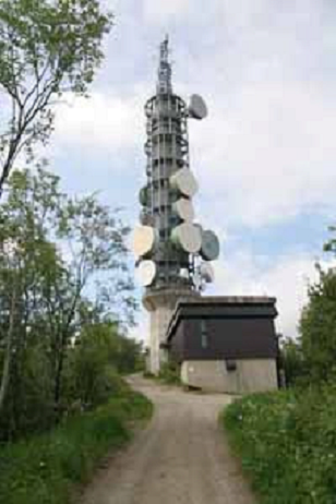
    TV Tower

    This is the TV-tower in Sandnessjøen. It is often decorated with lights on special occasions, such as new year’s eve and the main festival in Sandnessjøen, Havnafestivalen.

    Fortress & Bunker Area

    There is very little information about the fortress area. It was home to the Artillery Group Sandnessjøen. There were 7 Heeres Küsten Batteries and 3 Marine Artillery Batteries in the group.

    The battery was set up in 1940.

    There are information signs on all the main sights that you can read.

    Torolvstein

    During the Viking Age, this was one of Northern Norway’s largest and most powerful chieftain seats. At this building you can learn about Norwegian Viking History with the key figures from Sandnessjøen, Torolv Kveldulvson and Sigrid of Sandnes. The area around Sandes was one of the best documented areas from the Viking Age.

    The long house was very common in Norway during the Iron Age. They were long houses built to accommodate both housing and livestock. Longhouses throughout the Nordic region are made up of a log system.

    The building is located on almost the same site as the old chieftain seat from 1,000 years ago.

    Enjoy More of Sandnessjøen

    Visit the travel guide page to see road-trips, restaurants, and top activities that you can do. 

    Norway's Coastal Road

    Bodø is located at the end of the Fv17, which is Norway’s Coastal Road. You can find my guide to the Fv17 by clicking the link below. 

    Norway's Coastal Ferry

    Kirkenes is a port of call of Norway’s coastal ferry. Find my guide for the coastal ferry by clicking the link below. 

  • From the First People to Klippfisk: the History of Kristiansund

    From the First People to Klippfisk: the History of Kristiansund

    Kristiansund is an important place in Norway. Today it’s associated with the klippfisk (clip fish, dried and salted cod) trade that took place here. And rightly so! Thanks to klippfisk, we have Kristiansund. Still, there’s a lot more to this island city that is worth knowing before you make the trip there. The history of Kristiansund is truly fascinating.

    Here’s my historical overview of Kristiansund. As always, I have relied on books and websites that provide an incredible amount of detail. You can find links to them throughout and at the bottom of this article.

    In this article...

    The E39 Highway

    Kristiansund is located on the E39, the main highway along the west coast. You can find my guide to the E39 by clicking the link below. 

    Norway's Coastal Ferry

    Kirkenes is a port of call of Norway’s coastal ferry. Find my guide for the coastal ferry by clicking the link below. 

    Kristiansund is the oldest settlement in Norway

    Kristiansund wasn’t always known as Kristiansund. The name came in 1742 when King Christian VI gave the settlement a town charter. The town gets its name from him, but more on that later.

    The first name of Kristiansund is Fosna. It’s generally believed that this place was one of the earliest settlements after the last Ice Age. People likely arrived around 8000BC as Kristiansund (and its surrounds) were one of the first ice-free places in Norway. Additionally, the surrounding sea had lots of food. Additionally, there was lots of stone and flint they could use as weapons and tools.

    Today, the first Norwegian peoples as known as the ‘Fosna culture’. Traces of these peoples were first made in Voldvatnet (Vold Lake) in 1909. Kristiansund isn’t the only place where the Fosna people lived – it’s just where they got their name. Fosna is an umbrella term for the oldest settlements along the Norwegian coast. Additionally, similar cultures were on the coastline in Sweden and Northern Germany. The sea used to be much higher – today their settlements are 60-70m above present sea level.

    You can visit Voldvatnet (also spelt Vollvatnet) today. Sadly it’s in a very crowded industrial place in Kristiansund. 

    Wiki (English) https://en.wikipedia.org/wiki/Fosna%E2%80%93Hensbacka_culture

    Wiki (Norwegian) https://no.wikipedia.org/wiki/Fosna-Hensbacka-kulturen

    Vikings around Kristiansund

    While Kristiansund itself is not mentioned in the Viking Age, we know the Vikings were in this area. Firstly, because nearby Tingvoll was a historic meeting place. ‘Ting’ is an Old Norse word that means ‘assembly’. It’s where the chieftains would meet to discuss important matters. Secondly, the nearby island of Frei is mentioned in connection to a battle that took place during the Viking Age. You can read about it on my page about driving from Oppdal to Kristiansund as we drive past the place where it happened. 

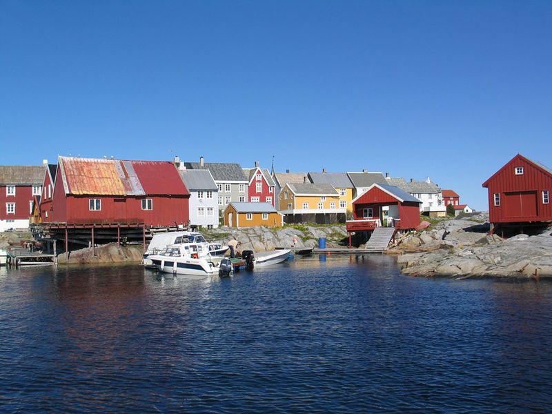
    Fil:Grip hamna2005.jpg
    Grip (Source)

    Trade & Stockfish on the island of Grip

    Grip is one of the places I hope to visit and write about someday, but if you go to Kristiansund it’s an island you can take a day trip to. I recommend it.

    We know Kristiansund wasn’t very populated in the early years, but the island of Grip sure was. The first settlement of Grip is unknown. The island emerged from the sea sometime between 3500BC and 2500BC. This is well after the Fosna people of Kristiansund (and surrounds). There are no archaeological traces on the island, which is notoriously hostile. The very first fishermen to settle here must’ve been very brave!

    There are no written documents about when Grip was first settled. However, it was likely between the 9th and the 13th centuries. The island has no arable land and no shelter from strong winds, but it does have very rich fisheries. The people who moved here wanted to be close to the fishing grounds. In the 13th century, the Hanseatic League was gaining prominence in Bergen. The export of stockfish from Lofoten was becoming big business. The fishermen likely saw an opportunity in settling on this island, which is on the journey south from Lofoten to Bergen. 

    Grip became a very important place. In fact, it was the largest settlement in Nordmøre. The island came under the control of the archbishop of Norway, which is common. The church was the wealthiest landowner until the Reformation. 

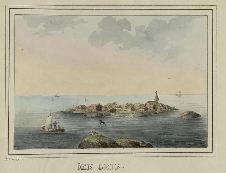
    Fil:No-nb digibok 2014091028002 0141 1.jpg
    Grip in 1833 (Source)

    Grip has one of Norway’s 28 remaining stave churches. Grip Stave Church is from 1470 and is the oldest building on the island today. The altarpiece represents the strong connection to the Hanseatic merchants from Europe. Having a decorated stave church on such a remote island indicates how important this island was for the merchants. 

    The 15th and 16th centuries were the peak period for the island, thanks to the Hanseatic trade. Many wealthy merchants settled on Grip, and the population was as much as 300, making it the largest village in the region. The Hanseatic merchants exported stockfish to Europe, and Grip was one of the production sites. 

    Everything came crashing down at the Reformation when in 1537 King Christian III seized all church property in Norway. From the 18th century onwards, several harsh storms hit Grip, and the fishing grounds began to fluctuate. The population came and went depending on how good fishing was. No one lives permanently on the island today. Simply put, the island didn’t have a good enough location to develop a city. Additionally, towns by the fjords were becoming more popular as timber export grew. The houses today are holiday homes. You can visit Grip via a ferry from Kristiansund. 

    A harbour founded amongst islands

    Grip was where the action was, but there was a tiny settlement in Kristiansund. At the time it was known as Lille-Fosen based on the first peoples who lived here. The people lived on the meadow by the bay, Vågen, and this is where the city began to grow. You can see it on a map. Firstly, it’s where the Shipbuilding Museum is. Secondly, you can see how the bay is sheltered from strong winds coming in from the North Sea. 

    We know Grip wasn’t a great place to live. So, as trade moved away towards timber in the 17th century, merchants started looking for a natural harbour. This is the basis for commercial expansion and settlement in many places along the Norwegian coast. This is how Kristiansund began to grow. Even though Grip was important for boat traffic sailing along the coast, the significance of Lille-Fosen’s harbour between three islands increased. The small community grew from the 17th century, especially when the Dutch discovered it.

    The Golden Age of the Dutch Merchants, otherwise known as Hollendertiden

    The Dutch began coming to Norway in the 16th and 17th century to take all the timber. At the time, the Netherlands was the leading shipbuilding nation in Europe. To maintain this they needed a lot of timber. But not any timber. They needed long, straight trees with strong resilience to withstand harsh weather. Norway had large quantities of timber that they could buy at a reasonable price. 

    Fun fact: Amsterdam is literally built on Norwegian timber as timber was needed for foundations under large buildings.

    The Dutch came to the area around Kristiansund. There are some rich forests on the fjords, and the harbour of Kristiansund (then Lille-Fosen) was safe and suitable for them. The harbour Vågen became a permanent mooring and gathering place for vessels that visited the district. A customs station was established in 1630 to control the timber trade. 

    The Dutch didn’t only come to take all the timber; they brought goods for sale. Ceramics were very important. It’s likely they also brought wine, beer and liquors to Kristiansund. The Norwegians profited heavily from this, especially the forest and sawmill owners. They didn’t only go to Kristiansund; many coastal towns in Sørlandet, Østlandet, Vestlandet and Nordmøre (the stretch of coast from Kristiansand to Kristiansund) saw Dutch merchants come here. 

    The Dutch period lasted until 1850. 

    In the 1690s, something happened that would change Kristiansund forever. A Dutchman named Jappe Ippes brought knowledge about the production of klippfisk. He received a royal privilege that gave him permission to manufacture and export klippfisk. And so, a new industry was born. 

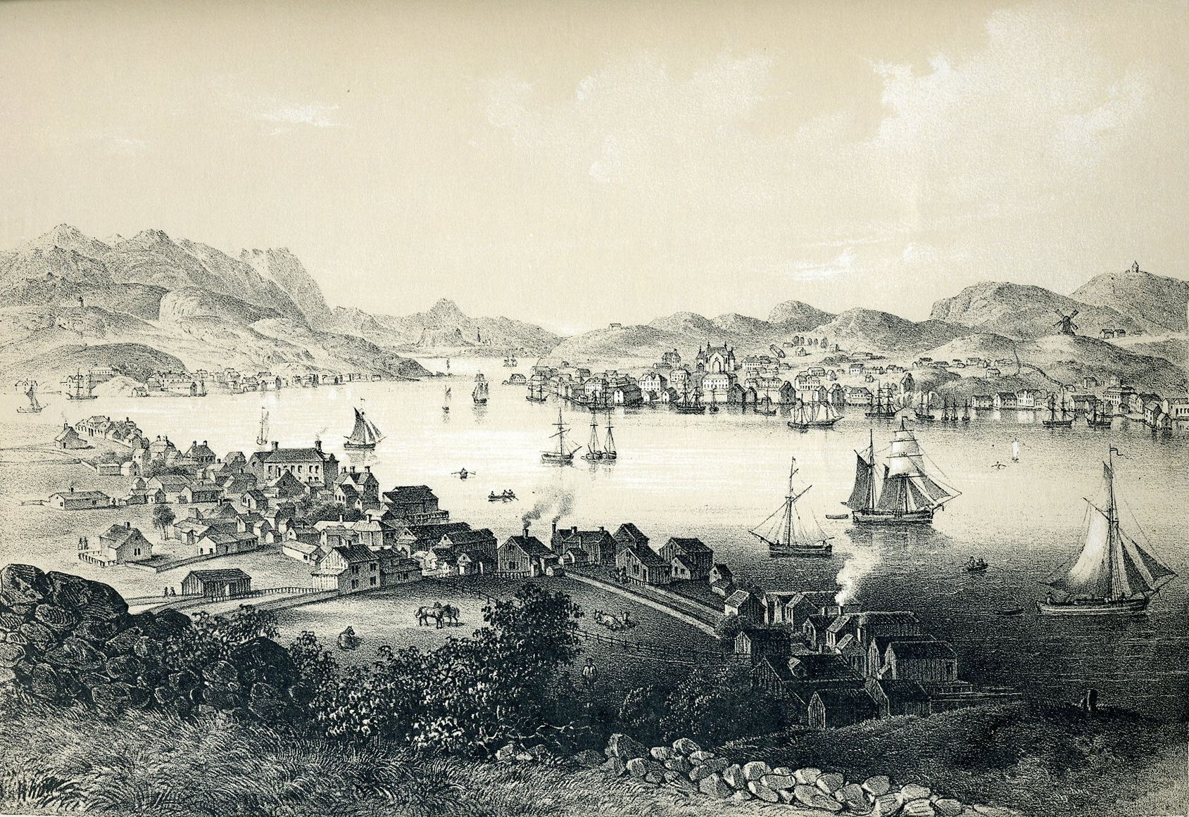
    Kristiansund in the early 18th century (Source)

    Klippfisk – Wikipedia
    Klippfisk

    The city founded on Klippfisk

    Kristiansund is said to be founded on klippfisk. After Jappe Ippes introduced the process in the 1690s, men came to Kristiansund to learn and expand the business. One of the most prominent men to come here was the Scotsman John Ramsay. John turned it into a large company, and soon after the most enterprising of merchants in Kristiansund gained control of all stages of klippfisk production. They received the catch, processed it, and then exported it. 

    We should back up a moment. What is klippfisk? It was virtually unknown in Norwegian cuisine at the time. Clipfish (I’m using the Norwegian name, klippfisk) is cod that has been both salted and dried. It is a descendant of stockfish – cod that dries unsalted and is as old as the Viking times. The process of salting fish started in the 15th century but was introduced to Norway by the Dutch. 

    ‘Klippfisk’ means ‘rock fish’ because they leave the fish out on rocks to dry. 

    There’s a big overview of how they make klippfisk (in English) here: https://cod.fromnorway.com/norwegian-cod/clipfish/

    During the 18th century, klippfisk became a major industry. Boats came in from the sea with the salted catch. Producing klippfisk was labour intensive, and soon factories popped up all over Vågen. They wash the fish before salting it again and drying it on a ‘fish mountain’. They then press it flat for two weeks to allow the saltwater to drain. Milnbrygga and Milnbergan are important cultural monuments from this time. Today, the whole process is modern and explained in that link above. 

    Thanks to klippfisk, the town began to expand. Lille-Fosen built up a large fleet with shipyards and ropeways. Expertise in shipbuilding was obtained from Copenhagen. The city grew in the 18th century as klippfisk became the major industry. 

    Lille-Fosen becomes Kristiansund

    The town got its name after King Christian VI granted it a town charter in 1742. He named it after himself, much like the Danish kings before him had named towns after themselves (see Kristiania/Oslo and Kristiansand in the south). Yes, there is often some confusion between Kristiansund and Kristiansand. Before postcodes, it was obligatory to add an N (for north) to Kristiansund and an S (for south) for Kristiansand. Some people still practice this, and when I say I’m going to Kristiansund, I have to word it like “KristianSUND (the one in the north)”. 

    The town charter meant expansion. Commerce in the town developed during the following decades and Kristiansund prospered. The demand for klippfisk was so great that the fishermen could not supply it all. Fishermen brought cod down from Lofoten and Finnmark to make the klippfisk. From the 1820s, salted herring also became an important export product. The city got a large fleet of sailing vessels, yachts, and galleys for traffic. The market expanded to the United States. The Danish merchant Christian Johnsen learned the principles of klippfisk trade in Bilbao and established his business in Kristiansund that exported klippfisk to Asia, South America, and Europe. Another klippfisk merchant, Nicolai H. Knudtzon, was Norway’s richest man at the end of the 19th century. 

    By the end of the 19th century, Kristiansund was a wealthy and prosperous town with merchant mansions, quaysides and wharves. 

    The Spanish Era & Eventual Collapse

    Around the time the Dutch trade was ending, the Spanish began to come to Kristiansund. Spain is one of the countries that ate a lot of klippfisk, due to the rules around Catholicism and not eating meat. Additionally, the Spanish had introduced bacalao using klippfisk. 

    Basically, the Spanish came to Kristiansund to buy klippfisk without a middle man. The Spanish sailors introduced bacalao to the city. 

    Fun fact: The ships that brought klippfisk to Spain brought back soil as ballast. The area around Kristiansund had little soil and Spanish soil was used in, among other things, the towns first public cemetery. 

    The klippfisk business continued until 1884. A sudden fall in market prices in Spain hit the companies in Kristiansund. All klippfisk exporters, with one exception, went bankrupt. 

    1870: https://digitaltmuseum.no/011013318326/kristiansund-more-og-romsdal-lunds-nr-21

    1880: https://digitaltmuseum.no/011013318387/panorama-av-havna-pa-innlandet-kristiansund-ca-1880-del-av-panorama-se

    Kristiansund in 1911 (Source)

    Kristiansund or Fosna?

    When Norway became independent in 1905, many cities started discussing the possibility of changing their name back. The Danes had changed many Norwegian town names. This is most prominent in Oslo, which was named Kristiania by Christian IV and changed back shortly after World War I. In Kristiansund, it was argued that the old name Fosna should replace Kristiansund. In 1929, a vote showed overwhelmingly that 99.1% of locals didn’t want the name changed. 

    The 1920s & 1930s: Wealth and Collapse

    At the end of the 19th century, Kristiansund was a beautiful city with many large merchant farms, boathouses and piers. The city didn’t have much of a zoning plan; instead, a house went wherever you could fit it. While this was impractical when cars were introduced, it was charming. Most of the houses were wooden.

    Kristiansund in 1882: https://digitaltmuseum.no/011013318183/gatebilde-fra-torvet-kirkelandet-kristianssund-1882-i-forgrunnen-til-venstre

    In 1928, 32 years before a national opera was founded in Oslo, the Norwegian Peoples Opera was founded in Kristiansund. So, opera came to Norway through Kristiansund. Today there is an opera festival that takes place every February. 

    Due to the limited scope of commercial activities, Kristiansund struggled to recover after the post-WWI economic collapse. Attempts in the 1930s to find new industries for Kristiansund began, but that was all halted by World War II. 

    The Bombing of Kristiansund (Source)

    World War II

    At the end of April 1940, when Nazi Germany was invading Norway, Kristiansund was subject to almost four days of continuous bombing by the German Luftwaffe. The town was left almost in ruins. Five people died, and 800 buildings were destroyed by fires that ravaged for days after the bombing. This corresponds to 28% of Norway’s total war damage to buildings during World War II. 

    Why did Germany bomb Kristiansund? Well, they thought the Norwegian King and the government were hiding here. They were not; they were in Molde. 

    Little could be rebuilt during the war, and most of the inhabitants who became homeless had to live in barracks until the end of the war. Some Swedish prefabricated houses were built in Kristiansund, and they still stand today. The street they are on is Vuggaveien. 

    Post-war Rebuilding

    After the war, Norwegian architects got to re-designing towns that were damaged during the war. The rebuilding was initiated under the ‘Brente steders regulation’ (Burnt Places Regulation). While a zoning plan was ready as early as August 1940, work couldn’t begin until after the war.

    Kristiansund got typical post-war architecture that characterises many of these ‘burnt places’. It’s best described as a sober functional style. The central parts of the city completely changed from charming, wooden districts to planned streets with concrete blocks. The building of Kirkelandet Church in 1964 marked the end of re-building.

    By 1950, 68% of the city had been rebuilt.

    Today, the reconstruction of Kristiansund is highlighted as one of the 20th century’s most worthy cultural environments in Norway. Furthermore, the town has the best-preserved examples of post-war architecture. The area that was rebuilt is the ‘Reconstruction City’ and has a very strong concentration of post-war houses not found elsewhere in Norway. 

    The main street, Kaibakken, is a great example of post-war design. It was a key element in the city’s reconstruction architecture. Many ‘burnt places’ in Norway got long, main streets like this one. They found inspiration in streets like the Champs Eylyss in Paris. 

    Finding new industries

    After the war, Kristiansund knew it had to expand beyond klippfisk. While klippfisk is still at the heart of the city, there are new industries in Kristiansund. The food industry is still important, but Kristiansund is now a central operations and supply base for the offshore oil industry. Oil is now the main commercial basis in the town.

    Modern Kristiansund's Highlights

    Today 24,334 people live in Kristiansund and it has all the facilities you’d ever need. The population of Kristiansund is actually rising. 

    Transport connections to Kristiansund are pretty good. Besides ferries out to the surrounding area, Kristiansund has the Norwegian National Road 70 and the European route E39. The airport, Kvernberget, has connections to major cities in Norway plus some European destinations in the summer. Kristiansund is also a port on the Hurtigruten. If you take the Hurtigruten southbound (Kirkenes – Bergen), you stop in Kristiansund for one hour in the afternoon. They have excursions to the Atlantic Road.

    There are plenty of primary, middle and upper secondary schools in Kristiansund. However, there no higher education facilities. 

     Culture & Tradition

    Kristiansund has a rich cultural life with the Opera Festival, the Nordic Light International Festival of Photography, the City Festival and the Tahiti Festival. The Opera House is the oldest in Norway. It is from 1914 and is one of the few buildings to survive the World War II bombing. Another one of the few buildings to survive World War II is Nordlandet Church, which is built of stone from 1914. It dominates the skyline on the island of Nordlandet. The newest church is Kirkelandet Church, which was the final postwar building in Kristiansund. 

    As you may imagine, there’s also a rich food culture in Kristiansund. Besides bacalao, another main dish is blandaball. I know the name doesn’t sound great in English. It’s a fishball consisting of fish (of course!), onion and potato. The ingredients are ground and shaped. In the middle is a piece of pork, just like a Norwegian Kinder Surprise. They don’t look great, but they taste excellent. 

    There are plenty of museums in Kristiansund about the history of the city. The Norwegian Bacalao Museum is the most popular. The Nordmøre Museum is also located here, plus the historic Mellemvaerftet Shipyard that you can visit. Vågen – the old harbour – has many interesting cultural monuments and is a great place to visit. Some old merchant farms and wharves are still standing. The old town was somehow spared during the bombing and it gives an insight into what Kristiansund used to look like.

    Lastly, the big thing people come here to see is the famous Atlantic Road – one of 18 national tourist roads in Norway. But more on that in a separate article.

    I hope you’ve enjoyed this overview of Kristiansund’s history, and that it’s inspired you to visit someday!

    The E39 Highway

    Kristiansund is located on the E39, the main highway along the west coast. You can find my guide to the E39 by clicking the link below. 

    Norway's Coastal Ferry

    Kirkenes is a port of call of Norway’s coastal ferry. Find my guide for the coastal ferry by clicking the link below. 

  • Visiting Urke with Hurtigruten

    Visiting Urke with Hurtigruten

    If you are fortunate enough to be on the Hurtigruten in the autumn/fall season travelling northbound, you’ll get to travel into Urke via the Hjørundfjord. Normally, in the summer months, Hurtigruten travels to Geiranger, the more famous of the two. That’s what makes Hjørundfjord even more special – it’s a bit of a secret, and Urke is way, way less crowded than Geiranger.

    I visited Urke last October on the Hurtigruten (M/S Nordlys) with a group. I couldn’t go out and do the excursions, but I did get to take my group on a little walk around the village. I’ve put together a little overview of how the stop in Urke works and what you can see in this stunning village.

    In this article...

    The Hjørundfjord

    The Hjørundfjord is a branch of the Storfjorden, which leads into the Geirangerfjord. At 20km (12 miles) long, it is surrounded by the Sunnmøre Alps that rise close to 1000m (3000 ft) above sea level. At the end of the Hjørundfjord, it splits into the Norgangsfjord, which has the famous village of Øye at the end.

    Visiting the fjord started to become popular in the late 19th century as a hiking and tourist destination, and the farmers worked to provide transport services for the tourists.

    About Urke

    Urke is a small settlement located midway on the Hjørundfjord. The village has a permanent population of between 40 and 50 residents, but many have holiday homes here. Urke is one of the towns experiencing depopulation; fifty years go the population was 350.

    Urke & Hurtigruten

    Shortly after departing Ålesund in the morning, you follow the same path the ship would take on its way to Geiranger. Shortly after entering the Storfjord, you turn off and start going into the Hjørundfjord. Sometimes, the expedition team will come out to talk a little about the Hjørfundfjord. In any case, you want to be outside for this!

    When the ship arrives at Urke, it doesn’t dock at the harbour. Rather, it anchors out in the fjord (this alone is stunning). You access Urke by tender – those who have booked one of the excursions are prioritised. Once they have left, it’s your turn!

    The ship is anchored in the fjord between 12:15pm and 3:45pm. Typically, the first non-excursion tender boat leaves around 1:15pm. The Hurtigruten staff tell you that you have to take the tender boat exactly one hour after you leave the ship. This isn’t strictly enforced but highly recommended – that way everyone doesn’t pile onto the tender boats at the end.

    The tender boat is free, there are seats on the boat, and the trip across only a few minutes. There are steps getting onto the boat, and when you arrive at Urke the pier is floating and therefore a little uneven (there are railings to hold onto).

    Once in Urke, there is usually a local standing there with some maps and walking routes. If not, it’s posted on a sign so just take a photo of it. 

    Urke Walking Path

    I would’ve done one of the hikes if I was by myself, but I wanted to show my group around. You arrive at number 1 on the map, where there’s a cafe and toilet. I made a plan to head straight to the grocery store. You won’t exactly get lost; not only is the town tiny, but there are signboards everywhere. And you can see the ship at all times.

    Some of the buildings, particularly the historic ones, have little signs on them with information in Norwegian, English and German.

    Local power plant

    This power plant is located by the waterfall. It was built by Tussa Kraft. It’s possible to walk further down and have a look inside the building. Sadly I didn’t take any photos!

    The power station has a 3 km long pipeline that lies in the ground up to an intake at Myrsætra in Langsæterdalen. It is a working hydropower plant, producing electricity for approx. 2000 households. There is a millhouse close to the river.

    Urke Landhandel

    In the 1990s, the shop was at risk of being closed down because no one wanted to take over it. However, the locals didn’t like the thought of having to travel to Hellesylt for groceries. The locals decided to form a limited company and the store was bought by the company. The store was then refurbished thanks to the locals – all volunteer work.

    You can buy almost anything here – petrol, groceries, medicine. There aren’t any souvenirs, but it’s worth going inside and having a look.

    Stabburet / The Storage House

    This belonged to the original farm property at Urke and was used for storing food. It was common for the servants to have bedrooms here as well. You’ll notice the building has been raised on stones – this is to stop animals from getting inside and eating all the food; the stairs were often separated from the doorstep by an opening of 30cm. It also kept the food nice and dry in case of rain and flooding. You will see nine storehouses around Urke.

    Back to the ship

    An hour in Urke is plenty of time, unless you plan on doing one of the hikes. The easiest hike is number three on the map.

    To go onto the tender boat, just head back down to where you are dropped off. When it makes its way across from Hurtigruten, it’s time to go!

    Hurtigruten Excursions

    The most popular excursion is A Taste of Norway, which takes you on a scenic drive to the famous Hotel Union at Øye. Once there, you get to eat some local food. Sadly no one from my group took this excursion, so I know little about it. https://global.hurtigruten.com/excursions/norway/2f-a-taste-of-norway/

    If you are looking to do an easy-ish hike, there is a standard hike available. Some members of my group did this tour and said it was challenging in some sections but the guides are excellent. https://global.hurtigruten.com/excursions/norway/2g-mountain-hike-in-the-hjorundfjord/

    For a little more, there is a hike to a shielng. See here: https://global.hurtigruten.com/excursions/norway/2h-hike-with-a-visit-to-a-shieling/

    If you want to see Geiranger, you can take the bus tour. It’s a lot of driving but they have some photo-stops along the way. It covers a lot of ground and a lot of scenery along the way. https://global.hurtigruten.com/excursions/norway/2j-hjorundfjorden-geiranger-and-alesund/

  • Hammerfest Self-Guided Walking Tour: A Perfect Walk for Hurtigruten Passengers

    Hammerfest Self-Guided Walk

    One of the most popular Hurtigruten port is Hammerfest on the southbound journey, and rightly so. With Hurtigruten, you get a couple of hours to go exploring. Here’s my Hammerfest Self-Guided walking tour to make the most of your stay!

    In this article...

    Norway's Coastal Ferry

    Hammerfest is a port of call of Norway’s coastal ferry. Find my guide for the coastal ferry by clicking the link below. 

    Downloadable Version of This Guide

    We offer downloadable versions of our self-guided walks on our online store. 

    Royal & Ancient Polar Bear Society

    The Royal & Ancient Polar Bear Society is not royal and ancient at all, but it still highlights Hammerfest’s history as a polar capital. Founded in 1963 by two local businessmen, it’s more of a joke amenity for tourists. Visitors are encouraged to join the society and are invited to the annual meeting every January. You have to be in-person to sign up, so when Elvis Presley wrote to them in 1973 asking to join, they rejected him.

    Sure, it’s touristy. But still – the money goes to the tourist information centre, the museum, as well as various initiatives to protect the environment. For example, earlier this year they were helping fund the care of Hvaldimir, the Russian spy whale that made Hammerfest harbour home. I recommend coming back to the Royal and Ancient Polar Bear Society – it’s got the best souvenir shop in town as well as a free exhibition about polar life and Arctic hunting. And since it’s so close to the ship, you can use your leftover time here.

    Hammerfest City Hall

    The Hammerfest City Hall is another popular stop for Hurtigruten passengers. Here you can see Hammerfest’s coat of arms: the polar bear. It’s designed to represent the town’s importance as an Arctic hunting and trading port. There aren’t any polar bears in Hammerfest, though. There are, however, reindeer! The grass around the city hall is popular for the migrating reindeer, and every year up to 3,000 reindeer pass through, eating grass and gardens. They tried to build a fence around Hammerfest to stop them coming in, but it was ineffective. If you’re in the area in early summer watch out for reindeer!

    Around the City Hall, you can see the main town square and harbour. This is a popular spot to come back to after the walk.

    Reconstruction Museum

    Eventually, you’ll get to the Museum of Reconstruction, a museum dedicated to the rebuilding effort after the Germans’ scorched earth policy destroyed the town. Before the Germans forced the public out, the locals buried their most prized possessions underground. This museum displays many of those items, such as a barber chair. It’s a small museum and something you can certainly fit into your Hammerfest visit. If you are interested in World War II history or just cool old objects, this is a worthy museum. The shop has some cute unique items, but sadly the books are in Norwegian.

    Museum of Reconstruction Opening Hours: Monday-Friday 10am – 3pm (to 4pm in summer) / Sat-Sun 11am-2pm (10am – 4pm in summer) Admission: Adult 80 NOK / Pensioner 50 NOK / Groups 10+ 50 NOK pp

    Hammerfest Chapel

    Hammerfest’s chapel would not be that interesting if it wasn’t the only building left after the Germans’ retreat. But here it is, and it’s worth seeing. The funeral chapel was built in 1937 and was only saved because it stands in the middle of the cemetery and the German’s believed it would be bad luck to burn down a cemetery.

    Hammerfest Church

    It’s believed the first church was built in Hammerfest around 1620, but the church you see today is at least the sixth church on the site. The previous church (from the mid-19th century) was destroyed by the Germans. The current church was built in the 1950s and seats 525. Its strange shape is designed to represent fish drying racks.

    If you manage to get inside, be sure to look at the stained glass windows, which illustrate the basics of Christian faith. The three mosaics under the stained glass are made in Norwegian stone and show Christ entering Jerusalem, the Last Supper and the betrayal of Christ. There are some historical elements in the church – the triptych is from the first church in Hammerfest and the two brass chandeliers are from 1750. Don’t miss the wooden carvings in front of the organ that shows six of the earlier churches in Hammerfest.

    Blue Pavilion

    The blue music pavilion was gifted to Hammerfest during the town’s 200th jubilee in 1989, and it represents the Russian architecture that used to characterise the town. Behind the pavilion you’ll find the hiking path entrance – you probably won’t have enough time to do this including my walk. If you only want to do the hike, go straight there or join the Hurtigruten excursion.

    Norway's Coastal Ferry

    Hammerfest is a port of call of Norway’s coastal ferry. Find my guide for the coastal ferry by clicking the link below. 

  • Trondheim Self-Guided Walking Tour: Medieval History & Everyday Life

    Trondheim Self-Guided Walking Tour: Medieval History & Everyday Life

    Trondheim is best explored on foot, and if you get the chance I highly recommend it over a bus tour. You can pass some historically important cities as well as modern wonders. For my Trondheim self-guided walking tour, I’ve mapped out a path that I like to take.

    This walk is designed for those on Hurtigruten; it starts and ends at the pier. If you are travelling to Trondheim without Hurtigruten, you can still do this walk. However, I’m going to put together a separate walking path for non-Hurtigruten visitors because you get much more time to explore the city 🙂 For now, though, here’s the walk.

    In this article...

    The E6 Highway

    Trondheim is located on the E6, Norway’s main highway. You can find my guide to the E6 by clicking the link below. 

    Norway's Coastal Ferry

    Tromsø is a port of call of Norway’s coastal ferry. Find my guide for the coastal ferry by clicking the link below. 

    Downloadable Version of This Guide

    We offer downloadable versions of our self-guided walks on our online store. 

    Online Guide

    Downloadable Guide

    The walk: Trondheim

    Pirsenteret

    Pirsenteret is part of the new development this part of Trondheim is seeing. It has historically been a major industrial area with shipping ports and rail connections, but since the late 1990s, there has been an urban renewal program. Pirsenteret is a modern school, shopping & office complex.

    Rockheim

    Image result for rockheim

    Rockheim is Norway’s national museum for popular music and it also includes the Rock Hall of Fame for established Norwegian bands, the most internationally famous being A-Ha.

    Visit the Rockheim Museum website

    Trondheim Central Station

    Image result for trondheim train station

    A railway station was first built in Trondheim in 1864, and in 1877 a new station (the one we see today) was built to serve the Meråker Line to Sweden, which has since become the Nordland Line to Bodø. The older building is the Nordland Line, whereas the newer post-modernist building was built in 1921 for the Dovre Line, which connects Trondheim to Oslo. Today Vy serves the station with express trains to Oslo and Bodø, regional trains to Røros and Ostersund in Sweden, and the local Trøndelag commuter rail.

    The Last Viking Statue

    This statue is to reflect on the fishing traditions that have existed in the area for the centuries. The name comes from a popular book with the same name, written by Johan Bojer. The quote says: “In winter, they would sail 500 nautical miles to Lofoten in their open boats. Perhaps it was only the hint of profit that lured them, but perhaps it was also because of the open sea, they were free men.”

    The statue is situated next to Ravnkloa, which has been a Trondheim port and fish market for centuries, though it was first mentioned in history in 1619. You can see the modern fish market, built in the early 2000s, just behind the statue.

    Stiftsgården

    Stiftsgården is a true highlight of Trondheim; this massive timber building has a fascinating history. It was built between the years 1774-1778 for Cecilie Christine Schøller (1720-1786), who was a wealthy widow of a merchant who had passed away in 1769. She was looking for a private townhouse to settle down in, so she had this 140-room or 4,000m2 (43,000ft2) house built for just her. When the house was finished, she barely used it as she travelled abroad often. When Cecilie passed away in Copenhagen in 1786, the house had been rented by her son-in-law, General Georg Frederik von Krogh (1732-1818), and his son inherited the building. Stiftsgården was sold to the state in 1800 for 10,000 rigsdaler (about 26,427 NOK today) and went through various functions, serving as the house for the Governor, the law courts, and a residence for the visiting Danish Royal Family.

    When Norway became part of Sweden in 1814, the house was used for the coronation of King Carl Johan III (1818). It became the royal residence for the Swedish monarchy, and all Swedish Kings were coronated here. After Norway gained her independence in 1905, it officially became the royal residence of Trondheim, and King Haakon VII and Queen Maud (1906) were coronated here. Each Norwegian king has since had a benediction in Trondheim (as they are now a purely representative figurehead), and the procession has always started from Stiftsgården before reaching Nidaros Cathedral.

    The exterior of the building is very much in its original form, but the interior has changed extensively. The garden was separated as a public park in 1906, and that’s our next stop.

    Stiftsgården Park

    Inside the park, you’ll get a lovely view of Stiftsgården, and you’ll also see a statue of Olav V looking out to the palace. Olav V was always seen as the people’s king, and he was very popular in Trondheim. The statue was placed here in 1997 as part of Trondheim’s 1000-year birthday celebrations.

    Torvet

    The square was designed as part of Cicignon’s town plan of 1681, and before it was laid out the area was a known market square. Torvet has just undergone a major renovation, and nearby archaeological digs have uncovered the original market square. Trust me, the last few years have been terrible at Torvet: construction, congestion and the statue was hard to see. Since 2003, Torvet has been home to Trondheim’s annual Christmas market. The statue is of Olav Tryggvason (Olav I) and it was placed here in 1921. He is 3.5m high and stands on a pedestal that’s 14.5m high. In his left hand is a communion chalice and in his right hand is a sword. At his feet is the head of the god Thor, which symbolises the King’s victory over the pagans. Poor Thor.

    Church of Our Lady

    Image result for vår frue kirke

    Vår Frue Kirke is the third-largest preserved Middle Age church in Norway and first built in the late 1100s. It’s believed that the first version of this church may have been built by King Harald Hardråde (1015-1066) as his saga mentions him building a church near Nidaros Cathedral in 1060. The church has been rebuilt and expanded multiple times due to fires, and got its current appearance in the 19th century, though the tower was built in the early 18th century.

    In 2004, the church was included in the Directorate of Cultural Heritage’s list of 12 churches of national significance. Today Vår Frue Kirke functions as a missionary church, serving lunch to those in need.

    Trondheim Courthouse

    Image result for trondheim courthouse

    Trondheim Courthouse was completed in 1951, though construction began before the Second World War. The foundation stone was laid by cabinet minister Trygve Lie, who later became the UN General Secretary. In 2003, the courthouse was merged with other municipalities to become the Sør-Trøndelag District Court (South Trøndelag). The judicial duties of this court are mainly to settle criminal cases and resolve civil litigation. The administrative tasks include death registration, certificate issuing, performing duties of a notary public, and officiating civil wedding ceremonies.

    Trondheim Cathedral School

    Image result for trondheim cathedral school

    Trondheim Cathedral School is the oldest school in Norway, founded in 1152 as ‘Scholae Cathedralis Nidrosiensis’. It has been in at least five different locations since its founding and moved to its present building in 1786. The school was further expanded in 1960.

    Across the street is the National Museum of Decorative Arts, which opened in 1986 and exhibits textiles, glass, silverwork, costumes, furniture and ceramics from all over Europe.

    Military Buildings

    The Non-Commissioned Officers Academy (Munkegata 6)

    This building was built in 1812-1814 for the Engineer Corps as a depot and was also used as a training college for non-commissioned officers. From 1930 it served as the Officers Academy, which moved in 1975.

    The Exercise House (Munkegata 4)

    The exercise house was built in 1806 as a gym and training centre for soldiers in Trondheim. The gymnasium was 350m2.

    The Military Bakery (Munkegata 2)

    The military bakery was built between 1808 and 1810. It served as a bakery for the military until 1870, after which it became a cobbler and tailors workshop.

    Trondheim City Hall

    Image result for trondheim city hall

    Trondheim City Hall was originally built as the Technical College in 1895, but in 1929 it became the City Hall.

    Nidaros Cathedral

    The iconic Nidaros Cathedral is the northernmost medieval cathedral in the world and is Norway’s national sanctuary.

    Nidaros Cathedral is worthy of its own page, which will come soon.

    Visit the Nidaros Cathedral Website

    Archbishop's Residence

    The Archbishops Palace was originally constructed in 1152 when the Episcopal seat was founded. The stone building we can see now dates back to around 1500. The building served as the residence of the Archbishop until the Reformation when the Danish King confiscated the building and renamed it Kongsgården. During the Danish union, the feudal overlords were based here, and from the end of the 1600s, it was used as a military depot with an arsenal and textile store for the northern troops.

    Today the Archbishop’s Palace is a museum that displays the foundations uncovered during archaeological excavations as well as the statues from Nidaros Cathedral that were recovered in the 19th century. It’s a fascinating museum but sadly there isn’t enough time to visit it during the Hurtigruten stay. Just an excuse to come back to Trondheim!

    Pilgrims Route

    Image result for pilgrims route trondheim

    The 640km (400 miles) journey begins in Oslo’s Old Town and continues north along Lake Mjøsa, up the Gudbrandsdalen valley, over the Dovrefjell mountain range, down the Oppdal valley, and then finishes in front of Nidaros Cathedral. Once you arrive at Nidaros, the nearby Pilgrims Centre (which is located where you are currently standing) has a certificate for you. You have to “sign-in” to special places along the way and collect stamps in your “Pilgrims Passport”.

    The route can be traced back to the Iron Age when it was used as a highway for merchants and travellers. Around 700 Viking-era grave mounds have been discovered in the Oppdal valley, indicating that it was also used by the Vikings. The road was used for hundreds of years, and many settlements along the way developed as places for the travellers to rest and get food. In the mountains, special houses (fjellstue) were built for travellers to seek shelter. It served as a road until the railway line Rørosbanen opened on the 13th of October 1877, connecting Hamar and Trondheim via Elverum and Røros, and then the Dovre Line connected Oslo to Trondheim in 1921. The thought of crossing mountains suddenly lost its appeal and the train sounded much more comfortable, so travel along the road died out.

    Today people still use the Pilgrims Route and it even has a website where you can find sections of the route to complete and tourist attractions along the way. Very few people complete the entire journey, but some parts of it are very popular.

    Gamle Bybro

    The bridge was originally built in 1681 to provide better access to the Kristiansten Fortress. It had a toll booth and a guardhouse with guards at each end – the western guardhouse remains today and is the red concrete building you just passed. Today it’s a kindergarten!

    The archway on the bridge is known as the ‘gateway to happiness’. The warehouses date back to the olden times when extensive trade took place here. In the time of King Sverre (1177-1202), the quays were used as defence barriers. The River Nid runs through Trondheim. It is the northern part of the 153km-long watercourse that has its source in Nesjon in Sweden (950m above sea level). Hydroelectric plants along the river produce electricity to Trondheim and the surrounding areas. The river has been used for industrial purposes since the Middle Ages.

    Trampe

    This is the only bicycle lift in the world. It was installed in 1993 and has a length of 130m, a height of 24m and a gradient that varies from 1:11 to 1:5. The speed is 2m per second and the lift has a capacity of 288 cyclists per hour, with a maximum of 5 cyclists simultaneously. To use it, you stay on your bike and put your right foot over the silver beam. When you press the button, the beam starts pushing you up the hill, and a little footrest will take you to the top.

    Bakklandet

    Bakklandet is an authentic look into old Trondheim. Technically the first suburb of the city, Bakklandet was built up throughout the 17th century as a poor area where seamen, fishermen and manual workers lived in small wooden houses. It was not part of the town plan of 1681, so it developed naturally and not in a grid pattern. Also, as Bakklandet was not part of Trondheim, it was able to continue building in wood. Bakklandet was incorporated into Trondheim in 1847.

    Bakklandet has historically been an industrial area, and from the Middle Ages, a brick factory was located along the river. Today the company is known as “Trondhjems Aktieteglverk”, and brick from Bakklandet had a reputation for high quality. The area was also key for boat building, and from the 1600s boats were being repaired here. Bakklandet has been the victim of the Swedish raids as well as redevelopment. During the siege in 1658, Swedish troops burned down the area, and in 1718 Bakklandet was destroyed by the Norwegian side in an attempt to defend the city. The area was in decline for most of the 20th century and it was anticipated that it would be condemned and demolished, with a highway to be built over it. However, the locals complained and in 1983 a decision was made to preserve the historic houses.

    Today Bakklandet is one of the most charming areas in Trondheim and has many well-cared for (now very expensive!) houses and distinctive cafes. By following Nedre Bakklandet, you’ll get a taste of this lovely picturesque area.

    Seafarers Museum

    Image result for sjøfartsmuseum trondheim

    Trondheim Seafarers Museum contains exhibitions around fishing and trading in Trondheim throughout history until the present day, but this wasn’t always the function fo the building. it was originally a defensive structure, and around 1725 a Corps de Garde with a slavery was erected. The current building was built in 1784 after the slavery was moved to Skansen. A slavery was a building where hard punishment was carried out by criminal prisoners. They were common in the 18th century and abolished in the 19th century. This one was one of the last ones standing, lasting until 1885.

    Leif Ericson Monument

    Image result for leif ercison monument trondheim

    This statue was given as a gift to the city in connection with the millennium celebrations in 1997. the statue is dedicated to the many thousands of emigrants who left for America in the 19th/20th centuries. The statue is an exact copy of the original that stands in Seattle.

    Leif Ericson was a Norse explorer from Iceland (his parents settled there from Norway) who is believed to be the first European to set foot on continental North America, before Christopher Columbus. He attempted to establish a Norse settlement at Vinland, considered today to be the northern tip of Newfoundland in Canada.

    The E6 Highway

    Trondheim is located on the E6, Norway’s main highway. You can find my guide to the E6 by clicking the link below. 

    Norway's Coastal Ferry

    Tromsø is a port of call of Norway’s coastal ferry. Find my guide for the coastal ferry by clicking the link below.