Hiking Up and Down Mount Fløyen

A trip to the top of Mount Fløyen is a must for anyone visiting Bergen. It’s the most famous of the seven mountains that surrounds the city centre. From the top, you get sweeping views over Bergen, the suburbs, the fjords, and the ocean. It makes sense that it is one of the top five destinations in Norway. And who wouldn’t miss a chance to get a selfie at the top?

The most popular thing to do in Bergen is take the funicular – Fløibanen – that goes from the city centre to the top of Mount Fløyen. But why funicular when you can walk? Walking up to the top station has so many benefits – you get to see the nature, different sides of the city, and you get this sense of accomplishment when you reach the top.

The walk to the top of Mount Fløyen is easy, short, and one of my favourite things to do.

Information online about walking up Mount Fløyen is scattered at best because there are so many ways to get to the top. I’ve put together this guide with the best way up and down so you can make the most of your own hike.

If you do want to know more about the funicular, or plan on taking it one way, you can view their website here.

In this article...

About Fløyen

Fløyen is one of the seven mountains that surrounds Bergen. It is 400m (1300ft) high at its highest point, though the top station of the funicular is 320m (1000ft) above sea level.

The name fløyen probably comes from a weathervane that used to be at the top. It was used to indicate the direction of the wind for sailing ships – the Norwegian word for it is fløystangen.

The mountain used to be used for farming, but since the 19th century there has been an increased focus on using it for recreation purposes.

About the Hike

There are many different paths up and down Mount Fløyen. The way up and down that I’m about to describe is (in my opinion) the best for views and the best for your legs if you aren’t an experienced hiker.

The hike up is 3km (2 mi) and takes around 1 hour – it can take as little as 45 minutes if you are quick or using it for exercise. However, I’d allow an hour if you plan on taking photos or want to set your own pace.

The walk down is a different path so you see different views. It is roughly the same distance – 3km/2 mi – as the walk up. It is mostly on a paved road. The walk down takes about 40 minutes.

The Hike Up

Starting Point

We are going to stat at the lower Fløibanen station. Behind it, you’ll see a hairpin road that leads up the hill. At the top, you’ll see a white wooden building with a tower. That’s where we are going.

Skansen

Skansen is a district in Bergen that was a farming area until the late 19th century. Throughout the 19th century, Bergen became increasingly overpopulated. Skansen was built up with housing to accommodate the growing population. At one point, Skansen and the neighbouring Fjellsiden were the most densely populated suburbs in Norway.

Originally running water didn’t reach Skansen, so the Skansedammen (Skansen Lake) was built to provide water to the area. The lake was built in 1881 and was not just for running water but was also used as a water source to protect the wooden houses in the area. There used to be carp fish in the lake for fishing; in 2014 they were taken and given to the Aquarium as food for crocodiles! The lake was rebuilt at this time; and the new lake is 19.5cm deep. Under the lake is a parking garage with space for 193 cars.

Today Skansen is characterised by its old fire station, which is the white wooding building we’ll reach at the end of the hairpin road. The fire station was built in 1903 after a large investment in fire protection. The building is inspired by 17th and 18th century Bergen architecture and is built in the typical timber style. It originally had one garage, a stable room and a workroom. The fire station closed in 1969 and today it is used as a clubhouse for the Skansens Battalion, the local buekorps group.

Memorial

Before you get to the staircase, you’ll pass a memorial commemorating all the members of the Skansens Battalion who fell during World War II.

Husk at hesten trenger hvile

The beginning of Tippetue is at the famous rest stop Husk at hesten trenger hvile (remember that a horse needs rest).

This is where the intersection with Fjellveien is. Fjellveien is a well-known and much-loved flat walking trail that goes around the mountain. It’s a great option if you want to see a lot of the city and forest without too much hiking.

At the rest stop you’ll find the bust of Ole Irgens, who was one of the main driving forces behind the construction of Fjellveien.

Tippetue

Tippetue is the name of the hiking trail. The name, which is quite strange (it’s pronounced like tip-eh-two-ah), comes from a town legend. There was a man who lived in Bergen in the second half of the 19th century. He frequently hung out at the pub not far from the starting point of the trail. The pub was known as Breistølen Farm and there was a scenic overlook point next to the pub. The man probably had outrageous behaviour when he was drunk, so the locals named him Tippetue. Originally the path was to be called Skovveien (Forest Way), but the locals always referred to it as Tippetue and the name eventually stuck. The famous scenic overlook is a little later on our walk.

The gravel road up from the city was finished in 1908, and the path to Fløyen was finished a few years later.  UiO Information about Tippetue

Note – the starting point of Tippetue is around 900m from the lower funicular station – our starting point. The next 1km of the path consists of a series of hairpin bends, but you are never walking on a steep path.

Kindergarten & Trollskogen

Shortly after the kindergarten you’ll see Trollskogen, or the troll forest. It’s about 200m from the top funicular station. Trollskogen is a play area in the forest for kids, with plenty of wooden troll statues scattered throughout the park. There are cubby houses, bridges, ropes, and anything kids can use for play. It’s understandably very popular with kids, but also with visitors who want to see real trolls!

At the Top of Mount Fløyen

There are three places to get food at the top of Mount Fløyen. The first is in a small, white wooden building and doubles as a souvenir shop that’s well worth checking out. The second is a new cafeteria-style building with baked goods and coffee. The third is in the largest white wooden building and is the Fløyen Folkerestaurant (click here to see their website).

For the kids, there is a large playground that will keep them busy for hours. At the front of the playground is a troll, so be sure to get a photo with him!

Of course, don’t miss the scenic view over Bergen. You’ll see the bay (Vågen), Bryggen, the churches, the fortress, the fjord, the island Askøy, the peninsula Nordnes, the mountains surrounding Bergen, and so much more.

There are many hiking trails that start from the top of Mount Fløyen. You can read about them on the Fløibanen website (click here). I’ll cover them in a future article.

The Hike Back Down

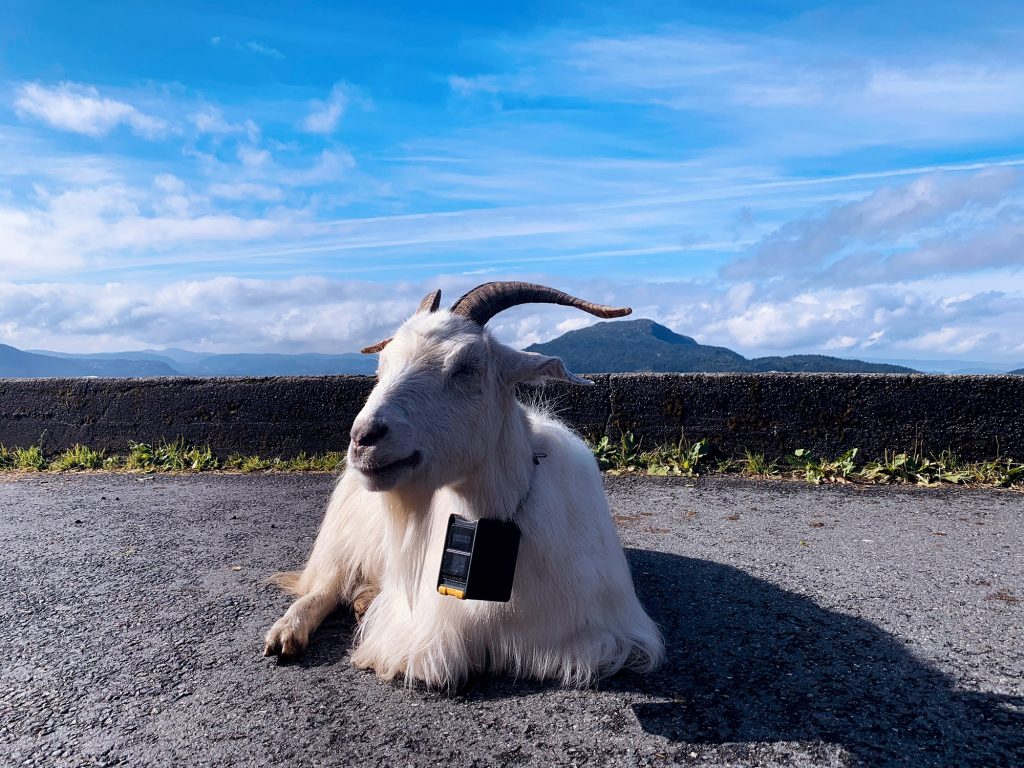
To get to the beginning of the path down, walk around the Fløyen Folkerestaurant with the view over Bergen to your right hand side (and the restaurant on your left). You’ll pass the wooden building where the goats live – and might even see them! – before reaching a concrete path that feels like it’s sticking out of the mountain over the view.

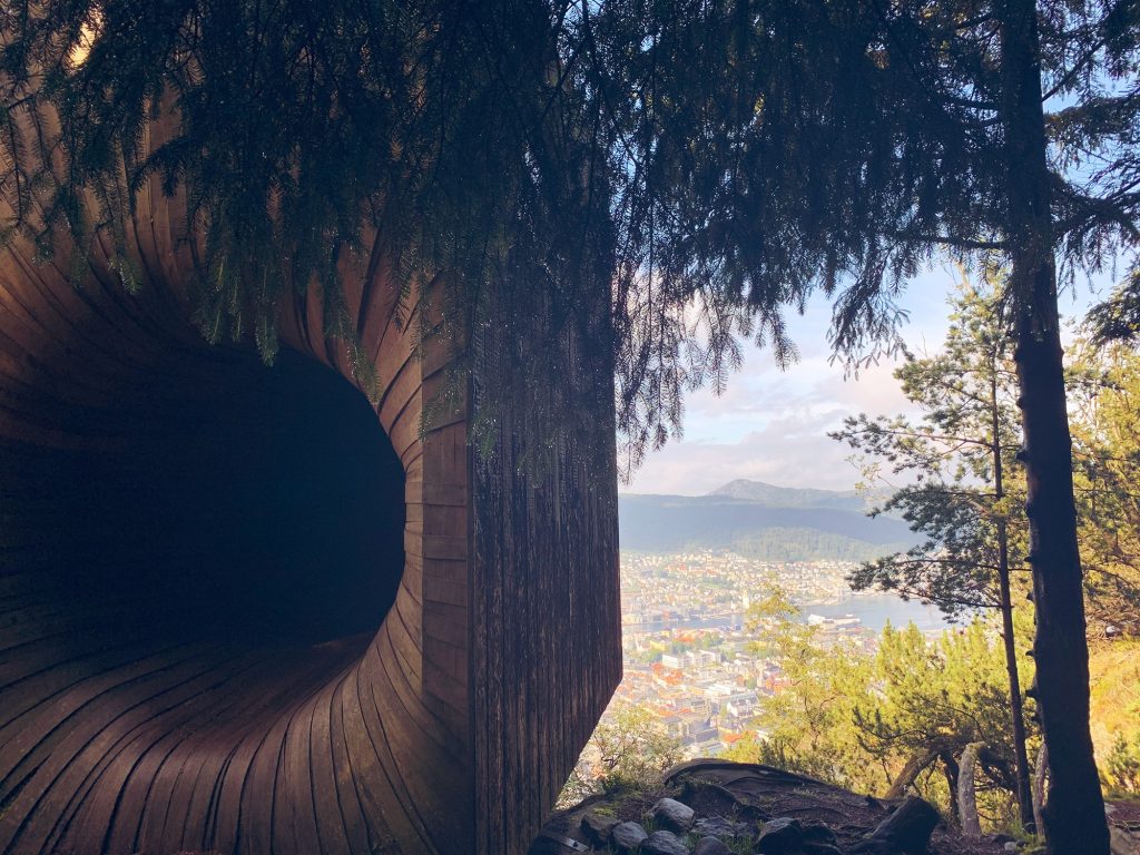
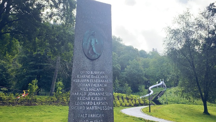
The path winds around an active park where you can zipline and take part in various outdoor activities. If you take a detour and walk through the forest you’ll get to Bergen’s secret cabin, TubaKuba.

TubaKuba

TubaKuba was designed by students from the Bergen School of Architecture as a way to get more children to play in the Norwegian woods. The wood has been bent to mimic the horn of a tuba (hence the name). The cabin is intended to be explored – children have an easier time fitting through the rabbit hole door than adults and can emerge on the other side to be in a small box that overlooks Bergen city centre.

TubaKuba can be rented as a cabin for a night – groups of up to five individuals (with families being given priority) can rent TubaKuba on a nightly basis. It’s small, but very cozy with a wood stove and a lofted area with the beds. The only condition is that they accept that people may come through the rabbit hole at any point to have a look – it is first and foremost a public space.

TubaKuba Links:

http://www.bas.org/en/News/Tubakuba-er-apnet!

https://www.atlasobscura.com/places/tubakuba

https://www.bergenoghordalandturlag.no/artikler/turtips/12632-utforsk-nrmiljet-besk-tubakuba/

The Old Ski Jump

If you keep an eye out on your right hand-side, you’ll pass a plaque. It commemorates an old ski jump that used to be on the side of the mountain. On Midsummer 1949 an event took place here that brought well-known ski jumpers from around the country to jump off this old ski jump. If you look up the mountain behind the plaque, you can see where the old ski jump was.

The stone reads:

til minne om tranegutter som St. Hansaften 1949 arrangerte hopprenn i denne bakken med deltakere som Birger Ruud, Petter Hugsted og med flere av de best hopperne i Norge. Bakkerekorden har tilhørt vår alles skuespiller Rolf Berentzen.

in memory of ‘tranegutter’ who on Midsummer 1949 arranged jumping races on this hill with participants such as Birger Ruud, Petter Hugsted and with several of the best jumpers in Norway. The record has belonged to our all-time actor Rolf Berentzen.

Skansemyren Sports Ground

We are now in the residential area of Skansemyren, which has a mix of houses and apartments. We’ll walk between them for a little while, giving you a nice look at some typical family homes.

Fjellsiden

You’re getting close to the city when you see the bunched up wooden houses of Fjellsiden. Those 19th century buildings were built to accommodate Bergen’s rapidly growing population. You see them when there’s less than 1km to go!

Back at Tippetue!

The path ends at the husk at hesten trenger hvile rest stop we began at. From here, cross the road and head back down the stairs to reach Skansen and the city.

I hope you enjoyed the walk! In total, it should take 2-3 hours, depending on your pace.