
Drive it Yourself: Oslo to Bergen on the E16
The E16 between Oslo and Bergen follows the historic road between east and west Norway that has existed for thousands of years. Over the centuries the road has gradually been modernised, but traces of the past remain.
While the E16 is the longer way between the two cities, the road is lined with historic monuments, including stave churches, runestones, and lodgings. It makes for a great, scenic road-trip!
Here’s our guide to the E16 highway.
In this article...
Download this Guide
All of our guides can be downloaded via our online store.
We offer downloadable versions of our self-guided drives on our online store.
Online Guide
- Information about points of interest
- Images of each point of interest
- Historic overview of the neighbourhood
- Directions between points
- Historic photos
- Information about facilities along the way
Downloadable Guide
- Information about points of interest
- Images of each point of interest
- Historic overview of the region & towns
- Directions between points
- Historic photos
- Facilities including supermarkets, toilets, petrol, hotels, cafes, restaurants with addresses.
The Drive: Oslo to Bergen on the E16
This drive begins in Oslo.

Oslo Travel Guide
Read more about Oslo, Norway’s capital, on our dedicated travel guide page. Click the button below.
Sandvika
Neighbourhood
The first neighbourhood you drive through is called Sandvika. While it is technically part of Oslo city, it is in many ways regarded as its own community. The population is approximately 130,000.
Claude Monet visited the city in 1895. During his visit, he painted the city. Perhaps the most famous work from this visit is “Sandviken Village in Snow”, which shows the Løkka Bridge in the foreground with the hill Kolsås in the background. The bridge still stands today.
The area of Sandvika has existed since for thousands of years. The Sandvik grounds were rich fishing grounds that provided an important supplement to the farms in Sandvika.
Sandvika is home to Scandinavia’s largest super mall – the Sandvika Storsenter – with 190 stores and a total area of 60,000 square metres or 650,000 square feet.
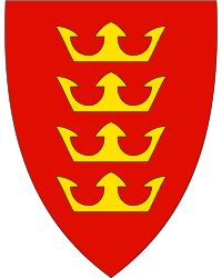
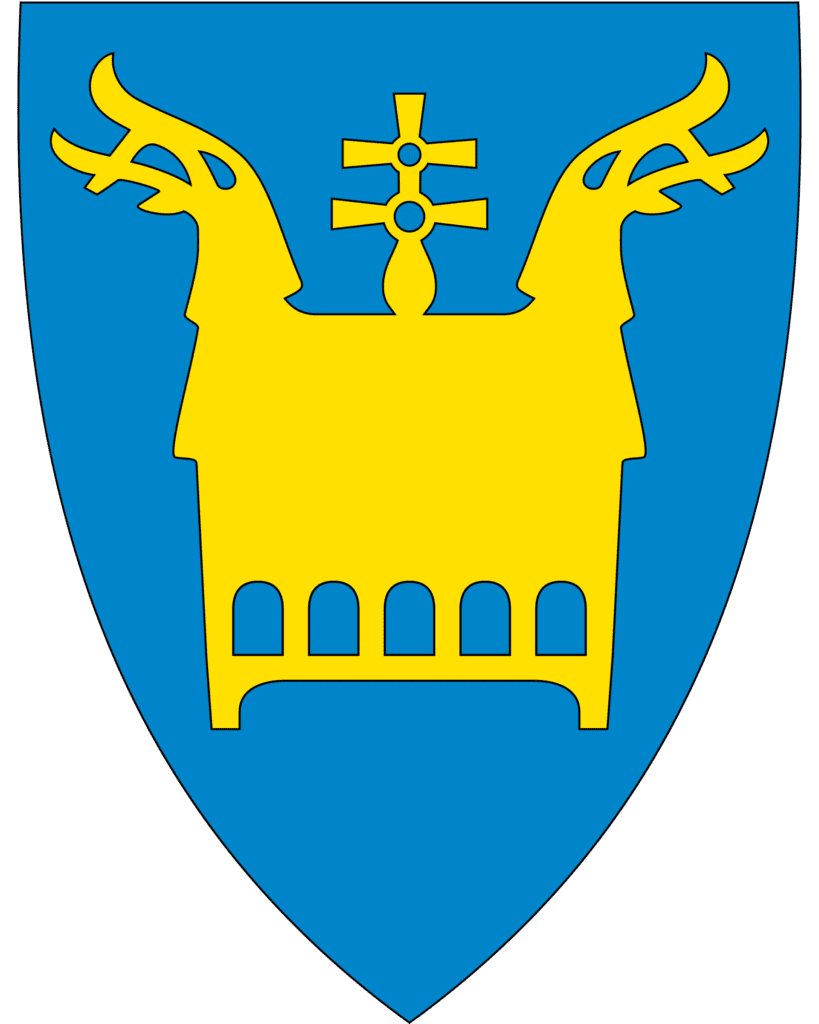
Hole Municipality
The municipality of Hole is situated around the Tyrifjord, where the soil is fertile and suited to growing fruit, berries, and other agricultural products. The coat-of-arms depicts the four Norwegian Kings who lived in the municipality in the 9th to 11th centuries. The most famous of the four is St. Olav (Olav Haraldsson), though Harald Hårdrade is a close second for fame – he was the one credited with ending the Viking Age at the Battle of Stamford Bridge in 1066. The other three kings are Halvdan Svarte (820-860), Sigurd Syr (-1018), and Harald Hardråde (1015-1066). Harald Hardråde is the king who lost at the Battle of Stamford Bridge in 1066, which is considered to be the event when the Viking Age ended.
Hole is important in Norwegian history. Archaeological finds from the Roman and Migration periods are numerous, and Hole is known as one of the traditional landscapes from the Viking Age and plays a prominent role in the Norse sagas.
Stein Church Ruins (Stein Kirkeruin) are located at Steinsfjorden. The church was constructed in the latter half of the 1100s. By the second half of the 1500s, the chapel was no longer in use. There are some historic churches in the area: Bønsnes Church is a medieval church from 1100 and Hole Church is probably from 1200.
Utøya
Memorial
As you drive along the Tyrifjord, down on your left is the island Utøya. This was the site of the terrorist attack that happened in Norway in 2011. It is possible to take a detour down to the memorial site. On GPS it is marked as “Minnesmerke Utøya”.
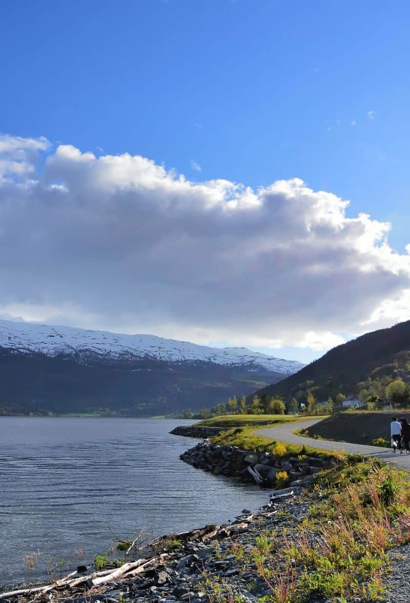
Tyrifjord
Lake
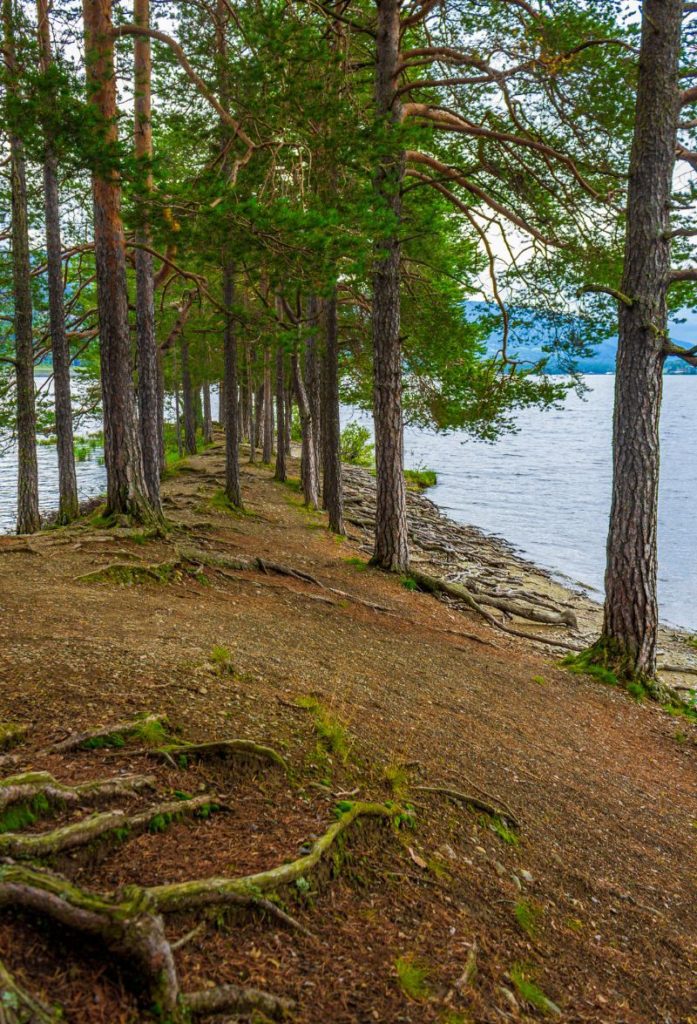
The Tyrifjord is a lake (not a fjord like the name suggests). It is the fifth largest large in Norway with an area of 139km2 and a maximum depth of 295m. It is one of Norway’s most species-rich lakes. The lake used to be part of the sea, but as the land has risen it has become landlocked. In the fjord, free fishing without a licence is accepted based on tradition and custom. Brown trout is caught in the lake, though crayfish is also popular.
Sundvollen
Village
Sundvollen is a village located along the eastern part of the Tyrifjord. The name comes from the name of a farm that used to be here. Sundvollen is most noted for its hotels. Sundvolden Hotel is one of Norway’s oldest hotels – it was mentioned in written sources dating from 1648. Kleivstua Hotel was a coaching inn in 1780 which catered to travellers going between Christiania (Oslo) and Ringerike. It is on the Old Royal Bergen Road, the historic road between Oslo and Hadeland. The road is also part of the Old Pilgrims Route from Oslo to Trondheim. Understandably, there were many travellers coming through here. They would stop at one of the hotels for food, accommodations, and to give their horses a rest. Unfortunately both of the hotels have been renovated extensively, so there’s no trace of the original lodgings.
Petroglyphs from the Bronze Age have been found approximately 100m from the E16 and show ship figures, circuit figures and bowl pits.
In Sundvollen you can hike to “Kongens Utsikt”, a scenic viewpoint overlooking the Tyrifjord.
Norderhov Church
Historic Church
Norderhov Church is a medieval church that was built in 1170. The church is built in local sandstone and limestone in a Romanesque style of architecture. The church was built on a former pagan court for the god Njord, and that’s where the name Norderhob comes from. The church was historically the most important church in Ringerike.
Across the road from the church is Norderhov’s old rectory, which is now the Ringerike Museum. The museum has runestones and its collection of the private belongings of Jørgen Engebretsen Moe, a Norwegian author most famous for ‘Norske Folkeeventyr”, a collection of Nowegian folk tales which he edited in collaboration with Peter Christen Asbjørnsen.
The church and vicarage are known for their close association with the vicar’s wife Anna Colbjørnsdatter (1667-1736), who legend says tricked the Swedes by getting the Colonel drunk. This gave the far smaller Norwegian-Danish force an opportunity to inflict a defeat on the Swedes. This was in connection with the Battle of Norderhov in 1716. She then received heroine status and is one of the very few female heroes in Norwegian history. She was married to historian and parish priest Jonas Ramus and they are in the crypt under the church. Her portrait can be seen inside the church. The pulpit is from 1582 and is considered one of Norway’s oldest preserved pulpits.
Hønefoss Travel Guide
You don’t drive through Hønefoss on the E16; it is approximately a five-minute drive into the town. However, this is the first major town that you pass on the drive, so it can be a useful rest stop.
Hønefoss is regarded as the centre of Ringerike. The town is located by a waterfall and is founded on the sawmill business that arose from the waterfall in the 17th century. Hønefoss is home to several factories and other industry, with Norske Skog Follum, a timber company, having its headquarters here. Dating from 1873, Norske Skog Follum was one of the largest producers of newsprint in Europe until it closed in 2012.
Follum
Village
Follum is a small village after Hønefoss on the western side of the Ådal River. It is on the old road that led to the Ådal Valley. The name comes from the oldest farm in the area.
Ådal Valley
Valley
You are now driving through the Ådal Valley.
The first church built in Ådal was a stave church built during the 15th century. It is mentioned in the Diplomatarium Norvegicum in 1462. The church was eventually removed to make way for a larger, more modern church.
Viker Church is located on the western shore of the Sperillen Lake and is from 1702. The pulpit, altar and crucifers from the old stave church are inside Viker Church.
Valdres Natur og Kulturpark
Preserve
You are now entering the traditional district of Valdres, which is situated between the Gudbrandsdal and Hallingdal valleys. The river Begna runs through the municipality.
The traditional Valdres region is located approximately halfway between Oslo and Bergen. The valley has the Jotunheimen mountains to the west and the north. Historically, Valdres has been an agricultural economy, but tourism is becoming more important – especially for skiing.
Sør-Aurdal Municipality
The name comes from the valley in which it is located. The coat-of-arms represents a medieval reliquary that is based on the one found at Hedal Stave Church. It has two dragons heads in the design since Sør-Aurdal is one of only two municipalities in Norway that have two stave churches that are still in use. The colour blue represents the two river systems that have historically been important for the logging industry and sawmills.
Olav Haraldsson, later St. Olav, travelled through Valdres in 1023 and visited Reinli. At the time, there was a pagan temple at the same location where the stave church stands.
One of the highlights of the municipality is Hedalen Stave Church was built in 1160 but rebuilt in 1699. An old legend says that the valley was abandoned during the Black Death and the church was discovered by a bear hunter. A hide is hanging in the church, although there is only a small part of it left as visitors have cut away pieces over the years. We will pass the turnoff for it a little later.
Bagn
Village
Bagn is the administrative centre of Sør-Aurdal. This area saw extensive fighting during World War II as advancing German forces were stopped in Bagn. The battles in the valley were extensive.
In Bagn you can find the Bagn Bygdesamling, a small museum that includes farmhouses, a sawmill, a flour mill, and other buildings. The museum is on a preserved farm. Next to Bagn Church is an intact shop from 1881, which may have been the largest business in Valdres. The shop is open during the summer holidays and before Christmas.
Bagn Church is the main church in the valley and seats 350 people. The earliest church in the area was mentioned in 1327, but the church was not new that year. The first church was likely a wooden stave church from the 13th century. The old church was closed in 1683 and for some time the locals had to use Reinli Stave Church. The church that we see today is the second church and dates to 1736.
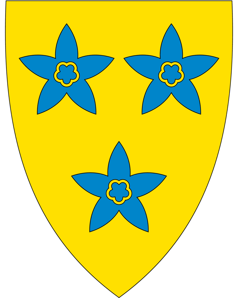
Nord-Aurdal Municipality
The coat-of-arms for Nord-Aurdal depicts three blue flowers called ‘Snow Gentian’. The flowers are locally known as ‘the blue eyes of Christ’ and grow all over Norway but grow abundantly in this area. They represent the three main settlements of the municipality: Aurdal, Fagernes, and Leira. This is a fairly mountainous municipality. The highest point is 1,325m (4,347ft) high and about 50% of the land is above 900m (3000ft).
Aurdal
Village
Aurdal is a small village with a population of around 647. The village is known for its winter sports activities and is in Valdres’ Alpine Centre. There are several places to stay and eat. There used to be a railway here – the Valdresbanen – but it stopped in 1888.
Just after Aurdal is the Noraker Gård. This farm is currently being run by the 12th century. Rakfisk is a highly desirable food from this farm, and in 2022 they won the expert jury award at the Norwegian Rakfisk Festival. In 2006, Rakfisk from Valdres was approved as a protected geographical indication. This means that only fish hatched, reared, and processed in Valdres can be sold under the Rakfisk fra Valdres brand.
They have a farm shop that also sells trout, mustard, beer, moose, goat, and art.
Rakfisk is a dish made from trout or char where it is salted and autolyzed for two or three months. It is then eaten without cooking and has a strong smell and pungen salty flavour. After the fish is gutted and rinsed, it is placed in a bucket and salt. It is then placed under pressure with a lid that fits down into the bucket and a weight on top. A brine is formed as the salt draws moisture from the fish. The rakfisk bucket is stored at under 5 degreesC for one to three months. The finished product doesn’t need cooking.
Fagernes
Fagernes is a major hub along the E16.
The word ‘Fagernes’ is a combination of ‘fager’ (beautiful) and ‘nes’ (headland). The town was established in 1857, when the first trading operations started. The first hotel started operations in 1875, and from 1906 there was a train line (it has since closed).
If you are travelling in November, you may be in town for the Norwegian Rakfisk Festival, which takes place in the first week of the month.
In Fagernes is the Valdres Folkmuseum, a well-known museum that shows the culture of the Valdres region. It is both an indoor and outdoor museum.
Ulnes Church
Historic Church
Ulnes Church is a beautiful church that you’ll pass shortly after leaving Fagernes. The earliest records of the church go back to 1307, but it was not new that year. Estimates say that the church was built around the year 1265 as its architecture reflects the transition between Romanesque and Gothic architecture.
In 1675, there were plans to replace it with a new wooden church as it was decaying, but thankfully that didn’t happen. Around 1720, the church was put out of use. It was described in 1733 by a bishop as “a pile of stones” with only the choir being suitable to keep. The church was restored in 1737, with the nave being demolished and rebuilt. The interior was also refurbished.
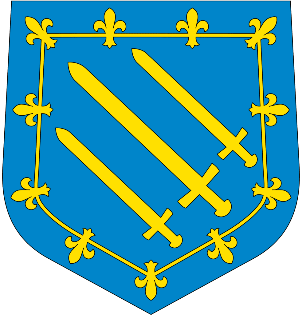
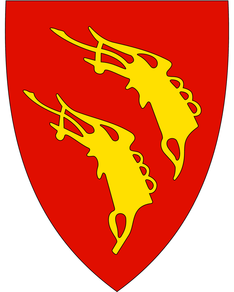
Vestre Slidre Municipality
The next municipality is Vestre Slidre. The municipality is partly named after the historic Slidre Church, which you’ll see soon. The coat-of-arms are based on a heraldic decoration found in the Slidredomen church that dates to 1170. The design was originally part of a seal that belonged to a medieval nobleman in the area. The meaning of the design is unknown.
Vestre Slidre is mentioned in the Old Norse sagas. Harald Fairhair, who became the first King of Norway (872-930), did some conquests over petty kingdoms. One of the encounters that led to the overall conquest was with Skallagrim Kveldulvssøn in Vestre Slidre. Also, in 1023, King Olav Haraldsson came to the area to Christianise the people. The locals were caught unaware, and Olav took all their boats. They would only get them back if they accepted Christianity, which they did.
Lastly, in 2000 Sami gamme huts (a simple form of a hut) were found in the municipality. This is the southernmost discovery of Sami settlements.
Slidre
Village
Slidre is the next village on the E16. It has a population of around 337.
In Slidre you can see the Vestre Slidre Church (Slidredomen), a historic stone church from around 1170. The church is built in the Romanesque style of architecture and the stone walls are approximately 160cm (63 inches) thick.
The church is unique in that it doesn’t have a west portal. Instead, the main entrance is from the south.
The furniture is from the 18th century, while there are frescoes from the 15th century. The choir has a painted wooden vault from the 14th century, which depicts Jesus Christ in the mandorla centrally in the middle. On the north wall, a medieval coat-of-arms has been uncovered and is used as Vestre Slidre’s coat-of-arms.
The area here is very old. Above the village of Slidre is an ancient burial ground called the ‘Gardberg Site’. Here you can see the Einangsteinen runestone. It is believed to be from the 4th century and is considered the oldest runestone in the Nordics that is standing in its original place. The name Einang comes from a nearby farm.
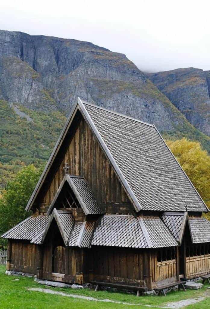
Lomen Stave Church
Lomen Stave Church is from around the year 1192. The church is a pillar stave church, meaning the main room has four supporting stave beams. The style and decoration of the church is part of the “Valdres-Sogn” stave churches. This groups many of the churches from Valdres Valley and around the Sognefjord that have the same features. Considering the old King’s Road used to run through the valley to Sogn, they likely shared design tips.
Like all stave churches, Lomen Stave Chuch has fallen victim to modernisation and renovation. The choir is from a major renovation in the 1750s. During this time, the walls were also expanded to make the main room larger.
During the last refurbishment, archaeological excavations uncovered 71 artefacts, including jewellery and coins. The oldest coin found here is from King Sverre’s time, 1177-1202.
Today the church, neighbouring bell tower and cemetery are under protection. Many original features of the church remain, despite major renovations. The most illustrative are the portals, which have decorations of dragons, vines, and animal heads. Some of the portals have moved around the church, but they do date back to medieval times. These kinds of decorations are common on Valdres-Sogn stave churches. The roof and wall timbers are also original.
Vang Municipality
Vang is a small municipality in the traditional Valdres region. The name comes from an old farm, though vang comes from the Old Norse word vangr meaning ‘field’ or ‘meadow’. The coat-of-arms are rather special – they are based on historic descriptions and depictions of the personal arms of a local medieval nobleman called Sigvat of Leirhol. He was named as one of the members of the delegation that followed King Håkon V Magnusson to Copenhagen in 1309. He then became the governor of Valdres. His coat-of-arms can also be seen on Vang Church.
The municipality was originally populated by migrants from Western Norway.
The ancient Vang Church was the site of a legal court held by King Håkon VI in 1368.
Høre Stave Church
Høre Stave Church is one of the stave churches with an insight into the fascinating past of Norway. Especially around and shortly after the time of the Civil War in the 12th and early 13th century. We know that the Christianisation of Valdres wasn’t easy. St. Olav, then King Olav, came from the west through the valley. He held farmers hostage and burnt down farms until they agreed to convert. According to the Sagas, Olav had churches built and clergymen appointed. None of these churches remains, but many of the stave churches are on the same spot, including Høre Stave Church.
In medieval times, Valdres had many churches. There were at least 21 of them; 18 of which were stave churches. To compare, the neighbouring valley Hallingdal had 8 stave churches. Sadly very few remain today.
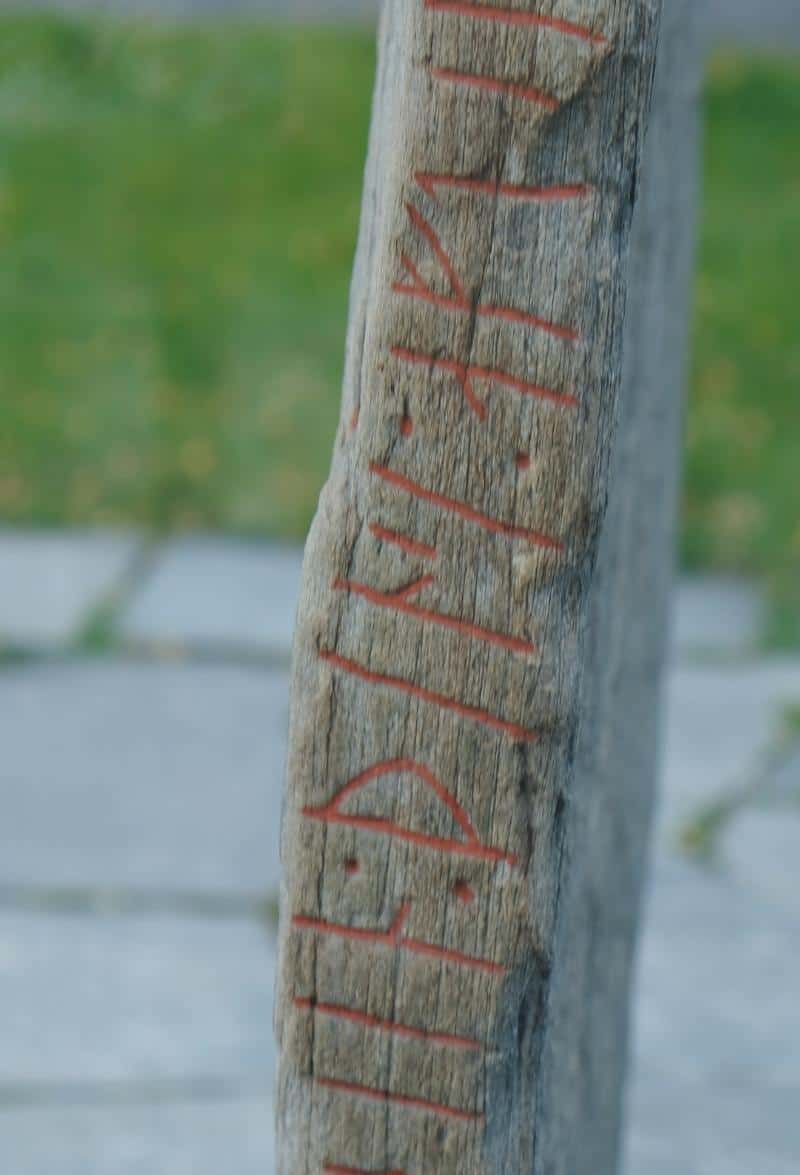
Judging from the rune inscriptions found inside the church and dating the timber, Høre Stave Church is from around 1179. It was originally a pillar church, with four corner staves. Under the church are graves, some of them children. It wasn’t allowed but common to bury children under stave churches. As they had not been baptised yet, the parents worried the children would not be accepted into heaven. Some foetuses were also found under the church. There is evidence of ceremonial burials under the church, likely from pre-Christian times.
The original stave church somewhat exists today; all that remains is its skeleton. The skeleton is hidden by the cladding. The ship is still the original size, giving a sign of the original size of the church room.
Vang i Valdres
The word ‘vang’ comes from an old farm that stood here; this farm is also where the first church stood. Vang, like the rest of the Valdres Valley, was populated by migrants from Western Norway. People have lived in this valley (Vangr means meadow or field) for thousands of years. This is likely due to its proximity between east and west Norway. Vang is by a lake just before the mountain pass to Western Norway and thus made for a good rest stop.
Vang became the site of a legal court (ting in Norwegian), and the ancient stave church was next to the site. The site was famously used by King Haakon VI in 1368 when he was settling a boundary dispute.
Vang also became part of the ancient royal road between Bergen and Oslo. In the 16th century, it was the postal road, and from the 18th century, it was Kongevegen. Kongevegen was the first road for horse and cart between East and West, and I’ve covered it on my page for the E16. Today, the highway follows the same path as Kongevegen. Still, the town and nearby area became a place where travellers would seek refuge at some point on their journey.
The Vang Stone is clearly marked and is by the E16. Parking is available across the street.
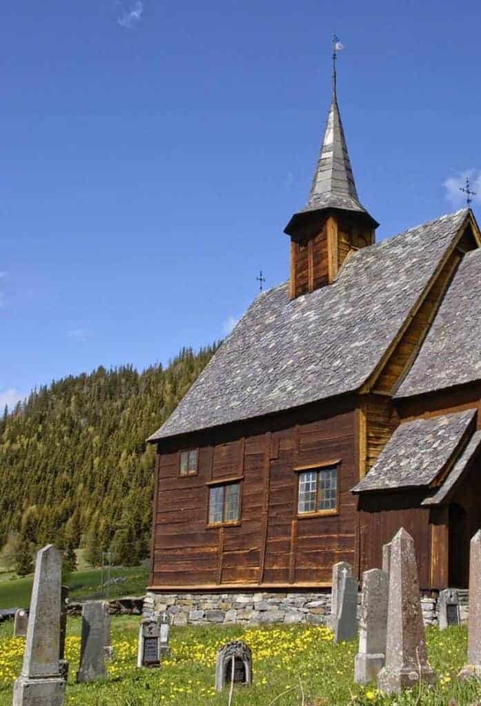
Øye Stave Church
Øye Stave Church is one of the smallest and oldest stave churches in Norway. It is likely from some time during the second half of the 12th century. The church is first mentioned in written documents in 1347. It stood by the old traffic road over Filefjell, which was the first road between Bergen and Oslo.
Kongevegen
Historic Road
As you may have noticed by now, there are a number of churches and important historic sites along the E16. This is because the E16 follows one of the ancient crossings between east and west Norway. It is called ‘Kongevegen’ (The Kings Road). The road is ancient and is believed to have been the first way between east and west. The first postal road was laid here in 1647, and the road received official status in 1791.
Ever since people have lived in Norway has this been the most useful route between east and east. A number of tracks show traffic throughout the Stone Age and Bronze Age. The road was also important in the Christianisation of Norway, as is evident in the large number of churches along the road. Many ancient farms here also became inns for travellers, and some survive today. In the Middle Ages, the road was known as the most difficult and dangerous in the country. As many Danish public servants were travelling between Bergen and Christiania (Oslo), it was decided to modernize the road in the 17th century. The road was built as straight as possible and became known as the Royal Postal Road. Most of the trip was done on foot.
In the 18th century, travelling with horse and carriage became more common, so it was decided to modernise the road again. In 1791, the official road was completed and Kongevegen became the first carriage road between east and west Norway. The road was built by hand. Today the E16 skips many of the most difficult parts with tunnels, but parts of the old road remain and are now a popular hiking trail. In 2017, Kongevegen was awarded the EU’s most important cultural heritage award, Europa Nostra.
It is possible to spend the night in one of the many lodges over the mountains and do short or long hikes.
Tyinkrysset
Village
Tyinkrysset is a village located in the Filefjell mountains, which is where the historic crossing between east and west Norway was. The village sits at an elevation of around 900 metres (3,000 feet). This area is popular with hikers. You’ll find some hotels up in the area.
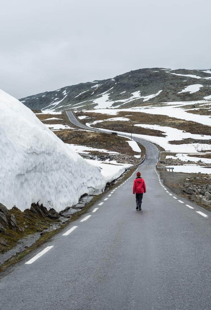
Filefjellet Mountains
Mountains
You are now crossing the Filefjellet mountain range across to Western Norway. It has been an important crossing path between east and west Norway since ancient times. The highest peaks are 1013m above sea level.
The E16 follows a lot of the same path as the old road.
Lærdal Municipality
Lærdal is the first municipality in Vestland county. Lærdal has a dry climate, with 420mm – 600mm of rainfall annually in the inhabited areas. Through the valley runs the Lærdalselvi, or the Laerdal River, known as the ‘Queen of the Salmon Rivers’. It is one of the country’s most famous large salmon rivers. The valleys have opportunities for hunting deer, reindeer, and elk. The valley was inhabited and used by humans as far back as 6,000 years ago. In places, the vally has been used since the Early Stone Age. In the mountains are the first traces of people in the mountain areas of Norway.
Lærdal has always been the main road between east and west Norway. The area where the village Lærdalsøyri is developed as a marketplace in the Middle Ages. Coastal farmers brought herring and fish and exchanged goods with mountain farmers from Valdres. At least five generations of road structure remain in the Lærdal valley, which proves the valleys important function as a hub. Lærdal has a long tradition with agriculture. The lower part of the valley has one of the country’s best climatic conditions for growing vegetables. Early production of potatoes and vegetables is important.
Borlaug
Village
The next village is Borlaug. This is where the E16 joins with Highway 52, which runs over the Hemsedal mountains (it’s an alternative way between Oslo and Bergen). You’ll pass some old farmhouses on the right as you drive through the village.
Borgund
Village
Borgund is a mountain village. It has been an important spot on the journey between east and west Norway for hundreds of years. There are several farms in the village and agriculture is the main industry here.
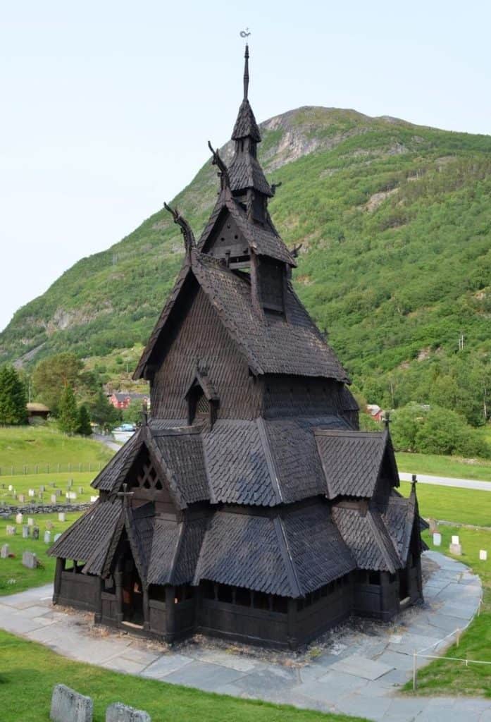
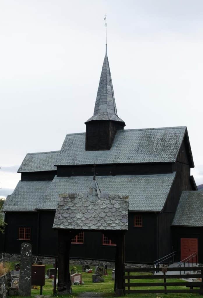
Borgund Stave Church
Borgund Stave Church is the most famous of Norway’s 28 remaining stave churches. The exact age of Borgund Stave Church is unknown. It is possibly as old as 1150 when looking at the timber. However, the church is generally regarded as being from around the year 1200. It is dedicated to the apostle Andrew.
The church is fascinating; a visit to it should not be missed. The church is open in the summer for tourists for a small fee. Check their website for more information.
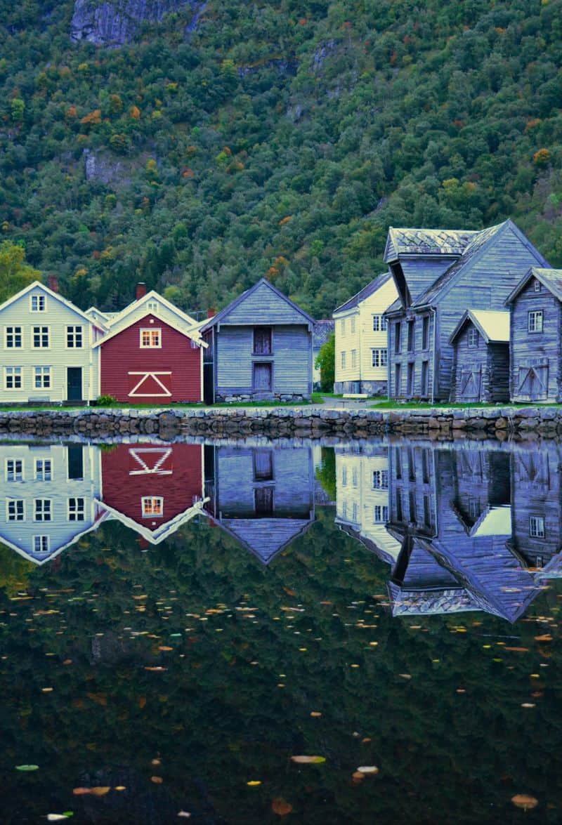
Lærdal
You will bypass the village of Lærdal on the E16, but it’s a worthwhile detour to drive into the village. Lærdal is a historic trading place on the old postal route between Oslo and Bergen. It was where the travellers would leave their horses behind and take boats the rest of the way to Bergen. Lærdal is also a fantastic place for trying the foods from the Sognefjord region, including potatoes, berries, and cider.
You can read about Lærdal on our dedicated travel guide page.
Aurlandsfjellet Tourist Road
In the summer months, it’s possible to take the Aurlandsfjellet Tourist Road across to Aurland instead of going through the tunnel.
Lærdal Tunnel
Tunnel
Welcome to the world’s longest road tunnel! The Lærdal Tunnel is 24.5km (15.2 miles) long. The tunnel was constructed between 1995 and 2000 and cost $113 million USD. The tunnel does not have emergency exits; there are emergency phones every 250 metres as well as 15 turning areas for buses and semi-trailers. There are rooms in the tunnel with food and supplies in case anyone gets stuck in there. The tunnel has high air quality through ventilation and purification.
It incorporates features to help manage the mental strain on drivers. Every 6km there is a cave to separate sections of the road. The lighting varies throughout the tunnel and caves to break the routine.
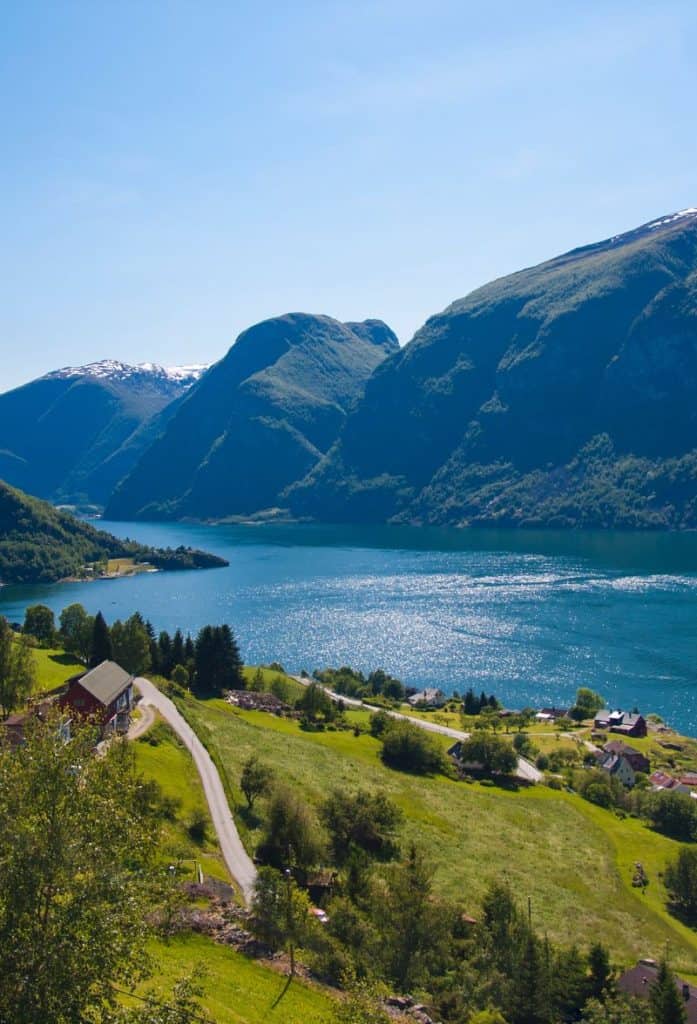
Aurland Municipality
Aurland municipality is perhaps one of the most visited municipalities in Norway. After all, it is home to the famous Flåm village as well as the UNESCO World Heritage-listed Nærøyfjord. The main industry in Aurland is agriculture, with goats’ cheese being an important product from here. Tourism is also a major industry.
Aurland
It is worth driving into the village of Aurland. In many ways, it is more charming than Flåm. Aurland is home to Vangen Church, a historic stone church from 1202. The fact that it is built in stone and not wood signifies that the area must’ve been of importance around the time it was built. Aurland is also home to the Aurland Shoe Factory, where the pennyloafer was invented.
Flåm
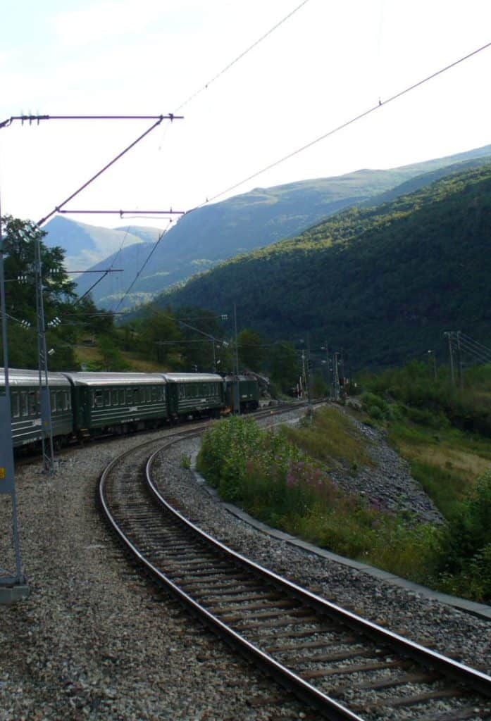
Located at the end of the Aurlandfjord, a branch of the Sognefjord, Flåm is a gorgeous little village. Many people come to Flåm to do the Flåm Railway, regarded as the most beautiful train journey in the world. This train journey goes from Flåm through the valley and up the mountains to Myrdal, located close to the Hardangervidda National park. Myrdal is also where you board the train to Bergen or Oslo. Besides the train ride, there’s a gorgeous ferry journey from Flåm to Gudvangen. It takes you on the UNESCO World Heritage-listed Nærøyfjord – something you shouldn’t miss.
Flåm has a population of 350, though on a summer day there will be several thousand people in the village. Seriously. The Flåm Railway has become incredibly popular – it’s sold out months in advance. Additionally, Flåm is becoming a major cruise port.
Gudvangen
Village
Gudvangen is a small village with a population of around 120. It is a popular tourist destination due to its proximity at the end of the Nærøyfjord. The popular Gudvangen – Flåm cruise stops here, and many people also come to visit the Viking Village in Gudvangen. The Viking Village is a recreated village as Gudvangen is believed to have been an important trading place for the Vikings.
It is worth driving into Gudvangen (approx 5 mins off the E16) and stopping in front of the Nærøyfjord. The Nærøyfjord is the narrowest branch of the Sognefjord, only 250 metres at its narrowest and 12 metres at its shallowest. The fjord is 20km long. It is UNESCO World Heritage-listed as it is one of the best representations of what a fjord looks like.
Stalheim Hotel & Stalheimskleiva
Historic Hotel
The site where the hotel is has been an important place for hundreds of years. When the Royal Postal Road between Oslo and Bergen was established in the 17th century, this hotel was where the postal workers would stop to rest.
The hotel as it is known today opened in 1885 with 10 rooms. The hotel burned down in 1900, 1902 and 1959. The current hotel building you see today is from after the 1959 fire. Today the hotel is a high-end historic hotel where many famous people have stayed. It also has arguably one of the best views of any hotel in Norway, but good luck trying to see it. They don’t allow visitors to come in and take pictures without paying or having coffee.
Stalheimskleiva is a 1.5km (1 mile) stretch of road that leads from Stalheim Hotel down to sea level towards the Nærøyfjord. It was one of the country’s first roads built according to the new road engineering requirements that came around 1850, the so-called chaussee, with a maximum gradient of 1:20. Around 1,000 men built the road over 7 years. The road was a motorway for cars going in both directions, which was of course dangerous. It was eventually replaced with the two tunnels you’ll be driving through. The road then became a one-way tourist road, however in 2020 part of the road was in danger of collapsing due to landslide. In 2021, the road closed for all motor vehicles for the foreseeable future. This is due to the poor condition of the road and the extensive damage done by traffic. The road is on the conservation plan, so it’s being repaired and may become a hiking trail instead.
Across from the Stalheim Hotel is an open-air museum with farmhouses collected from the area. There are also a number of hiking trails starting from around the hotel, so it could be a good option for spending the night.
Voss Municipality
Voss municipality is an inland municipality with about 90% of the area mountains over 300m (1000ft) above sea level. Because of that, the municipality is a popular place for people from Bergen to go skiing. Voss is home to the largest ski resorts in Western Norway. The area has been settled for at least 3,000 years, with people coming here for the rich valleys, waters, and animal life. Voss was also largely an isolated municipality, meaning it has kept its own unique culture and traditions.
Oppheim Lake
Lake
After leaving Gudvangen, you will drive up the Nærøy Valley. This is part of the UNESCO World Heritage area. The stone they are mining here is anorthosite, a rare stone found in large amounts in this valley. The stone is typically used on the roads because it is reflective.
The drive through the valley is short; you will then take two tunnels to get up the mountain. However, before you get into the tunnels, you will see a red hotel and a hairpin-turn road on the hillside.
As you drive along the lake, you’ll drive through the village of Oppheim and past the Oppheim Church.
Vinje
Village
Vinje is a small village located at the junction of the E16 and the Rv13, which runs over the Vikafjellet mountains to Vik by the Sognefjord. This is a long but beautiful detour; the road does close in winter, though. In Vik you’ll find the Hopperstad Stave Church (one of Norway’s 28 remaining stave churches) as well as some other historic buildings.
Tvindefossen
Waterfall
It is worth stopping and taking some photos of Tvindefossen Waterfall. It will be clearly marked with signs as you approach it. The waterfall is 152m high and has two streams (tvinde=twin). In the late 1990s, the waterfall acquired a reputation for having special powers of reviving sexual potency, so it became common to see visitors from the U.S., Japan and Russia visiting and filling containers with water.
Voss
If you are following the E16, you will take a bypass and not see Voss at all. It is possible to drive into Voss, park by the lake, and see some of the town.
Voss has a population of around 14,000 people. The town is known for its cultural traditions in folk music, art, handicrafts, and traditional foods. Voss sits on the shore of the lake Vangsvatnet.
During World War II, the town was bombed by the Luftwaffe and almost all the buildings were destroyed.
In Voss it’s worth visiting Voss Church. According to legend, the people of Voss was forced to convert to Christianity by King Olav (later Saint Olav). A stone cross can be seen by the lake which is believed to have been erected by St. Olav himself. The church was built in 1277 and is one of the only buildings to survive World War II.
In Voss you can do the Voss gondola to the top of the mountain, where the open-air museum is.
Evanger
Village
Evanger has a well-preserved village centre that is believed to be one of the better-preserved villages in the area. Most of the wooden houses are from the late 19th/early 20th centuries. Evanger is known for its production of cured meat because the village is home to several companies that specialise in the production of traditional meats such as pinnekjøtt (dried, salted rib of lamb), cured lamb, and sausages.
Bolstadøyri
Village
Bolstadøyri is located at the end of the fjord. When the old postal road came through here, this is the point where the workers would leave their horses and take a boat to Bergen. This has always been an important meeting place for the courts as well as a trading post.
Vaksdal Municipality
Vaksdal is a small industrial municipality in Western Norway. The coat-of-arms show three black shuttles for weaving. The shuttles were chosen to represent the textile industry of the municipality. The municipality is located alongside the fjord and is also very mountainous.
Dale
Village
Dale is a small industrial village with a population of around 1,100. The village was built around the Dale power planet and factory that were founded and constructed in the 1870s. The machines were brought over by boat from England – carding machines, spinning machines and 200 looms, as well as finishing and dyeing machines. When the factory was built, there was only a homestead here. However, by the end of the 19th century the factory had 500 employees and the village had 1,000 inhabitants. At its peak in the 1950s and 1960s, Dale had a population of 4,000.
Dale is where the Dale of Norway company is based. This is arguably Norway’s most famous textiles company. They make the sweaters for the Norwegian Olympics Team and are known for their classic patterns. There is an outlet store in Dale, if you wish to visit that.
Osterøy
Island
Soon you will reach the wider part of the Osterfjord, which you will follow for the journey into Bergen. Across the fjord is an island called Osterøy. Osterøy is the largest inland island in Norway at around 330km2. Around 8,000 people live on the island and it is largely an agricultural island. You’ll see the bridge to the island soon.
Vaksdal
Village
Vaksdal is a small village located on the fjord. Like Dale, it is an industrial town. In the late 19th century, the Vaksdal Mølle (Mill) opened here, utilising the hydropower in the region. This is where flour would be made. At the time it was built, it was the largest mill in Northern Europe.
Bergen Municipality
Welcome to Bergen! We are now on the outskirts of Bergen municipality.
Trengereid
Village
Trengereid is the next village you will pass on your way into Bergen. Like the other villages along the fjord, Trengereid was established in the late 19th century around a factory. The factory (Trengereid Fabrikker) specialised in ribbon and lace production.
In Trengereid you will see the round-a-bout that leads off to the Hardangerfjord and Hardanger Tourist Road. However, you have been driving from Oslo, so probably save that for a separate road-trip.
Arna
Village
Arna is one of Bergen’s eight districts and was incorporated into the city in 1972. Around 14,000 people live in Arna and are connected to the city centre of Bergen by the railway. The train between Bergen and Arna takes only 10 minutes as it cuts through the mountain Ulriken; the road follows the coastline and takes 30 minutes to get to the same place.
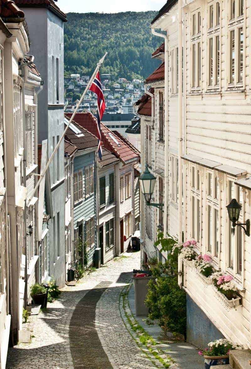
Bergen
Welcome to Bergen! Bergen is Norway’s second-largest city and is regarded as the Capital of the Fjords.
If you liked this drive, or if you have any travel tips, please leave a comment in the section below!