

Drive it Yourself: E6 from Mo i Rana to Trondheim
The E6 (European Highway 6) is the main highway that runs through Norway. This section, from Mo i Rana to Trondheim, runs primarily through the county of Trøndelag. While not as dramatic as some other stretches of road on the E6, it’s the way between central Norway and Northern Norway, and there are some nice places to stop along the way.
You’ll probably use this road if you are looking to get to Northern Norway quickly. Sure, the coastal road is much more scenic, but the E6 is much quicker. There are some beautiful spots to stop at along the way, which I’ve done my best to highlight below.
In this article...
Downloadable Version of This Guide
We offer downloadable versions of our self-guided drives on our online store.
Online Guide
- Information about points of interest
- Images of each point of interest
- Historic overview of the neighbourhood
- Directions between points
- Historic photos
- Information about facilities along the way
Downloadable Guide
- Information about points of interest
- Images of each point of interest
- Historic overview of the region & towns
- Directions between points
- Historic photos
- Facilities including supermarkets, toilets, petrol, hotels, cafes, restaurants with addresses.
Watch on Youtube
All of our roadtrips are available on YouTube to watch. They include information about the area provided in text and voiceover form, plus they show the drive in full (sped up in some spots!) so you can get an idea what the drive is like.
The E6 Between Mo i Rana & Trondheim
Mo i Rana
This drive begins in Mo i Rana. You can find a detailed overview of Mo i Rana on our travel guide.

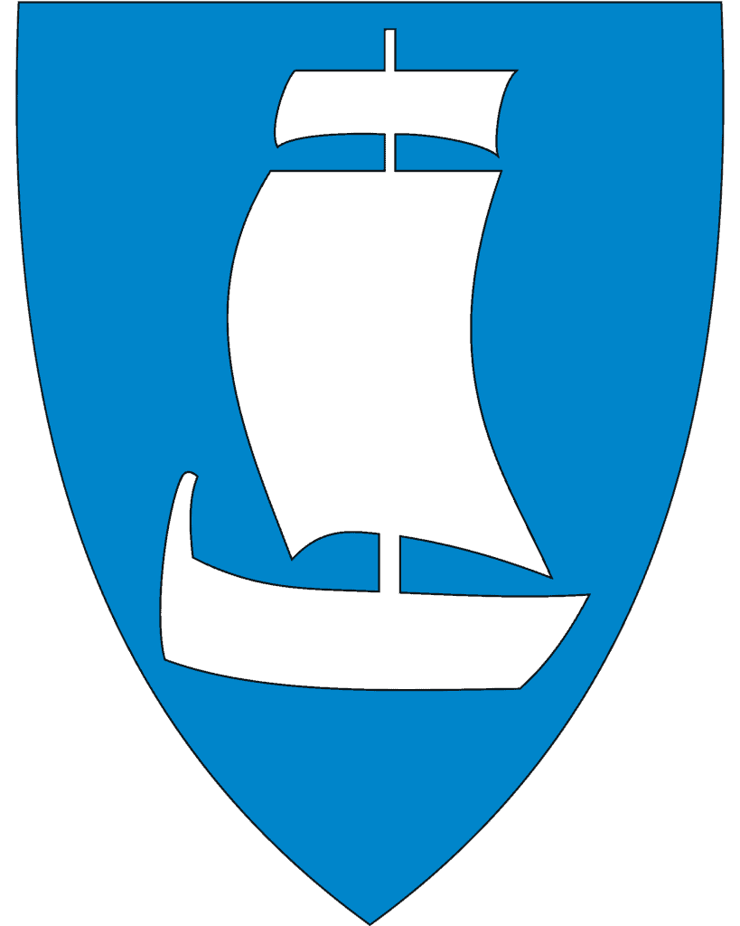
Hemnes Municipality
Hemnes Municipality is located in Nordland County . The municipality focuses on agriculture, power production, the mechanical industry, wood products and boat building. The coat of arms represents this industry with a boat clamp in gold against a blue backdrop.
Hemnes has the oldest operating local radio network in Norway, called Radio Korgen, which was established in 1982.
Finneidfjord
Village
Finneidfjord is a small settlement. The name comes from its Sami heritage; Finniedt was a Sami farm first mentioned in 1567. The settlement saw growth starting in 1925 with the establishment of a margarine factory. The margarine factory was very well-known in Norway until it was bought out and closed in 1973. A caviar factory was built on the same site and operated until 2007, when it closed down.
Bjerka
Town
Bjerka is a small town located at the mouth of the river Røssåga. One of the main employers in town is the slaughterhouse, which slaughters cattle, pugs and sheep producing dry beef and pork ribs. Since 2008, it has been the only slaughterhouse in Nordland County. About 90 employees work here.
Korgen
Town
Korgen is the main town for Hemnes municipality. Many Norwegians have heard of Korgen because of the Korgenfjellet mountain range, which is perfect for skiing. Because of that, the town is quite popular for people staying for a few days to take advantage of the mountains. The tallest mountain in Northern Norway, Oksskolten, is located here. Korgen is also close to the Okstindan Nature and Culture Park.
The Okstindan Nature and Culture Park is a centre full of hiking trails, ski trails, and history. It includes the “Blood Trail”, which chronicles the Nazi’s attempt to construct a railway to Narvik and the Soviet POWs tasked with building the railway. There are also glaciers and caves to explore.
You can easily spend a few days here if you love the outdoors. Visit the park website for more detailed information about what you can see and do. https://visitokstindan.com/en/kategori/the-okstindan-nature-and-cultural-park/

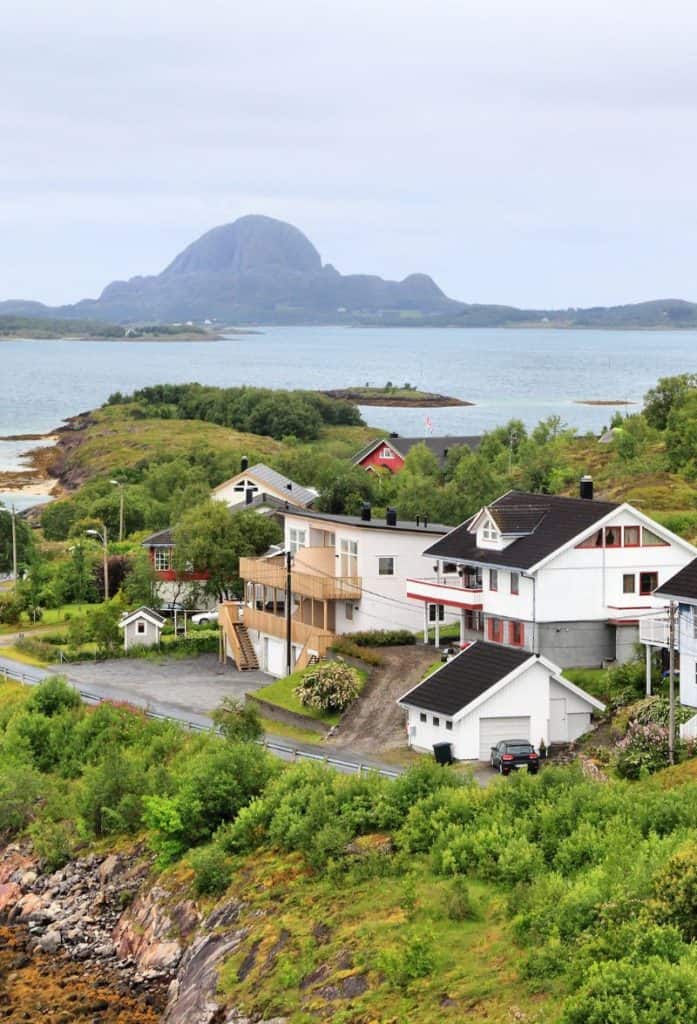
Sandnessjøen
Sandnessjøen is a charming little town located on the Hegleland Coastal Road (one of Norway’s 18 National Tourist Roads). It’s a lovely place to visit, but the detour can be a little lengthy. It takes about 45 minutes to get there from the E6, but you’d want to spend a little time in the area driving around to see the Seven Sisters and surrounding region.
You can learn about Sandnessjøen by reading my travel guide (to the left).
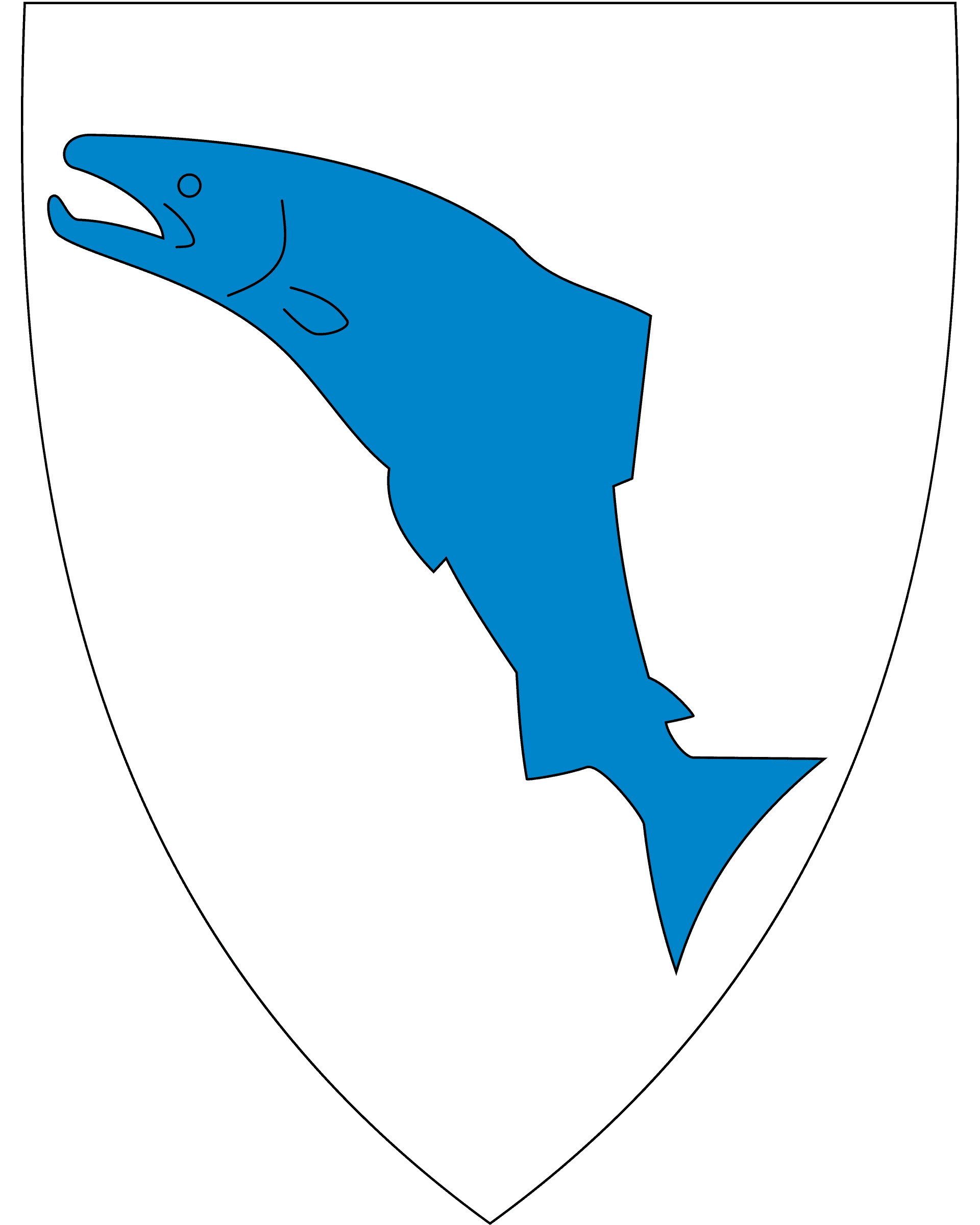
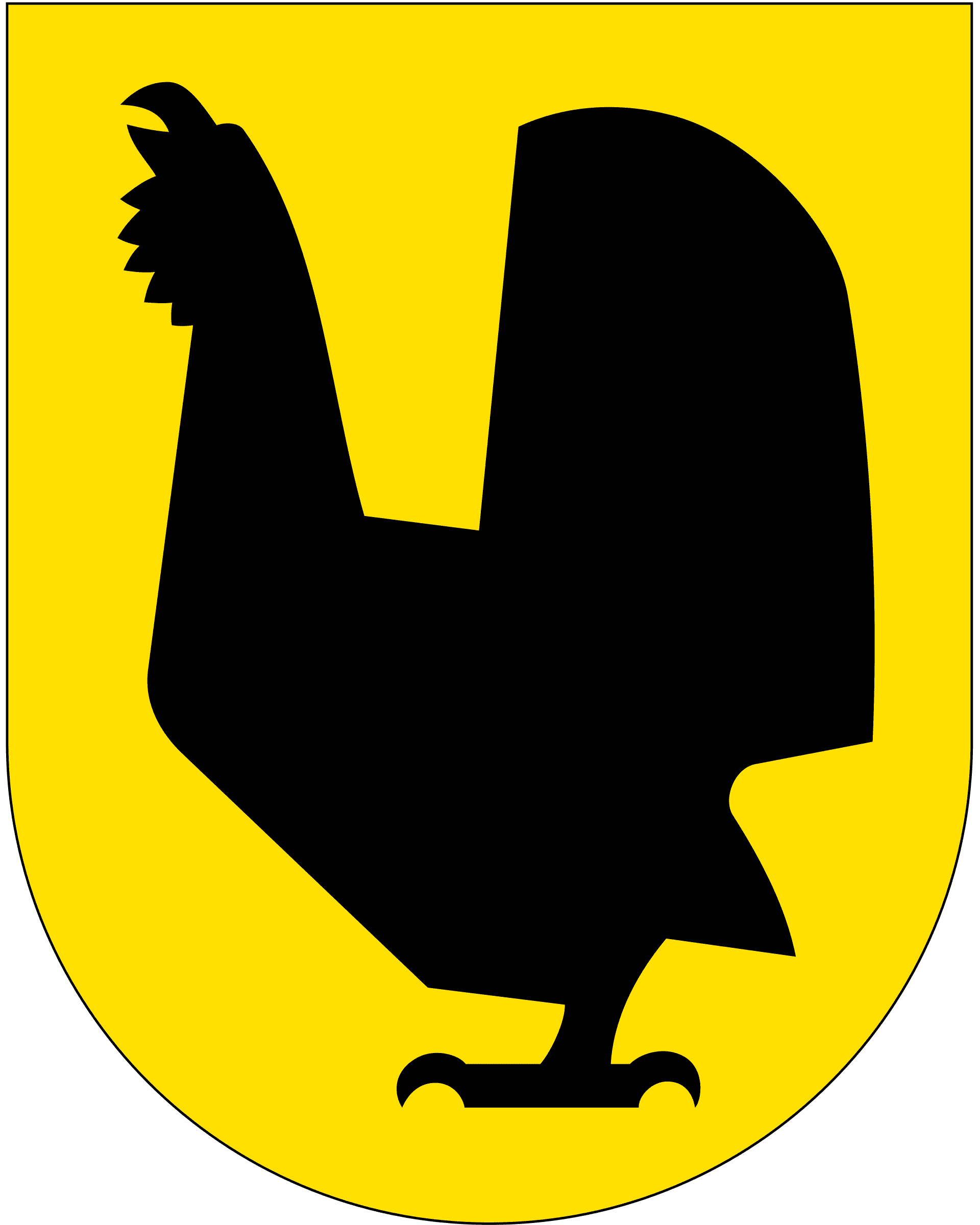
Vefsn Municipality
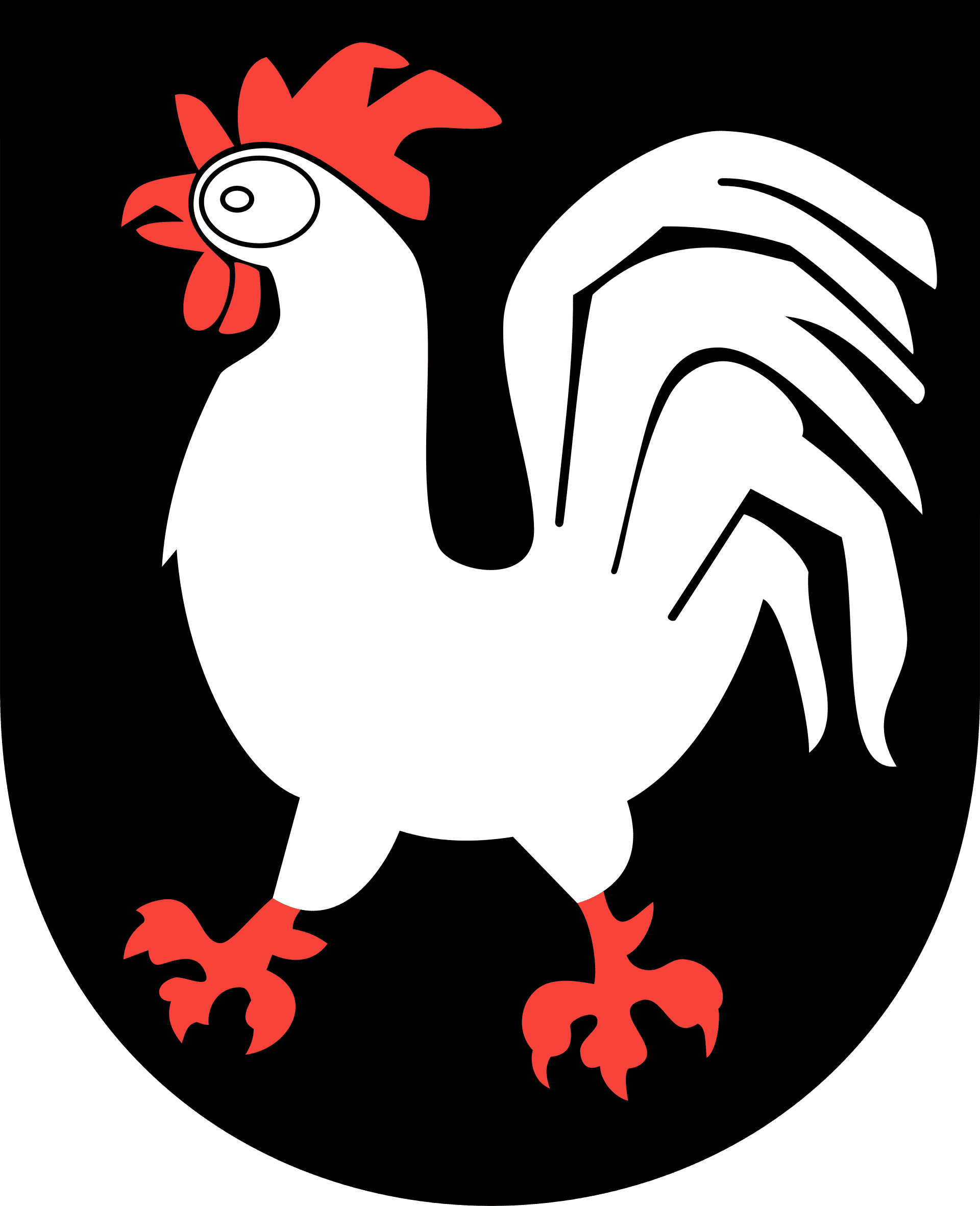
Vefsn is a municipality with arguably the best coat-of-arms in Norway – a surprised chicken! The name Vefsn comes from the river Vefsna, which flows through the municipality into the Vefsnfjorden. The meaning of the name is unknown.
The main town centre for Vefsn is Mosjøen, a town a highly recommend visiting on this drive. The landscape is dominated by spruce forests, mountains, lakes, agriculture, and the river.
This area is very old; there are traces of settlement in Vefsn back to the Stone Age. Among other things, Norway’s oldest skis have been found in Drevja. Vefsn also appears in the story of how Torolv Kveldulvsson demanded the ‘Finn treasure’ in Egils saga, and the road where this supposedly took place is now called “Toraveien”.
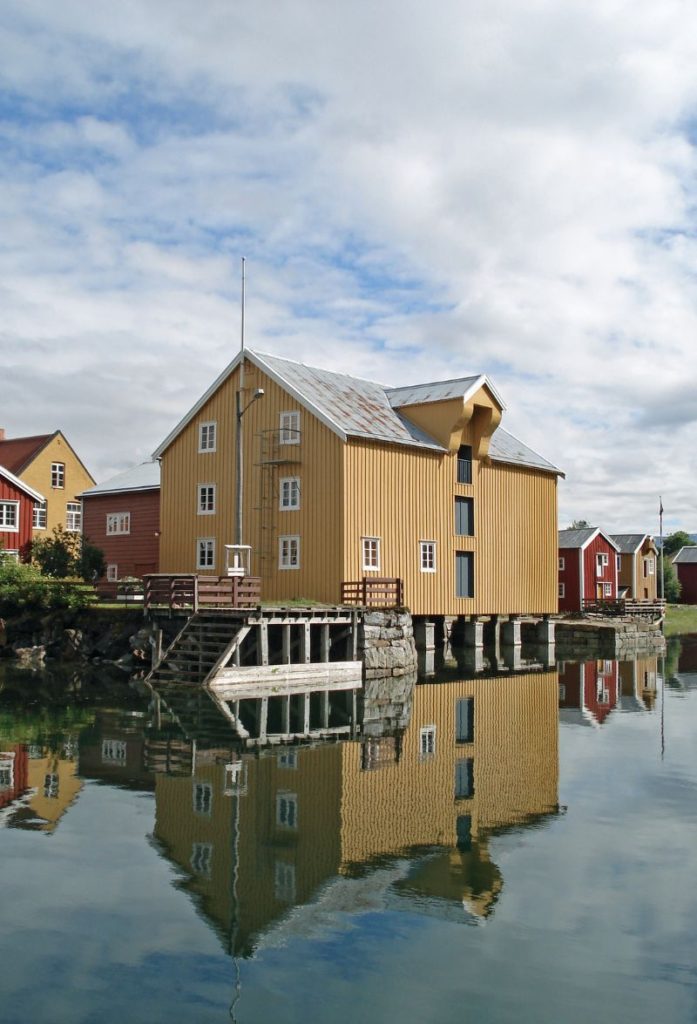
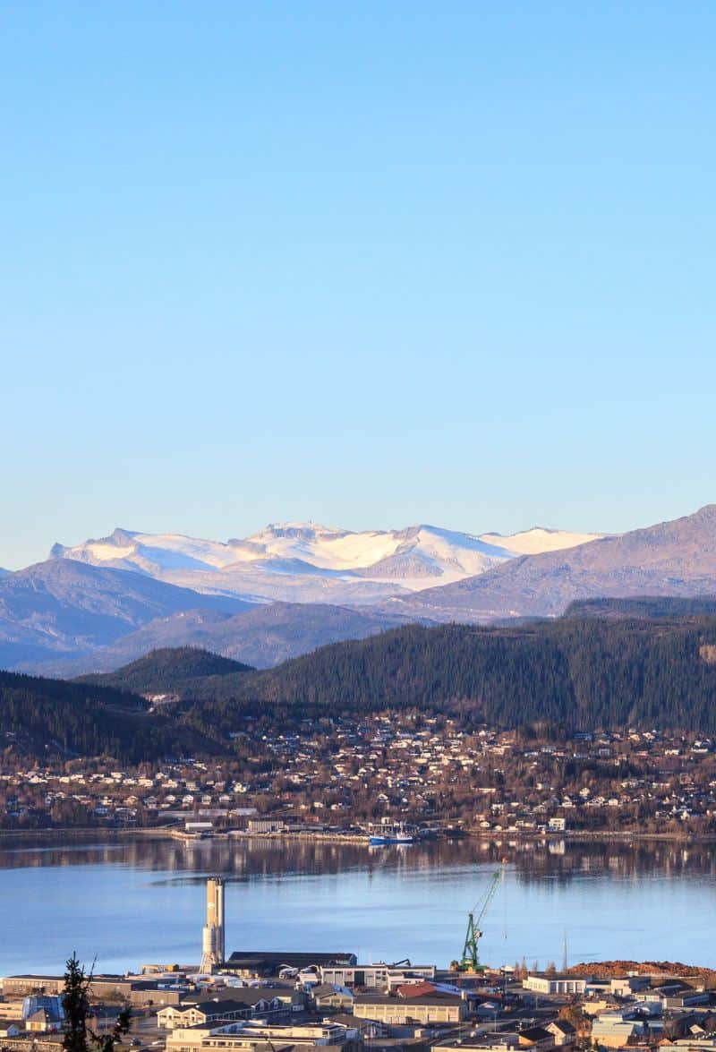
Mosjøen
Mosjøen is an adorable small town located on the Helgeland coast, and I highly recommend visiting here. It is, in fact, the oldest town in Helgeland (the name of the traditional region in) and the second-oldest town in Nordland County after Bodø. Mosjøen was declared a trading place in 1875 and has historically been an important industrial and transportation town. Many of the original wooden buildings are still standing today, making it a charming town to go walking through.
Grane Municipality
Grane (Sami name: Gaala) is a small municipality within Nordland County. It is located in the southernmost part of Nordland County, and it links Nordland with the next county, Trøndelag. The main town for Grane is Trofors, which we’ll drive through.
The name Grane comes from an old farm that used to be here. The farm is known from the Middle Ages, but it rose to prominence in the 17th century. The main industries here are agriculture, forestry, and some reindeer husbandry. Grane is one of the southernmost settlements of the Sami people, and about 10 reindeer husbandry units operate here.
Laksforsen
Cafe
Soon after the Grane municipality sign is Laksforsen, a rest stop and cafe. It is located by a waterfall and has lovely views out to Vefsna river.
Vefsna River
River
The Vefsna River (Sami name: Vaapstenjeanoe) is the largest river in Nordland County – about 163km (101 mi) long. The river flows north, not far from the Swedish border. At Mosjøen, the river empties into the Vefsnfjord.
Historically Vefsna was known for its salmon, but due to a parasite the salmon population have declined. So, while salmon fishing can’t be done here anymore, it is still possible to fish for trout and char. A fishing licence is required to fish here.
Brønnøysund
Trofors is located at the junction between the E6 and Highway 73, which runs between Brønnøysund and Sweden. Both are about 40 minutes from this junction, and each is a great detour.
I’ve covered Brønnøysund at the travel guide section.
Trofors
Village
Trofors (Sami name: Trovvegarse) is the main centre for Grane. It is located at the main junction between the European Highway 6 and the Norwegian National Road 73, which runs between Brønnøysund and Tårnaby in Sweden. The town is primarily an agricultural town, but there are over 2,000 fishing lakes here too, making it great for fishing.
Majavatn
Village
Majavatn (Sami name: Maajehjaevrie) is a small village at the bottom of Grane municipality. It has a substaintial Sami settlement who work with reindeer husbandry. Majavatn is also known from World War II. There were confrontations between the Germans and the Norwegian citizens at a nearby farm, and many of the Norwegians involved were later executed by Germans at Falstad concentration camp in 1942.
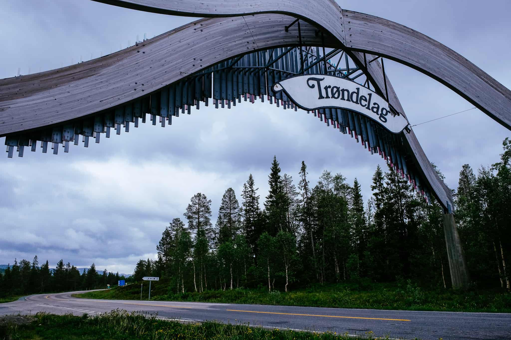
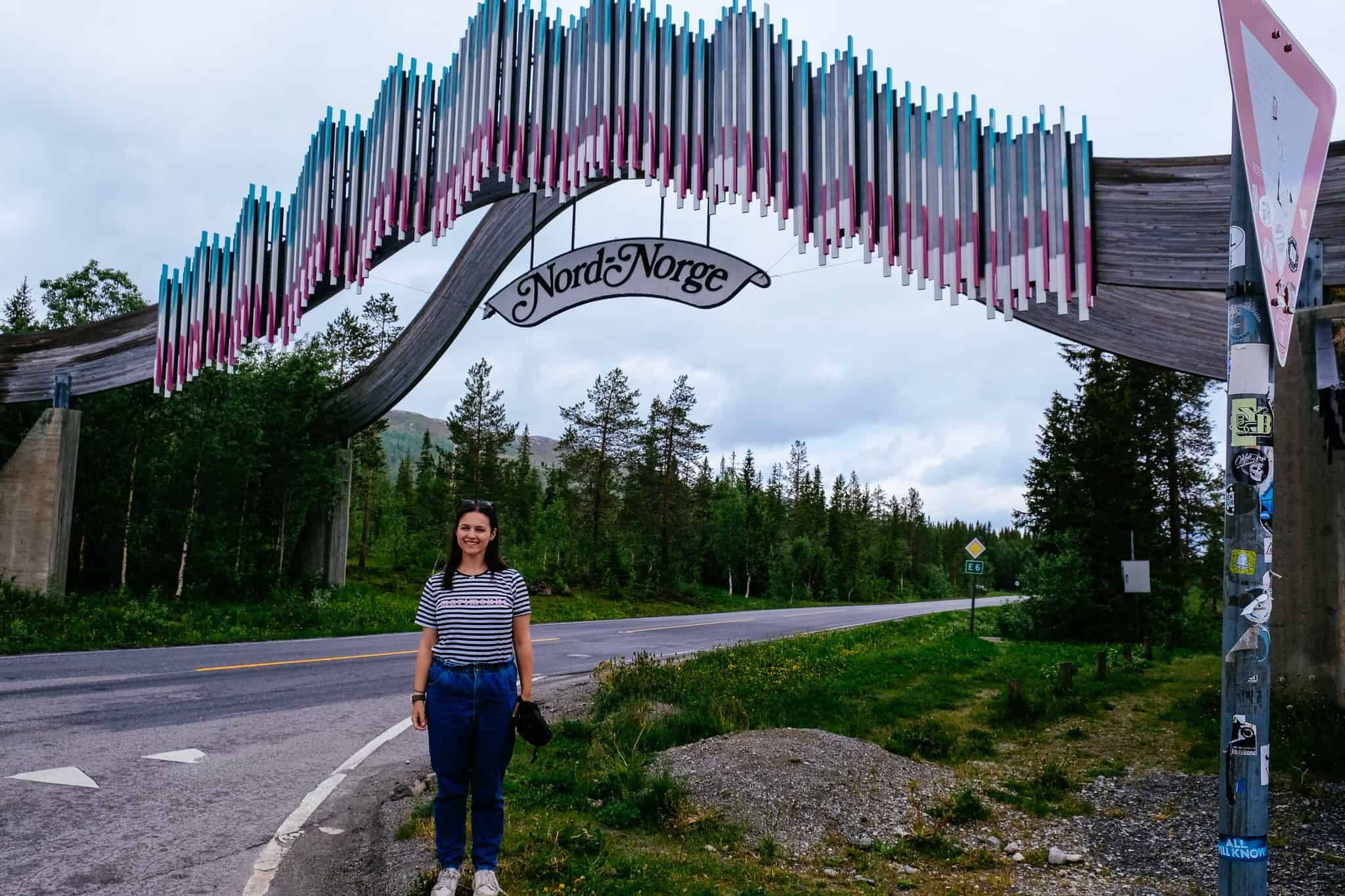
Crossing into Trøndelag
County Border
As you leave Nordland County there is a fun sign over the highway with ‘Trøndelag’ on the side we are going and ‘Nord Norge’ on the opposite side, signifying the boundary between Trøndelag County and Norland County. There is a carpark by the sign so you can take some photos, and there’s also a rest area.
Trøndelag Municipality
We have now crossed into Trøndelag County, which is in the central part of Norway. A person from Trøndelag is known as a trønder, which the dialect here is called trøndersk.
People have lived in Trøndelag for thousands of years, and during the Iron Age Trøndelag was divided into several petty kingdoms, each with their own common law and all sharing the parliament or thing called Frostating. This is sometimes regarded as the first real democracy.
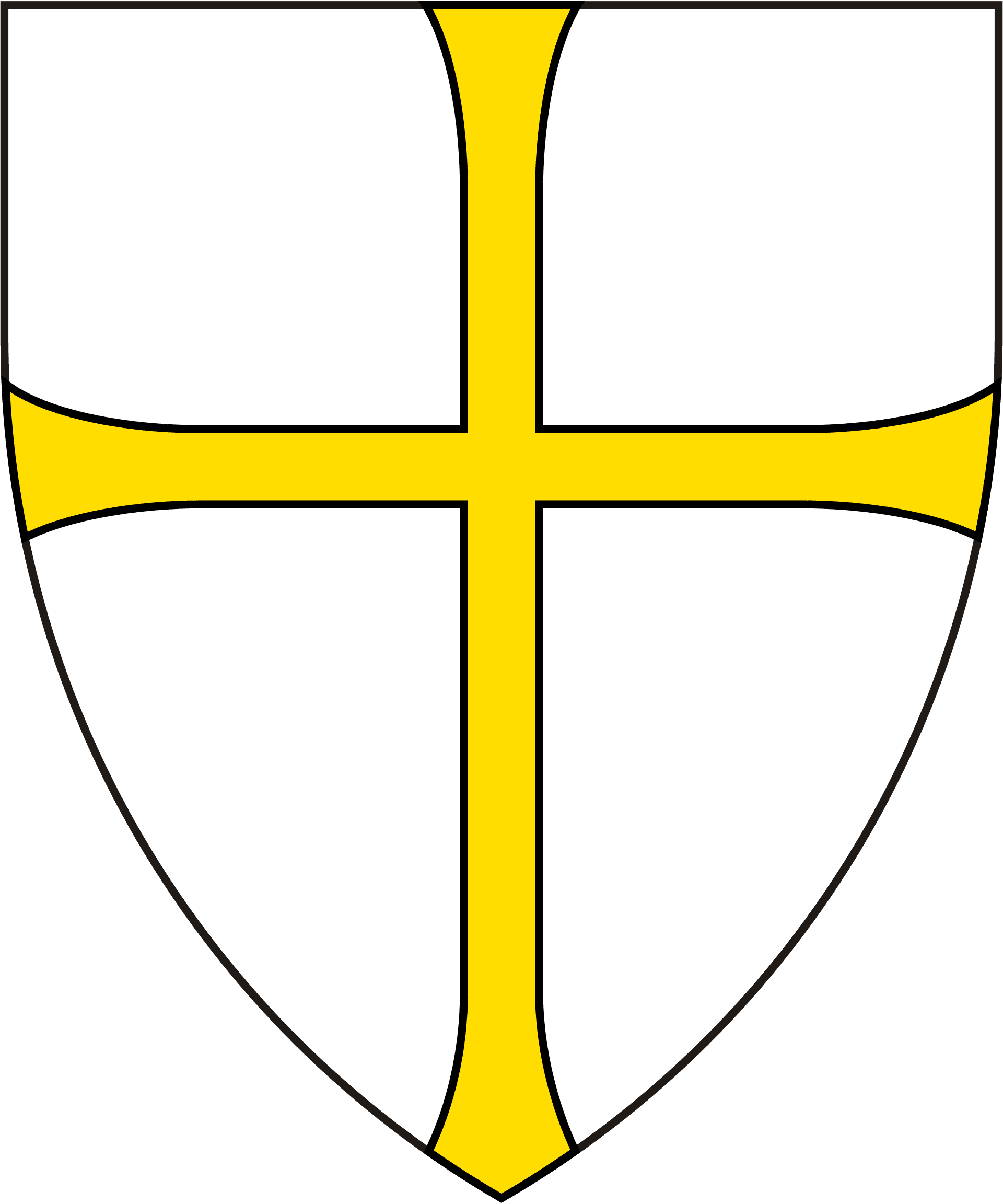
Trøndelag was well-known during the Viking Age, and many of Norway’s most famous Vikings lived here. Before the capital was moved to Bergen in 1214, Trøndelag was the site of many of the famous palaces and residences of the Kings. When Bergen (and eventually Oslo) became the capital, Trøndelag’s importance in Norway declined. Today Trøndelag is known for its well-preserved Viking history and the Nidaros Cathedral, located in Trondheim.
The proximity to Sweden has led to conflicts over the years. Trøndelag was briefly ceded to Sweden in 1658 in the Treaty of Roskilde. It was returned to Denmark-Norway after the Treaty of Copenhagen in 1660. Another attempt was made in 1718 by the Swedes to take Trøndelag, but they were not successful.
Trøndelag has a diverse climate and geography. Along the coast are the largest islands in Norway south of the Arctic Circle. The south-western part of Trøndelag is separated from Norway by large mountain ranges, especially the Dovrefjell and Trollheimen Mountain Ranges. Closer to the Swedish border the land flattens into a high valley, where Røros is located. In the north, there are several large valleys and flatlands. The rivers in Trøndelag are among the best salmon rivers in Eruope.
The climate varies dramatically depending on where in the county you are. Closer to the sea has a oceanic climate with mild, wet winters, while closer to the Swedish border are some of the lowest temperatures in Norway during winter. Røros, for example, is the only place in south-central Norway to have recorded -50C (-58F). Most of the lowland areas have a humid continental climate, while the inland valleys, hills and highlands have a boreal climate.
Trøndelag is primarily an agricultural region, with some of the most fertile land in Norway. Most of the production is meat and milk. Other traditional industries are forestry, mining, and fishing. Today Trøndelag has significant hydropower and wind power companies that support power-intensive industries such as the various timber mills. Aquaculture countes for half of Trøndelag’s export value. The oil and gas industry is also significant. Trondheim is a centre for higher education and has the largest educational institution at the country’s largest university, NTNU.
The region is known for its moonshine homebrew, known as heimbrent. It is officially banned, but the art of producing moonshine has a strong following in parts of Trøndelag. Traditionally the spirit is served mixed with coffee to create a drink called karsk. The official dish is sodd, made from diced sheep or beef meat and meatballs in boiled stock. The Norwegian Grey Troender sheep is an endangered breed of domesticated sheep originally from Trøndelag. There are approximately 50 sheep left, and efforts are being made to revive the breed.

Nammskogan Municipality
We are currently in the upper part of the Namdalen valley, and the municipality takes its name from this. The municipality is heavily forested with several large lakes and the river Namsen running through it.
Namdalen (Sami name: Nååmesjevuemie) is also the name of the traditional district here. There are three towns here: Namsos, Rørvik and Kolvereid. The rest are small villages and settlements. The river Namsen is one of the best salmon rivers in Europe (only the Tana River in Finnmark has a larger catch of salmon). Agriculture and forestry are also, understandable, important to Namdalen. Norway spruce is the main tree species.
Namsen River
River
The Namsen River (Sami name: Nååmesje) is one of the longest rivers in Trøndelag – around 228km (142 mi) long. It has traditionally been used for floating timber down from the forests to the town of Namsos, where the sawmills were located. The river begins in springs in the Børgefjell National Park and travels through the valley, ending at the coast in Namsos. It is considered one fo the best Atlantic Salmon fishing rivers in the world and is often called the ’Queen of Rivers’. Catching salmon that weigh 23kg (51lb) is not unusual.
Børgefjellet National Park
National Park (Detour)
Børgefjellet National Park is a scenic off-the-beaten path national park with high mountains, rivers, and mountain lakes. The landscape has remnants of Sami domestic reindeer herding, which continues still today. It is a place to go fishing or take some lovely hikes. It is a largely undeveloped area with virtually no construction activity. If you do want to spend some time here, you need to be aware of where you are and camp in the area. The park is located in the centre of Norway along the Swedish border and is also home to the Scandinavian Mountain range.
Brekkvasselv
Village
Brekkvasselv is a tiny village in Namsdalen. The village is also known as Ælva, and a person from Brekkvasselv is known as an Ælving. The first peoples settled here in the 20th century, coming from other places in Norway. However, the Sami have been here for thousands of years, and reindeer herding took place in the highlands.
The people who came here in the 20th century came because they were helping with the construction of the Nordlandsbanen, and if they settled here they were offered free plots of land to build on.
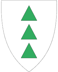
Grong Municipality
Grong (Sami name: Kråangke) is a municipality in Trøndelag with Medjå being the main town. The name comes from an old farm, and the first element is an Old Norse word for spruce. This is also represented on the coat-of-arms; the three spruce trees represent the three main villages in the municipality.
One of the main waterfalls here is Fiskumfoss, an economically important waterfall that is used for power production. There is also a salmon ladder here. A salmon aquarium has been built by the waterfall, where you can sit and eat salmon while watching the waterfall. The building also has the Norwegian Sport Fishing History Museum. Burial mounds are also found throughout the area from the older Iron Age, and there are ancient moose hunting grounds, house foundations, and roads.
Medjå/Grong
Village
We are passing the village of Medjå, which is sometimes called Grong. It is a small village with a petrol station and supermarket.

Snåsa Municipality
Snåsa (South Sami: Snåase) is a small but important municipality: it is one of the last strongholds of the seriously endangered Southern Sami language. In Snåsa you’ll find the Saemien Sijte, which is the national museum of South Sami history and culture. The goal of the museum is to strengthen South Sami identity and a sense of community. Next to the museum is a primary school that teaches the South Sami language.
The coat-of-arms represents a yellow Lady Slipper orchid on a blue background. At least 15 species of orchid have been found growing in Snåsa, and they are known as some of the magnificent orchids in Scandinavia.
Snåsavatnet / Snåsa Lake
Lake
The lake we see straight ahead is Snåsavatnet, the sixth-largest lake in Norway at 122km2 (47 sq mi). The lake reaches depths of up to 186m (610ft) and was made by glacial erosion.
Egge
Historic Site (Detour)
We are passing the exit to Egge. Egge is a known Viking town, and it was home to the powerful chieftains who gathered the peasants to fight against Olav Haraldsson in the Battle of Stiklestad in 1030.
The museum has a reconstructed manor and fun activities for kids. For the adults, the cultural landscape is preserved and there are a number of hiking trails you can take to enjoy the ancient scenery.
Click here to read more.
Steinkjer Municipality
Steinkjer is one of the larger municipalities in the region, though its population density is very low, with just 12.6 inhabitants per sq km (33 sq mi). The population has increased by 2.4% over the last 10 years. The coat-of-arms shows a verranjekt, a type of boat that is very common in the area. It’s a new coat-of-arms from 2020.
The area around Steinkjer is historic – it has been populated since the Stone Age. Rock carvings can be seen in the area, and the oldest are 6,000 years old. During the Viking Age, Steinkjer was an important base and Maere was one of the best known religious places with sacrifices and gatherings before Christianity came to the country.
The town of Steinkjer was sadly bombed during World War II. The attack destroyed a large part of Steinkjer, and many priceless historic buildings, including the church, were lost. The town was quickly rebuilt after the war with the help of aid from the United States. Much of the architecture found in Steinkjer is from the 1950s and 1960s and is inspired by functionalism. One of the few buildings to survive the bombing is the train station, which is designed in art nouveau.
Steinkjer is one of the northernmost areas with rich agriculture, allowing large production of grain. You’ll notice as you drive through just how important grain production is to the area. Tall grain silos can be seen all over the landscape.

Inderøy Municipality
Inderøy is an agricultural municipality located in North Trøndelag. The municipality has been inhabited since the Middle Ages, and the village of Sakshaug used to be an important political centre. It is home to one of the oldest churches in the area, Old Sakshaug Church, from 1184.
The coat-of-arms shows the European plaice. The fish was once plentiful int he waters and was one of the main sources of income in the area until around 1940. Fishing is still important to the region. Farming is also very important to the area, and most of the municipality is cultivated. Grass and grain are the most common crops, but strawberries are also common. Most farmers have their own forest, too.
The population density is 19.4 inhabitants per sq km (50/sq mi). The population has increased by 15.9% over the last 10 years.
One of the most prominent 20th century Norwegian sculptors, Nils Aas, is from this area.
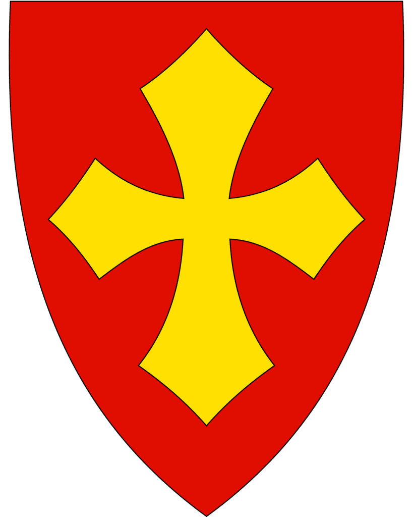
Verdal Municipality
People have lived at Verdal since the Stone Age, and there are farms in the region that are mentioned as far back as the 12th century. The municipality is best known for the site Stiklestad, where we are heading to next.
A unique word to learn for this area is råning. It refers to all the young people here who are interested in cars. They spend a lot of their time improving or styling their cars and then driving them on a particular route to show them off.
The economy here is supported by the offshore industry as well as agriculture. Verdal is also known as one of the greatest lottery towns of Norway, with several lottery grand prizes going to people living in Verdal.
Stiklestad
Historic Site (Detour)
Stiklestad is one of the most important religious sites in the country. It is where, in 1030, St. Olav fell in battle during the Battle of Stiklestad. His sainthood arose from this death.
Today Stiklestad feels like a bit of a tourist trap – they’ve built up all these new centres, exhibitions and hotels in the last 20 years – but there’s still historical interest in visiting here.
You can read my separate guide to Stiklestad below.
Levanger Town Centre
Town
Shortly after the Falstad Centre, we pass turn-offs to Levanger. If you want to visit the main street, just follow signs towards Levanger. I mentioned the history of Levanger town centre in the section about Levanger municipality.
Munkeby Abbey Ruins
Historic Site (Detour)
Just after Levanger town is the turn-off to the ruins of Munkeby Abbey. It’s just a short drive from the E6, and is a nice area to go to stretch your legs.
The Munkeby Abbey was founded some time between 1150 and 1180 and it was the most northly Cistercian foundation in the world. It was likely built by English monks. The monastery was eventually closed down, though the church was used until 1587.
Falstad Centre
WWWII Site (Detour)
You can visit the Falstad Centre, which is an old concentration camp from World War II. Today it is a museum. Read a more detailed article below.
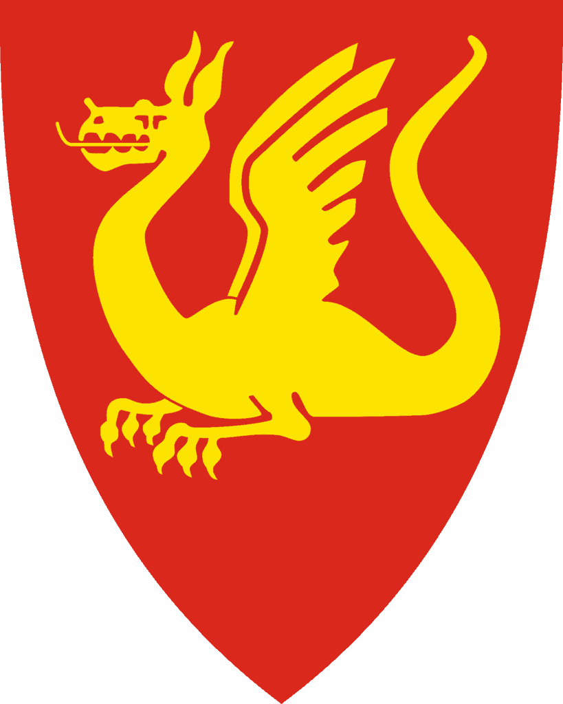
Stjørdal Municipality
We have arrived in Stjørdal, which has an amazing coat-of-arms! The design is modern but comes from the old medieval seal of Stjørdal, which dates from 1344. The dragon is a symbol of Saint Margaret of Antioch, and the old seal showed Saint Margaret standing on a slain dragon. It has always stood as a symbol for authority, power, and exalted dignity of the region. Stjørdal is the location of Steinvikholm Castle, a nice detour.
Steinviksholmen Castle
Historic Site (Detour)
How to get here:
Steinviksholmen is clearly marked on Google Maps. It’s just off the E6 and marked with brown tourist signs the entire way. It’s about 10-15 minutes off the E6.
The road is very narrow, and you’ll have to watch out for traffic coming the other way.
—–
Steinvikholmen Castle is a 16th century castle constructed by Norway’s last Roman Catholic Bishop, Olav Engelbrektsson. After meeting with the Pope, Olav’s resistance to the Danish rule and the Reformation escalated. Steinvikholm was built as the Catholic churches military stronghold. The castle was finished in 1532, but sadly for Olav the Reformation succeeded in 1537 and Olav was forced to flee to Lier. It was the last Catholic stronghold in Norway. When Olav fled, he left Saint Olav’s shrine and other treasures, and they were returned to Nidaros Cathedral in 1568.
After the Reformation, the site was used as a quarry and some of its masonry was sold off. Since the late 19th century, the site has been owned and operated by the Past Memory Association (Fortidsminneforeningen). It is used as concert hall for a midnight opera, Olav Engelbrektsson, which details the life and struggles of the archbishop. The opera takes place annually.
Steinvikholm Castle is Norway’s largest structure from the Middle Ages.
In summer, it is open as a museum. There are also photographs and information boards (Norwegian and English) around the site. You can walk around the fortress for free, but the interior is what costs money. When we visited, we saw lots of kids swimming in the water around the fortress.
You park on the mainland and pay a small fee (they use Vipps to accept parking payment), and then walk across the bridge (photographed) to the castle. The entrance is on the other side from my photos.
Even if you aren’t interested in the castle, the surrounding scenery is gorgeous.
Hell Station
Train Station
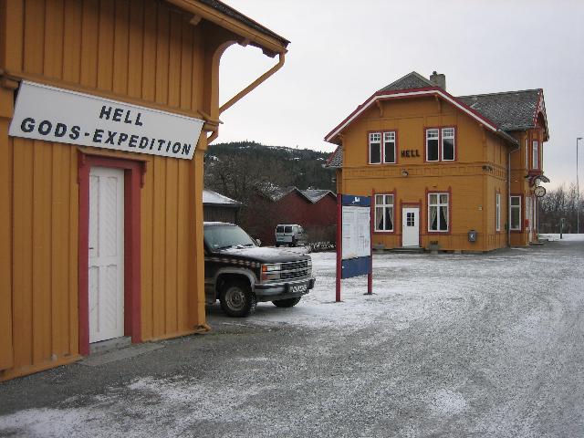
Hell is a small village by Trondheim Airport. The village has become a bit of a tourist attraction because of its name, which means “luck” in English. In modern Norwegian, the word for “hell” is “helvete”. The sign underneath says “Gods Expedition”, which actually means “Cargo Handling” in English. Stop by the train station and get a photo!
Malvik Municipality
Malvik is a small municipality just outside of Trondheim. It is one of the few municipalities in the area seeing population growth, with the population rising 13% of the last 10 years. Many people work in Trondheim. The coat-of-arms shows a black capercaillie, which is a symbol for the rich nature in the area.
Trondheim Municipality
Trondheim (South Sami name Tråante) is the third-most populous municipality in Norway, though it’s the fourth largest urban area. The settlement is a known Viking area, and Trondheim itself has many famous monuments from medieval times. There’s so much to say about Trondheim, so you can read a detailed overview by clicking the button below.
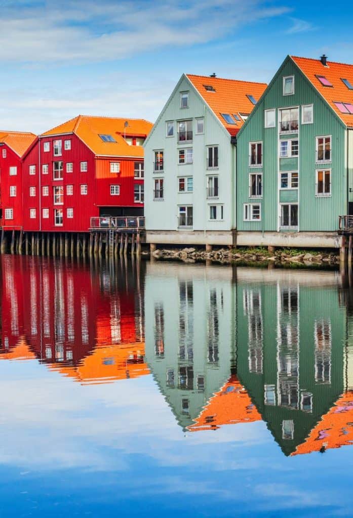
Trondheim
We have now arrived in Trondheim! A detailed overview of Trondheim can be found on the travel guide section of The Hidden North.
This is the end of our two-week drive from Trondheim to Senja and back again. Be sure to check out our next series, summer in the West Fjords!
Previous Drive
Narvik to Mo i Rana on the E6
See the previous day’s drive on the E6 between Narvik and Mo i Rana
If you liked this drive, or if you have any travel tips, please leave a comment in the section below!