
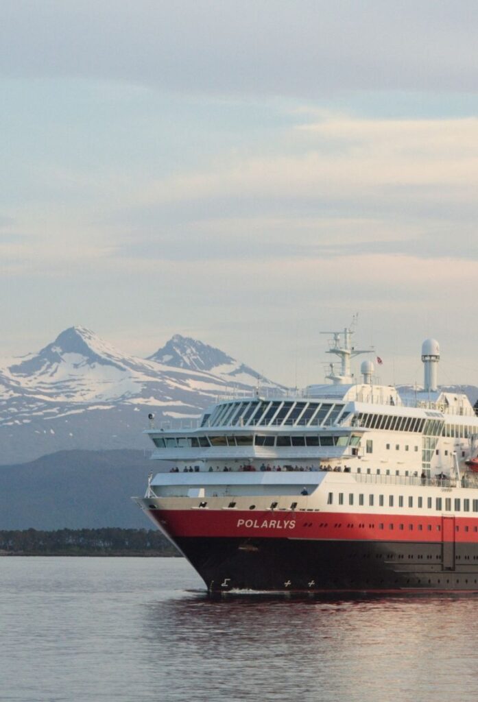
Coastal Ferry Day 7
Vadsø - Kirkenes - Vardø
Welcome to day seven of the sailing! This is a beautiful day as the ship reaches the easternmost point in Norway, passing by the beautiful region of Varanger and isolated fishing villages of Finnmark. This is also the turning point for the ship; at Kirkenes the ship docks for 3.5 hours before turning around and heading south. For those doing the Bergen-Kirkenes-Bergen roundtrip, you have a chance to do an excursion in Kirkenes.
The southbound journey starts with a high as the first port is Vardø, a fascinating historic city.
On this day of sailing...
Coastal Ferry Guide
I’ll be releasing my coastal ferry guidebook in May 2025. If you want to receive updates about the book, subscribe to my newsletter below.
Also, I am travelling on the coastal ferry all winter and will be publishing information about the voyage via the newsletter.
12am - 12:30am
Båtsfjord
31st port - 70.2 degrees north - population 2,165 - Sami name: Báhcavuonna
For information about Båtsfjord, see further down when the ship docks there on the southbound journey.
3:30am - 3:45am
Vardø
32nd port - 70.2 degrees north - population 2,029 - Sami name: Várggát
For information about Vardø, see further down when the ship docks there on the southbound journey.
6:55am - 7:10am
Vadsø
33rd port - 70 degrees north - population 5,788 - Sami name: Čáhcesuolu
About Vadsø
Vadsø is a charming community that we recommend going out and seeing. It’s believed that people have lived here for at least 9,000 years. The first people to be here were likely the Sami. In the 16th century there was considerable Norwegian settlement here and a fishing community was established with its own church. Originally, they settled on the island, but gradually the community moved across to the mainland. Today the town is spread out over both.
Vadsø is known as the ‘Kven Capital’ of Norway. The Kven are an ethnic minority in Norway of Finnish descent. There was considerable migration from Finland in the 18th and 19th centuries; they were fleeing poverty and harsh conditions in their home country. Finnish is still the first language of some people living here.
The Pomor Trade was very important to Vadsø during the 19th and early 20th century. You can read more about the Pomor Trade via the button below.
During World War II, Vadsø was at times the headquarters of 2000 German troops. The centre of town was badly damaged when the Allies bombed the town in 1944. In spite of the bombing, almost 1/3 of the town’s buildings were left standing. In Vadsø, there are more preserved pre-war buildings than anywhere else in Finnmark.
Vadsø has an airport with flights to Kirkenes, Tromsø, Alta, Båtfjord, Hammerfest, and other small communities in Finnmark.
What You See from the Ship
From the ship you can clearly see Vadsø Church. . It is the fourth church to be built on the site. The earliest church was mentioned in 1589, but it was not new at that time. It was located over on the island but was moved in the early 1700s to the mainland. That church was replaced in 1858, but it was destroyed during World War II. The current church was completed in 1958.
9am - 12:30pm
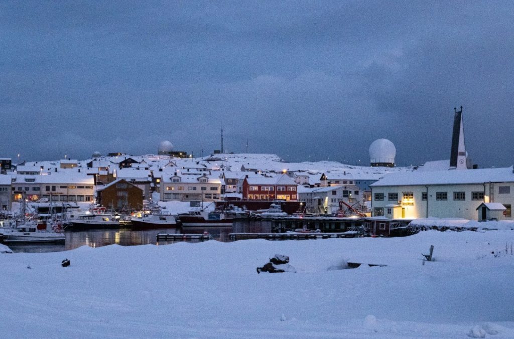
Kirkenes
34th port - 69.4 degrees north - population 3,529 - Sami name: Girkonjárga
About Kirkenes
The area around Kirkenes has been lived in for hundreds, if not thousands, of years by the Sami. It was where they would spend their summers with the reindeer.
Norwegians came here in 1902 in connection with the discovery of ore deposits in the mining settlement of Bjørnevatn, 10km south of Kirkenes. Mining began in 1906 and Kirkenes was established as a shipping port. The town experienced a steady increase in prosperity and importance.
Kirkenes was severely affected during World War II. The Russian city of Murmansk is over the border and its port is ice-free. During the war, it was the only European port in Russia that was not under control by the Nazis. Large Allied convoys carried supplies of food and war materials via Murmansk. Over 30,000 Nazis were stationed in Kirkenes during the war. Kirkenes was subject to repeated bombing from Soviet aircraft. Air-raid warnings sounded over 1,000 times and there were over 300 bombing raids. It is claimed that Kirkenes was one of the towns in Europe that was subjected to the most intensive bombing, in terms of the number of raids, during World War II.
Kirkenes was liberated by Soviet soldiers in October 1944. The Nazis then retreated across Finnmark. Kirkenes was destroyed by retreating Nazi soldiers. Apart from a few houses, all the buildings remaining after the bombing were burned down. The local people that had avoided evacuation hid in mine tunnels and caves. Approximately 2,500 people sought refuge in caves.
Kirkenes was rebuilt after the war and the mines began operating in 1953. Iron ore from Bjørnevatn was very much sought after throughout Europe to be used in reconstruction work and this brought in a good income. The infrastructure in the municipality was restored and the town got its own airport. A modern town centre was built and there are good museums containing information about the cultural history.
Explore Kirkenes Independently
The town centre is a short walk from the port. If you don’t wish to do an excursion, you can follow our self-guided walk below.
Kirkenes Self-Guided Walk
Follow this self-guided walk for Kirkenes, starting and ending at the coastal ferry pier. This walk passes by historic and cultural highlights.
Excursions
This is the turning point for the ferry. The journey now continues southbound to Bergen.
+2 hours 40 minutes after Kirkenes: Kiberg
Kiberg will be clearly visible on the port left side. The village has a population of 207. In the 16th and 17th centuries, Kiberg was one of the largest fishing villages in the area and was important during the period of Pomor Trade with Russia. Some buildings from the Pomor Trade survive in Kiberg today.
We have a separate article about the Pomor Trade, which you can find below.
During World War II, Kiberg was a strategic town. The geographical proximity to the Soviet Union had, over the years, brought Russians and Norwegians together. When Kiberg was occupied, many locals left and went across to the Soviet Union. Some returned and worked for the Soviet military intelligence forces. It is thought that there were as many as 45 partisans in the Kiberg area. They monitored and passed on the radio communications about the German shipping fleet back to the Soviets.
About half of the partisans were killed in battle or were executed during the war. However, because of their efforts about 80 German merchant ships were sunk on their way to Kirkenes. The surviving partisans returned to Kiberg after the war. One of the partisans who survived, Aksel Jacobsen Bogdanoff, became famous in 1953 when he and his brother encountered and shot the last polar bear seen in Finnmark.
Picture of Aksel Jacobsen Bogdanoff
During the Cold War, things became tense between the Soviet Union and Norway. In Kiberg, this led to suspicion being directed to those who had been partisans during the war. It led to them largely being outcast from the community. King Harald honoured the partisans during a speech in Kiberg in 1992. For many, this was the first official recognition of their efforts during World War II. Today in Kiberg you can visit the Partisan Museum, which documents their efforts during the war.
Kiberg is still a fishing harbour today.
+3 hours after Kirkenes: Domen and the Witchcraft Trials of Finnmark
Shortly after Kiberg you’ll see a large, flat mountain called Domen. This played an important role in the witch hysteria that swept Finnmark in the 17th century.
There is so much to say about the witchcraft trials, so I’ve put it in a separate article.
4:05pm - 5pm
Vardø
1st port - 70.2 degrees north - population 2,029 - Sami name: Várggát
About Vardø
Welcome to Vardø! Vardø is one of our favourite places on the southbound journey due to its unique history and setting.
The village is built across two islands; the ship has to go around the islands before it docks in port. The islands are called West Island and East Island (Vestøya and Østøya). The islands are connected by a low neck of land; from above, Vardø resembles a butterfly. The islands are separated from the mainland by a 1.7km long strait, and an undersea tunnel connects the islands to the mainland.
Vardø is Norway’s most easterly town and is known as the Gateway to the Barents Sea and the North-East Passage. Vardø used to be the only place in Western Europe that lies within the Arctic climate zone, i.e. the average temperature in summer doesn’t go above 10C (50F). However, since 2020 this has not been the case. Still, the climate here is harsh. In the old days, children had to carry rocks in their pockets so they didn’t blow away.
Vardø is one of Northern Norway’s oldest towns. It was first mentioned in history in 1307, though evidence of settlement goes back 4,500 years. In 1307 a church and fortification were constructed to defend Vardø from the Russians and claim it as Norwegian territory. Today Vardø is considered to be the world’s northernmost fortified town.
There’s a lot to say about Vardø, so you’ll find a detailed guide in our travel guide section.
Explore Vardø Independently
When in port, the Expedition Team usually lead a walk to the fortress (for free). You can enter the fortress as well. I don’t recommend spending all your time there; it is possible to walk towards the town centre as well.
You can find more information via the links below.
+1 hour after Vardø: Hamningberg
Hamningberg is an abandoned fishing village on the port left side. There is a road connection to Vardø. It is one of the few places in Finnmark that was not burned down by retreating Germans in the latter part of the Second World War. Approximately 700 people lived here before World War II, but after the war approximately 500 people left. There were three people left in 1978. It was depopulated and abandoned in 1964, although some houses are still used as summer cottages.
Hamningberg is one of the few places where you can see what parts of Finnmark would’ve looked like before World War II. Many of the surviving buildings are from the 19th century. The buildings here are Russian inspired, showing clear influence from the Pomor Trade. The Pomor fishermen were here from the 18th century and dried fish was previously exported to Russia and Europe from Hamningberg.
8pm - 8:30pm
Båtsfjord
2nd port - 70.2 degrees north - population 2,165 - Sami name: Báhcavuonna
About Båtsfjord
Båtsfjord is one of the newer fishing harbours that you visit on this journey. It is believed that the village was settled in the early 19th century. Many Finnish immigrants came here in the second half of the 19th century as they were fleeing famine in their home country. However, the village didn’t see growth until the early 20th century. The old fishing harbour Hamningberg was becoming too small and outdated for the modern fishing boats, so much of the activity was moved to Båtsfjord. Several landing stages and quays were built, and three whaling stations existed here.
Båtsfjord suffered the least damage in the Nazis ‘scorched earth’ policy in 1944/45. Although 27 houses were totally damaged, there was otherwise relatively little damage. The place was therefore used as a supply base for the liberated Finnmark. Båtsfjord developed quickly after the war but has always economically relied on the fish stocks in the sea.
Today Båtsfjord is considered one of Norway’s largest fishing communities and is also one of Finnmark’s largest fishing ports. There are several fish processing plants here with people from all over the world working.
There is an all-year-round road connection to the E6 (the main highway running through Norway) that only closes in extreme weather. Båtsfjord airport is Norway’s newest airport and has 4 daily scheduled flight departures served by Widerøe.
Just out of Båtsfjord is Fuglefjellet Syltefjordstauran, one of Norway’s largest bird mountains. It is world-renowned for its diversity of nesting birds and sea eagles. The worlds largest gannet colony can be found here.
The landscape is geologically very old by Scandinavian standards and to a large extent was formed before the last ice ages. The ice left behind a large number of distinctive ring-shaped formations that are otherwise known in only a few other places around the world.
Båtsfjord Walking Tour
Join me on an early morning walk around the town of Båtsfjord.
10:25pm - 10:35pm
Berlevåg
3rd port - 70.2 degrees north - population 2,165 - Sami name: Báhcavuonna
About Berlevåg
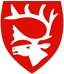
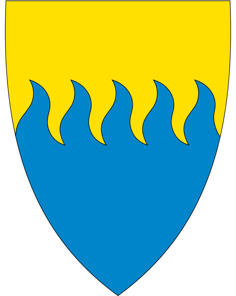
Berlevåg is one of the largest fishing communities in Finnmark, with industrial fishing plants, boatyards, and mechanical workshops. The coat-of-arms symbolises the municipality’s dependence on the sea. The motif shows the sea and the waves towards the beach, and the five waves symbolise the five places where there have been permanent settlements within the municipality.
During World War II, a German coastal battery was built in Berlevåg. When the Nazis retreated after World War II, Berlevåg was left in ruins from the Nazis scorched earth policy. The buildings were burned to the ground and livestock was slaughtered. During the 1950s the fishing community was rebuilt in a post-war architectural style that is typical for the period.
Berlevåg’s church is from 1960 and is a marker point for approaching ships and is built on a slight rise. The first church was the local chapel that the locald had converted into a church. Before then, the locals had to go to Vardø which was too difficult. The church was restored in 1939 but was destroyed during the war.
You will notice that Berlevåg has very large breakwaters. Berlevåg faces directly out to the Barents Sea in the north, meaning it is exposed to extreme weather. This has created great problems for the community. Several breakwaters have been built to try and protect the harbour. During the period 1875 to 1975, four breakwaters have been built but all destroyed by fierce storms. The current outer breakwaters are built from 10,000 four-armed cast concrete blocks (known as tetrapods), each weighing 15 tonnes. They have withstood waves up to 9.8 metres in height. The harbour is continually dredged, and deep-water berths have been created to allow larger vessels to dock.
Berlevåg is as far east as Istanbul and is almost as far north as North Cape and Barrow in Canada. Berlevåg is the northernmost town on mainland Norway (both Hammerfest and Honningsvåg are on islands).
Berlevåg is famous as it was the centre of a documentary called “Cool and Crazy” (Heftig og begeistret”, which followed the Berlevåg mens choir. Berlevåg is also the setting of Karen Blixen’s novel Babette’s Guest. Sangkraft Berlevåg (Arctic Centre of Music Theatre) is an initiative to put Berlevåg on the map and increase vocal activity in the region. They have established an opera choir and arrange concerts.
In Berlevåg you’ll find the Berlevåg Harbour Museum, which also manages a cultural heritage trail in town.
Berlevåg airport has daily departures to Hammerfest and Tromsø, as well as regular flights to Vadsø, Kirkenes, Båtsfjord and Vardø.
Photos