
Coastal Ferry Day 6
Finnmark
Today you have the opportunity to visit the northernmost point in mainland Europe – North Cape! First, though, be sure to enjoy the day as you sail along the top of Norway.
On this day of sailing...

Coastal Ferry Guide
You can find all this information plus so much more in my coastal ferry guidebook, available both in print and as a digital book.
1:50am - 2am
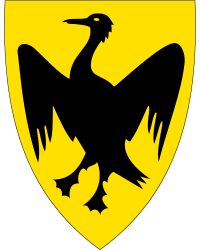
Øksfjord
24th port - 70.2 degrees north - population 504 - Sami name: Ákšovuotnan
About Øksfjord
Øksfjord sits at the foot of the mountain Grasdalsfjellet (830m above sea level). Almost half of the municipality’s population lives in Øksfjord. The village got a road connection in 1986. The industry here includes a fish fillet factory with a freezer warehouse and a herring oil factory. As the outer parts of the municipality have poor road connections, most transport is by boat. Øksfjord has express boats to Hammerfest and Hasvik. The closest major city is Alta, which is approximately 120km away.
5:05am - 5:45am
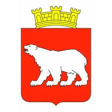
Hammerfest
25th Port - 70.3 degrees north - population 11,274 - Sami name: Hámmerfeasta
About Hammerfest
Welcome to Hammerfest! Hammerfest is the northernmost city in the world with a population over 10,000 people. Hammerfest is one of the oldest cities in Northern Norway and is the designated regional port for Finnmark county.
There is a lot to say about Hammerfest, which you can read on our travel guide page.
What You Can See From the Ship
For all of 2023 the ship will be docking at the industrial harbour while the main harbour undergoes renovation.
You can visit the Meridian Monument. The Russian scientist Fredrik G.W. Struve started a survey project in 1816, to determine the degree of flattening of the earths surface that occurs at the poles. The information would enable cartographers to draw up more precise charts and maps. The survey was carried out at a number of separate points along a meridian from the town of Ismail on the Black Sea and northwards to Fuglenes in Hammerfest. Struve’s meridian curve passes through 10 countries: Norway, Sweden, Finland, Russia, Estonia, Latvia, Lithuania, Belarus, Moldova and Ukraine. These countries have preserved the 34 measuring sites.
In 2005, UNESCO accepted the application to include the survey points on the World Heritage List. The basis was that Struve’s meridian curve is a ‘scientific work that is unsurpassed in dimension and scope”. Due to the precise nature of the survey, the results have remained extremely useful in charting and mapping sciences, right up until the advent of satellite technology.
8:30am - 8:45am
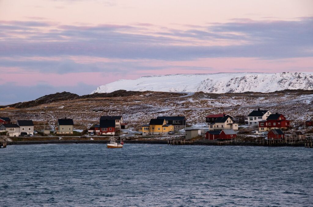
Havøysund
26th port - 70.5 degrees north - population 976 - Sami name: Ávanuorri
About Havøysund
Havøysund is located on the island Havøya but is connected to the mainland via the Havøysund Bridge, which you’ll see straight ahead when the ship is docked. The bridge is the northernmost bridge in the world. Havøysund is part of Måsøy Municipality, which is named after the little island you pass between Honningsvåg and Havøysund.
Havøysund has been a fishing community for a long time. It was first mentioned in history in 1666 in tax documents when two people living there paid taxes. The first trading licence was issued to a merchant in 1811. The museum called ‘Måsøy Museum” has items including tools used by fishermen in the early 1900s as well as a preserved kitchen, living room and schoolhouse. The entire village was destroyed by retreating Nazi soldiers in 1944 but experience rapid growth after the war.
The main industry here is fishing with fish processing factories, a boatyard, petrol station, medical centre, shops and a museum.
The northbound and southbound ships meet at Havøysund.
Magerøy Strait
The ship goes through the narrow Magerøy Sound (Magerøysundet). At its most narrow point, it is 1.8km wide. Every April thousands of reindeer used to swim across the sound to the island Magerøya, where they would spend the summer eating away from predators. In modern times, though, the reindeer are transported across on trucks.
Magerøya Island
Magerøya is the name of the island Honningsvåg is on. It has an area of approximately 436.6 square kilometres (168.6 sq mi) and the highest peak is 417m (1,368ft) high. The island is a barren, tundra covered landscape with no trees. Traces of settlement go back 10,000 years here.
Note – you often lose internet connection while sailing along Magerøya.
10:55am - 2:30pm
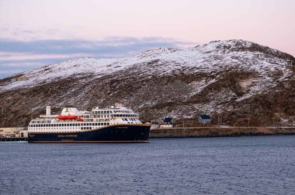
Honningsvåg
27th port - 70.5 degrees north - population 2,326 - Sami name: Áváhki
About Honningsvåg
Compared to other fishing harbours, Honningsvåg is relatively modern. It was built up in the late 19th century as a modern fishing harbour compared to the older port Kjelsvik.
The town was destroyed by Nazi solders in 1944 with only the church left undamaged. Today Honningsvåg is characterised by its 1950s architecture.
Today Honningsvåg is one of the largest fishing ports in Northern Norway. Besides fishing, tourism is a major industry because of North Cape close by. When oil and gas is further explored in the Barents Sea, Honningsvåg has been chosen as a major base for the industry.
Honningsvåg has an airport with regular flights to other communities in Finnmark and major connections to Hammerfest and Tromsø.
After leaving Honningsvåg, you sail along the east coast of Magerøya through the narrow Magerøysundet.
What You See from the Ship
Honningsvåg Church is just visible from the ship. It is from 1885 and is a longhouse-style church. The church provided shelter to the community while they were rebuilding the town after the war.
The large modern building on the hill is the upper secondary school, where students specialise in becoming a seafarer.
Excursions
Explore Honningsvåg Independently
Honningsvåg from the Coastal Ferry Self-Guided Walk
Honningsvåg is the northernmost city in the world. While not an old city, there are a number of interesting buildings here. This walk takes you around the city centre, providing insight into life far above the Arctic Circle.
4:40pm - 5pm
Kjøllefjord
28th port - 70.5 degrees north - population 879 - Sami name: Gilivuotna
About Kjøllefjord
Kjøllefjord is a small community with around 845 people living here.
Kjøllefjord has been an active fishing community since at least the 16th century. In the old town centre was a trading post that was built before the 16th century.
The Norwegian author Jonas Lie travelled here and wrote about Kjøllefjord. “As a storage place for Finnmark products that were picked up by Bergens and later Danish ships, as a harbor for Russian lodges that moored along the coast, and as an emergency port for foreign ships on the White Sea voyage at Arkhangelsk, there was always a lot of life and stir”. Kjøllefjord was then a bigger trading post than Vardø and Vadsø. Kjøllefjord was therefore, according to the author Jonas Lie, a flourishing place around approx. 1750.
The town was destroyed by Nazi soldiers in the autumn of 1944, and the entire population were evacuated. After liberation most came back and the town was rebuilt.
The main industry in Kjøllefjord is fishing, with a fish farm operating here. In 2005, Statkraft started constructing a wind farm here. Tourism is becoming an important industry with snowmobile trips and northern lights safaris. There are also hundreds of kilometres of hiking trails.
The closest airport in Kjøllefjord is at Mehamn.
What You See from the Ship
Kjøllefjord Church is from 1951 and was a gift from Danish church communities. It was built “in gratitude for Denmark’s escape from destruction of the war and as a symbol of a deep sympathy for our brethren in the north”. The church has King Fredrik II’s bible from 1589 that was rescued when the last church was destroyed.
As you come in and out of Kjøllefjord, you’ll see a red wooden building surrounded by smaller buildings on the harbour just out of town. This is an old fish processing centre from the beginning of the 20th century. It was where fish was dried and salted before being exported. The building survived World War II but had fallen into disrepair by 1986. It has been restored and is now a culture centre.
On the edge of the Kjøllefjord is Finnkirka, a weathered sea cliff that resembles a church. In ancient times, it was a Sami sacrificial site. It has always been used as a landmark for seafarers.
Nordkinnhalvøya Peninsula
This is the name of the peninsula where Mehamn and Kjøllefjord are located. The peninsula is located between Tanafjord in the east and Laksefjord in the west. The highest point on the peninsula is 486m above sea level.
Excursions
Kjøllefjord Walking Tour
Join me for a walk around the town of Kjøllefjord, starting in the town centre and finishing at Foldalbruket.
6:55am - 7:15am
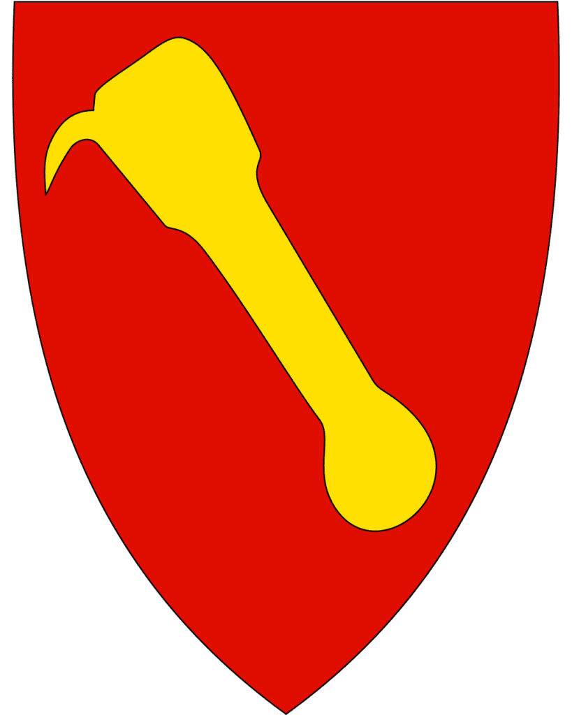
Mehamn
29th port - 71 degrees north - population 726 - Sami name: Donjevuotna
About Mehamn
Mehamn is a small community that is practically dependent on the supplies of fish coming in from the sea. Mehamn’s harbour is regarded as one of the best in Finnmark. Fish processing and other relevant industries are important in Mehamn. King crab is caught here and typically exported to Japan and other countries in Asia, while the dried cod goes to Eastern Europe and Africa and the fresh and frozen fish goes to Scandinavia and Europe.
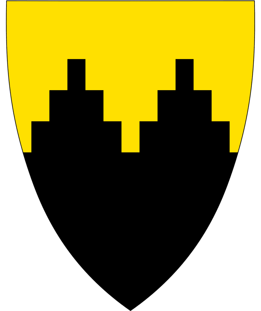
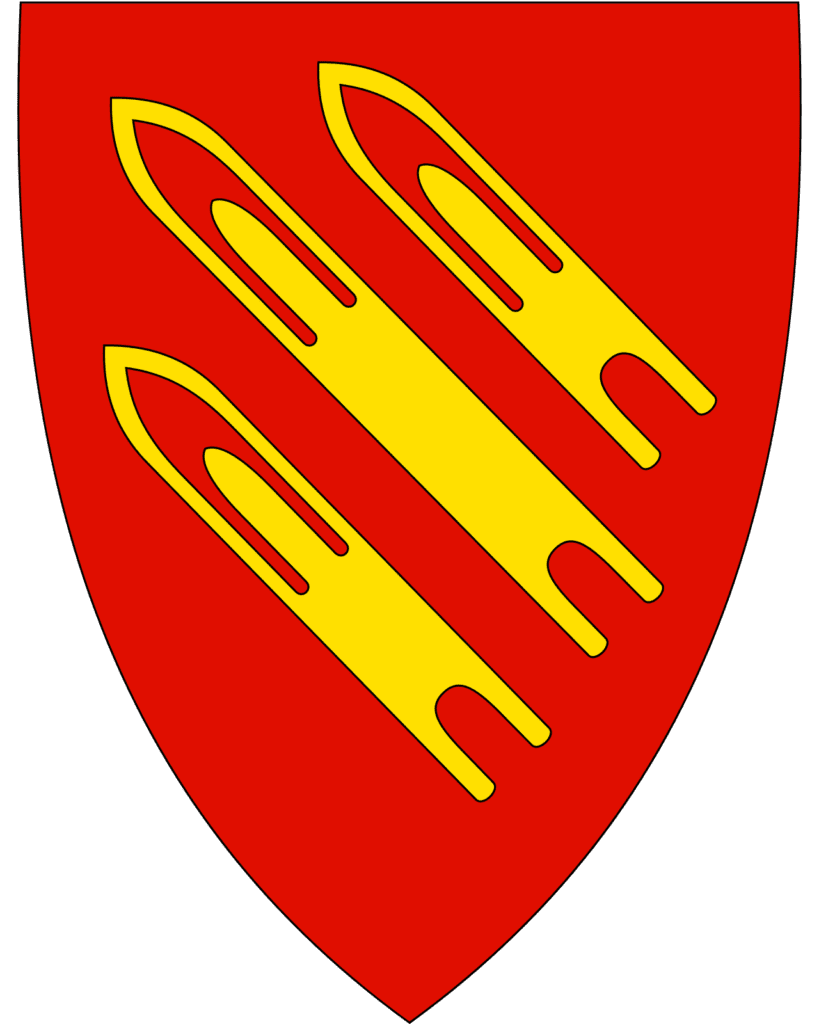
The municipality Gamvik is known as one of the poorest and most undeveloped municipalities in Norway due to the serious dependence on fishing. The coat-of-arms depicts three fishing net sewing needles. These needles are a characteristic tool used for making and mending the fishing nets used by local fishermen.
Mehamn is also known for its uprising in 1903. There were a considerable number of whales in the area, and the fishermen had a good relationship with the whales. The fish, escaping the whales, would swim into shallow waters, where the fishermen would be able to catch them. However, when whaling developed in the 1870s whalers came to Mehamn. The reduction in whales led to the reduction in fish. The fishermen tried to get the authorities to stop the whaling, but it didn’t work. The fishermen took matters into their own hands. 1,200 fishermen stormed the whaling station and destroyed all the equipment the whalers had. Military forces were called in to restore law and order, and several leaders of the uprising were jailed. Whales were protected by law the following year but it was too late: many of the whales had disappeared.
Mehamn has a small airport connecting it to Hammerfest and other communities in Finnmark.
10pm - 10:10pm
Berlevåg
30th port - 70.2 degrees north - population 2,165 - Sami name: Báhcavuonna
About Berlevåg
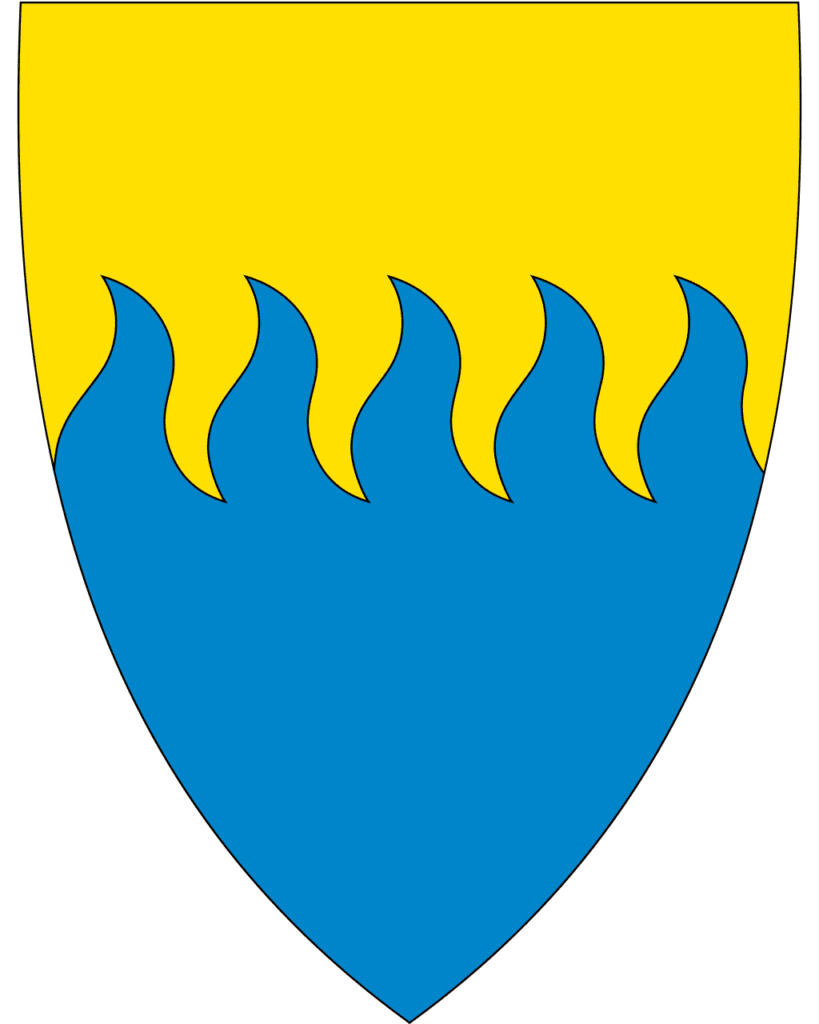
Berlevåg is one of the largest fishing communities in Finnmark, with industrial fishing plants, boatyards, and mechanical workshops. The coat-of-arms symbolises the municipality’s dependence on the sea. The motif shows the sea and the waves towards the beach, and the five waves symbolise the five places where there have been permanent settlements within the municipality.
During World War II, a German coastal battery was built in Berlevåg. When the Nazis retreated after World War II, Berlevåg was left in ruins from the Nazis scorched earth policy. The buildings were burned to the ground and livestock was slaughtered. During the 1950s the fishing community was rebuilt in a post-war architectural style that is typical for the period.
Berlevåg’s church is from 1960 and is a marker point for approaching ships and is built on a slight rise. The first church was the local chapel that the locald had converted into a church. Before then, the locals had to go to Vardø which was too difficult. The church was restored in 1939 but was destroyed during the war.
You will notice that Berlevåg has very large breakwaters. Berlevåg faces directly out to the Barents Sea in the north, meaning it is exposed to extreme weather. This has created great problems for the community. Several breakwaters have been built to try and protect the harbour. During the period 1875 to 1975, four breakwaters have been built but all destroyed by fierce storms. The current outer breakwaters are built from 10,000 four-armed cast concrete blocks (known as tetrapods), each weighing 15 tonnes. They have withstood waves up to 9.8 metres in height. The harbour is continually dredged, and deep-water berths have been created to allow larger vessels to dock.
Berlevåg is as far east as Istanbul and is almost as far north as North Cape and Barrow in Canada. Berlevåg is the northernmost town on mainland Norway (both Hammerfest and Honningsvåg are on islands).
Berlevåg is famous as it was the centre of a documentary called “Cool and Crazy” (Heftig og begeistret”, which followed the Berlevåg mens choir. Berlevåg is also the setting of Karen Blixen’s novel Babette’s Guest. Sangkraft Berlevåg (Arctic Centre of Music Theatre) is an initiative to put Berlevåg on the map and increase vocal activity in the region. They have established an opera choir and arrange concerts.
In Berlevåg you’ll find the Berlevåg Harbour Museum, which also manages a cultural heritage trail in town.
Berlevåg airport has daily departures to Hammerfest and Tromsø, as well as regular flights to Vadsø, Kirkenes, Båtsfjord and Vardø.
Photos