
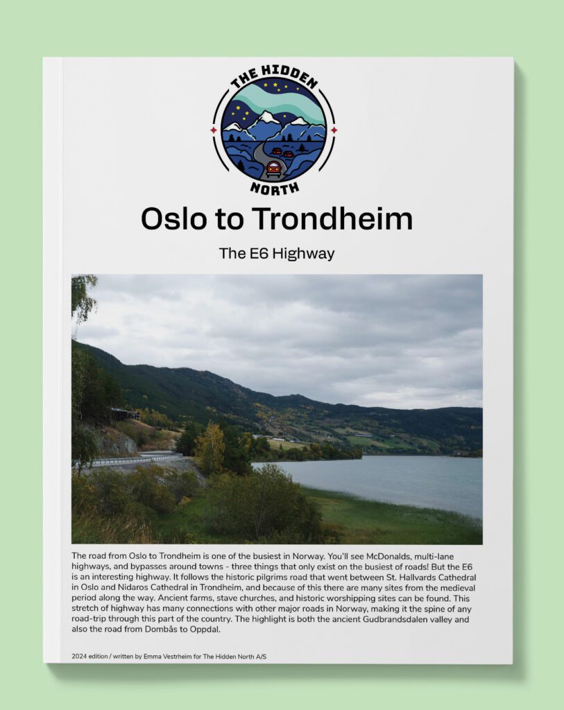
Drive it Yourself: Oslo to Trondheim on the E6
The E6 is the longest road that runs through Norway. Starting in Svinesund, on the Swedish border, it goes all the way to Kirkenes on the Russian border, stretching 2,576km.
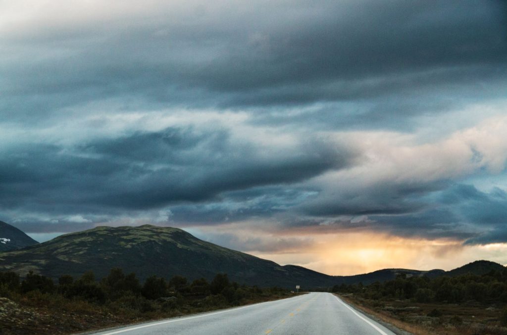
The busiest stretch of road, and the part that we cover here, is the stretch between Oslo and Trondheim. The E6 also follows the old Pilgrims Road that went from Hallvard Cathedral in Oslo to Nidaros Cathedral in Trondheim, and you will see many historic places associated with the old pilgrim’s road.
This guide will start at the part of the E6 shortly after Oslo Airport, when you cross into Eidsvoll County.
In this article...
Downloadable Version of This Guide
We offer downloadable versions of our self-guided drives on our online store.
Online Guide
- Information about points of interest
- Images of each point of interest
- Historic overview of the neighbourhood
- Directions between points
- Historic photos
- Information about facilities along the way
Downloadable Guide
- Information about points of interest
- Images of each point of interest
- Historic overview of the region & towns
- Directions between points
- Historic photos
- Facilities including supermarkets, toilets, petrol, hotels, cafes, restaurants with addresses.
Oslo to Trondheim on the E6

Oslo
This drive begins just north of Oslo’s Gardermoen Airport, but you can learn more about Oslo via the travel guide below.

Eidsvoll Municipality
The first municipality that you cross through after Oslo is Eidsvoll.
The part ‘eid’ means “a road passing around a waterfall”, while ‘voll’ means “meadow” or “field”. The name therefore refers to the fact that people from the districts around the lake Mjøsa (you will see it later) were sailing down the river Vorma and people from Romerike were sailing up the river. They had to enter this area by passing the Sundfossen Waterfall. Because of this, the site has been an important meeting place long before the introduction of Christianity. The coat-of-arms depict a scale as a symbol of justice, representing the old court.
Eidsvoll is mentioned in the Old Norse Sagas back to the 11th century. The sagas were a court and assembly for the eastern part of Norway mostly due to the lake and the river that served as a transport road. Historically the main industry was agriculture, despite the fact that there is a lot of clay in the soil.
The town of Eidsvold in Queensland, Australia, and Eidsvold Township in Minnesota use the old spelling of the municipality. The current ‘Eidsvoll’ was adopted in Norway in 1918.
Small Detour: Eidsvoll Town
Eidsvoll is a historically important place in Norway. You must leave the E6 and take a small detour, but it is worth it. Eidsvoll Church is an old church from 1200 and is built in the Romanesque style. The church is located on the old Pilgrims Road and is one of the important stops along the way.
Eidsvoll Verk (how it is written on Google Maps) refers to the smelt iron ore that King Christian IV of Denmark opened in 1624. He was relying on the excellent water power from the Andelva River. The smeltery was taken over by Kongsberg Silver Mines. Carsten Anker bought the works in 1794 and restored it, setting up the production of stoves and similar iron goods. He also took residence in Eidsvoll, building a manor house now known as Eidsvollsbygningen. The Eidsvoll Verk has closed, but the name still remains. The old mill can be seen in the town.
In 1854, Eidsvoll became the end point for the first railroad line in Norway from Oslo.
This is the site where the constitutional assembly met to draft and sign the Constitution of Norway on the 17th of May 1814. The building is considered to be one of Norway’s most important national monuments and the cradle of modern Norway. Today it is a museum. The home was lived in by Carsten Anker, owner of the iron works, lived here during the time when it was used to sign the constitution. He went bankrupt in 1822 and the ownership of the estate was transferred to British creditors. A group of private citizens led by Henrik Wergeland organised a fundraiser that allowed them to buy the building with the pavilion and surrounding garden. When the purchase was finalised, the group donated the property to the Norwegian estate.
I will visit the building eventually and write a more detailed overview of it.
Minnesund
Minnesund is a small village on the southern tip of Lake Mjøsa at the place where the lake flows into the Vorma River. Minnesund is an old ferry pier and has always been important for travel and communications.
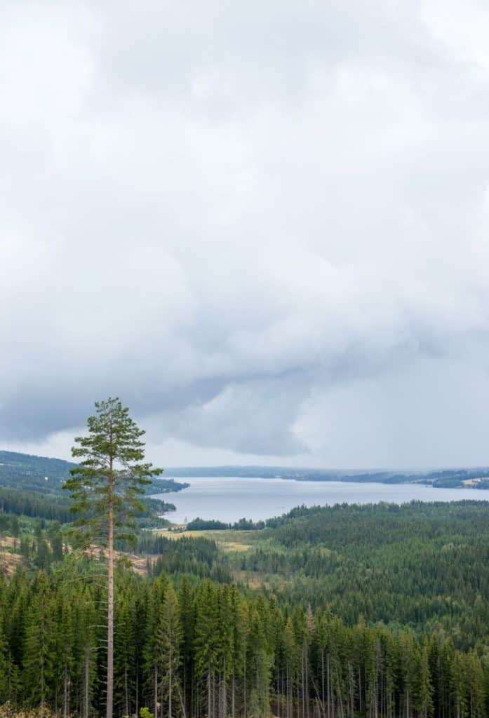
Lake Mjøsa
Lake Mjøsa is the largest lake in Norway and the 35th largest in Europe. It is also Norway’s and Europe’s fourth-deepest lake with the greatest depth being 453 metres. Lake Mjøsa provides drinking water for up to 100,000 people.
The area around the lake is one of the most fertile agricultural districts in Norway.
The meaning of the word ‘Mjøsa’ is unknown.
In summer the surface temperature averages between 13 and 16 degrees and up to 20 degrees deep in the Furnesfjorden. Parts of the lake freeze over in December. In January, almost all the lake is covered with ice and in particularly cold winters the entire lake can be covered with ice in February.
Mjøsa is home to Norway’s largest inland fishery and is also one of the country’s most species-rich lakes. 21 fish species have been found in the lake, including perch, trout, pike and other species.
The lake has also been an important transport and traffic artery, even when frozen. The lake is commonly mentioned in the Viking Sagas and the transport of goods on the lake was probably extensive and well organized in the Viking Age and Hamar’s heyday in the High Middle Ages. Salt, grain, iron, coffee, sugar and tobacco went north, while alcohol, glass, timber, ore, cheese, butter and grain went south. Steamships were launched on the lake in 1840 for better transport.

Innlandet County
You will now be driving through Innlandet County.
Stange Municipality
Stange is the first municipality you will pass through in Innlandet county. There have been settlements here since well before the Viking Age. Because of the old transport route went along here, there has been trade and hospitality here since time immoral. Stange Church, with is in Stange village, is first mentioned in 1225 in Håkon Håkonssons saga. The current building is from 1250.
Stange is one of the largest agricultural municipalities in Innlandet. Norway’s oldest agricultural school, Jønsberg High School, is located here. The high school teaches in nature management, agriculture, animal husbandry, forestry, and biology, as well as organic farming, mathematics and chemistry. The school was established in 1847. You will pass the school on your right shortly before going into Hamar.
Espa
Espa is a small village that saw fighting during World War II, when battles were fought between Norwegians and Germans to prevent the Germans from following the King as he fled Oslo. The Espa Servicesenter has become kind of (?) famous because it has sold a large number of buns in recent years, earning the nickname ‘bolle land’ . You can visit their website here: https://www.bolleland.no/
Hamar Municipality
Hamar municipality is named after the main town in the area – Hamar. We’ll cover Hamar next, but first lets talk about the coat-of-arms for the municipality. The coat-of-arms depict a Black Grouse sitting on top of a pine tree. The first version of this coat-of-arms was depicted in 1553
Hamar
Hamar is the first major town on the E6. It is also one of the major historic towns in Norway and was one of the powerful centres of Norway during the Viking and medieval times.
You can read our separate guide to Hamar below.
Ringsaker Municipality
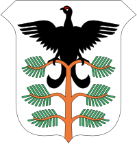
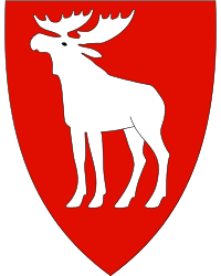
Ringsaker Municipality gets its name from the old Ringsaker Church. The coat-of-arms shows a moose; the image is taken from a pre-historic cave painting that has been found in the municipality. The area is mentioned in King Harald Hårfagres Saga as well as St. Olavs Saga when St. Olav was christening the area.
Ringsaker is primarily an agricultural and lumbering region.
Brumunddal
The town of Brumunddal (population 11,019) grew as a settlement with the establishment of the Dovre train line in 1894. The major industry in the town is agriculture and forestry. Close to Brumunddal is the Mjøsa Tower (Mjøstårnet), the world’s tallest wooden building. It is 18 floors and 85.4 metres high.
Rudshøgda
Rudshøgda is best known as the childhood home of author, poet, playwright, songwriter and musician Alf Prøysen. Prøysenhuset is a cultural centre and museum honoring his memory. He wrote the very popular Mrs Pepperpot series of childrens books.
Moelv
The town of Moelv (population 4,459) was built around various mills that were utilising the power of the Moelva River. The largest industrial company here is Moelven Industrier, which is one of Scandinavia’s leading suppliers of building products.
Rock carvings have been found in Moelv that can be traced back tot he Stone Age and are generally regarded as the best-preserved rock carvings in Norway. Additionally, the Ringsaker Church is located here. It was completed in the middle of the 12th century and is dedicated to St. Olav.
North of Moelv is Tovsteinsringen (The twelve-stone ring). This is an ancient stone circle that is often compared to Stonehenge (this one is much, much smaller). It is believed to have been the site of a burial ritual, likely for a wealthy, high-ranking person.
Lillehammer Municipality
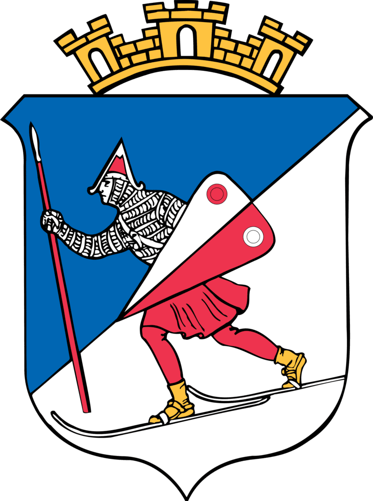
Lillehammer Municipality is named after the major town of Lillehammer, your next detour. The name Lillehammer means “Little Hammer” and was developed as a new trading town on the Lake Mjøsa after Hamar, hence the name. The coat-of-arms depict a birkebeiner, a 12th-century civil war fighter, carrying a shield, who is skiing down a silver/white mountainside under a blue sky. The birkebieners carried the future King Haakon from Lillehammer to Rena on skis during the Civil War.
There have been settlements here since the Iron Age and the market here was mentioned in Håkon Håkonssons saga in 1390. It was also believed to have a site for the Ting assembly. However, despite this history, Lillehammer was registered as a trading down in 1827.
Lillehammer
Lillehammer is the next major stop on the E6. There is so much to say about Lillehammer, so check out our separate travel guide page.
Øyer Municipality
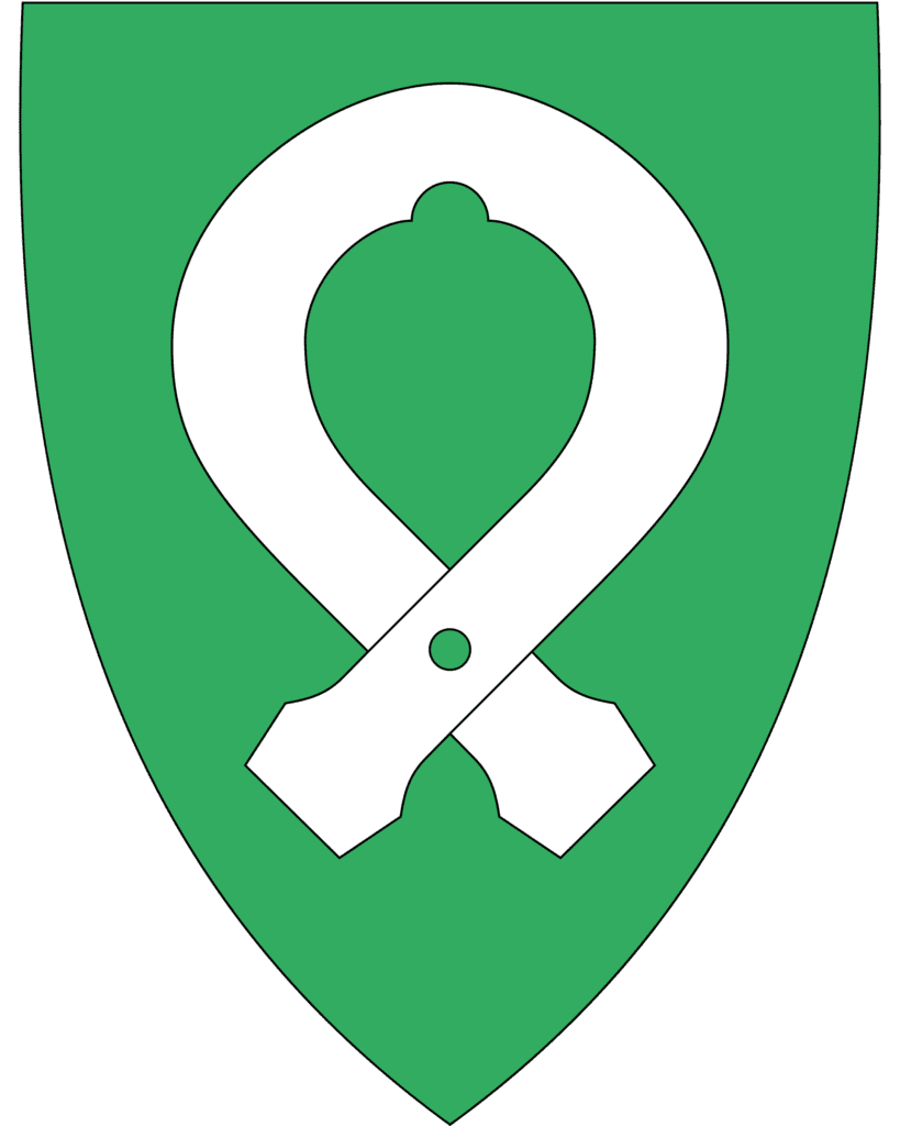
Øyer Municipality is the first municipality within the Gudbrandsdalen region. The coat-of-arms show a silver-coloured wooden ring on a green background. This is a type of ring that was historically made of wood and was used to fasten a tree trunk to a rope to haul it over the land. Similar devices were used all over Norway, but this shape was typical for the area.
Øyer was one of the area’s most severely impacted by the Black Death in 1349-1350. It is believed that up to 75% of residents here died, and many of the farms were deserted until the late 17th century.
Øyer is a farming and logging municipality, though recreation is increasingly through the ski centres.
Tretten
Tretten is a small village with a population of 860. In 2022, it made the news as the bridge that crosses the river completely collapsed.
Ringebu Municipality
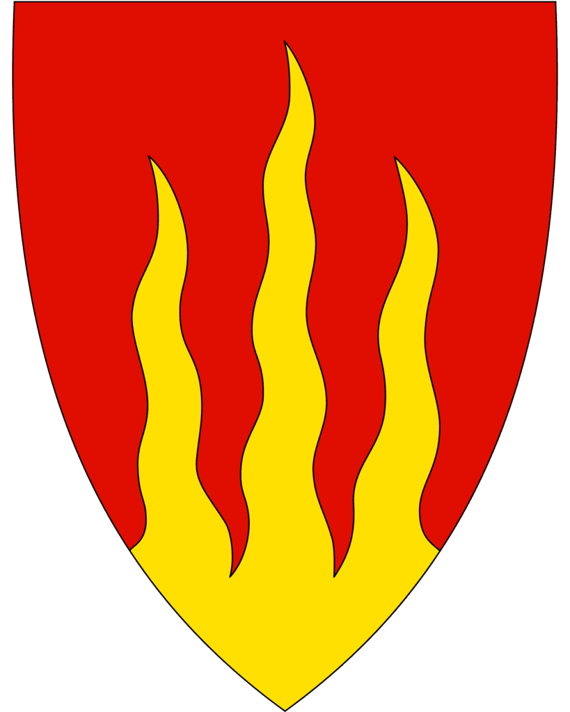
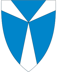
Ringebu municipality is located within the traditional Gudbrandsdalen region and has a population of 4,800. The largest and main settlement is the town of Ringebu. The coat-of-arms represents shows three flames, representing the three valleys and three parishes in the municipality.
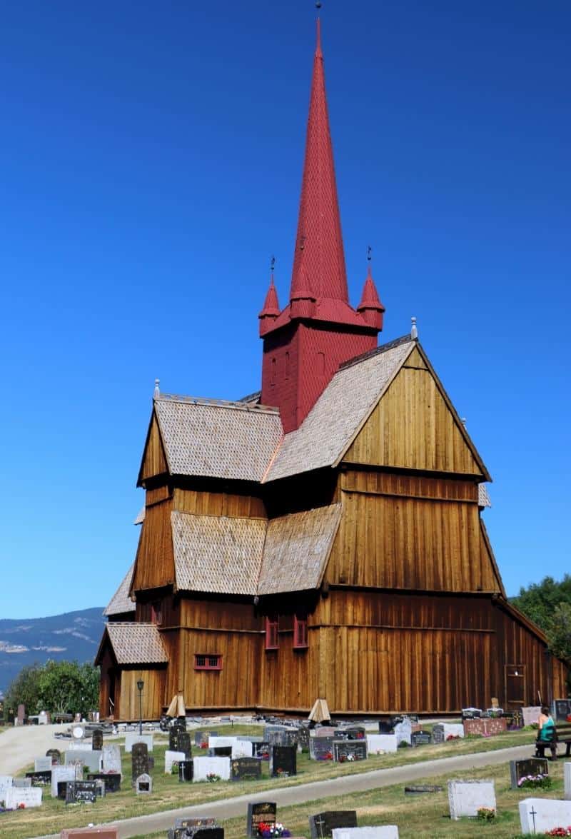
Ringebu
Ringebu may be a small village, but it is home to Norway’s largest stave church. Read our travel guide below.
Sør-Fron Municipality
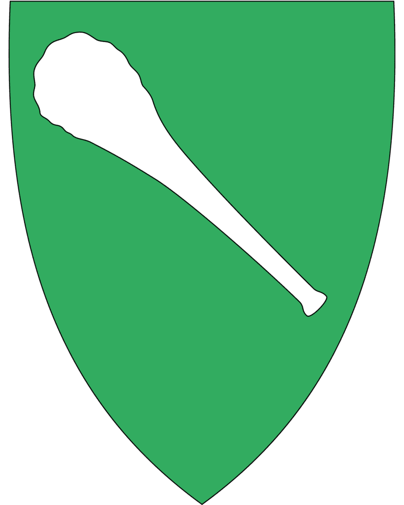
Sør-Fron Municipality is a small municipality in the Gudbrandsdalen valley. The coat-of-arms show a white or silver club on a green background. The club is reminiscent of the club that Kolbein Sterke used in 1021 when King Olav Haraldsson met the people of Fron and Dale-Gudbrand at Hundorp. The meeting is depicted in the Norse Sagas.
The most important industries here are agriculture, industrial factories, and tourism.
The famous play Peer Gynt is staged annually at Lake Gålå in the mountains around Sør-Fron. It is believed that Peer Gynt is set in the area.
Hundorp
Hundorp is the administrative centre of the municipality. Historically, Hundorp is a very important place. It was the centre of the petty kingdom of the Gudbrand Valley and as such an important place in terms of religion and politics.
All this took place at Dale-Gudbrand’s farm. Dale-Gudbrand is a famous historic figure from the 1100s. He is mentioned in multiple Norse sagas, but most famously in the story of Olav the Holy christianising Gudbrandsdalen. You can read the story here. The image above is a drawing of Olav christianising the farmers.
Around the farm are five large grave mounds, though sadly one of them was removed. The four remaining are between 23 and 32 metres (75ft and 105ft). Additionally, there’s a square ring of stones and the remains of a round ring of stones, indicating a possible worshipping site.
Today it is a Pilgrim Centre. There is a small farm shop with local food products and souvenirs. You can also spend the night there if you wish. Click here to visit their website.
Harpefoss
Harpefoss is a small town with a population of 335. The name comes from the railway development in 1896, when the railway station was named Harpefoss. People have lived here for centuries, though, and old names were Skurdal and Ryssland. Harpefoss is the name of the waterfall that separates two hamlets.
During the railway development, Harpefoss Hotel was built. It is the only hotel left that is one of the original hotels from the railway development period that still stands. It is built in Swiss style with neo-Gothic features. It has long since been closed down as a hotel, and after a period as a country store, the house is now a residence.
In Harpefoss you can stay in a historic farm!
The farm ‘Sygard Grytting’ has belonged to the same family since the 14th century. The current owner is the 16th generation since the year 1534.
It’s believed that as far back as Christianity goes, pilgrims would stay at the property on their way towards Nidaros in Trondheim. Because of these, there are unusual details in some of the buildings that are very similar to details found in monasteries.
You can stay in historic houses from the 17th century – the same houses the pilgrims stayed in – or buildings from the 19th century.
The property is still a working farm.
Agriculture specialises in sheep, grain, grass production and forestry. In ancient times, the operation was very versatile and the farm was self-sufficient in most things.
Sødorp Church
Sødorp Church is a wooden cruciform church from 1752. It’s believed the first church on the site was a stave church, but it was replaced in 1570 and no trace of it remains today. In 1752, the church was replaced once again with the church we have today.
Originally the church stood in Sødorp, a small town just south of Vinstra – hence its name. However, Vinstra emerged as a major town in the early 20th century, and it was decided to move the church there. In 1910, the church was moved to its present location.
The 18th century church originally had a very high tower, but it was destroyed by wind in 1850. The church then got a stumpy small tower (click here for a photo of it). When it was moved to Vinstra, they made a new high tower for the church. You can see photos of the construction process here, here, and its completion here.
Much of the interior is from the 18th century, including the altarpiece, pulpit, choir arch, crucifix and relief figures. The soapstone baptismal font is from the Middle Ages, though.
In the graveyard you’ll find a memorial stone to the real Peer Gynt.
Nord-Fron Municipality
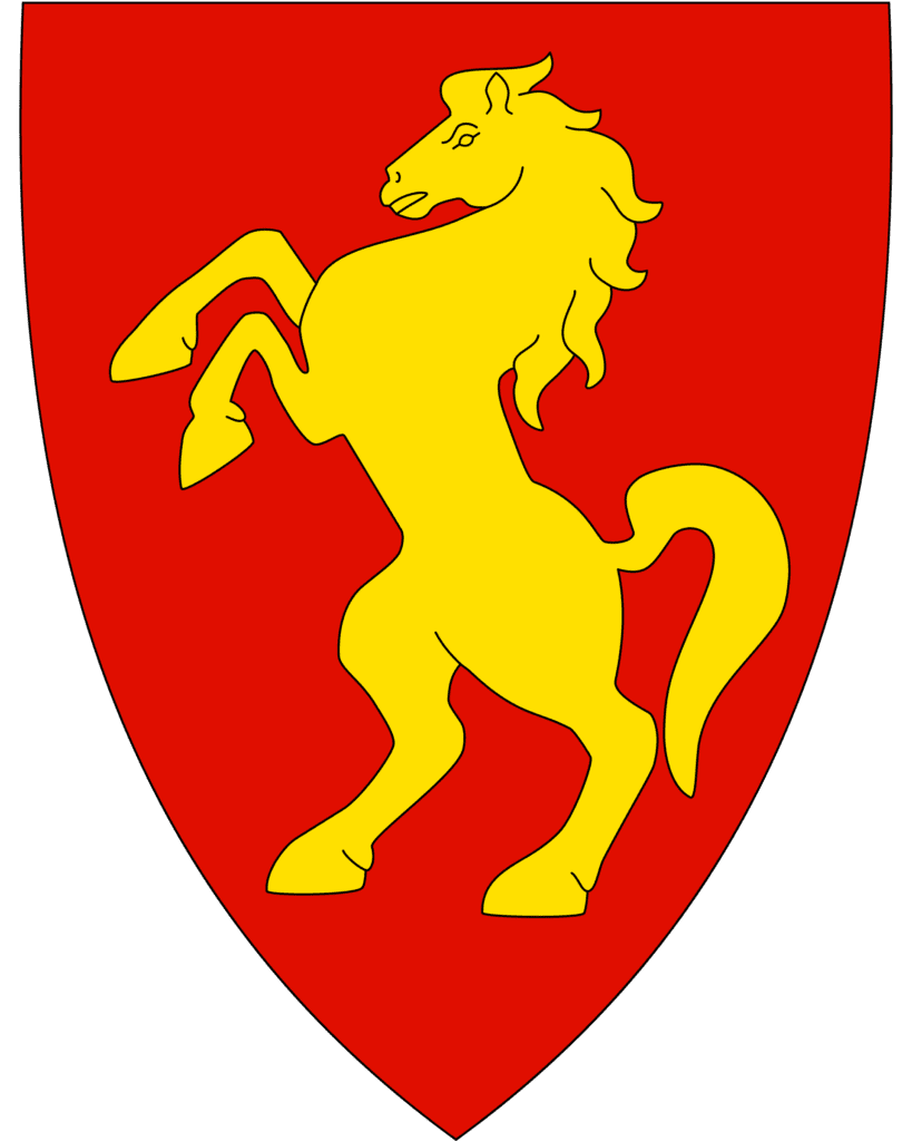
Nord-Fron is a small municipality with a population of around 5,600. It is home to Skåbu, a village located 870m above sea level. It is Norway’s highest situated rural area with a permanent settlement. The coat-of-arms depicts a Dole Gudbrandsddal horse; the area has a long tradition of horse breeding and is one of the main centres in Norway.
Kvam
Kvam is probably most famous for the battles that took place here during World War II. During the military campaign in Norway in 1940, Kvam was the scene of a battle between German and British forces. During the battle, the original Kvam Church (from 1776) was destroyed, along with 70 houses. There is a whole Wiki page to the battles, which you will find here.
By Kvam Church is the Peace Park, which is a memorial to the locals killed during World War II. There are also memorials on Stølane (Kvamsfjellet) where Russian soldiers were shot by Germans, and on Hillingen where three Norwegian soldiers lost their lives in a battle against German troops.
Kvam has a British military cemetery. There is also a museum about World War II, the Gudbrandsdal War Memorial Collection, in town.
Remember the battle at Otta in 1612 between Norwegian peasants and the Scots? Well, after the battle 134 Scottish prisoners were taken from Otta to Kvam. At Klomstadlåven, most were killed in a massacre. The barn building where they were kept before they were massacred, was destroyed during World War II.
Kvam currently has a population of 762. Most of the industry has closed down in the last few years.
Sel Municipality
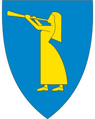
Sel’s coat-of-arms depicts a girl playing a trumpet. This represents the local legend about the Prillar-Guri, where in 1612 a Scottish army marched through on its way to Sweden. They were stopped by the farmers at the Battle of Kringen, and legend says that the farmers were made aware of the army’s arrival by a local girl with a trumpet.
Sel is regarded as one of the more scenic and historically significant areas of the Gudbrandsdalen valley, which a large number of Norway’s heritage-listed farms being here.
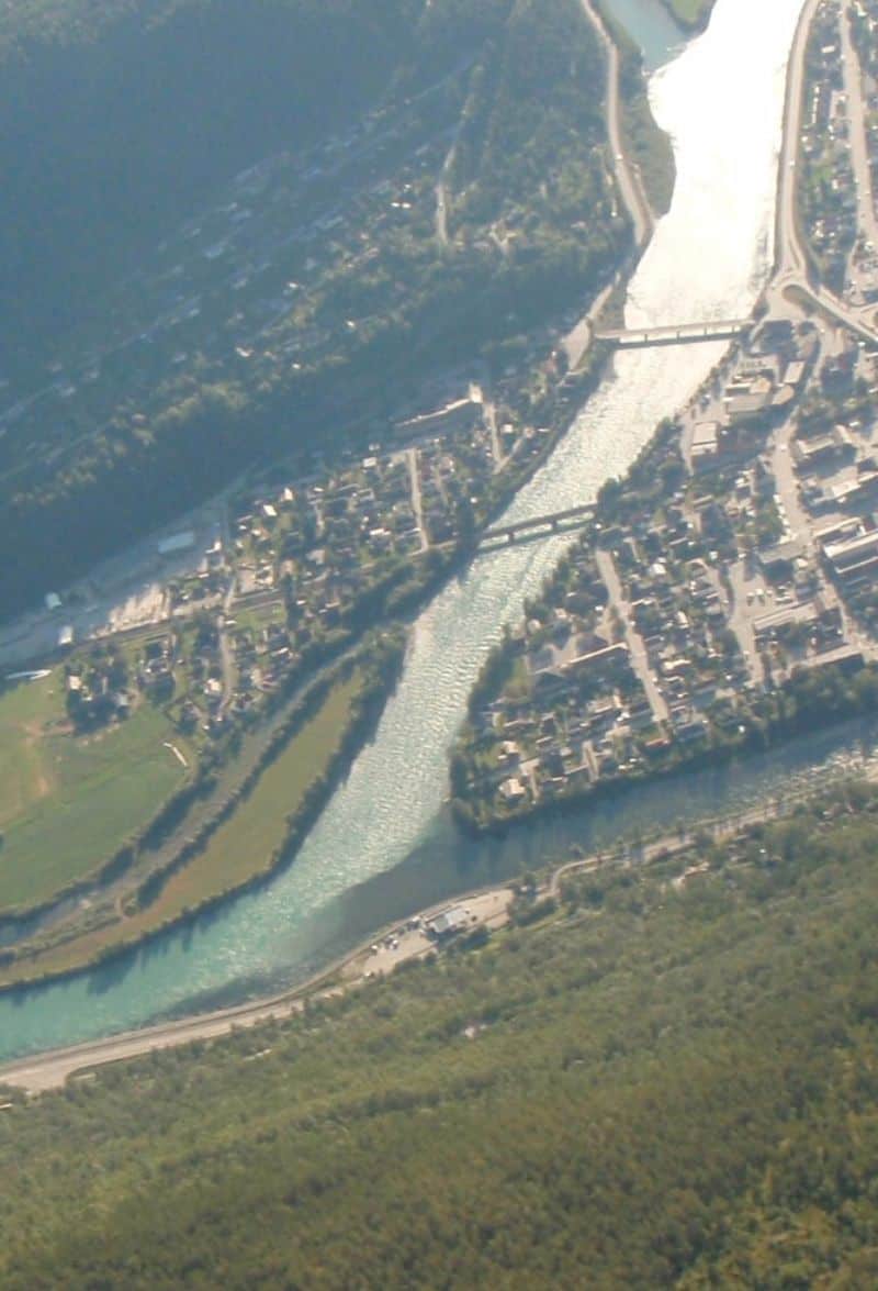
Otta
In the higher part of the Gudbrandsdlaen valley is the town of Otta. It is the next major town after Lillehammer, and you can find out more via our travel guide.
Sel Church
Sel Church is a historic wooden church dating back to 1742. It is not the first church on the site, though. It is believed that the first church here was a wooden stave church built in the 13th century. However, the church has since been rebuilt twice due to the older ones deteriorating.
Sel
Sel is a small village with a population of 437. Sel was the main town in the region until Otta was built up around the time the Dovrebanen was completed in the area.
In Sigrid Undset’s novel about Kristin Lavransdatter, the protagonist grows up at Jørundgard, a medieval farm. The movie was filmed on the property too. Unfortunately the property is now closed to the public.
Dovre Municipality
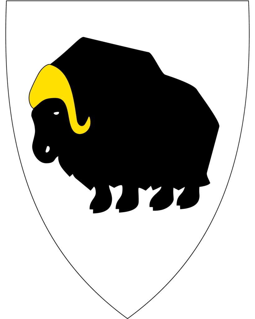
You are starting to get higher into Norway now! Dovre municipality gives its name to the railway line but also the Dovrefjell National Park. The coat-of-arms depicts a muskox. The animal is not native to Norway, but in 1932 ten were released near Dovre. Besides muskox, wild reindeer and wolverines also live in the municipality.
People have lived at Dovre for around 6,000 years. In the Stone Age, they were primarily hunters and fishermen. Approximately 2000 years ago, the first farms were developed. Dovre is mentioned in the Norse Sagas when King Olav travelled through the area, forcing the locals to either become Christian or suffer death.
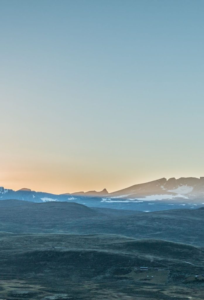
After leaving Dovre, the path becomes more mountainous. As this is located on the Pilgrims Road, many mountain stations were established on the road to accommodate those crossing the mountains to Trondheim.
Dovre Village
Dovre is the administrative centre of the municipality. Close to Dovre is Budsjord Pilegrimsgården – hotell Dovre, a historic mountain farm and accommodations for travellers on the Pilgrims Road. The property is mentioned in documents from the 1400s, while the 17 protected buildings are from between the 17th and 19th centuries.
Dombås
Dombås is the next major town that you pass through and it is also an important meeting point between east and west. You can read more about Dombås on our travel guide.
Fokstugu Fjellstue
On your left you will pass one of the historic mountain accommodations. The first accommodations on the site were constructed around 1120 by King Øystein Magnusson, wo wanted the pilgrims to have places to stay on their journey. While the farm has been rebuilt multiple times since then, pilgrims heading to Trondheim have always stayed there.
Today the property is a sheep farm, and it does open in the summer for travellers who want to spend the night there. The farm is run by the 11th generation of the same family who have owned it.
Hjerkinn
Hjerkinn is in the Dovrefjell mountains and is one of the driest places in the country, with only 222 millimetres (8.7 inches) in annual precipitation. The train station is an impressive looking building. The Hjerkinn Station is Dovrebanens highest station at 1,017 metres above sea level.
Hjerkinn is an old rest station with traditions dating back to the 13th century, when pilgrims would travel through the area.
Trøndelag County
You now cross into Trøndelag county.
Oppdal Municipality
Oppdal is the first municipality you drive through in Trøndelag. This is a mountainous municipality, with large parts of it in the Dovrefjell. Østfjella and Trollheimen mountains. This is represented in the coat-of-arms.
125 years ago, Oppdal was a purely agricultural community where the people produced practically everything they needed themselves. Today agriculture is still a significant industry. The sheep industry in Oppdal is the largest in the country with 45,000 sheep here.
Kongsvoll Mountain Lodge
Kongsvoll is another historic mountain lodge. The original inn was built in the 12th century, while the oldest parts of the lodge date back to the 18th century.
Nearby is the Kongsvoll Alpine Garden, run by Trondheim’s university. This is the only alpine botanical garden in Scandinavia.
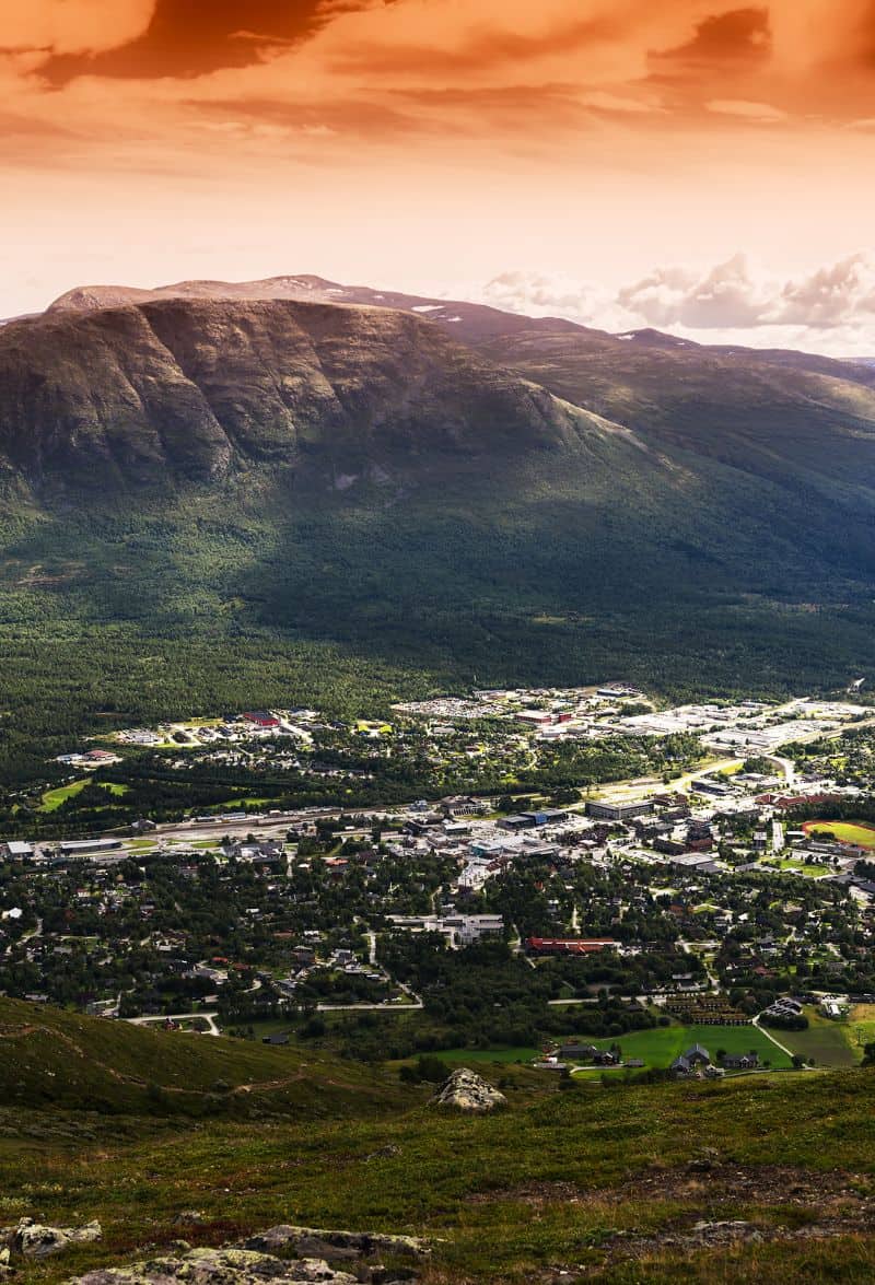
Oppdal
Oppdal is a major town and the administrative centre for the municipality.
Rennebu Municipality
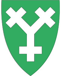
Rennebu is a mostly mountainous municipality. The coat of arms shows the outline of the local church, Rennebu Church, which is one of the oldest churches in Norway based on a Y-shaped outline. The Trollheimen and Forollhogna National Parks lie in the municipality and the salmon river Orkla flows through it.
Berkåk
Berkåk is a small village with a population of around 959. The name comes from the word birch, referring to a prominent type of tree in the area. Every year in August, the Rennebumartnan is hosted in town. It is a sales exhibition for home improvement and handicrafts with around 20,000 visitors.
Mitre Gauldal
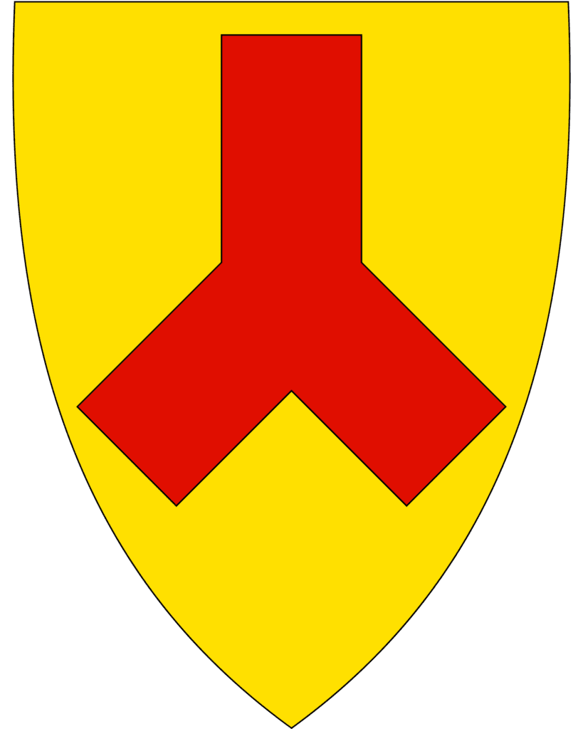
Mitre Gauldal is primarily an agricultural municipality. Every third person living here works in agriculture. Milk, poultry and eggs are produced here. The coat-of-arms shows a silver crossed Y figure on a green background. The crossed Y has several meanings. First, it symbolises the landscape which is based on the meeting of the two valleys here (Gauldal and Soknedal). The municipality also has a major Y-shaped road and railway junction. Lastly, the Budal Church, dating from 1745, is one of the oldest and few remaining Y-shaped churches in the country.
Soknedal
Soknedal is a small village located by the river Sokna.
Støren
Støren is the administrative centre of Mitre Gauldal municipality. It is located in the Gauldalen valley where the Gaula and Sokna rivers meet. The Dovrebanen and the Rørosbanen meet here as well.
Melhus Municipality
Melhus is the last municipality you pass through before Trondheim. Agriculture is important here, and the valleys are dominated by grain fields. The coat-of-arms symbolise a man called Einar Tambarskjelve, a famous chieftain and archer from Melhus in the 11th century. The entire area of Melhus was known during the Viking Age. It was the site of the first farm Rimul at which Jarl Haakon was killed by his slave, Tormod Kark. Archaeological excavations in the area have uncovered discoveries from the Viking Age. Additionally, 3,000 year old graves have been found.
Melhus
Melhus is the administrative centre of the municipality. Melhus is home to the Rimul farm, which is known from the Viking Age. It was the scene of the murder of Håkon Sigurdsson by his slave Tormod Kark, as described in the Saga of King Olav. The farm is still in operation today.
Hakon had a mistress called Thora at the Rimul farm. Hakon and his slave were seeking shelter in hiding from Olav Tryggvason (founder of Trondheim) and his men, who were at the time searching for him. Thora led them to a pig sty beneath a great stone. Later, after killing the Earls son, Olav Tryggvason arrived at Rimul with a group of local farmers, now supporting him. The story continues in the Norse Sagas:
Then Olaf held a speech out in the farm, he went up unto a great rock lying near the pig sty. Olaf spoke, and in his speech he said he would reward any man richly who could harm Hákon Earl. The Earl and Kark heard this speech. They had light where they lay. The Earl said: “Why are you so pale, yet sometimes black as dirt? It is not so that you wish to harm me?” “No,” says Kark. “We were born on the same night,” says the Earl. “Close will also our deaths be.”
Lying in the pig sty at night, Kark killed Hakon. He brought the head to Olav, hoping to collect a reward. Unfortunately, Olav did not respect a slave murdering his own lord. Tormod Kark was himself decapitated. Both heads were put on stakes at Munkholmen for people to spit at.
Trondheim Municipality
You now cross into Trondheim municipality, the last municipality for the drive.
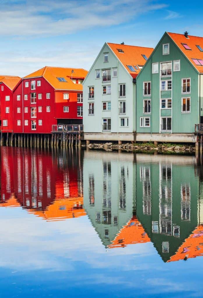
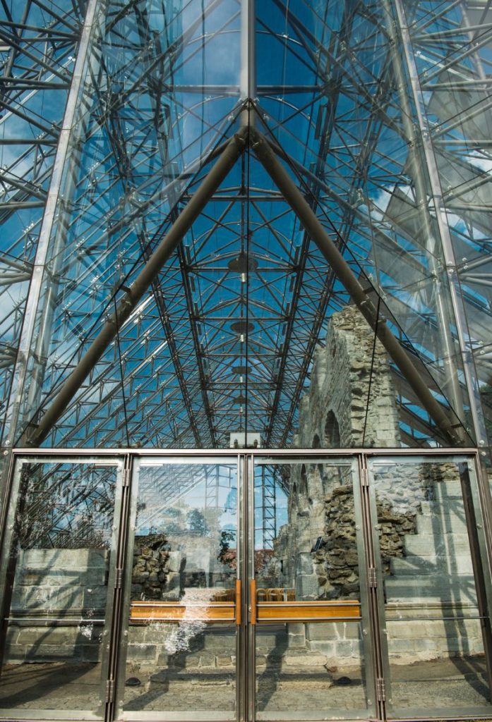
Trondheim
You have made it to Trondheim, Norway’s third-largest city. You can read more about Trondheim via our travel guide below.
Continue the drive
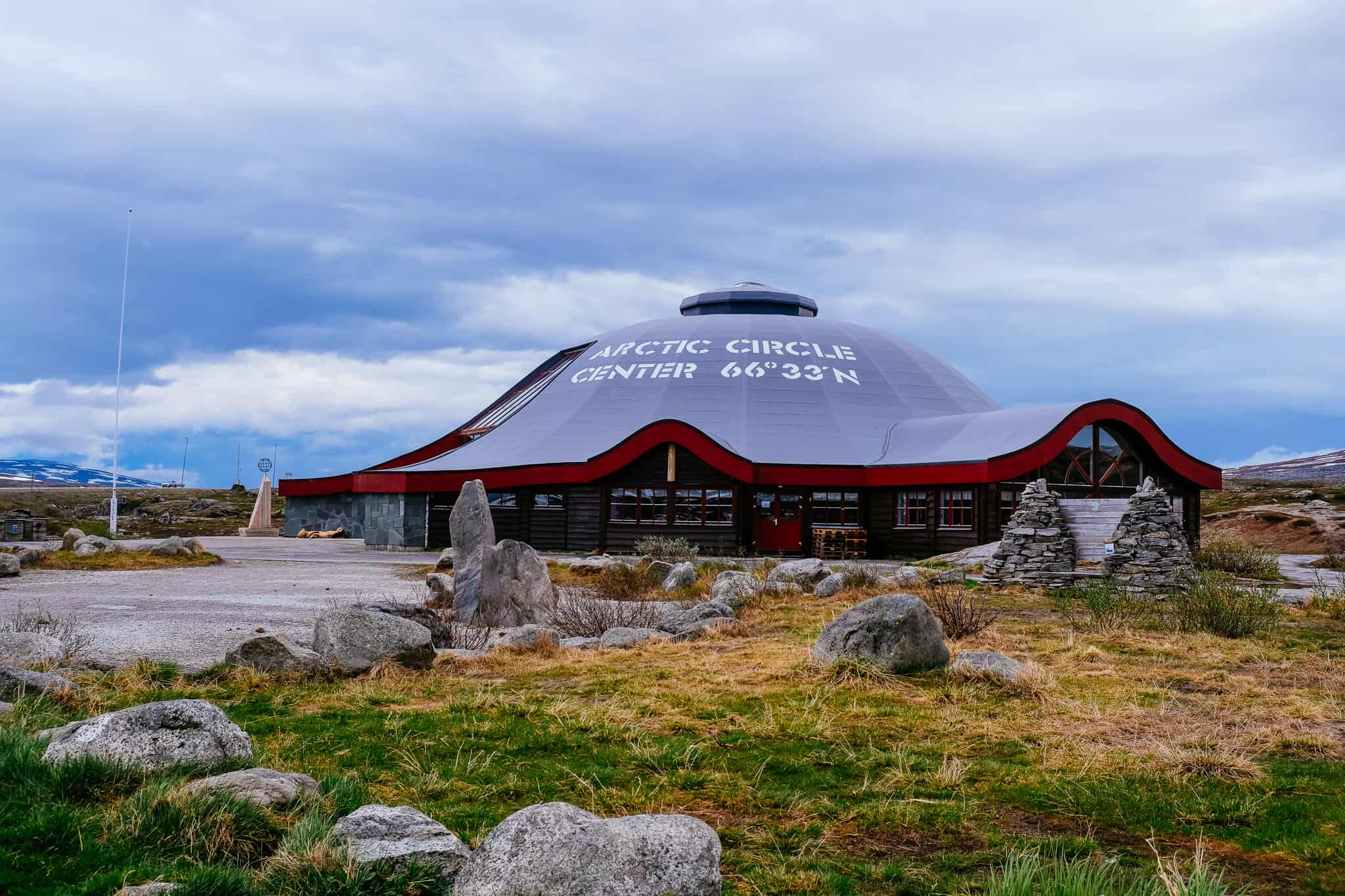
Mo i Rana to Trondheim on the E6
Continue your drive along the E6 up to the Arctic Circle and Mo i Rana.
If you liked this drive, or if you have any travel tips, please leave a comment in the section below!