Road-Trip Guides Norway
Below you’ll find my available road-trip guides for Norway. They are divided into several categories:
– National Tourist Roads
– European Highways (E Highways)
– National Highways (Rv Highways)
– County Highways (Fv Highways)
They are listed in order of highway and then number. They are not listed accorded to region (though the numbers often determine the region).
You can use the map below to find the road you’re looking for, or you can visit our travel guide if you are looking for a specific location.
All guides comes as a PDF with a separate Google Map (accessible by QR code or link). Contact me at emma@thehiddennorth.com if you have any questions.
God tur!!
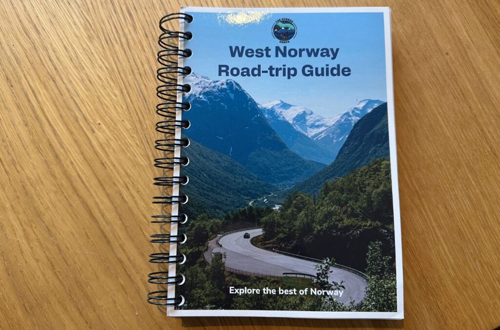
West Norway Road-trip Guide
I’ve written a book! This book is every single highway and scenic road in Western Norway, and provides in-depth information about what to see and do along the way. If you are road-tripping around the west coast and the fjords, this is the book for you.
Table of Contents
National Tourist Roads
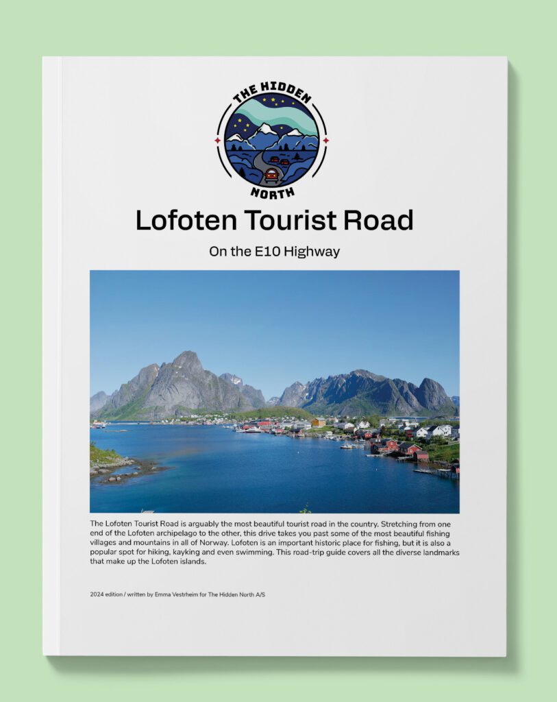
The Lofoten Tourist Road (E10)
The Varanger Tourist Road is unlike any other scenic road in Norway. With its flat, rocky landscape, it feels like you are driving to the end of the world. You pass the Varanger park area, known for its bird life, before heading above the tree line. The stretch from Vardø to Hamningberg is particularly scenic – it feels like you are driving on the moon! Despite its remote location, this is a road rich in history and there are several fascinating places to stop at along the way.
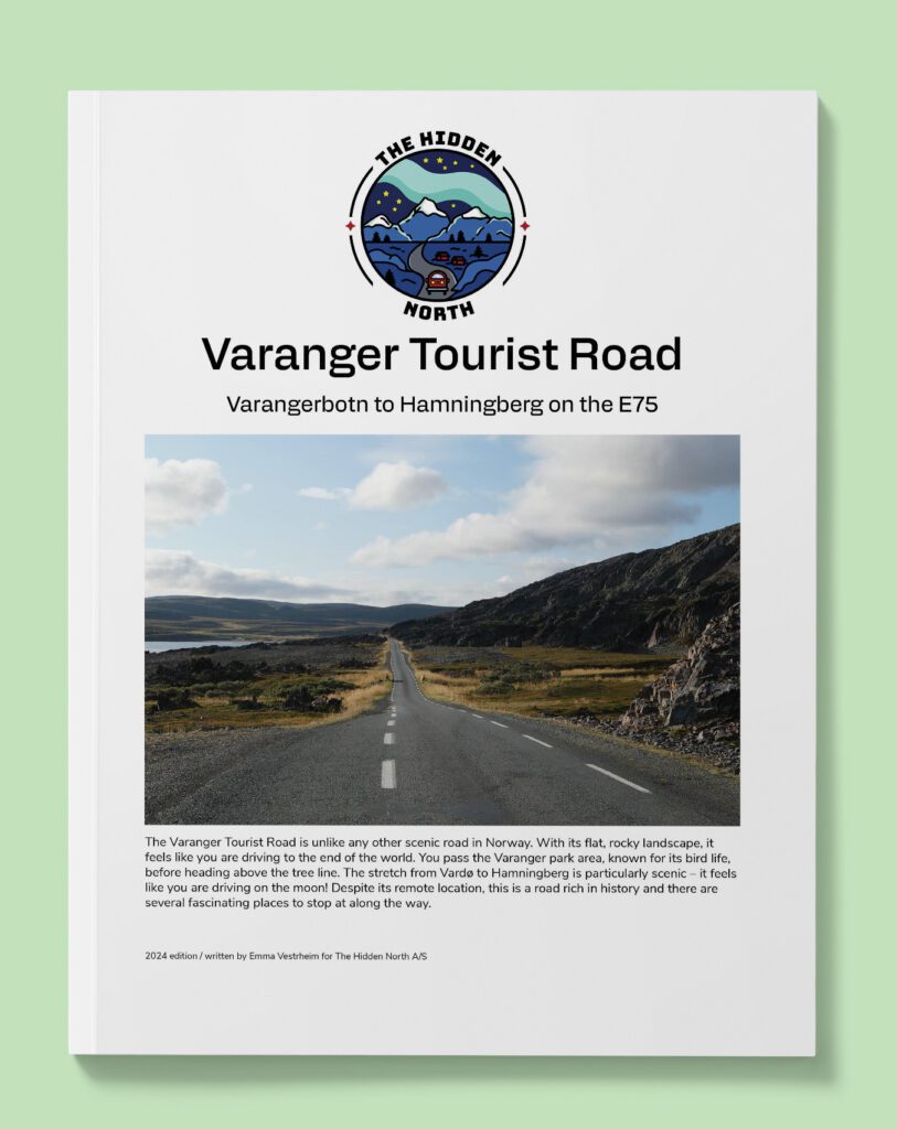
The Varanger Tourist Road (E75)
The Lofoten Tourist Road is one of the most incredible roads in Norway. Winding its way the length of the Lofoten archipelago, this drive will not leave you disappointed. This guide goes from Å i Lofoten to Gullesfjord and includes the popular stops Reine, Unstad Beach, Borg, Henningsvær, Svolvær, and so much more.
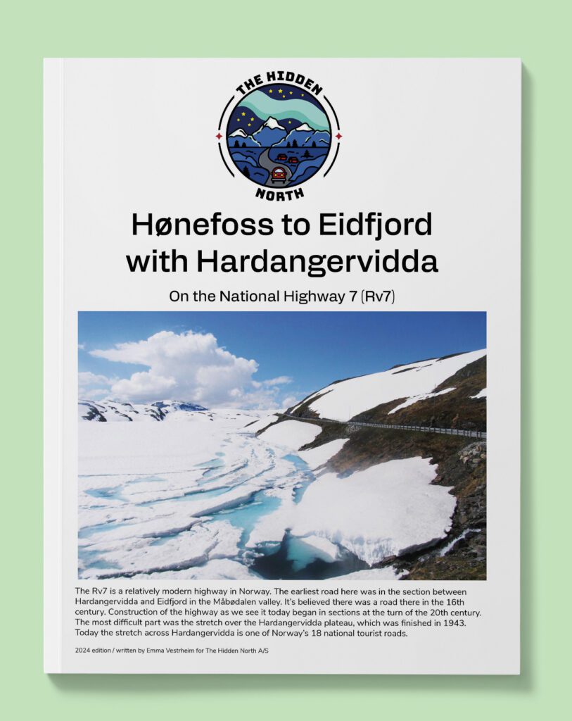
Hønefoss to Eidfjord on the Hardangervidda Tourist Road (Rv7)
The Rv7 is a relatively modern highway in Norway. The earliest road here was in the section between Hardangervidda and Eidfjord in the Måbødalen valley. It’s believed there was a road there in the 16th century. Construction of the highway as we see it today began in sections at the turn of the 20th century. The most difficult part was the stretch over the Hardangervidda plateau, which was finished in 1943. Today the stretch across Hardangervidda is one of Norway’s 18 national tourist roads.
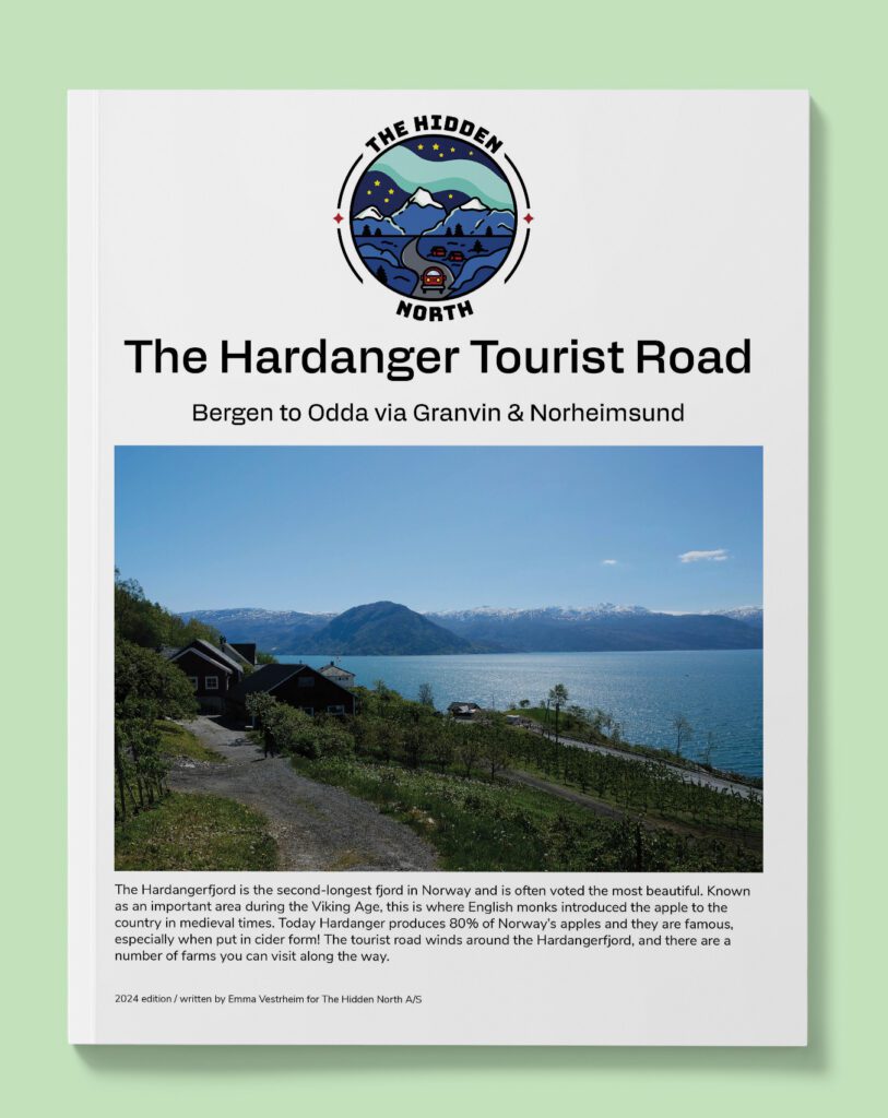
Hardanger Tourist Road (Fv7)
The Hardangerfjord is the second-longest fjord in Norway and is often voted the most beautiful. Known as an important area during the Viking Age, this is where English monks introduced the apple to the country in medieval times. Today Hardanger produces 80% of Norway’s apples and they are famous, especially when put in cider form! The tourist road winds around the Hardangerfjord, and there are a number of farms you can visit along the way.
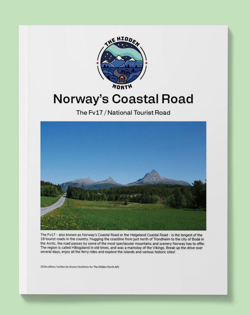
Norway's Coastal Road (Fv17)
Norways coastal road is the longest of the national tourist roads and hugs the Helgeland coastline from close to Trondheim all the way to Bodo.
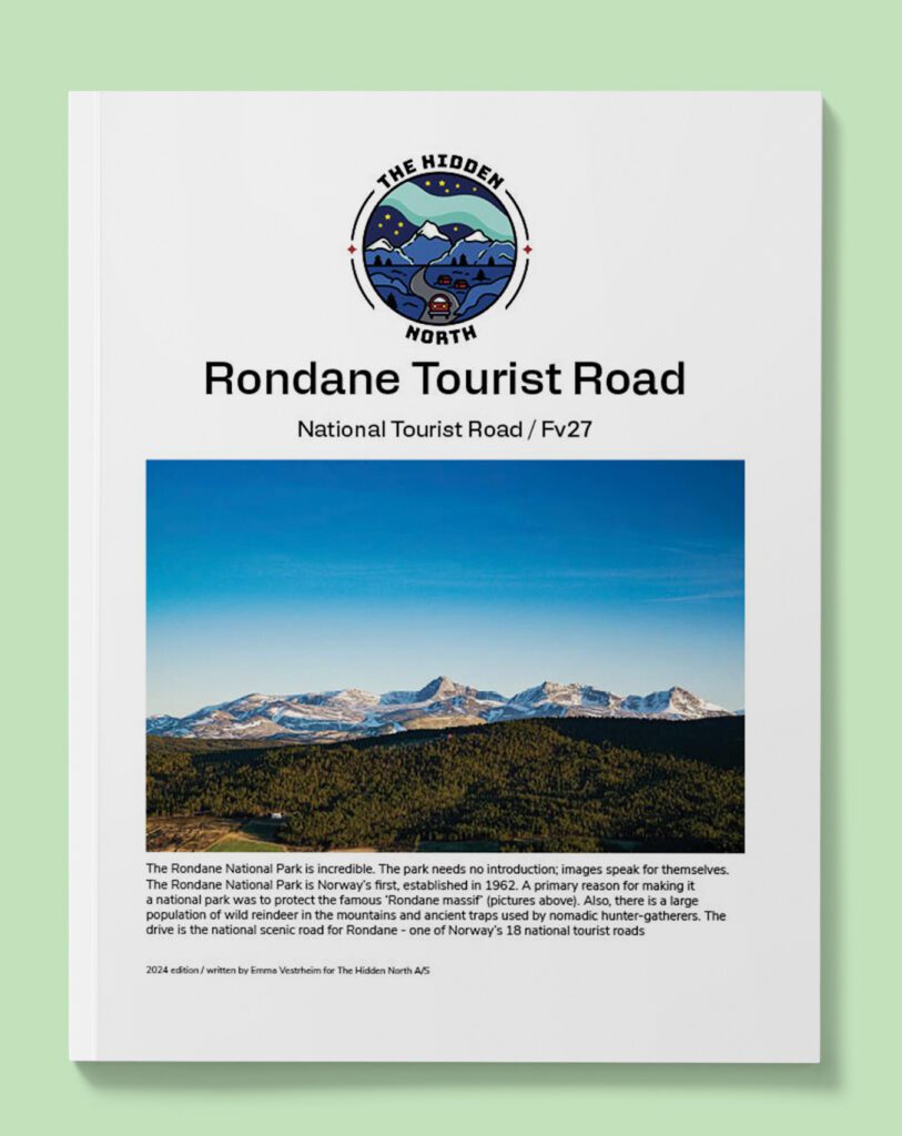
Rondane Tourist Road (Fv27)
Journey through Norway’s first national park on one of the most scenic tourist roads in the country.
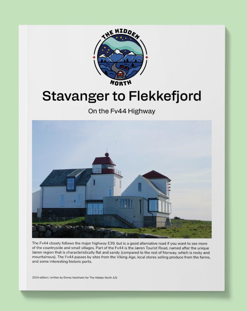
Stavanger to Flekkefjord via the Jæren Tourist Road (Fv44)
The Fv44 closely follows the major highway E39, but is a good alternative road if you want to see more of the countryside and small villages. Part of the Fv44 is the Jæren Tourist Road, named after the unique Jæren region that is characteristically flat and sandy (compared to the rest of Norway, which is rocky and mountainous). The Fv44 passes by sites from the Viking Age, local stores selling produce from the farms, and some interesting historic ports.
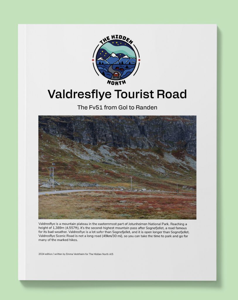
Valdresflye Tourist Road (Fv51)
Valdresflye is a mountain plateau in the easternmost part of Jotunheimen National Park. Reaching a height of 1,389m (4,557ft), it’s the second-highest mountain pass after Sognefjellet, a road famous for its bad weather. Valdresflye is a lot safer than Sognefjellet, and it is open longer than Sognefjellet. Valdresflye Scenic Road is not a long road (49km/30 mi), so you can take the time to park and go for many of the marked hikes.
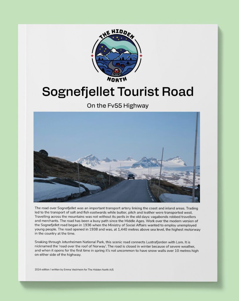
Sognefjellet Tourist Road (Fv55)
The road over Sognefjellet was an important transport artery linking the coast and inland areas. Trading led to the transport of salt and fish eastwards while butter, pitch and leather were transported west. Travelling across the mountains was not without its perils in the old days: vagabonds robbed travellers and merchants. The road has been a busy path since the Middle Ages. Work over the modern version of the Sognefjellet road began in 1936 when the Ministry of Social Affairs wanted to employ unemployed young people. The road opened in 1938 and was, at 1,440 metres above sea level, the highest motorway in the country at the time.
Snaking through Jotunheimen National Park, this scenic road connects Lustrafjorden with Lom. It is nicknamed the ‘road over the roof of Norway’. The road is closed in winter because of severe weather, and when it opens for the first time in spring it’s not uncommon to have snow walls over 10 metres high on either side of the highway.
IMPORTANT: TROLLSTIGEN CLOSED
Please note that Trollstigen Tourist Road is closed until mid-July 2025 due to concerns over rockslides and subsequent safety issues. It is possible to visit the visitor centre and viewpoint at the top, but you must come from the southern (Valldal) side. It is not possible to drive on the Trollstigen switchback road.
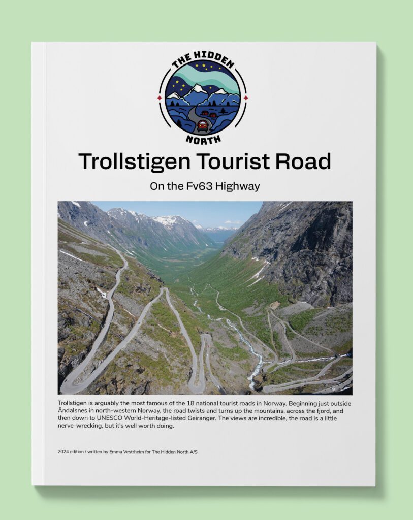
Trolstigen Tourist Road (Fv63)
Trollstigen is arguably the most famous of the 18 national tourist roads in Norway. Beginning just outside Åndalsnes in north-western Norway, the road twists and turns up the mountains, across the fjord, and then down to UNESCO World-Heritage-listed Geiranger. The views are incredible, the road is a little nerve-wrecking, but it’s well worth doing.

The Atlantic Road (Fv64)
The Atlantic Road is one of Norway’s most famous roads. Going between Kristiansund and Molde, the road crosses several islands and bridges and is famous for its dramatic scenery. Be sure to follow the entire road to Åndalsnes, which is just as breathtaking! This guide covers the entire stretch from Kristiansund to Åndalsnes including some scenic detours.
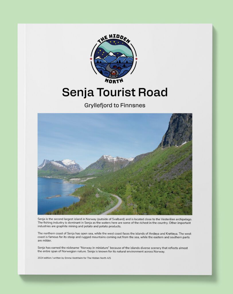
The Senja Tourist Road (Fv86)
Senja is the second largest island in Norway (outside of Svalbard) and is located close to the Vesterålen archipelago. The fishing industry is dominant in Senja as the waters here are some of the richest in the country. Other important industries are graphite mining and potato and potato products.
The northern coast of Senja has open sea, while the west coast faces the islands of Andøya and Krøttøya. The west coast is famous for its steep and rugged mountains coming out from the sea, while the eastern and southern parts are milder.
Senja has earned the nickname “Norway in miniature” because of the islands diverse scenery that reflects almost the entire span of Norwegian nature. Senja is known for its natural environment across Norway.
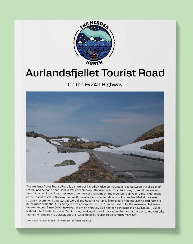
Aurlandsfjellet Tourist Road (Fv243)
The short but spectacular Aurlandsfjellet Tourist Road links Lærdal to Aurland. This used to be the only way to get between the two towns, but thanks to tunnel-building there’s now a safer tunnel through the mountains. Still, in summer the old highway opens and is well worth the detour.
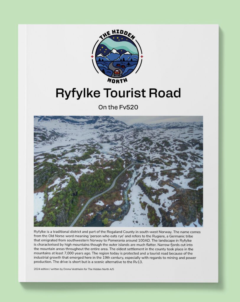
Ryfylke Tourist Road (Fv520)
Ryfylke is a traditional district and part of the Rogaland County in south-west Norway. The name comes from the Old Norse word meaning ‘person who eats rye’ and refers to the Rugiere, a Germanic tribe that emigrated from southwestern Norway to Pomerania around 100AD. The landscape in Ryfylke is characterised by high mountains though the outer islands are much flatter. Narrow fjords cut into the mountain areas throughout the entire area. The oldest settlement in the county took place in the mountains at least 7,000 years ago. The region today is protected and a tourist road because of the industrial growth that emerged here in the 19th century, especially with regards to mining and power production. The drive is short but is a scenic alternative to the Rv13.
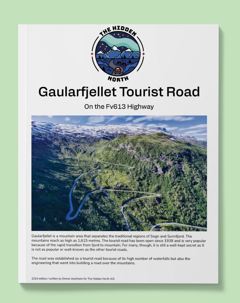
Gaularfjellet Tourist Road (Fv613)
Gaularfjellet is a mountain area that separates the traditional regions of Sogn and Sunnfjord. The mountains reach as high as 1,615 metres. The tourist road has been open since 1938 and is very popular because of the rapid transition from fjord to mountain. For many, though, it is still a well-kept secret as it is not as popular or well-known as the other tourist roads.
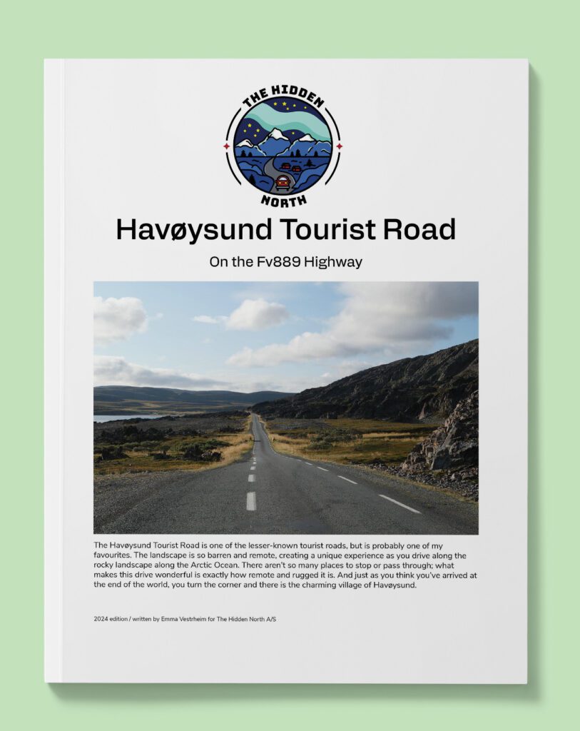
Havøysund Tourist Road (Fv889)
The Havøysund Tourist Road is one of the lesser-known tourist roads, but is probably one of my favourites. The landscape is so barren and remote, creating a unique experience as you drive along the rocky landscape along the Arctic Ocean. There aren’t so many places to stop or pass through; what makes this drive wonderful is exactly how remote and rugged it is. And just as you think you’ve arrived at the end of the world, you turn the corner and there is the charming village of Havøysund.
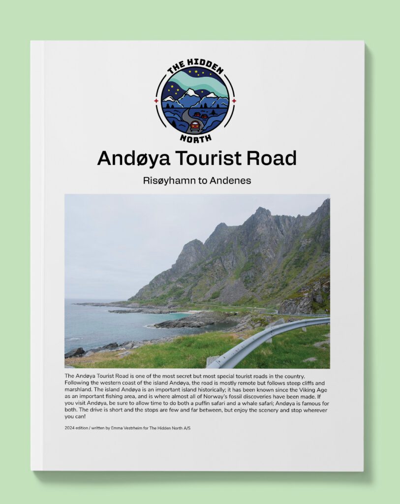
Andøya Tourist Road (Fv974)
The Andøya Tourist Road is one of the most secret but most special tourist roads in the country. Following the western coast of the island Andøya, the road is mostly remote but follows steep cliffs and marshland. The island Andøya is an important island historically; it has been known since the Viking Age as an important fishing area, and is where almost all of Norway’s fossil discoveries have been made. If you visit Andøya, be sure to allow time to do both a puffin safari and a whale safari; Andøya is famous for both. The drive is short and the stops are few and far between, but enjoy the scenery and stop wherever you can!
European Highways (E Roads)
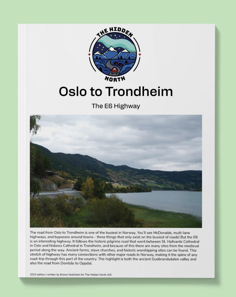
Oslo to Trondheim (E6)
The E6 is the main highway through Norway, beginning on the Swedish border near Oslo and ending at Kirkenes on the Russian border. This section covers the busiest part of the drive and main connection between Oslo and central Norway.
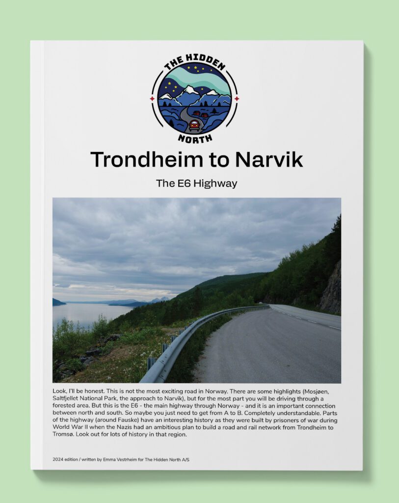
Trondheim to Narvik (e6)
Look, I’ll be honest. This is not the most exciting road in Norway. There are some highlights (Mosjøen, Saltfjellet National Park, the approach to Narvik), but for the most part you will be driving through a forested area. But this is the E6 – the main highway through Norway – and it is an important connection between north and south. So maybe you just need to get from A to B. Completely understandable. Parts of the highway (around Fauske) have an interesting history as they were built by prisoners of war during World War II when the Nazis had an ambitious plan to build a road and rail network from Trondheim to Tromsø. Look out for lots of history in that region.
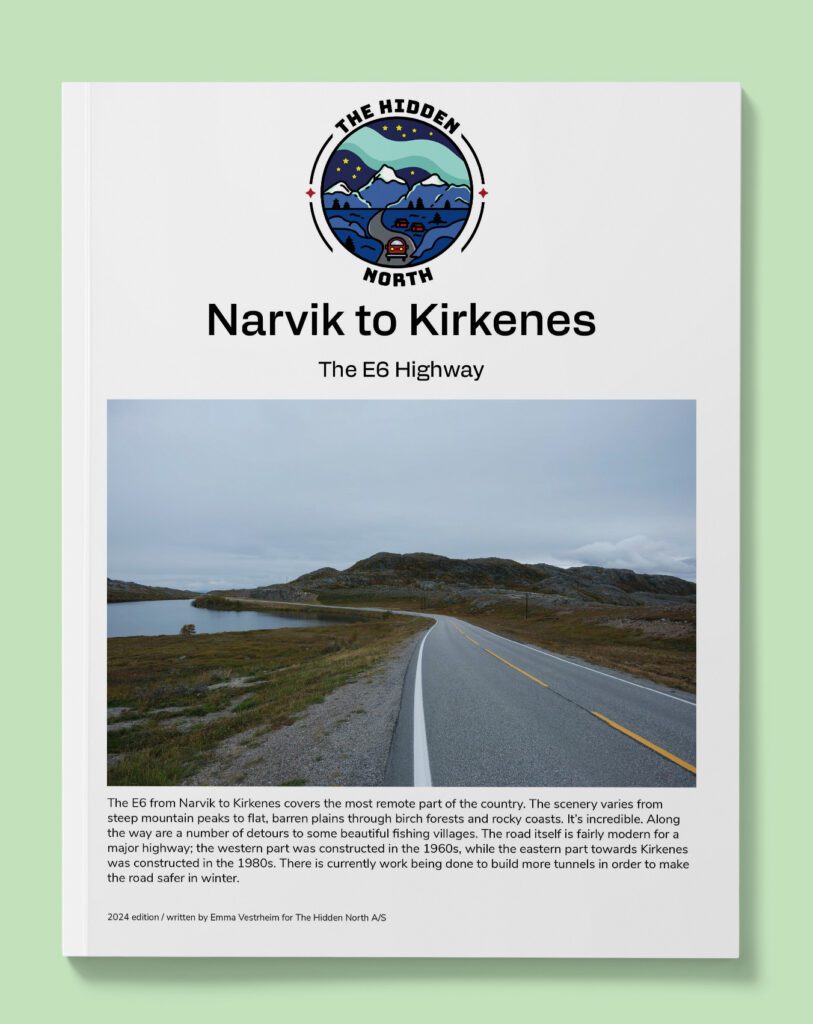
Narvik to Kirkenes (E6)
This stretch of the E6 goes across Northern Norway to Kirkenes on the border with Russia.
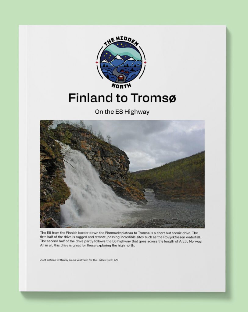
Finland to Tromsø (E8)
Follow this scenic but remote drive from Finland to Tromsø on the E8 highway.
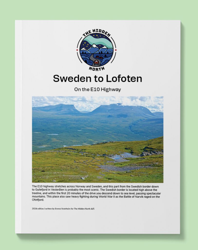
Swedish border to Lofoten (E10)
The E10 highway stretches across Norway and Sweden, and this part from the Swedish border down to Gullefjord in Vesterålen is probably the most scenic. The Swedish border is located high above the treeline, and within the first 20 minutes of the drive you descend down to sea level, passing spectacular mountains. This place also saw heavy fighting during World War II as the Battle of Narvik raged on the Ofotfjord.
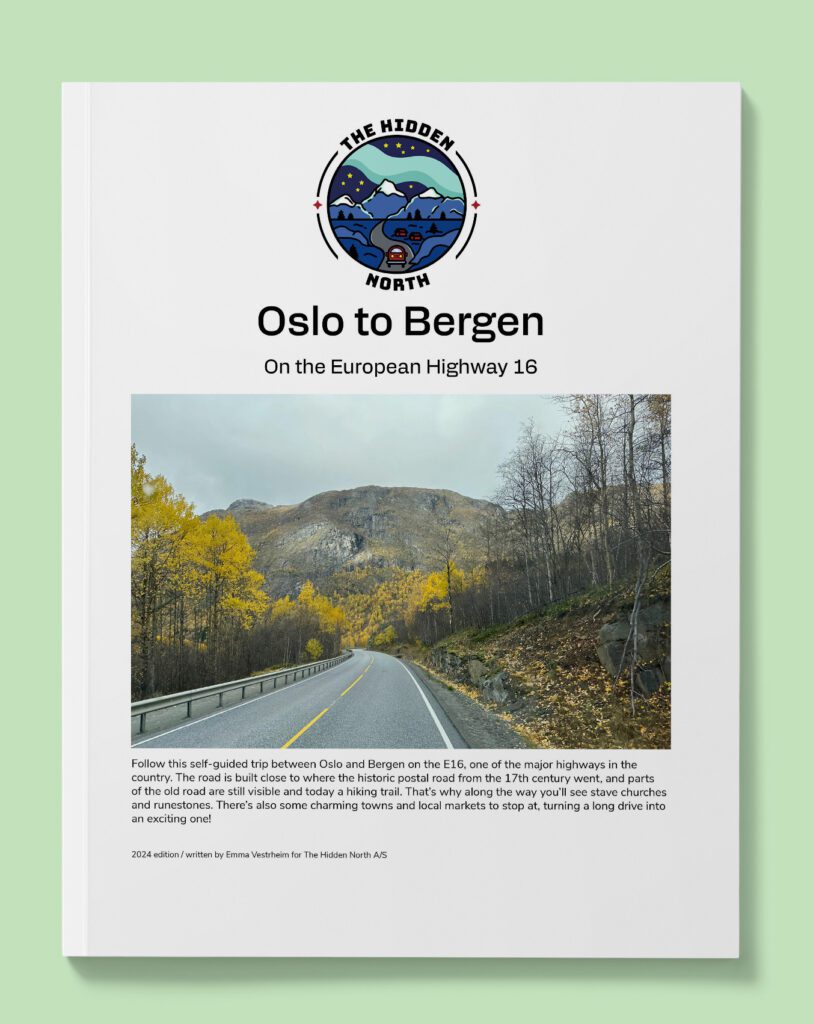
Oslo to Bergen (E16)
Follow this self-guided trip between Oslo and Bergen on the E16, one of the major highways in the country. The road is built close to where the historic postal road from the 17th century went, and parts of the old road are still visible and today a hiking trail. That’s why along the way you’ll see stave churches and runestones. There’s also some charming towns and local markets to stop at, turning a long drive into an exciting one!
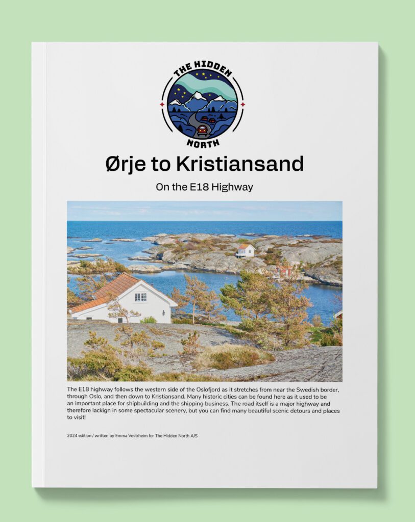
Oslo to Kristiansand (E18)
Follow this self-guided trip between Oslo and Kristiansand along the west coast of the Oslofjord and down to the Skaggerak coast. Along the way you’ll pass important historic towns from the early years of Norway and height of Norwegian trade.
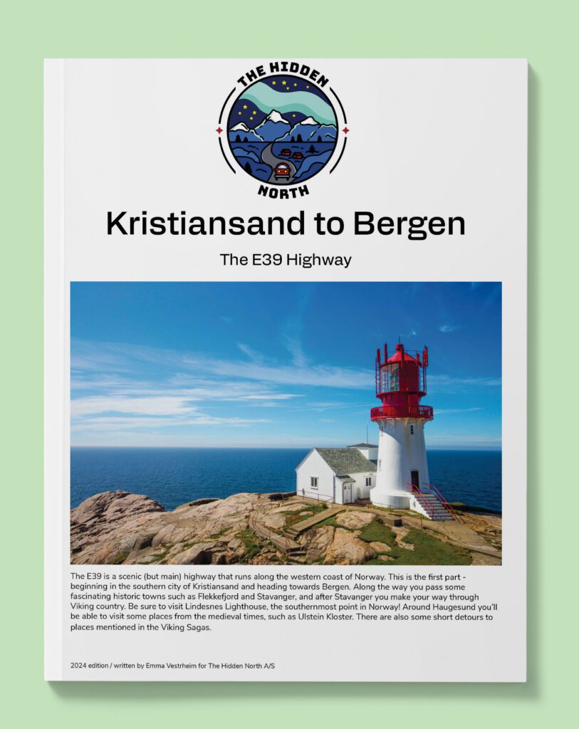
Kristiansand to Bergen (E39)
The E39 is the main highway that goes along the west coast of Norway. The stretch from Kristiansand to Bergen passes by medieval sites, Viking Age farms, and some incredible views out to the rocky southern coast.
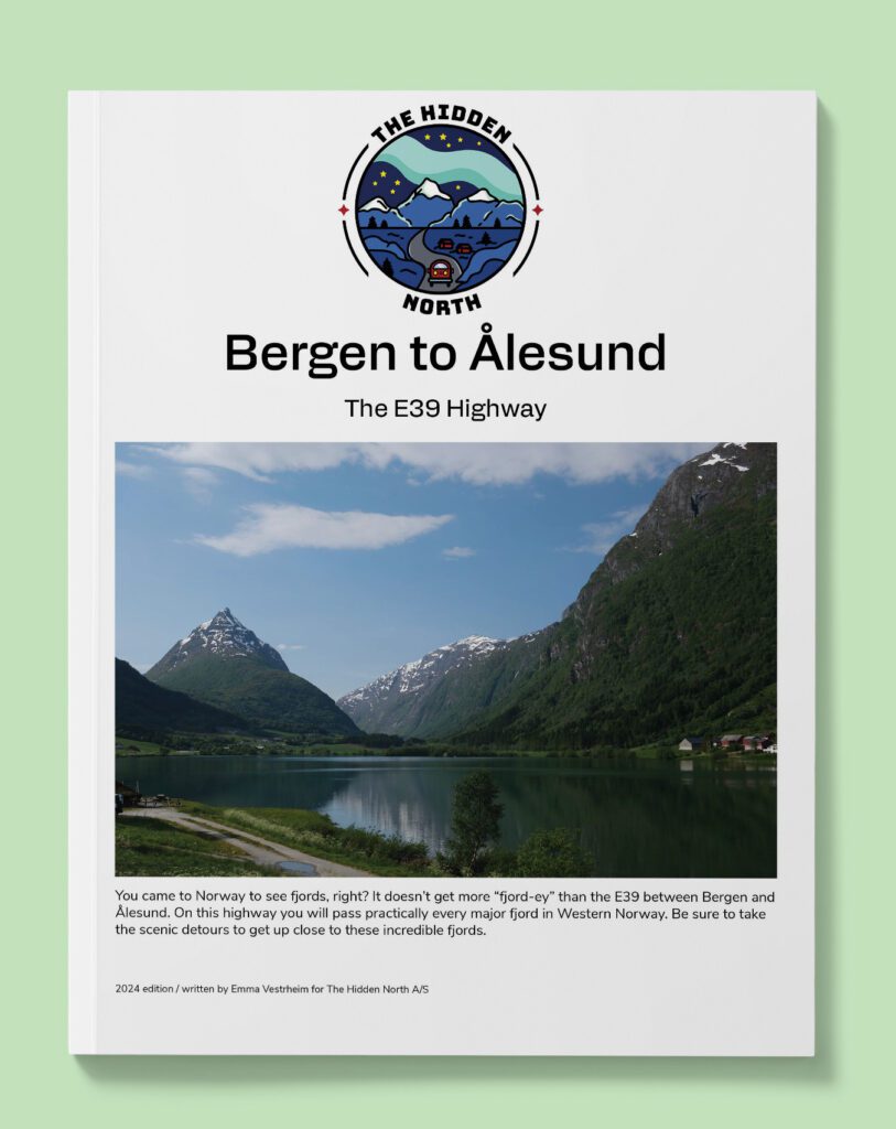
Bergen to Ålesund (E39)
The E39 is the main highway that goes along the west coast of Norway. The stretch from Bergen to Ålesund passes all the major fjords of the west coast, and has connections to all the scenic roads that loop around the fjords.
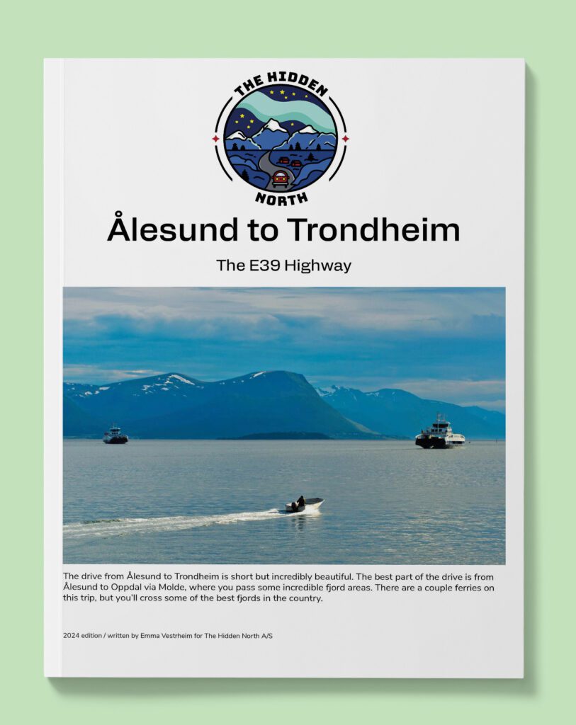
Ålesund to Trondheim (E39)
The northernmost stretch of the E39 highway covers the beautiful west coast between Ålesund and Trondheim. Along the way, you can visit the coastal towns of Molde and Kristiansund and even detour to the famous Atlantic Road highway. The drive is relatively short (for a major highway) but the scenery is incredible.
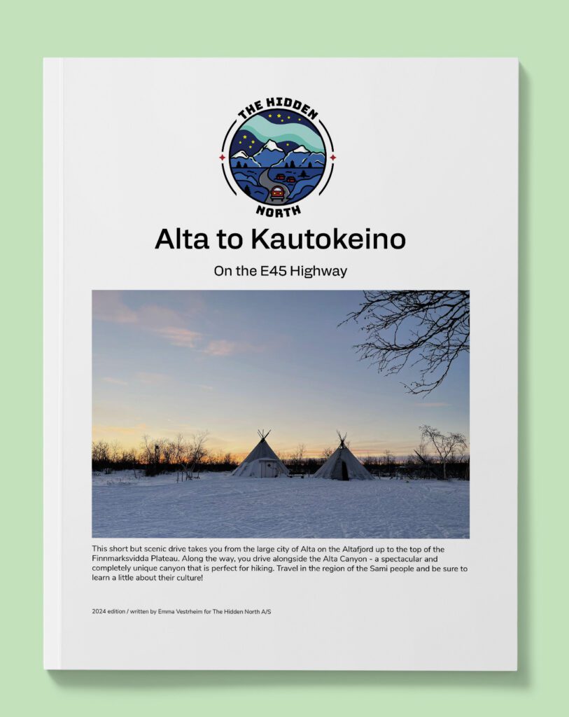
Alta to Kautokeino (E45)
The northernmost stretch of the E39 highway covers the beautiful west coast between Ålesund and Trondheim. Along the way, you can visit the coastal towns of Molde and Kristiansund and even detour to the famous Atlantic Road highway. The drive is relatively short (for a major highway) but the scenery is incredible.
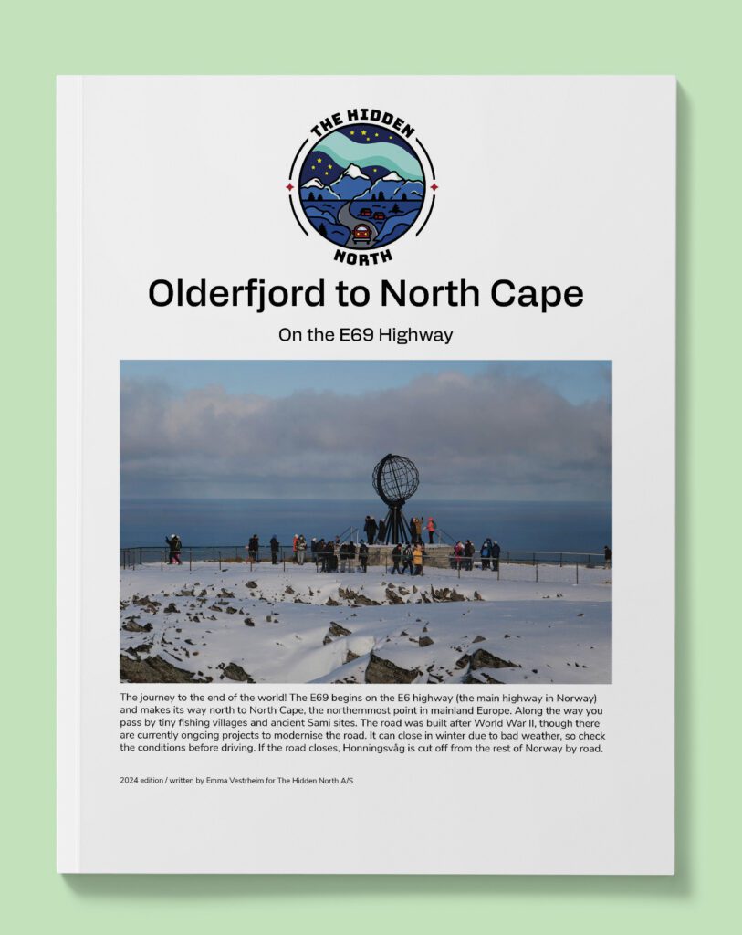
The Road to North Cape (E69)
The northernmost stretch of the E39 highway covers the beautiful west coast between Ålesund and Trondheim. Along the way, you can visit the coastal towns of Molde and Kristiansund and even detour to the famous Atlantic Road highway. The drive is relatively short (for a major highway) but the scenery is incredible.
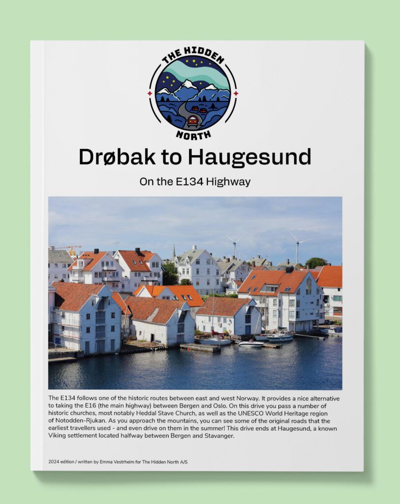
Oslo to Haugesund (E134)
The E134 follows one of the historic routes between east and west Norway. It provides a nice alternative to taking the E16 (the main highway) between Bergen and Oslo. On this drive you pass a number of historic churches, most notably Heddal Stave Church, as well as the UNESCO World Heritage region of Notodden-Rjukan. As you approach the mountains, you can see some of the original roads that the earliest travellers used – and even drive on them in the summer! This drive ends at Haugesund, a known Viking settlement located halfway between Bergen and Stavanger.
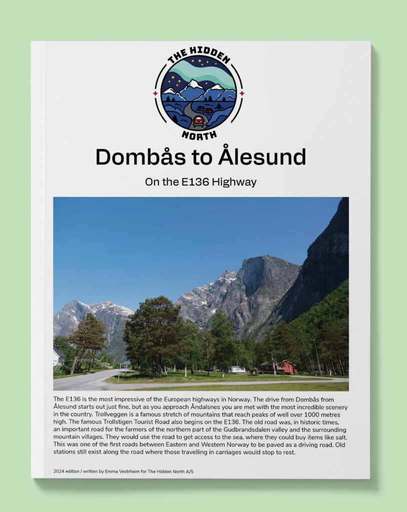
Dombås to Ålesund (E136)
The E136 is the most impressive of the European highways in Norway. The drive from Dombås from Ålesund starts out just fine, but as you approach Åndalsnes you are met with the most incredible scenery in the country. Trollveggen is a famous stretch of mountains that reach peaks of well over 1000 metres high.
National Highways (Rv Roads)
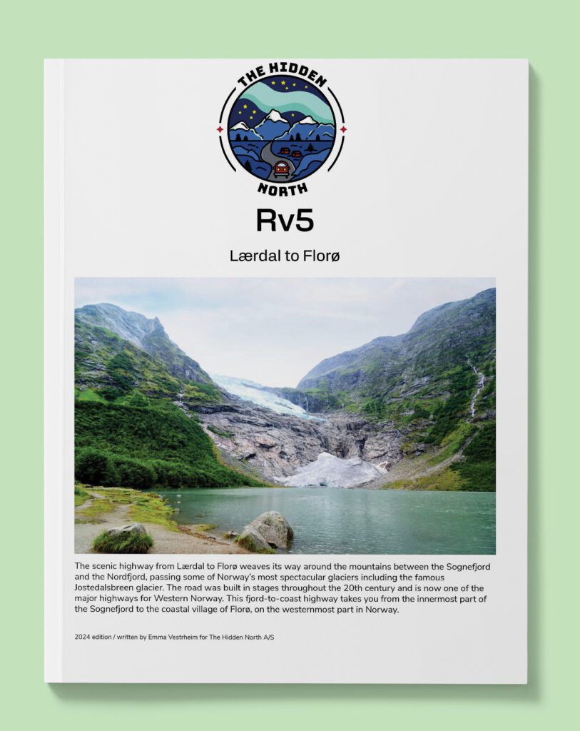
Lærdal to Florø (Rv5)
The scenic highway from Lærdal to Florø weaves its way around the mountains between the Sognefjord and the Nordfjord, passing some of Norway’s most spectacular glaciers including the famous Jostedalsbreen glacier. The road was built in stages throughout the 20th century and is now one of the major highways for Western Norway. This fjord-to-coast highway takes you from the innermost part of the Sognefjord to the coastal village of Florø, on the westernmost part in Norway.
Hønefoss to Eidfjord on the Hardangervidda Tourist Road (Rv7)
The Rv7 is a relatively modern highway in Norway. The earliest road here was in the section between Hardangervidda and Eidfjord in the Måbødalen valley. It’s believed there was a road there in the 16th century. Construction of the highway as we see it today began in sections at the turn of the 20th century. The most difficult part was the stretch over the Hardangervidda plateau, which was finished in 1943. Today the stretch across Hardangervidda is one of Norway’s 18 national tourist roads.
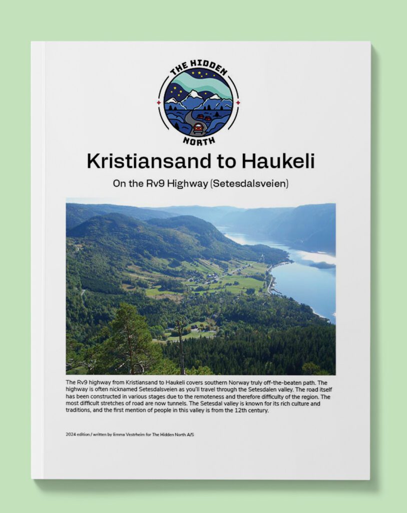
Kristiansand to Haukeli on the Rv9 (Setesdalveien)
The Rv9 highway from Kristiansand to Haukeli covers southern Norway truly off-the-beaten path. The highway is often nicknamed Setesdalsveien as you’ll travel through the Setesdalen valley. The road itself has been constructed in various stages due to the remoteness and therefore difficulty of the region. The most difficult stretches of road are now tunnels. The Setesdal valley is known for its rich culture and traditions, and the first mention of people in this valley is from the 12th century.
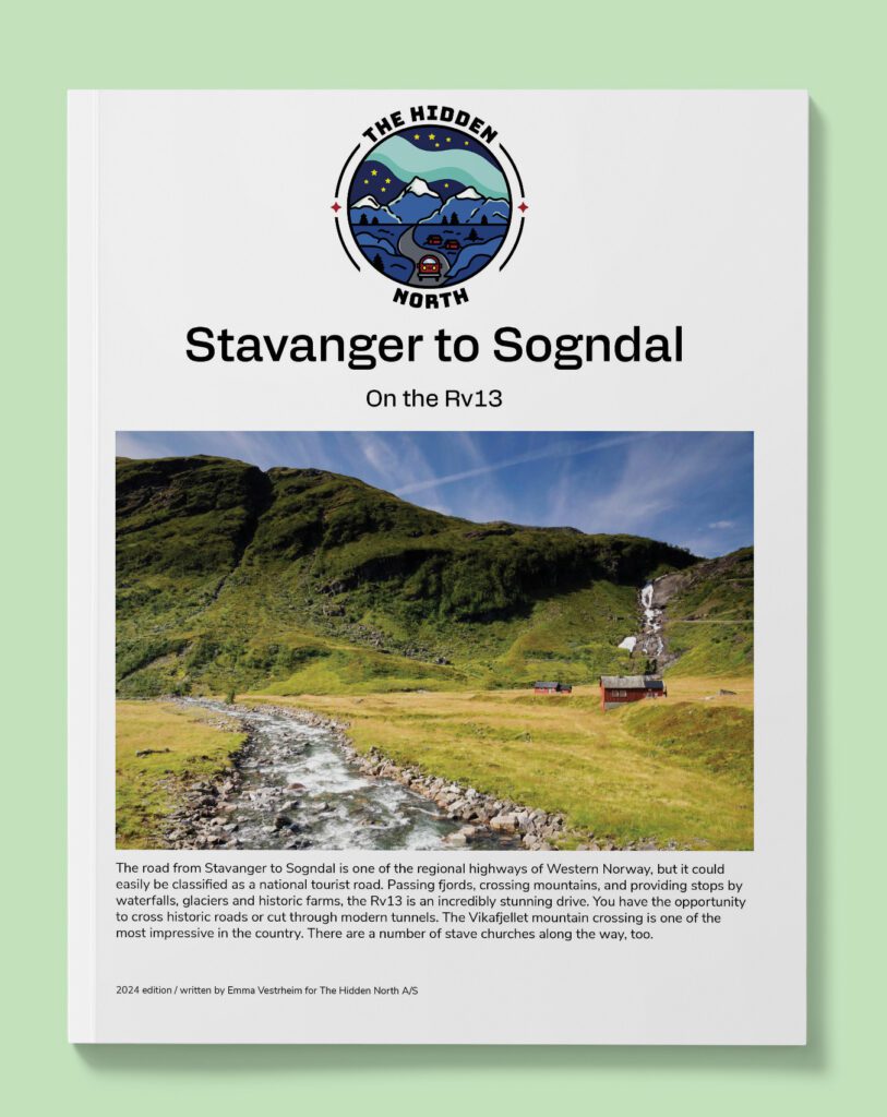
Stavanger to Sogndal (Rv13)
The road from Stavanger to Sogndal is one of the regional highways of Western Norway, but it could easily be classified as a national tourist road. Passing fjords, crossing mountains, and providing stops by waterfalls, glaciers and historic farms, the Rv13 is an incredibly stunning drive. You have the opportunity to cross historic roads or cut through modern tunnels. The Vikafjellet mountain crossing is one of the most impressive in the country. There are a number of stave churches along the way, too
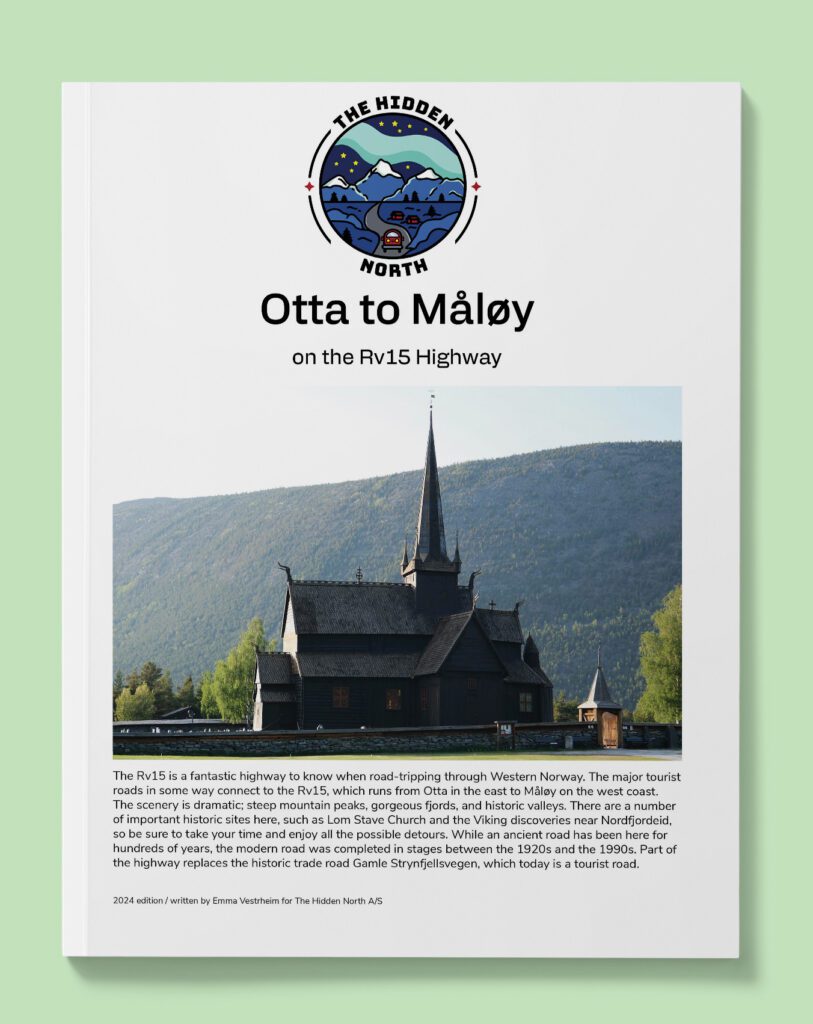
Otta to Måløy (RV15)
The Rv15 is a fantastic highway to know when road-tripping through Western Norway. The major tourist roads in some way connect to the Rv15, which runs from Otta in the east to Måløy on the west coast. The scenery is dramatic; steep mountain peaks, gorgeous fjords, and historic valleys. There are a number of important historic sites here, such as Lom Stave Church and the Viking discoveries near Nordfjordeid, so be sure to take your time and enjoy all the possible detours. While an ancient road has been here for hundreds of years, the modern road was completed in stages between the 1920s and the 1990s. Part of the highway replaces the historic trade road Gamle Strynfjellsvegen, which today is a tourist road.
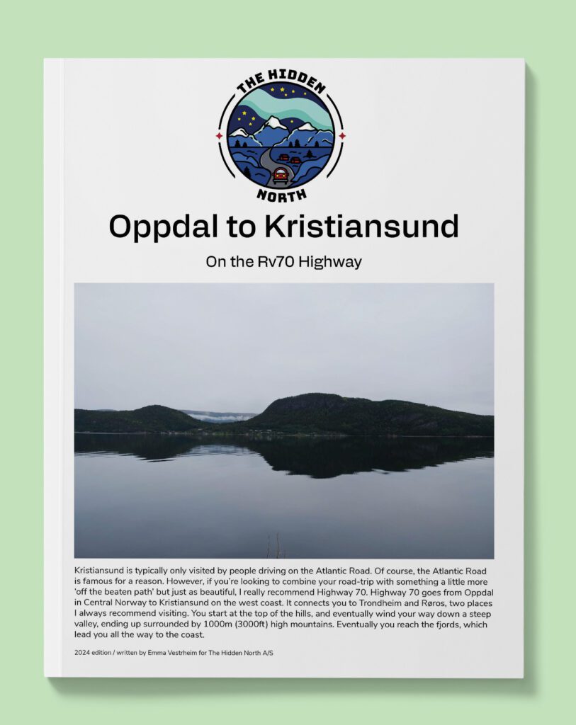
Oppdal to Kristiansund (Rv70)
Kristiansund is typically only visited by people driving on the Atlantic Road. Of course, the Atlantic Road is famous for a reason. However, if you’re looking to combine your road-trip with something a little more ‘off the beaten path’ but just as beautiful, I really recommend Highway 70. Highway 70 goes from Oppdal in Central Norway to Kristiansund on the west coast. It connects you to Trondheim and Røros, two places I always recommend visiting. You start at the top of the hills, and eventually wind your way down a steep valley, ending up surrounded by 1000m (3000ft) high mountains. Eventually you reach the fjords, which lead you all the way to the coast.
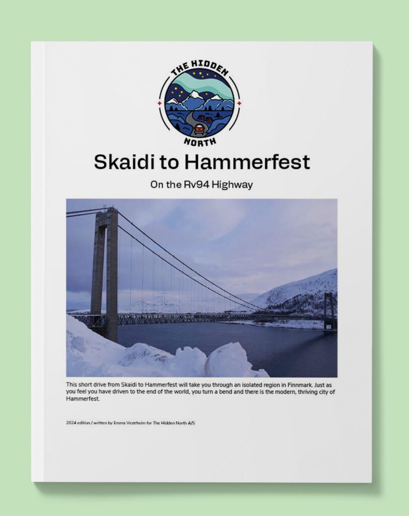
Skaidi to Hammerfest (Rv94)
This short drive from Skaidi to Hammerfest will take you through an isolated region in Finnmark. Just as you feel you have driven to the end of the world, you turn a bend and there is the modern, thriving city of Hammerfest.
County Highways (Fv Roads)
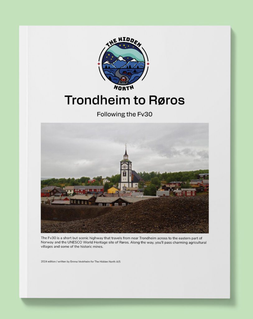
Trondheim to Røros on the Fv30
The Fv30 is a short but scenic highway that travels from near Trondheim across to the eastern part of Norway and the UNESCO World Heritage site of Røros. Along the way, you’ll pass charming agricultural villages and some of the historic mines.
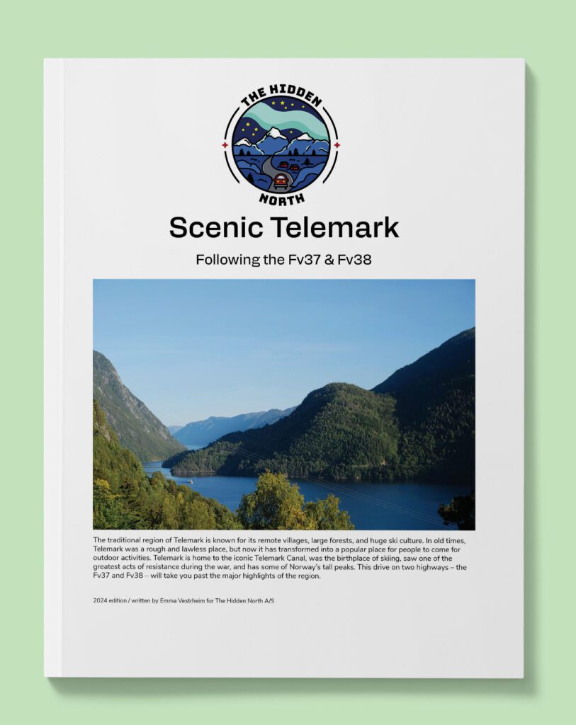
Scenic Telemark Drive (Fv37 & Fv38)
Take this scenic drive through Telemark to pass important historic and cultural sites.

The Numedal Valley (Fv40)
The Numedal Valley is perhaps one of the best-kept secrets in Norway. Located between Kongsberg and Geilo, the valley contains the largest number of medieval wooden buildings in Norway; an impressive 40 ancient farm buildings and 4 stave churches. On this drive, you’ll see these beautiful historic sites.
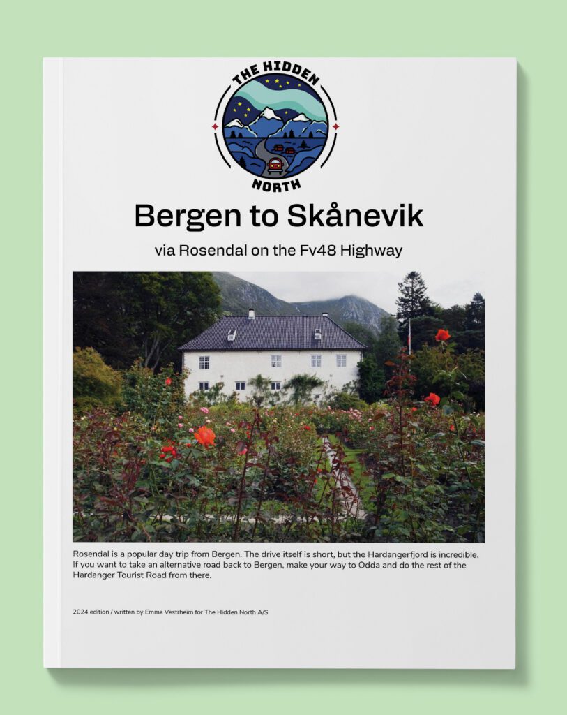
Bergen to Skånevik via Rosendal (Fv48)
Looking for a scenic fjord drive that avoids many of the crowded areas? Well, I only discovered the Fv60 when working on my road-trip guide for Norway. This drive includes the stunning Storfjord, Nordfjord and Sunnylyvsfjord and includes the villages of Stryn, Stranda, Loen and Olden.
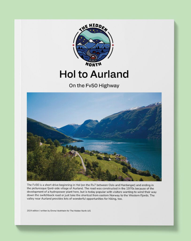
Hol to Aurland (fv50)
This is a short drive, but the scenery here is incredible. You will cross the mountains before descending down the Aurland Valley – a famous hiking area.
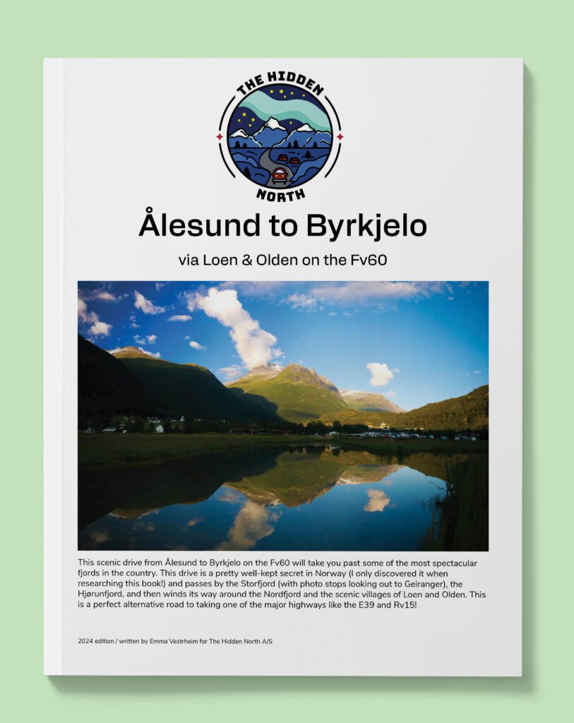
Ålesund to Byrkjelo (Fv60)
Looking for a scenic fjord drive that avoids many of the crowded areas? Well, I only discovered the Fv60 when working on my road-trip guide for Norway. This drive includes the stunning Storfjord, Nordfjord and Sunnylyvsfjord and includes the villages of Stryn, Stranda, Loen and Olden.
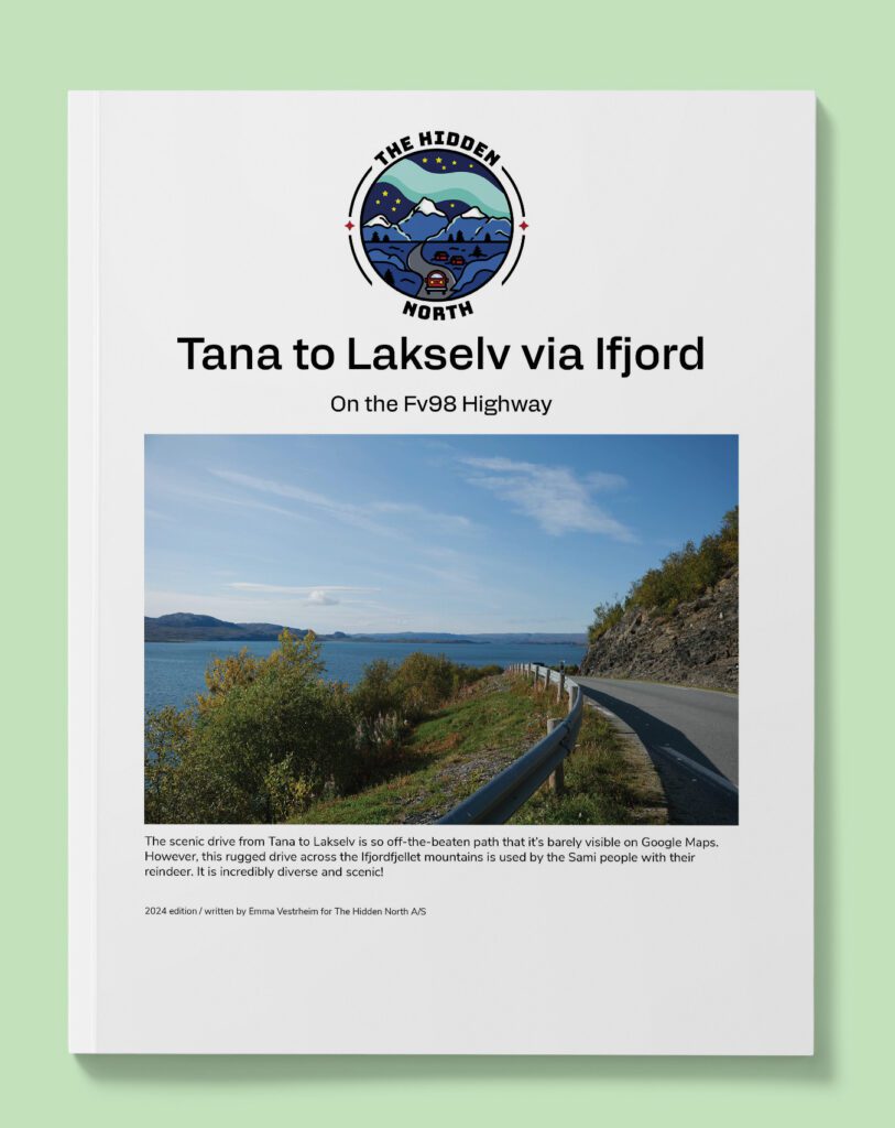
Tana Bru to Lakselv via Ifjord (Fv98)
The scenic drive from Tana to Lakselv is so off-the-beaten path that it’s barely visible on Google Maps. However, this rugged drive across the Ifjordfjellet mountains is used by the Sami people with their reindeer. It is incredibly diverse and scenic!
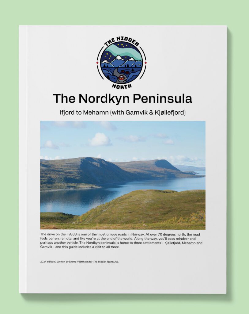
Ifjord to Kjøllefjord via Mehamn and Gamvik (Fv888)
The Nordkyn peninsula has a unique barren landscape. There’s no high peaks here, and there are large areas of ‘boulder oceans’ – expanses of broken rock virtually without soil or vegetation. The peninsula also has bustling fishing villages and lots of history. It ends at Kinnarodden, the northernmost point on mainland Europe. Follow this scenic drive across one of the remote places in Norway.
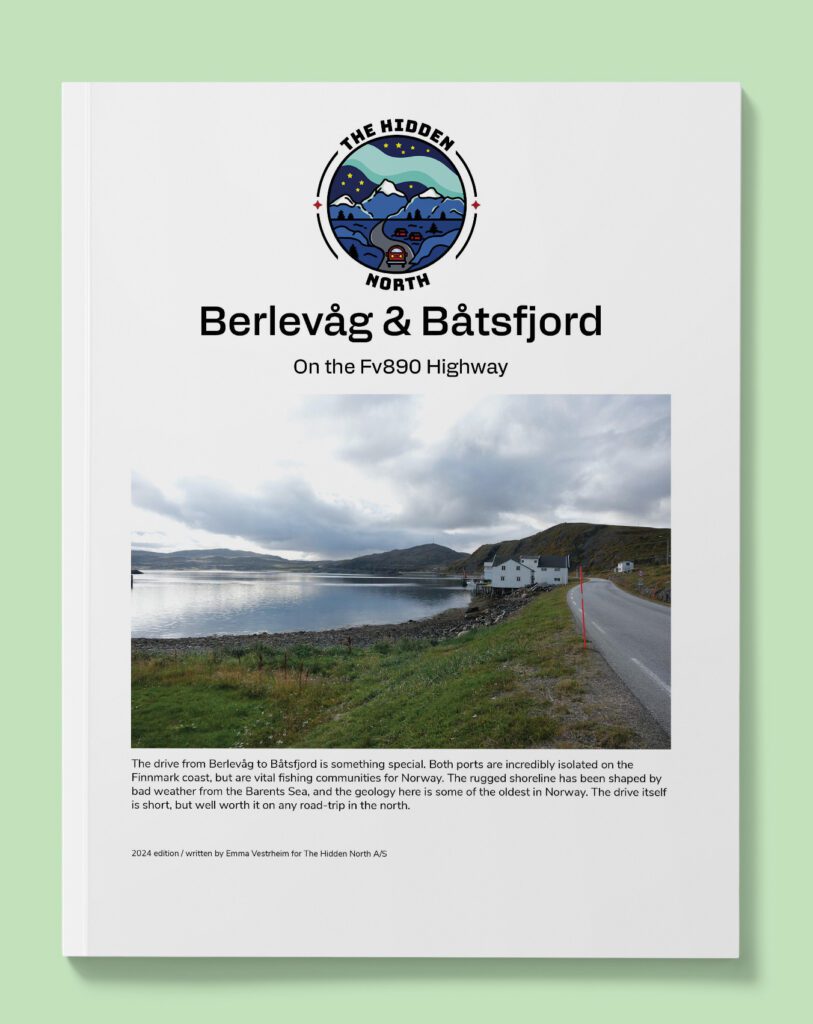
Berlevåg & Båtsfjord (Fv890)
The Nordkyn peninsula has a unique barren landscape. There’s no high peaks here, and there are large areas of ‘boulder oceans’ – expanses of broken rock virtually without soil or vegetation. The peninsula also has bustling fishing villages and lots of history. It ends at Kinnarodden, the northernmost point on mainland Europe. Follow this scenic drive across one of the remote places in Norway.