Description
Looking to enhance your Norwegian road-trip? Get our guide to the Aurlandsfjellet Tourist Road!
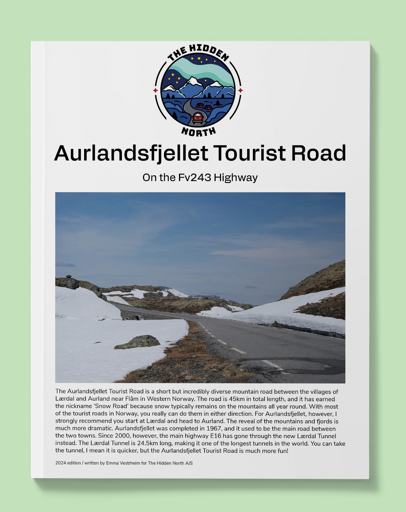
The Aurlandsfjellet Tourist Road is a short but incredibly diverse mountain road between the villages of Lærdal and Aurland near Flåm in Western Norway. The road is 45km in total length, and it has earned the nickname ‘Snow Road’ because snow typically remains on the mountains all year round. With most of the tourist roads in Norway, you really can do them in either direction. For Aurlandsfjellet, however, I strongly recommend you start at Lærdal and head to Aurland. The reveal of the mountains and fjords is much more dramatic. Aurlandsfjellet was completed in 1967, and it used to be the main road between the two towns. Since 2000, however, the main highway E16 has gone through the new Lærdal Tunnel instead. The Lærdal Tunnel is 24.5km long, making it one of the longest tunnels in the world. You can take the tunnel, I mean it is quicker, but the Aurlandsfjellet Tourist Road is much more fun!
This guide will:
- Answer the question “How do people live here?”
- Provide you with historic images and stories relevant to where you are
- Give you practical tips such as – where’s the nearest toilet? When can I get a hot dog? You know, the important stuff.
- Show you interesting points where you can stop to stretch your legs or get beautiful photos of Norway
- Give you information about museums (including opening hours), attractions, and major points of interests that you can visit
This guide won’t:
- Drive for you (Sorry, we aren’t that advanced yet)
- Give you accommodation tips (this guide assumes you know where you are staying already). If you want accommodation tips, visit our (free) online travel guide https://thehiddennorth.com/norway
- List experiences (think of this guide as more of a fun, informative directory. If you want to know what you can do, head to our free online travel guide)
- Detailed overview of hikes. We do list famous hikes, but don’t provide much information each one. This guide is purely for the A to B. Again, head to our free online travel guide for that information.
- Give you a detailed map overview. We have a basic map guide, but if you are looking for something detailed, I recommend buying one online! (click here for my recommendation)
Our guides are packed! Here’s what this one includes:
- Free interactive Google Map (with every place mentioned in the guide marked with an address) that can be loaded into your GPS, making finding that stave church or petrol station much easier.
- Detailed overviews of all the major points of interest on the road.
- Practical information (cafes, dining, museums, toilets, petrol, road-side rest areas, detours, alternate routes)
- Historic, modern and practical information for every city, town, village, and farm you pass through
- Modern and historic images of all the major points of interests
- Distance between points
- QR code & interactive links to museum websites, relevant pages on our website, ferry timetables, and more!
This guide was published in January 2024.
You can read our free, summarised guide to the drive here: https://thehiddennorth.com/aurlandsfjellet-tourist-road/
This guide is 5 pages and 6MB.
Reviews
There are no reviews yet.