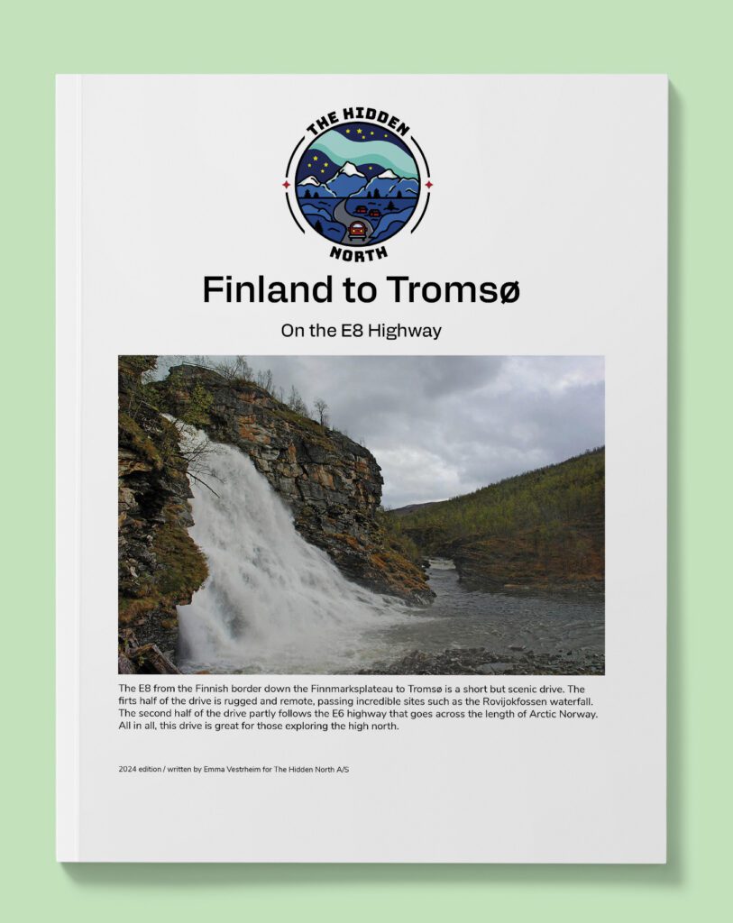
Drive it Yourself: Finland to Tromsø on the E8
The E8 from the Finnish border down the Finnmarksplateau to Tromsø is a short but scenic drive. The first half of the drive is rugged and remote, passing incredible sites such as the Rovijokfossen waterfall. The second half of the drive partly follows the E6 highway that goes across the length of Arctic Norway. All in all, this drive is great for those exploring the high north.
In this article...
Download this Guide
All of our guides can be downloaded via our online store.
I offer downloadable versions of my self-guided drives on my online store.
Online Guide
- Information about points of interest
- Images of each point of interest
- Historic overview of the neighbourhood
- Directions between points
- Historic photos
- Information about facilities along the way
Downloadable Guide
- Information about points of interest
- Images of each point of interest
- Historic overview of the region & towns
- Directions between points
- Historic photos
- Facilities including supermarkets, toilets, petrol, hotels, cafes, restaurants with addresses.
- Interactive Google Map that can be loaded into your phone for better navigation!
Finland to Tromsø on the E8

Kilpisjärvi
This drive begins in Kilpisjärvi, a Finnish village just over the border. The road from Finland to Tromsø is commonly called “Nordlysveien” – the Northern Lights Road – as there are many spots to pull over to observe the northern lights.
Storfjord Municipality
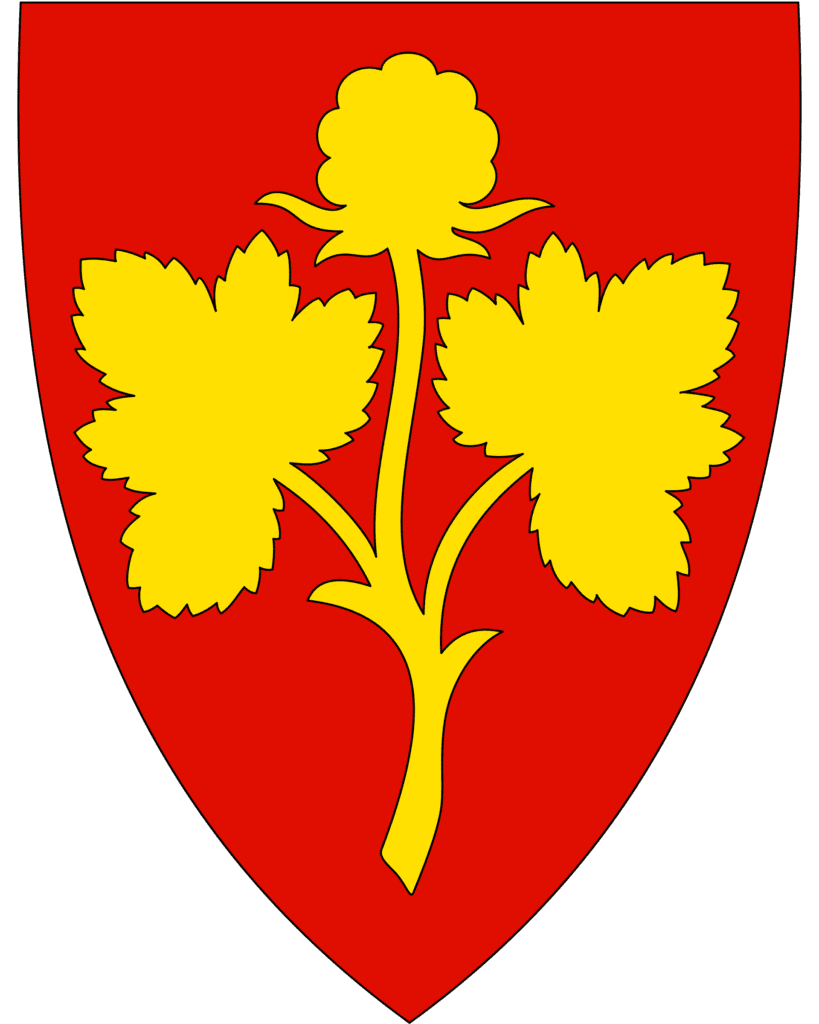
Storfjord is a municipality in the Troms County of Northern Norway. The name comes from the Storfjorden that runs through the area, while the coat-of-arms shows three poppies that are rotated around a meeting point which represents the meeting point of the three countries Norway, Sweden, and Finland.
The first peoples to live here were the Sami people. In the 19th century settlers from Finland and Southern Norway began to establish themselves. Sami culture has survived in parts of the municipality. In the 19th century the Laestadianism religious movement obtained a strong position, and Skibotn is still a stronghold for this movement.
The landscape of Storfjord is characterised by alpine mountains, and the highest mountain is Vassdalsfjellet (1587m), while the most ‘famous’ mountain is Otertind.
Highest Point on the Road
Landmark
Just after coming into Norway, you pass the highest point on the E8 highway. It is 542 metres high.
The first stretch of the E8 highway is remote and rugged. You will pass numerous parking places along the way.
Skibotndalen Valley
Scenic Area
The valley area you are driving through is called Skibotndalen, which is a popular valley for hunting moose. The river you are driving along is the Rovijokkelva, a 60km long river that originates from the lake Bajimus Rovvejarvi and flows in a south-west direction.
Rovijokfossen
Waterfall
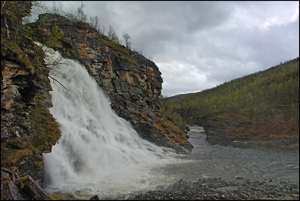
Rovijokfossen is a waterfall located by the highway. There is a large parking lot by the waterfall but no signage. In Google Maps the waterfall is called “Rovijoen putous”. This is where the river Rovvejohka drops 28 metres and ends in the river Skibotnelva. It is possible to go for a short walk to get close to the waterfall.
Skibotn
Town
Skibotn is a small village with a population of 538 located at the end of the Lyngen fjord and close to Kilpisjarvi in Finland. The residents of the village are either descendants of the Sami and Kven people or the Norwegian immigrants who came in the 19th century.
Historically, Skibotn was a meeting point and market for the different ethnic groups in the area. The market still takes place today and is named ‘Skibotn markedsplass’ on GPS if you want to visit.
Skibotn is the place in Norway that has registered the clearest days and it is one of the driest places in Norway. Because of the lack of clouds, there is an astrophysical observatory located in Skibotn.
Hatteng
Town
Hatteng is located at the southern end of the Storfjorden, a branch of the Lyngenfjorden and the fjord you will start driving along.
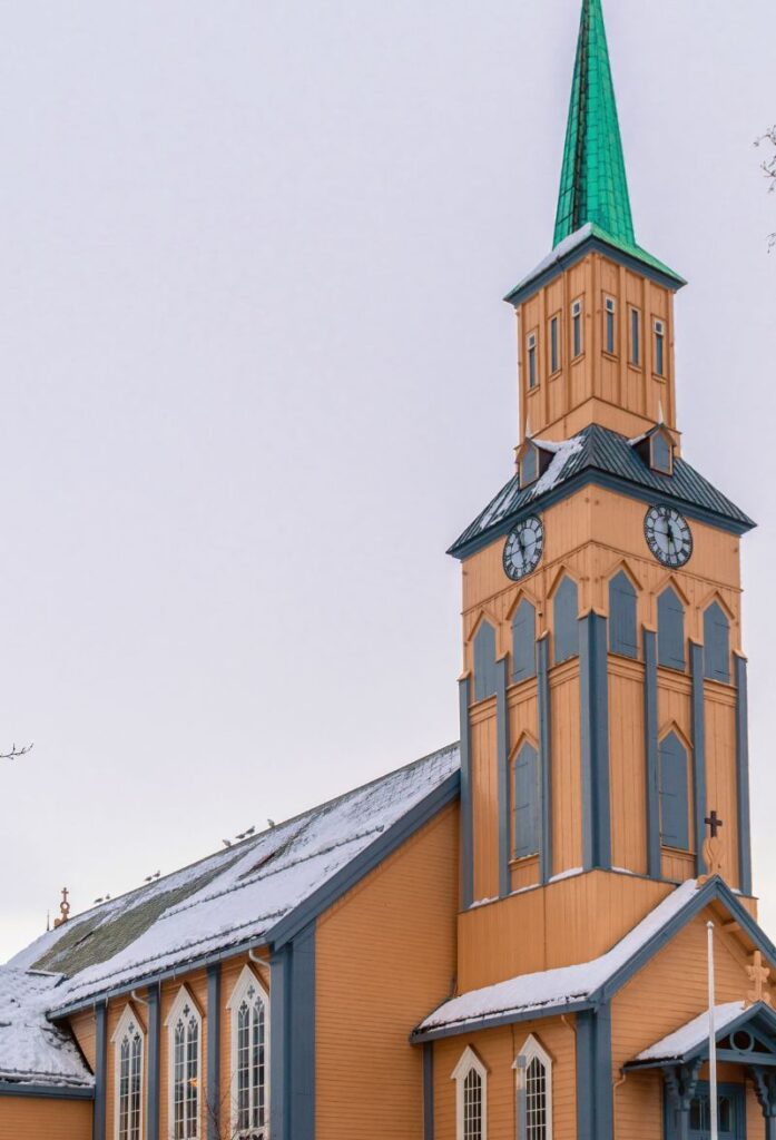
Storfjord Church is the main church and was built in 1952. The first church was built in 1917 and was used both as a church and the local school. The old church wasn’t destroyed during World War II, but after the war a new church was built and the old building was used just as a school. The church is located at the address Rv868 6, 9046 Oteren
In 1944 the Nazis established a village here with several thousand soldiers stationed here. The nickname was “Little Berlin’ and the village had several camps with Russian prisoners of war. Two marked graves have been identified. A Nazi watertower is located in the village (“Tysk vanntårn” on GPS).
Balsfjord Municipality
Balsfjord is a municipality in the Troms County of Northern Norway. The coat-of-arms depicts a yellow plough on a red background, symbolising the importance of agriculture in the municipality. The plough also symbolises that the municipality is at the northernmost border on which grain can be grown in Norway. No other area in Troms has so much cultivated land. Agriculture is mostly based on milk and meat production and Balsfjord has the highest number of cattle, sheep, and goats among the municipalities in Troms. One of the dairies is the country’s largest goat cheese producer.
The Sami people were the first people to inhabit the area, but around 1800 new settlers came from Finland and Southern Norway. Today, very few traces of Sami culture survive. From the 18th until the 20th century, trappers from Balsfjord were active in the Arctic, hunting in the areas around Greenland and Svalbard.
The municipality was home to a religious group of ‘mindekirken’ or ‘freechurch dissenters’ who split from the state church in Tromsø. They were led by a seminary student, Johannes Andreas Johannessen and they established their own church, the Free Apostolic Christian Church, in Balsfjord. Bomstad and his followers were said to have protested against the Tromsø state church minister and Troms Bishop’s religious rulings, eventually leading to a riot in Tromsø. The state church members yelled at Bomstad and his dissenters to “go back to Kautokieno!”. In 1862, Bomstad led a group of colonists to America, arriving into Chicago. After that they went to the area of St. Peter, Minnesota, where they remained. Bomstad left St. Peter and became the founding father of Lake Lillian in Minnesota. After staking his original claim, Bomstad and the rest of the colonists arrived at Lake Lillian and built dugout shelters to live. Eventually they all had log cabins to live in.
Close to Balsfjord Church are 6000-year-old rock carvings at Tennes.
Piggsteinen
Roadside Attraction
Located just out of Nordkjosbotn is Piggsteinen. It has been a tradition since ancient times to carve ones name into this stone when travelling. In recent times spray cans have taken over and many thousands of names have formed a thick layer of paint on the stone. It’s not marked on the highway and difficult to see if you’re driving towards Tromsø, but put in the address 137 E6 9040 Nordkjosbotn or “Piggsteinen” into GPS.
Nordkjosbotn
Town
Nordkjosbotn is a small town with a population of around 480 people. Nordkjosbotn is located at the junction of the two major highways in Northern Norway – the E6 and the E8 – and it is located in one of the few winter-safe passages for the region. Because of its location, the town is the commercial centre of the region. Nordkjosbotn is also a town with a growing population.
Tromsø Municipality
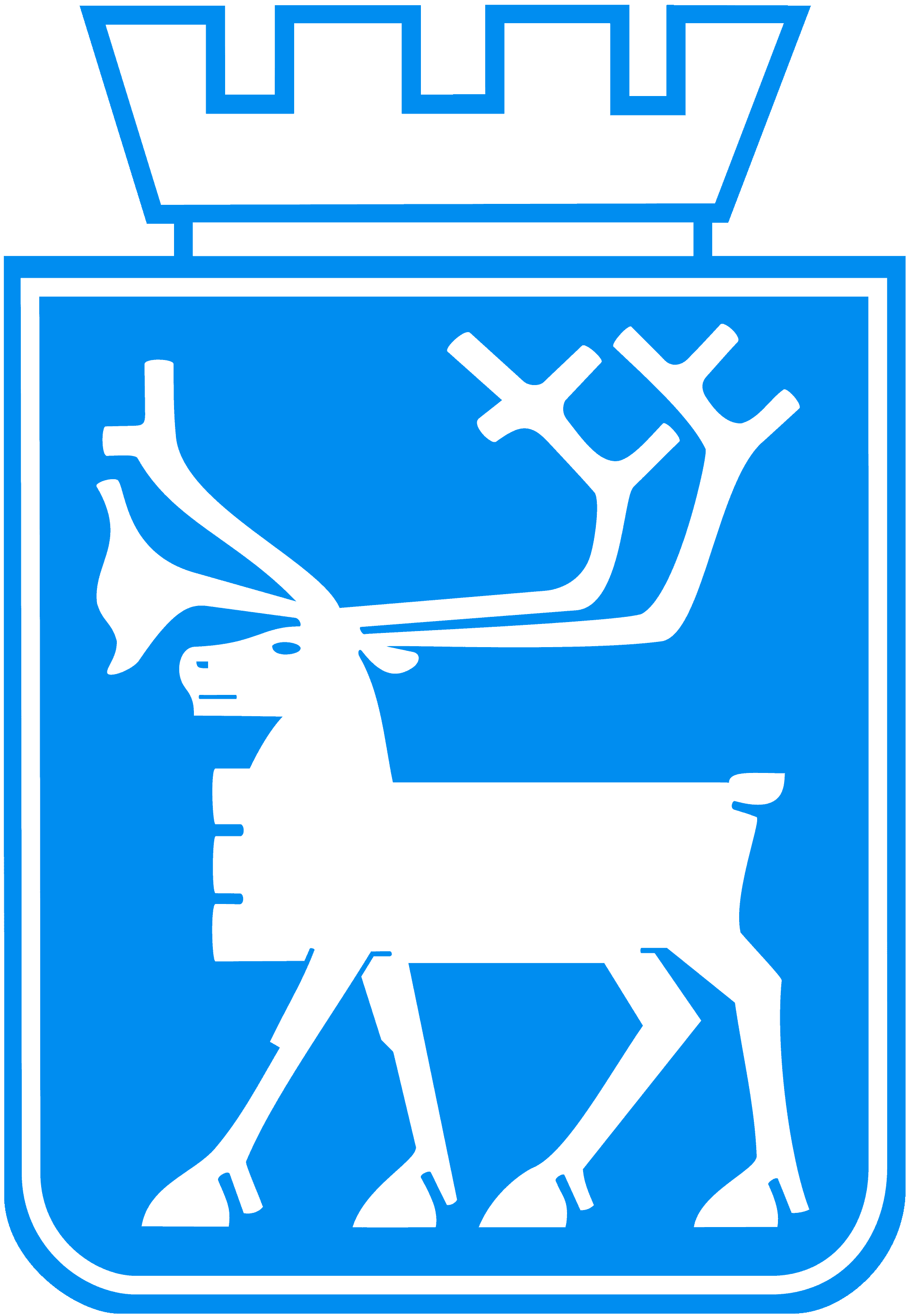
Vadsø municipality is named after the town of Vadsø that we will soon be driving through. The coat-of-arms shows a reindeer as reindeer husbandry is common for the municipality and of great economic importance, especially for the Sami people.
The municipality spreads across the southern coast of the Varanger peninsula. There are trees here as this part of the peninsula is sheltered from the sea, but the tree line is at around 200 metres above sea level.
Ramfjord
Village
Ramfjord (also called Fagernes) is a small village located just south of Tromsø. Around 1,000 people live here and there’s schooling and a trotting track. The Univeristy of Tromsø has a research station here too.
Tromsø
Tromsø is the largest city in Northern Norway and fourth-largest city in all of Norway. Located on an island in the middle of a strait, Tromsø was first mentioned in history in the mid-13th century when King Håkon Håkonsson had a fortress and church built there to defend Norway against the ‘heathens’ (Sami people).
Tromsø didn’t see growth until the 18th century, when it emerged as an important harbour for Arctic hunting and trade. Tromsø earned the nicknamed ‘the Paris of the North’ because Europeans visiting to partake in trade were surprised to find that people living this far-north weren’t harsh and basic, but rather they were speaking multiple languages, wearing the finest Parisian clothing, and had many cultural events.
Tromsø is one of the few places in Northern Norway that wasn’t destroyed during World War II, so has a number of wooden houses from the 19th century.
Today Tromsø has a population of around 70,000 and is a major university town. Tromsø also has one of the major hospitals for Northern Norway.