Drive it Yourself: Telemarksveien (Rv41)

The Rv41, also known as Telemarksveien (or Telemarksvegen) is a truly remote road. This journey from Kristiansand to Brunkeberg takes you through one of the least populated places south of the Arctic Circle. Along the way, you’ll pass historic farming towns and the famous lake Nisser.

In this article...

Download this guide to have it as a PDF ready to go for your road-trip!

All downloadable guides come with an interactive Google Map for easier navigation. 

Online Guide

Downloadable Guide

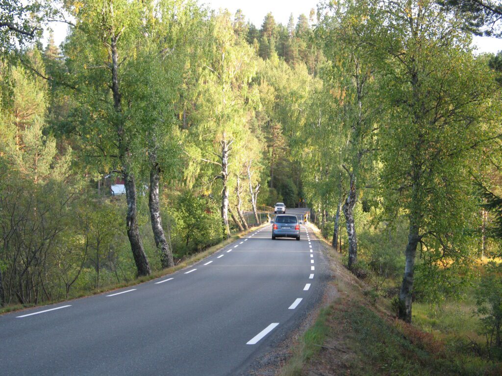
The drive: the Rv41 from Kristiansand to Brunkeberg

Kristiansand

Kristiansand was established in 1641 and is named after the Danish-Norwegian King Christian IV (who also renamed Oslo after himself to Kristiania). The city is strategically located on the Skaggerak coast and used to be an important military base as all traffic had to pass here in and out of the Baltic Sea. Kristiansand was also an important shipbuilding harbour, and experienced its golden age after the American Revolutionary War and up to the Napoleonic wars.

Tveit

Town
Tveit is the first town you pass through after leaving Kristiansand. The town has a population of 1,600 people. It has an Air Force School because of its proximity to the Kristiansand airport. The name comes from the Old Norse word ‘Tveit’, which refers to a separated land or a cleared area of land. Tveit Church (Tveit Kirke) is a stone church from the 12th century. It is clearly marked from the highway.

Birkenes Municipality

Agriculture and forestry are important industries in Birkenes. The largest company here is the 3B fiberglass company. The Norwegian Institute for Air Research is located here, and it is one of the most important stations in Europe for measuring trans-boundary air pollutants and climate drivers in Europe. 

Birkenes Church

Church
Birkenes Church is from 1858 and replaced an earlier church on the site. The church is fairly unique for Norway as it is constructed in a Byzantine/Romantic style. The church is located by the highway.

Mollestadeika

Famous Tree
The Mollestad Oak is an oak tree close to the village of Mollestad. It is one of the largest trees in Norway, with a circumference of 9.2 metres (30 feet) and a height of around 12 metres (43ft). Estimates of the age are between 450 and 550 years, but there are also outliers to around 1000 years. The nickname Vetteika comes from the vaettir. She believed that when the farm builder died, he returned as a guardian spirit. The trees that grew around his burial mound were protected and the surrounding land sacred. It was believed that when these trees were damaged this would bring bad luck. To ensure everything went well, sacrifices were made to the tree, including the first brewed beer of the year. The tree is marked with a white sign from the highway.

Birkeland

Town
Birkeland has a population of around 3000 people. A short drive out of town is the Birkenes Bygdemuseum, an open-air museum that is home to the Myhre Peat Litter Factory (Myhre torvstrøfabrik), a museum about a factory that produced peat that was sold to the cleaning works in the cities. Peat litter is used as a component in power, commercial fertilised produced from doe waste.

Froland Municipality

Froland Municipality is a largely forested municipality. The coat-of-arms shows a squirrel, which is supposed to represent the forests. An ironworks was founded here in the 18th century and was the main industry until forestry and saw-milling took over in the 19th century. In 2008 there was a forest fire in Froland that is regarded as one of the worst forest fires in history. Over 10,000 acres of forest burned and were fought by around 300 men from the fire brigade, the Home Guard, the civil defence and the red cross. The smell of the smoke could be felt all the way to Thisted in Denmark. Several cabins burned, but no homes were damaged in the fire.

Åmli Municipality

Åmli municipality is a forested municipality. The municipality is linked to the beaver, which is clear from the coat-of-arms. It shows a standing white beaver on a blue background. When the beaver was about to become extinct in Eurasia who guys from Åmli were central to saving the remaining Norwegian population. Around 1900, the global population of Eurasian beaver numbered around 1200. The population in Norway was between 60-100. These two men started introducing more beavers and the population grew. In 1918, the population was 7000. Today it is more than 70,000 in Norway and more than 130,000 (originating from southern Norway) in Sweden. Some were also taken to other European countries. The global population has now passed one million. Åmli is home to Scandinavia’s most modern sawmill. The sawmill began operation in 1971 and has been expanded several times.

Dølemo

Town
Dølemo is a historic meeting place. In old times, people would meet here for markets and horse races. The town emerged as a densely populated place around 1880. A surplus of people living in the surrounding farm hamlets, together with the need for other services that could provide livelihoods for people, meant that Dølemo eventually became a centre. Agriculture is the main industry here, and beekeeping has traditionally been an important livelihood with many large producers. Vehus Bigård is still one of the largest honey producers in Southern Norway. Dølemo is known for its annual market, which started in 1980. The market gathers 15,000 visitors a year to a traditional market.

Åmli

Town

Åmli town is the administrative centre of the municipality. Åmfoss Bridge is from 1918 and is one of Northern Europe’s longest stone bridges. Åmli Church is a long church from 1909. It replaced the previous church that burned down on Palm Sunday in 1907.

Elvarheim Hunting Museum is a museum all about (you guessed it) hunting traditions in Norway.
You can find more information on their website:
https://www.kubenarendal.no/lokale-museer/elvarheim-museum

Nissedal Municipality

The municipality surrounds the lake Nisser. There are over 1,750 large and small bodies of water and lakes, so the main industry here is hydropower. The name comes from the folkloric creature Nisse. In the 19th century, M.B Landstad suggested that the nisse came from this municipality because there the gnome tradition must have been so alive that Landstad thought the place was named after them. The municipality is actually named after the Lake Nisser, which comes from the Old Norse word referring to a rushing sea. In any case, now the municipality is associated with the nisse and this is reflected in the coat-of-arms. Beaver, roe deer, badger, elk, red fox, porcupine, marten, lemur, hare and viper are found here. Wolf and lynx are very rare. The main industry is agriculture, forestry, the wood industry, and power production.

Treungen

Town
Treungen is a town with a population of 550. It is located at the southern end of the lake Nisser. The town has been closely associated with the city of Arendal throughout history because the lake was part of the Arendal water system. Treungen was an important hub where timber was towed here on the lake before it was sent on its journey towards Arendal. Tveitsund Bride is a historic bridge from 1919 and is the country’s second-longest stone vault bridge with a span of 51 metres. The bridge is known for its high-class engineering. Before there was a bridge, there was a ferry going across. Many people from the village participated in the construction work.

Nisser Lake

Lake

The Nisser is a lake in the Telemark region. It is the second largest lake in telemark with a length of 35km. The tourist industry began around the lake in the 1960s and is a popular place to go swimming in the summer. Whoever buys a fishing license can fish for trout, char, whitefish, and perch.

Nissedal Church

Church

Nissedal Church (Kirke) is a church from 1764. The church is located by the highway on the northbound side.

Kviteseid Municipality

Kviteseid is a municipality in the upper part of Telemark. The municipality has existed since the Middle Ages and was an important administrative centre in Telemark. Kviteseid was originally an agricultural community without any real urban development. The most important industries here are still agriculture and forestry, though tourism is on the rise.

Kviteseid is known for its distinctive cultural traditions, including folk music, arts and crafts, food and architecture. The dialect in Kviteseid is one of the Norwegian dialects that has preserved the most features from Norse and is close to the most conservative form of nynorsk.

Kviteseid Bygtun

Museum

Kviteseid Bygdetun is an open-air museum that is located by the Kviteseid old church and Kviteseid farm. It is in one of Norway’s oldest rural areas. The site has 12 buildings that have been moved from various farms in the district throughout the 20th century. The oldest building is from the 16th century.
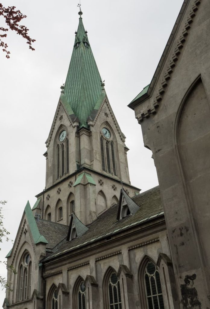
Kviteseid Church

Church

The church is from the 13th century. For long periods, especially in the 17th century, the church was the religious and official centre, and the area has been important since ancient times. The church is built in the Romanesque style.

The church is located next to the historic Kviteseid farm. The farm has been inhabited for over 1000 years and is in the historic centre of the town. For many hundreds of years the farm was the official farm for the parish priest in Kviteseid. The main building burned down in 1764 and the farm was rebuilt in 1769. Today the yard consists of seven buildings forming a square.

After the old church you will cross two bridges. The second bridge crosses the famous Telemark Canal.

Kviteseid

Town

Kviteseid is a small town with a population of around 800. It is not where the original town was; the original town was closer to the old church. However, the modern town centre was built here. The opening of the Telemark Canal brought a lot of traffic to the region, and this led from Kviteseid being a small settlement to being a modern village.

Kviteseid has a long tradition in butter production. The first dairy came in the 1890s, and ever since then the town has been known for its butter production.

Brunkeberg

Town

Brunkeberg is a small settlement. Norway’s first teacher’s school was located here. Today the school building has been moved and is being used as a private cottage. Brunkeberg Church is from 1790.

If you liked this drive, or if you have any travel tips, please leave a comment in the section below!

Download this guide to have it as a PDF ready to go for your road-trip!

All downloadable guides come with an interactive Google Map for easier navigation. 

Welcome to the Hidden North

The Hidden North is an online travel guide written by me, Emma, to help you make the best of your trip to Northern Europe. Welcome!

Originally from Australia, I moved to Bergen in Norway eight years ago after marrying a local ‘Bergenser’. I started doing local tours of Bergen before becoming a tour leader in Northern Europe. After doing that for a few years, I have settled down in Bergen to operate my tour company I Love Bergen and write my travel site The Hidden North

Follow me on social media!

I wrote a book!

My first book – the West Norway Road-trip Guide – is now available for order! This book is the perfect guide for planning a trip to Western Norway and includes dozens of roads + detailed information on what to see and do. It is a mix between travel guide and directoy. 

My guides for Northern Europe

We have a series of printable guides designed to make the most of your trip to Northern Europe. You can find them over on our store. 

Need help planning a trip?

I can help you plan your trip to Northern Europe. Book me for a consultation or let me put together the whole itinerary!

Recent Posts on the Website