
Drive it Yourself: Stokmarknes to Andenes on the Fv82
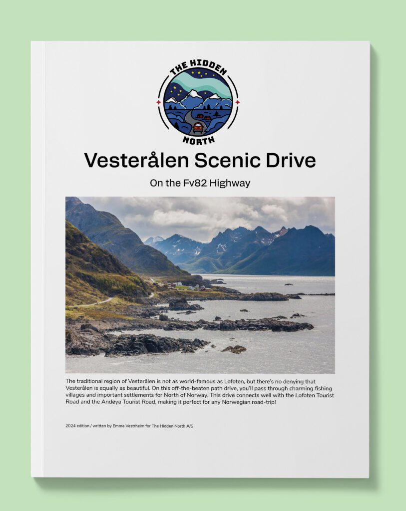
The scenic drive from Stokmarknes to Andenes on the Fv82 will take you through the Vesterålen region. The traditional region of Vesterålen is not as world-famous as Lofoten, but there’s no denying that Vesterålen is equally as beautiful. On this off-the-beaten path drive, you’ll pass through charming fishing villages and important settlements for North of Norway. This drive connects well with the Lofoten Tourist Road and the Andøya Tourist Road, making it perfect for any Norwegian road-trip!
In this article...
Download this guide to have it as a PDF ready to go for your road-trip!
All downloadable guides come with an interactive Google Map for easier navigation.
Online Guide
- Information about points of interest
- Images of each point of interest
- Historic overview of the neighbourhood
- Directions between points
- Historic photos
- Information about facilities along the way
Downloadable Guide
- Information about points of interest
- Images of each point of interest
- Historic overview of the region & towns
- Directions between points
- Historic photos
- Facilities including supermarkets, toilets, petrol, hotels, cafes, restaurants with addresses.
- Interactive Google Map for easier navigation
The drive: Stokmarknes to Andenes
Melbu
Town
Melbu is a small town with a population of 2,250 people. The town is located on the southern side of the Hadseløya island. Melbu is often referred to as the “Pearl of Vesterålen” because of its beauty.
A large farm at Melbu is mentioned in the Viking Sagas, meaning settlement here is very Melbu has been a trading post for hundreds of years but began to see modern development in the 19th century. Melbu became an industrial centre with a dairy, wool and margarine factories and a large fishing industry. Fishing is still an important industry for Melbu.
Vesterålen’s largest village museum is in Melbu, with one of the country’s finest collections of traditional costumes from the 18th century.
The historic Melbu Farm is a museum that has exhibitions on the history of the region, the bunad, and shows what life was like in the 19th century. The museum is located at the address M. Fredriksens alle 1, 8445 Melbu
Hadseløya
Island
Hadseløya is the largest island in the municipality. The island is hilly. In common with the rest of Vesterålen, there are large areas of flat marshy terrain between the fells. The coastal area in the south west is cultivated.
The island used to be a popular place for Engishmen to come fishing, and many books were written about the hunters paradise in Northern Norway. The first ptarmigan hunt in Norway using dogs took place on Hadseløya. Hunters from England brought their dogs with them and used the area to train their English setters as hunting dogs. During this period the island was almost cleared of ptarmigan.
Hadsel Church
Island
The church is from 1824 but contains an Olav figure from the early 16th century. The triptych is also from the 16th century and was probably made in Utrecht. It is one of five found in Norway.
The parish of Hadsel has been in existence since the Middle Ages and at least three churches have stood on the same site since the 14th century. One of these was dedicated to St. Stefanus, the first Christian martyr, and it is thought that the triptych was built for this church as Stefanus is one of the persons depicted in the carvings.
It is believed that Hadsel was the regional and political chieftain seat during the Iron Age and had a settled population. So far nine archaeological finds have been made; one of them is the largest star-shaped sacrificial monument that has been registered in Norway.
Hadsel Cultural Heritage Park
Historic Site
Close to Hadsel Church, by the highway, is the Kulturminneparken på Hadsel, or the Hadsel Cultural Heritage Park. This park has been excavated, and finds going back to before the Vikings have been found here. This indicates the importance of Hadsel in older times.
Stokmarknes
Stokmarknes is the administrative centre of Hadsel and has a population of around 3,500 people.
Traces of ancient settlements in the area around Stokmarknes with sites from the Iron Age, burial sites and boathouse remains. Received status of ‘privileged trading post’ in 1776. It was strategically placed for vessels sailing along the outer side of Vesterålen, before the shallow Risøyrenna was dredged and opened for shipping in 1922.
Around 1900 many industrial and commercial innovations occurred. Stokmarknes is regarded as the birthplace of the Hurtigruten as Richard With founded the company here in 1893. In town is the Hurtigruten Museum (address Richard Withs gate 1, 8450 Stokmarknes), which explains the history of the coastal ferry. You can also walk on the old ship M/S Finnmarken.
Stokmarknes does have an airport and it is one of Norway’s most used regional airports with approximately 100,000 passengers annually.
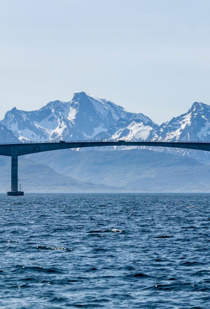
Børøy Bridge
Bridge
The Børøy Bridge connects the islands of Hadsel and Børøya. It is 336 metres long and has a maximum clearing of 15 metres. The bridge was built in 1967 and was the first of the bridges to be built in Vesterålen.
Børøya
Industrial Area
Børøya is a small industrial area with 500 people from 25 nations working here. The main industry on the island is fish farming and the processing of fish.
Hadsel Bridge
Bridge
The Hadsel Bridge is 1km long and has a maximum clearance of 30 metres. The bridge opened in 1978 and is one of the four bridges built during the 1970s to connect the islands of Vesterålen to each other. Before the bridge, there was a ferry service here.
Langøya
Industrial Area
Langøya is mainland Norway’s third-largest island and is 5km long and 40km wide. The highest mountain is 763 metres high.
Grytting
Village
Grytting is a small village with a population of around 125 people. It is a popular place to go skiing, and there are tracks and ski jumps here. Tufts have been found from the Viking Age after a chieftains farm, and there are burial mounds here.
Sortland Municipality
Sortland Municipality is part of the traditional region of Vesterålen. It is located in the southern part of Vesterålen on the islands Langøya and Hinnøya, and the municipality surrounds the inner part of the Eidsfjorden and the Sortland Strait. The midnight sun occurs from 23 May to 23 July, while the polar night is from 30 November to 12 January. The region is popular for observing the northern lights.
The region is mentioned in the Viking Sagas, where it is written as the home of Karle and Gunnstein, who took part in Tore Hund’s campaign against King Olav. The first church is mentioned in written sources in 1370. Yacht skipper Søren Mørch from Bergen settled here and started a yacht trade in 1659. This is the year Sortland is considered to be founded.
Sortland is home to the Coast Guard Base in Norway. Tourism is also important, as is agriculture. Parts of the municipality were known in the latter half of the 19th century as one of Norway’s best regions for herring. The herring adventure here helped lay the foundation or the establishment of Hurtigruten. While the herring aren’t as plentiful as back then, there are still fishing in Sortland.
Sortland has a small Sami population. A Sami family runs reindeer herding on Hinnøya. There used to be a reindeer husbandry, but it was closed in 1972. Some place names in the region come from Sami words.
Sortland is regarded as one of the best music communities in Norway and the local band Madrugada has been one of the best in the country. The Sortland Jazz Festival takes place every autumn, and some of the world’s leading jazz musicians have taken part.
Sortland is the only municipality in Vesterålen that has seen a stable increase in the popular over the past 25 years.
Sortland
Sortland has a population of around 9000 people. Archaeological finds indicate that the area has been inhabited for as long as 5000 years ago. The hunter gatherer population moved from settlement to settlement. 270 graves have been located from the Iron Age. Over 30 house remains have been found.
Sortland grew after Risøyhamn was dredged and was opened for larger ships.
Sortland became the busiest trading post in Vesterålen, schools were built and it became a traffic hub for the local area. The arrival of the Hurtigruten in 1922, the establishing of the Coast Guard and the airports have contributed to Sortland growing.
Sortland has a small museum located at Strandgata 1, 8400 Sortland.
Hinnøya
Island
Hinnøya is the fourth-largest island in Norway, or the largest if you don’t include the Svalbard archipelago. The island is 80km (50 miles) long and 55km (34 miles) wide, and the highest elevation is at 1262m (4140 ft) above sea level. The best agricultural area is in the northeast, while the southern part is the Møysalen National Park. In the northwest of the island is a nature reserve containing a valley with forests and bogs, including the oldest pine trees in Norway, more than 700 years old.
Inga Sami Siida
Sami Site
The Inga Sami Siida is a Sami visitors centre run by the Inga family, who have been reindeer herding here for 150 years. They began the property in 2009 and in the summer months have a drop-in centre where you can visit the exhibition, meet the reindeer, and have a try and reindeer lassoing. In winter you must prebook the experience.
Andøy Municipality
Andøy is the northernmost municipality in Nordland, and forms part of the Vesterålen archipelago. The population of Andøya has decreased by 6.8% over the last ten years, and the main settlement is Andenes. The meaning of Andøy is unknown, though the last element means ‘island’.
The municipality is spread across the island of Andøya and Hinnøya. The mid-section has bogs and marshes known for their Arctic cloudberries, and there are numerous lakes here too. The island is the only place in continental Norway where coal and fossils from dinosaurs are found. The Forfjorddalen nature reserve has some of the oldest pine trees in Scandinavia – some are more than 700 years old. Andøys is also the place where Egga, the edge of the continental shelf, is closest to the land.
The municipality has a strong connection to aviation, with the 333 Squadron of the Air Force being stationed at Andøya Airport. The Andøya Space Centre is involved in international cooperation of the polar atmosphere and the northern lights. Andøya Airport is proposed to be closed by 2025, with air traffic moving to Evenes Airport.
The fishing industry is still important to the municipality, and Andenes is one of the country’s largest fishing harbours and one of Northern Europe’s largest port facilities.
Forfjord
Town
The name of the village is Forfjord, which comes from the name of the fjord the village is built around. The nature reserve here has the oldest living pine trees in Northern Europe, with some of them dating back to 830 AD. It is assumed that the forest was a source of timber and tar for Viking ships, and there are settlements and burial sites that are yet to be excavated.
A famous person in Norwegian exploration came from Forfjord: Hans Jørgen Furfjord. He led the first expedition to stay the winter on Svalbard to hunt silver foxes, walruses, seals and polar bears. Items from his expeditions are on display in museums in Tromsø and Svalbard. Hans also kept diaries describing his adventures, including European monarchs visiting, his being imprisoned by British soldiers for not supplying them for free, barely surviving polar bear encounters, and surviving not freezing to death. He died at the age of 81 at his home in Forfjord. Some of his children emigrated to Canada and the United States, where some of his descendants live today. Some remain in Forfjord.
Andøy Bridge
Bridge
The Andøyabrua is 750 metres long and 30 metres high. The bridge was built in 1974 and is one of the four bridges built to connect Vesterålen together. The bridge crosses the Risøysundet strait.
Andøya
Island
The island Andøya is the 10th largest island in Norway. In the marshy areas there is peat production and cloudberry harvesting. The only Norwegian deposits of coal outside of Svalbard have been found here, but mining the coal is not seen as economically viable. The island is well-known for its many fossils. Among others, a fossil of a 3m long fish lizard has been discovered. Finds of 11,000 year old charcoal deposits indicate that the island has been inhabited since the Stone Age.
The island is mentioned in the King’s Sagas with the ancient Norse name Omd, both in the Ynglingsaga and the saga of Olav Trygvason. Omd was the ancestral land of the earls of Hålogaland. Some of the first Viking expeditions took place from here.
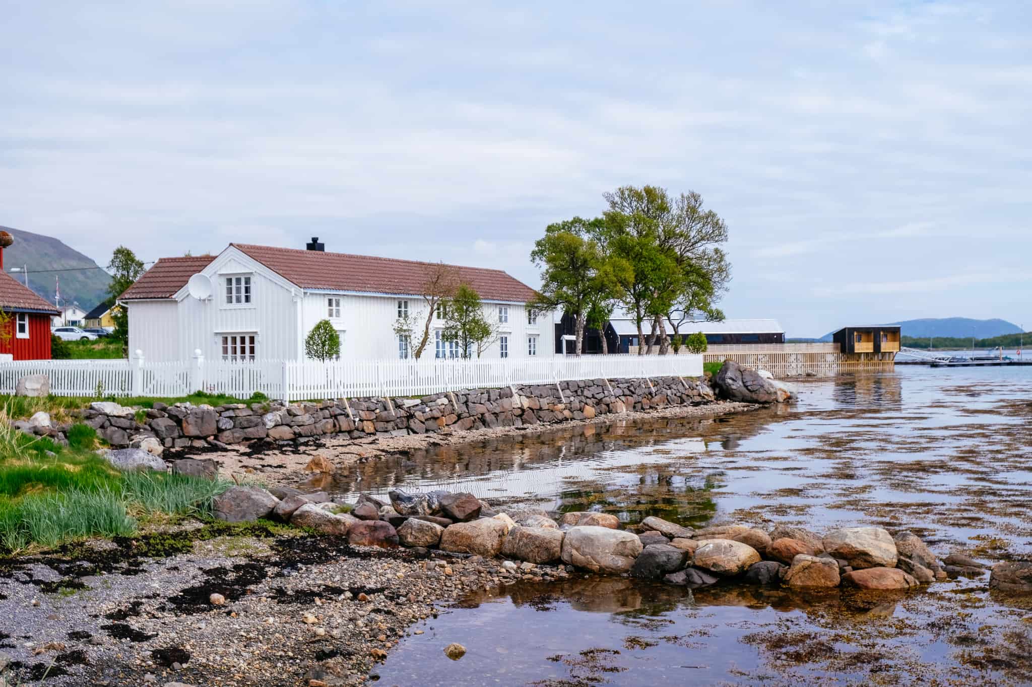
Risøyhamn
Town
Risøyhamn is a small village located on the island Andøya. It has a population of 216 and is serviced by the Hurtigruten twice a day – if you take the Hurtigruten southbound you see the village around 11:30am. There are many older buildings in Risøyhamn, including Gammelgården from the early 18th century. There is a small open-air museum here with five buildings.
Dverberg
Town
Dverberg is a small town with a population of around 200 people. Dverberg is known for its theatre club for kids, which has existed for 30 years.
Dverberg Church is an old wooden church from 1843. Records show there has been a church here since at least 1589, but it was not new at the time. In 1658, the church in Dverberg underwent a major repair, but in 1734 the church was struck by lightning and had to be rebuilt. In 1839, it was decided to build a new church, and that’s the church standing today.
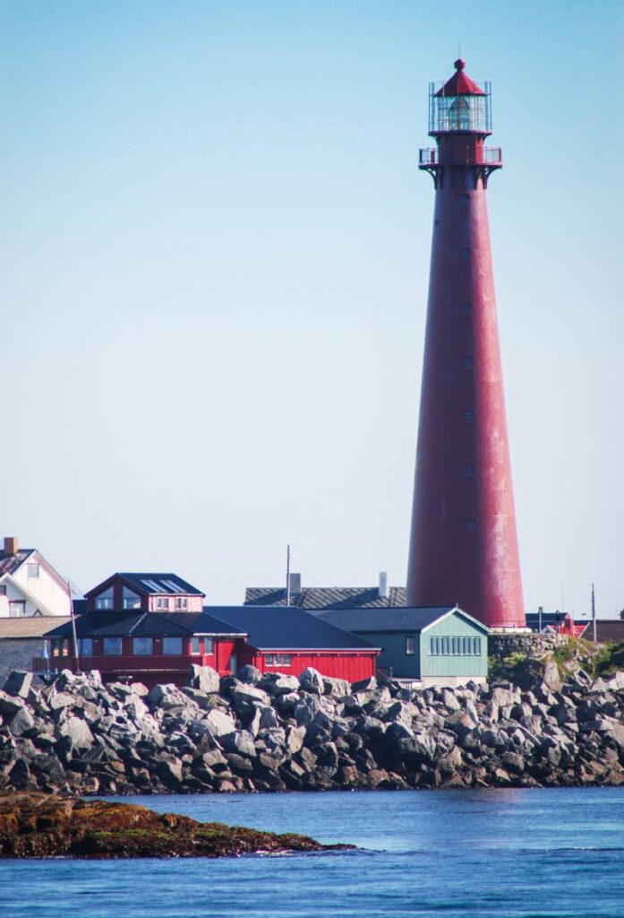
Andenes
Andenes is a small fishing community located on the top of Andøya. The village is known as being one of the best places to set off on a whale safari, and it has a direct ferry connection to the famous Senja Island, which we will be taking the following day.
Andenes is close to the rich fishing grounds and these is evidence of fishing settlements from 500AD. The location means that it is very exposed to the weather. In the Middle Ages, Andenes was a wealthy fishing village with traders from Germany and Holland coming to buy dried fish and the fishermen encountered the German Hanseatic League. It is claimed that the fishermen also caught species of shark the Greenland Shark. The fishermen used dead calves and dogs that had decomposed in barrels as bait.
In 1520, around 590 people lived on the island. Andenes had its golden age around the year 1600, before a steady decline set in. Andenes was integrated with the Bergen trading monopoy in Northern Norway.
Today fishing is still important, though tourism is a growing industry thanks to the whale safaris.
If you liked this drive, or if you have any travel tips, please leave a comment in the section below!
Download this guide to have it as a PDF ready to go for your road-trip!
All downloadable guides come with an interactive Google Map for easier navigation.