Drive it Yourself:
Harstad to Svolvær (via the Fv83)
The drive between Harstad and Svolvær is a scenic drive through the traditional regions of Vesterålen and Lofoten.
There are actually two ways to get between the two towns. The first way is to follow the E10, the major highway that runs through Lofoten. We covered that drive in 2021 (click here to read it). This way, via the Fv83, is the second way. It does take a little longer, but it is worth it. The Fv83 is regarded as a scenic road for the Vesterålen region, which is just as beautiful as Lofoten but with less tourists. It does include one ferry, but the ferry runs regularly.
Here’s our guide to the drive from Harstad to Svolvær via the Fv83.
In this article...
Watch on Youtube
All of our roadtrips are available on YouTube to watch. They include information about the area provided in text and voiceover form, plus they show the drive in full (sped up in some spots!) so you can get an idea what the drive is like.
Kvæfjord municipality is a scenic municipality located on the island of Hinnøya, which is the largest island in Norway. Around 2,800 people live in the municipality. Kvæfjord is known for its agricultural heritage and its production of strawberries and potatoes. The farms here benefit from south-facing slopes and bright nights under the midnight sun. The fjord is known for its rich supply of herring.
Archaeological evidence shows there has been settlement here since at least the Iron Age, and there are farms that have evidence of habitation back to 300BC. Some place names in the area come from the Viking Age. There has also always been a small Sami settlement in the area.
Kvæfjord is home to Norway’s national cake, the Kvæfjord cake. The cake is made with meringue, vanilla cream and almonds.
Kvæøya
Island
You’ll pass a right turn that takes you towards the island. Kvæøya is a small island in the Kvæfjord. It is connected to the mainland via a small bridge, the Kvæøy Bridge, which was completed in 2010. The island is highly regarded for its farming, with large farms on the southern and western sides.
Hemmestad
Village
Hemmestad is a small village with an interesting history. It used to be the ‘capital’ of Kvæfjord and was a major trading area. In the village today you’ll find the old Hemmstad Brygge (pier), a heritage-listed building that was the trading centre for Kvæfjord throughout the 19th century. Twice a year boats came here with coffee, spices, candy, textiles and spirits. From Hemmestad, rockfish, cod, fowl and mullet was exported.
Today Hemmestad Brygge is a museum complex that explains the history of trade here.
Refnes - Flesnes
Ferry
You will now take the ferry between Refnes and Flesnes, two small villages on either side of the Gullesfjorden.
Bogen
Settlement
Bogen is a small settlement that relies on agriculture and fish farming. There is an annual festival here called Flesnes i fest, where several hundred people come to compete in football and car races.
Langvassbukta
Village
Langvassbukta is a small village by the Gullefjord. This is where the county road ends. From here, it turns into Highway 85 (Rv85). To go towards Lofoten, turn left towards Lødingen. It is also recommended to take a scenic detour to Sortland and back.
This guide follows the scenic detour.
Sortland Municipality
Sortland municipality is the administrative centre for the region and is named after the town of Sortland, which is the largest town and commercial centre in the traditional region of Vesterålen. It is part of the county of Nordland.
The municipality is spread across the islands of Langøya and Hinnøya in the Vesterålen archipelago. The mountain Møysalen is part of the Møysalen National Park, located in the southern part of the municipality. The midnight sun occurs from the 23rd of May to the 23rd of July, while the polar night occurs from the 30th of November until the 12th of January.
Sigerfjord
Town
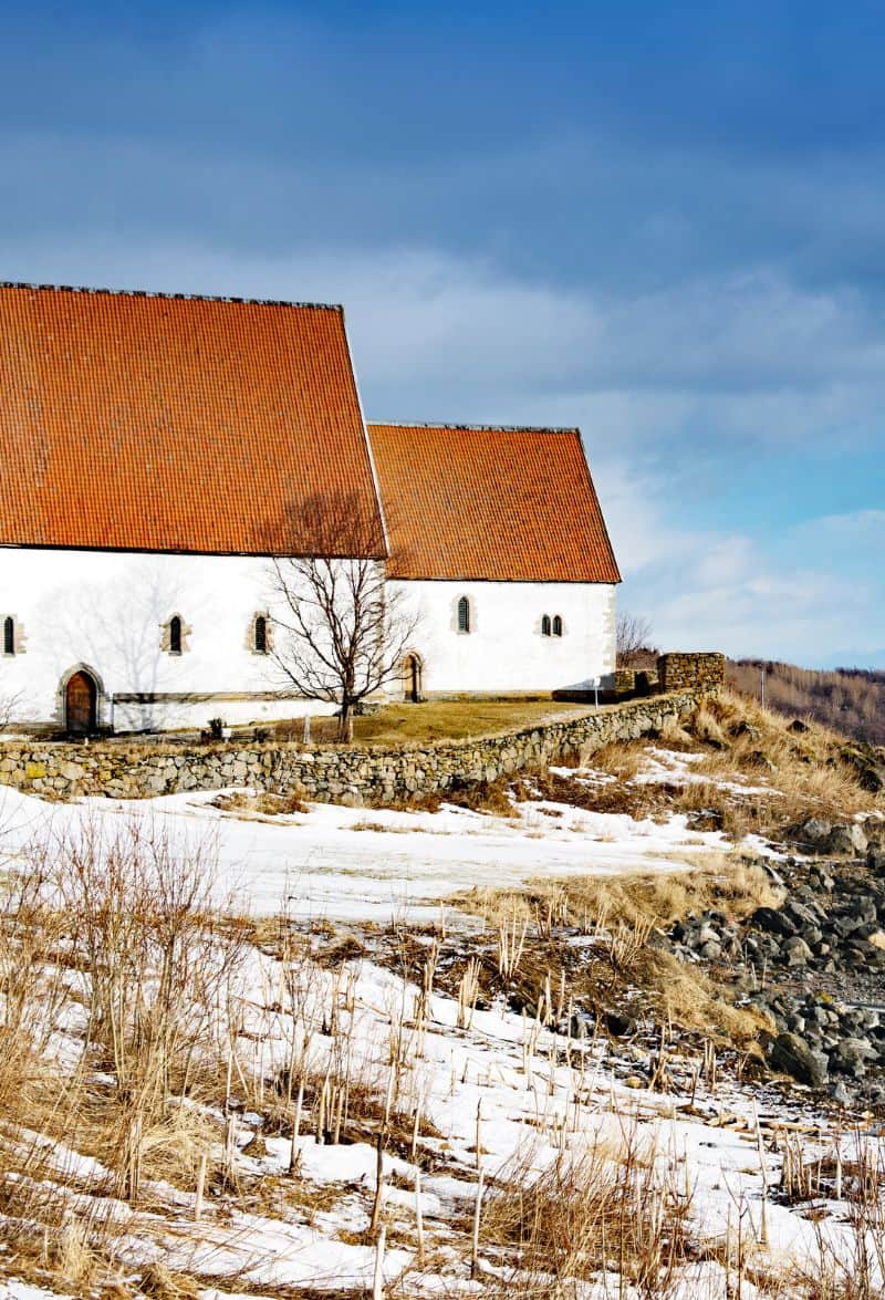
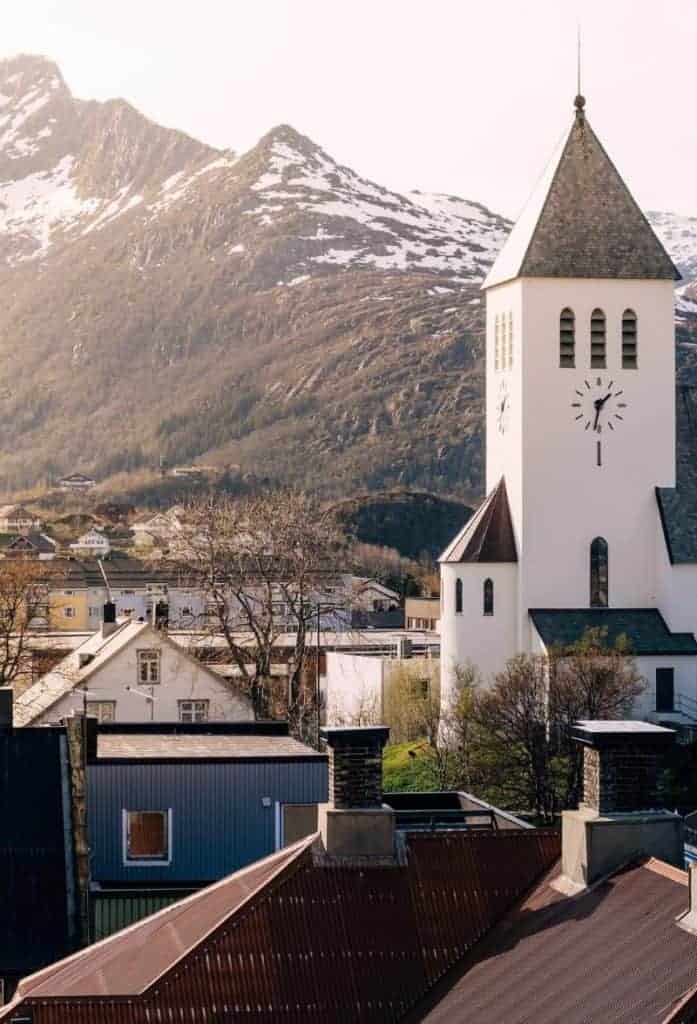
Sigerfjord is a small town with around 800 people living there. The church is from 1933 but has a figure of St. Olav from the 15th century inside. It came from an earlier church on the same spot. The town has a primary school and kindergarten. Most of the industry here is connected to the sea.
Sortland
Sortland is the main town and administrative centre for the region. It is also known as the ‘blue city’.
Sortland is a 15 minute detour from Sigerfjord, but is well worth it if you want to stop for a coffee break or pick up some supplies.
You can read about Sortland via our travel guide below.
This drive now continues back towards Lødingen. You’ll reach a round-a-bout and turn onto the E10 towards Å i Lofoten.
Hadsel Municipality
Hadsel municipality is located on four main islands in Vesterålen – Hinnøya, Langøya, Hadseløya, and Austvågøya.
Hadsel has been an important hub for the fishing industry, and due to its proximity to Lofoten has always been an important trading place for Lofoten residents. The oldest settlements were likely on the southern side of Hadseløya, but the main harbour has always been Stokmarknes.
The name “Hadsel” comes from the Old Norse word “Hovdasegl”, meaning “main sail”. The name describes that Hadseløya can look like a merged mainsail on a Nordland boat when you see Hadseløya from Langøya. The Sami name for Hadsel is Ulpesuohkan, referring to the old name for the area (Ulvøya).
The main airport here is the Stokmarknes Airport, the busiest small aircraft airport in Norway. Stokmarknes is also the birthplace of Hurtigruten, the Norwegian coastal ferry.
The coat of arms represents four yellow rings, representing the four main islands the municipality is on.
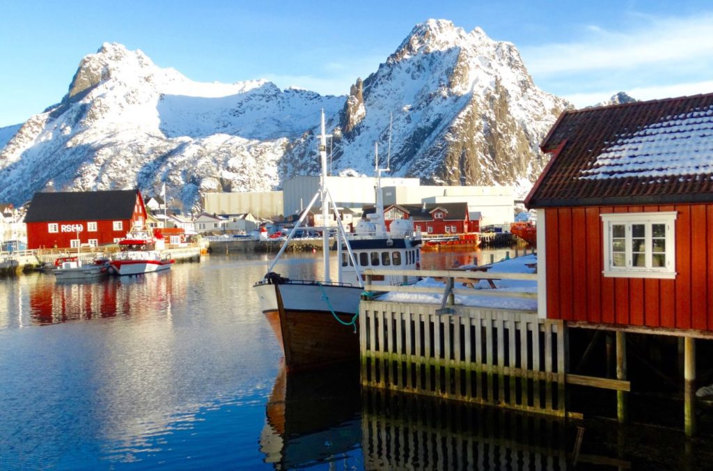
Vågan Municipality
Vågan is a major municipality in Lofoten. It includes most of the island Austvågøy as well as Gimsøya. It is the easternmost of Lofoten’s six municipalities. The main town in Vågan is Svolvær, where this drive ends. Fishing is the most important industry here, and Vågan is North Norway’s 8th largest fishing municipality.
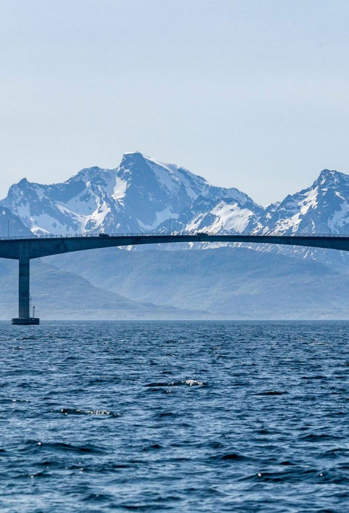
Austnesfjorden
Photo stop
The view is excellent over the fjord and you can see Sildpollnes Church in the distance.
Sildpollnes Church is a small white wooden church from 1891. The church had some drama recently, when the current neighbour refused to let people through his property to get to the church because he said the 1890 agreement stated people could pass on foot, but it didn’t mention automobiles. The church closed in 2015 and the case went to court, with the neighbour loosing and the Lofoten District Court ruling in favour of the church.
At the photo stop they have a place you can walk up to with a viewing platform. I’ve used a photo of it at the top of this page. This is where you get the view out to the church.
Svolvær Airport
Airport
Svolvær Airport is a regional airport in Lofoten. While it is one of the main airports for Lofoten, it is likely not the one you will fly to if you are flying to Lofoten – instead, it’s better to fly to Harstad/Narvik and drive from there. Svolvær Airport is served by Widerøe and the routes are subsidized by the government with direct flights to Bodø, Oslo, and small communities in Nordland county. There are plans to make a new primary airport to serve the Lofoten and Vesterålen region, making it more attractive to visit out of the tourist season.
Svolvær
We have made it to Svolvær, the end of today’s drive! You can read more about Svolvær on our dedicated travel page.