Drive it Yourself: The Coastal Road Day 2 – Namsos to Brønnøysund
This is part two of Norway’s coastal road.

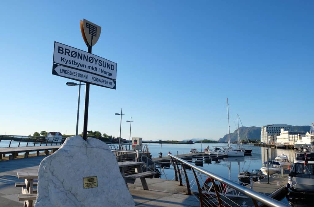
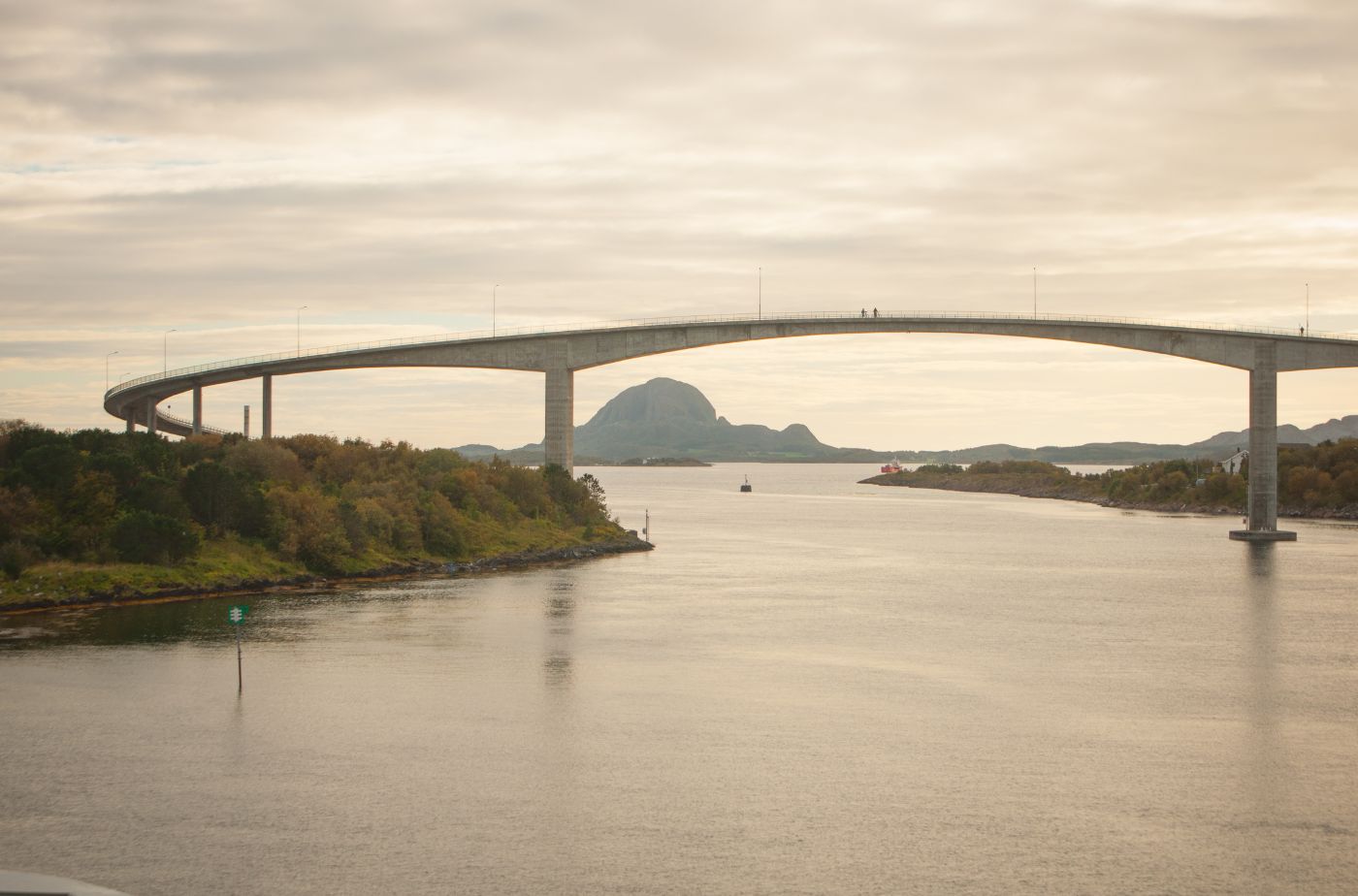
Located in the geographic centre of Norway, Brønnøysund is the beginning of the Coastal Road – one of Norway’s 18 national tourist roads. It’s a sleep little town on an archipelago, but the surrounding nature is beautiful. The famous mountain Torghatten is also located here.
Latitude: 60.5 degrees north
Population: 1,766
Hottest Month: July
Coldest Month: January
Wettest Month: November
Windiest Month: January
Annual Precipitation: 588.3mm
Brønnøy Municipality
Here are some things that you must try in Brønnøysund
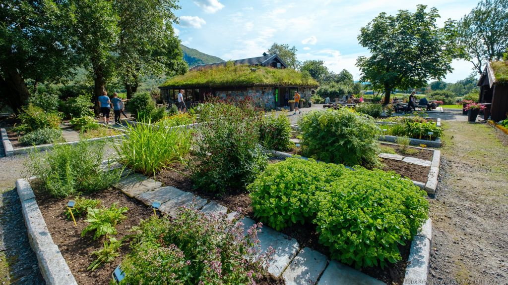
Located just outside the town centre, this farm has around 400 types of herb, 100 varieties of rose, and 1000 species of cactus. The old farm buildings have a gallery and shop. There’s a place to have lunch, too.
Here’s an overview of some of the best things to see and do in Brønnøysund.
Brønnøy Church, a beautiful stone church whose Neo-Gothic structure dates to 1870. Parts of the church’s walls are medieval, and inside it holds treasures like a pre-Reformation wooden crucifix.
The Norwegian Aquaculture Centre (Norsk Havbrukssenter) is just north of town, where you can learn about modern salmon farming and even visit a working fish farm up close. It’s an interactive attraction, complete with exhibits and underwater feedings, that’s especially fun for families curious about Norway’s famed seafood industry. W
Looking to go for a hike or take part in a unique experience? Here are our recommendations!
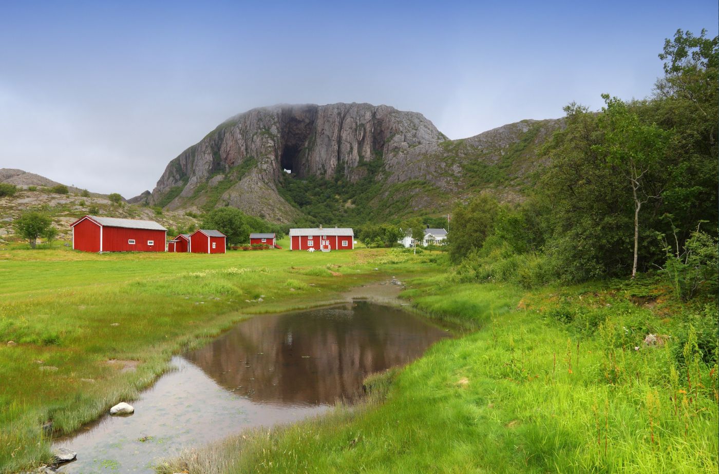
Torghatten is a unique mountain with a hole going through it. The walk isn’t too tricky and only takes around 20 minutes to reach the hole.
To the west lie the Vega Islands, a UNESCO World Heritage Site of over 6,500 islands and skerries. These low green isles have been inhabited for millennia and are famous for the unique harmony between locals and wild eider ducks – for over 1,500 years, fishermen-farmers here have protected nesting eiders and harvested their down, a tradition that earned Vega its UNESCO status. From Brønnøysund you can join boat tours or ferries to Vega to explore its fishing villages, tiny eider houses, and coastal museums.
For a shorter walk steeped in history, head to Skarsåsen Fortress just outside town. This World War II coastal fort sits on a low hill overlooking Brønnøysund, and reaching it is as simple as a 5–10 minute stroll from the parking area.The trail is gentle and suitable year-round (mind your footing inside the old tunnels).
At the top, you’ll discover remnants of four large gun positions, bunkers and trenches built by the occupying forces in the 1940s, now marked with information signs explaining their history. It’s an open-air museum of wartime history, and also a fantastic panorama point. From Skarsåsen you can gaze out over Brønnøysund town, see Torghatten’s hulking profile to the south, and even spot the Vega islands on the western horizon in clear weather
Follow our road-trip guides for scenic trips around Brønnøysund.
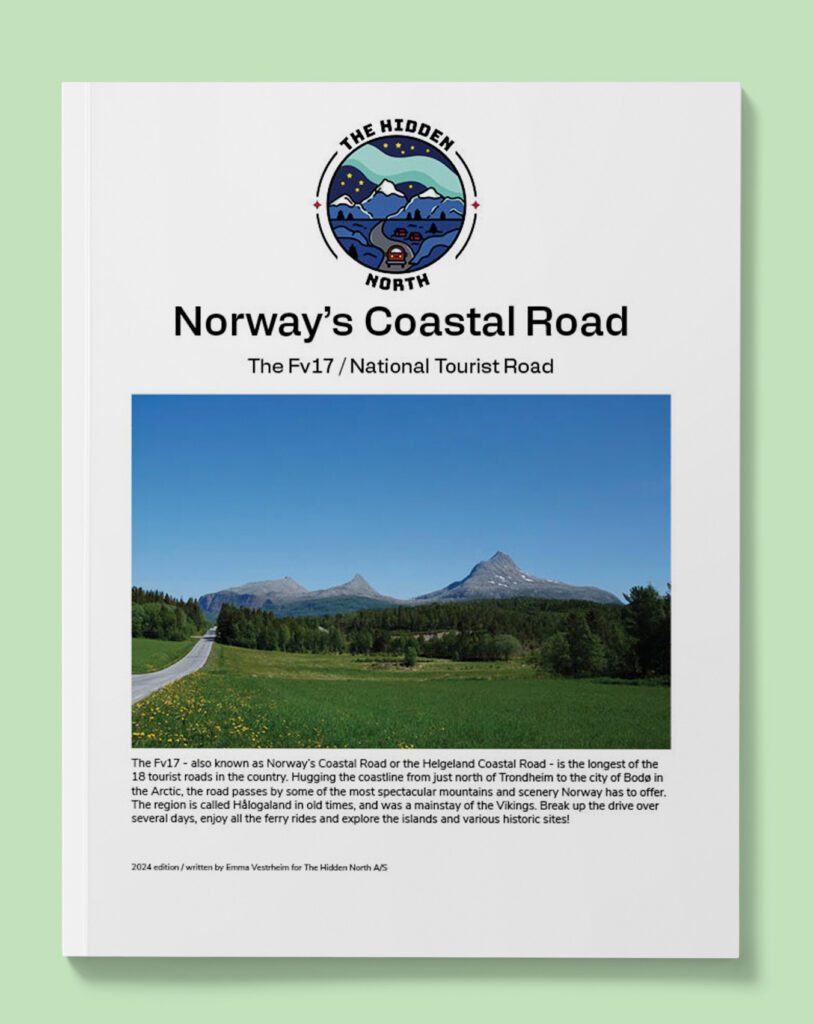
The Coastal Road is the longest of Norway’s 18 national tourist roads, and covers the length from Trondheim to Bodø.
We currently do not have any self-guided walks available in Brønnøysund.
Watch our YouTube videos featuring Brønnøysund
Follow us past the famous Seven Sisters mountain range.
Human history runs deep in Brønnøysund, with traces of settlement going back thousands of years. Archaeologists have found evidence of Stone Age habitation in caves just outside town – in the limestone caverns at a site called Sportsplassen, tools and remains indicate that people lived here as far back as 10,000 years ago, when the ice age retreated and the sea was the highway of the north.
By the Viking era (around 800–1100 AD), this area had become a power centre. The Torgar farmstead near the foot of Torghatten, was a mighty chieftain’s seat and a thriving coastal marketplace.
Given the rich fisheries and sheltered waters, it’s easy to see why Norse chieftains valued Torgar – it sat strategically along the sailing route and commanded respect as a place of abundance and trade. However, Torgar’s prominence also drew conflict. During Norway’s medieval civil wars, around the year 1240, the powerful Duke Skule marched his men to Torgar and, in a notorious massacre, wiped out the local chieftain’s family and followers.
This bloody episode ended the Viking line at Torgar and is a dark chapter in Brønnøysund’s early history – one still recalled in local lore.
In the following centuries, Brønnøysund gradually re-emerged as a modest trading and fishing outpost. The very name Brønnøy hints at its significance to seafarers: it comes from Old Norse Brunnøy (well island) or brunnur (well), referring to freshwater wells where sailors could replenish their water supplies.
Indeed, for generations of coastal travelers, this spot was known as a reliable harbor to drop anchor and find fresh water and provisions. By the 19th century, as steamships and commerce increased along Norway’s coast, Brønnøysund’s sheltered harbour became even more important. The Hurtigruten coastal steamer began calling here (today the southbound Hurtigruten still docks every afternoon) and the town grew around the maritime trade.
Brønnøy’s main church has always been a focal point of the community. The earliest church on the site was likely built around the year 1200, and though it suffered fires from lightning strikes in later centuries, it was always rebuilt – a testament to local resilience. The current Brønnøy Church, completed in 1870, incorporated stones from the medieval church into its walls, linking the present to the past.This stately cruciform church has watched over Brønnøysund through the ages, from its days as a few huts by the sea to its current status as a vibrant town.
In the 20th century, World War II brought upheaval even to this remote corner. The occupying German forces fortified Brønnøysund’s coast, building the Skarsåsen battery in 1942 with four big cannons to guard the shipping lane. Though no major battles took place here, the fort remains as a historical site (discussed in Hikes) and a reminder of war’s reach. After the war, Brønnøysund developed steadily. A significant boost came when the Norwegian government located the national Brønnøysund Register Centre here – a collection of business and administrative registries that provided many jobs and put the town on the map in modern Norway. By 2000, Brønnøysund was officially given town status (despite its long history, formal “town” designation came relatively late).
The largest employer in Brønnøysund is the Brønnøysund Register, a department of the government used to register businesses. There’s also a large seafood company and the largest limestone mine in Northern Europe.
Fly: Widerøe operates flights out of Brønnøysund airport, linking the town to Trondheim, Oslo and Bergen.
Drive: Brønnøysund is located on the Fv17, otherwise known as Norway’s coastal road.
Train: No train access.
Ferry: The coastal ferry calls at Brønnøysund.
Brønnøysund is walkable.
There are some good options in Brønnøysund, but variety is fairly limited.
Cafes & Bakeries
Casual Eateries
KRED Pub & Café on Storgata is a favourite hangout for locals. By day, KRED serves light meals, coffee, and house-baked cakes in a cosy setting that feels like a slice of city nightlife transported to this small town. By night, it transforms into a lively pub with a big-city vibe – it’s known as the spot to catch live music and even stand-up comedy shows, especially on weekends
Svang Restaurant & Wine Bar, right in the heart of town, is a prime choice for an informal dinner or lunch. Svang prides itself on using local Helgeland ingredients – from seasonal fish to locally foraged herbs – but presents them with an international twist. You might find Norwegian lamb with an Asian-inspired sauce, or Arctic char fish with Mediterranean vegetables. The atmosphere is cozy and unpretentious; you can drop in for a glass of wine and small plates or settle in for a full three-course meal.
High End & Unique Eats
The restaurant at Hildurs Urterarium is called Restaurant Sagastua and is one of the top picks in Central Norway.
Reasonable Restaurants
All my hotel recommendations are based on research and experience. I don’t recommend somewhere unless I think it is wonderful! The Hidden North focuses on accommodation that provides good quality for price or offer local or unique experiences.
Camping
Torghatten Camping is located close to the Torghatten mountain.
Another option is Skogmo Familiecamping, located about 12 km south of Brønnøysund along the coastal highway. True to its name, Skogmo is family-friendly: a quiet countryside setting with plenty of space for kids to run around. They have simple cabins (without bath, using a shared service building) as well as spots for caravans and tents.
BnBs & Guesthouses
Chains & Mid-Range
Thon Hotel Brønnøysund is a great option for the centre of the town.
High End & Unique Properties
Norsk Havbruksenter is half fish farm and half cabins for rent. The location is gorgeous, but you will need a car to reach there. This is where I stayed and I loved it!
Sunrise: 9:56am
Sunset: 2:44pm
Average Temperature: 1C (34F)
Sunrise: 8:14am
Sunset: 4:37pm
Average Temperature: 0.4C (32.7F)
Sunrise: 6:31am
Sunset: 6:10pm
Average Temperature: 1.4C (34.5F)
Sunrise: 5:35am
Sunset: 8:49pm
Average Temperature: 4.7C (40.5F)
Sunrise: 3:41am
Sunset: 10:36pm
Average Temperature: 8.1C (46.6F)
Sunrise: 1:56am
Sunset: 12:26am
Average Temperature: 11.2C (52F)
Sunrise: 2:58am
Sunset: 11:33pm
Average Temperature: 14.3C (57.7F)
Sunrise: 4:51am
Sunset: 9:37pm
Average Temperature: 14C (57F)
Sunrise: 6:30am
Sunset: 7:40pm
Average Temperature: 11.1C (52F)
Sunrise: 8:04am
Sunset: 5:48pm
Average Temperature: 6.8C (44.2F)
Sunrise: 8:51am
Sunset: 2:59pm
Average Temperature: -4C (39F)
Sunrise: 10:24am
Sunset: 1:47pm
Average Temperature: 1.9C (35.4F)
This is part two of Norway’s coastal road.

Drive it Yourself: The Coastal Road Day 3 – Brønnøysund – Sandnessjøen The Coastal Road that runs from Brønnøysund to Bodø is one of Norway’s