
Self-Guided Walk on the Akerselva River in Oslo
Here’s my self-guided walk on the Akerselva River in Oslo. The Akerselva is easily the most charming area in Oslo.
The Akerselva (Aker River) is a 8.2km (5.1 mi) long river that flows through the middle of Oslo.
The river can be credited with the development of Oslo. In the 19th century, it became the centre of the new industries coming to the city, as factories were able to utilise the power of the river.
Today the river has been cleaned up and is known as ‘Oslo’s green lung’. Along the banks of the river are park areas, with the factories being converted into offices, schools, bars, cafes and restaurants.
I honestly believe no trip to Oslo is complete without a visit to the river. While much of the city centre of Oslo feels like “Anywhere, Europe”, Akerselva has a distinctive personality that makes Oslo stand out from other Norwegian cities.
This walk starts at Nydalen and continues all the way back to the city centre.
In this article...
Oslo Travel Guide
You can find a detailed overview of Oslo, including practical, historic and travel information on our dedicated travel guide page.
The Walking Route
Where we begin:
We begin in Nydalen. To get there, take the metro to the stop ‘Nydalen’ and then walk through the shopping mall called ‘Torgbygget’. When you reach the river, cross the bridge and turn right. After 2-3 minutes, you’ll see the preserved factory.
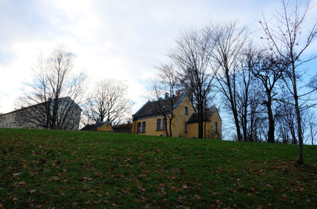
Part One: Nydalen
Nydalen is the first neighbourhood we will visit. The first mention of this neighbourhood was in 1578, when a farm called ‘Nygårdsdalen’, meaning ‘the valley belonging to the farm Nygård’, was mentioned in documents.
The area didn’t see major growth until the late 19th century, when the banks of the river were sold off and industrial buildings were constructed. The first type of industry in Nydalen was sawmills, but later the textiles industry came here and then the iron industry.
At the time, Nydalen was relatively isolated from Christiania, so it was important to build a community here. The workers were therefore very closely tied to the factory. For example, between 1857 and 1905 there was a school for the children who also had to work at the factory, and then from 1876 the companies financed their own midwives. When the tram came here in 1902, people moved further away and began to commute.
Today the neighbourhood is very modern with residential buildings, commercial and service establishments, shopping centres, eateries and corporate offices. The BI Norwegian Business School is located here, and since the opening of the metro in 2003 a lot of people have been attracted to the area.
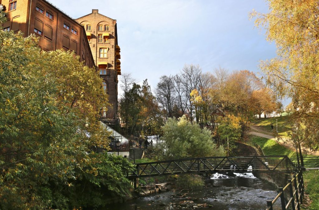
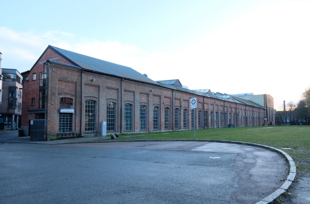
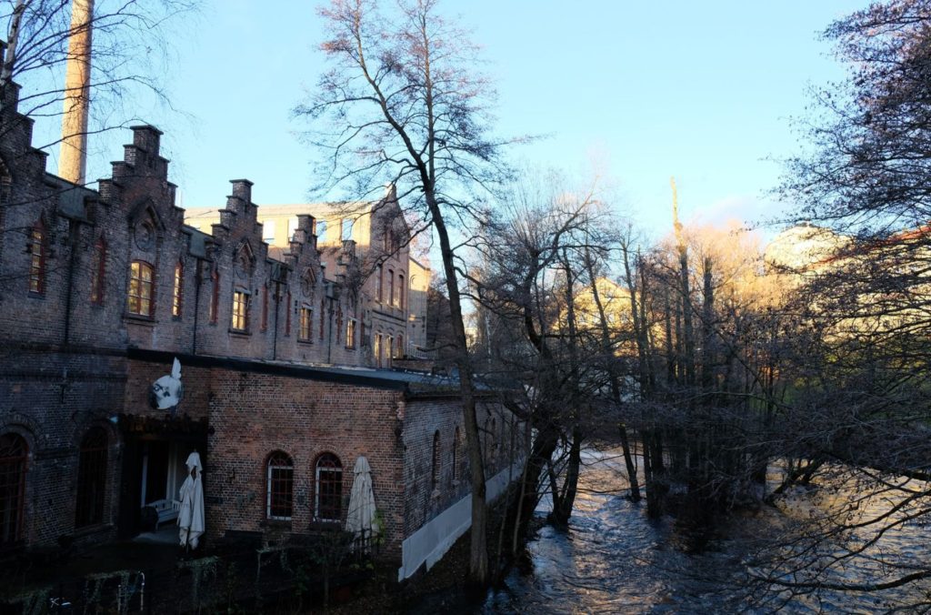
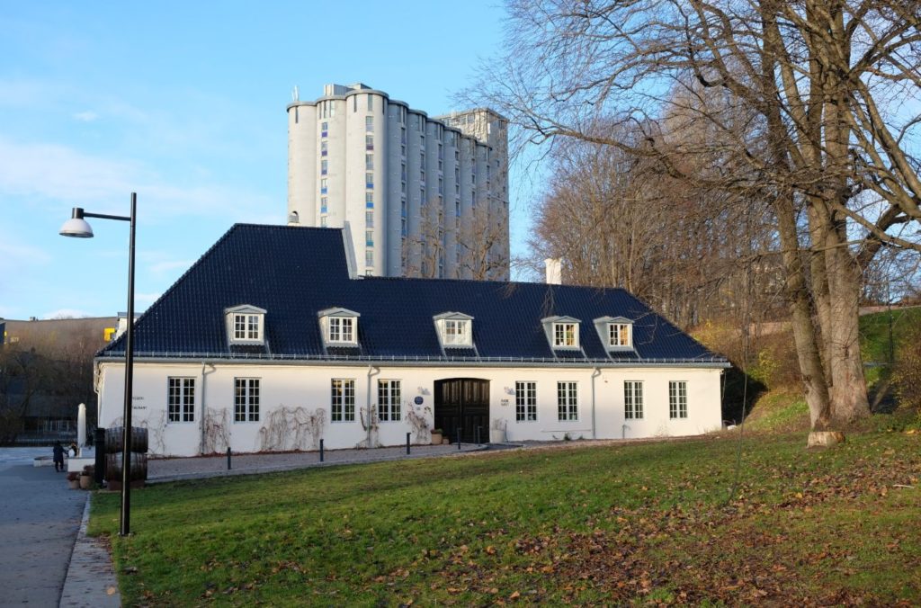
Bakke Mølle
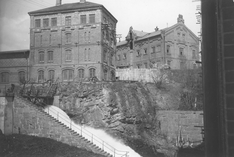
Bakke Mølle is a mill established in 1811 by Hans Nielsen Hauge, a famous Norwegian preacher and founder of the ‘Haugien movement’. He had just been released from prison after preaching illegally, and he was given the nearby farm Bakkehaugen from his brother. He had a dam and mill built on the property and did well, selling the mill in 1824.
For a while Bakke Mølle was owned by Peter Larsen & Co and was important for Nydalen. Eventually the mill was taken over by Christiania Spigerverk, who was expanding in Nydalen (see the historic photo above) and wanted the waterfall at Bakke Mølle. The building we can see became a storage building.
Today the building is used by the local government as offices.
Part Two: Bjølsen
Bjølsen is a district in Oslo’s north. The area is characterised by old workers housing and green areas. Bjølsen has a high young population and there is a lot of active nightlife along Bergensgata. Bjølsen has traditonall been a working class area. Half the population is under the age of 40.
Vannvoktboligen
Due to pollution, Christiania’s water intake was moved to Maridalsvannet in 1867. This increased so much pressure that a reduction pool had to be built here. It is still located at the top of the hill, above today’s playground. Upstairs is a watchtower that is now a kindergarten.
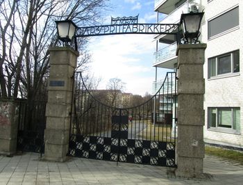
Idun Gjaerfabrikk
This is the second yeast factory to start up in the area. Idun was one of the companies that lasted the longest along the river, however in 2005 it ended after more than 100 years of operation. You can see the great factory gate towards Treschows gate.
From the 1930s they also produced broth, vinegar, mustard and other foods. After 1991, the production of Idun mustard and ketchup as well as vinegar was transferred out of Oslo to Staburet. Yeast and baked goods production in Oslo was discontinued in 2005 and moved to Sweden. Idun still has bakery production elsewhere in the country. The factory was one of the last factories to be closed down.
From 2010, the factory area was converted to apartments. The wrought iron gate, designed by Henrik Bull, has been preserved.
Treschows Bridge
For a few years in the 19th century the towns water intake was located by the bridge. The city’s water supplies improved when wooden water pipes were replaced with iron pipes. But the water was filled with sawdust and soon the water supply was moved. The bridge is named after Admiral Gerhard Treschow, who owned Bjølsen farm and was behind several industrial companies in the area.
Bjølsenfossen
Bjølsenfossen has largely influenced the industrial history of the area. From the 14th century onwards there were mills here, before Bjølsen Valsemølle took over and became the country’s largest flour producer. The waterfall, called Little Niagara, is the largest in Akerselva with a drop of 16 metres. The waterfall is unfortunately locked inside the factory area. You can hear the waterfall from one of the bridges.
This is the largest waterfall on Akerselva but can’t be seen today. There is a proposal to open a footpath on the west side of the waterfall. There is a music group named after this area, Bjølsen Valsemølle.
The deep gorge through the waterfall is called Jerusalem after an old farm in the area.
Bjølsen Valsemølle
Was the country’s largest flour mill. Built in 1884. The mill was founded by Gustav Martinson in collaboration with Ole Amundsen who owned Bjølsen Mølle. The silo is from 1939. As recently as 1967, Akerselva delievered power to production. The mill had 60 horses carrying grain and flour between Vippetangen and the mills at Bjølsen and Nedre Foss. From 1918 horse transport was replaced with the grain tram.
You can visit their website here: https://www.bjolsenvalsemolle.no/
Svalgangshuset
House that belongs to Bjølsen Valsemølle. Located at Treschows gate 4. It is a two storey house where all the rooms have access from a covered porch. The house is from 1850 and was the mill master residence.
Directors House
House that belongs to Bjølsen Valsemølle. Located at Treschows gate 4. It is a two storey house where all the rooms have access from a covered porch. The house is from 1850 and was the mill master residence.
Lilleborg Fabrikker
Since 1712, soap has been boiled here. Lilleborg Fabrikker was established by Ludvig Mariboe in 1812 as a clothing factory. The factory was established in the old Jerusalem Paper Mill from the latter half of the 18th century. The mill was bought by Mariboe in 1812 and he wound up in the mill operation and instead established a clothing factory with the name Lilleborg Fabrikk.
Eventually they built an oil mill and a by-product of the oil was soap, so in 1842 the soap factory was established. The company was sold in 1862 to Peter Wessel Wind Kildal, who focused the company on the oil mill and soap factory. He grew Lilleborg to be one of the most important companies in Norway. In 1987, the production of household goods was moved to Ski, where it still takes place today.
Bentse Brug Bentsegata 31-35
Norway’s first paper mill was built here in the 1690s. It was primarily newsprint and brown paper that were produced. Paper production was discontinued in 1898. Ole Bentsen, the owner of the paper mill, had received royal privilege from King Christian V and the mill was the first of its kind in Norway.
In 1858, it became the first mill in Norway to use wood pulp. By 1865, other companies were doing the same and Bentse Brug struggled to compete. In 1889, it went bankrupt and was then acquired. The buildings were demolished in 1976.
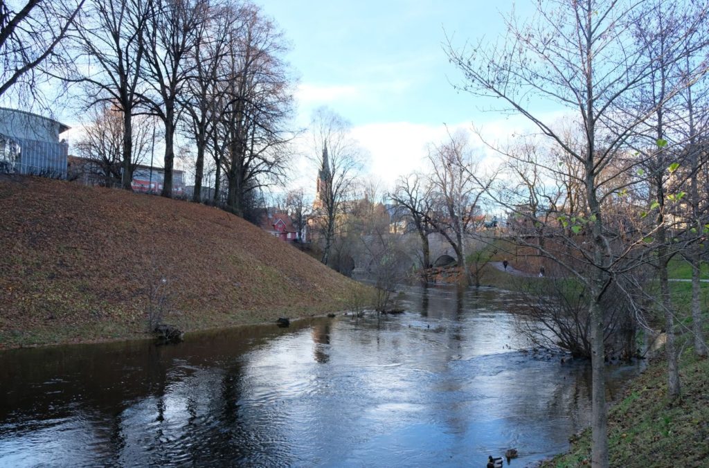
Part Three: Sagene
Sagene is a district located 2-3km north of the city centre. Originally associated with factories, today Sagene is one of the more attractive areas to live in in Oslo.
The area used to be a farm called Vøyen, which is from pre-Christian times. Nonneseter monastery owned Vøyen and Sagene with a mill and fishing rights. Christian IV laid the area out as an urban land in 1629. The main building on Nedre Vøyen still exists at Maridalsveien 87.
From the 16th century Sagene had a population associated with sawmills. In 1624, the king decided that only half-timbered houses should be built in Christiania, and those who couldn’t afford it had to move to Sagene. In 1683, 89 people lived on Sagene.
Factories were built up in the 1700s and 1800s and this attracted people to the area. In 1875, 2000 workers were here. A horse tram was completed around 1880.
Myraløkka
Has always been a popular place for ids to play and swim. The valley is shaped like an amphitheatre because huge amounts of clay were excavated here for making bricks. Akerselva had many brickworks, and the business was seasonal. The bricks were mined in the summer and the clay was burned at high temperatures. Under the round mound at the bottom of the amphitheatre is the factory chimney buried. At the top of Myraløkka is English-style workers housing that was completed in 1914.
Myrens Verksted
This is one of Akerselva’s pioneer companies. It was known as the ‘factories factory’ as it made and repaired machines for other companies.
Today the building is used by NRK.
Vøyen Brua
From the beginning of the 17th century, the towns drinking water source was here. This was the city’s first public water intake. Hollowed out logs led the water to Akershus Fortress. For a fee, citizens could have branch pipes added to water posts in their own courtyard. At the same time it was common for the water to be filled with rotten sawdust.
Woman's Monument
Below the bridge is a monument of Betzy Kjelsberg (1866-1950), a female pioneer and Norway’s first female factory inspector. As a factory inspector, she had responsibility for children and women’s working conditions throughout the country.
Nords Isproduksjon
Before the time of refrigerators, goods were cooled down with ice. In the 19th century, Martin used Edvard North Akerselva for ice production. He cut out ice blocks and the demand for ice was so great that eventually he dammed up parts of the Ila valley to make ice ponds. The water he collected was put into one large ice rink down by Waldemar Thranes gate.
Glads Mølle
Yellow building. It is from 1736 and is called Glads Mølle. It is Akerselva’s oldest preserved factory building and is the only listed industrial building. It made paper and is still a printing house inside.
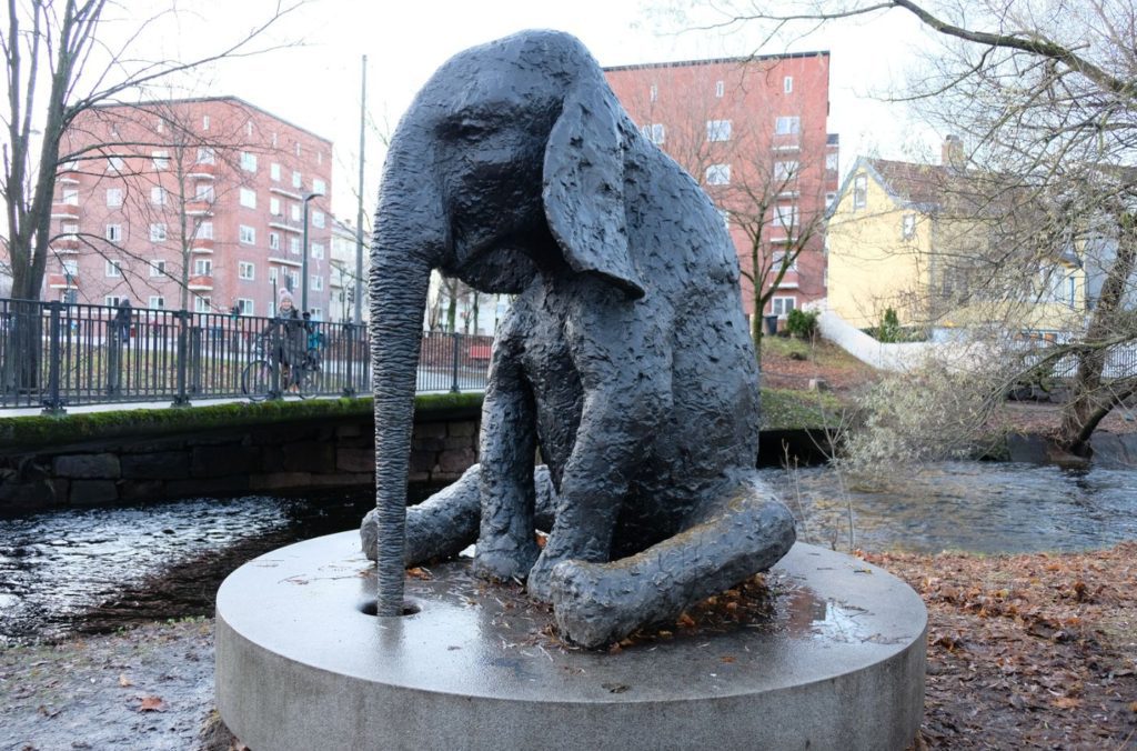
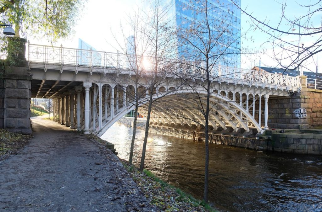
Beierbrua
Named after Anders Beyer, who owned it in 1671. It is one of the finest bridges along the river and is the factory girls bridge. The bridge was a link between the textile industry on the west of the river and the residential areas on the east side. The sculpture is from 1986 and is made by Ellen Jacobsen.
Hjula Væverier
The founder of this company was Halvor Schou, who had been studying the brewing of beer in England. He came back to Norway, however, with plans to make a textiles factory. His factory became the largest textile factory in Akerselva. The factory supplied dresses, shirts, and bus clothes. It closed in 1857.
Due to the American Civil War, cotton supplies became low so Schou began producing wool sweaters.
The clothing company closed in 1957. Today, a real estate company called Hjula Vaeveri Halvor Schou currently operates.
The buildings still stand today and characterise the area of Akerselva.
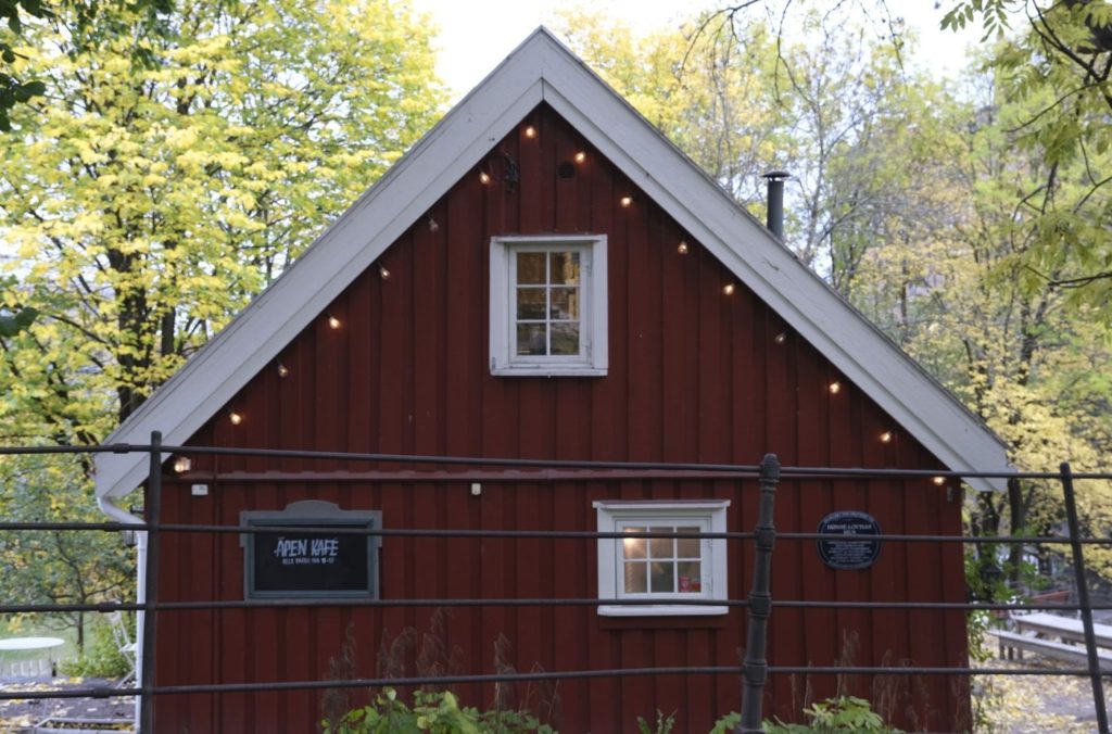
Hønse Lovisa House
This charming red house was a sawmills residence and today it is a nice little café.
It is known as Hønse-Lovisa’s House. Why?
Hønse-Lovisa was an important literary figure in the play The Kid. The name has been associated with the house since the 1970s because it was used in the film adaptation from 1974. The play takes place in the industrial area along the river at the end of the 19th century. There is an older woman called Hønse-Lovisa. Her house is called ‘Hønsereiret’ because she takes care of single mothers. She gives the factory girls who are injured a roof over their heads so they can keep their kids even if they are illegitimate cildren. The character represented a revolt against societal norms that existed about single mothers and their children in the 19th century.
Workers Museum
This is an old wood house building on Sagveien 28. The museum tells about Akerselva’s labour and industrial history. A little further away is an apartment on Sagveien 8 which shows the living conditions of the workers.
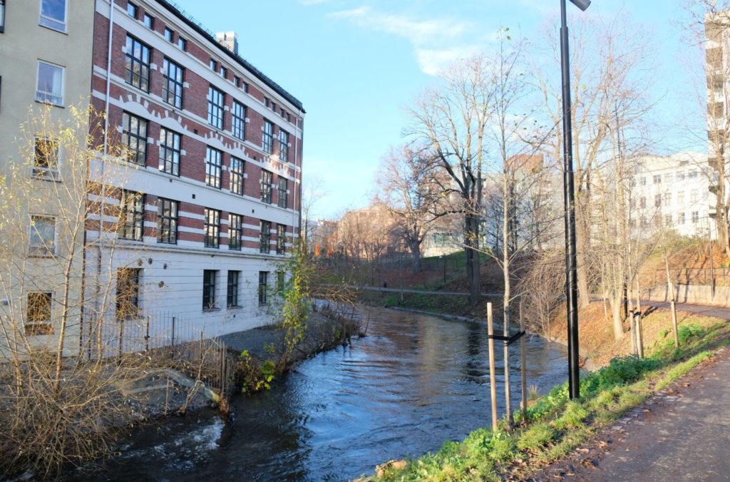
Vøyens Bomuldsspinderi
South of Beierbrua is the textile giant Vøyens Bomuldsspinderi, founded by Knud Graah. The textile factory started in 1846 and lasted until 1955. At the time the river had colour in it due to the cloth dyeing. Even the rates were green, blue or purpose. If you go down the stairs on the west side of the river you can feel the splash from Nedre Vøyenfallene.
Part Four: Øvre Grunnerløkka
Grunerlokka was named after the mint master Friedrich Gruner who owned Nedre Foss Mill. Grunerlokka was incorporated into Oslo in 1858. Before it became part of Oslo, a neighbourhood of affordable wooden houses was built here called “New York”.
From 1861 the land was sold off to be developed.
The district became an immigrant district, and many of the Jews who immigrated at the end of the 19th century settled here. Most immigrants came from Nordic countries. In recent times, it is Pakistanis and Turks who left their mark on the district. Grunerlooka has also always been popular with artists, and Edvard Munch lived in both Fossveien 7 and Thorvald Meyers gate 48 (now Shous plass 1). In the latter he painted Sick Child and Spring.
Sannerbrua
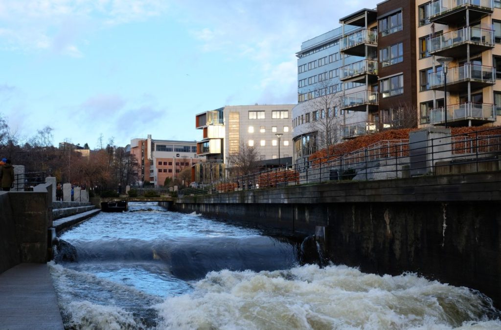
Discharges from factories and sewerage made the river a stinking puddle. It was the worst in the summer. It was not so bad on Sundays when the factories weren’t operating. It got so bad that the conservatives in 1915 proposed to put a lid on the river was a river when it should be a smile. That same year, the city council decided that the river should be cleaner and there should be parks. During the cleaning strikes in the 1920s the bins were emptied into the river and as late as 1962 there were 71 outlets from the public sewer system into the river.
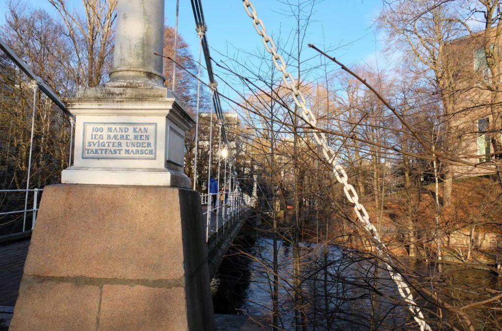
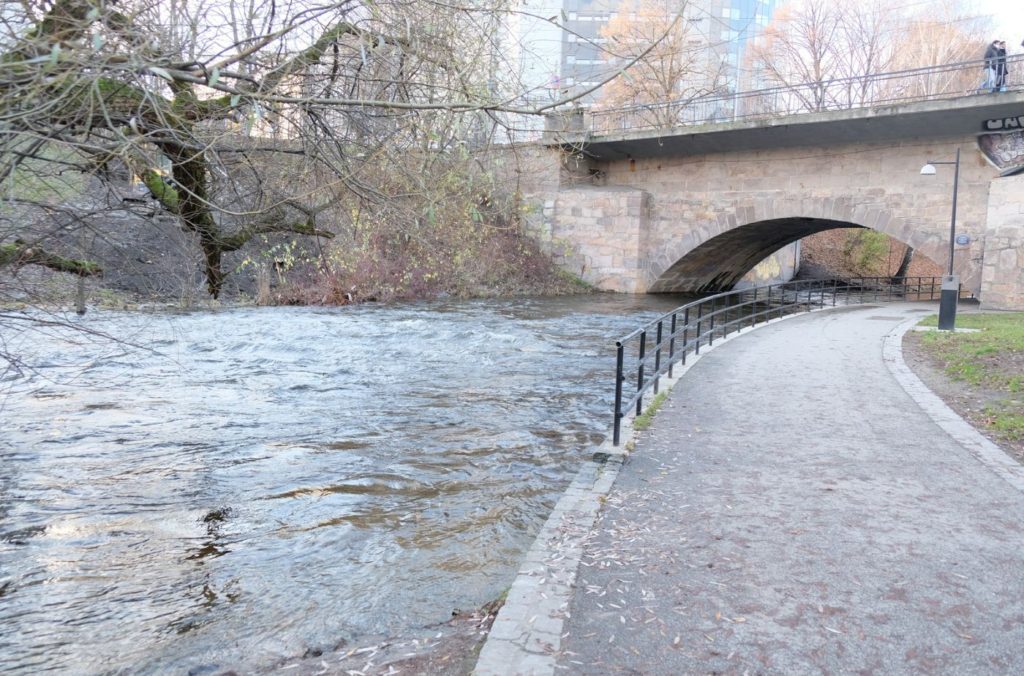
Åmot Bridge
Suspension bridge from 1851. Was moved here in 1952. On the bridge we find the inscription “100 men I carry, but fail during steady march”
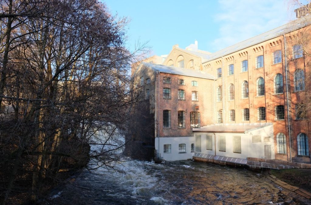
Christiania Seildugsfabrik (Seilduken)
The canvas was one of the largest workplaces along the river, founded in 1858. The factory produced canvas and ropes, and people made a pilgrimage here to look at the building – which was described as the second largest after the castle. Today the Oslo Academy of Arts has moved to the plot, and if you take the hill up by Åmot Bridge, you find the college patio.
One of the best preserved industrial plants. The factory made sails for sailing ships but gradually expanded to fishing equipment, nets, ropes and sacks. It was established by Ole Hauge. Most of the employees were women and the working conditions are among the worst in the entire city. In 1908 there were 900 employees here. Production was discontinued in 1960 when there was overproduction of textiles in the world.
In 1999, the buildings were given to the Oslo Academy of Arts.
Akers Mek. Verksted
On the site by the factory is a small half-timbered house by the river. This was the Akers Mek. Workshop in 1841. Eventually the business moved to Pipervika.
The founder was War Captain P.S. Steenstrup, who owned the factory until his death in 1863. He was the master of Norway’s first steamship, D.S. Constitutionen. He had built Carl Johans Shipyard as the navy’s main shipyard.
The company moved by the Oslofjord in 1854 and grew into a shipyard.
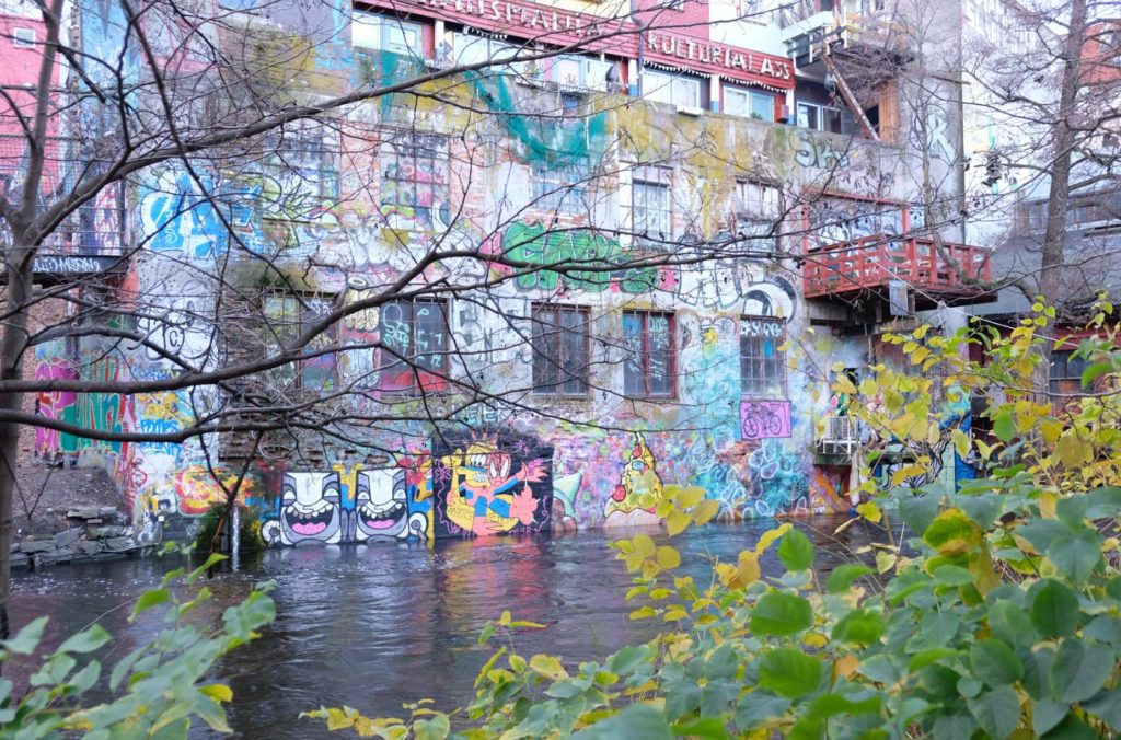
Kuba
There are different views about the origin of the name Cuba, but one of the theories is that the name can be seen in connection with the wooden houses called “new york” further down. It is a large circular square on the west side of the river that used to have a giant gas bell owned by Oslo gassverk. For a long time, gas was the competitor to electricity, and gas was used in street lights. Gas was produced by heading up coal, and therefore there is a lighthouse here. The gas bell has been torn down, but the lighthouse is restored and has re-emerged as a café.
Christiania was the second city in the Nordic region to have its own gasworks after Christiania. The municipality took over the gasworks in 1878. The gas plant improved the city’s street lighting, but it was also in demand for indoor lighting in factories, institutions and in prosperous homes. When electricity came, gas was outcompeted as an indoor light source. For private space heating, gas was of little important. When the gas burner came for cooking in 1890s, gas was in demand.
During the 1920s electric stoves became more common and street lighting was electrified. The last gas lantern disappeared in 1929. The company continued because many businesses preferred to use gas in production rather than electricity because gas heat was quicker. However, the gasworks was closed in 1976. The old office building in Storgata has a historic sign on it.
The Silos
This belonged to Bjølsen Valsemølle and was completed in 1953. In an architectural competition in the 1980s it was proposed to turn it into a hotel, but it was taken over by the student organisation and turned into a student house. In 2002 it received the Oslo City Architecture Prize. If we look through the window in the first one, we can see a tram – this is what the grain tram looked like.
Part Five: Nedre Grunerløkka
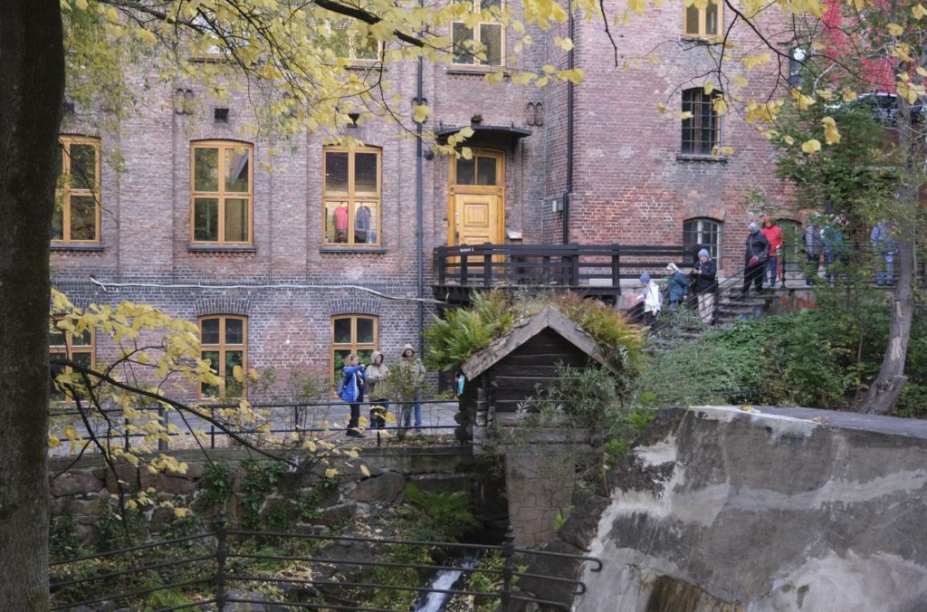
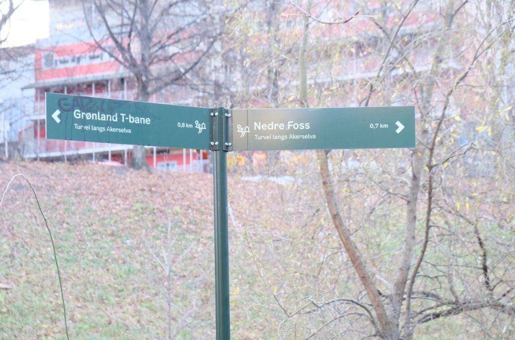
Nedre Foss
From ancient times the boats went all the way up here. Today, only the fish take the route at Nedre Foss. There are traces of what is perhaps the country’s oldest mill operation. The monks from Hovedøya had a mill here, which was later taken over by the King at the Reformation in 1537 and then went by the name of the King’s mill.
The farm was owned by Hovedøya monastery and was well located for business since the only bridge over Akerselva was here. A fee was charged for crossing the bridge until 1865. The king took over the farm during the Reformation in 1537 and in the early 17th century instructed farmers to cut timber and drive it to the rising saw at Nedre Foss. The farm was called “Kongens Mølle”.
Salmon went up Nedre Foss and the fishing provided income to the farmer.
The farm was subdivided in 1668 and after that Fredrik Gruner bought the farm. His surname gave name to the neighbourhood. The family owned the property for extended periods of time. In 1801, farming was largely discontinued. Plans for dredging the river and establishing a harbour at Nedre Foss were discussed in the 1840s and 1850s. In the 1850s, Gruner subdivided 53 plots of land 30 metres south of the farm, and the wooden building known as ‘New York’ was built.
The silo was in operation until 2000.
A mill has been here since before the 1200s and mill operations took place here until 1985. The main building from the farm remains – it was restored and opened in 2017 as a restaurant, but later that year parts of the building were damaged by fire.
Nedre Foss Park
Here you’ll find Grunerløkka’s oldest building. The main building is from 1802, however there has been a farm here since the Middle Ages when it was owned by the monastery on Hovedøya, later by the Gruner family, and most recently by Bjølsen Valsemølle. There has been mill operations since the 13th century until 1985. The municipality bought the areas by Nedra Waterfall to build one of Akerselva’s greenest areas.
Grunerhagen
The Gruner family, who gave the name to the area Grunerlokka, laid out a legendary garden on the east side of the river. They found a pond, terraces, gazebos, fruit trees, geese and peacocks. The garden was private and surrounded by a fence. Today only the name survives.
The family laid out the garden in the beginning of the 18th century as a magnificent garden. The park had terraces, avenues, a pond with gazebos on stilts and a zoo with peacocks, geese and turkeys. There are no pictures of the old garden. The park was completely redesigned in the middle of the 19th century. When Edvard Munch lived on Fossveien and made pictures of the park there was still a pond. In the early 20th century, the park was dilapidated. During the war it was used for growing food. In 1986 a real estate company wanted to build offices, hotels and homes in the area. After major protests from the residents, through a state zoning plan for Nedre Foss, the park was preserved.
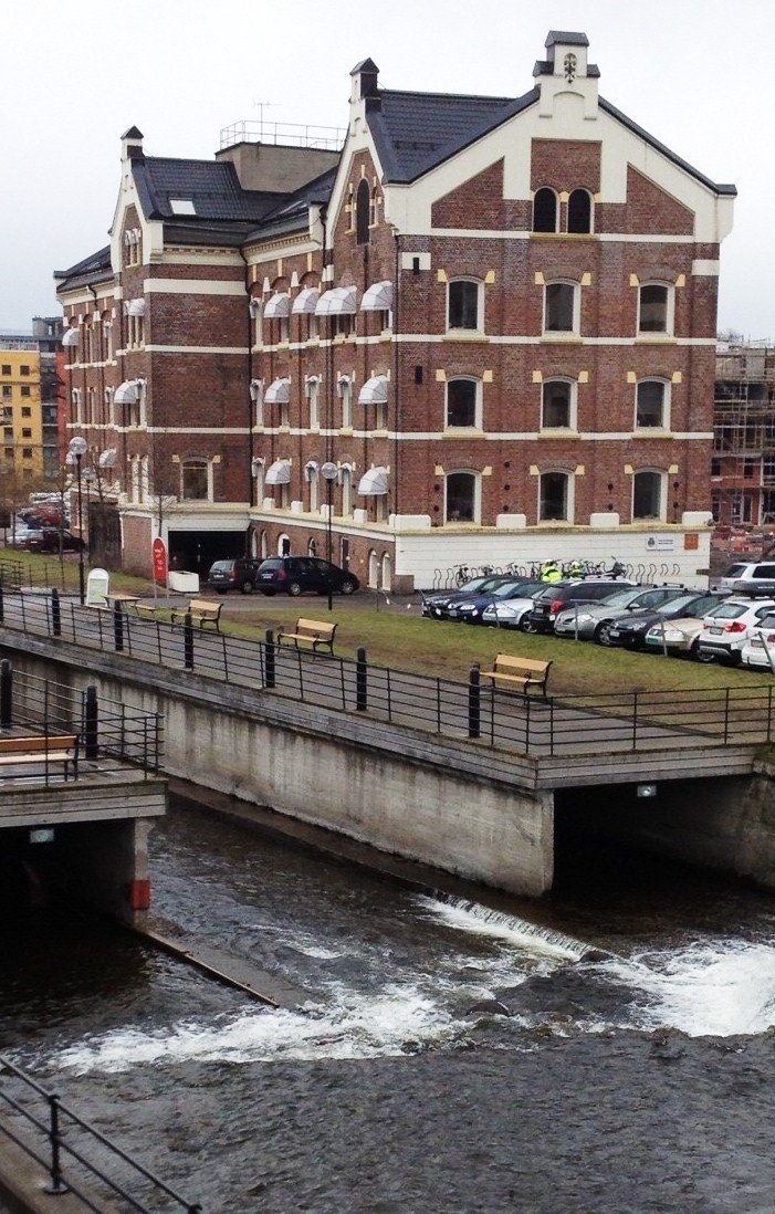
Vulkan & Mathallen
Vulkan Jernstøberi was built by Akerselva in 1873 and was a pioneer in Norway in the production of steel bridges. The old area now has hotels, restaurants, the Dansens hus, the School of Communications and Mathallen Oslo which moved here in 1908.
Former industrial area. In 2013-2014 the area was transformed into a business and residential area. In earlier times there was a sawmill here. The sawmill closed in 1840. There was also a cement factory, brickworks, veneer saw and chair factory here, as well as Oslo’s first publicly available shower path.
In 1873, Vulkan Jernstøberi took over the site. They specialised in steel bridges for railways and roads, but also had other assignments, such as the dome at the old Colosseum cinema. It closed in the late 1950s. The buildings were then rente dout for various business and office purposes.
The redevelopment has been praised with several awards for the way the old industrial area has been redeveloped.
Grunerbrua
Akerselva’s oldest bridge was where Grunerbrua is today. Until Vaterlandsbrua was built in 1654 this was the only connection between east and west. Before the bridge was called Frysja Bridge, Akers Bridge and Møllebroen. Today th ename restifies that the Gruner family owned the bridge. You used to have to pay tolls to get to the city, and this was the only bridge over the river. Battles took place here during the civil war.
Christiania Bryggeri
For a time, the city had many breweries and beer was promoted as a healthy drink. The Christiania brewery was located at Maridalsveien 3, where the city archives are located today.
Ved Brenneriveien
One of the city’s popular concert venues, Blå, is located on Brenneriveien, and on Sundays there is a market with arts and crafts. Right by the bridhe someone has put up the sign “Ingens gate”. On the opposite side we find a curved building that once housed Indigo, Akerselva’s Klaedesfabrik, which engaged in cloth dyeing, and further down is the Hausmania culture house.
There are older industrial buildings on both sides of the street. The left side has a huge complex that used to be a brewery and food factory from 1855 to 1972, later small industry, cultural activities and offices. At number 9 there has been a textile factory since the mid 1850s,
The street is known today for its concerts, markets, and bars.
Norwegian Design & Architecture Centre
Oslo’s oldest transformer station. Today it has exhibitions on design and architecture.
Jakob Church
The only listed church in Oslo that is not a medieval church. Consecrated in 1880 and is located in the former Ankerløkken cemetery, which was a cholera cemetery. The church was threatened with closure in the 1980s, but has remerged as a cultural church.
Ankerbrua
Named after one of Oslo’s richest families, the Anker family, but is also called the adventure bridge. The bronze decorations from 1937 are made by Dyre Vaa and taken from Norwegian folk tales.
Part Six: Vaterland
Vaterland is a district. The name comes from the Dutch Waterland and can refer to the water-stretched land at the mouth of Akerselva. Dutch schooners docked here to load timber in the 17th century. The first settlement here was older than Christiania, but the suburb was burned by the governor in 1658. After the construction of Vaterland’s Bridge in 1654, it was an important gateway to the city.
Vaterland was a centre for peasant trade and also became a place for pubs, brothels and prisons. Vaterland was the scene of organised crime well into the 20th century. Most of the buildings in the area were demolished from the end of the 1950s in connectionw with the construction of the metro between Tøyen and Jernbanetorget. Today many big buildings are at Vaterland and a lot of the old part of the district is gone.
Nybrua
Here people had berths, but in the 1960s everything was levelled with the ground and the lower part of the river laid under a lid. The boat people were moved to Hovedøya and the old buildings were replaced with high-rise buildings and traffic machines. It’s like Vaterland had ever been nice. Nybrua was built in 1827 because King Karl Johan demanded a finer for the entrance than the previous bridge. The emergency room is located here.
Hausmannsbrua
Named after Lieutenant general Fredrik F. Hausmann. The bridge is a cast iron bridge from 1892 and is worthy of protection and equipped with ‘iron lace’. It was built exceptionally solid because the city had procured an 18-ton modern steamroller that required a strong bridge. When the bridge was expanded to five lanes in the 1980s, they managed to copy the decoration and retain the bridges appearance.
Vaterlandsbrua
Everyone who came from the east of the city had to go over Vaterlandsbrua. Over Vaterland went one of the towns oldest bridge connections, and the first Vaterlandsbrua was built in 1654. Earlier was the city’s sewer lines, and when Christiania’s first sewer line launched in 1846, no one found that it was sent out to Vaterlandsbrua. The sludge led to a fermentation process so that gas bubbles formed on the river surface, which the kids lit to make bangs or so-called gunpowder bits.
Vaterland Park
Here you’ll see the bust of Olafia Johannisdottir (1863-1924), an Icelander who lived and worked as a slum nurse among prostitutes and the poor in Vaterland until her death.
Here the river enters a 500m long tunnel before it appears again by the sea. There used to be two more bridges down to the river, but today they are just a memory.
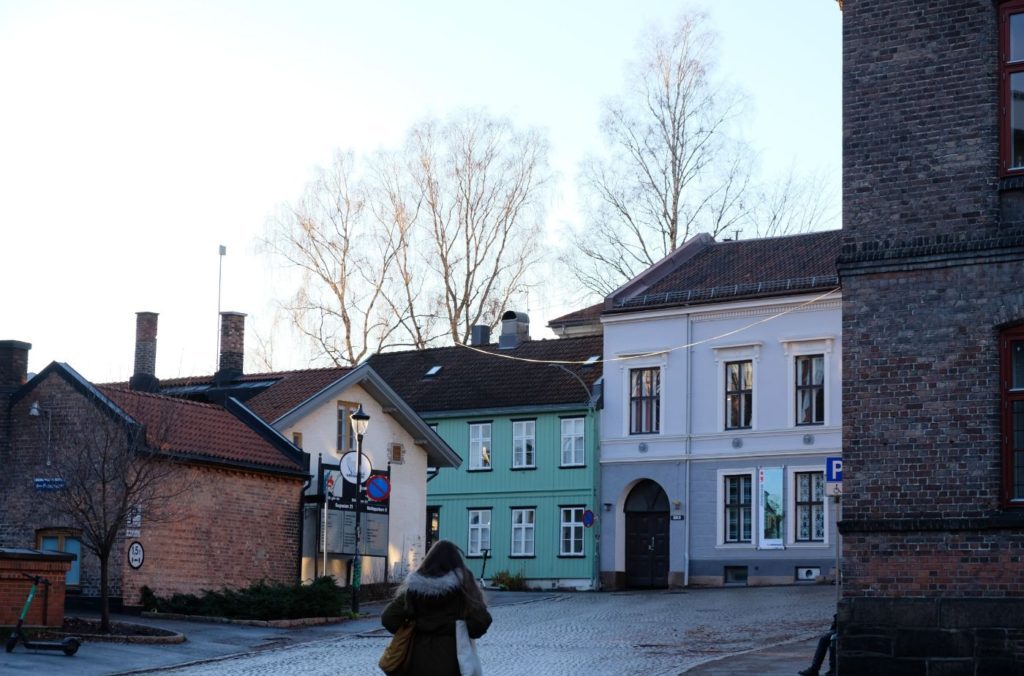
Brugata
Brugata was Christiania’s access road from the east and north after the construction of Vaterland’s Bridge in 1654. Peasant farms were built here, and some can still be seen today. The western part of the street is today dominated by restaurants, immigrant shops, and a shopping centre.
Number 3 Is Teddy’s Soft Bar, which opened in 1958. In the backyard you can see the remains of a peasant farm that was probably built in the middle of the 18th century.
Brugata 6 was a farm built in the 1760s.
Brugata 9 is Den Røde Mille. The house is from 1870 and it is built on the foundation of a house that stood there in the 18th century.
Number 14 is a half-timbered house from the end of the 18th century. It used to have a guest house on the ground floor.
End of the Walk
The walk ends at Brugata, where you can turn right off the river and make your way into the city. Brugata is only a couple blocks from Oslo Central Station.
I hope you enjoyed this beautiful walk down the Akerselva River! Let me know in the comments what you think about the walk.
Oslo Travel Guide
You can find a detailed overview of Oslo, including practical, historic and travel information on our dedicated travel guide page.