
Description
Download the road-trip guide for the Rv41 from The Finnish Border to Tromsø on the E8
The E8 Road-Trip Guide comes with:
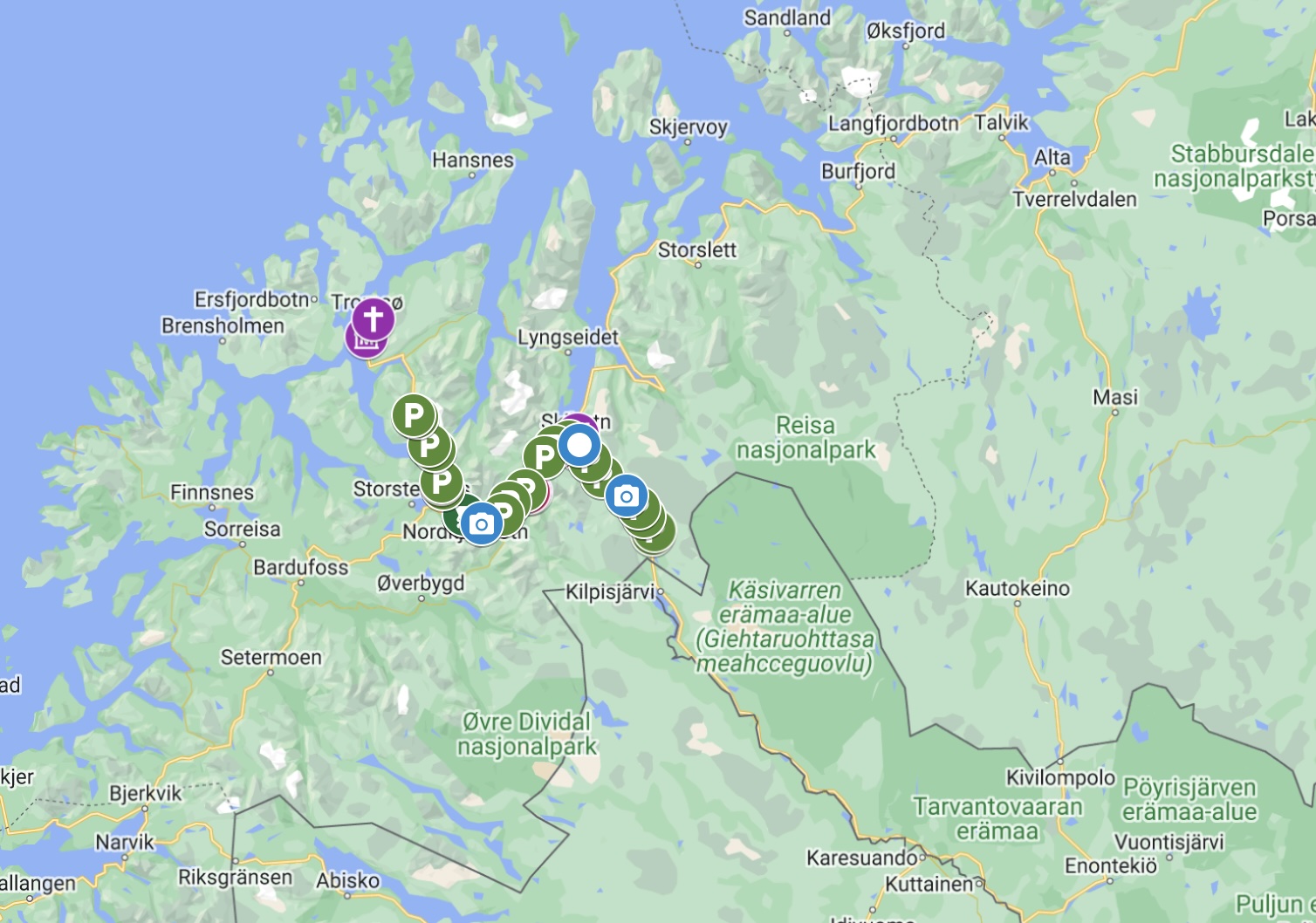
- Free interactive Google Map (with every place mentioned in the guide marked with an address) that can be loaded into your GPS, making finding that stave church or petrol station much easier.
- Detailed overviews of all the major points of interest on the road.
- Practical information (cafes, dining, museums, toilets, petrol, road-side rest areas, detours, alternate routes)
- Historic, modern and practical information for every city, town, village, and farm you pass through
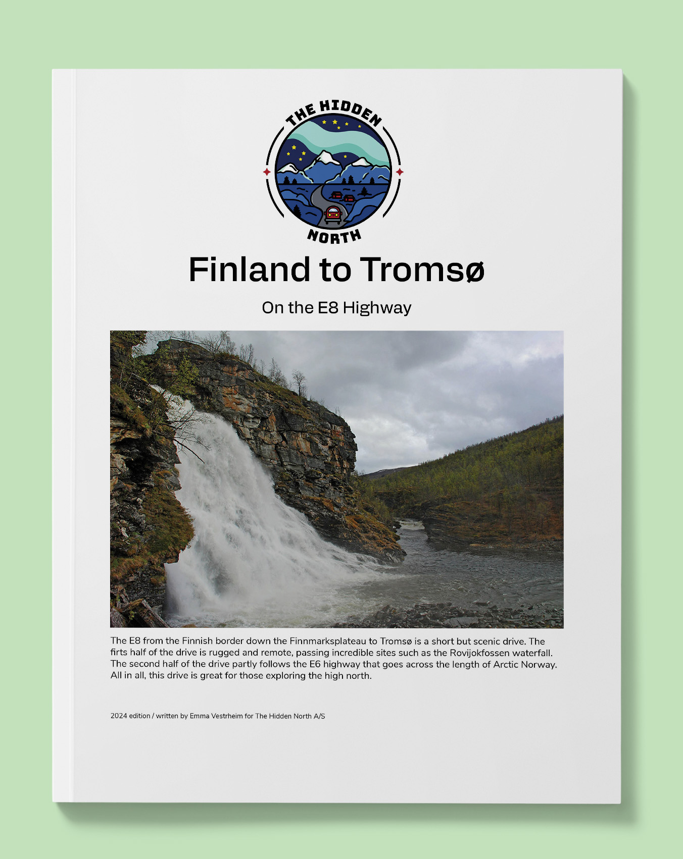
- Modern and historic images of all the major points of interests
- Distance between points (in kilometres and miles)
- QR code & interactive links to museum websites, relevant pages on our website, ferry timetables, and more!
Distance: 188km /117 miles
Reviews
There are no reviews yet.