Gaularfjellet is a mountain area that separates the traditional regions of Sogn and Sunnfjord. The mountains reach as high as 1,615 metres. The tourist road has been open since 1938 and is very popular because of the rapid transition from fjord to mountain. For many, though, it is still a well-kept secret as it is not as popular or well-known as the other tourist roads.
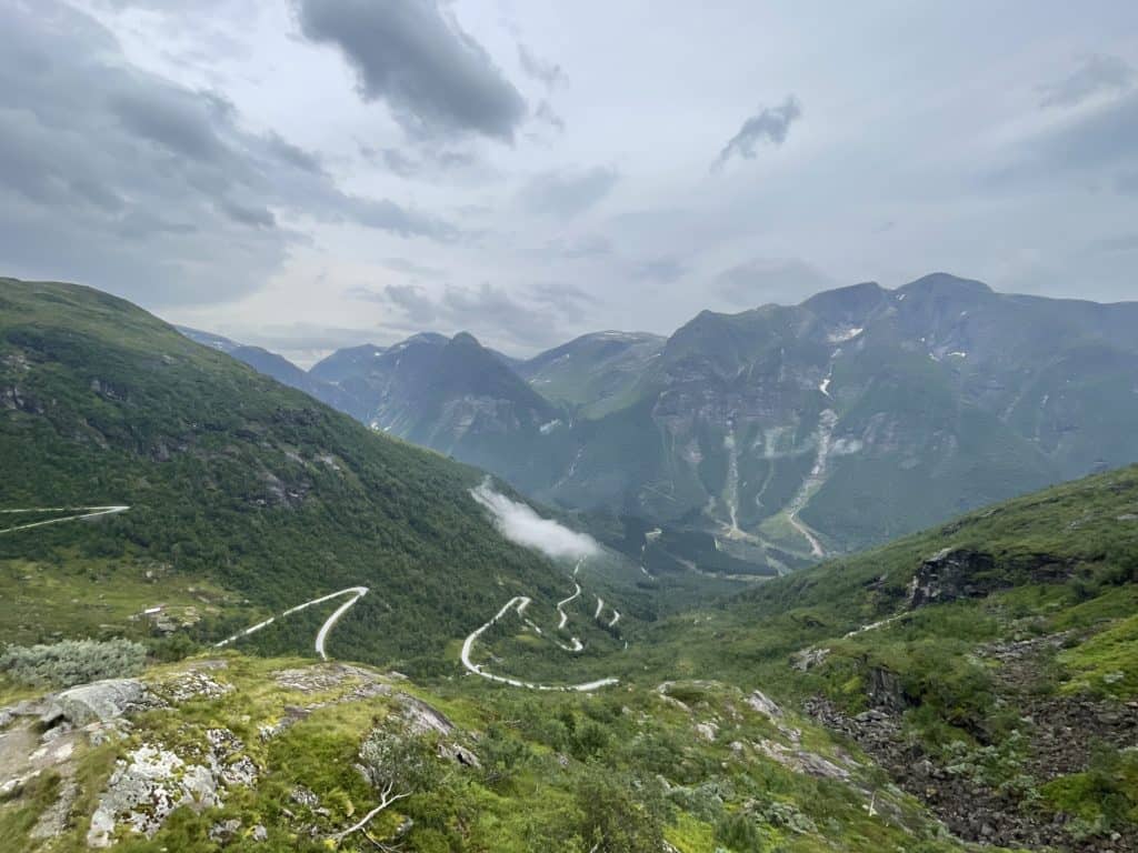
The road was established as a tourist road because of its high number of waterfalls but also the engineering that went into building a road over the mountains.
We decided to do this drive after heading to Balestrand for the day from Bergen. This tourist road isn’t as talked about as the others that I’ve been on, so I was curious to see exactly what it was like. I must admit – it was pretty neat! It’s not as spectacular as, say, Trollstigen or Hardanger, but there’s something charming about this tourist road. Maybe it’s because no one really knows about it. It’s much shorter than the other tourist roads, but in that short amount of time you’ll see some spectacular country.
Our premium version of this guide makes driving around Norway much easier! The printable guides come with:
Specific information about driving times, travel distances, and ferries
Detours to historic or unique attractions or hikes and walks to enhance your trip
Information about facilities along the way, including petrol stations, supermarkets, hotels, campgrounds (with RV parking) and museums
Historic overview of the road and regions
Interactive Google Map link with directions, points of interest, and practical stops
Watch on Youtube
All of our roadtrips are available on YouTube to watch. They include information about the area provided in text and voiceover form, plus they show the drive in full (sped up in some spots!) so you can get an idea what the drive is like.
The drive: Gaularfjellet Tourist Road
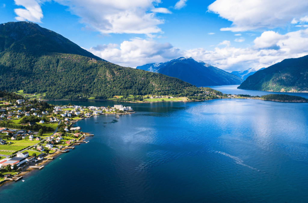
Balestrand
This drive begins in Balestrand, a scenic tourist town by the Sognefjord.
Located just outside Balestrand, Dragsvik is a resort hotel and ferry pier. The ferry connects the settlement to the other side of the Sognefjord. The hotel has both cabins and rooms, and they provide lots of information about hikes in the region.
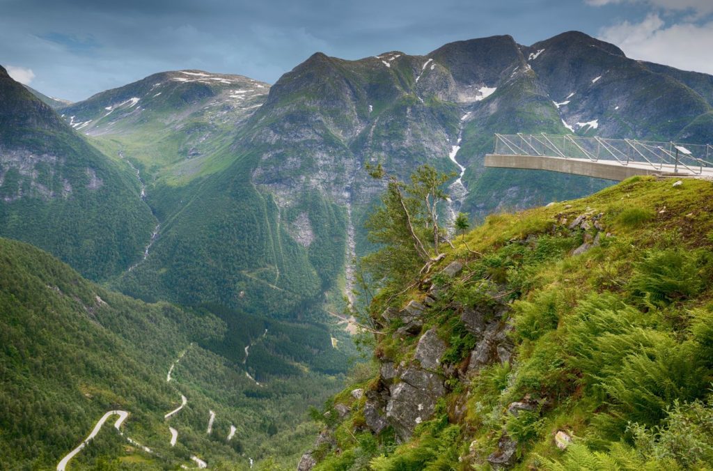
Gaularsfjellet Viewing Platform
Photo stop
The viewpoint opened in 2016. The viewpoint is a construction that has three ‘wings’ where you can take in unobstructed views over the mountains. There’s also a restroom here.
Sunnfjord Municipality
Sunnfjord is a traditional district and municipality. The central geographic characteristic of the region are the fjords and outdoor activities, including fishing, white-water rafting, and glaciers.
Førde
Førde is a town built up around the river Jølstra at the point where it flows into the Førdefjord. The town is surrounded by mountains, as we can see. Around 10,500 people live in Førde, making it a relatively large town for the region. There are schools at all levels here, as well as a major hospital. There is also a small airport.
Førde is an administrative centre, so it has all the facilities for the surrounding area. The town does have a slight industrial feel; it has often been voted by Norwegians as one of the ugliest towns in Norway. This is mostly due to the neighbourhood of Øyrane, which sits on the fjord by the river and was developed as a shipyard in the 1970s.
Førde is located on the E39, which links Bergen to Ålesund. We have written a guide to the drive from Bergen north along the E39, which you can view below.