Facilities including supermarkets, toilets, petrol, hotels, cafes, restaurants with addresses.
Watch on Youtube
All of our roadtrips are available on YouTube to watch. They include information about the area provided in text and voiceover form, plus they show the drive in full (sped up in some spots!) so you can get an idea what the drive is like.
North Cape Tunnel is an underwater road tunnel that runs between the island of Magerøya and the Norwegian mainland. The total length of the tunnel is 6.8km and it goes 212 metres below sea level. The tunnel opened in 1999, replacing a ferry that used to operate in roughly the same spot.
The tunnel has cold gates at each end that keep the cold out in the winter. This is done to prevent ice formation in the rock walls, and the gates open automatically when a car is approaching. The gates remain open in the summer.
Kåfjord
Fjord
Kåfjord is a fjord and small village located just after the tunnel. This is where the ferry used to leave before the tunnel was completed.
Repvåg
Village
Repvåg is a tiny fishing village located on the side of the highway. Historically it was an important fishing and trading place in Finnmark, especially during the Pomor Trade with Russia. Several settlements from the Stone Age have been found here. Today the village only has around 14 residents.
There is a large beach outside the village called Stranda, which used to have a large coastal Sami population and is the last area in the municipality that is still characterised by some coastal Sami culture. Today only some of the residents speak a Sami language. The beach has a number of important cultural monuments, hunting pits, graves and tufts.
Hammerfest
On the right you will pass the right-turn that will take you to the Havøysund Tourist Road, one of Norway’s 18 national tourist roads. That drive has been covered in a separate article, which you can view below.
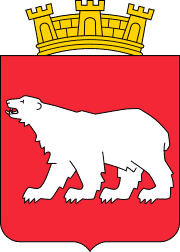
Hammerfest is a large municipality in Northern Norway. The main town is Hammerfest, which is located off the mainland on the island Kvaløya. The coat-of-arms depicts a polar bear, which was chosen as the symbol for fishing in the polar seas in Northern Norway.
Skaidi
Village
Skaidi is a small village and major traffic hub in Northern Norway. In the 1940s, the Skaidi Mountain Lodge and Station was built. Today it’s an important point to stop if you need a rest on the long road journeys.
Here you’ll find a petrol station, various electric car charging stations, a cafe and a hotel.
Repparfjorden
Fjord
Repparfjorden is a fjord located southeast of the island Kvaløya, where Hammerfest is. The fjord is quite shallow with an average depth of 40-60 metres and a maximum depth of 123 metres. There are strong currents at the bottom of the fjord.
Mining used to take place in this area for copper. The deposits were found around the year 1900 and between 1972 and 1978 Folldal Verk (the mine near Røros) ran the operations. More mining is planned in the area, but it is meeting protests by the local community.
Kvalsund
Village
Kvalsund is a small village and former municipality in Finnmark. It was its own municipality until 2020, when it was merged with Hammerfest. The name directly translates to the whale strait, refering to the whaling that used to take place in the area. The name of the island Kvaløya means ‘whale island’.
The village used to be known as “Finnbyen”, referring to the Coastal Sami settlement in the area. Until a few hundred years ago, the Coast Sami culture was completely dominant in Kvalsund. Norwegian and Kven immigration soon made the area multicultural, and during the ‘Norwegianisation’ process of the late 19th/early 20th century, most of the culture was lost. One of the only villages to still have the Coastal Sami culture is Kokelv.
Kvalsund is one of the areas in Finnmark county with the most cabins that are especially used by people from Hammerfest. There is good salmon fishing in the fjord and there are nice hiking trails in the area.
Kvalsund Bridge
Bridge
The Kvalsund Bridge is a suspension bridge over the Kvalsundet strait, linking the mainland to the island of Kvaløya. The bridge is 741 metres (2,431 ft) long and has 11 spans. It is the northernmost suspension bridge in the world.
Rypefjord
Village
Rypefjord is a village just outside Hammerfest. The village is considered more of a suburb of Hammerfest because of its proximity to the city. You’ll find a lot of industry here related to the LNG plant just off Hammerfest but also the fishing industry.
Hammerfest
We have made it to the city of Hammerfest! Hammerfest is the northernmost city in the world with a population over 10,000 people. The town has an ice-free harbour and is regarded as one of the oldest cities in Northern Norway (along with Vardø). People have been living and trading here for hundreds of years. Hammerfest rose to prominence in the 18th and 19th centuries due to its proximity to the Arctic hunting areas.
On The Hidden North you’ll find a travel guide for Hammerfest including a detailed historic overview.