
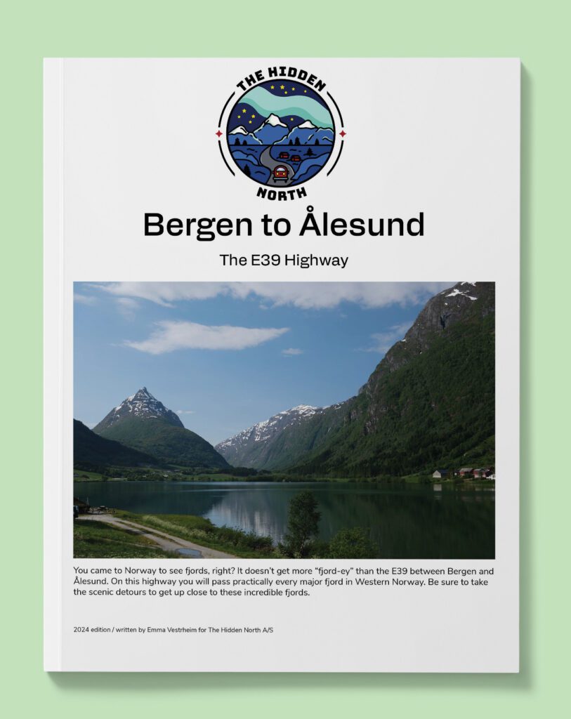
Drive it Yourself: Bergen to Balestrand on the E39
This drive really grew out of boredom. I was tired of always doing the same road out of Bergen. Follow the E16 towards Oslo. Surely there’s more to Bergen than that!
The area north of the city always felt like a mystery to me, and it was one I wanted to explore.
Balestrand, on the other hand is a place I knew very well. I have met many travellers who have passed through Balestrand as an alternative to touristy Flåm, and they loved it. I was curious – what was Balestrand like? Was it was amazing as I was hearing?
So off we go. Exploring the hidden north above Bergen before visiting one of the most popular fjord towns in the country.
This drive was a delight. It’s so diverse and so scenic. The best part is that it doesn’t get crowded with tourists.
Be sure to combine it with the Gaulafjellet Tourist Road.
In this article...
Download this Guide
All of our guides can be downloaded via our online store.
We offer downloadable versions of our self-guided drives on our online store.
Online Guide
- Information about points of interest
- Images of each point of interest
- Historic overview of the neighbourhood
- Directions between points
- Historic photos
- Information about facilities along the way
Downloadable Guide
- Information about points of interest
- Images of each point of interest
- Historic overview of the region & towns
- Directions between points
- Historic photos
- Facilities including supermarkets, toilets, petrol, hotels, cafes, restaurants with addresses.
Watch on Youtube
All of our roadtrips are available on YouTube to watch. They include information about the area provided in text and voiceover form, plus they show the drive in full (sped up in some spots!) so you can get an idea what the drive is like.
The drive: Bergen to Balestrand
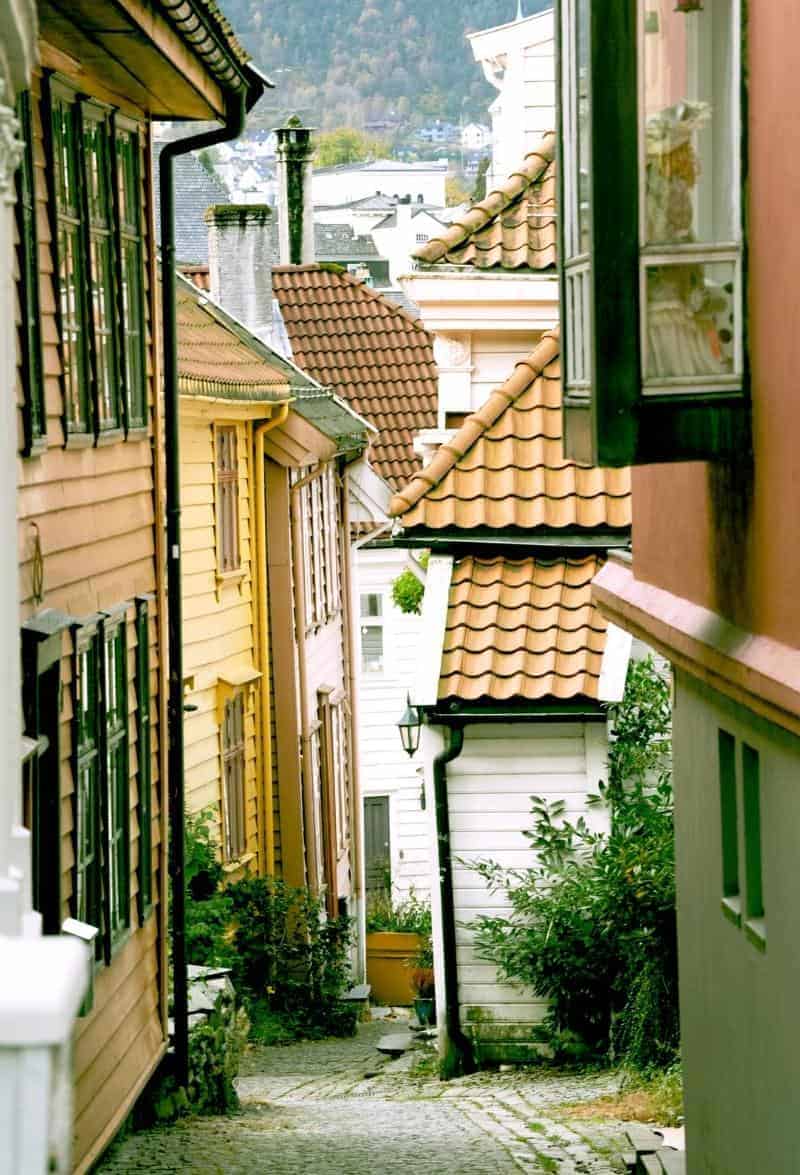
Bergen
This drive begins in Bergen, the second-largest city in Norway. You can read our detailed guide to Bergen via the button below.
Nordhordland Bridge
Bridge
The bridge that we are going to cross first is the Nordhordland Bridge, a combined cable-stayed and pontoon bridge. It is 1.6km long. Plans have existed for the bridge since the 1960s, but it wasn’t funded until 1989. Construction started in 1991 and it opened in 1994. The bridge is the second-longest in Norway.
The floating section is a steel box girder bridge with ten pontoons, and it is like this because of the fjord’s depth. The fjord end of the main span is supported by a 30m (98ft) deep foundation, where the two bridges meet. It is the second pontoon bridge to be built in Norway.
The European Highway 39 is sometimes referred to as the coastal highway. It starts on the south coast of Norway, close to Kristiansand, and then follows the coast all the way up to Trondheim. There are many ferries along the road because the road practically hugs the coastline.
Alver Municipality
Alver is a municipality just north of Bergen. Mongstad is Norway’s largest oil refinery, owned by Equinor and Shell, and is in the municipality. It is important to the business life here. Petrol, diesel oil, jet fuel and other products are produced at the factory and then sent abroad.
Knarvik
Town
The town we can see is Knarvik, the administrative centre of Alver. The E39 runs right through the middle of the village, cutting it into two. On the north is the Knarvik Senter, the largest shopping centre in the region. The southern part is older with its original buildings and shops. Knarvik has schools, a church, and an active community. The Knarvik upper secondary school is one of the county’s largest.
Before the 1970s, the community didn’t have more than 30 people in it. However, the council decided that Knarvik should be built up as a regional centre, and this caused the population to grow quickly. Because of this, Knarvik isn’t a very historic town, and the city centre does look a little 1970s. Now they are redoing the road, so it’s going to look like a messy construction site.
Masfjorden Municipality
Masfjorden is a small municipality around the Masfjorden (a fjord). The entire municipality has a population of around 1,630 people. Masfjorden is an industrial municipality with construction, power, and water companies. There are large hydropower resrouces here because of the mountains and high rainfall.
Matre
Town
Matre is a small village with around 100 people living here. The Institute for Marine Research has a research station here. There is a fantastic museum here called the Bjørn West Museum, which shows the resistance struggle during World War II.
Gulen Municipality
Gulen is a historic municipality. In historic times, the region was strategically located to both Hordaland (where Bergen is) and Sunnfjord (close to Ålesund). This was also the starting point for sailing into the Sognefjord. Finds from the Stone Age, Iron Age and Bronze Age indicate that this area has been used for thousands of years.
In Gulen was the Gulatinget, a place where chieftains and farmers from Western Norway gathered to settle legal disputes and pay homage to Norwegian hereditary kings. The ‘ting’ was established in 930 and the Gulating took place here for 400 years, when it was moved to Bergen. The kings, lords, and landowners met once a year and the hearing was governed by the appointed lawman. The Gulatinget is one of the most important institutions in older Norwegian history. The Gulating Act applied to most of Western Norway, the mountain areas of Valdres and Hallingdal, and the Faroe Islands and Shetland. The Gulating Act was considered one of the freest and most democratic laws in Europe 1,000 years ago. The laws in Norway today are based on the old Gulating laws. It is possible to visit the Gulatinget site today.
Gulen was important in the Christianisation of Western Norway. The first cross stood here before it was moved to the church Håkon Håkonsson built at Kyrkjehaugen. The areas importance eventually declined but remained an important agricultural area for the region. Gulen has many cultural relics from the Stone and Bronze Ages along the coast, and from the Viking Age around Eivindvik. There are also many old stone-built houses.
Otherwise, the municipality is important for agriculture and fishing. Fish farming is especially important to the community. The climate is like Bergen but snowier.
Oppedal - Lavik Ferry
Ferry
This is a short 20 minute ferry trip across the Sognefjord.
Høyanger Municipality
Høyanger is part of the traditional region of Sogn, which surrounds the Sognefjord. Høyanger is known as having one of the first industrial towns in Norway. The steep mountains and rainfall were used for producing hydroelectricity needed for electrolysis. The main product produced here is aluminium.
The Sognefjord divides the municipality and is the fjord you will be following for the rest of the journey. The Sognefjord is Norway’s longest and deepest fjord, reaching 205km long and 1303m deep. The Sognefjord is the third-longest fjord in the world.
Aven
Town
Aven is a small village with around 15 people living here. The name comes from the word ‘vin’, which meant fertile plain in the Viking Age. There has been a settlement here for over 1,000 years but experienced depopulation after the Second World War.
Vadheim
Town
Vadheim is a small village with a population of around 238.
Høyanger
Town
Høyanger is a small settlement with around 1,983 people living there. It is an industrial town with an industrial park. The Høyanger Aluminium Works produces raw aluminium. There is also a car rim factory that supplies rims to the car factory Audi.

Sogndal Municipality
Sogndal is a relatively new municipality; it was a merger between several different municipalities, including the old Balestand municipality. Sogndal is an old place and archaeological excavations show that people have been living here as far back as 700BC. Since ancient times, agriculture has been the most important trade. Fruit, especially apples, has been grown back as far as written sources.
Sogndal emerged as an industrial community towards the end of the 19th century. There has been a matchstick factory here and later a wool mill and then a bottling plant for softdrinks and fruit juices. A hydroelectric plant was built here in 1911 and was one of the first ones to be built in rural Norway.
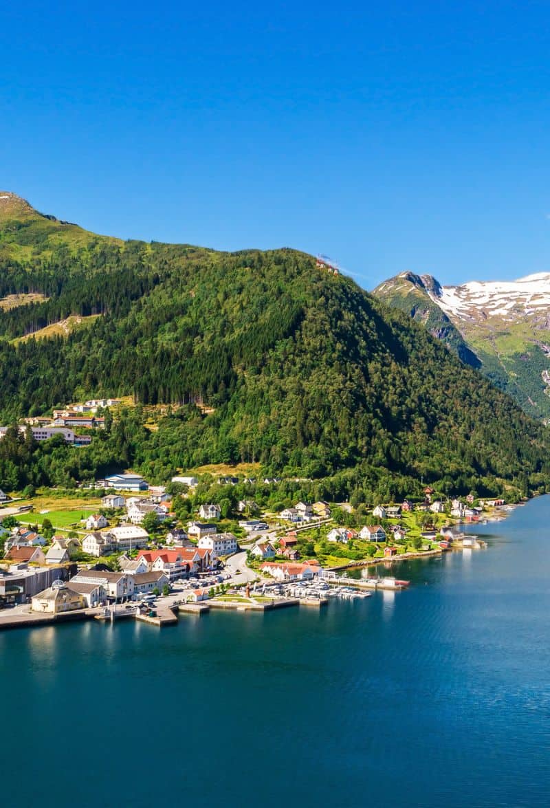
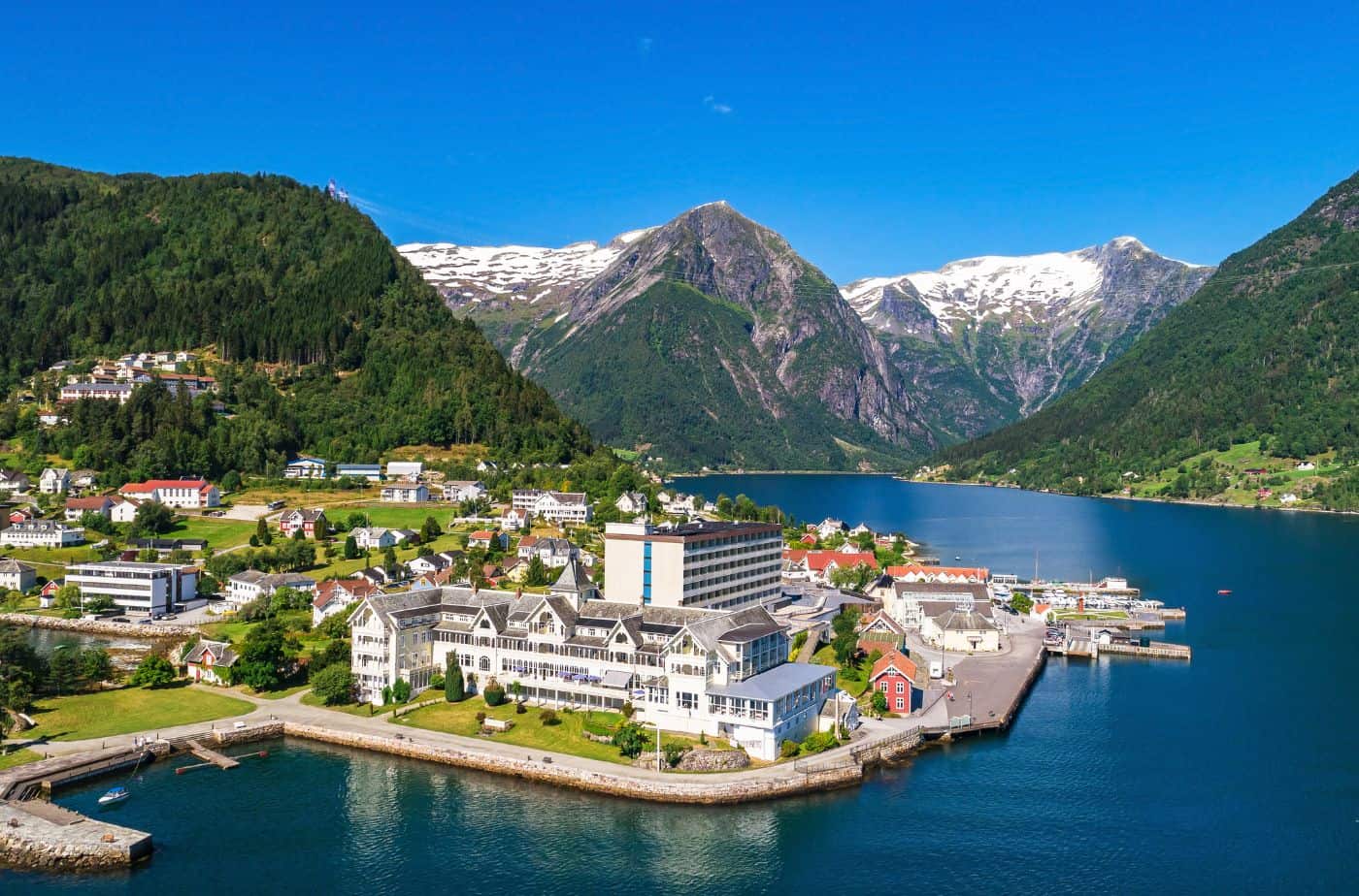
Balestrand
Balestrand is the last stop on today’s drive and a perfect place to spend some time if you want to enjoy the fjords. Balestrand has been a well-known tourist spot since the end of the 1800s.
Balestrand is home to Kviknes Hotel, a historic hotel from 1877. This hotel is where Kaiser Wilhelm II received the message about the outbreak of the First World War. The church has been owned by the Kvikne family ever since it opened. The hotel has 195 rooms.
St. Olafs Church is a well-known wooden church from 1897. It is often known as the English church because one of the English tourists who visited in the 19th century, climbing pioneer Margaret Sophia Green, enjoyed the Norwegian mountains so much that she married the innkeeper of Kviknes Hotel, Knut Kvikne, and moved to the area. Sadly, she contracted tuberculosis and died in 1894. On her deathbed, she told her husband that she had a dream that an English church would be built in Balestrand.
Knut Kvikne allocated a big plot of land close to the hotel and, with the generous help of monetary gifts from two American women, built the church. The church is designed to look like a stave church.
Balestrand is also where you can visit an apple farm called Ciderhuset to go on a tour or buy some cider. There is also the Norwegian Reiselivsmuseum, or the Museum of Tourism in Norway, and the Sognefjord Aquarium. Tours on the fjord and to a nearby glacier can be organised from Balestrand.