

A Self-Guided Walk Around Södermalm
I’ve never been a huge fan of Stockholm. I’ve always found it too big and crowded for my liking. However, every time I visit I find myself liking it a little bit more. Back in February of this year I went to Stockholm to do some research and met up with one of my friends, who lives in Södermalm. She took me on a walk around the neighbourhood and I fell in love. The neighbourhood doesn’t get the crowds that Gamla Stan does, and Södermalm has just as much history.
Södermalm is where you can find beautiful churches, street art, and some of the only remaining wooden buildings in central Stockholm. Södermalm is also popularly nicknamed ‘Sofo’ has it has become a gentrified, hipster neighbourhood.
So, if you want to see Stockholm beyond the ‘touristy’ areas, I strongly recommend this walk.
Here’s my self-guided walk to Södermalm.
Watch on Youtube
All of our roadtrips are available on YouTube to watch. They include information about the area provided in text and voiceover form, plus they show the drive in full (sped up in some spots!) so you can get an idea what the drive is like.
Downloadable Version of This Guide
I offer downloadable versions of my self-guided walks on my online store.
Online Guide
- Information about points of interest
- Images of each point of interest
- Historic overview of the neighbourhood
- Directions between points
- Historic photos
Downloadable Guide
- Information about points of interest
- Images of each point of interest
- Historic overview of the city
- Directions between points
- Historic photos
In this article...
Södermalm, a brief history.
Södermalm is one of the oldest places in Stockholm with roots back to the 13th century, when the city was founded. However, compared to Gamla Stan, which is the oldest settlement in Stockholm and was for the merchants, Södermalm was a workers neighbourhood with factories and accommodation for the lower-middle class. Its tasks involved providing pasture for the citizens cattle but also shipyards and manufacturing businesses.
When Stockholm began to experience a huge population boom in the 16th century, Södermalm and Norrmalm (where the central station and shopping area is today) were incorporated into Stockholm and Södermalm was developed. King Gustav II Adolf was aware of the urban ideals of the Renaissance style and had Södermalm laid out in an organised grid style.
During the industrialisation of the 19th century, Södermalm became an urbanised, working-class neighbourhood.
After World War II, Norrmalm was torn down to make way for modern concrete and glass buildings. Södermalm avoided this redevelopment and remains largely preserved with many of the old buildings still standing.
Södermalm today
Today around 130,000 people live here. Södermalm is considered to be a gentrified neighbourhood with significant shopping and expensive housing.
Södermalm Self-Guided Walk
Note that I have used images from three separate test walks I did – snow in February, sun in July, and rain in October.
Begin: Hilton Slussen or Slussen Metro Station
Today around 130,000 people live here. Södermalm is considered to be a gentrified neighbourhood with significant shopping and expensive housing.
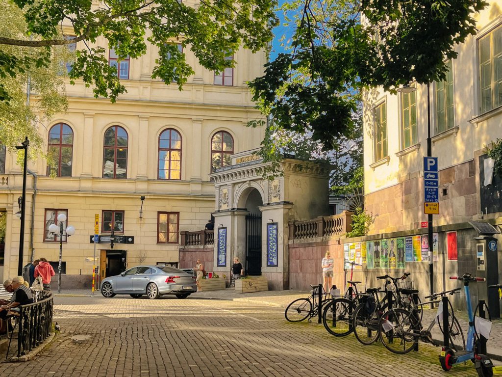
Stockholm City Museum
The Stockholm City Museum is located by the Slussen metro stop. It is a museum that collects, documents, and presents material about Stockholm’s history.
The building is the old Södra Stadshuset, or the Södra City Hall, which was built in 1663 based on drawings by city architect Nicodemus Tessin. The building was supposed to be a centre for merchants, but became a town hall instead.
Götgatan
Götgatan was laid out during the new planning regulations in the 1640s. ‘Götgatan’ means ‘the street lead leads to Gotaland’, Gotaland being a region in the south of Sweden.
Götgatan used to be one of Stockholm’s major cinema streets. A total of 10 cinemas were located here, though not at the same time.
The first cinema was a silent cinema from 1909. Today only two cinemas remain; Victoria (opened 1936) and Gota Lejon (opened 1928).
Part of the street is pedestrianised. The goal is to give pedestrians and cyclists more space to create a safer, more vibrant environment.
Dutch Embassy
The building is an example of a ‘Målmgarder’. This word refers to types of buildings built during the 17th and 18th centuries as manor-like houses used as summer or leisure houses for the nobility and middle class. They were also gardens, where everything including exotic plants and medicinal herbs were grown. The gardens often had a gazebo for outdoor parties. There are only 38 preserved ‘Målmgarder’ left in Stockholm, and most of them are in Södermalm.
Mosebacke Torg
We have made it to Mosebacke Torg, or the Mosebacke Square. The square was laid out after a fire in 1857, when many of the properties here burned to the ground.
The area of Mosebacke has always been associated with entertainment, with inns being built in the 18th century for concerts. Södra Teatern is located here and is a popular theatre in Stockholm.
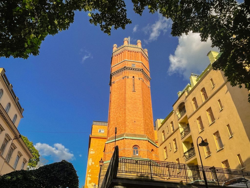
Mosebacke Water Tower
The Mosebacke Water Tower was a water reservoir. It was designed by architect Ferdinand Boberg and completed in 1896.
The purpose of the tower was to increase the water pressure for Katarinaberget’s (Katarina Hill – where we are now) higher buildings in relation to the general low-pressure network. The tower is clad with red brick from Helsingborg, a city in the southwest of Sweden.
Underneath it is the pump house with a coat of arms of St. Erik at the entrance. The tower was taken out of use in 1960. Only the facility under the tower functions as a pumping station, while the tower has been converted from a machinist’s residence to a private residence.

Svartensgatan
The streets oldest name is Fiskaregatan from 1646, but it got its name Svartens gatan in the 1840s. The origin of the name is not completely clear but could come from the church attendant in Katarina Church Johan Anersson Schwart who died in 1674.
The street has several important buildings. There are eight well-preserved houses from the 18th and 19th centuries.
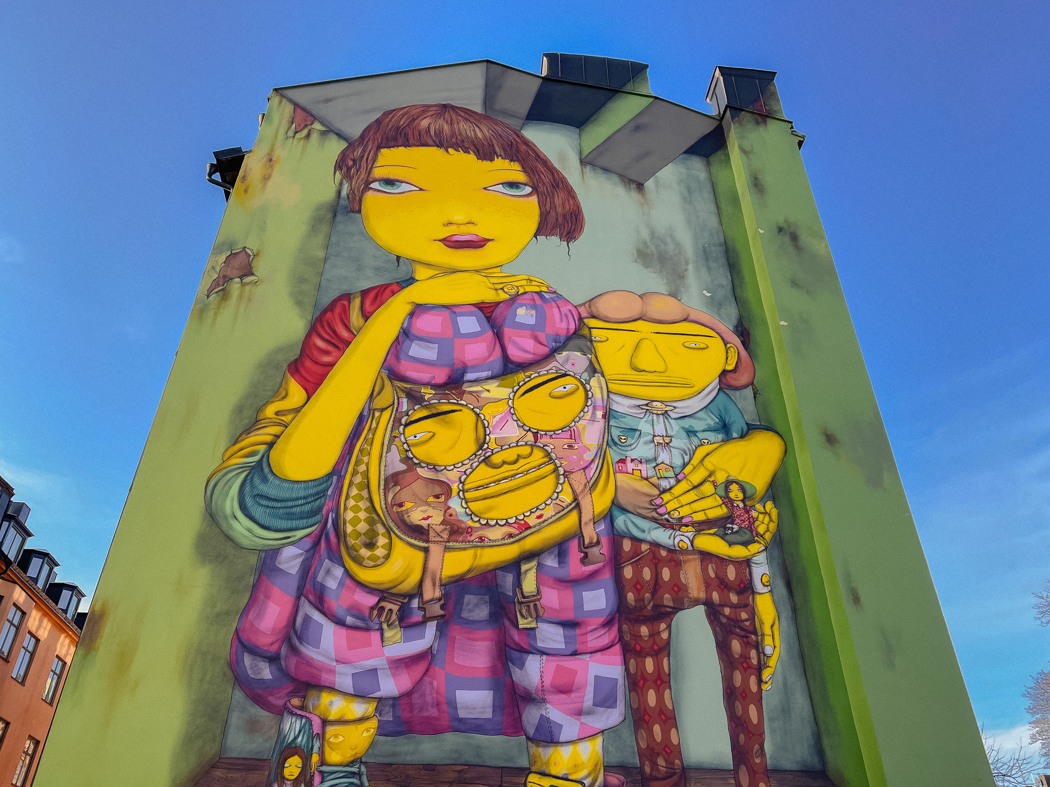
Os Gemeo’s Mural
The work is by the twin brothers from Brazil called Otavio and Gustavo Pandolfo – their artist name is Os Gemeos. The painting is subject to planning permission and according to the decision from June 2017 it may remain for a maximum of five years. After that, the wall will be resorted by being painted over with a neutral tone.
Svartensgatan 32 & 34
Number 32 is the red building, while number 34 is the yellow one. These are two residential buildings from the 18th century. The age of the stone house is unclear, while the wooden house was probably built shortly after the Katarina fire of 1723 and before 1736 when the city banned wooden houses.
The fire of 1723 destroyed 500 buildings (448 of them were wooden) in central Södermalm and badly damaged the Katarina Church. The fire began in a mill. After the fire, they immediately began repairing the church. All the houses in the surrounding area were destroyed. Despite the introduction of a wooden building ban in 1736, the houses on Master Mikaels gata were built of wood.
Drottningen Quarter
Drottningen 5 is a culturally valuable property because it was built in the mid 18th century as an apartment building. The quarter ‘Drottningen’ (everything to our left) is important because a glass factory used to be here in the 1660s and employed around 40 people. Drottningen is referred to as the ‘glassworks quarter’ and, as you can tell, it was not regulated during the city planning in 1641 so it has many stairs and crooked roads.
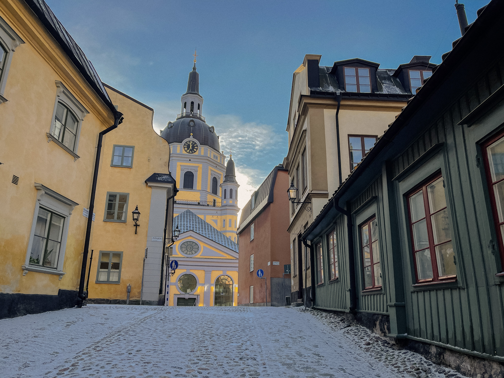
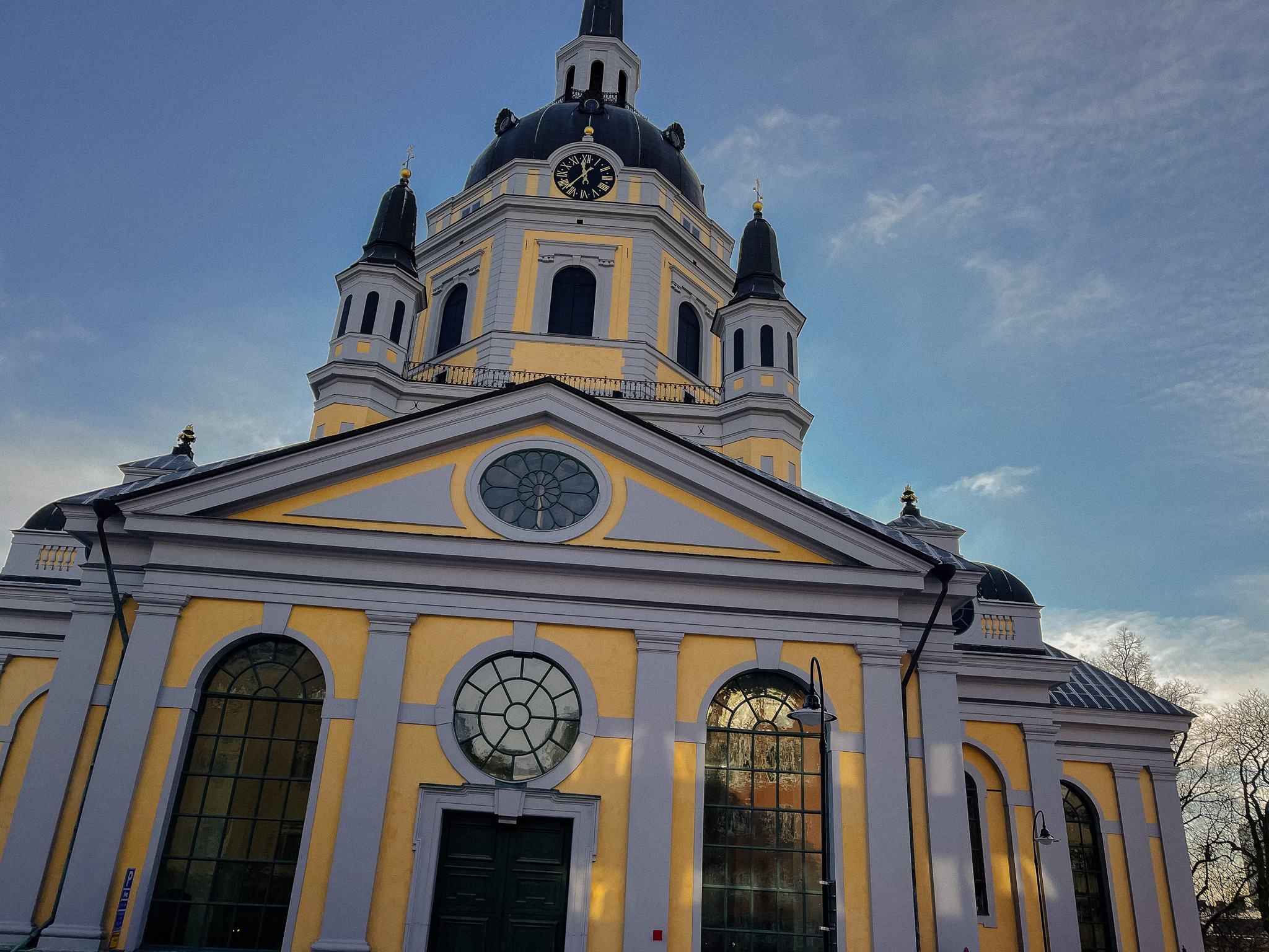
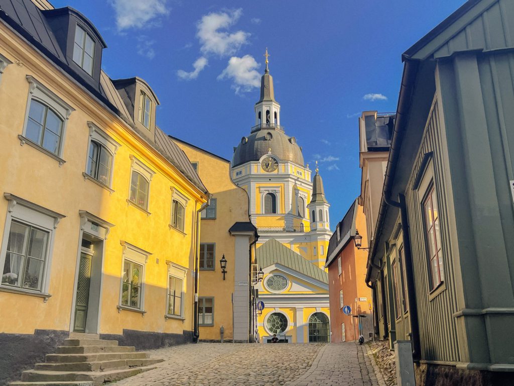
Katarina Church
The Katarina Church was first completed in 1695 but unfortunately has been destroyed twice by fire.
The church was first destroyed by fire in 1723, and architect Goran Josuae Adelcrantz was tasked with rebuilding the church. The church got a larger tower and the facade was painted yellow; previously it was painted red.
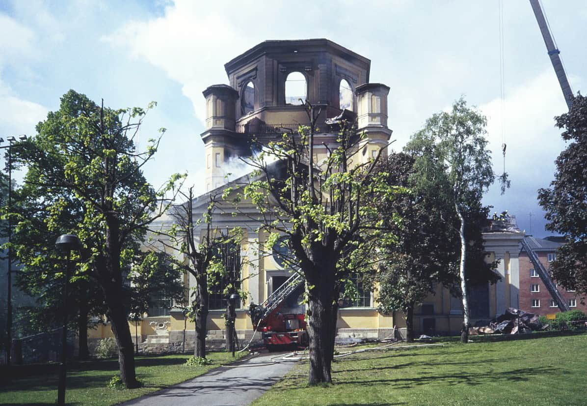
The church burned for the second time on the 17th of May 1990. The tower collapsed and went through the church vault. The only parts that survived was the ceiling and the outer walls. Thankfully, the church silver and the valuable textiles were saved.
Investigations showed that an electrical fault had caused the fire. Although the church was insured, a lot of fundraising was done to ensure the church could be completed. The reconstruction was done with the same technology and material used on the 17th century church.
During the 1670s, the famous Katarina witch trial took place here. It is one of the most famous witch trials in Sweden. The trial resulted in eight people being executed for witchcraft, one person committing suicide in prison, and two more people sentenced to death.
The church is built according to a Greek cross plan with the tower centrally located. When it opened in the 17th century, it became the first central church in Sweden. A chapel has been on the site since the 1300s.
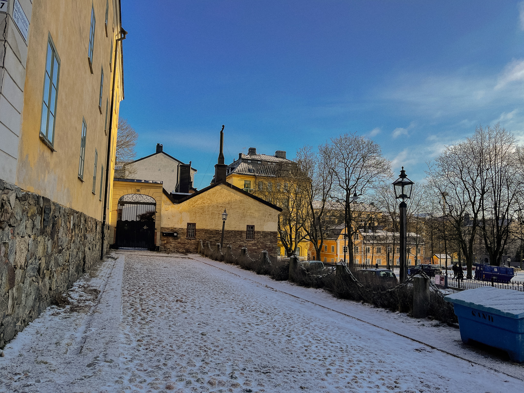
Drottningen 4
The building is located at Högbergsgatan 14. It was constructed in stages in the 1750s and 1830s. The oldest part was built for the tower keeper in the Katarina Church, Sven Grafman. When master shoemaker Jonas Wilhelm Gusten owned the building in the 1750s, he had it extended to the west. In 1838, the building had acquired its current appearance.
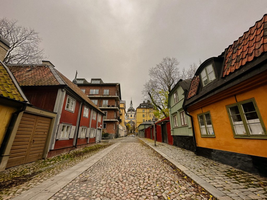
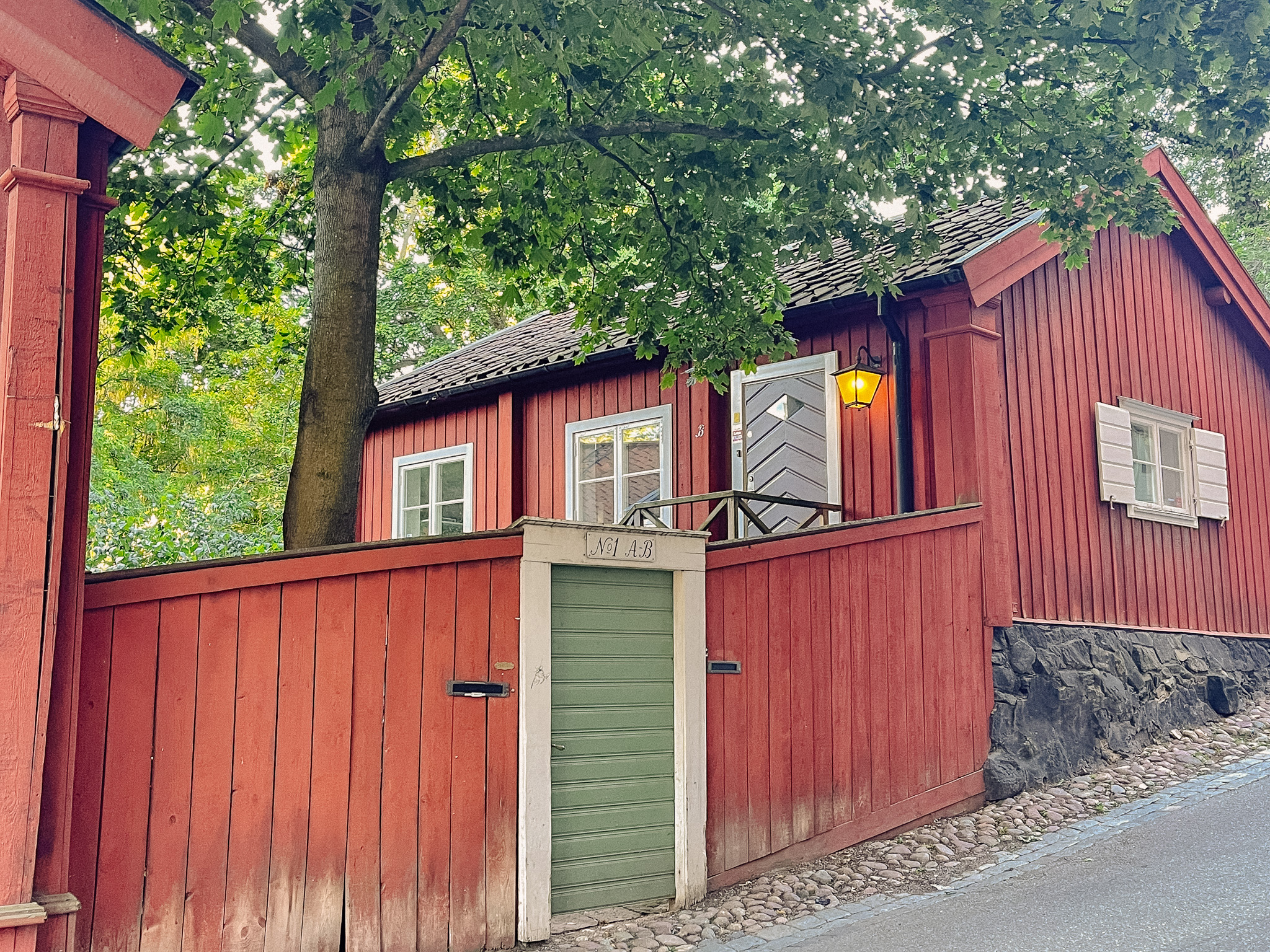
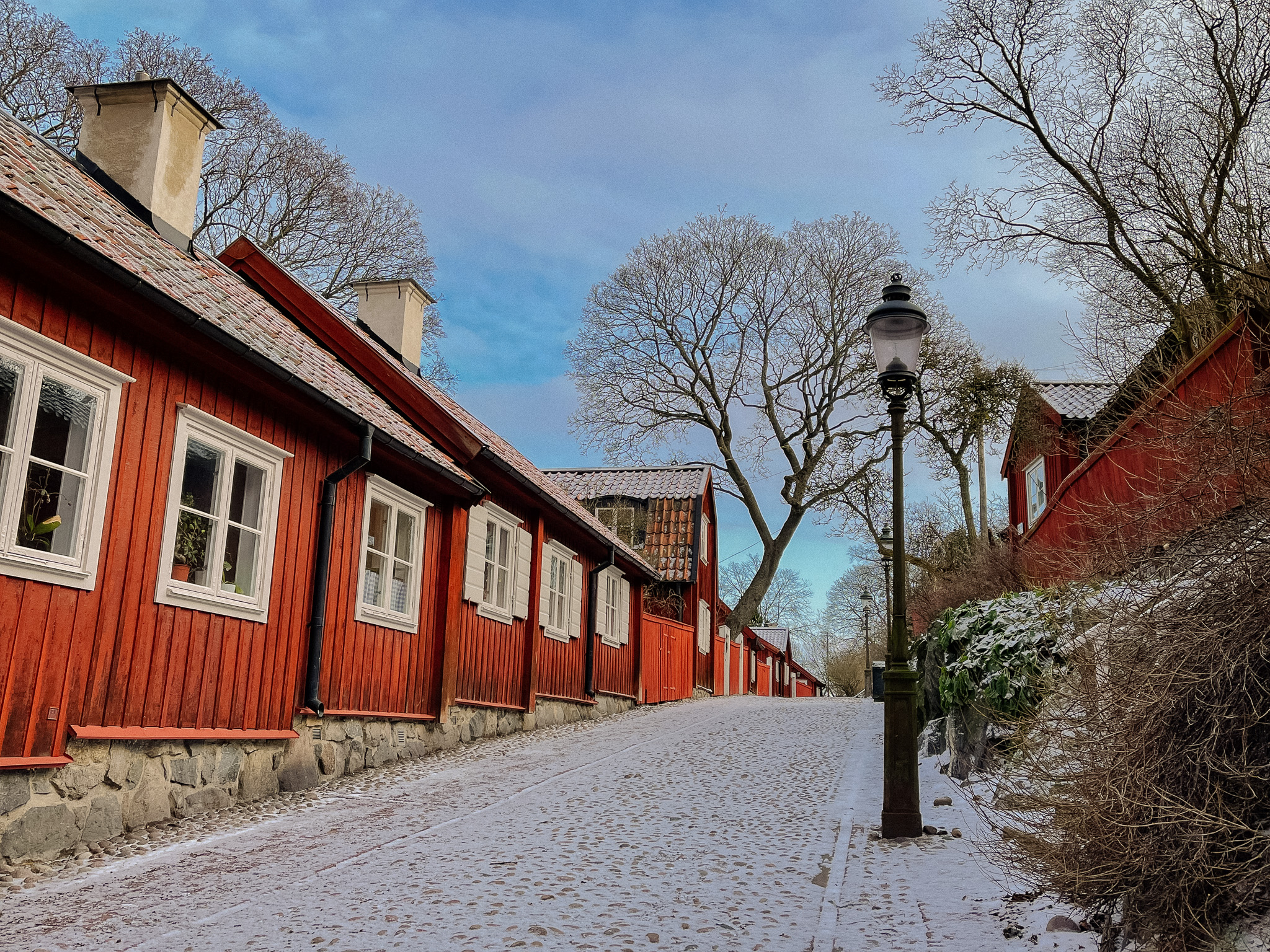
Mäster Mikaels Gata
Mäster Mikaels gata is one of the best-preserved streets showcasing old Stockholm. The street name is new; when the main road Renstiernas gata was blown into a deep ditch at the beginning of the 20th century, the then Fjällgatan was divided into two. The eastern part kept its name, while the western part became Master Mikaels gata.
Mikael was Stockholm’s executioner, who worked at the nearby gallows on Stigberget. He lived in this quarter. “Master” was a common title for an executioner.
He is one of the few executioners to get the job without committing any crime. A common way of recruiting executioners was to pardon a man condemned to death on the condition they put on the master’s hood. He was in charge of the ‘Rackare’, the executioner’s servant. The servants job was to set the place for the execution, picked up the dead and buried them in gallows hill.
Mikael broke the law when he let a criminal man live in his house. He was sentenced for this but continued to associate with the man. On one fateful occasion, they drank too much brandy and had a falling out. It ended with the man lying dead in the doorway. Mäster Mikael was beheaded by his successor.
This area was destroyed during the fire of 1723. Even though building in wooden houses was banned, the houses that line Mäster Mikaels gata were built of wood. They were completed in 1729. The houses were all bought by Stockholm at the turn of the century in 1900. They are now part of a so-called reserve that is owned and managed by AB Stadsholmen.
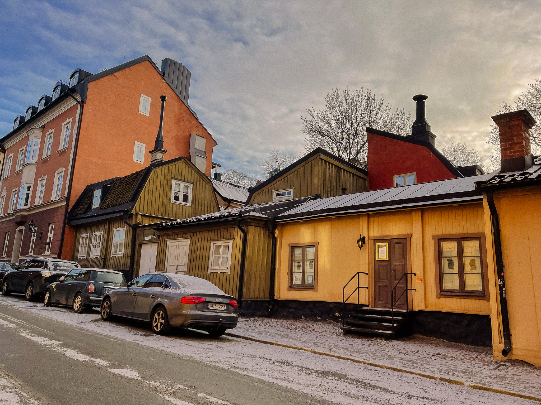
Fjällgatan 16
Fjällgatan 16 is Europe’s smallest theatre. Called ‘Teater Dur & Moll’ (Theatre Major and Minor), it was established by Gen Hedberg who wanted to set up a small theatre for adults. The theatre opened in 1996 and Gen Hedberg is still the theatre director and sole actor. The theatre is 34 square metres and can accommodate 20 people. The building is from the 1720s.
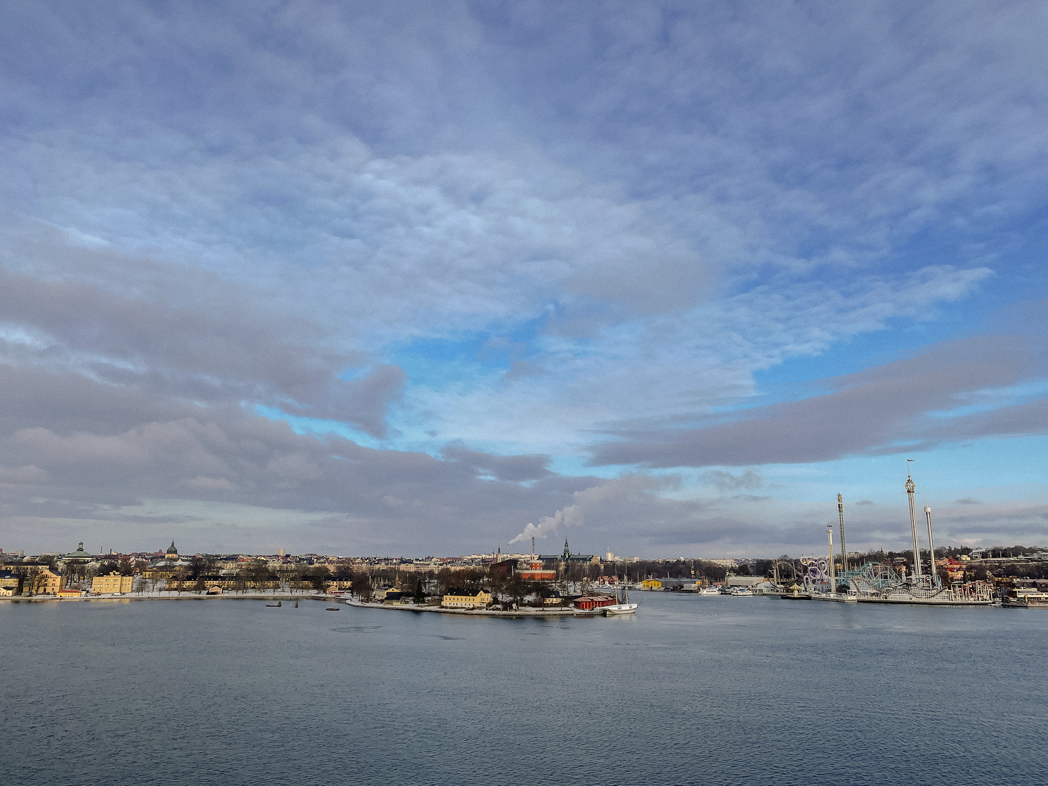
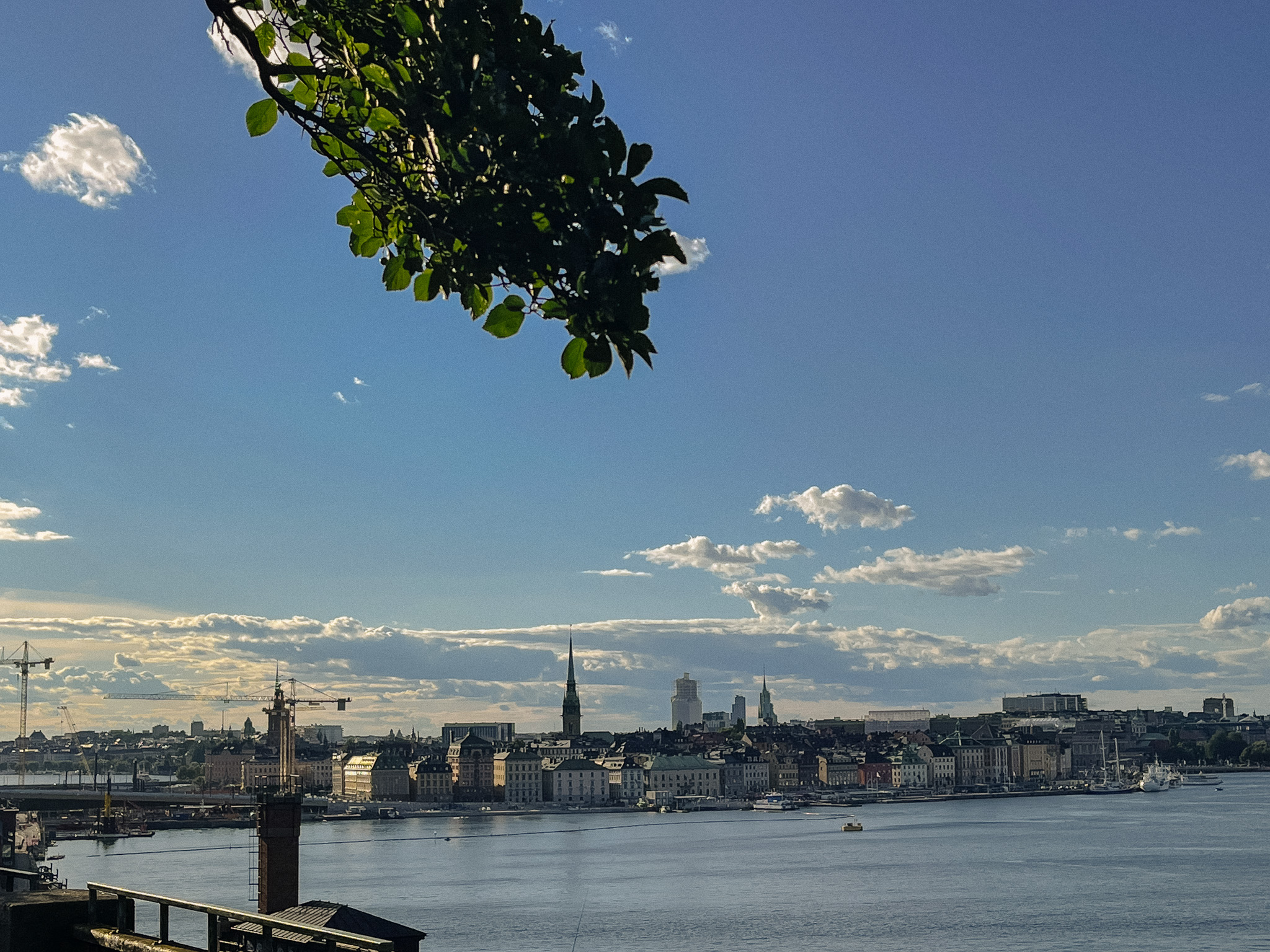
Viewpoint over Stockholm
We have now made it to the most famous viewpoint in Stockholm. From here you can see Gamla Stan (to your left) and Djurgården (to your right). On the far left you’ll see Slussen; where we began the walk.
Fjällgatan 40
The wooden house here was built shortly after the major fire of 1723. The house was lived in by a number of merchants and skippers before being abandoned in the 1980s since it had no electricity or running water. It has since been carefully restored by AB Stadsholmen.
Ersta Sjukhus
Ersta Sjukhus (First Hospital) began operations in 1864. It was partly a hospital for the poor and partly the first nursing school in Sweden. It was expanded towards the end of the 19th century. A new hospital is currently under construction south of the old one. Demolition and excavation work began in 2020.
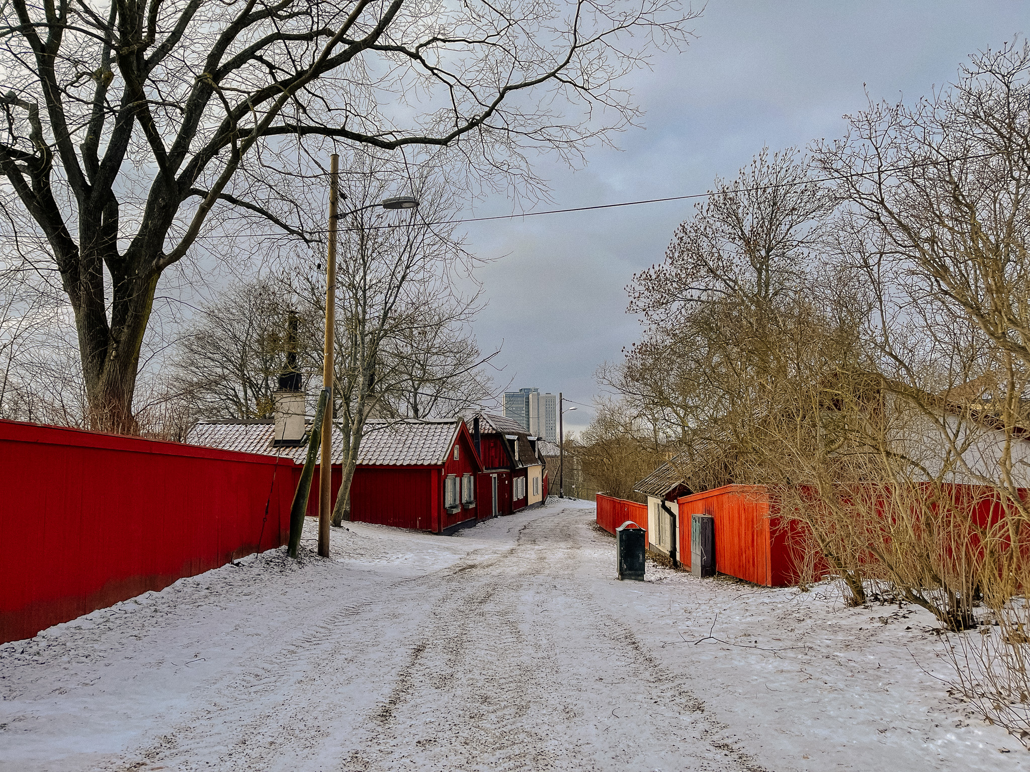
Sågargatan
This street is first mentioned in history in 1781, and the name probably comes from the sawyers who sawed planks and woods for the shipbuilding industry. They lived in this area. The street was originally a steep hill that was widened and lowered in the early 20th century. The red houses indicate how high the road used to be.
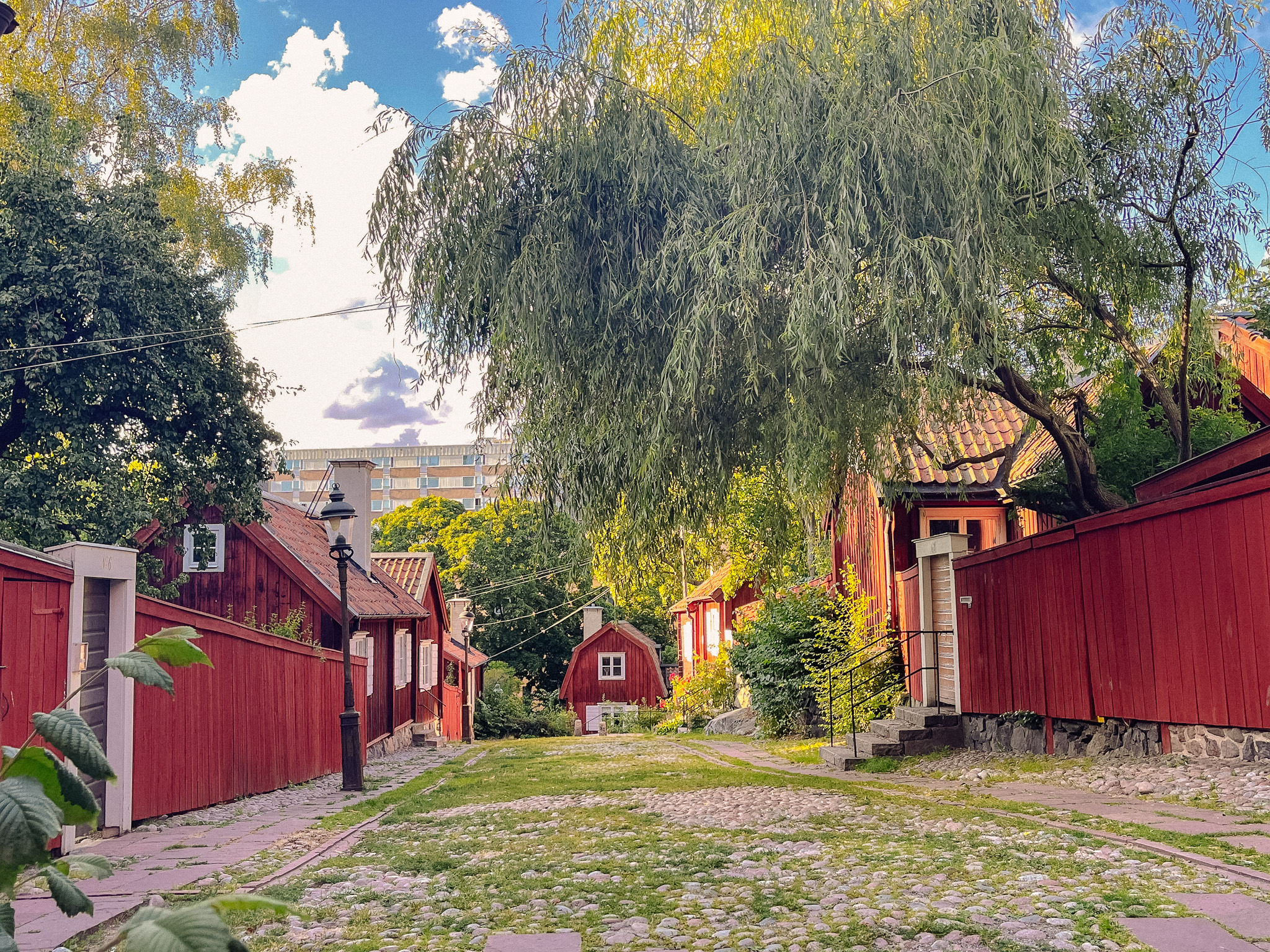
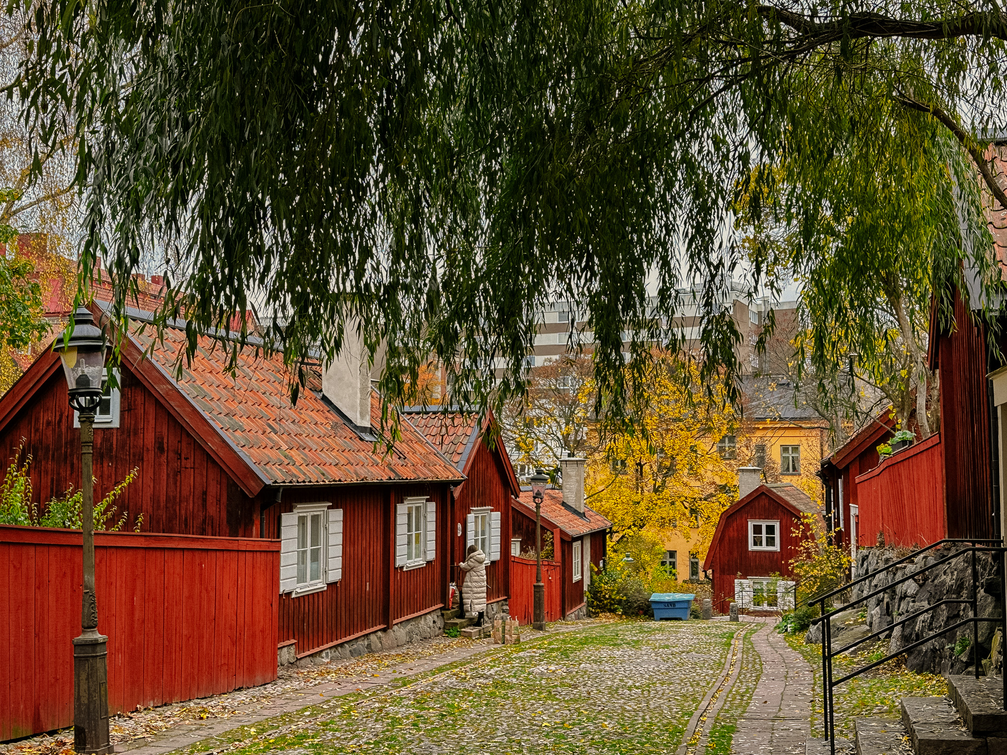
Skeppargränd
Skeppargränd is also lined with these cultural and historical houses that are managed by AB Stadsholmen. Most of the houses here were built in the 1720s on plots that were laid out in the 1680s.
Bondegatan
We are now crossing Bondegatan, which has been here since the middle of the 17th century. It refers to the transport companies that had established their businesses on this street. “Bonde” means farmer, which may refer to the type of people who lived here. If you want to explore this street further, there are some heritage-listed red wooden houses on this street as well (go to number 44).
Vita Bergen
Vita Bergen, or the White Mountains, is the name of the hilly park where the church stands today. The name probably derives from the light colour of the bedrock on the previously bare mountain. During the 18th century, poor people who worked in the textile factories settled on the rugged terrain of the mountains. August Strindberg described the area as “the city’s poorest and most destitute area” in the novel Röda rummet from 1879.
Many of the houses were demolished in the early 20th century to make way for the Sofia Church and the establishment of the park. Some of the old wooden houses remain, and we’ll see them a little later.
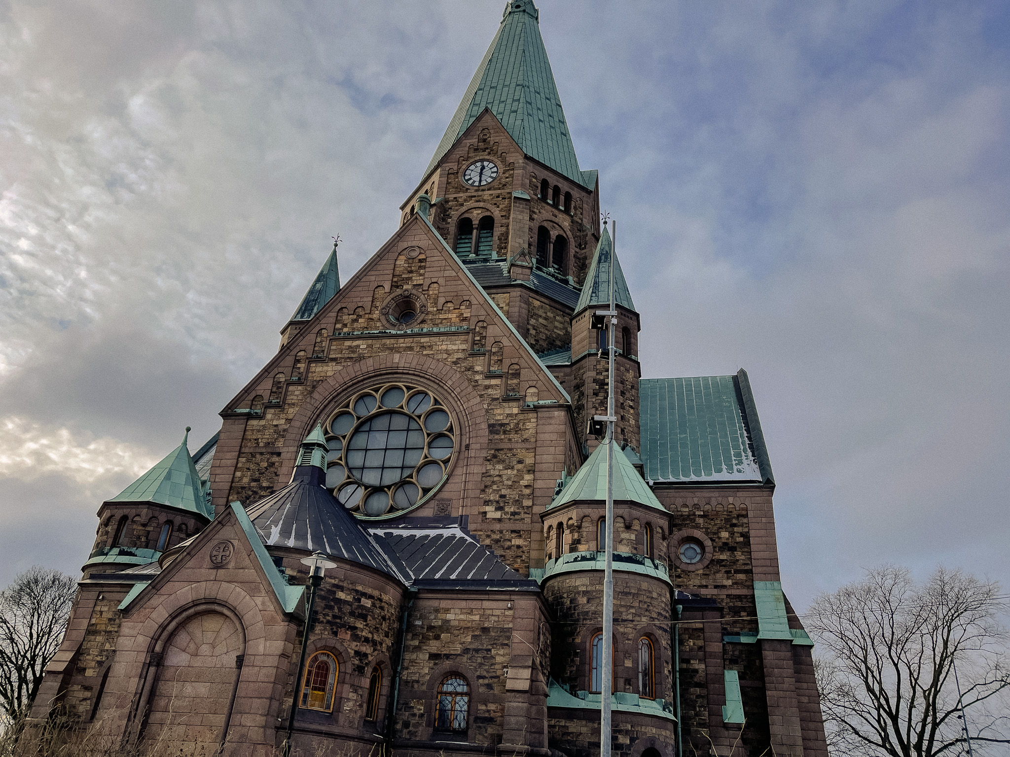
Sofia Kyrka
The church was designed by architect Gustaf Hermansson after an architectural competition in 1899. The building is in the Rhindeland transitional Romanesque style. King Oscar II laid the foundation stone on the 15th of May 1903 and four years later the church was inaugurated. It is named after Oscar’s wife, Queen Sofia.
The church is a central church from which four cross arms of equal length extend out. In the eastern transept is the chancel, while in the western transept is the main entrance. The walls are made of light red granite with elements of darker sandstone.
Mäster Pers grand
The name is fairly modern. It was established in 1928 and is named after Master Peder, the first vicar of the Katarina parish. In this area are around twenty wooden houses from the 18th and 19th centuries, and these were the lower classes because of the rugged terrain.
Mäster Pers grand 1 was the last one to be modernised. A man called Alrik Sundberg had lived here since 1928 and did just find without electricity, water or a sewerage system. Water was fetched from a nearby pump. After his death, AB Stadsholmen modernised the building.
Bergsprängargränd
The name comes from 1806 and means ‘rock blaster’, referring to the profession of the person who lived on this street. Otherwise, mainly shipyard and port workers lived here. They had large families, and these wooden houses were among the most dilapidated and poor in Södermalm. For example, in 1897, two dock worker families consisting of four adults and two children lived in a one-room cottage that had a floor area of 12m2 and a roof height of 1.8 metres.
SoFo
The area here is known as SoFo (the area south of Folkungagatan) and it is today regarded as the trendiest neighbourhood in Stockholm. You can find a guide to SoFo and all the trendy shops, cafes and restaurants via the link sofo-stockholm.se
As we’ve seen on this walk, Södermalm was once known as the ‘slum’ area of Stockholm with cramped, dilapidated wooden houses built on rugged, undesirable terrain. However, today Södermalm is known as the home of bohemian, alternative culture.
The growing demand for housing in Stockholm, as well as the increased gentrification of Stockholm’s inner city neighbourhoods, has driven up prices in Södermalm, making it one of the most expensive neighbourhoods in the city. What was once a working-class neighbourhood is now a neighbourhood for the privileged.
Södermannagatan
This street is part of the SoFo area and has lots of cafes, second-hand shops, and fashion stores. At the end of the street, we’ll see the wooden building I mentioned back at Bondegatan. These houses were built before 1748.
The neighbourhood has the name Bonde because of the farmers who, in connection with their visit to Stockholm would use these houses as accommodation.
End of the walk!
I hope you enjoyed this walk in Sodermalm through its past and present.