Stopping by Norway’s Famous Vøringsfossen Waterfall

Vøringsfossen is arguably the most famous waterfall in Norway. Water drops 182 metes from the Hardangervidda plateau down to the Måbødalen valley. I’ve taken people to the waterfall many times, and I must admit the first few times I didn’t quite understand the appeal of the waterfall. I think there are much nicer waterfalls in Western Norway, such as Tvindefossen. However, as I began to walk more around the viewing platform, I began to realise just how spectacular the valley is.

Here’s a short but useful practical guide to visiting the waterfall and making the most of your time there.

In this article...

The Rv7 Highway

Voringsfossen is located on the Rv7, a major highway between east and west Norway. You can find my guide to the Rv7 by clicking the link below. 

Geography & Location

The waterfall is located on Måbødalen, or the Måbø Valley. The deep and steep Måbødalen is the result of ice and water having cut into slacker and more open valleys. Remains of the older valley floor are found high up on the steep valley sides. The inner part of the valley is an extreme case of ice carving out the landscape. The deposits around the valley are visible and of great importance.

It is possible to see Vøringsfossen from the bottom of the valley, and you can hike up the valley today.

Discovery of the Waterfall

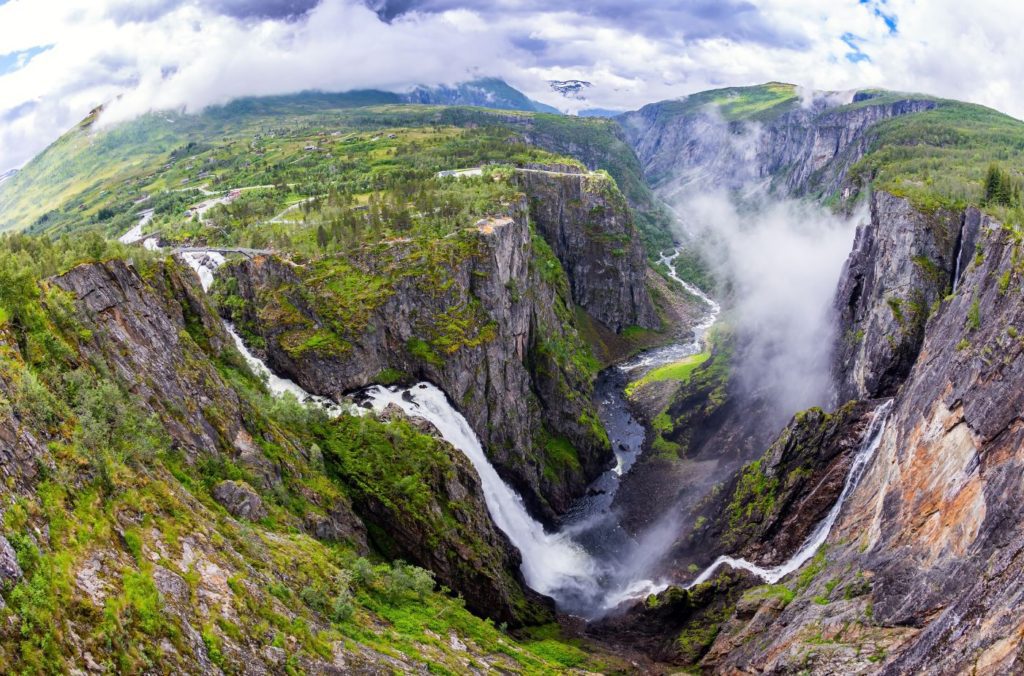
Vøringsfossen is part of the Bjoreio river in Eidfjord municipality. The amount of water is regulated in connection with power development, and there is a requirement for a minimum water flow during the summer so we are able to actually see the waterfall.

Until 1821, the waterfall was virtually unknown outside of the local community. Professor Christopher Hanseen crossed the plateau to make some astrological observations and while travelling he was stopping to admire the waterfalls. The mountain men carrying his equipment showed him Vøringsfossen and Hansteen was amazed by it. This visit was Vøringsfossen’s breakthrough as a natural attraction.

Cruise ships began coming to the Hardangerfjord region in the 1860s and passengers would be taken by horse to view the waterfall. Eventually a new road was built to make the journey a little easier for the tourists.

The road and tunnel network up the valley

Establishment of the Road

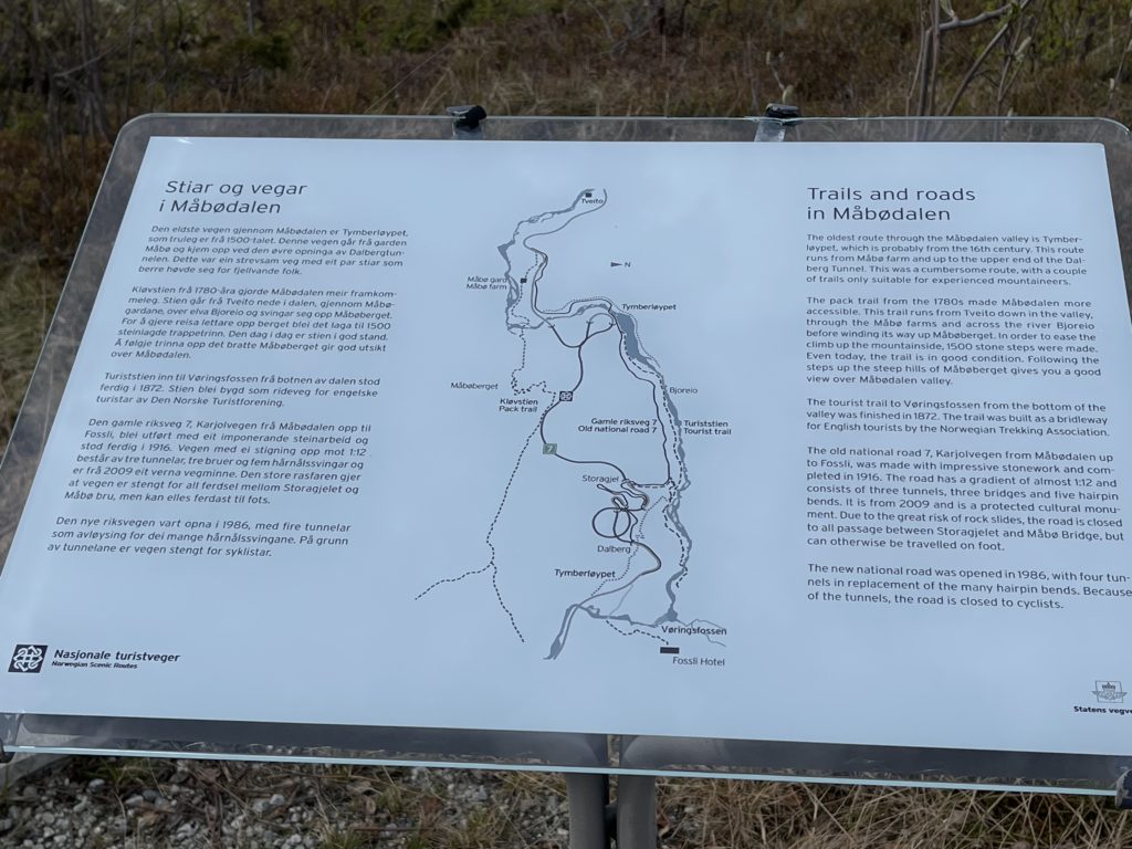
Måbødalen was impassable before 1790, when bridges and a stairway with 1300 steps were constructed for travellers going between east and west Norway via Hardangervidda. The steps were designed only for people accustomed to the mountains. Most of this road is inaccessible today as geological surveys found the road was at high risk of landslides and generally unstable.

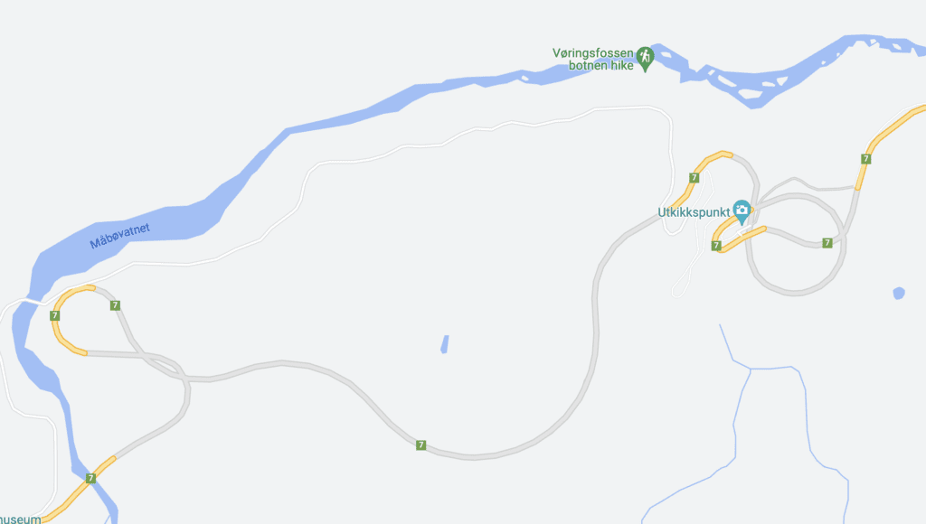
The car road was completed in 1916. Today it’s only possible to experience the old road on foot or bicycle. It was the first road connection between Eastern and Western Norway over the Hardangervidda Plateau. It is one of the best examples of road engineering from the early 20th century. The modern car road is from the 1980s and uses a tunnel system to make the drive a little easier. The road is especially exciting when looking at it on Google Maps. There are many nice viewpoints along the way, but I’ve found they get very crowded in summer as people park to go for a hike and the carparks can only fit 5 or so cars.

Vøringsfossen Fossli Hotel
Fossli Hotel

Fossli Hotel

Fossli Hotel is the building next to Vøringsfossen. The hotel was built in the 1880s by Ola Garen. It is designed in an art nouveau style, and all the materials were transported up the valley by horse. The hotel is a lovely place to stay, though it does look a little dated. However, you won’t be spending much time in the room anyway. The hotel is close to some spectacular hiking and cycling paths, and they have an in-house bar and restaurant. https://www.booking.com/hotel/no/fossli.html

The Viewing Platform at Fossli

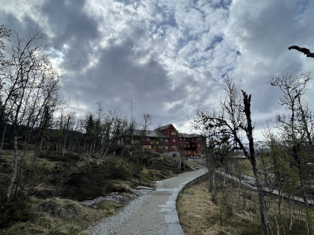
From Fossli Hotel, you can walk around the top of the plateau, getting different views as you go. This is where you get the nicest views of the waterfall; there are platforms further down but I believe the ones close to the hotel are the best.

You’ll find maps and information about walking routes outside the carpark.

Maps and trails in the valley

The Footbridge

A new footbridge was built over the waterfall in 2020 to much controversy. It was designed by architect Carl-Viggo Hølmebakk who won an architectural competition. The bridge has a span of 47 metres and has 99 steps. It was heavily criticized for ruining the natural view of Vøringsfossen, and I’m not convinced it has the best views; I’ve found the best views are from near Fossli Hotel.

Practical Information

Getting Here

Vøringsfossen is one of the tops on the Hardanger Tourist Road. It is located just off Highway 7, which runs between Bergen and Oslo via the Hardangervidda Plateau.

Parking

It is possible to park close to the Fossli Hotel. Parking is free.

Hiking

It is possible to hike from near Øvre Eidfjord (the last settlement before Vøringsfossen) up the Måbødalen to the viewpoint at Fossli. The hike is 9.3km and is considered a moderately challenging route, taking around four hours to complete. You can view it here: https://www.alltrails.com/trail/norway/vestland/mabodal-til-voringsfossen

Coming with a tour

Fjord Tours organises a sightseeing trip to the waterfall and nearby Hardangervidda Nature Centre. Click here for information about the tour.

You visit the waterfall as part of the ‘Hardangerfjord in a Nutshell’ day trip from Bergen, which I highly recommend. Click here to learn more about it.

Restrooms

Restrooms are available by the parking lot at Fossli Hotel. Inside the hotel is a café where you can get coffee, tea, waffles and snacks.

Visiting in winter

The waterfall is partially or completely frozen in the winter, making it difficult to see if there’s a lot of snow. If it is snowy, it is not safe to go to the viewpoint at Fossli Hotel because the safety fence can be hidden and it’ll be very slippery.

The Rv7 Highway

Voringsfossen is located on the Rv7, a major highway between east and west Norway. You can find my guide to the Rv7 by clicking the link below. 

Welcome to the Hidden North

The Hidden North is an online travel guide written by me, Emma, to help you make the best of your trip to Northern Europe. Welcome!

Originally from Australia, I moved to Bergen in Norway eight years ago after marrying a local ‘Bergenser’. I started doing local tours of Bergen before becoming a tour leader in Northern Europe. After doing that for a few years, I have settled down in Bergen to operate my tour company I Love Bergen and write my travel site The Hidden North

Follow me on social media!

I wrote a book!

My first book – the West Norway Road-trip Guide – is now available for order! This book is the perfect guide for planning a trip to Western Norway and includes dozens of roads + detailed information on what to see and do. It is a mix between travel guide and directoy. 

Need help planning a trip?

I can help you plan your trip to Northern Europe. Book me for a consultation or let me put together the whole itinerary!

Recent Posts on the Website